


Canadian Mapping Skills: Extending Knowledge Grades 5-6
EBJ169
$32.99 CAD
Additional information:
- Author : Golletz, Lynda
Immerse your classroom in the exciting world of Canadian geography with our comprehensive mapping resource! Designed specifically for Grades 5 and 6, this curriculum bundle equips students with an in‐depth understanding of Canada’s varied regions, provinces, territories, communities, bodies of water, natural resources, mapping symbols, and different kinds of maps.
Through engaging, interactive activities, students will develop essential skills such as:
-
Locating Places: Mastering various methods to find locations on maps.
-
Map Labelling & Coloring: Enhancing attention to detail while bringing maps to life.
-
Map Recognition: Identifying different types of maps and understanding their uses.
-
Regional Analysis: Determining the characteristics of Canadian regions and exploring their economic influences.
What’s Inside? This resource is thoughtfully packed with ideas and activities, ensuring that students not only learn mapping skills but also deepen their knowledge of their own country. Highlights include:
-
Bonus Content:
-
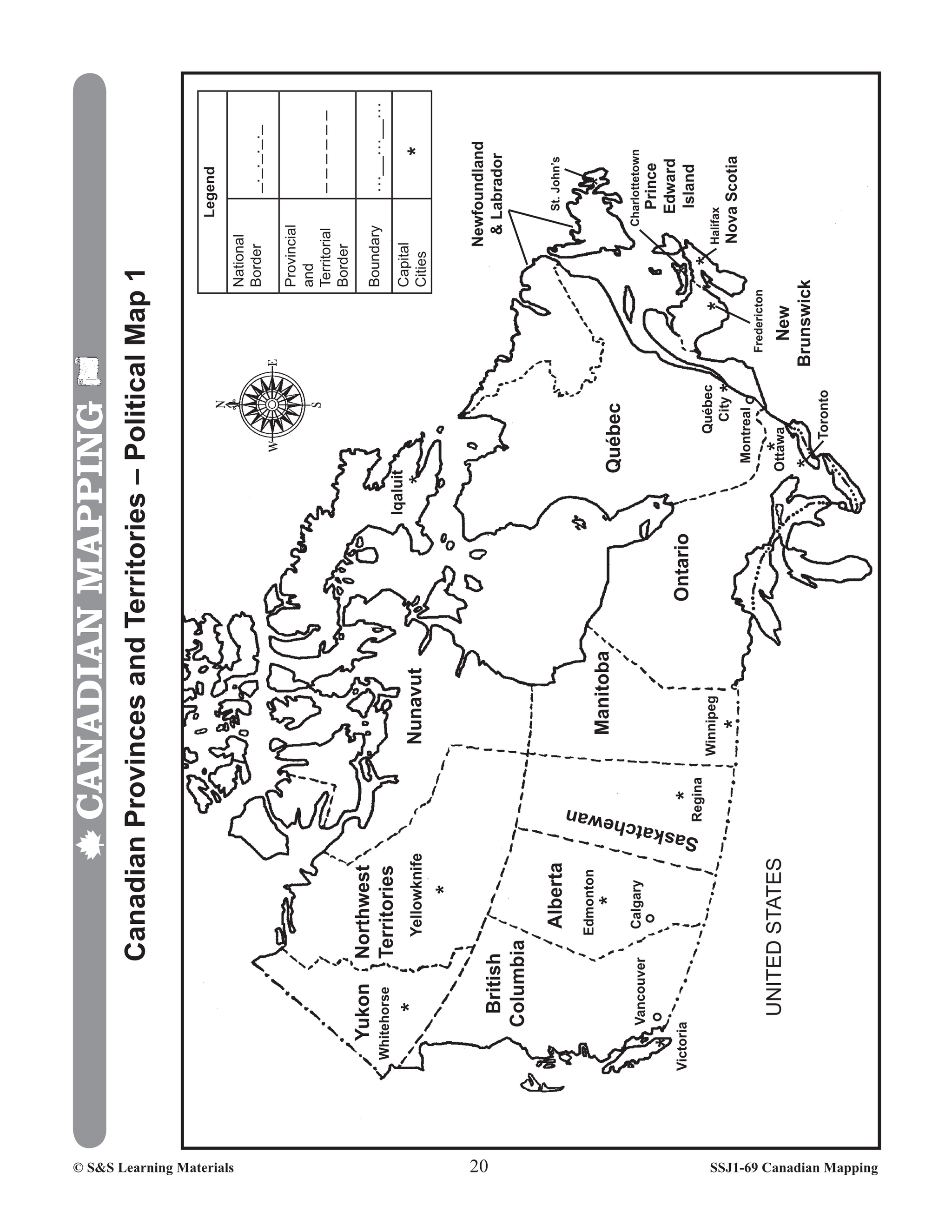
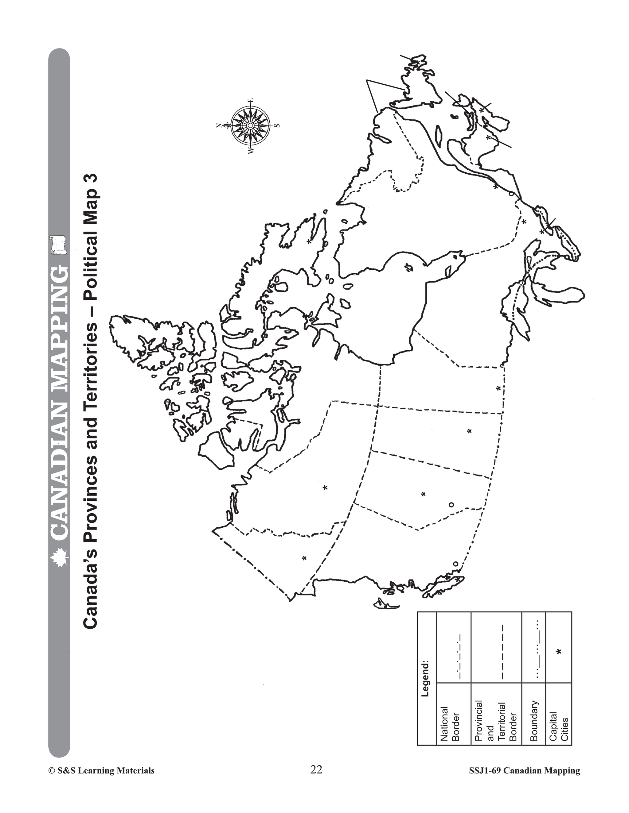
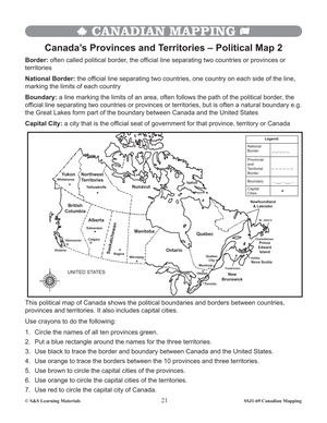
Five Full-Colour Maps: • Outline Map of Canada • Political Map of Canada • Physical Map of Canada • Land Elevations of Canada • Natural Resources Map
-
-
Teacher Support Materials:
-
At A Glance™ Overview
-
Teacher Rubric
-
Student Rubric
-
Comprehensive Introduction & Teacher Information
-
Glossary of Geographic Terms
-
Detailed Answer Key
-
-
Extensive Worksheets Covering:
-
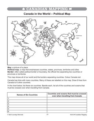
Mapping Canada Globally: • Canada on a World Map – 1 & 2 • Canada in the World – Political Map
-
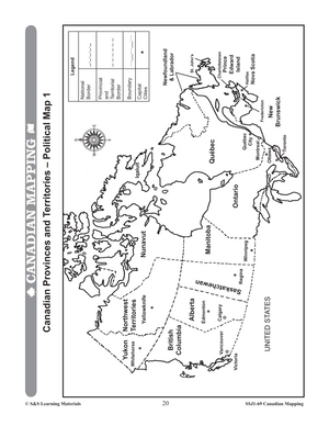
Provinces & Territories: • Multiple Political Map activities • What is Missing? (Location Challenges) • Capital Cities & Abbreviations for Provinces and Territories
-
Mapping Skills: • Understanding Map Scale & Using Scale for Distance Calculations • Cardinal and Intermediate Directions on the World Map and Canada • Using Coordinates, Map Grids, and Indexes • Drawing a Map of Canada • Exploring Parallels of Latitude and Meridians of Longitude
-
Exploring Types of Maps & Regions: • Many Kinds of Maps • Elevation and Physical Regions • Fold and Study Projects
-
Trade, Climate, and Economic Geography: • Analyzing Canada’s Large Bodies of Water • Research Projects on Oceans, Lakes, Rivers, and Bays • Climate Maps & Graphs for Canadian Locations • Economic Regions and Natural Resources Activities
-
Time Zones & Global Connectivity: • Understanding Time Zones, Airline Tickets, and Local Studies • Exploring Canada’s Links to the World, Trading Partners, and the Pacific Rim • Integrating GIS and Comparative Mapping Exercises
-
Whether you're looking to deepen your students’ geographic skills or offer a broad exploration of Canada’s physical and economic landscapes, this resource delivers a rich, hands-on learning experience that makes geography both engaging and accessible.
Offer your students the opportunity to become future geographers by transforming the study of Canadian mapping into an interactive investigation of their own country. Elevate your lessons, spark curiosity, and bring Canadian geography to life in every classroom session
You may also like:
Canadian Daily Language Activities
Canadian Math Google Slide Activities
Subscribe to our Fan List!: Our FANlist newsletter is full of tips on ways to save time with our resources, exclusive sales, new product info and free monthly downloads – you won’t want to miss out!
Follow us on:
![]()
![]()