


E Lesson Plan
Canada Maps & Map Features Worksheets Grades 2-3
EBJ16702
$8.95 CAD
Additional information:
Students will learn about Canada Maps and map features with the thirty worksheets in this lesson. Mapping symbols, using cardinal and intermediate directions, measuring distances using standard units of scale, locating Canadian cities, political boundaries, meridian of longitude, parallels of latitude and more!
Teacher information on these topics: what a map is, types of maps, how to read a map, map indexes, hemispheres, directional indicators, and map symbols. The glossary of geographic terms can be used to introduce the topic in a group. Helpful teacher notes are included for specific worksheets.
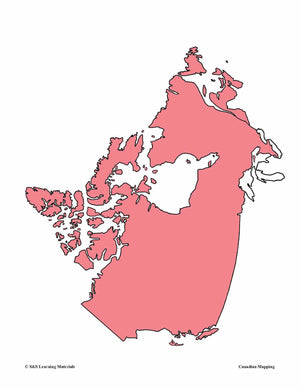
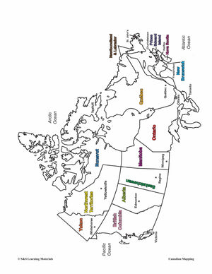
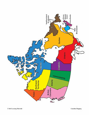
Bonus: Five Full-Colour Maps! (Outline Map of Canada, two Political Maps of Canada, Outline map of the World and North America)
Thirty worksheets on covering these mapping skills"
-
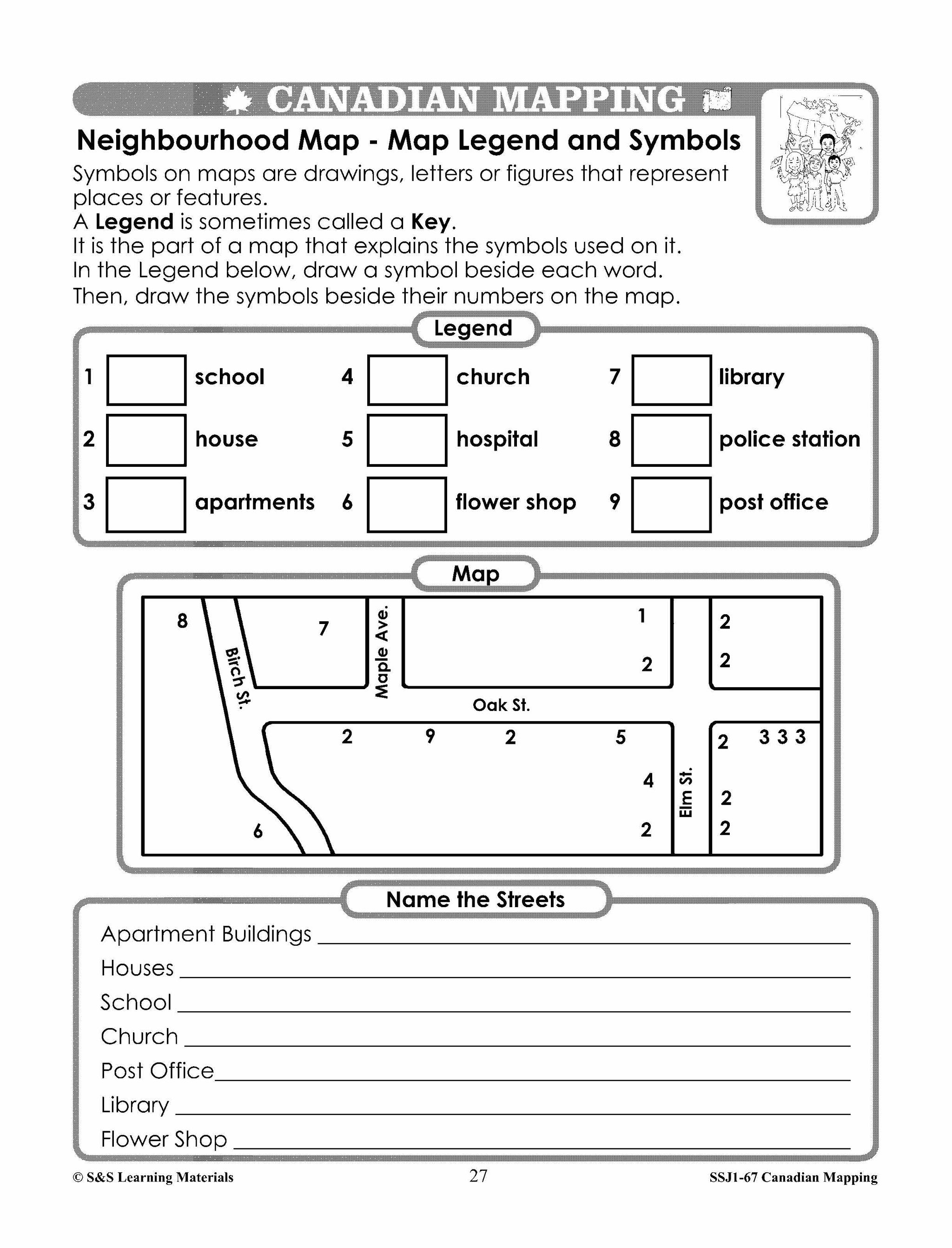
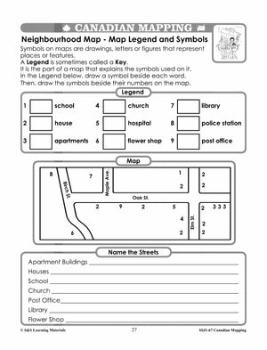
Neighbourhood Map (Map Legend and Symbols)
-
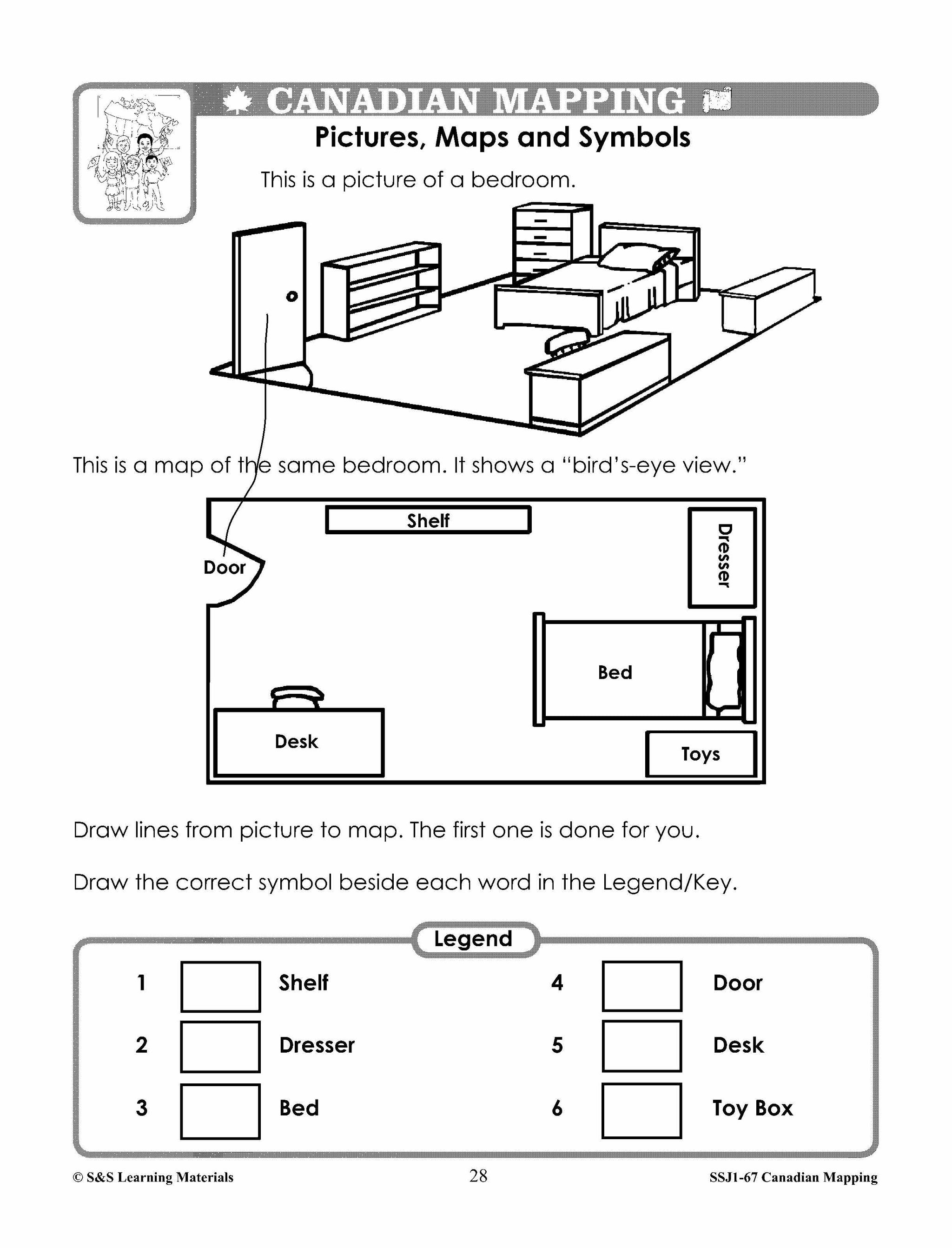
Pictures, Maps, and Symbols (How Symbols are Helpful)
-
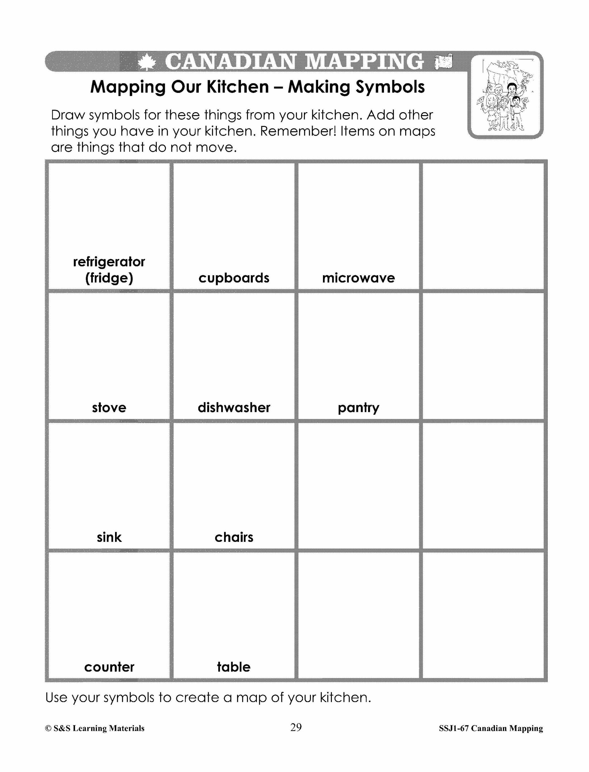
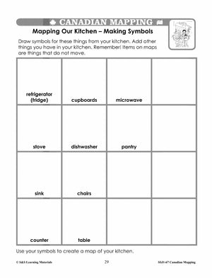
Mapping Our Kitchen - Making Symbols (Create Own Symbols)
-
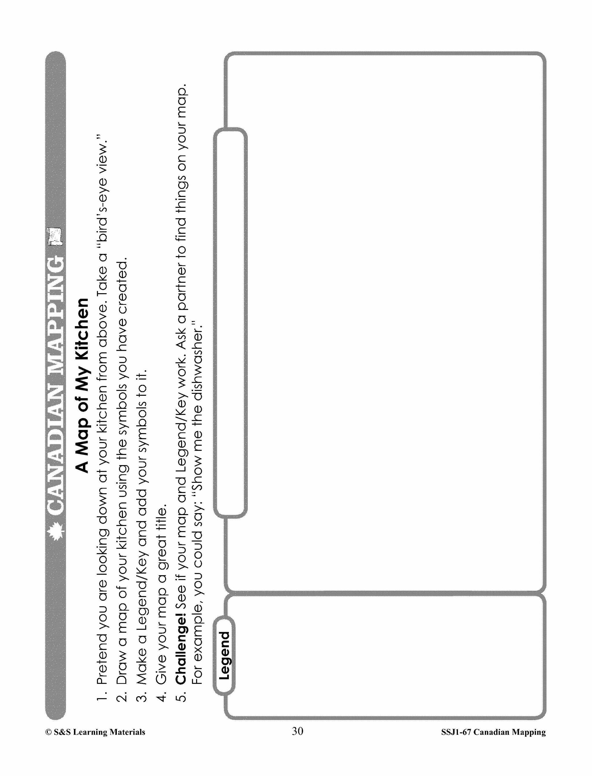
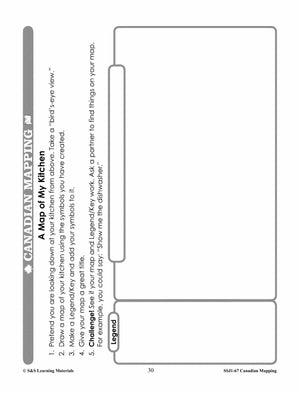
A Map of My Kitchen (Create a Map Using Symbols)
-
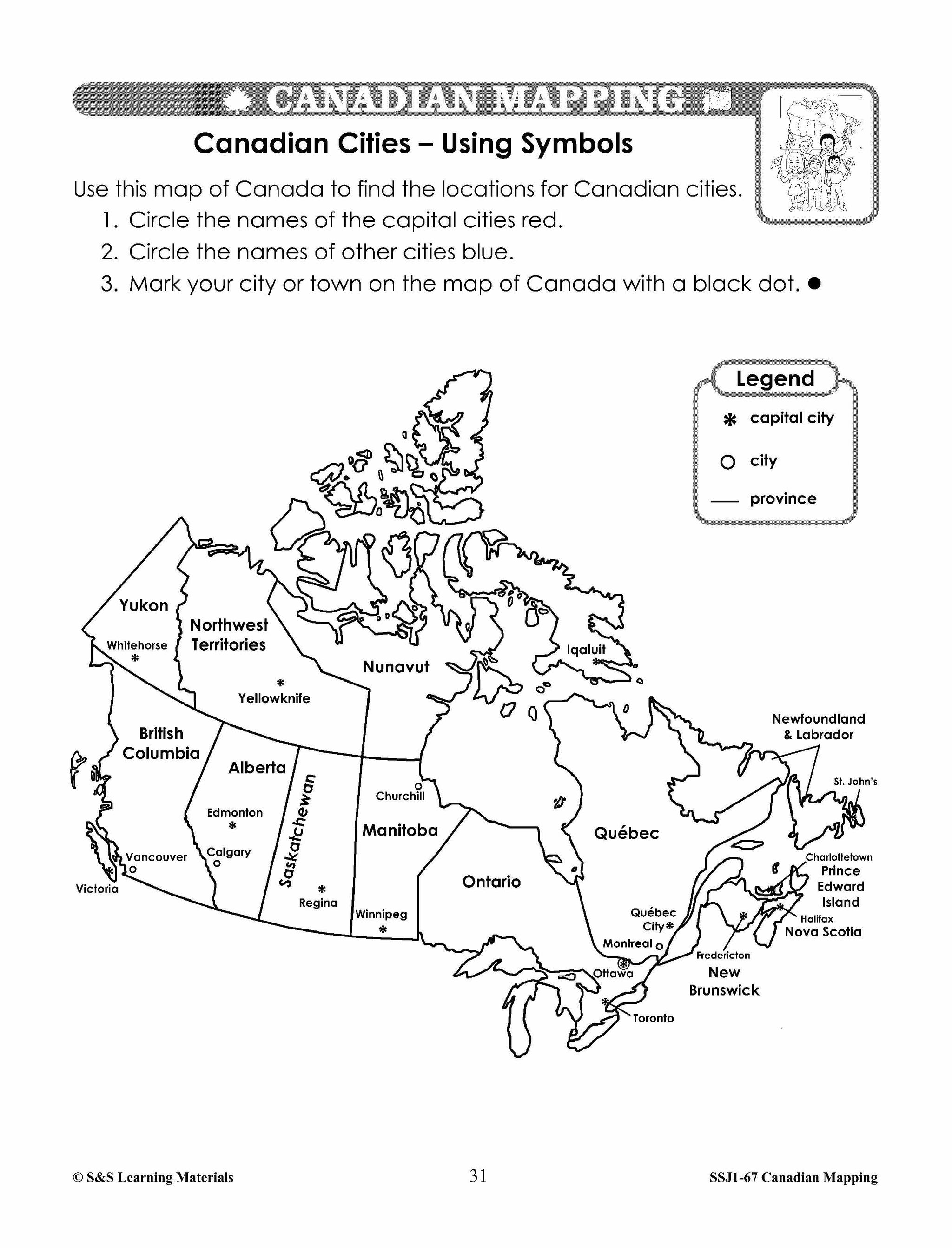
Canadian Cities - Using Symbols (Symbols for Cities on a Map)
-
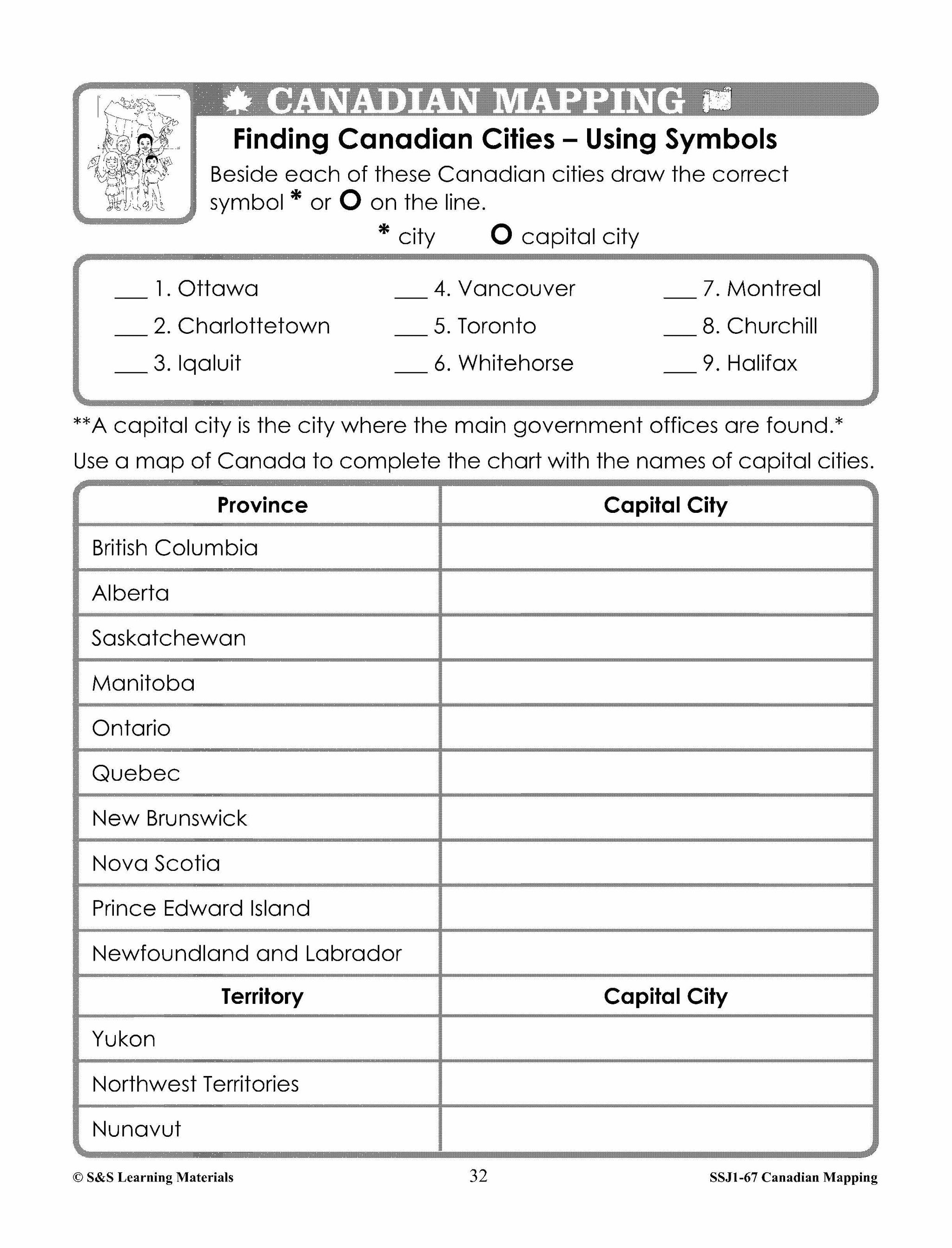
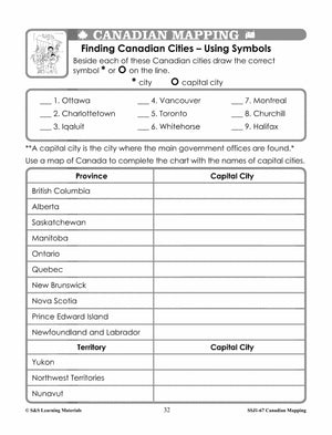
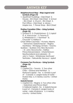
Finding Canadian Cities - Using Symbols (Locating Canadian Cities)
-
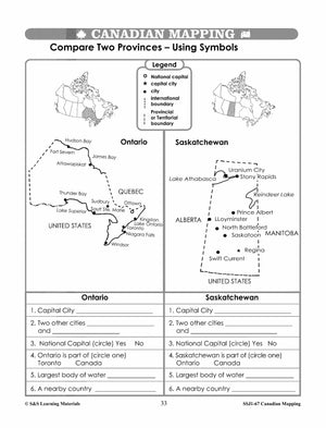
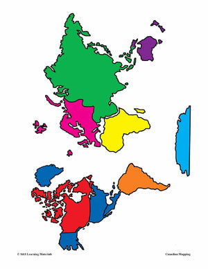
Compare Two Provinces - Using Symbols (Symbols can Provide Information)
-
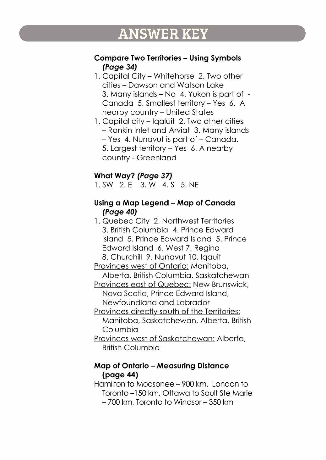
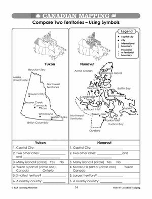
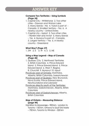
Compare Two Territories - Using Symbols (Symbols can Provide Information)
-
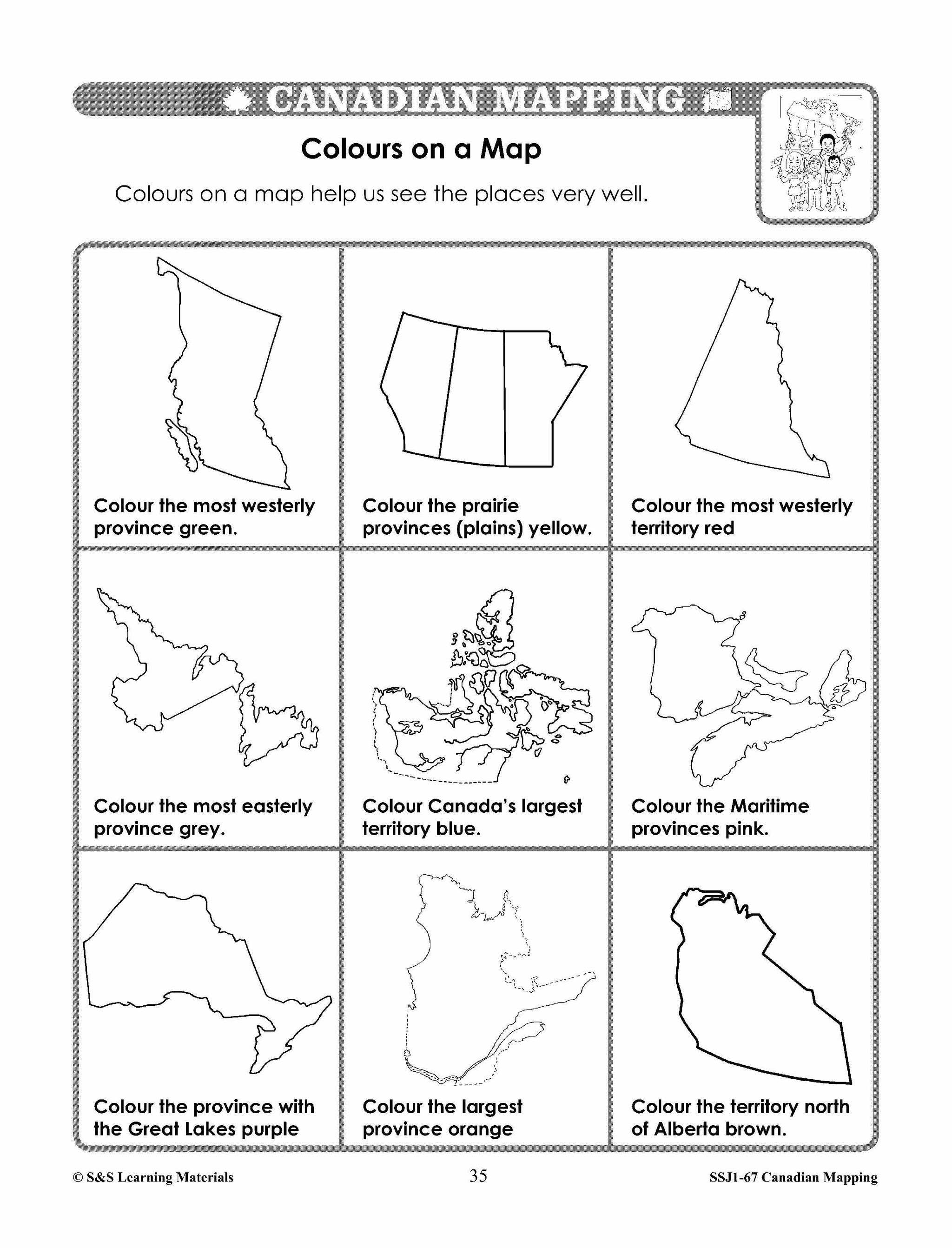
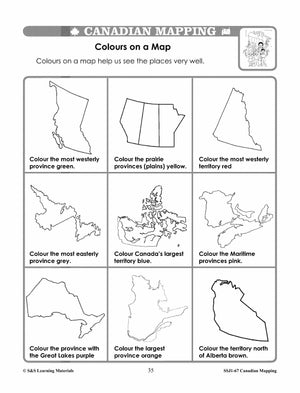
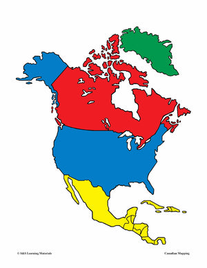
Colours on a Map (Colour Denotes Political Boundaries)
-
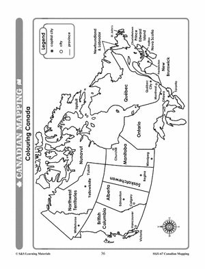
Colouring Canada (Colour on a Map of Canada)
-
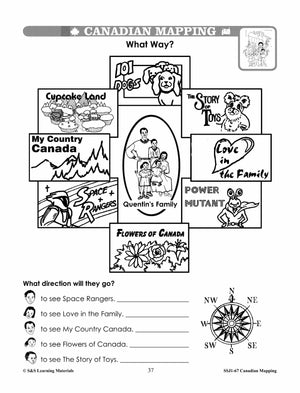
What Way? (Using Cardinal and Intermediate Directions)
-
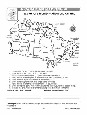
My Pencil's Journey -All Around Canada (Using Cardinal and Intermediate Directions)
-
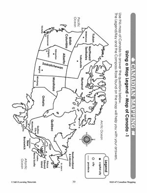
Using a Map Legend - Map of Canada - 1 (Interpreting Symbols on a Canada Map)
-
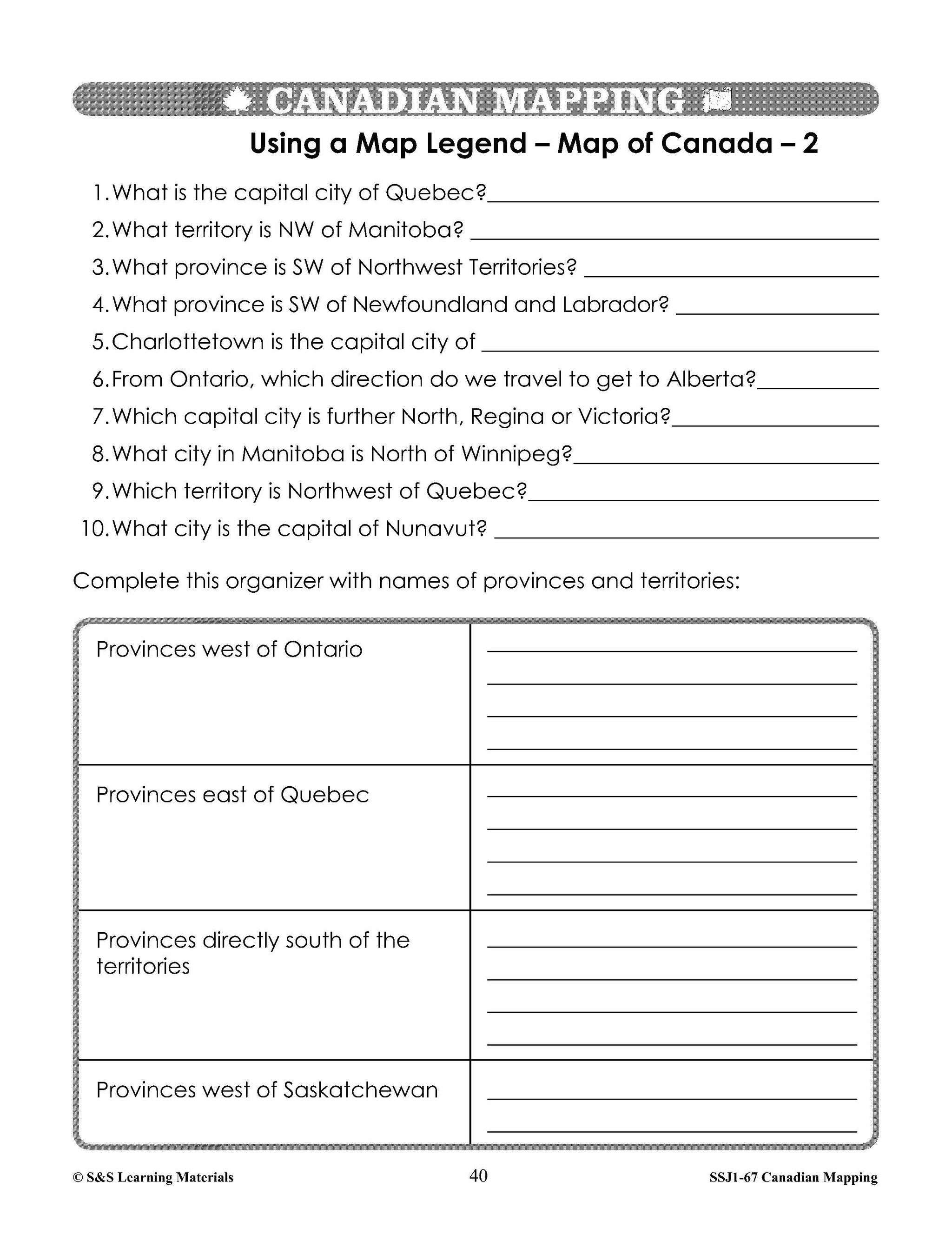
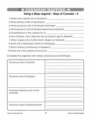
Using a Map Legend - Map of Canada - 2 (Interpreting Symbols on a Canada Map)
-
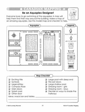
Be an Aquaplex Designer! (Draw a Simple Map with Specific Elements)
-
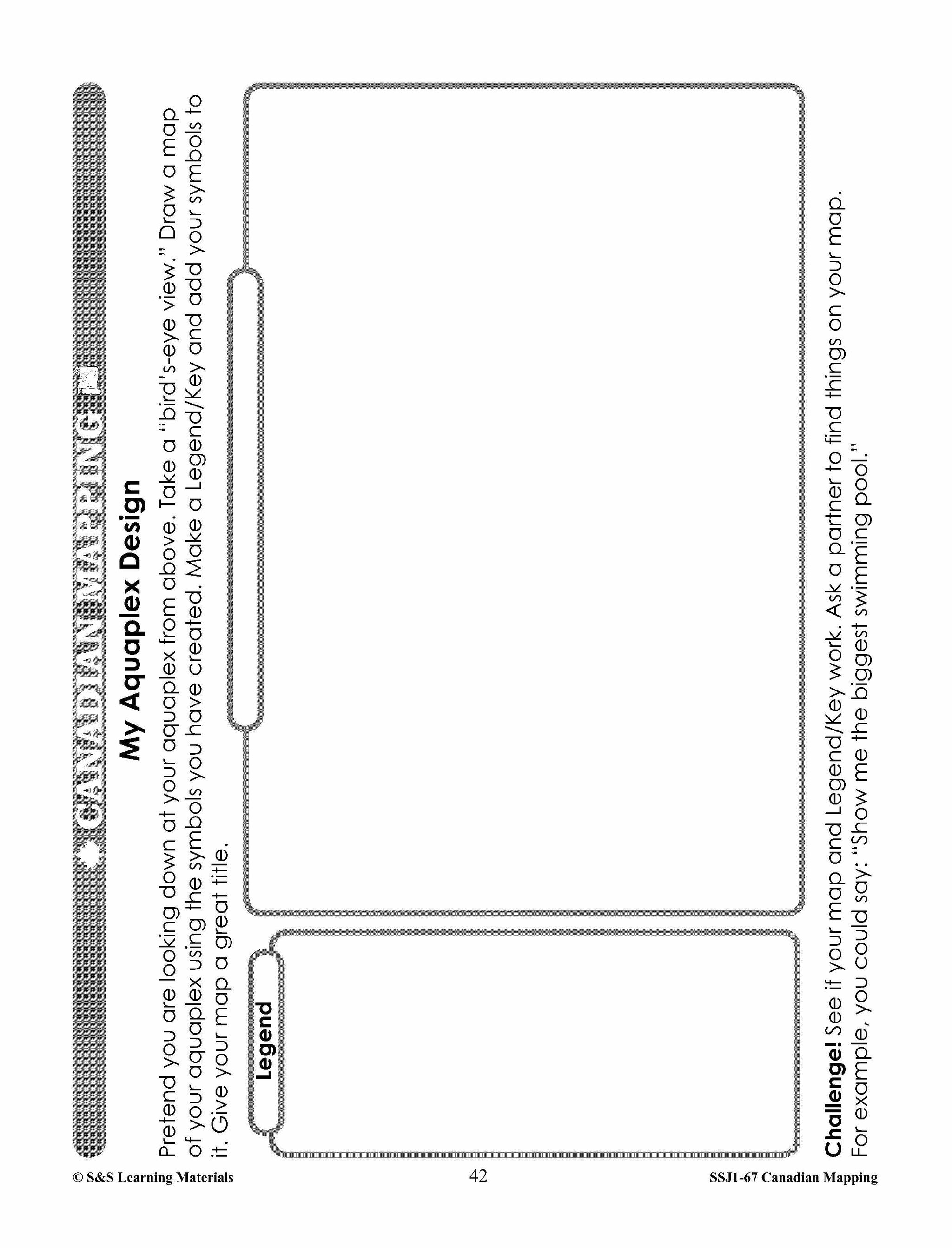
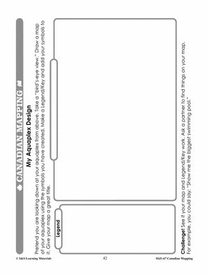
MyAquaplex Design (Draw a Simple Map with Specific Elements)
-
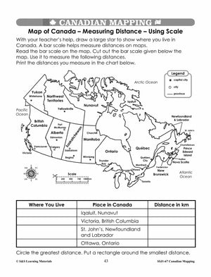
Map of Canada - Measuring Distance - Using Scale (Using Standard Units of Scale)
-
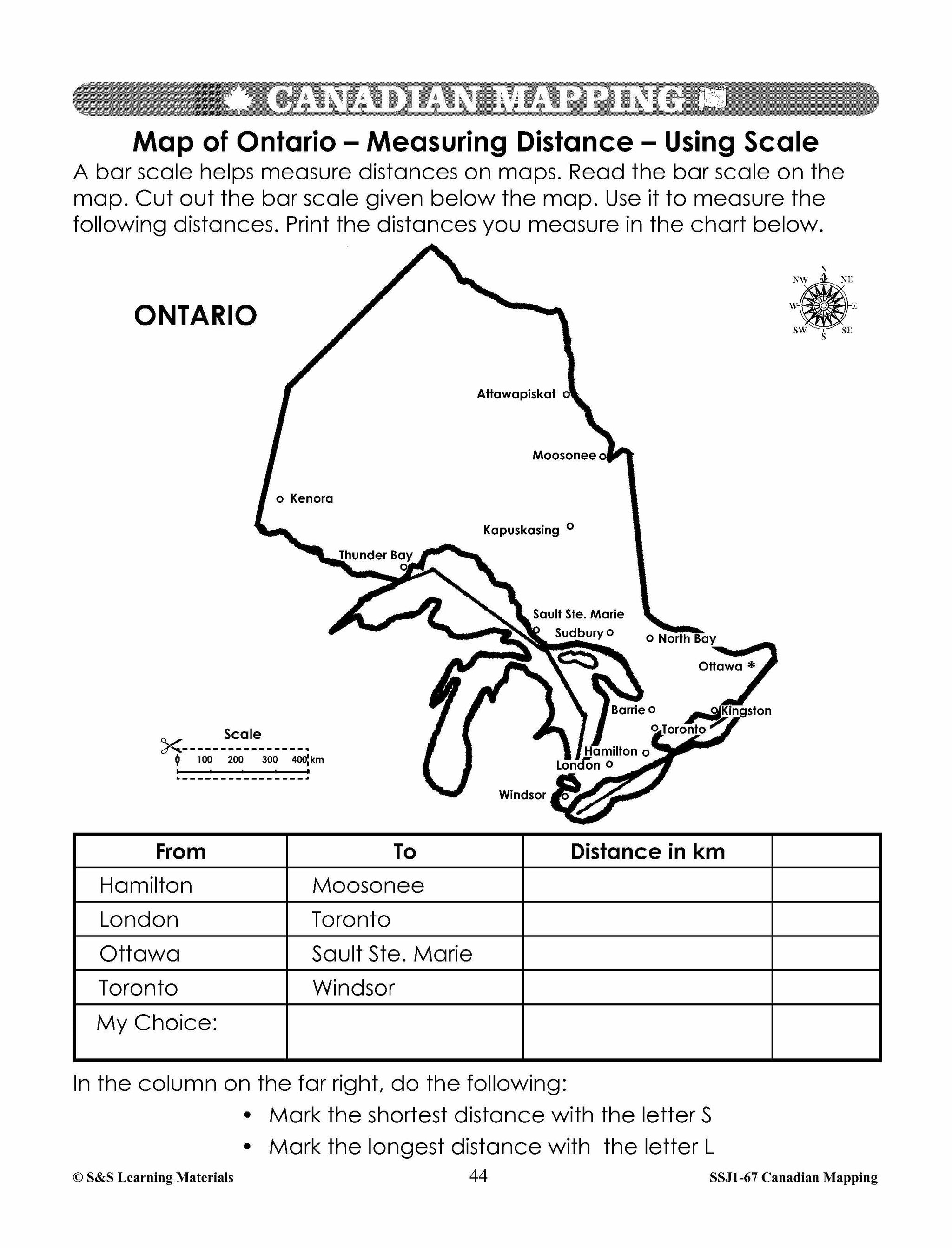
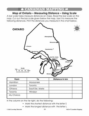
Map of Ontario - Measuring Distance - Using Scale (Using Standard Units of Scale)
-
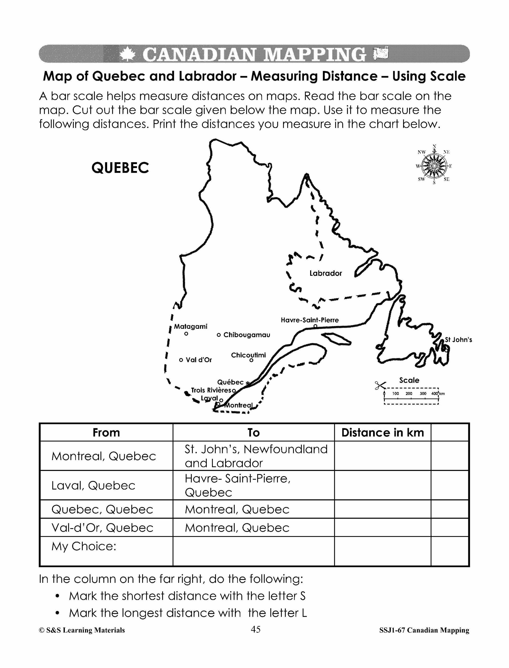
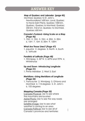
Map of Quebec and Labrador - Measuring Distance - (Scale Using Standard Units)
-
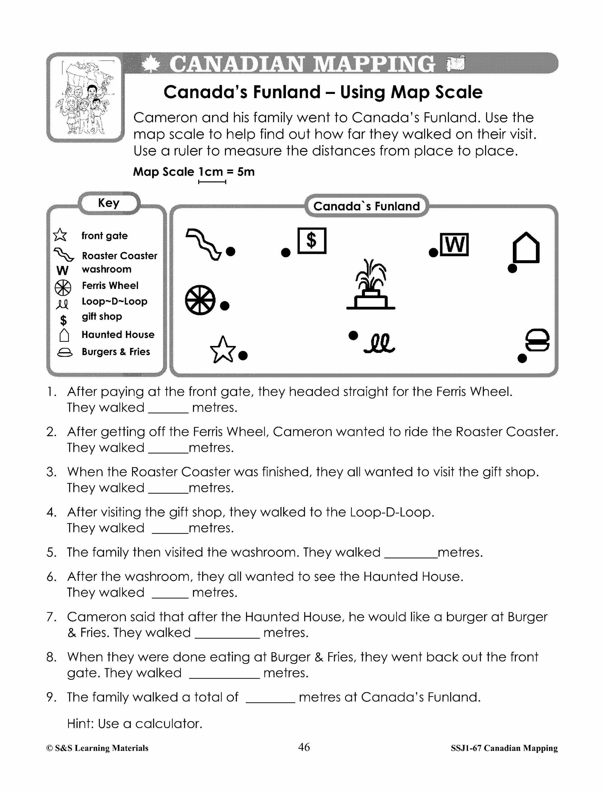
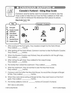
Canada's Funland - Using Map Scale (Use Simple Scale with Standard Units)
-
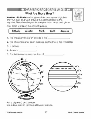
What Are Those Lines? (Parallels of Latitude)
-
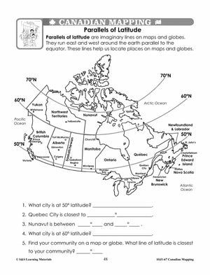
Parallels of Latitude (Map of Canada)
-
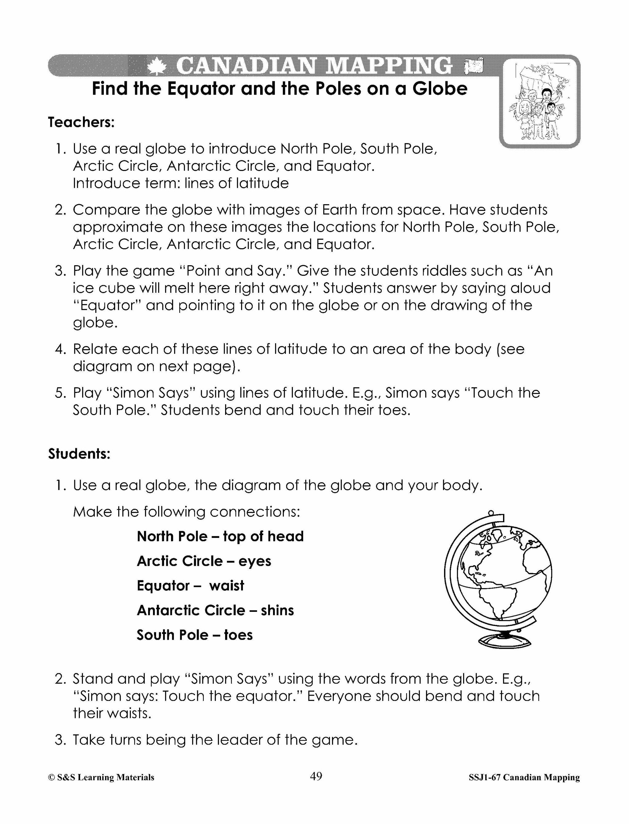
Find the Equator and the Poles on a Globe (Teacher Page)
-
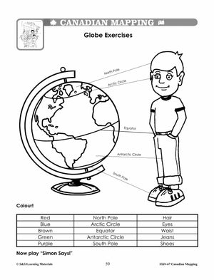
Globe Exercises (Game)
-
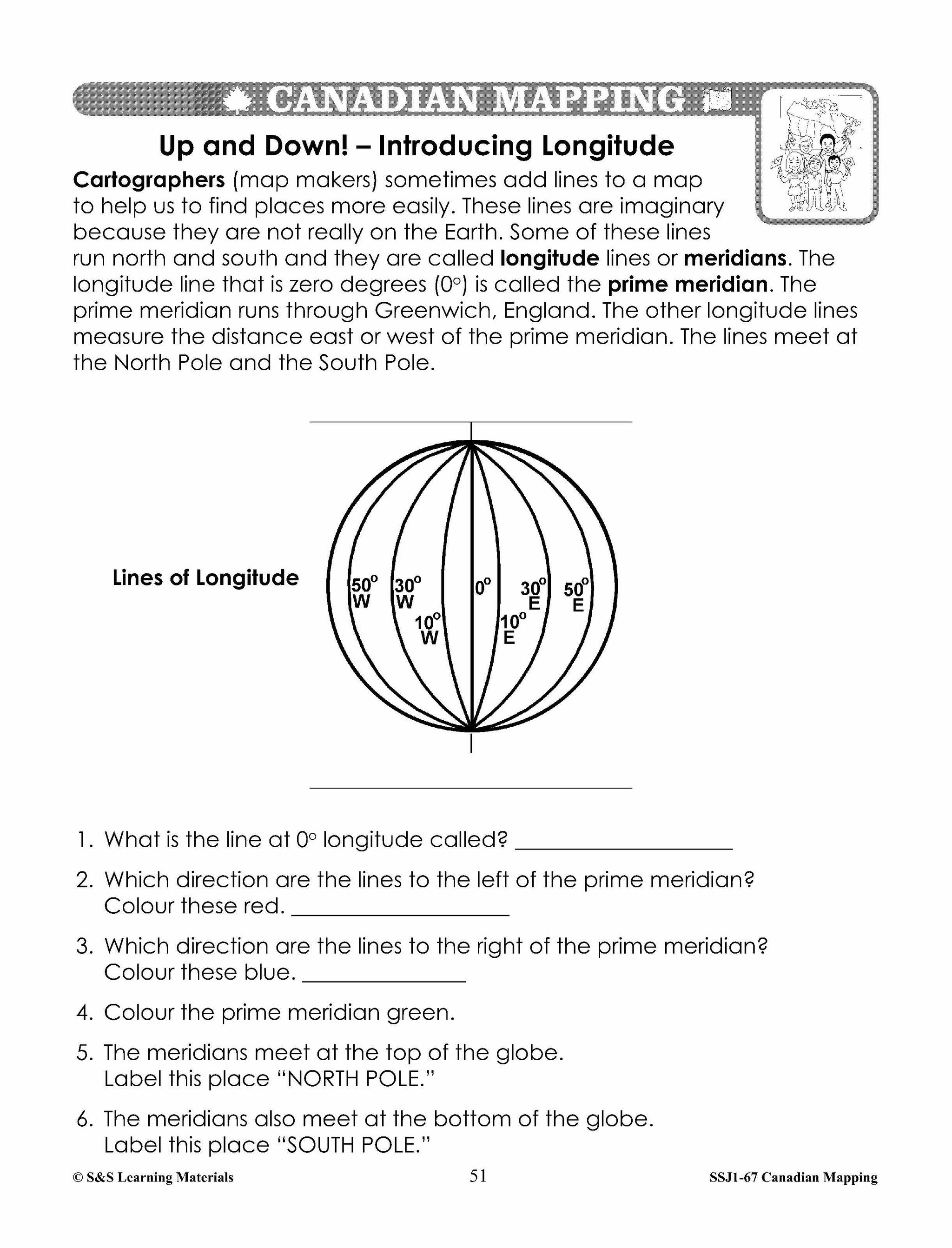
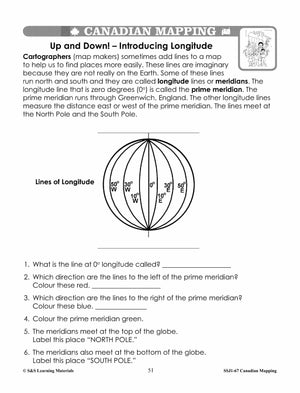
Up and Down - Introducing Longitude (Introduction)
-
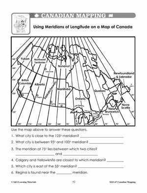
Using Meridians of Longitude on a Map of Canada (Canada Mapping Skill)
-
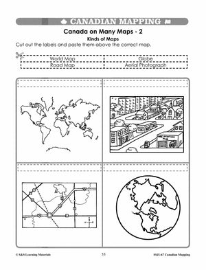
Canada on Many Maps - 2 (A Variety of Maps and Their Uses)
-
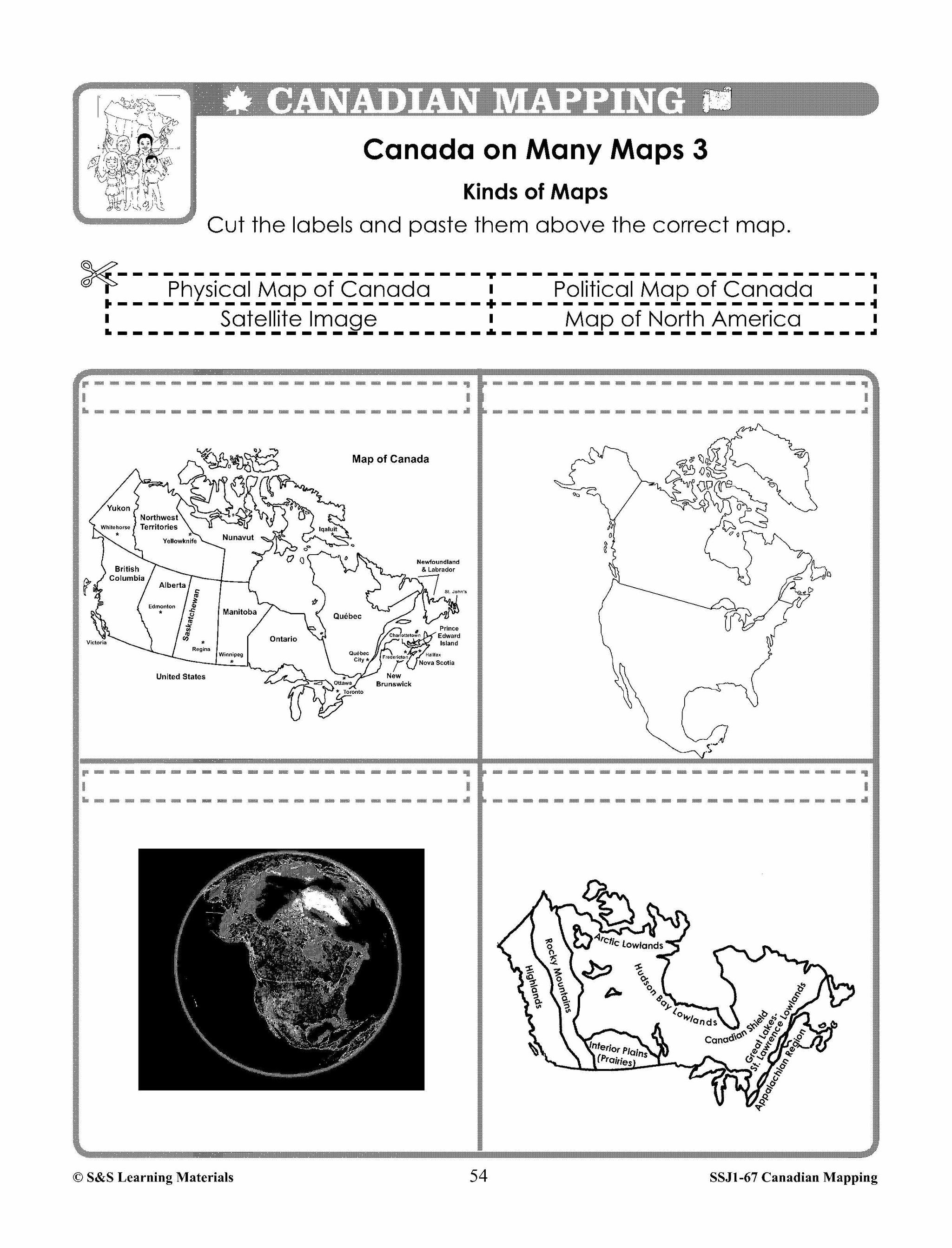
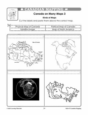
Canada on Many Maps - 3 ( A Variety of Maps and Their Uses)
-
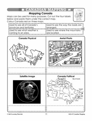
Mapping Canada (Getting Information from Maps)
-
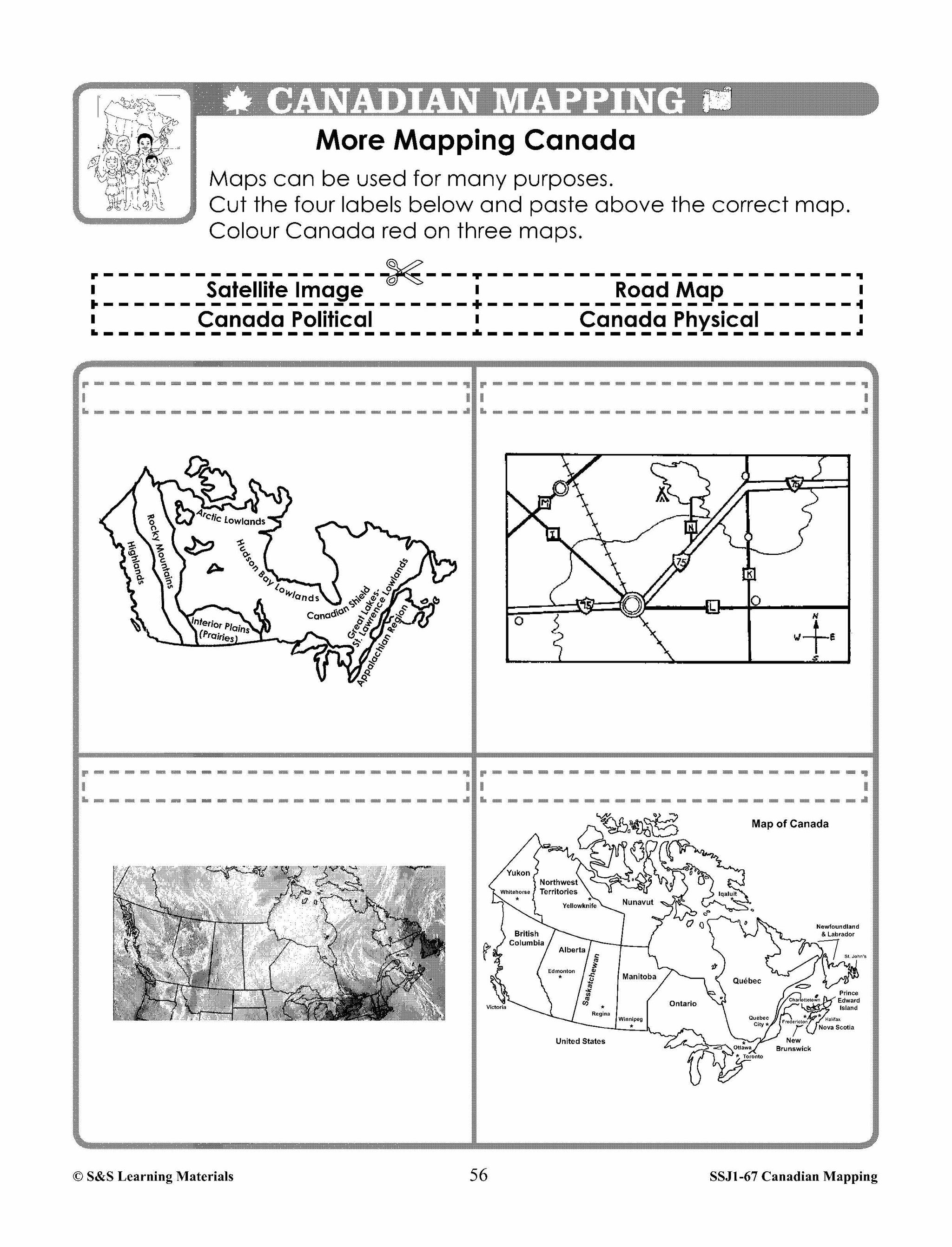
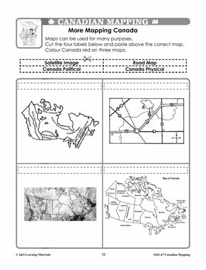
More Mapping Canada (Getting Information from Maps)