


E Lesson Plan
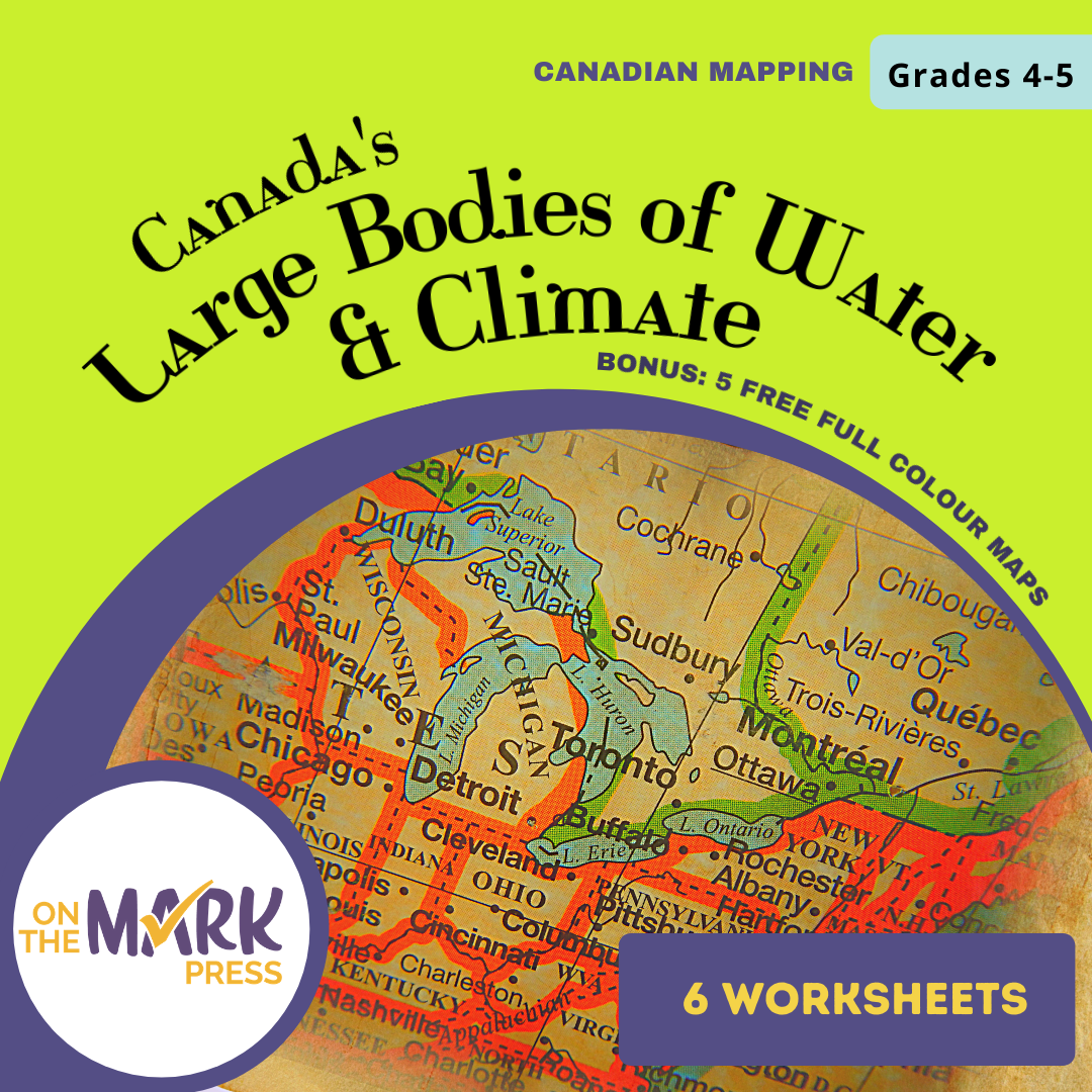
Canada's Large Bodies of Water & Climate Worksheets Grades 5-6
EBJ16905
$7.45 CAD
Additional information:
Using the six activities with worksheets, students will learn about Canada's large bodies of water, our climate and our geographic connection with the United States.
-
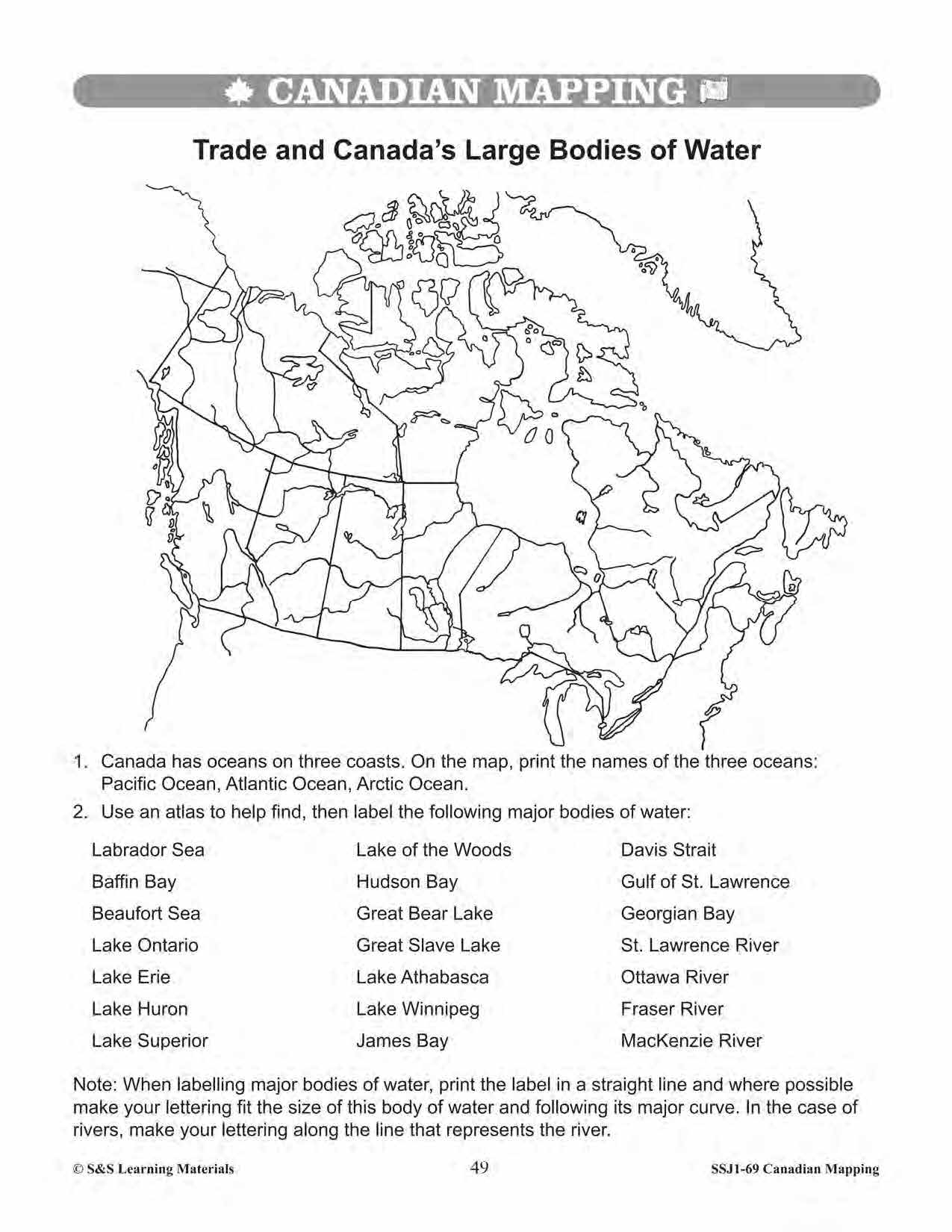
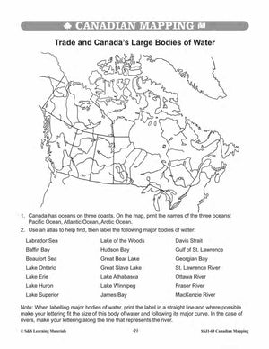
Trade and Canada’s Large Bodies of Water
-
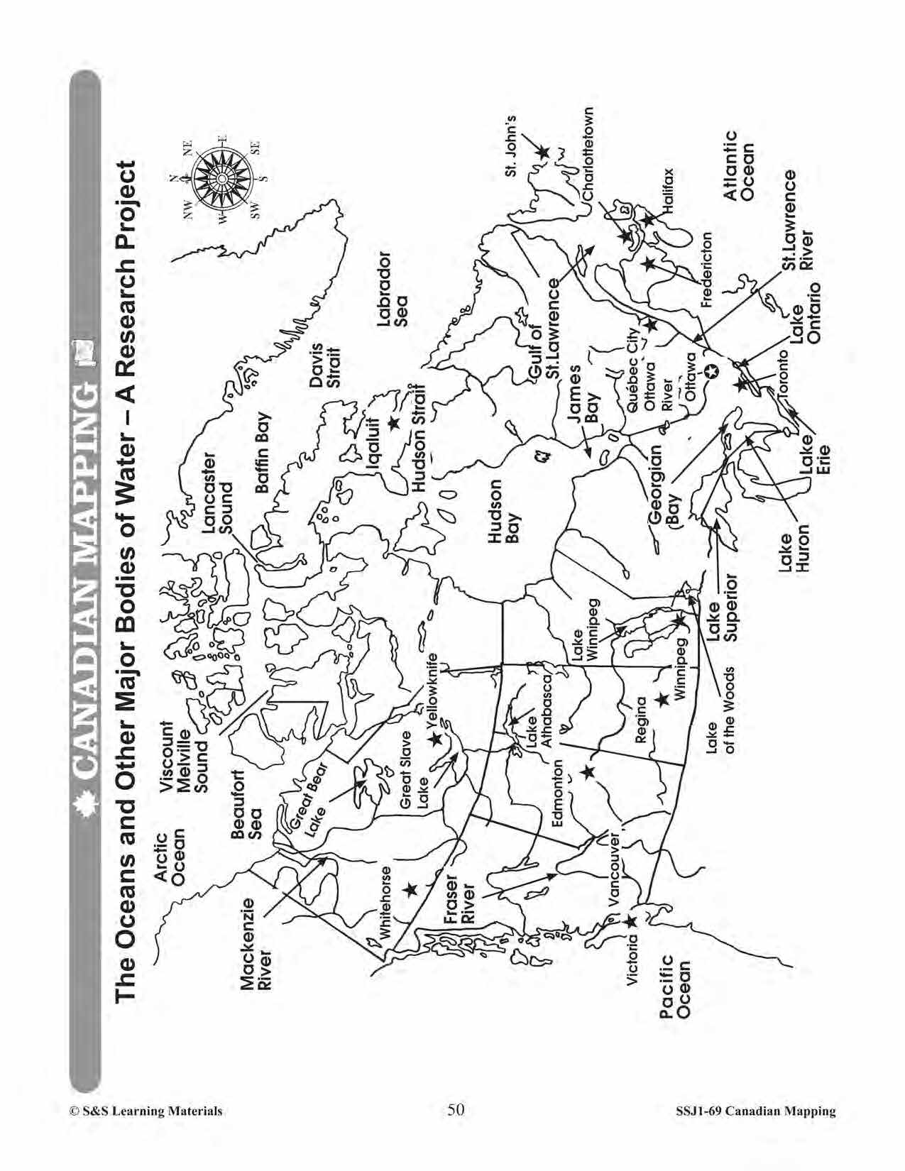
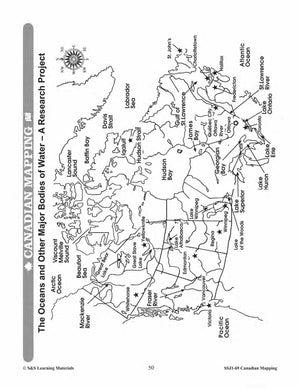
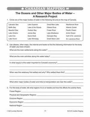
The Oceans and Other Major Bodies of Water - A Research Project
-
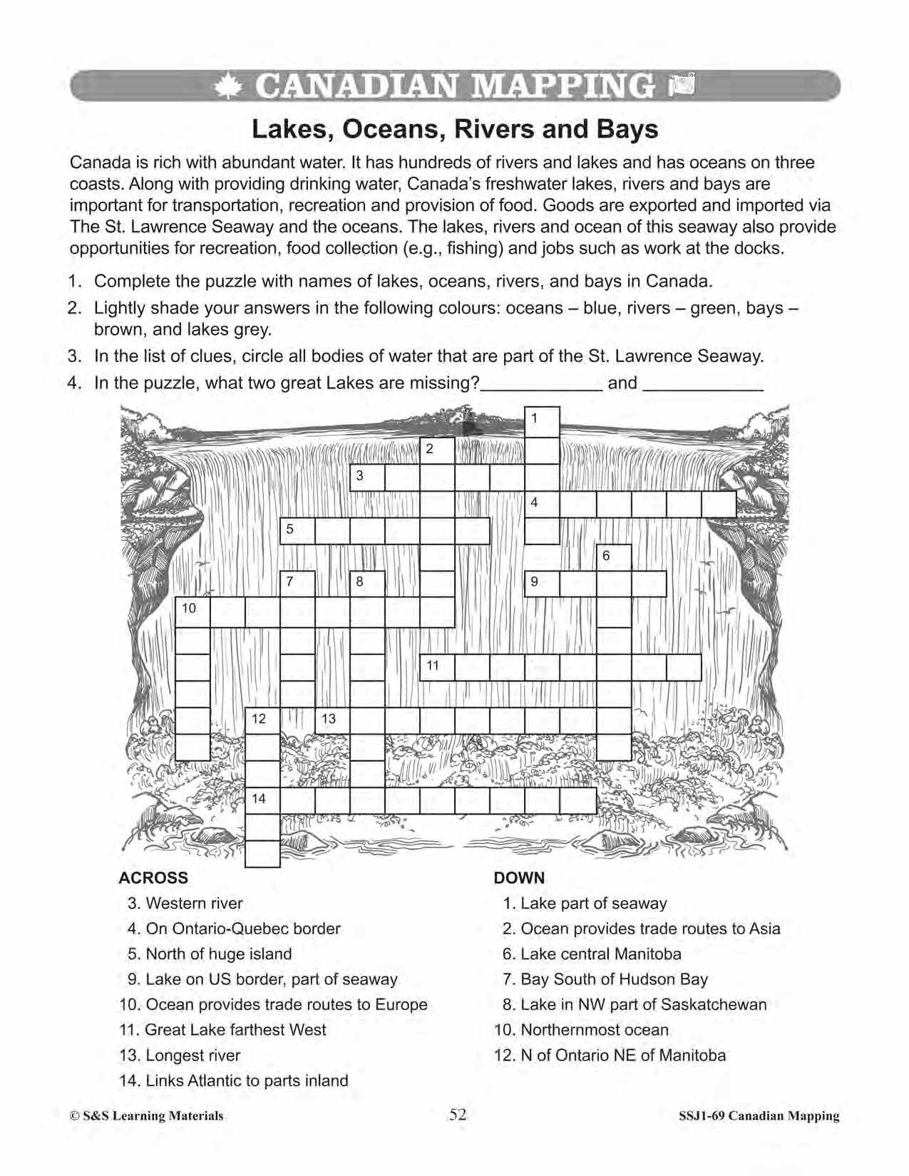
Lakes, Oceans, Rivers, and Bays
-
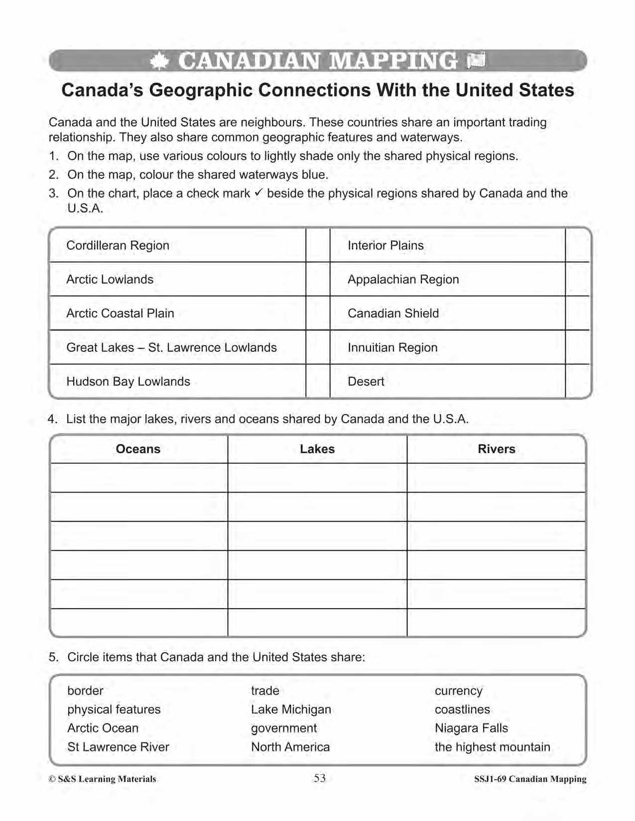
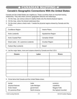
Canada’s Geographic Connections With the United States
-
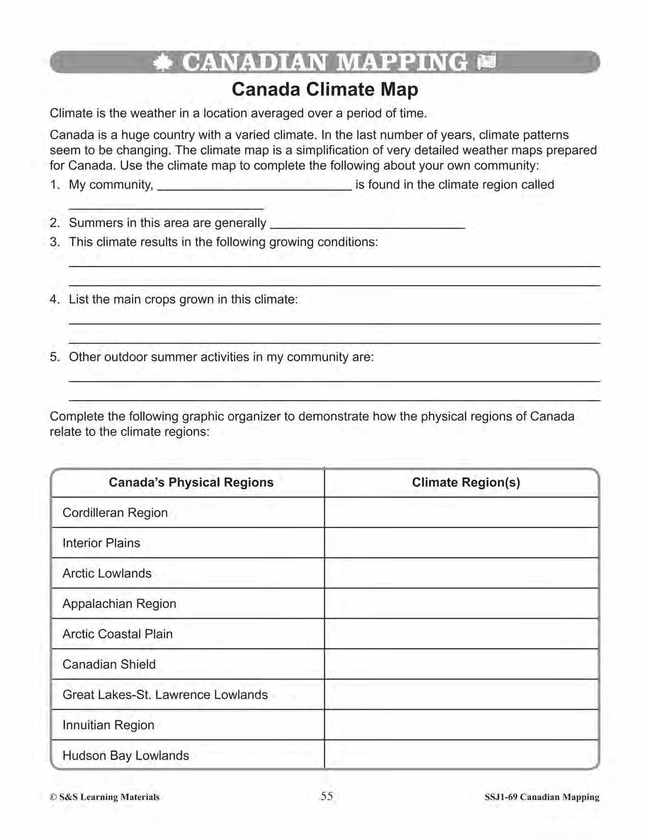
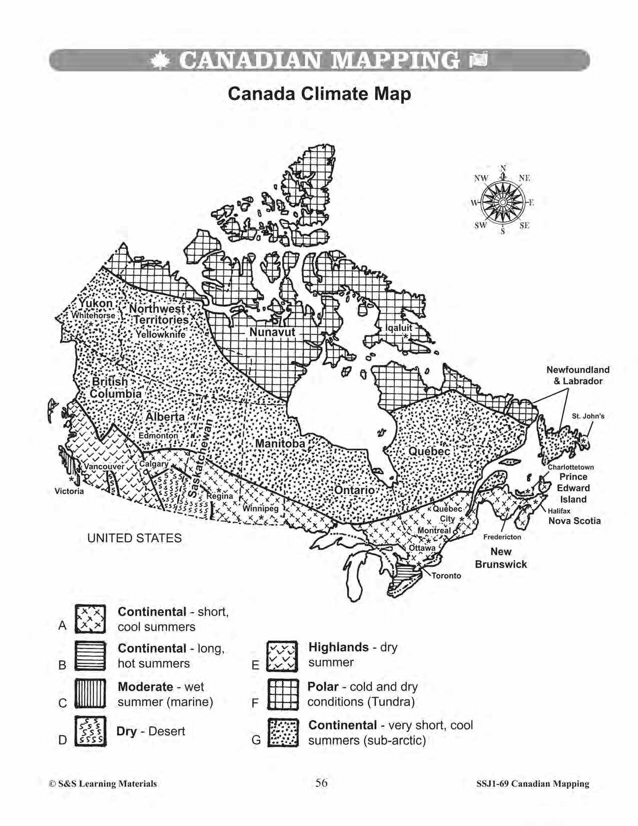
Canada Climate Map
-
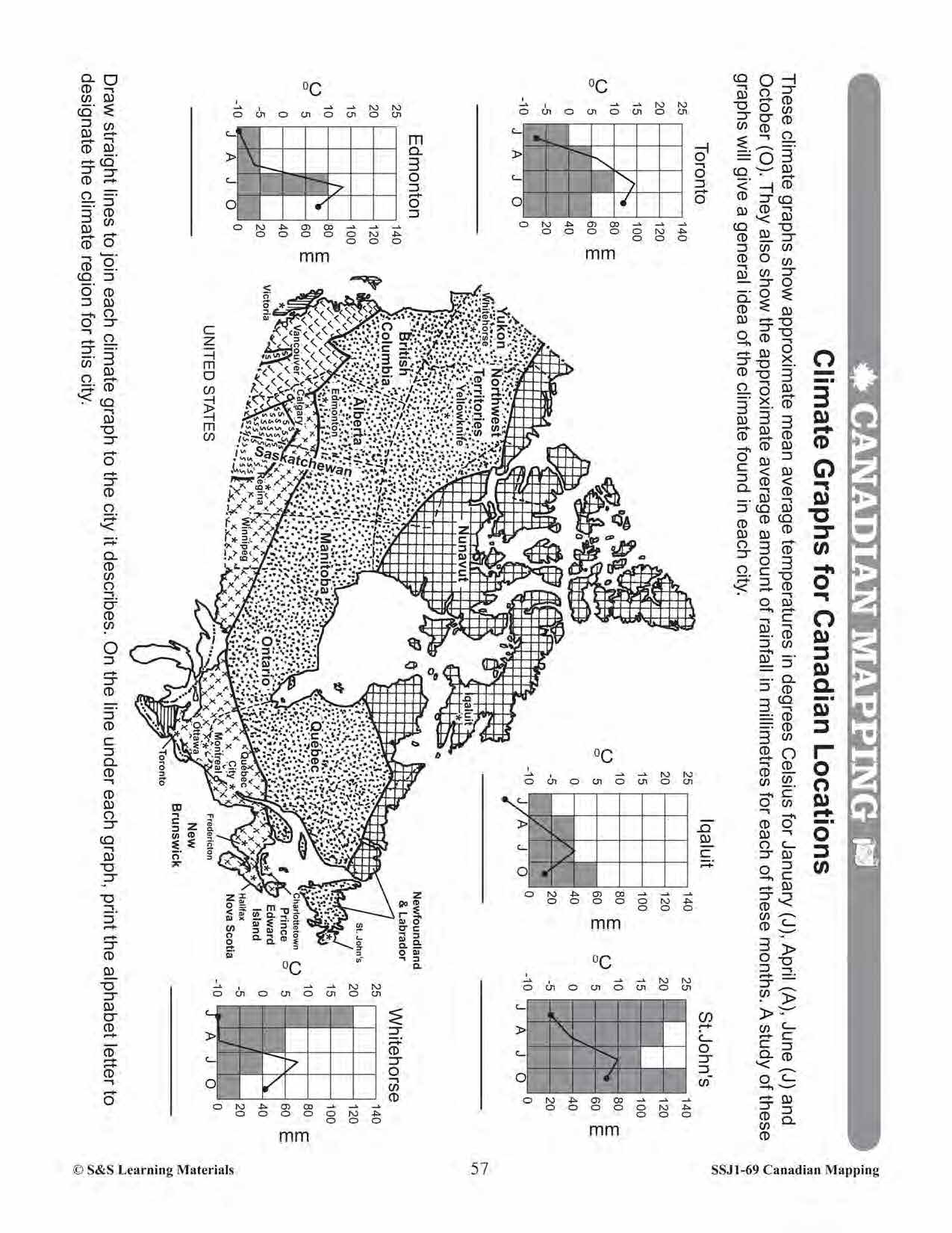
Climate Graphs for Canadian Locations
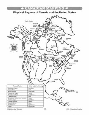
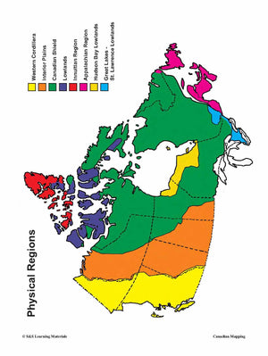
Teacher information on these topics: what a map is, types of maps, how to read a map, map indexes, scale, and geographic grids, hemispheres, directional indicators, and map symbols, GIS, and satellite images. The glossary of geographic terms can be used to introduce the topic in a group. Helpful teacher notes are included for specific worksheets.
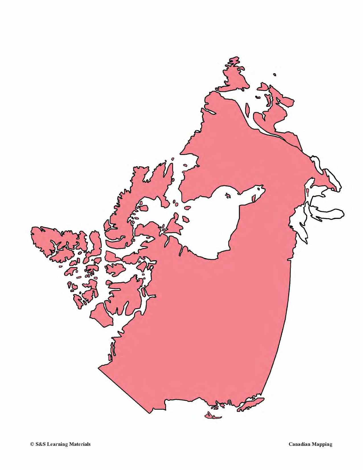
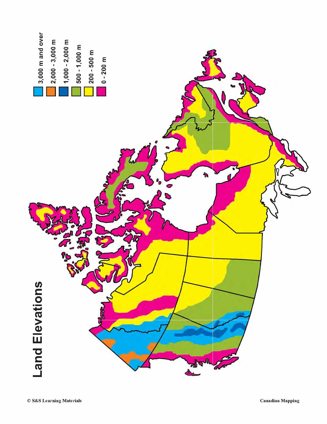
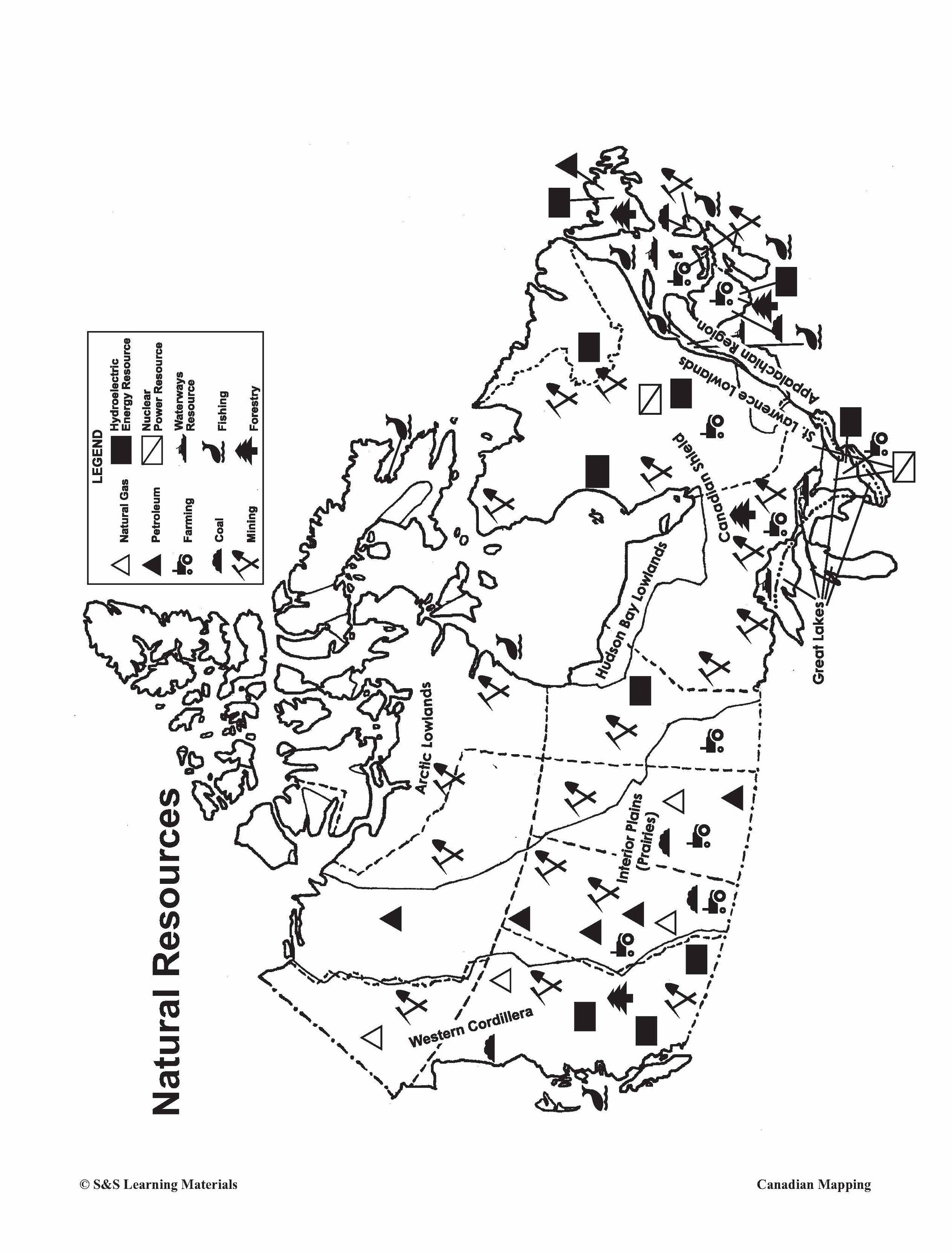
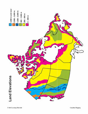
Bonus: Five Full-Colour Maps! (Outline Map of Canada, Political Map of Canada, Physical Map of Canada, Land Elevations of Canada, and Natural Resources map)
24 pages including an answer key.