


Big Book of Canadian Mapping Skills Grades 1-3
EBJ170
$39.99 CAD
Additional information:
- Author : Golletz, Lynda
They will be introduced to mapping terms such as; country, border, ocean, province, territory, continent, hemisphere, latitude, longitude, symbols, legend, scale, and cardinal and intermediate directions.
Everything you need to teach and strengthen mapping skills for Grades 1, 2 and 3! No Prep Worksheets teach every aspect of mapping. Students will learn about Canada, as they study its geography.
For the teacher:
- Helpful Teacher Tips & Forms
- Teacher Rubric - Grades 1 to 2 and 3
- Student Self-Assessment Rubric - Grades 1 to 3
- Teacher Information
- Glossary of Geographic Terms
- Helpful Teacher Notes for Specific Pages - Grade 3
- Outline Provincial & Territorial Maps
Bonus: Five Full-Colour Maps! (Outline Map of Canada, two Political Maps of Canada, Outline map of the World and North America)
Drilling down to the mapping skills covered:
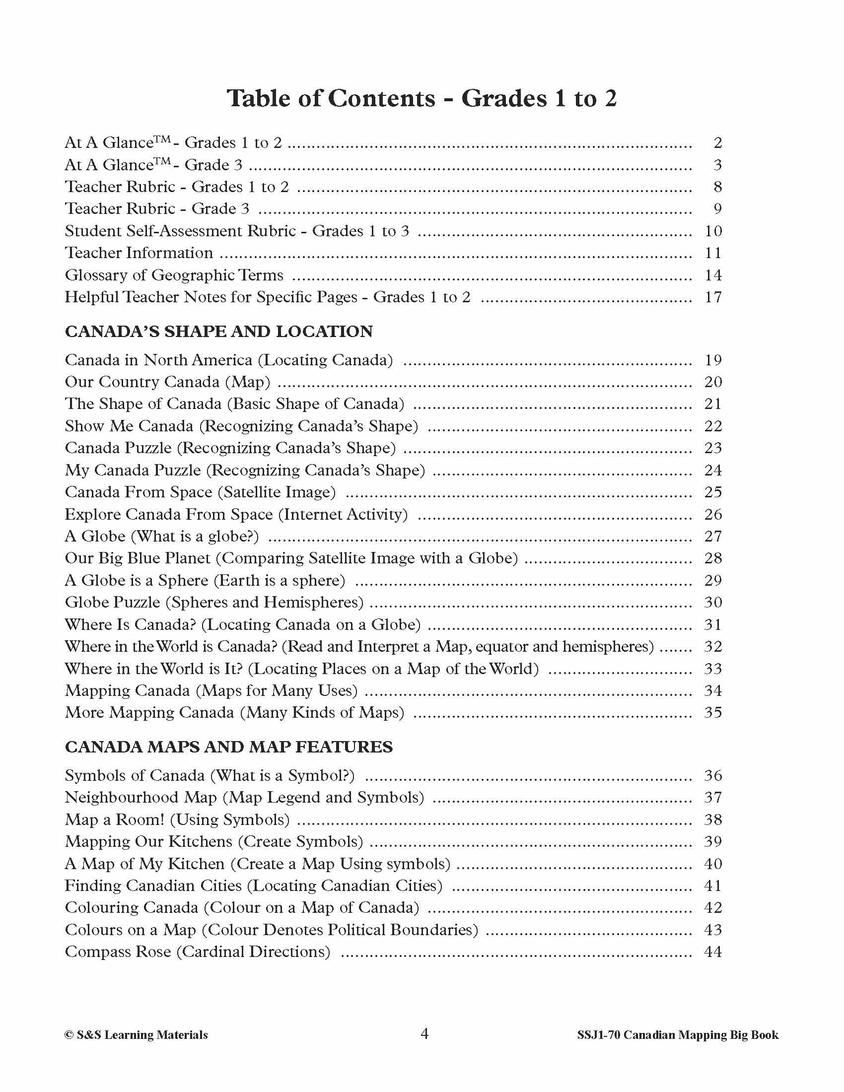
GRADES 1-2
CANADA’S SHAPE AND LOCATION
- Canada in North America (Locating Canada)
- Our Country Canada (Map)
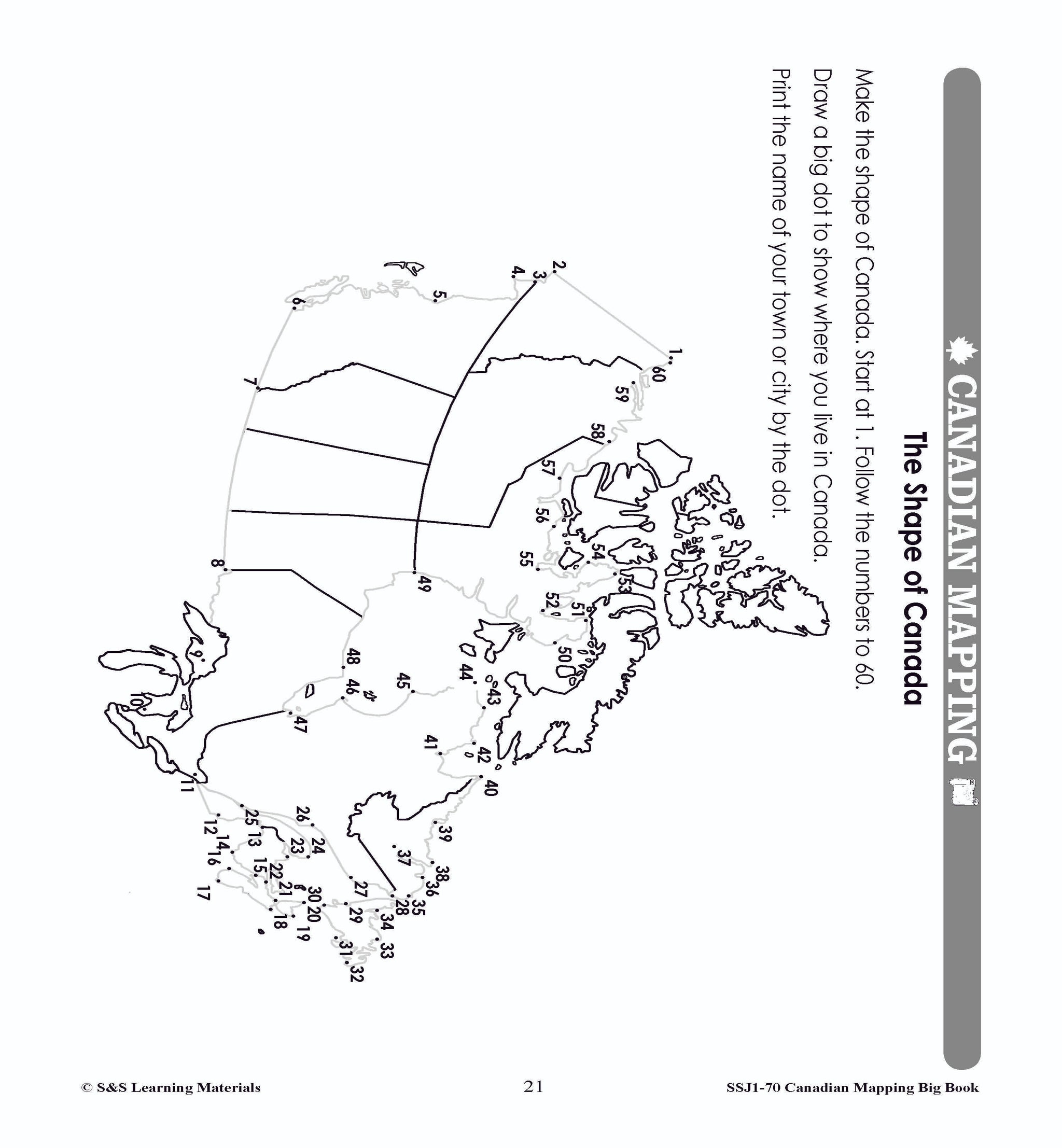
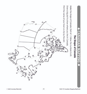
- The Shape of Canada (Basic Shape of Canada)
- Show Me Canada (Recognizing Canada’s Shape)
- Canada Puzzle (Recognizing Canada’s Shape)
- My Canada Puzzle (Recognizing Canada’s Shape)
- Canada From Space (Satellite Image)
- Explore Canada From Space (Internet Activity)
- A Globe (What is a globe?)
- Our Big Blue Planet (Comparing Satellite Image with a Globe)
- A Globe is a Sphere (Earth is a sphere)
- Globe Puzzle (Spheres and Hemispheres)
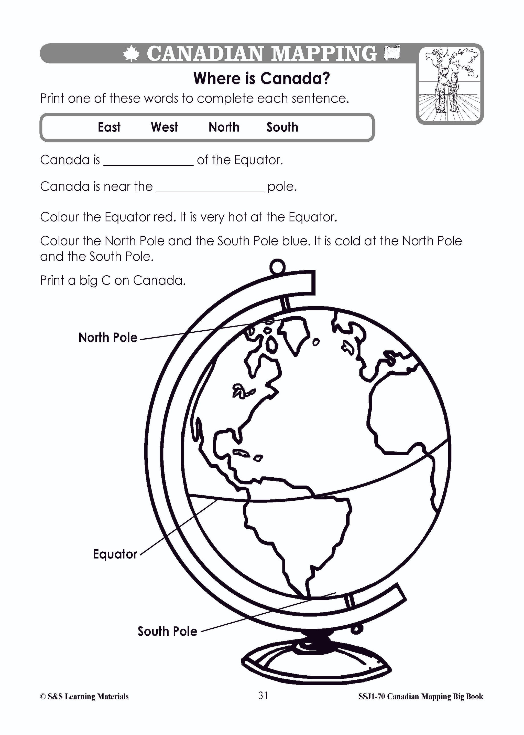
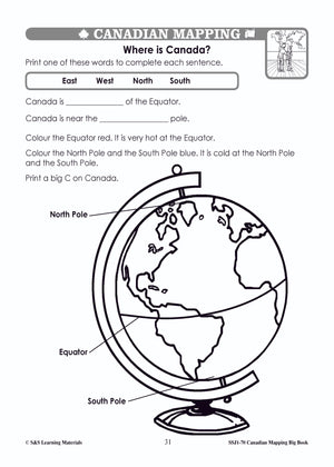
- Where Is Canada? (Locating Canada on a Globe)
- Where in the World is Canada? (Read and Interpret a Map, equator and hemispheres)
- Where in the World is It? (Locating Places on a Map of the World)
- Mapping Canada (Maps for Many Uses)
- More Mapping Canada (Many Kinds of Maps)
CANADA MAPS AND MAP FEATURES
- Symbols of Canada (What is a Symbol?)
- Neighbourhood Map (Map Legend and Symbols)
- Map a Room! (Using Symbols)
- Mapping Our Kitchens (Create Symbols)
- A Map of My Kitchen (Create a Map Using symbols)
- Finding Canadian Cities (Locating Canadian Cities)
- Colouring Canada (Colour on a Map of Canada)
- Colours on a Map (Colour Denotes Political Boundaries)
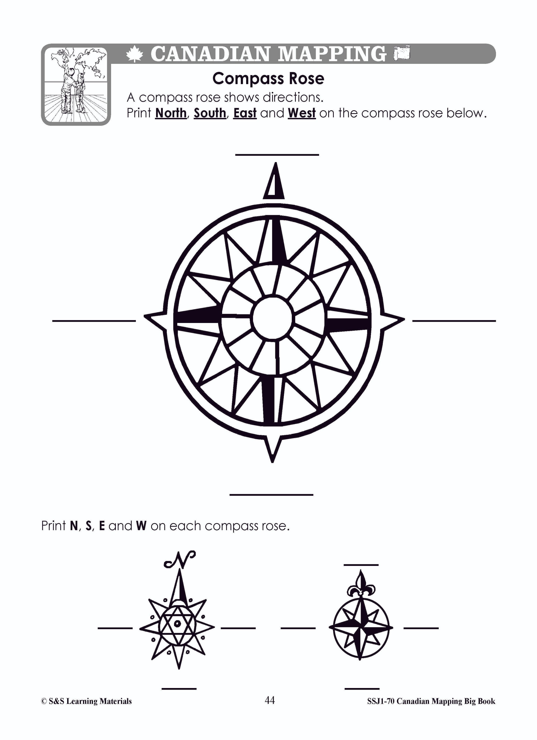
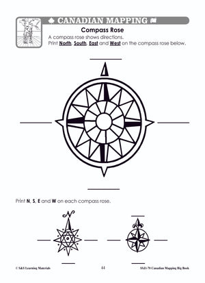
- Compass Rose (Cardinal Directions)
- North, South, East, West (Cardinal Directions)
- Mall Map (Using Cardinal Directions)
- What Way? (Using Cardinal and Intermediate Directions)
- Aidan Loses Things (Using Cardinal Directions)
- Jessie’s New House (Map Reading)
- Using a Map Legend (Symbols and Legend on Map of Canada)
- More Using a Map Legend (Symbols and Legend on Map of Canada)
- Be a Park Designer! (Creating a Map)
- My Park Map (Creating a Map)
- How Far Is It? (Using a Simple Scale - non standard units)
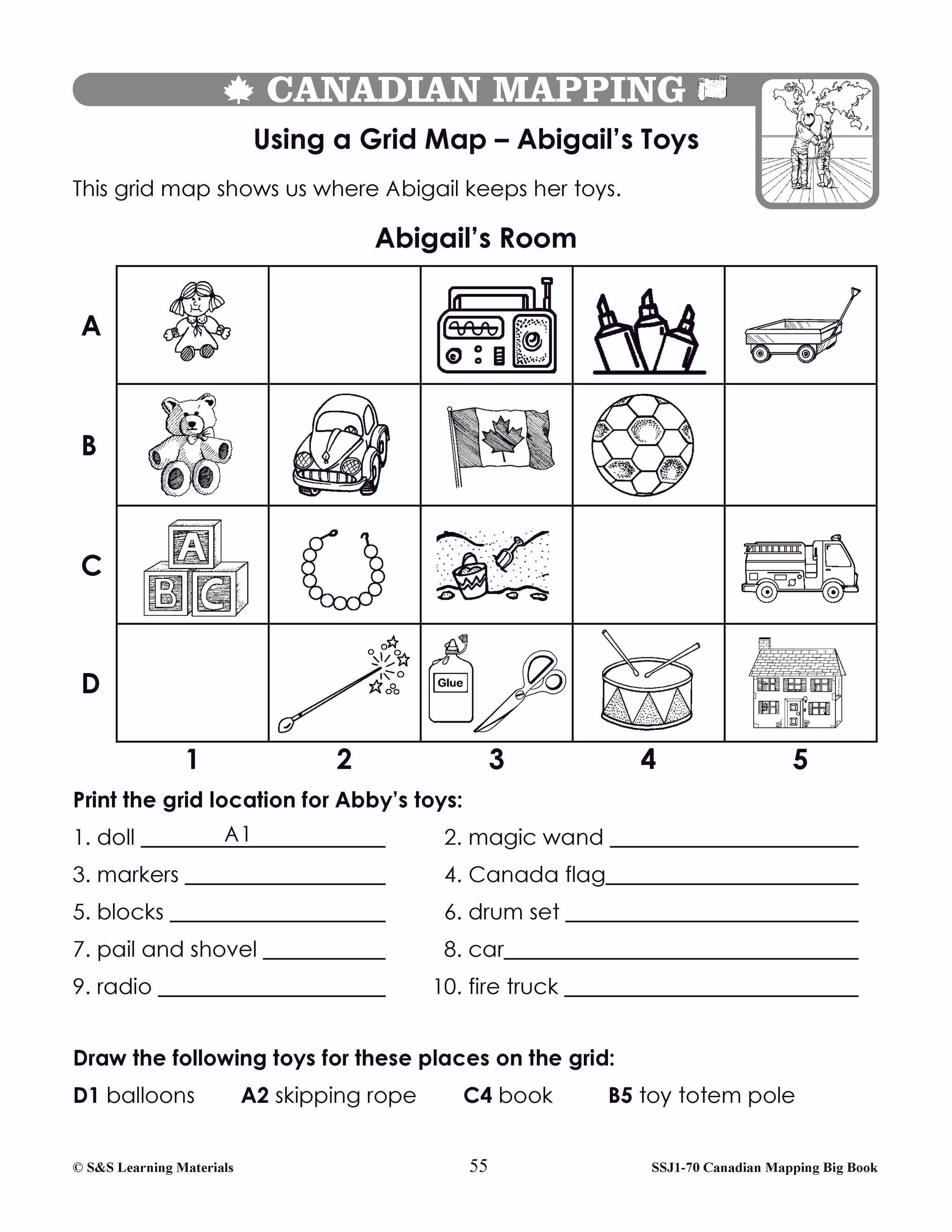
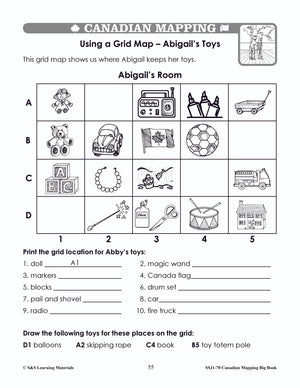
- Using a Grid Map (Using a Simple Grid)
- Using a Grid on a Map of Canada (Using a Simple Grid)
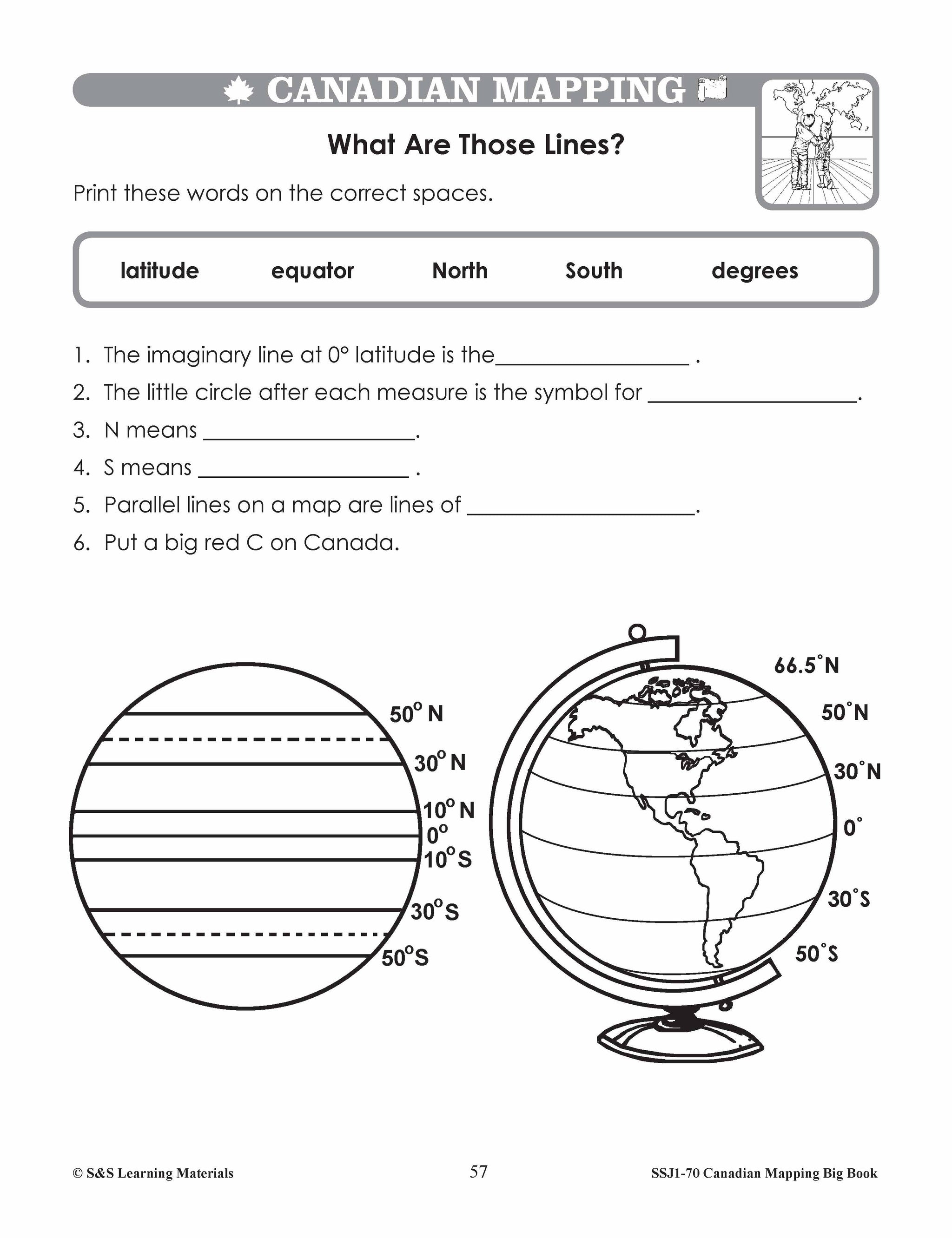
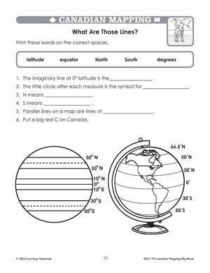
- What Are Those Lines? (Parallels of Latitude)
- Parallels of Latitude (Map of Canada)
- The Parallels and Longitude Game (A Game for a Large Group)
- Find the Equator and the Poles on a Globe (A Game for the Class)
- Now Play “Simon Says!” (Continuation of Game)
- Many Many Maps (Locate Canada)
- Global Views (Recognize Canada in a Variety of Views on Globes)
MAP VOCABULARY
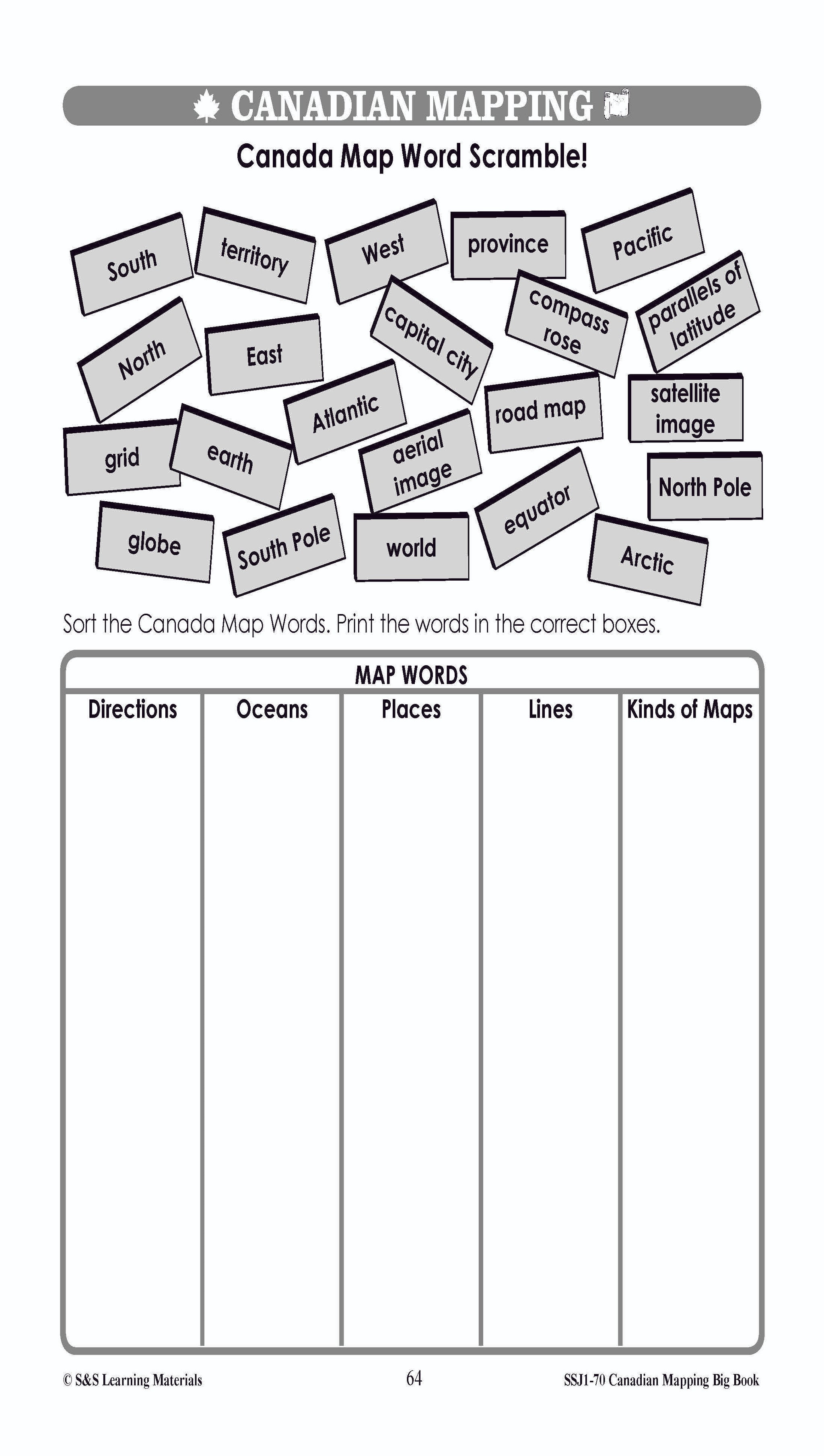
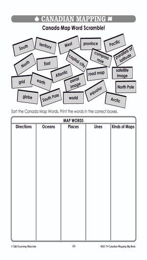
- Canada Map Word Scramble (Map Vocabulary)
- Canada’s Water (Major Bodies of Water)
- Can You Find the Water Words? (Major Bodies of Water)
- Country, Province, Territory (Map Vocabulary)
CANADIAN COMMUNITIES
- A Canadian Community Aerial View
- Where I Live (Locate Local Community on a Globe)
- Make a Road Map (Construct a Map)
- Lindsay and Anil’s Canadian Community (Consult a Map and Use a Legend)
- A Walk in Our Schoolyard (Checklist)
- A Map of Our Schoolyard (Creating a Map)
- A Walk in Our School Neighbourhood (Step 1: Drawing Activity)
- Our School Neighbourhood Checklist (Step 2: Checklist)
- Mapping Our School Neighbourhood (Step 3: Creating a Map)
- Assessment One (The Globe - Student Sheet)
- Assessment One (The Globe)
- Assessment Two (Canada in the World)
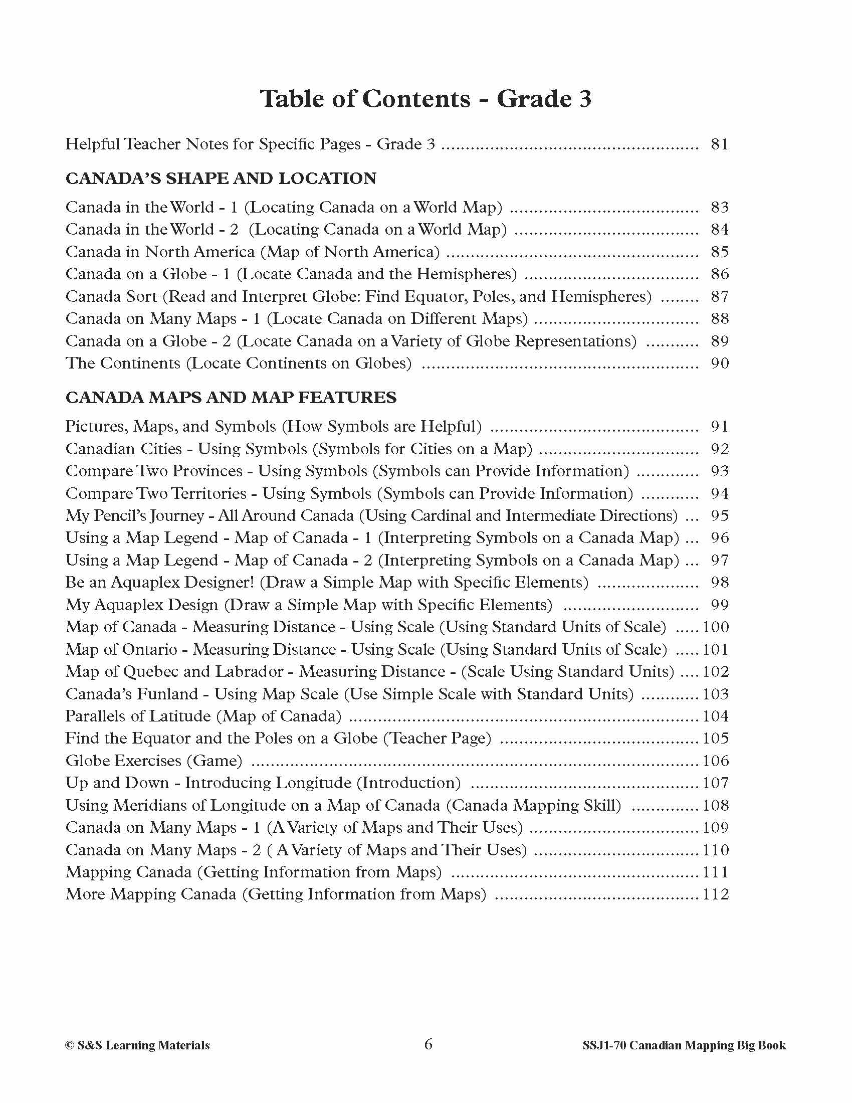
GRADE 3
CANADA’S SHAPE AND LOCATION
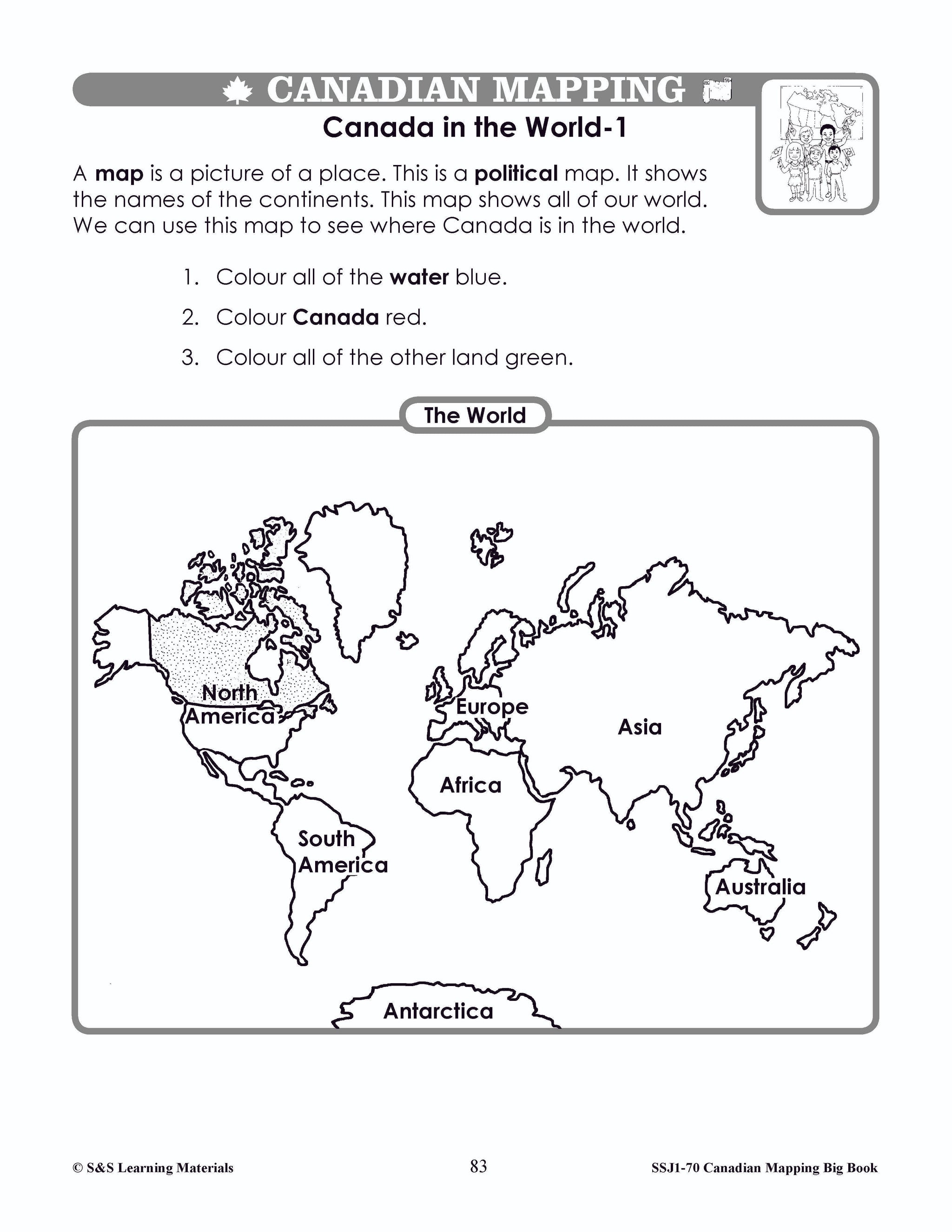
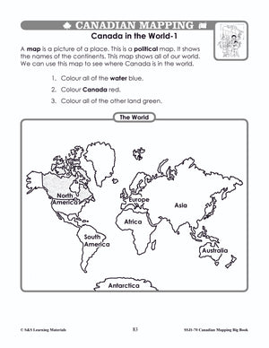
- Canada in the World – 1 & 2 (Locating Canada on a World Map)
- Canada in North America (Map of North America)
- Canada on a Globe - 1 (Locate Canada and the Hemispheres)
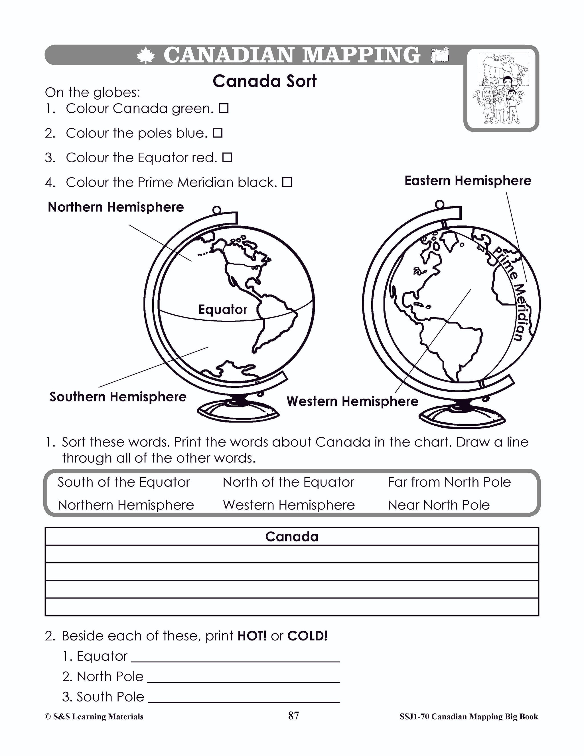
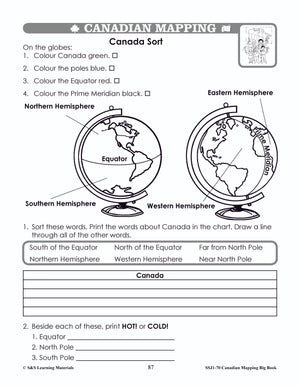
- Canada Sort (Read and Interpret Globe: Find Equator, Poles, and Hemispheres)
- Canada on Many Maps - 1 (Locate Canada on Different Maps)
- Canada on a Globe - 2 (Locate Canada on a Variety of Globe Representations)
- The Continents (Locate Continents on Globes)
CANADA MAPS AND MAP FEATURES
- Pictures, Maps, and Symbols (How Symbols are Helpful)
- Canadian Cities - Using Symbols (Symbols for Cities on a Map)
- Compare Two Provinces - Using Symbols (Symbols can Provide Information)
- Compare Two Territories - Using Symbols (Symbols can Provide Information)
- My Pencil’s Journey - All Around Canada (Using Cardinal and Intermediate Directions)
- Using a Map Legend - Map of Canada – 1 & 2
- Be an Aquaplex Designer! (Draw a Simple Map with Specific Elements)
- My Aquaplex Design (Draw a Simple Map with Specific Elements)
- Map of Canada - Measuring Distance - Using Scale (Using Standard Units of Scale)
- Map of Ontario - Measuring Distance - Using Scale (Using Standard Units of Scale)
- Map of Quebec and Labrador - Measuring Distance - (Scale Using Standard Units)
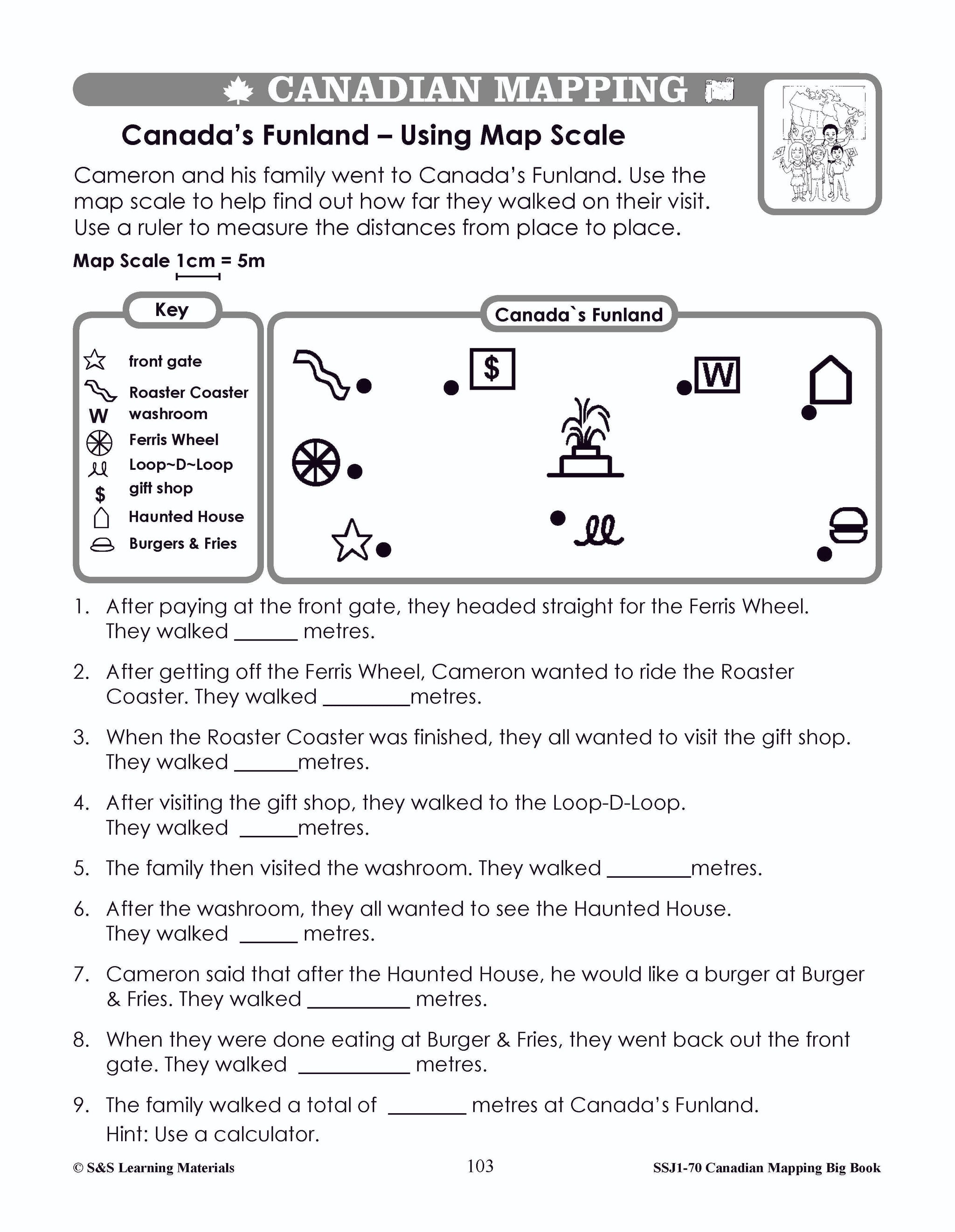
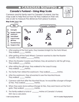
- Canada’s Funland - Using Map Scale (Use Simple Scale with Standard Units)
- Parallels of Latitude (Map of Canada)
- Find the Equator and the Poles on a Globe (Teacher Page)
- Globe Exercises (Game)
- Up and Down - Introducing Longitude (Introduction)
- Using Meridians of Longitude on a Map of Canada (Canada Mapping Skill)
- Canada on Many Maps – 1 & 2 (A Variety of Maps and Their Uses)
- Mapping Canada (Getting Information from Maps)
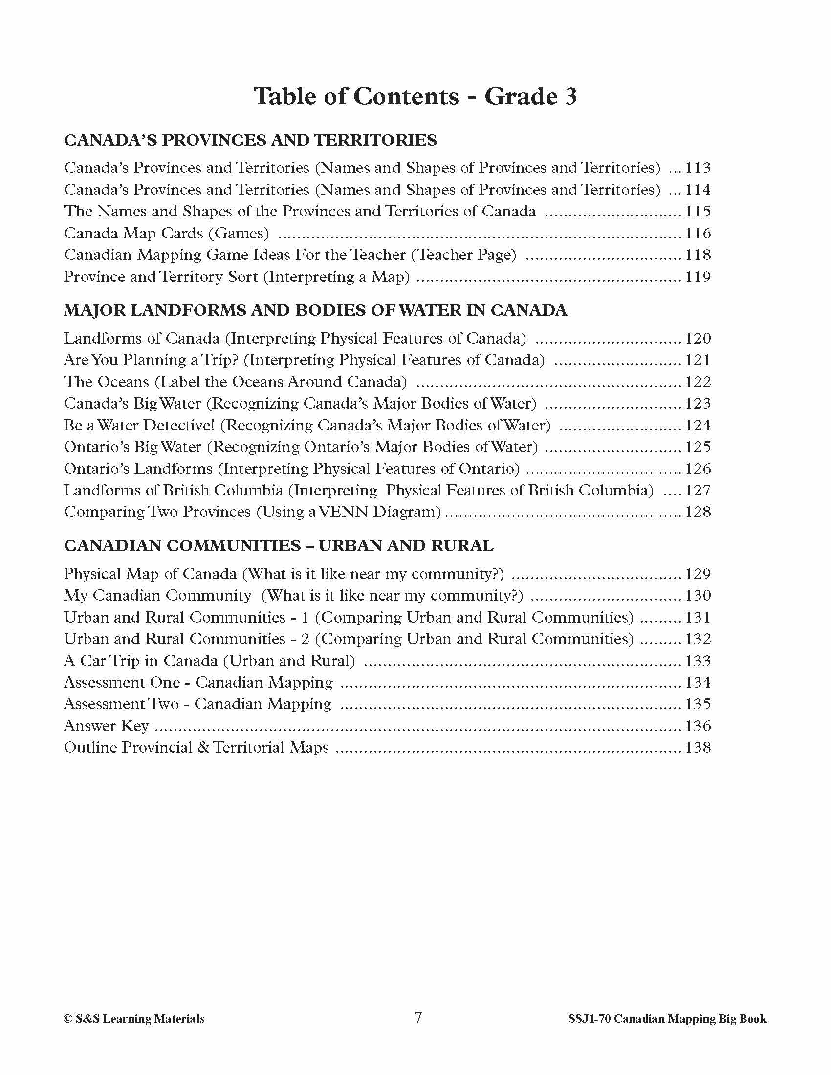
CANADA’S PROVINCES AND TERRITORIES
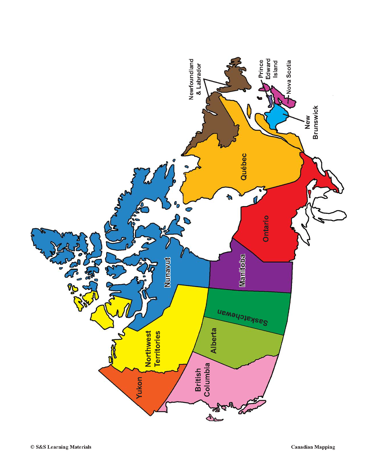
- Canada’s Provinces and Territories (Names and Shapes of Provinces and Territories)
- The Names and Shapes of the Provinces and Territories of Canada
- Canada Map Cards (Games)
- Canadian Mapping Game Ideas For the Teacher (Teacher Page)
- Province and Territory Sort (Interpreting a Map)
MAJOR LANDFORMS AND BODIES OF WATER IN CANADA
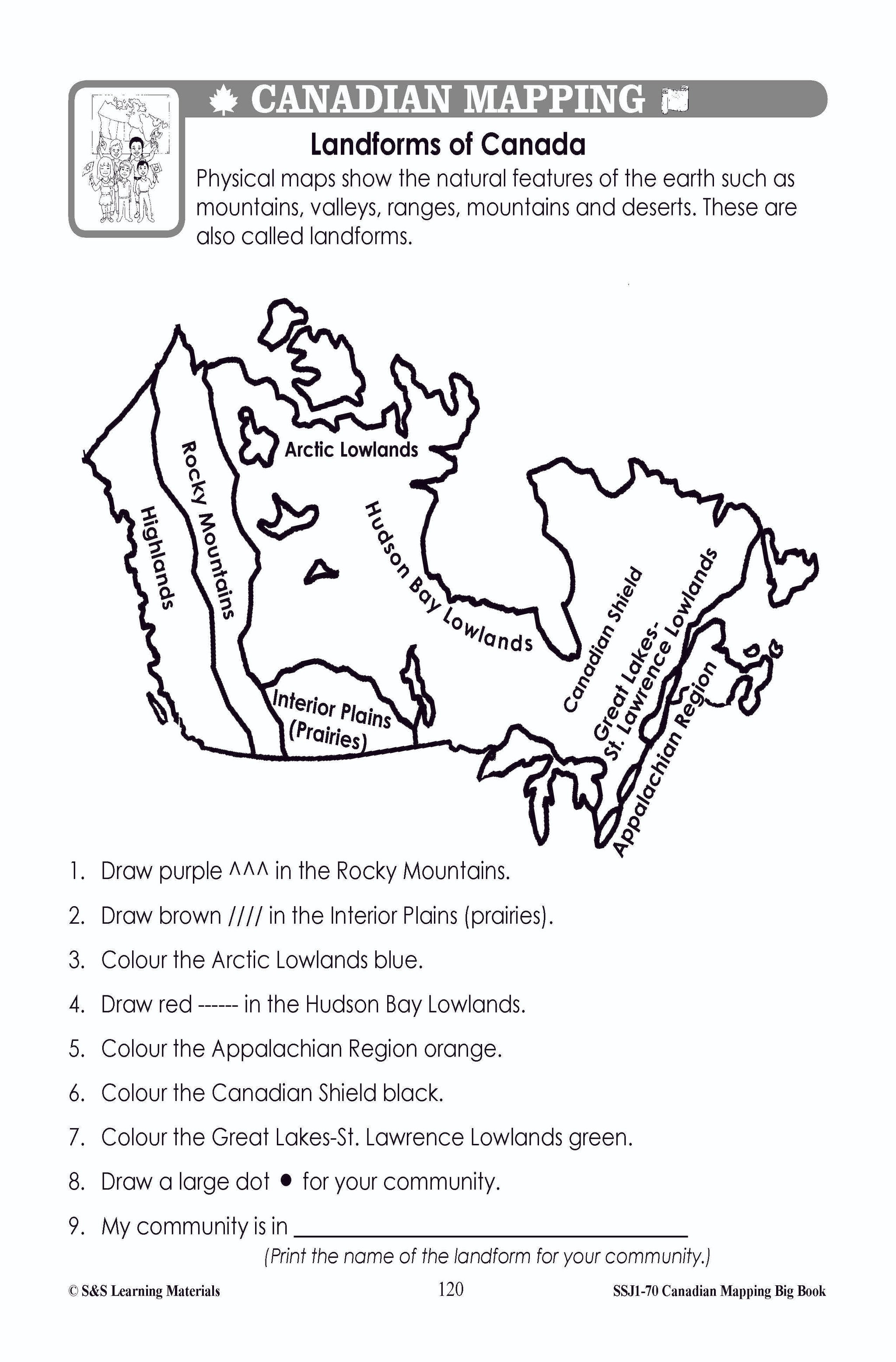
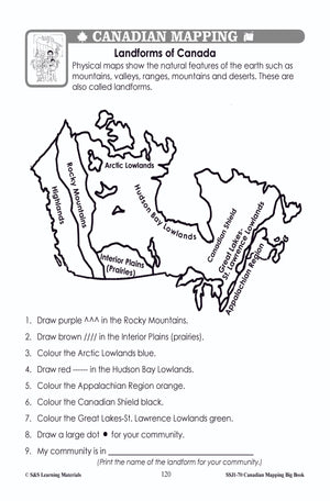
- Landforms of Canada (Interpreting Physical Features of Canada)
- Are You Planning a Trip? (Interpreting Physical Features of Canada)
- The Oceans (Label the Oceans Around Canada)
- Canada’s Big Water (Recognizing Canada’s Major Bodies of Water)
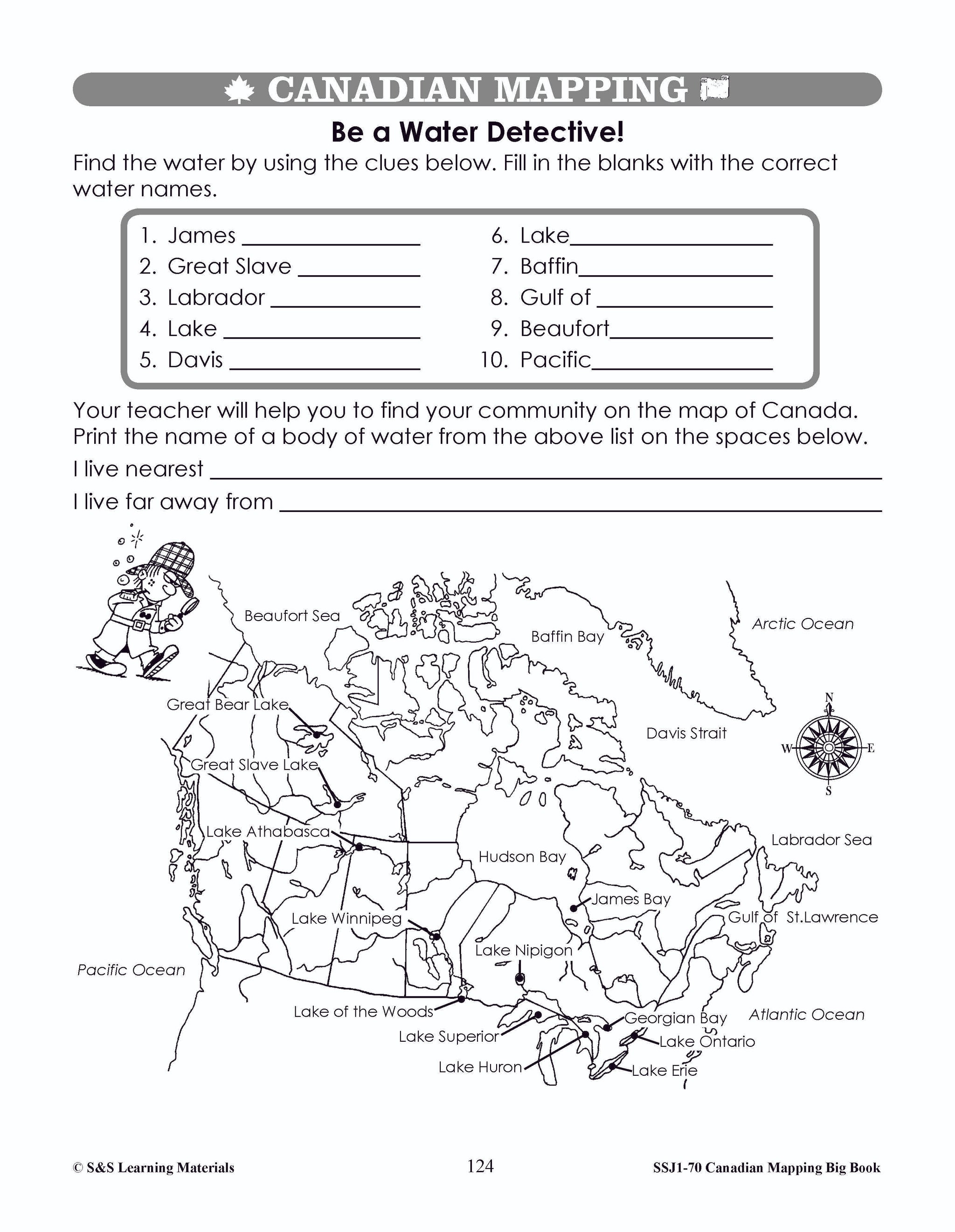
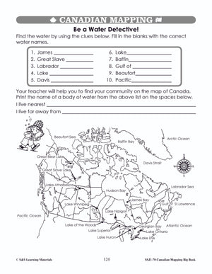
- Be a Water Detective! (Recognizing Canada’s Major Bodies of Water)
- Ontario’s Big Water (Recognizing Ontario’s Major Bodies of Water)
- Ontario’s Landforms (Interpreting Physical Features of Ontario)
- Landforms of British Columbia (Interpreting Physical Features of British Columbia)
- Comparing Two Provinces (Using a VENN Diagram).
CANADIAN COMMUNITIES – URBAN AND RURAL
- Physical Map of Canada (What is it like near my community?)
- My Canadian Community (What is it like near my community?)
- Urban and Rural Communities – 1 & 2 (Comparing Urban and Rural Communities)
- A Car Trip in Canada (Urban and Rural)
- Assessment One & Two - Canadian Mapping
144 pages including an answer key.
You may also like:
Canadian Daily Language Activities
Canadian Math Google Slide Activities
Follow us on:
![]()
![]()