
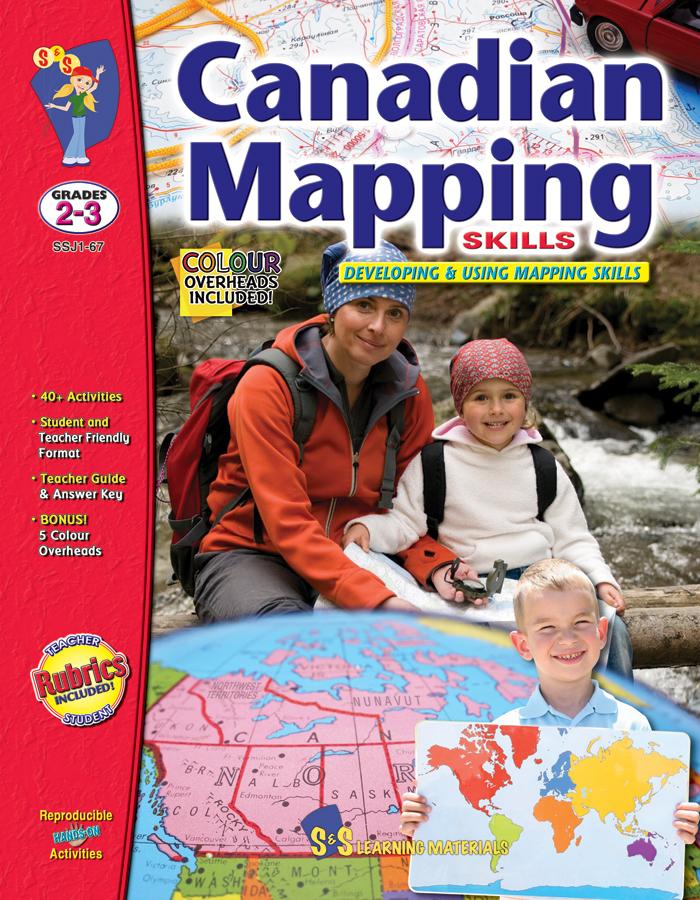


Canadian Mapping Skills: Developing and Using Mapping Skills Grades 2-3
EBJ167
$32.99 CAD
Additional information:
- Author : Golletz, Lynda
Help your Grade 2–3 students build strong mapping and geography skills with Canadian Mapping Grades 2–3! This comprehensive resource teaches students how to read, interpret, and create maps while exploring Canada’s provinces, territories, landforms, bodies of water, and communities. Students learn essential skills such as using symbols, legends, grids, scale, latitude, longitude, and directional indicators.
Aligned with Social Studies expectations across all Canadian provinces and territories, this resource includes hands‑on activities, map‑making tasks, comparison charts, community mapping, and real‑world applications. Students locate Canada on globes and world maps, compare provinces and territories, explore urban and rural communities, and interpret physical and political features of Canada.
Perfect for classrooms, homeschoolers, and Canadian geography units, this resource builds confidence, spatial reasoning, and a deeper understanding of Canada’s geography.
Bonus: Five Full-Colour Maps! (Outline Map of Canada, two Political Maps of Canada, Outline map of the World and North America)
FOR THE TEACHER:
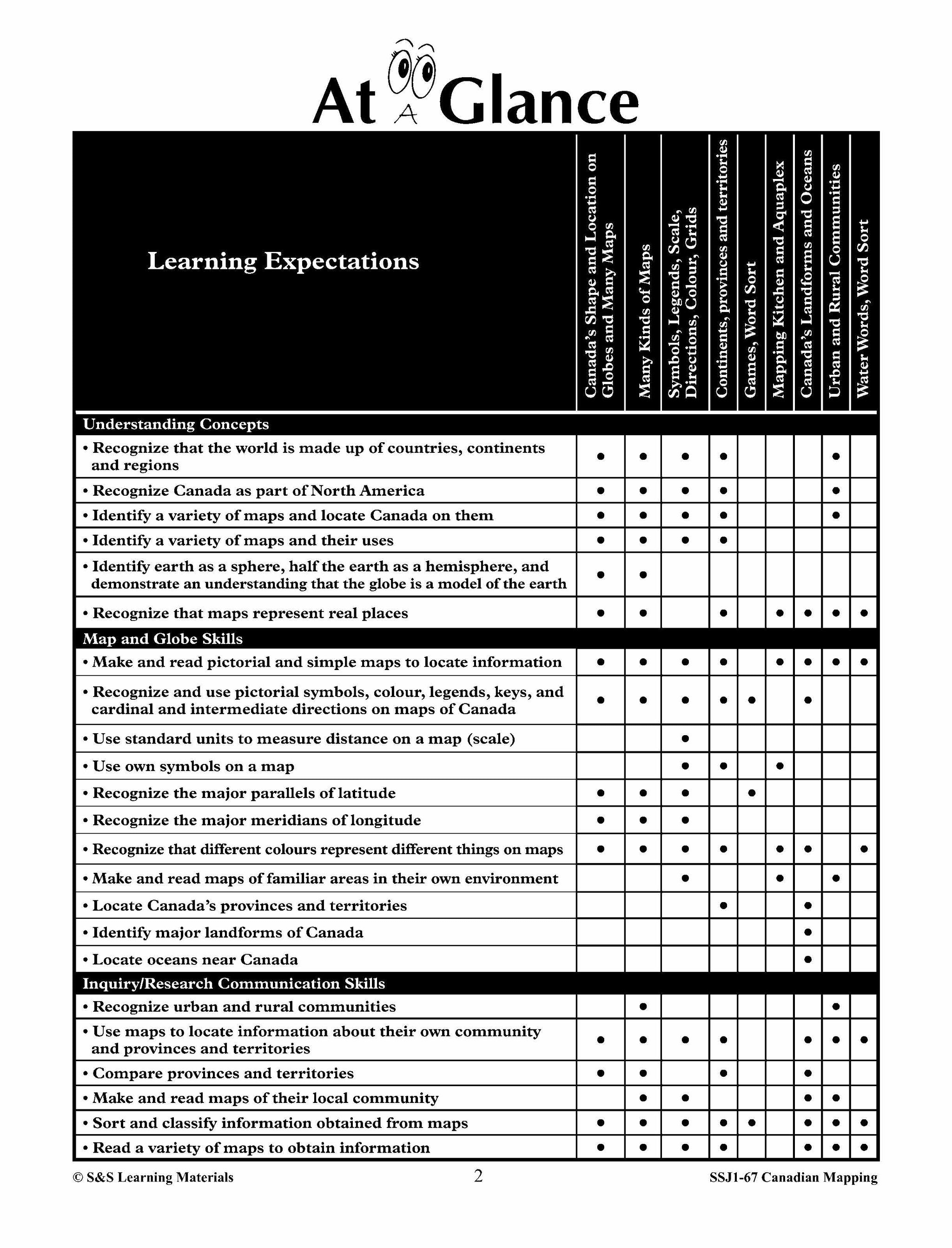
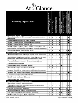
- At A Glance™
- Teacher Rubric
- Student Rubric
- Teacher Information
- Glossary of Geographic Terms
- Answer Key
CANADA'S SHAPE AND LOCATION
- Canada in the World - 1 (Locating Canada on a World Map)
- Canada in the World - 2 (Locating Canada on a World Map)
- Canada in North America (Map of North America)
- Our Country Canada (Map)
- Canada on a Globe - 1 (Locate Canada and the Hemispheres)
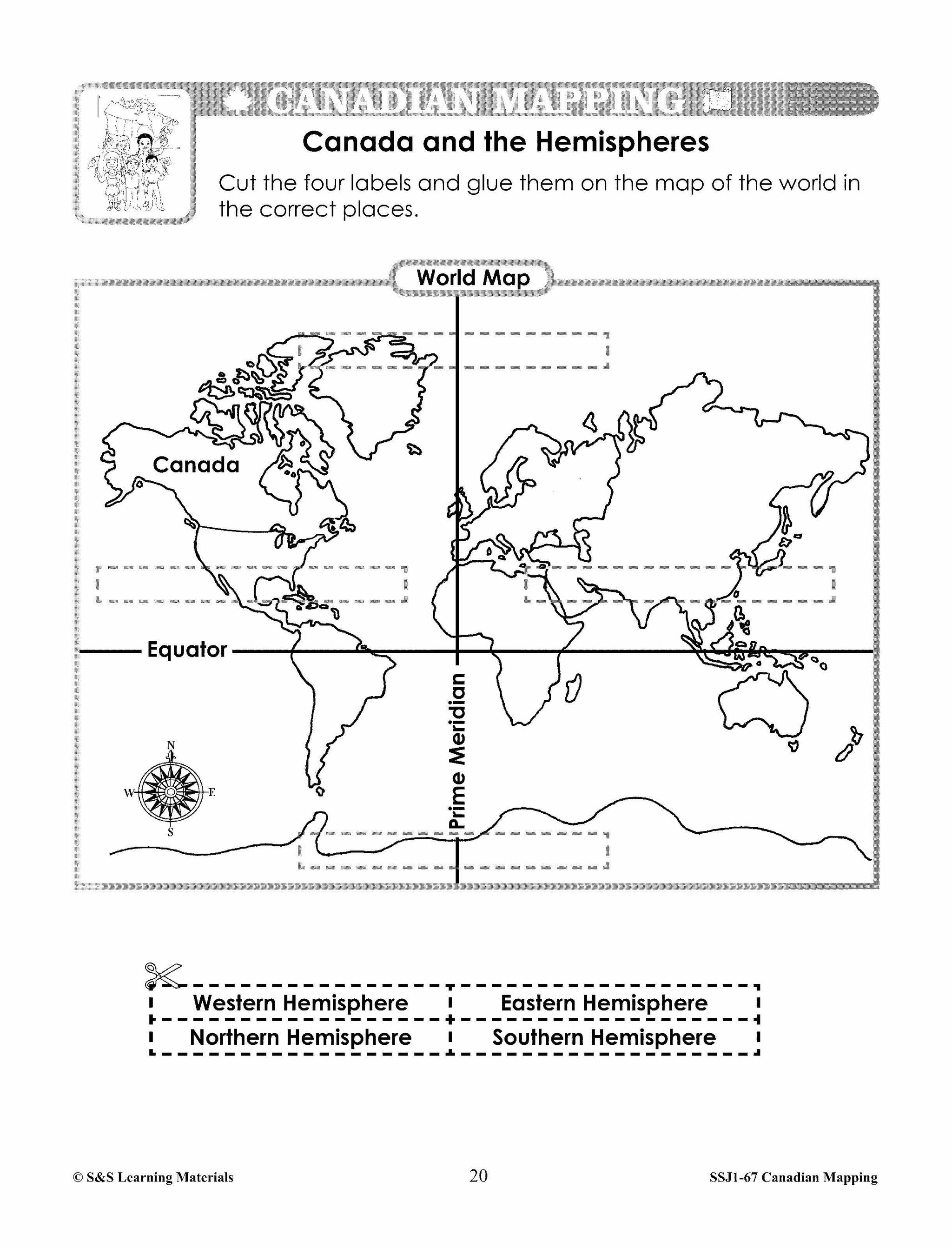
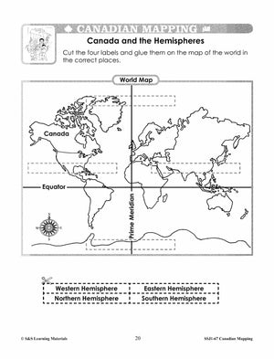
- Canada and the Hemispheres (Find the Equator and Hemispheres)
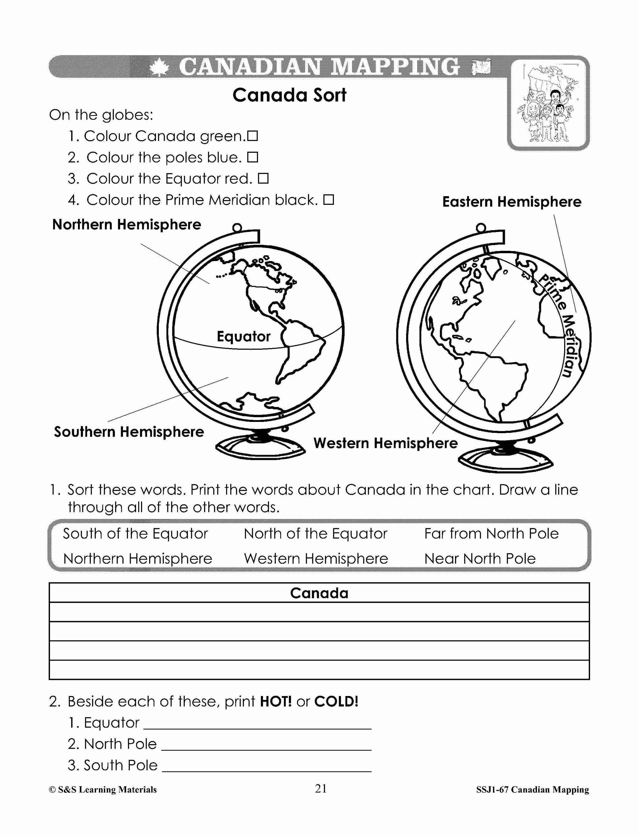
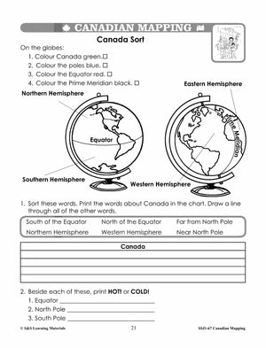
- Canada Sort (Read and Interpret Globe: Find Equator, Poles, and Hemispheres)
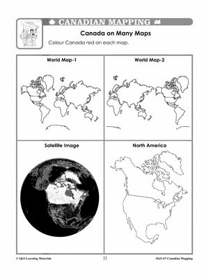
- Canada on Many Maps - 1 (Locate Canada on Different Maps)
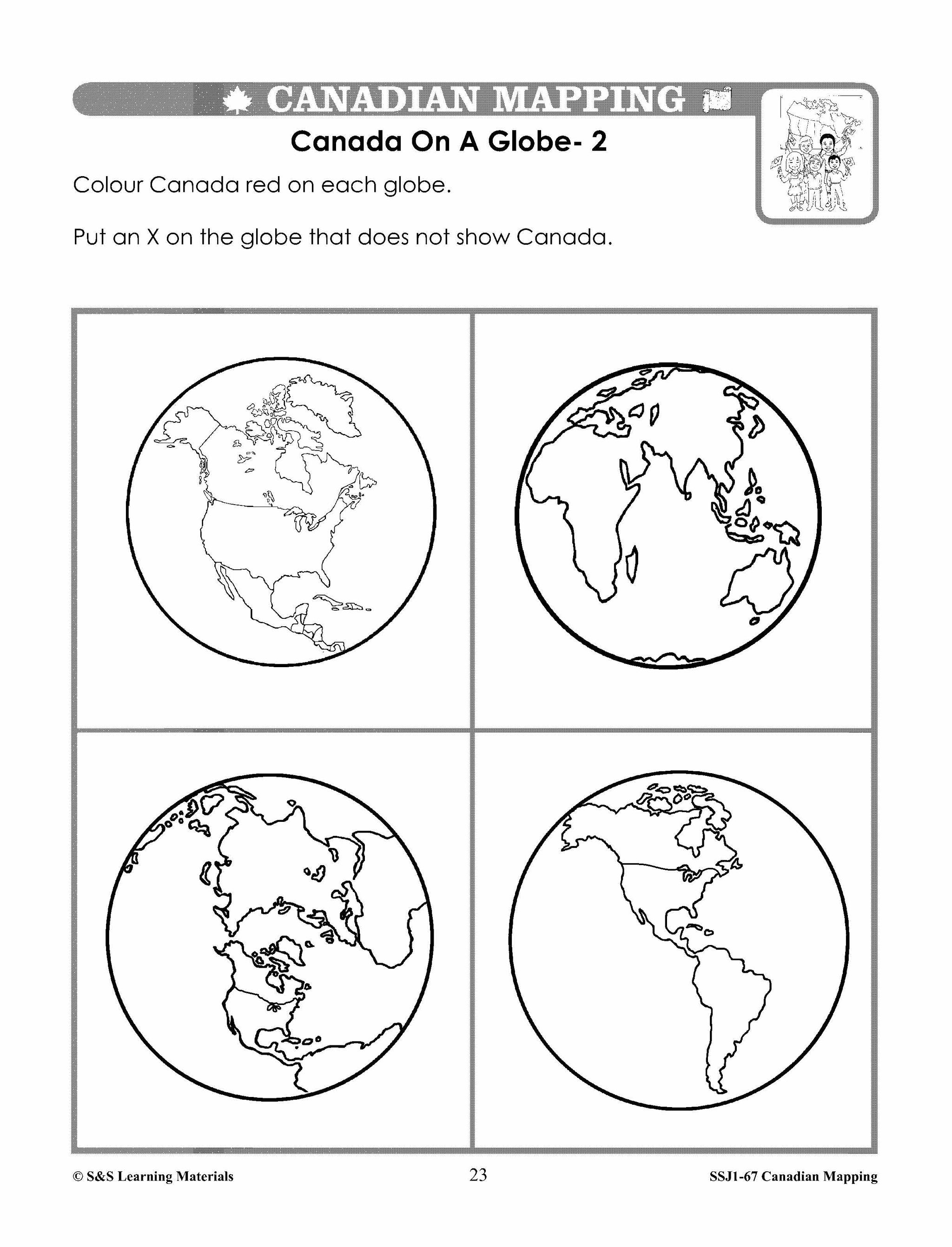
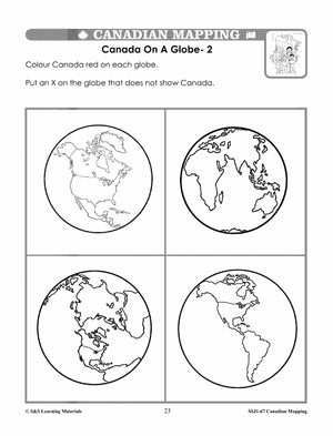
- Canada on a Globe - 2 (Locate Canada on a Variety of Globe Representations)
- The Continents (Locate Continents on Globes)
- Canada from Space! (Satellite Image)
- Explore Canada From Space (Internet Activity)
CANADA MAPS AND MAP FEATURES
- Neighbourhood Map (Map Legend and Symbols)
- Pictures, Maps, and Symbols (How Symbols are Helpful)
- Mapping Our Kitchen - Making Symbols (Create Own Symbols)
- A Map of My Kitchen (Create a Map Using Symbols)
- Canadian Cities - Using Symbols (Symbols for Cities on a Map)
- Finding Canadian Cities - Using Symbols (Locating Canadian Cities)
- Compare Two Provinces - Using Symbols (Symbols can Provide Information)
- Colours on a Map (Colour Denotes Political Boundaries)
- Colouring Canada (Colour on a Map of Canada)
- What Way? (Using Cardinal and Intermediate Directions)
- My Pencil's Journey -All Around Canada (Using Cardinal and Intermediate Directions)
- Using a Map Legend - Map of Canada - 1 (Interpreting Symbols on a Canada Map)
- Using a Map Legend - Map of Canada - 2 (Interpreting Symbols on a Canada Map)
- Be an Aquaplex Designer! (Draw a Simple Map with Specific Elements)
- MyAquaplex Design (Draw a Simple Map with Specific Elements)
- Map of Canada - Measuring Distance - Using Scale (Using Standard Units of Scale)
- Map of Ontario - Measuring Distance - Using Scale (Using Standard Units of Scale)
- Map of Quebec and Labrador - Measuring Distance - (Scale Using Standard Units)
- Canada's Funland - Using Map Scale (Use Simple Scale with Standard Units)
- Parallels of Latitude (Map of Canada)
- Find the Equator and the Poles on a Globe (Teacher Page)
- Globe Exercises (Game)
- Up and Down - Introducing Longitude (Introduction)
- Using Meridians of Longitude on a Map of Canada (Canada Mapping Skill)
- Canada on Many Maps - 2 (A Variety of Maps and Their Uses)
- Canada on Many Maps - 3 ( A Variety of Maps and Their Uses)
- Mapping Canada (Getting Information from Maps)
- More Mapping Canada (Getting Information from Maps)
CANADA'S PROVINCES AND TERRITORIES
- Canada's Provinces and Territories (Names and Shapes of Provinces and Territories)
- The Names and Shapes of the Provinces and Territories of Canada (Games)
- Canadian Mapping Game Ideas For the Teacher (Teacher Page)
- Province and Territory Sort (Interpreting a Map)
MAJOR LANDFORMS AND BODIES OF WATER IN CANADA
- Landforms of Canada (Interpreting Physical Features of Canada)
- Are You Planning a Trip? (Interpreting Physical Features of Canada)
- The Oceans (Label the Oceans Around Canada)
- Canada's Big Water (Recognizing Canada's Major Bodies of Water)
- Be a Water Detective! (Recognizing Canada's Major Bodies of Water)
- Ontario's Big Water (Recognizing Ontario's Major Bodies of Water)
- Ontario's Landforms (Interpreting Physical Features of Ontario)
- Landforms of British Columbia (Interpreting Physical Features of British Columbia)
- Comparing Two Provinces (Using a VENN Diagram)
CANADIAN COMMUNITIES - URBAN AND RURAL
- Where I Live (Locate Local Community on a Globe)
- Physical Map of Canada (What is it like near my community?)
- My Canadian Community (What is it like near my community?)
- Urban and Rural Communities - 1 (Comparing Urban and Rural Communities)
- Urban and Rural Communities - 2 (Comparing Urban and Rural Communities)
- A CarTrip in Canada (Urban and Rural)
You may also like:
Canadian Daily Language Activities
Canadian Math Google Slide Activities
Subscribe to our Fan List!: Our FANlist newsletter is full of tips on ways to save time with our resources, exclusive sales, new product info and free monthly downloads – you won’t want to miss out!
Follow us on:
![]()
![]()