


Big Book of Canadian Mapping Skills Grades 4-6
EBJ171
$39.99 CAD
Additional information:
- Author : Golletz, Lynda
Students will learn geographic terms such as regions, territories, provinces, communities, bodies of water, natural resources, mapping symbols, and types of maps.
The activities will develop skills such as reading and locating places on a map in a variety of ways, labeling and coloring maps, recognizing types of maps and recognizing characteristics of a region and its economic influence on Canada.
This resource is in-depth coverage of the various skills required in the development of students' ability to read maps proficiently through the study of Canada.
FOR THE TEACHER:
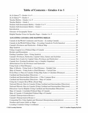
- At A GlanceTM - Grades 4 to 5
- At A GlanceTM - Grades 6
- Teacher Rubric - Grades 4 to 5
- Teacher Rubric - Grade 6
- Student Self-Assessment Rubric - Grades 4 to 5
- Student Self-Assessment Rubric - Grade 6
- Introduction
- Glossary of Geographic Terms
- Helpful Teacher Notes for Specific Pages - Grades 4 to 5
LOCATING CANADA AND MAPPING SKILLS
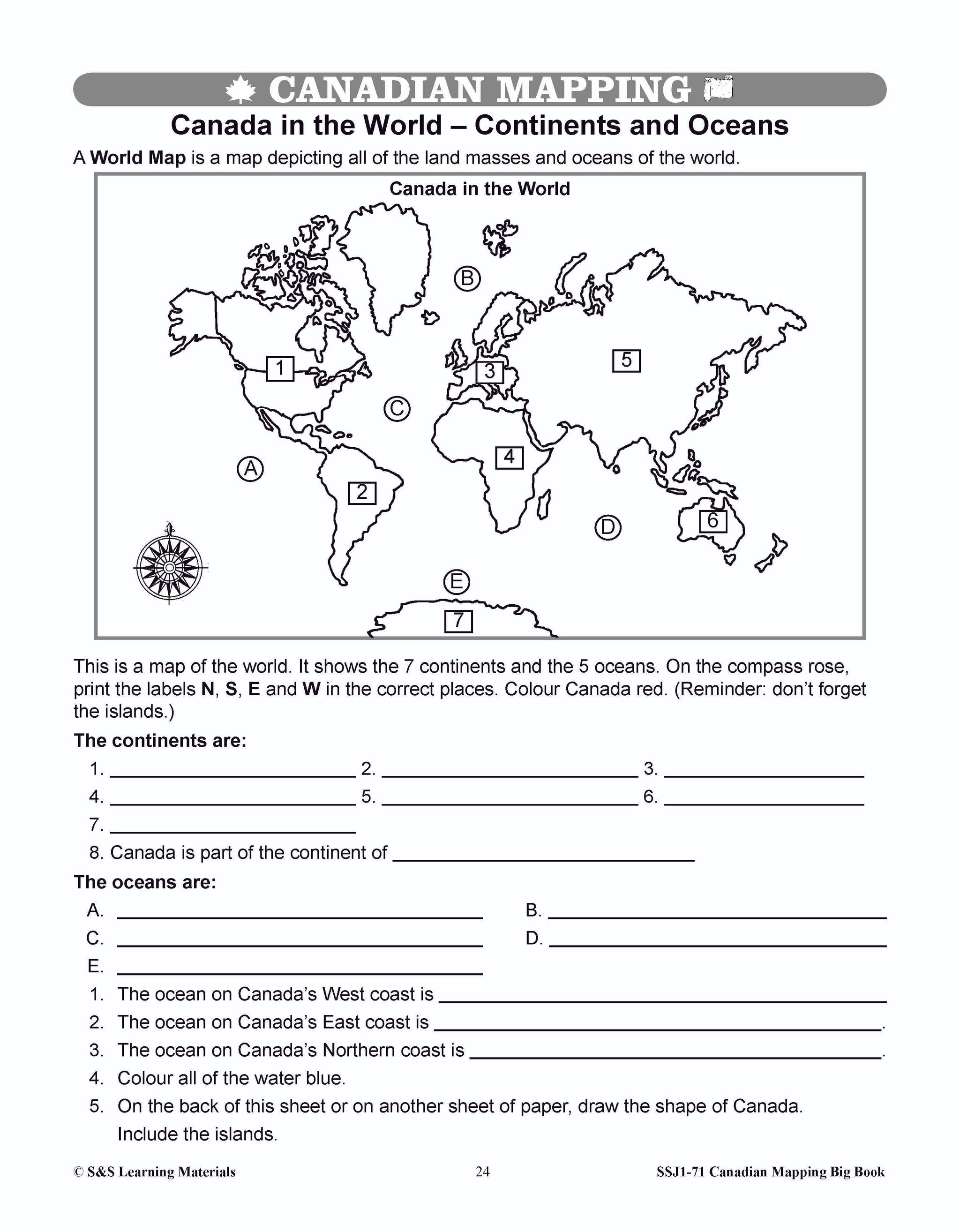
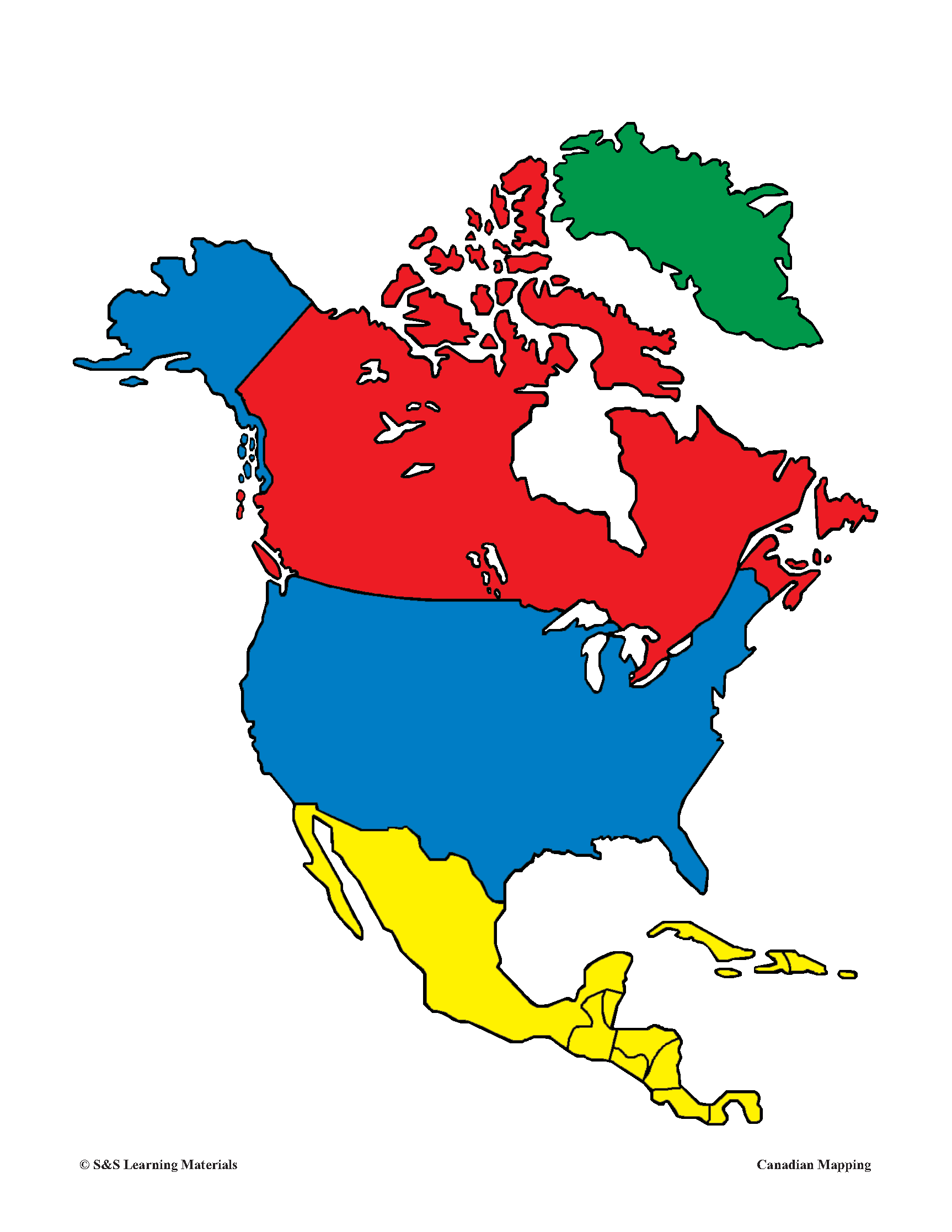
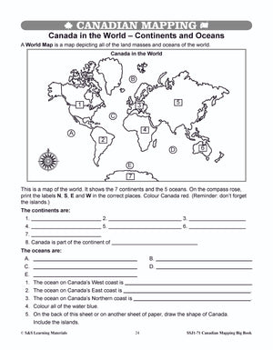
- Canada in the World Continents and Oceans - (Locating Canada)
- Canada in the World Political Map - (Locating Canada in North America)
- Canada’s Provinces and Territories - Political Map
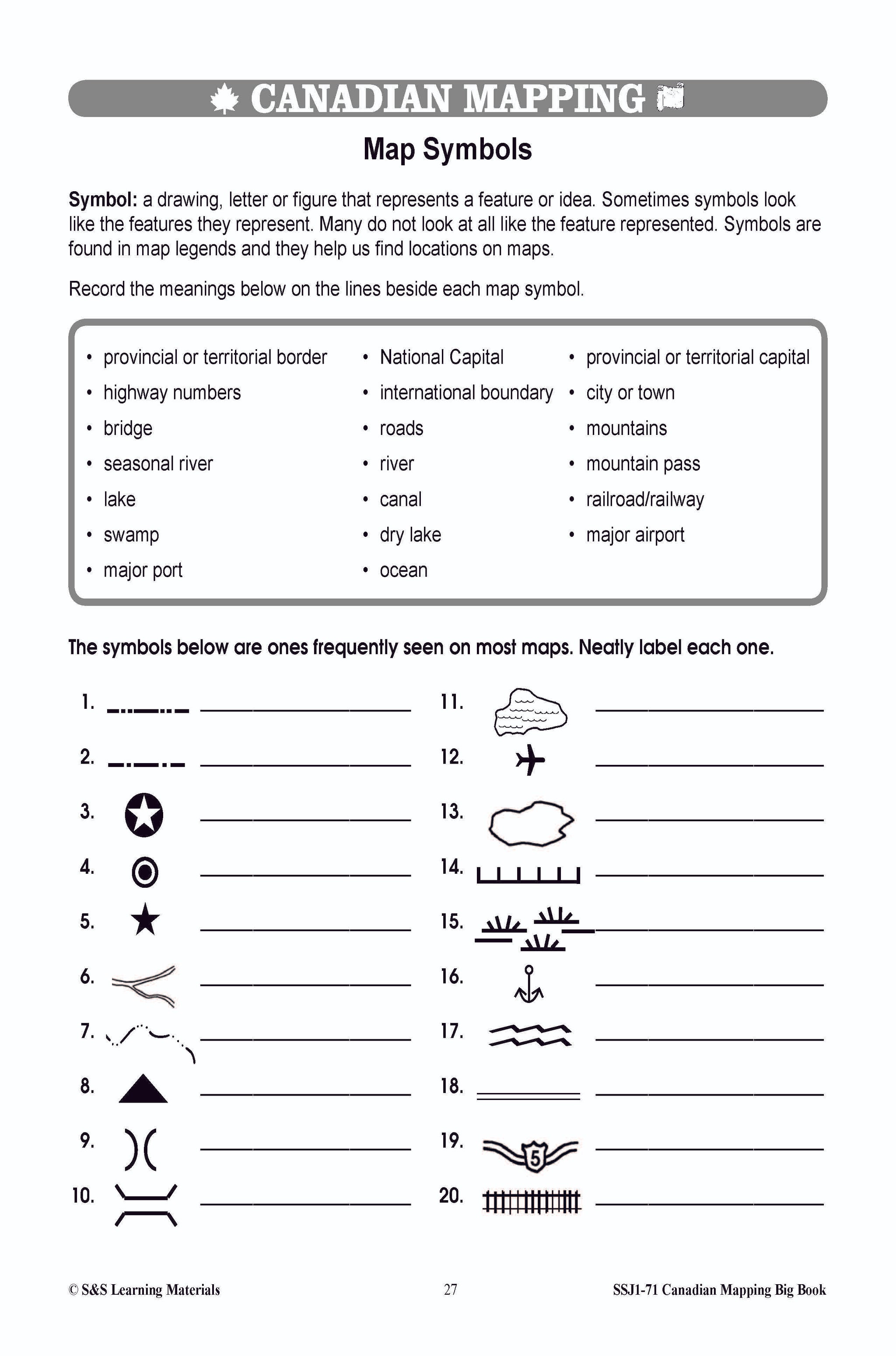
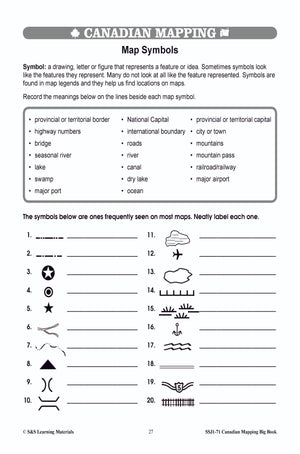
- Map Symbols
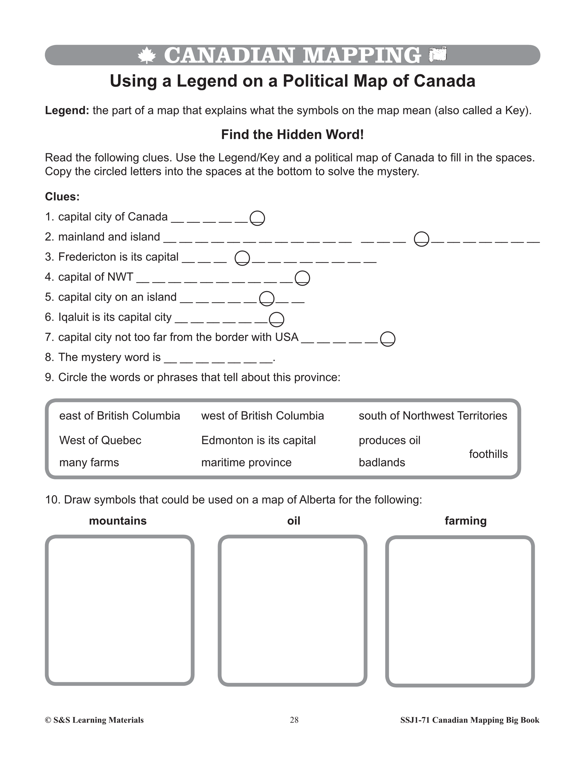
- Using a Legend on a Political Map of Canada
- Borders and Boundaries
- Finding Canadian Cities - Using Symbols
- Canada’s Provinces, Territories, Capital Cities, Games and Activities
- Canada Sort (Cards for Capital Cities, Provinces and Territories)
- Canada Sort (Sorting Vocabulary onto a Graphic Organizer)
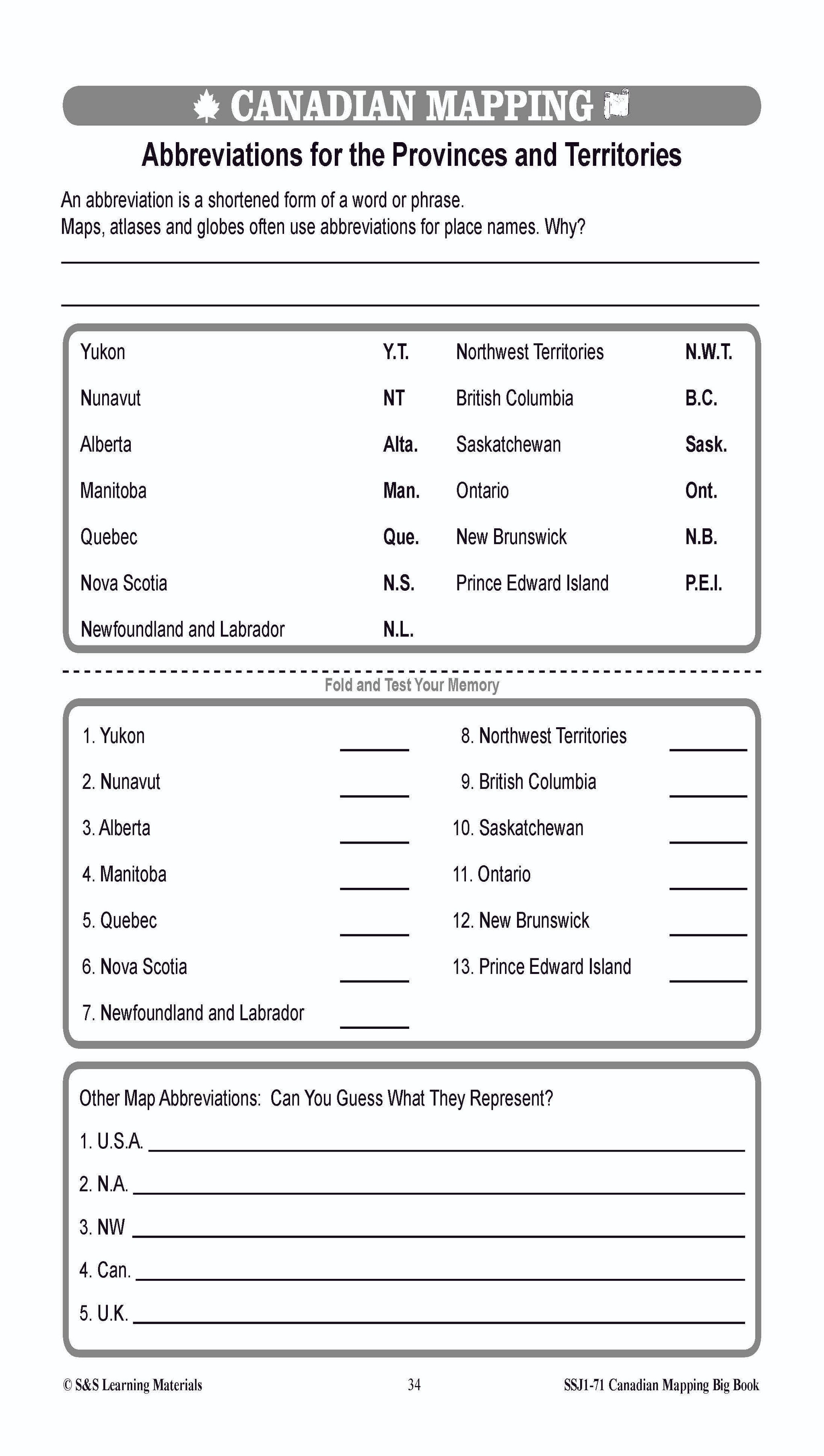
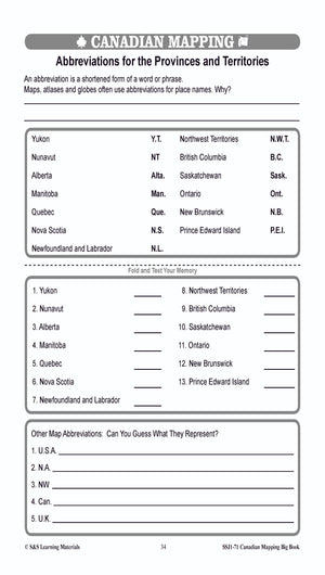
- Abbreviations For the Provinces and Territories
- Using Scale to Find Distance
- Map of Alberta - Using Scale to Find Distance - Straight Line
- Map of Ontario - Using Scale to Find Distance - Curved Line
- From Place to Place in Canada (Using Map Scale to Calculate Distances)
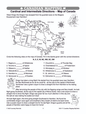
- Cardinal and Intermediate Directions - 1
- Cardinal and Intermediate Directions - 2 The Compass Rose
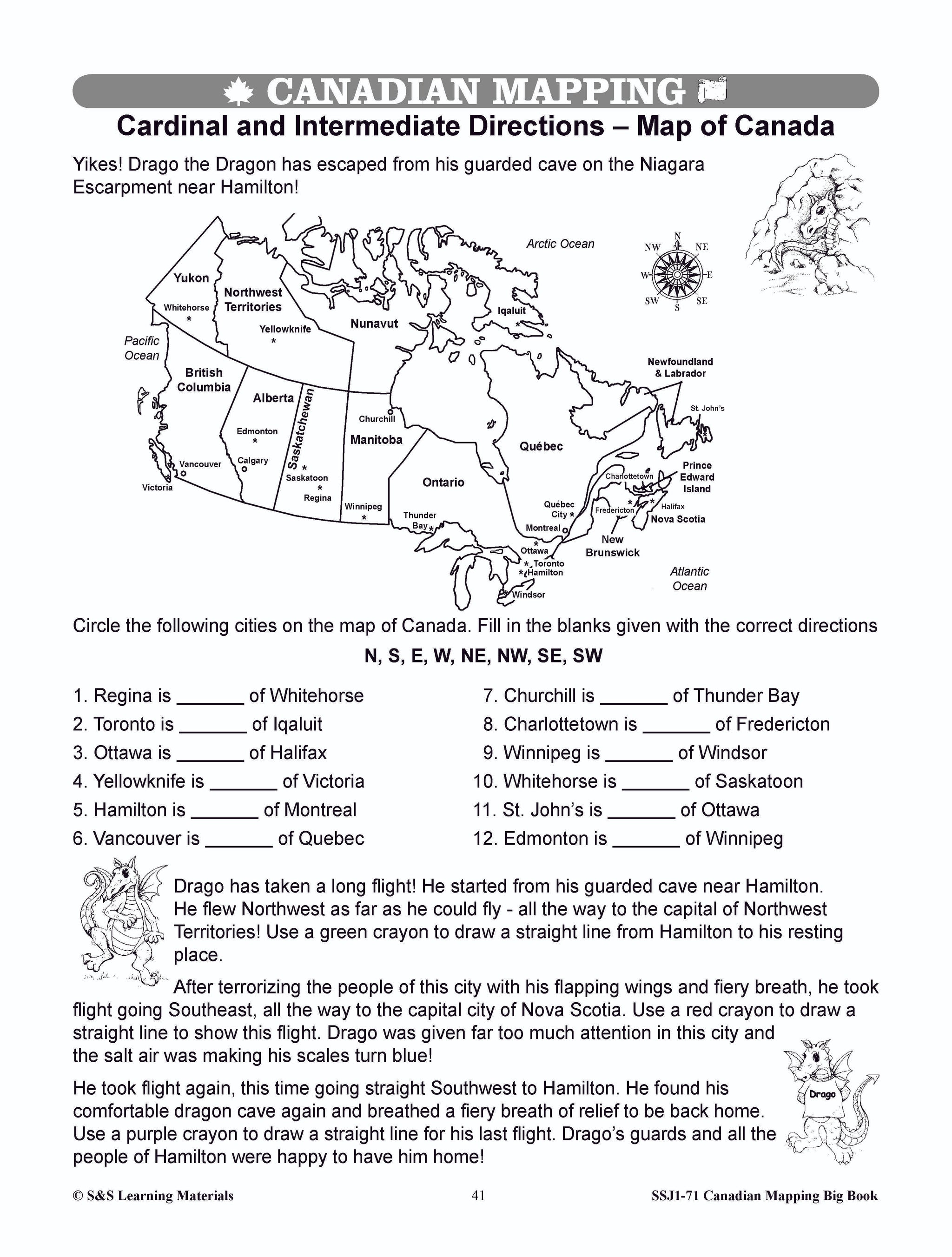
- Cardinal and Intermediate Directions - Map of Canada
- Using the Compass Rose With a Road Map
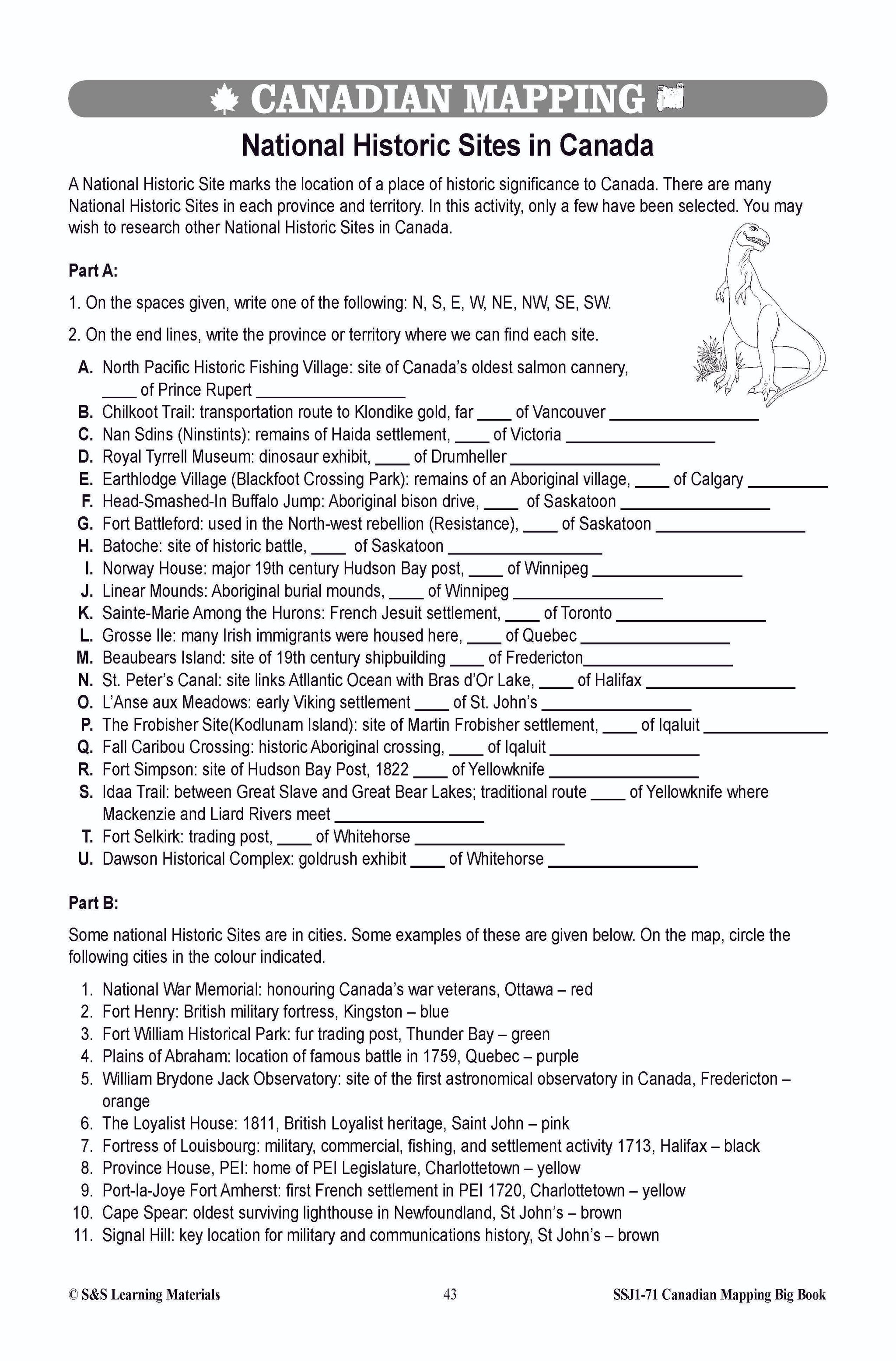
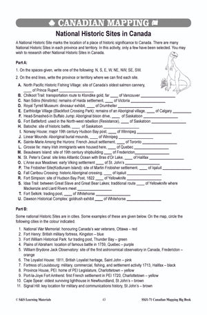
- National Historic Sites in Canada (Using Cardinal and Intermediate Directions)
- Directions Can be Helpful (Using Cardinal and Intermediate Directions)
- Map of Canada 1 (Labelled Political Map of Canada)
- Map of Canada 2 (Unlabelled Political Map of Canada)
- Canada’s Transportation Routes 1
- Canada’s Transportation Routes 2
- Comparing Two Cities Iqaluit and Montreal (Interpreting aerial photos)
- Number and Letter Grids on Maps
- Locating Countries Using Coordinates
- For Use With Locating Countries Using Coordinates
- Using a Map Grid - With a Map of Canada
- Using a Map Grid - With a Map of Ontario
- Parallels of Latitude
- Meridians of Longitude
- Latitude and Longitude - Using a Map of the World
- Latitude and Longitude - Using a Map of Canada
- Where I Live in Canada (Using Latitude and Longitude)
- Where I Live in Canada - An Interview
- Where I Live in the World
PHYSICAL AND ECONOMIC REGIONS IN CANADA
- Landforms: The Physical Regions of Canada - Part 1
- Landforms: The Physical Regions of Canada - Part 2
- Canada’s Natural Resources and Physical Regions
- Economic Regions in Canada
- The Niagara Region of Canada
- Alberta’s Oil Sands Region
- Comparing Two Regions of Canada
- Comparing a Region of Canada With a Region in the United States
KINDS OF MAPS
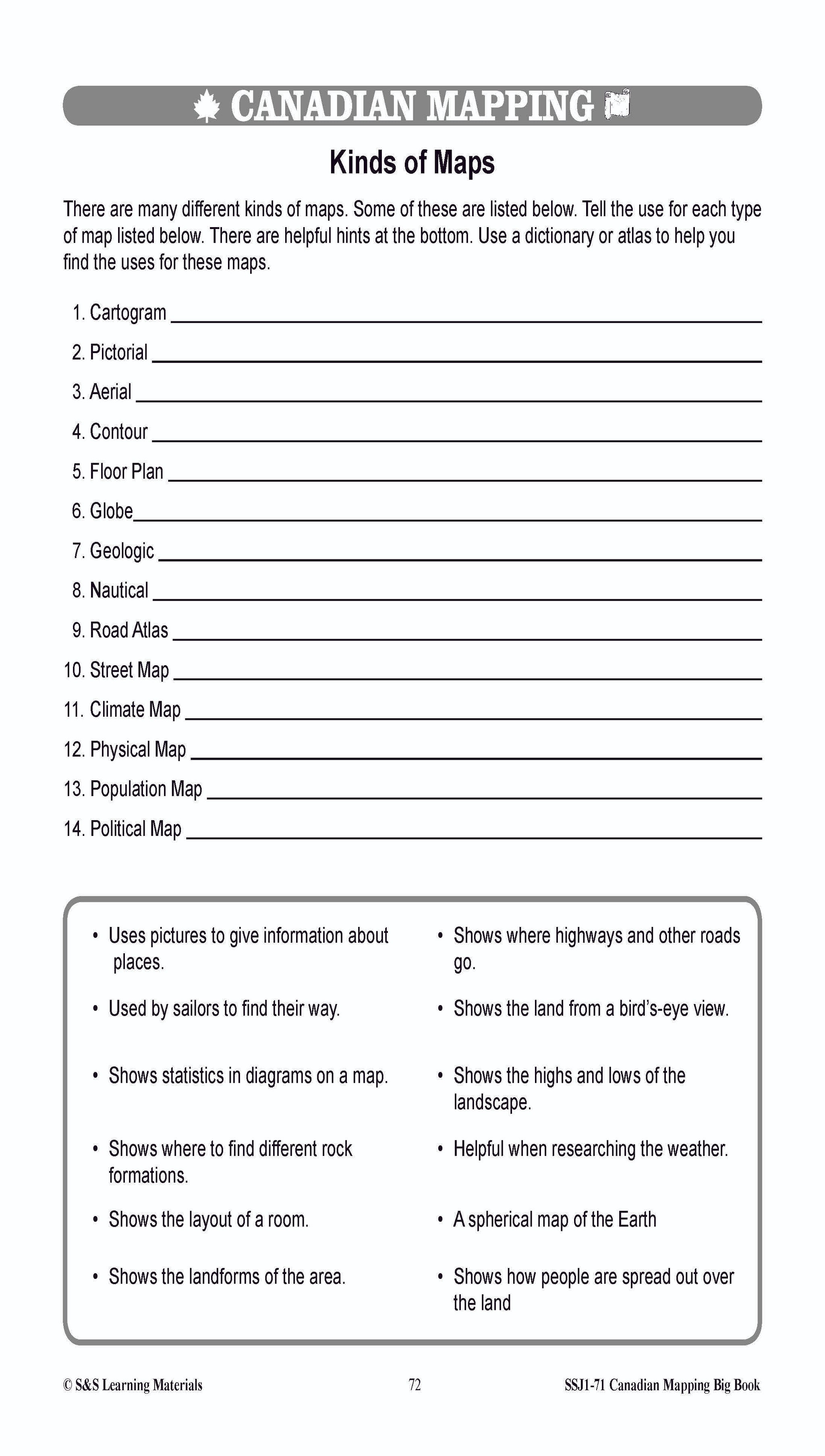
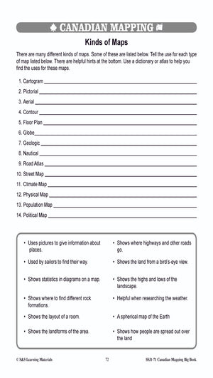
- Kinds of Maps
- Canada on Many Maps - Part 1
- Canada on Many Maps - Part 2
MAJOR BODIES OF WATER IN CANADA
- The Oceans and Other Major Bodies of Water
- The Oceans and Other Major Bodies of Water (Research Project)
- Canada’s Big Water
- Ontario’s Big Water
- The St. Lawrence River and the Great Lakes System
- Answer Key
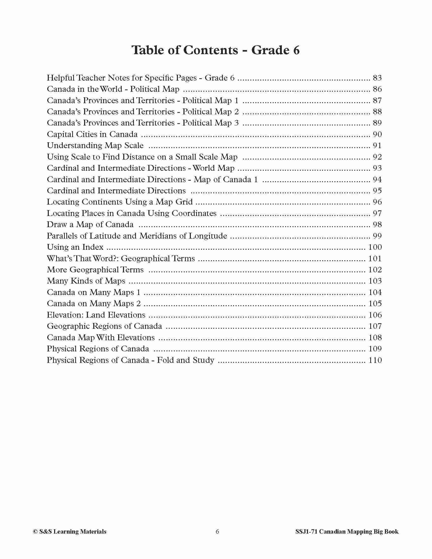
Table of Contents - Grade 6
- Helpful Teacher Notes for Specific Pages - Grade 6
- Canada in the World - Political Map
- Canada’s Provinces and Territories - Political Map 1
- Canada’s Provinces and Territories - Political Map 2
- Canada’s Provinces and Territories - Political Map 3
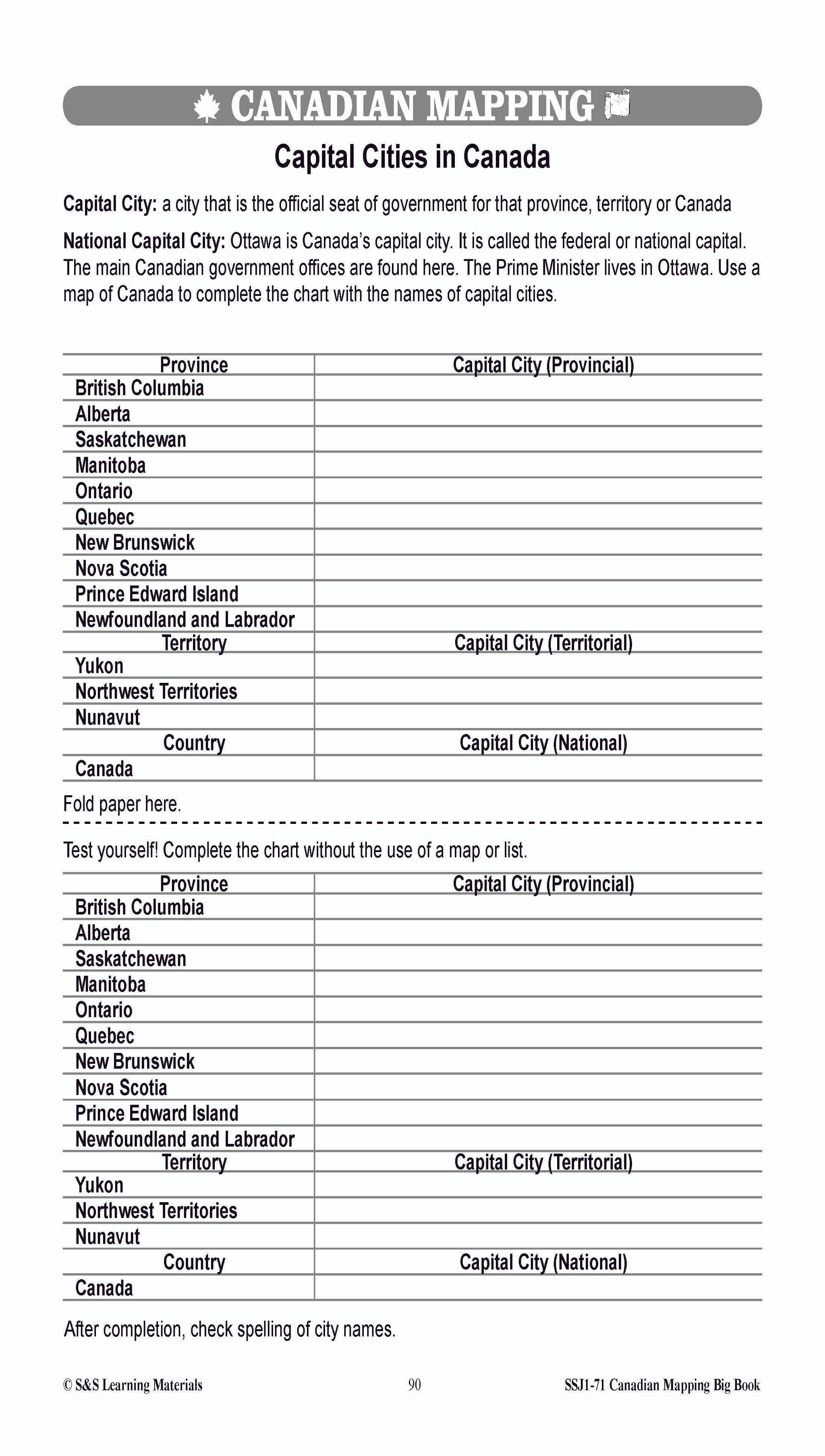
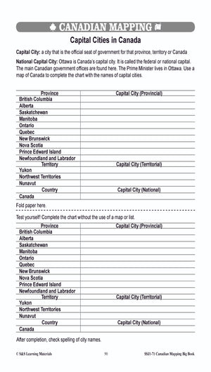
- Capital Cities in Canada
- Understanding Map Scale
- Using Scale to Find Distance on a Small Scale Map
- Cardinal and Intermediate Directions - World Map
- Cardinal and Intermediate Directions - Map of Canada 1
- Cardinal and Intermediate Directions
- Locating Continents Using a Map Grid
- Locating Places in Canada Using Coordinates
- Draw a Map of Canada
- Parallels of Latitude and Meridians of Longitude
- Using an Index
- What’s That Word?: Geographical Terms
- More Geographical Terms
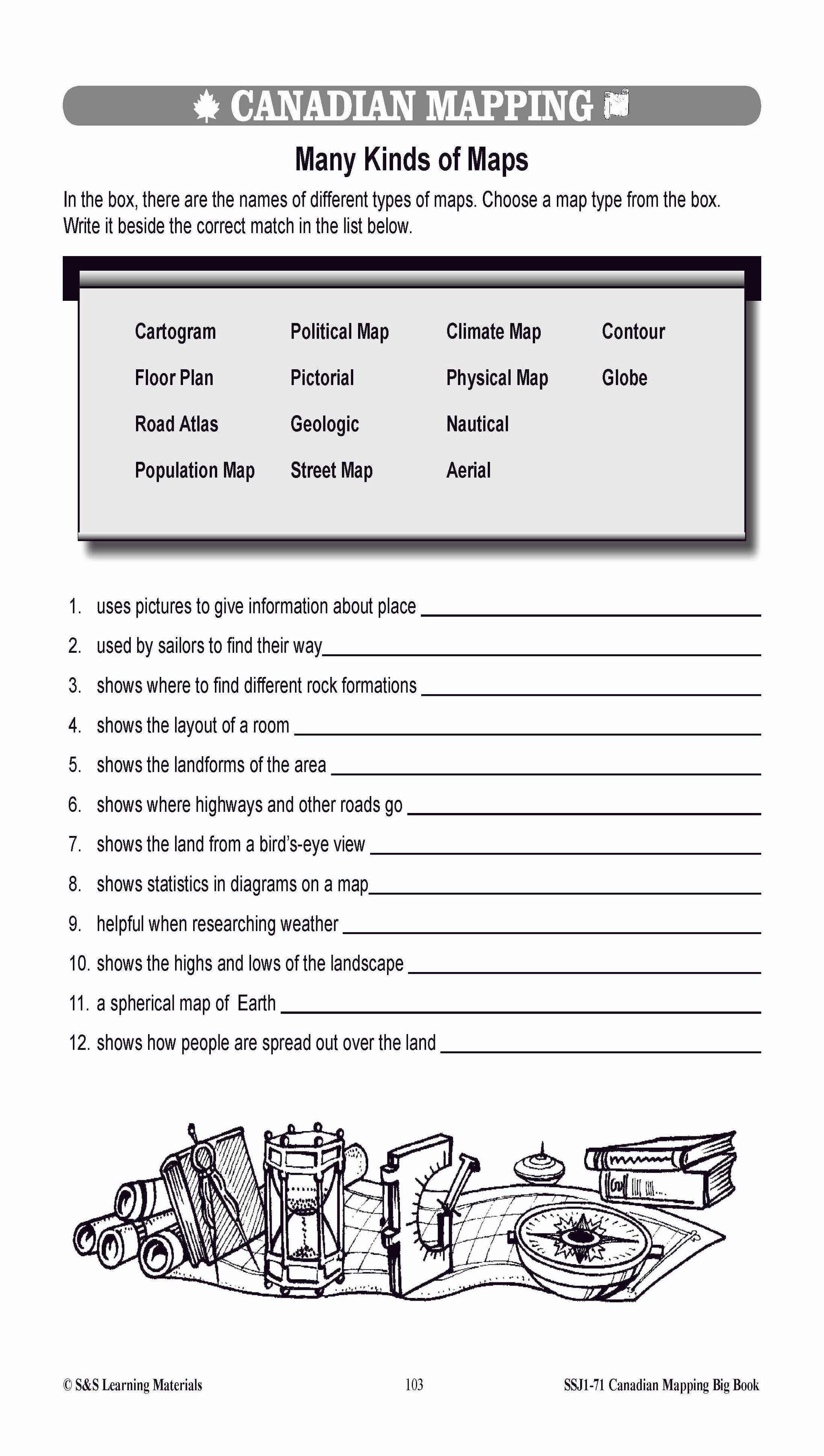
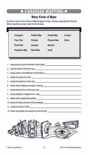
- Many Kinds of Maps
- Canada on Many Maps 1
- Canada on Many Maps 2
- Elevation: Land Elevations
- Geographic Regions of Canada
- Canada Map With Elevations
- Physical Regions of Canada
- Physical Regions of Canada - Fold and Study
- Physical Regions - Corner Fold Project
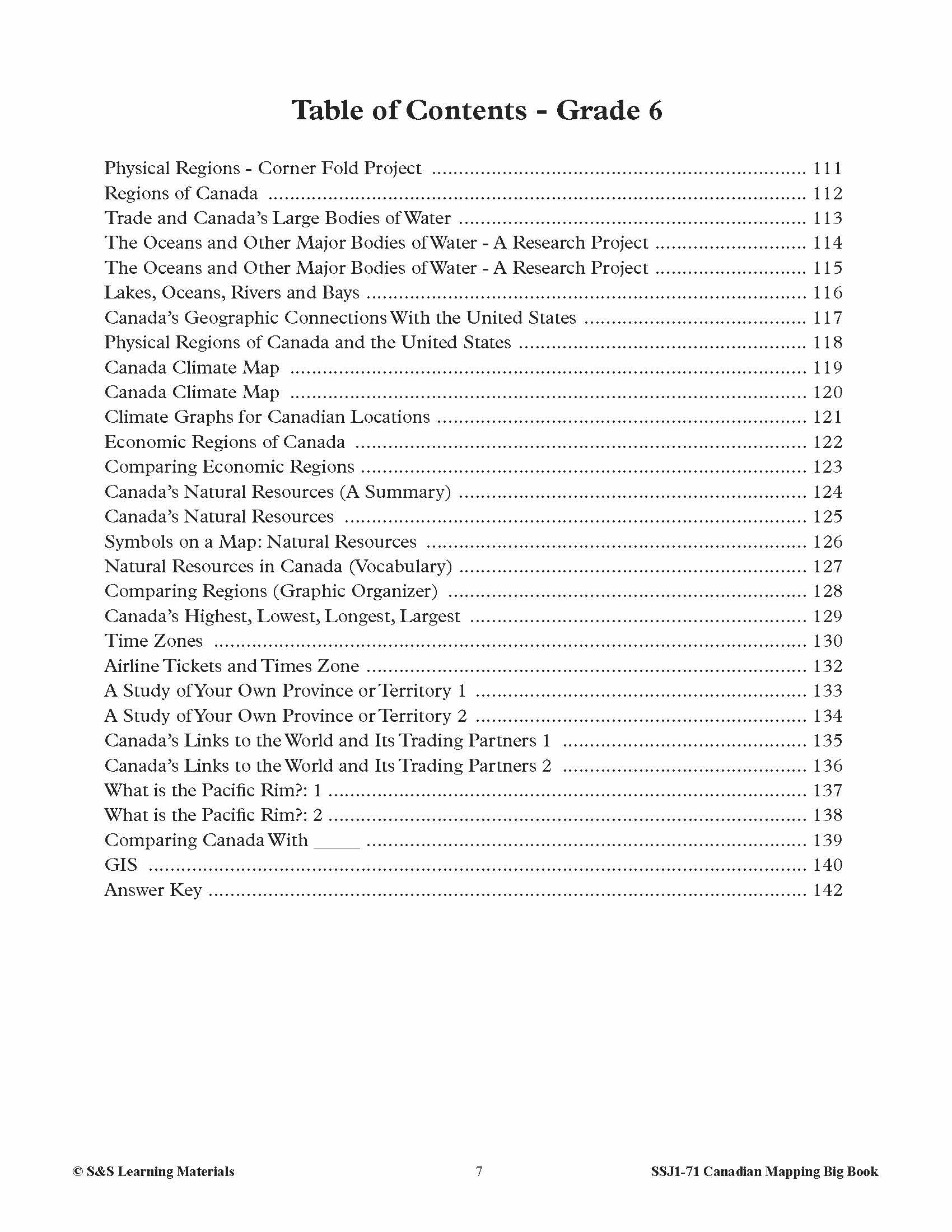
- Regions of Canada
- Trade and Canada’s Large Bodies of Water
- The Oceans and Other Major Bodies of Water - A Research Project
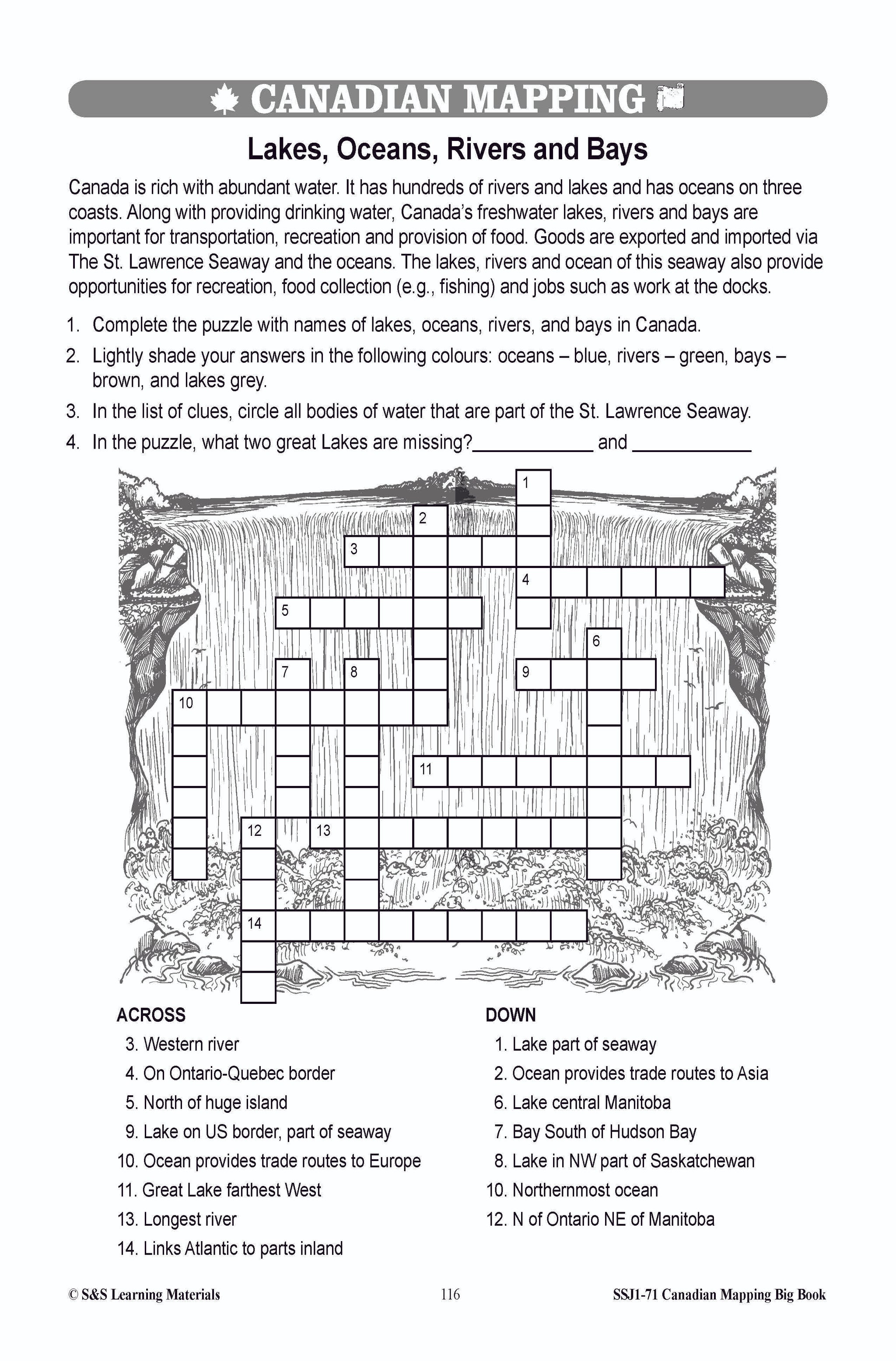
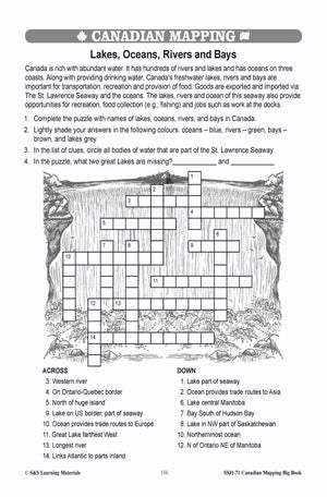
- Lakes, Oceans, Rivers and Bays
- Canada’s Geographic Connections With the United States
- Physical Regions of Canada and the United States
- Canada Climate Map
- Climate Graphs for Canadian Locations
- Economic Regions of Canada
- Comparing Economic Regions
- Canada’s Natural Resources (A Summary)
- Canada’s Natural Resources
- Symbols on a Map: Natural Resources
- Natural Resources in Canada (Vocabulary)
- Comparing Regions (Graphic Organizer)
- Canada’s Highest, Lowest, Longest, Largest
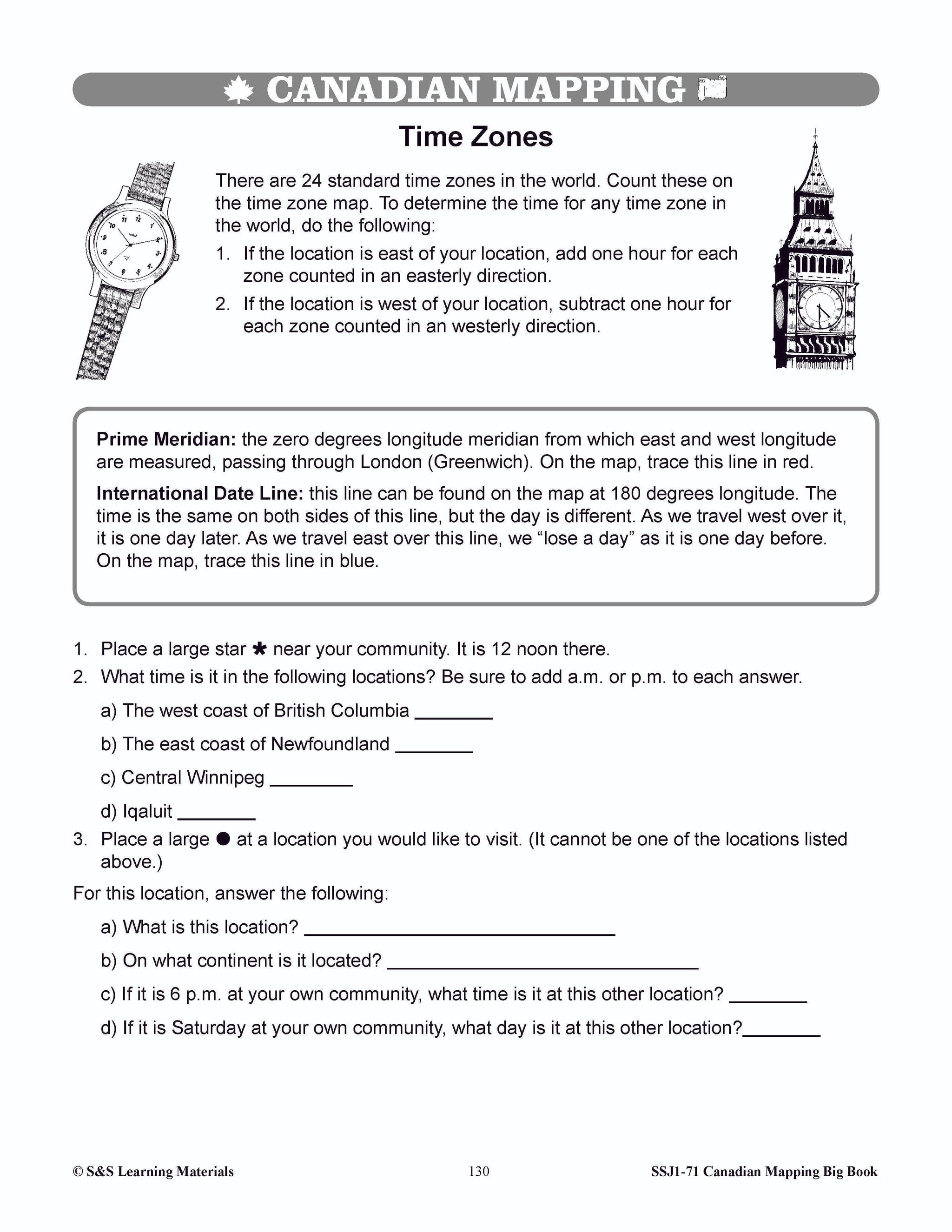
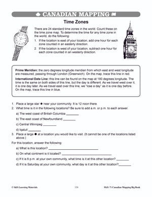
- Time Zones
- Airline Tickets and Times Zone
- A Study of Your Own Province or Territory 1
- A Study of Your Own Province or Territory 2
- Canada’s Links to the World and Its Trading Partners 1
- Canada’s Links to the World and Its Trading Partners 2
- What is the Pacific Rim?: 1
- What is the Pacific Rim?: 2
- Comparing Canada With _____
- GIS
- Answer Key
You may also like:
Canadian Daily Language Activities
Canadian Math Google Slide Activities
Follow us on:
![]()
![]()