
Products


Big Book of Canadian Mapping Skills Grades 1-3
$39.99 CAD
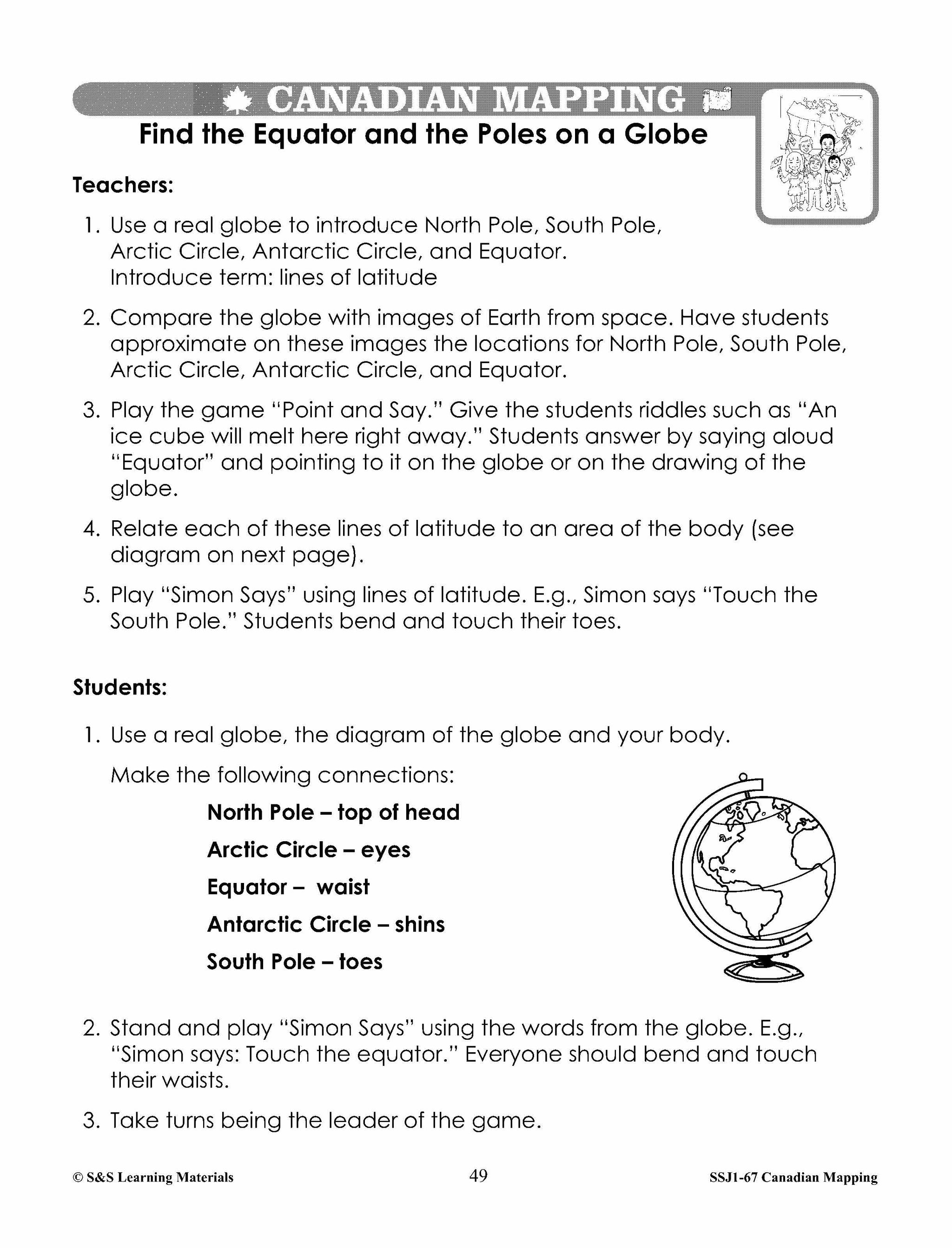
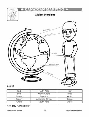
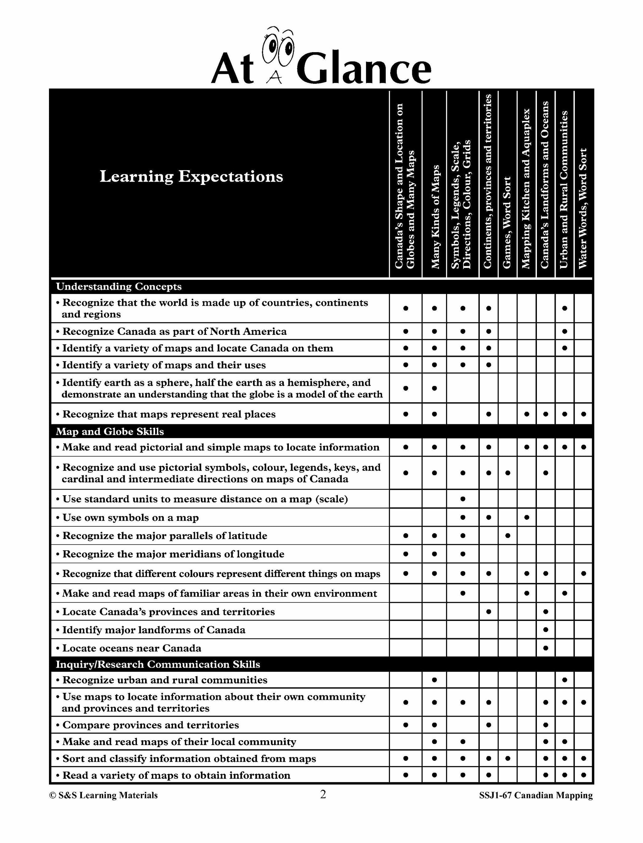
They will be introduced to mapping terms such as; country, border, ocean, province, territory, continent, hemisphere, latitude, longitude, symbols, legend, scale, and cardinal and intermediate directions. Everything you need to teach and strengthen mapping skills for Grades 1, 2 and...


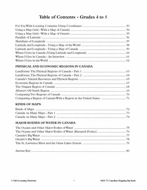
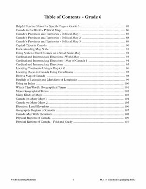
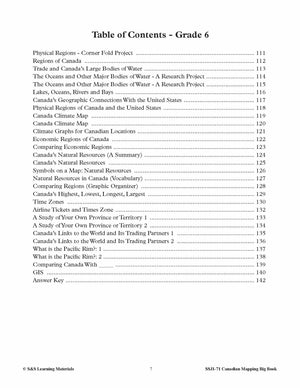

Big Book of Canadian Mapping Skills Grades 4-6
$39.99 CAD
Students will learn geographic terms such as regions, territories, provinces, communities, bodies of water, natural resources, mapping symbols, and types of maps. The activities will develop skills such as reading and locating places on a map in a variety of...


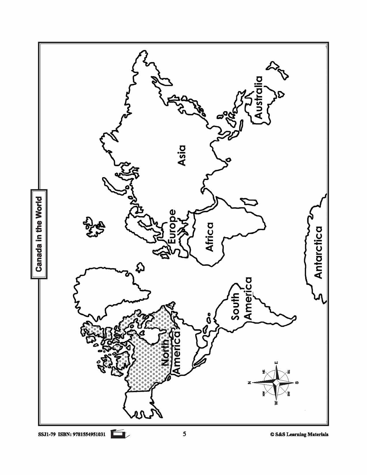
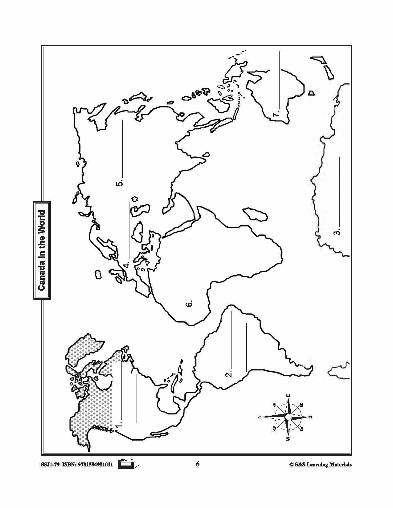


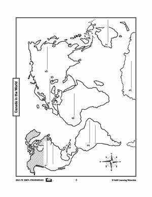


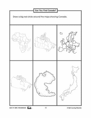


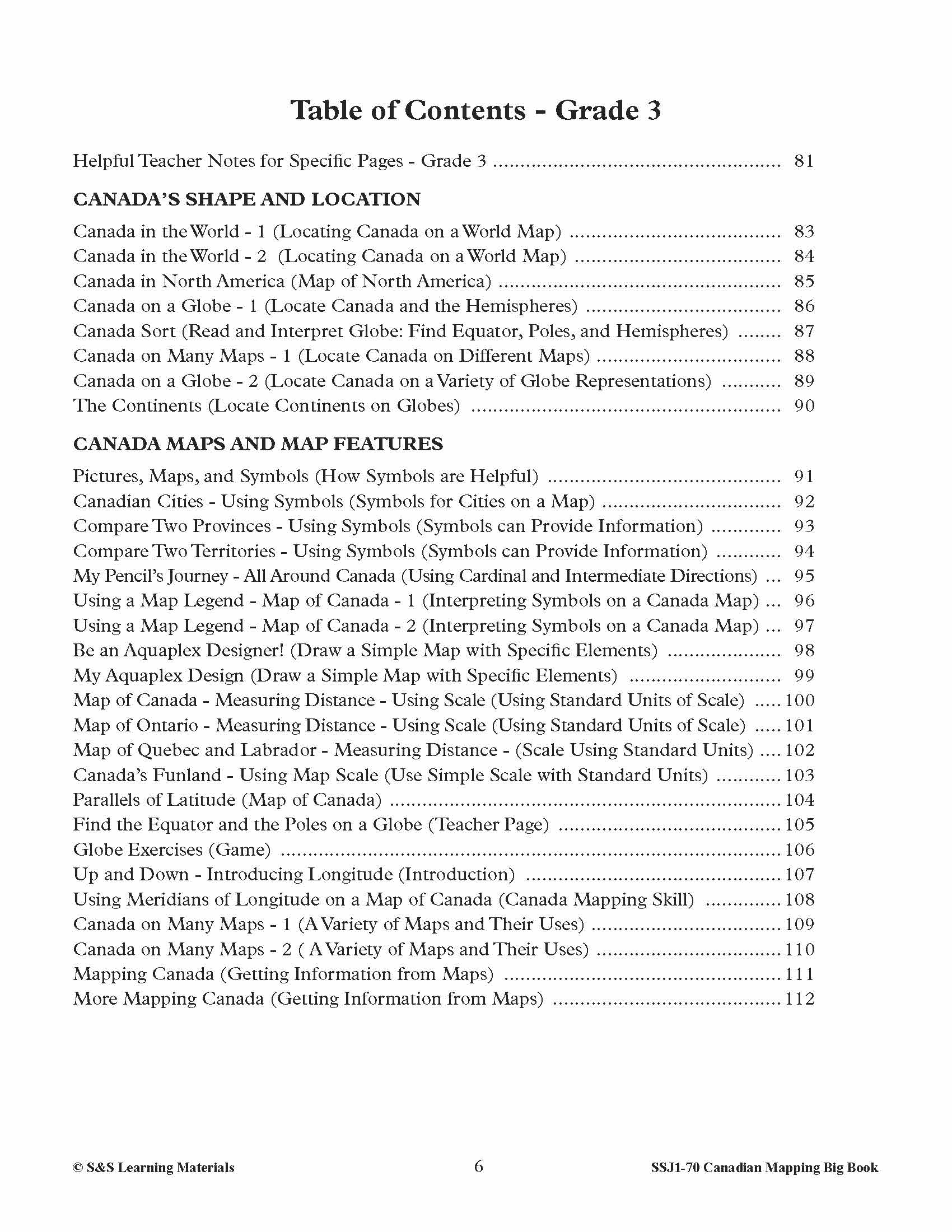
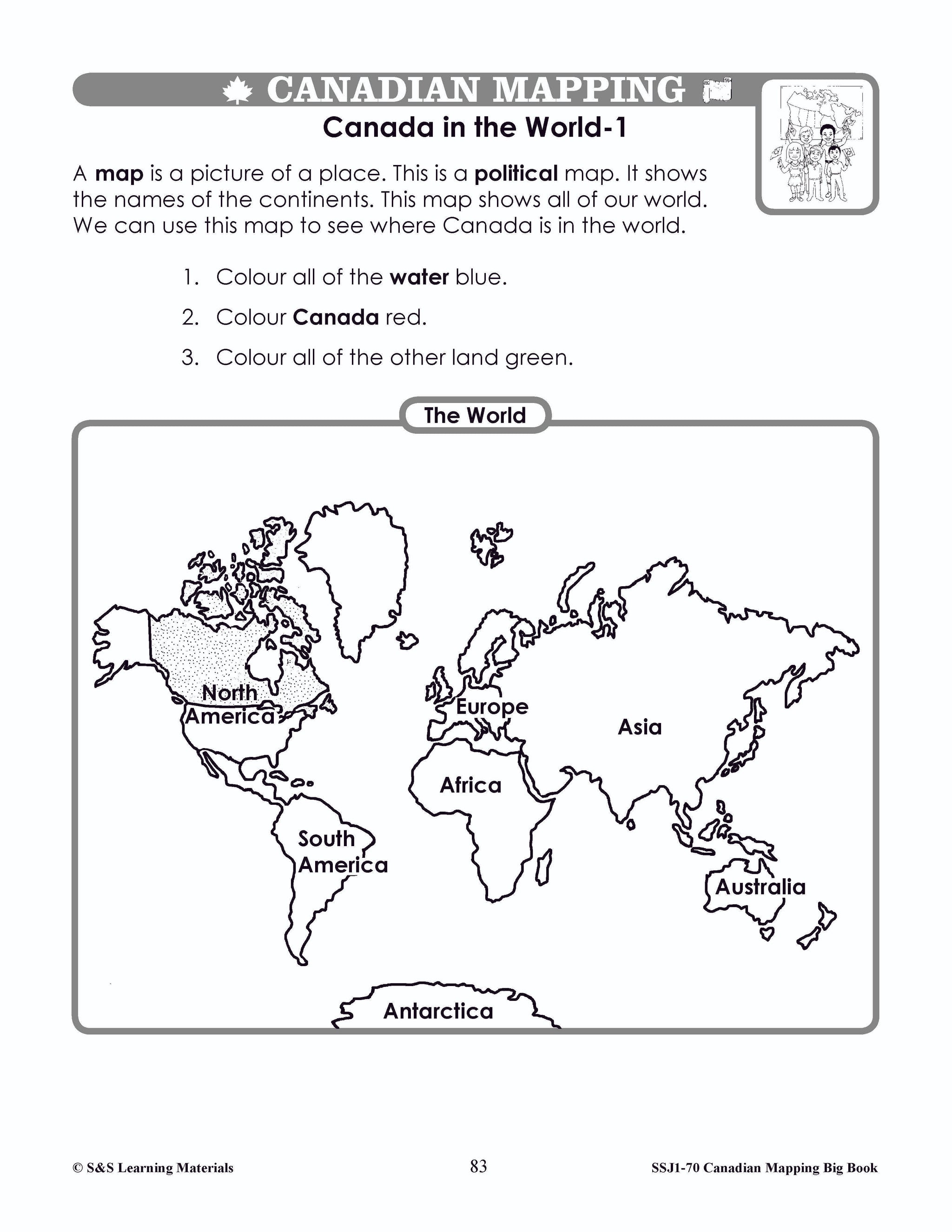
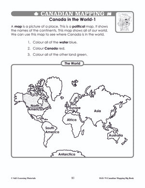
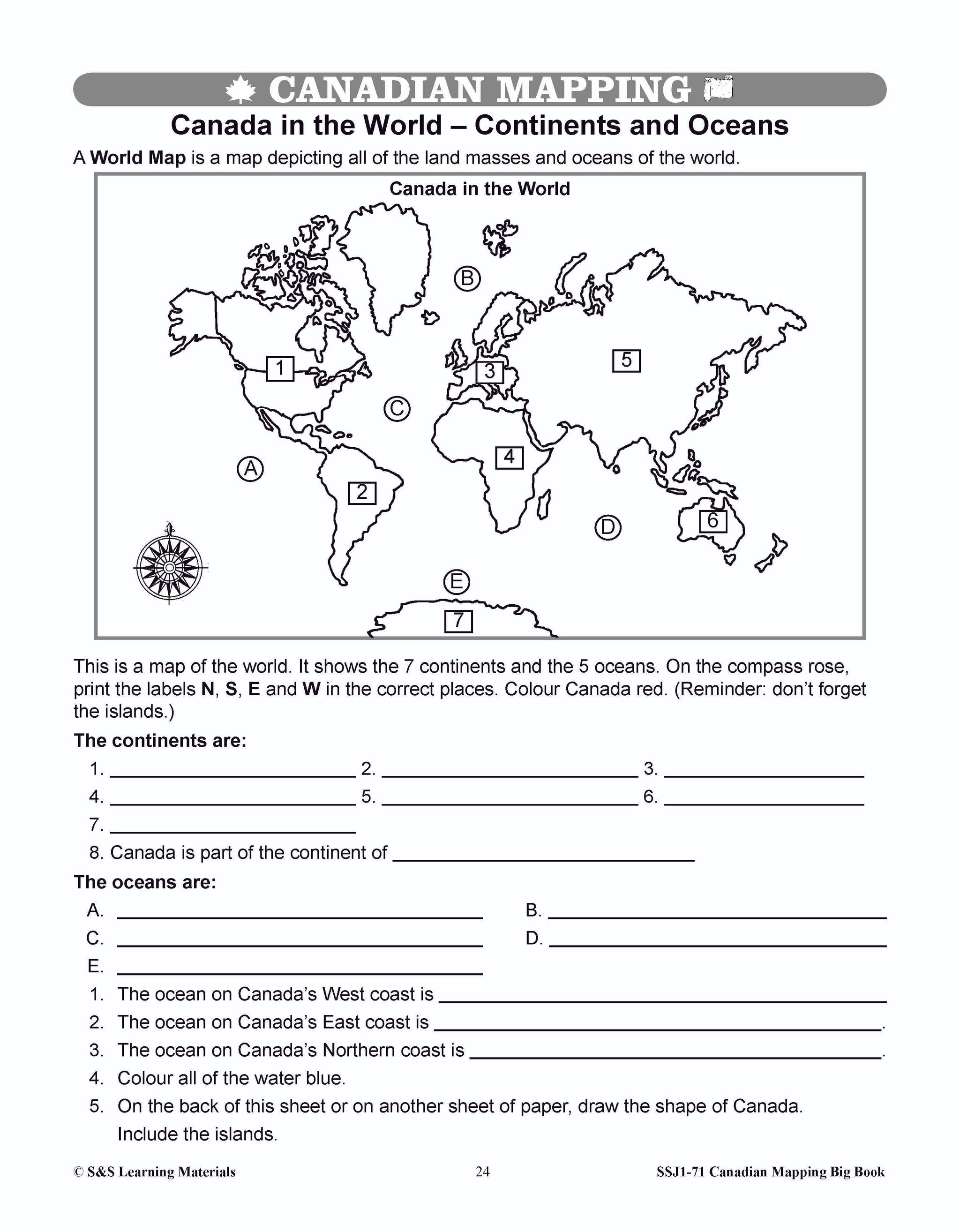
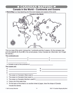
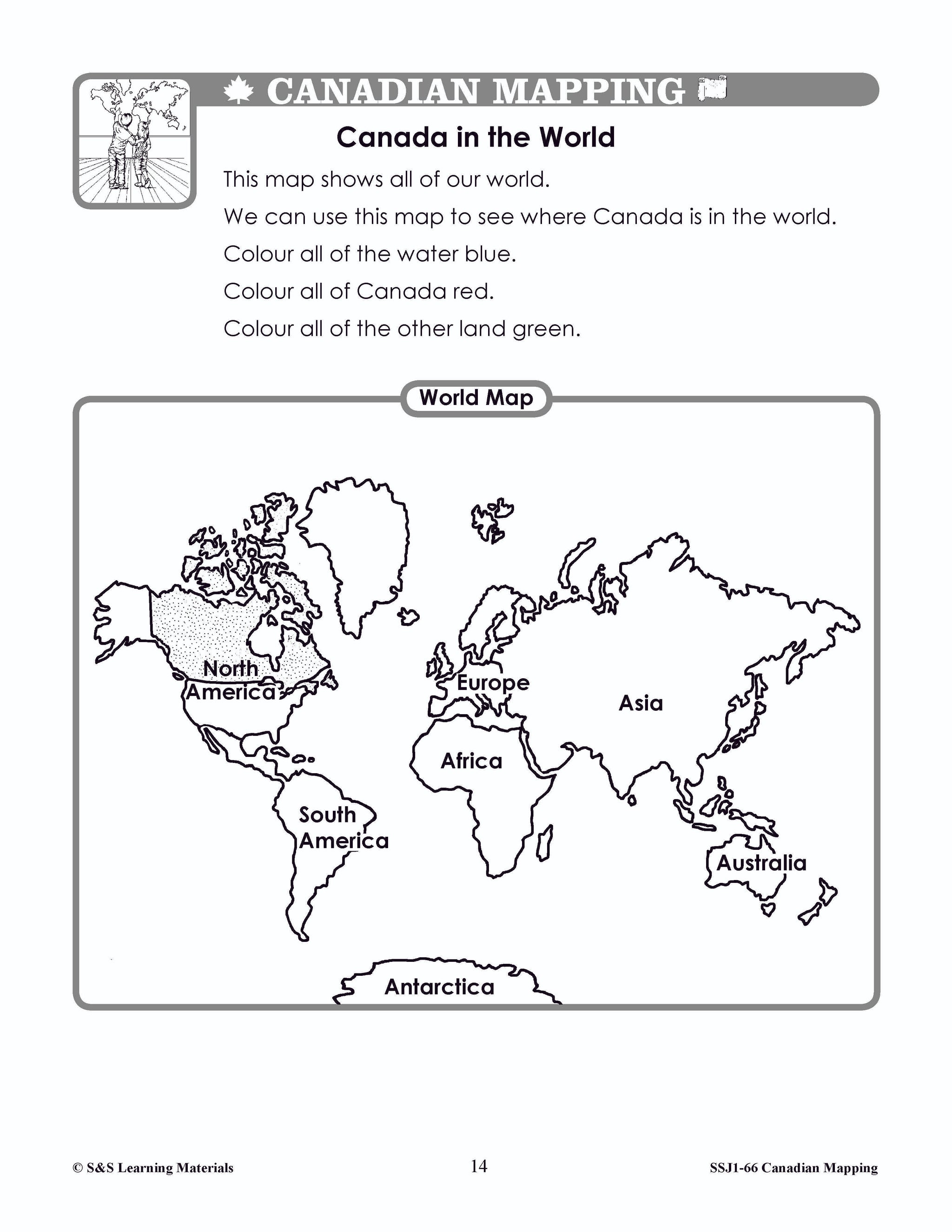
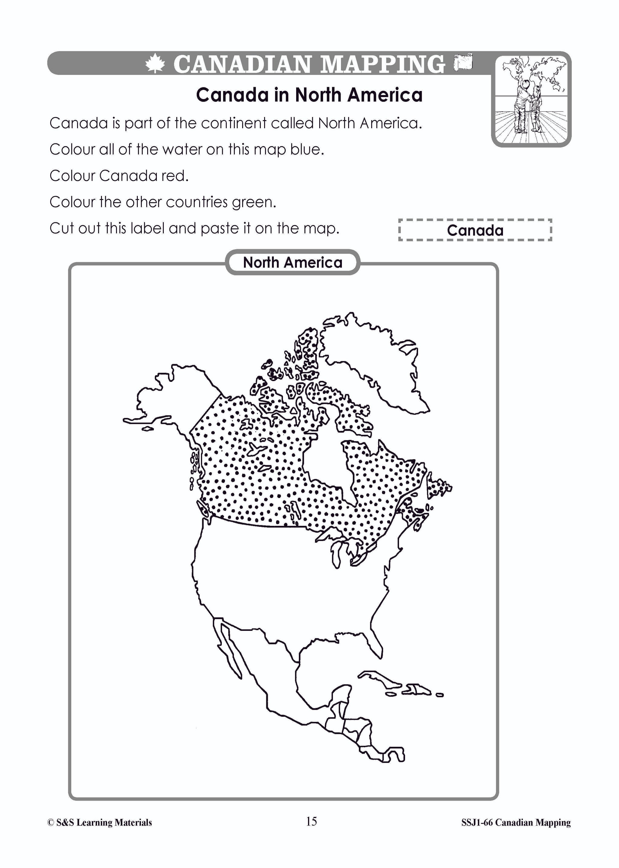
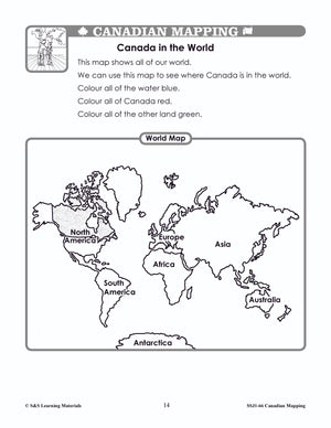
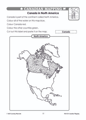
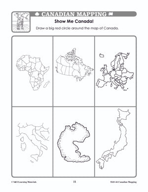
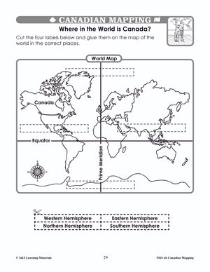
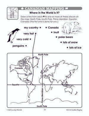
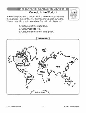
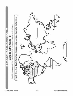
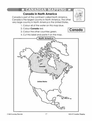
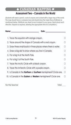
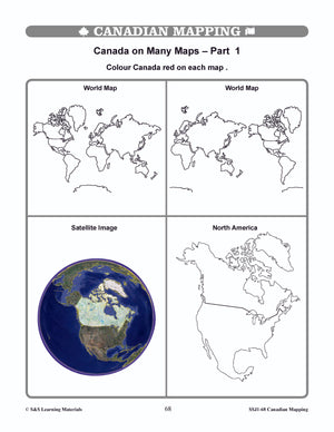
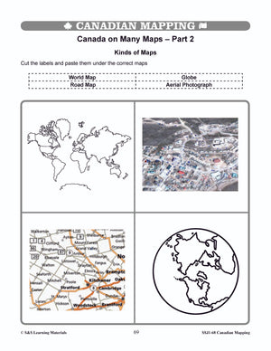
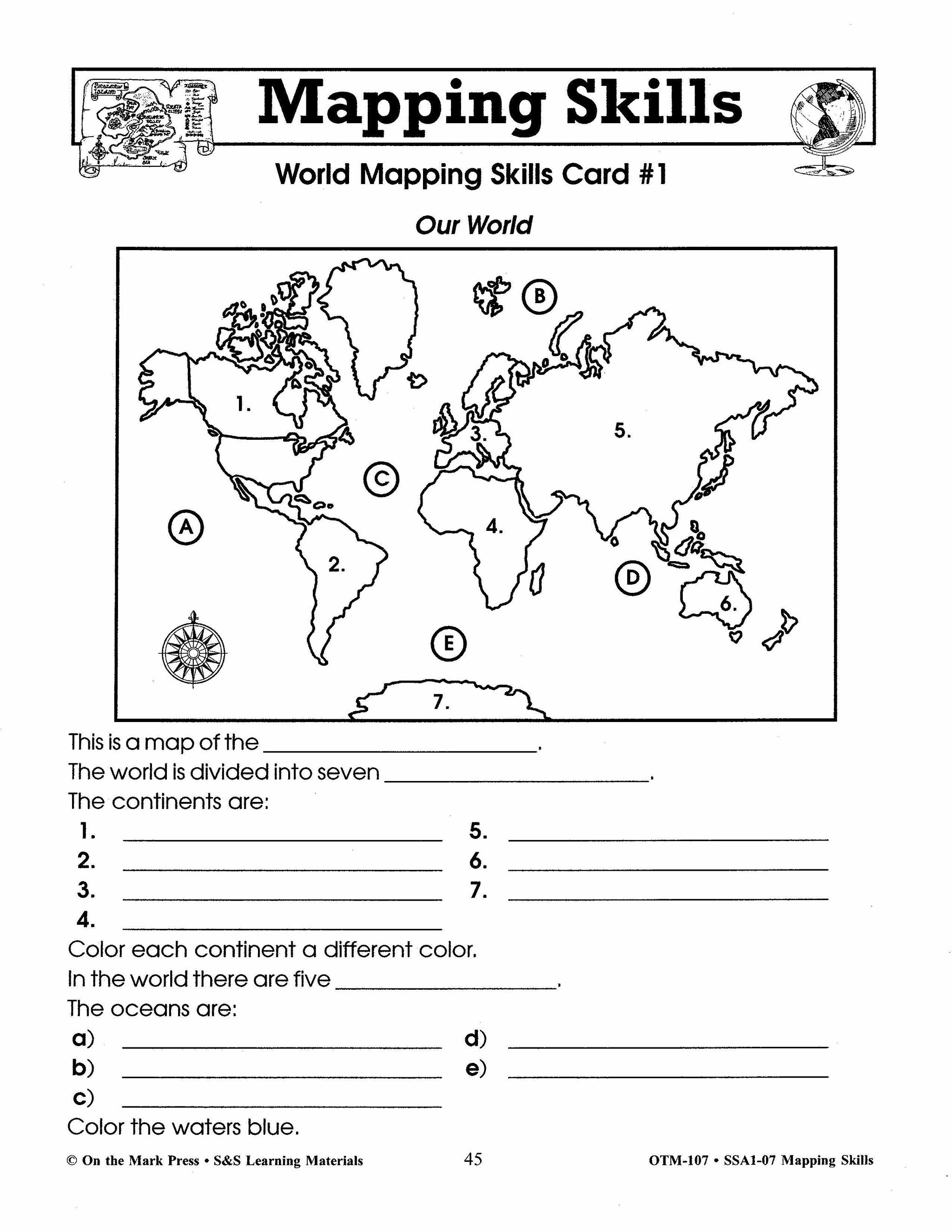
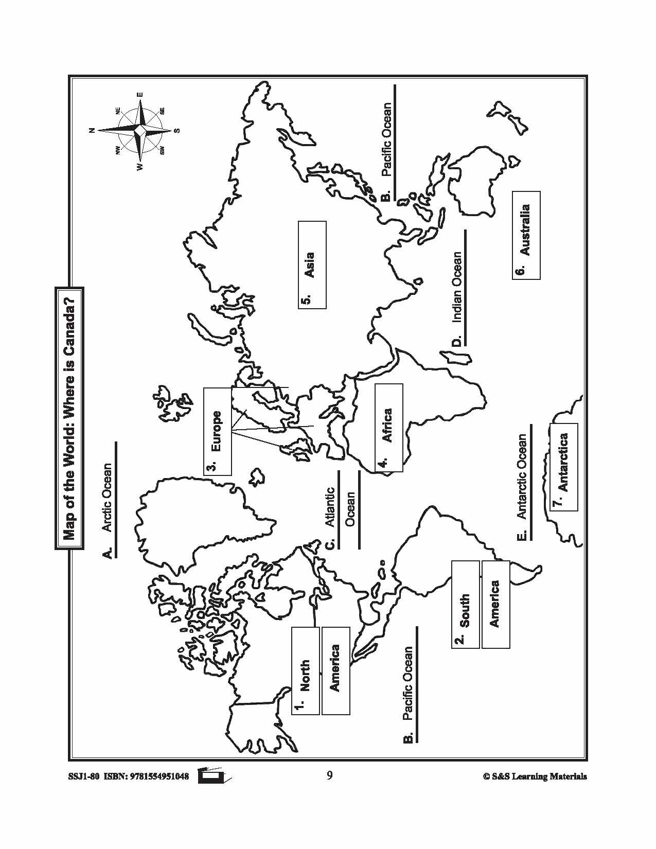
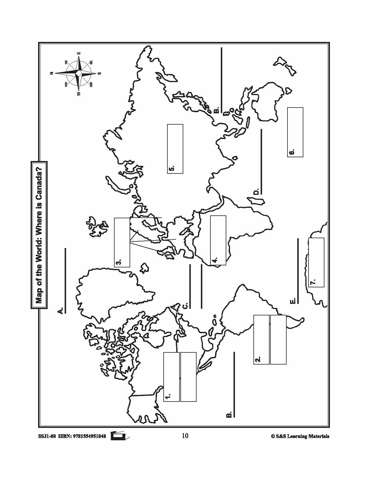
Canada in the World Mapping Activities Grades 1-3
$6.95 CAD
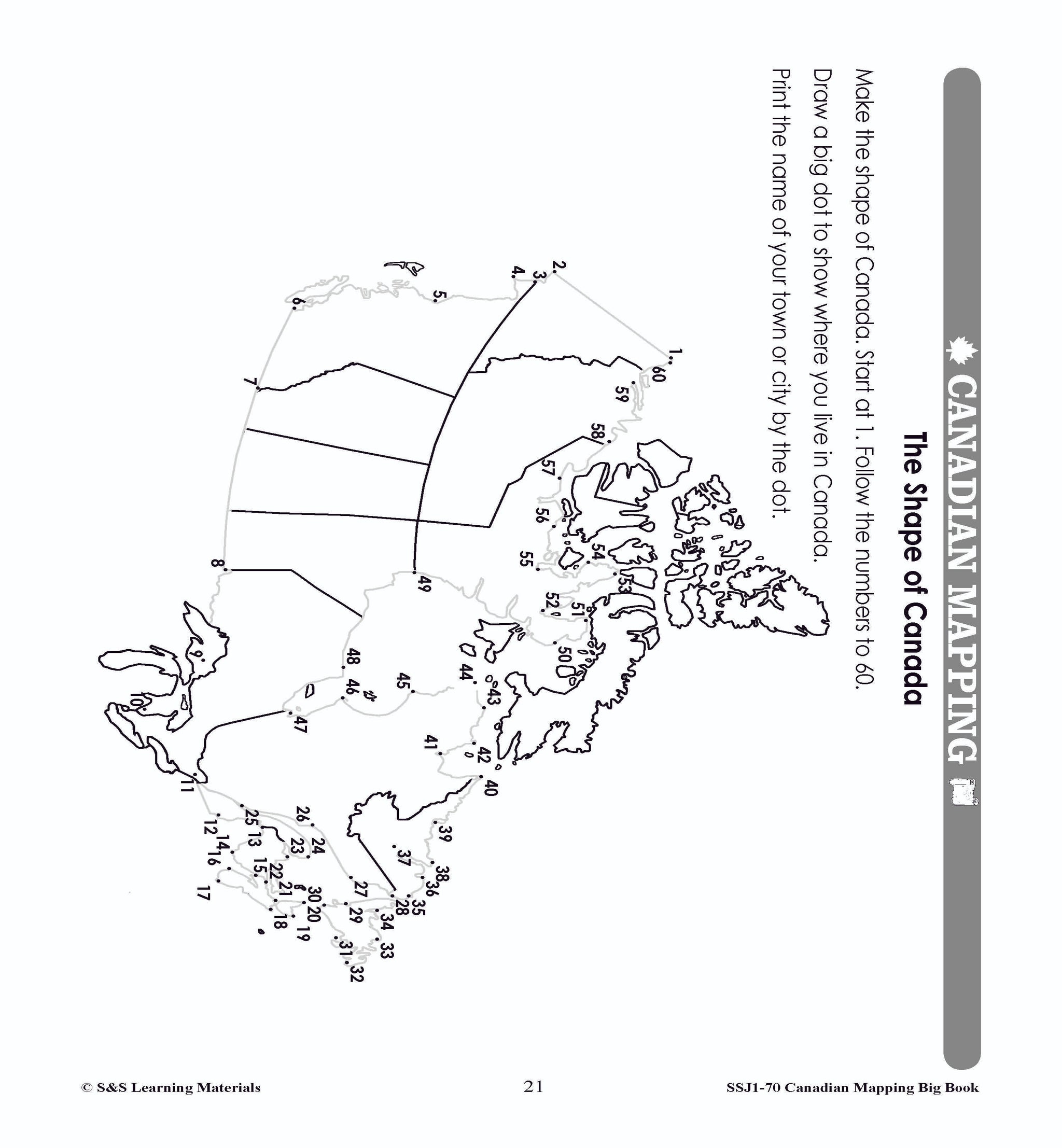
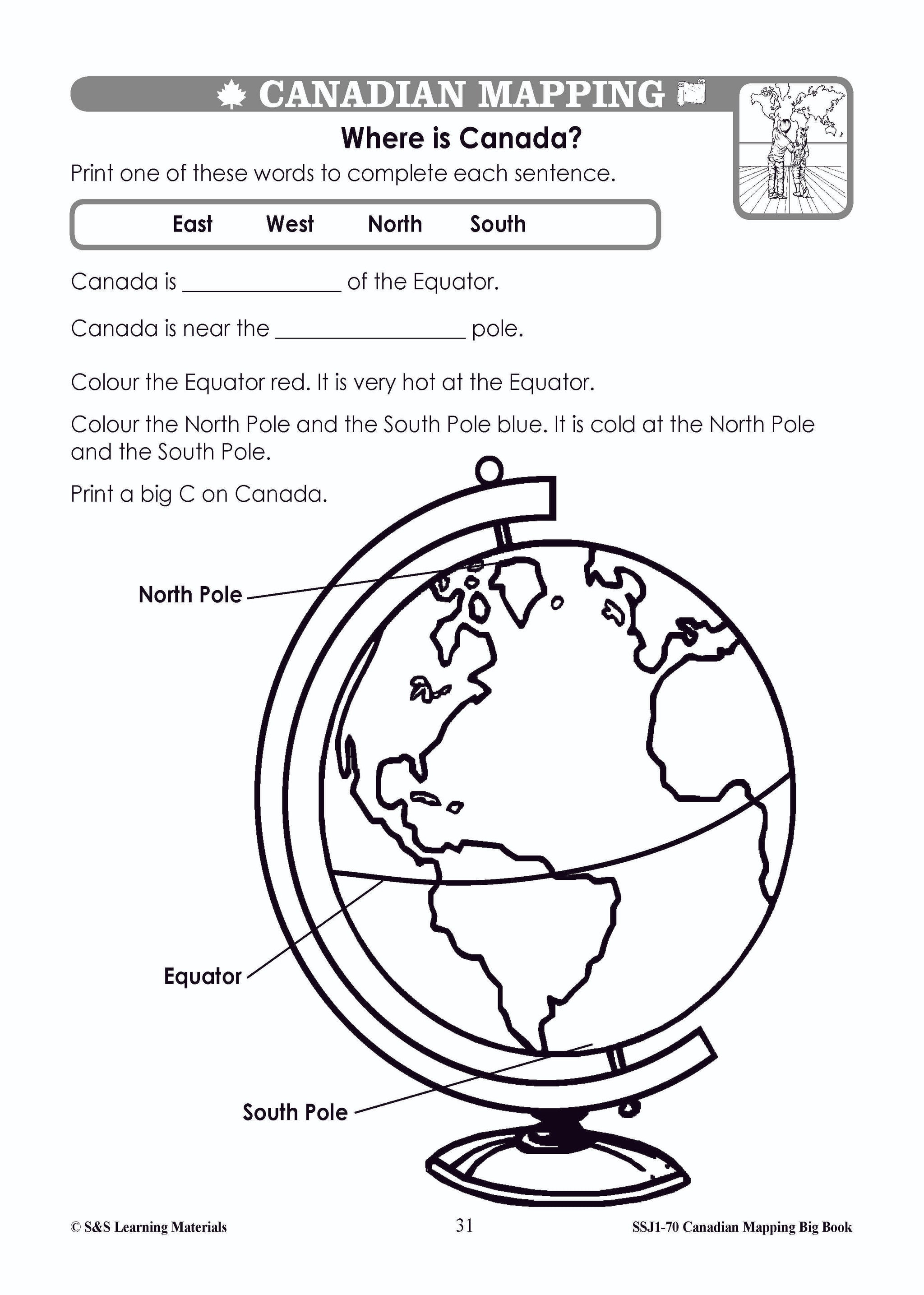
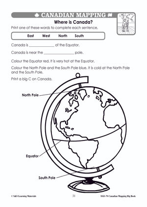
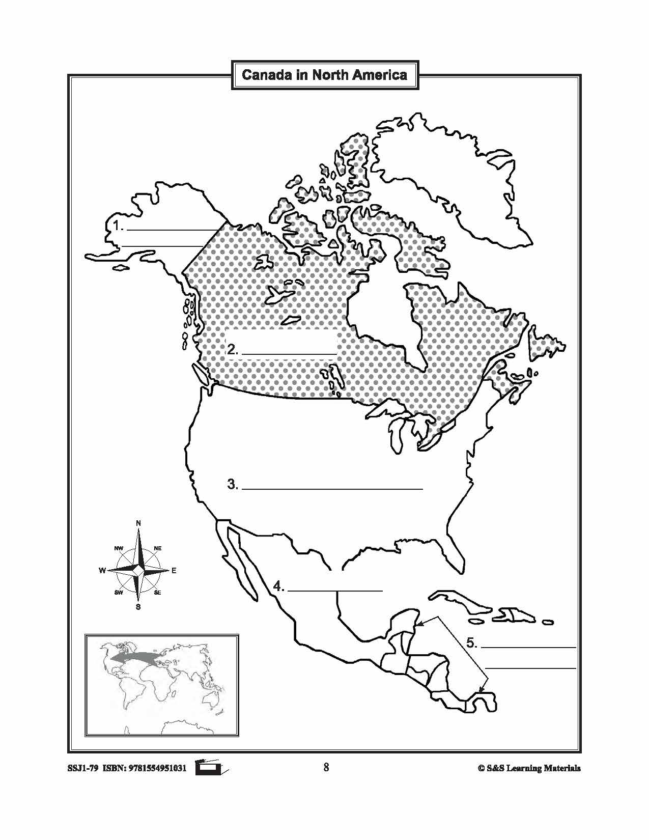
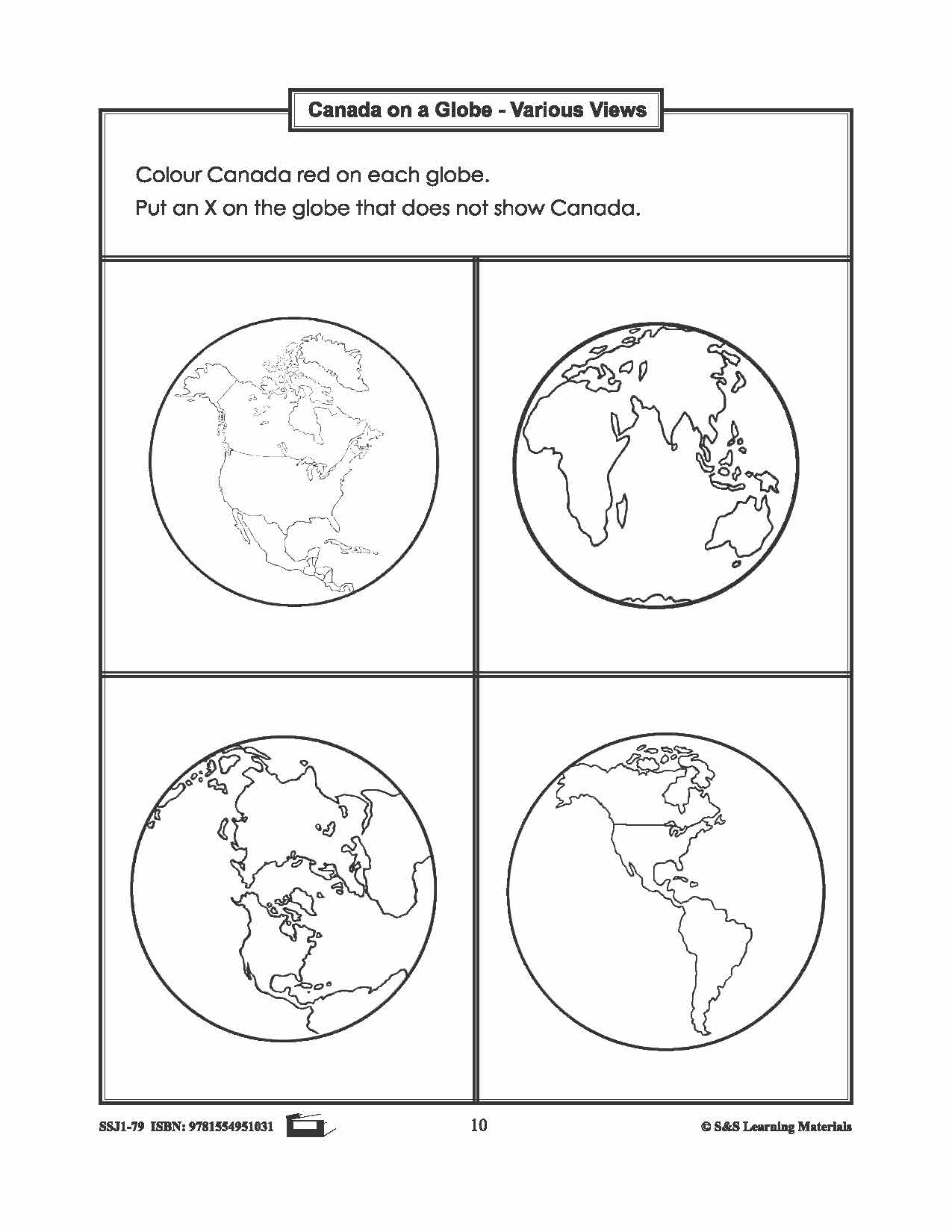
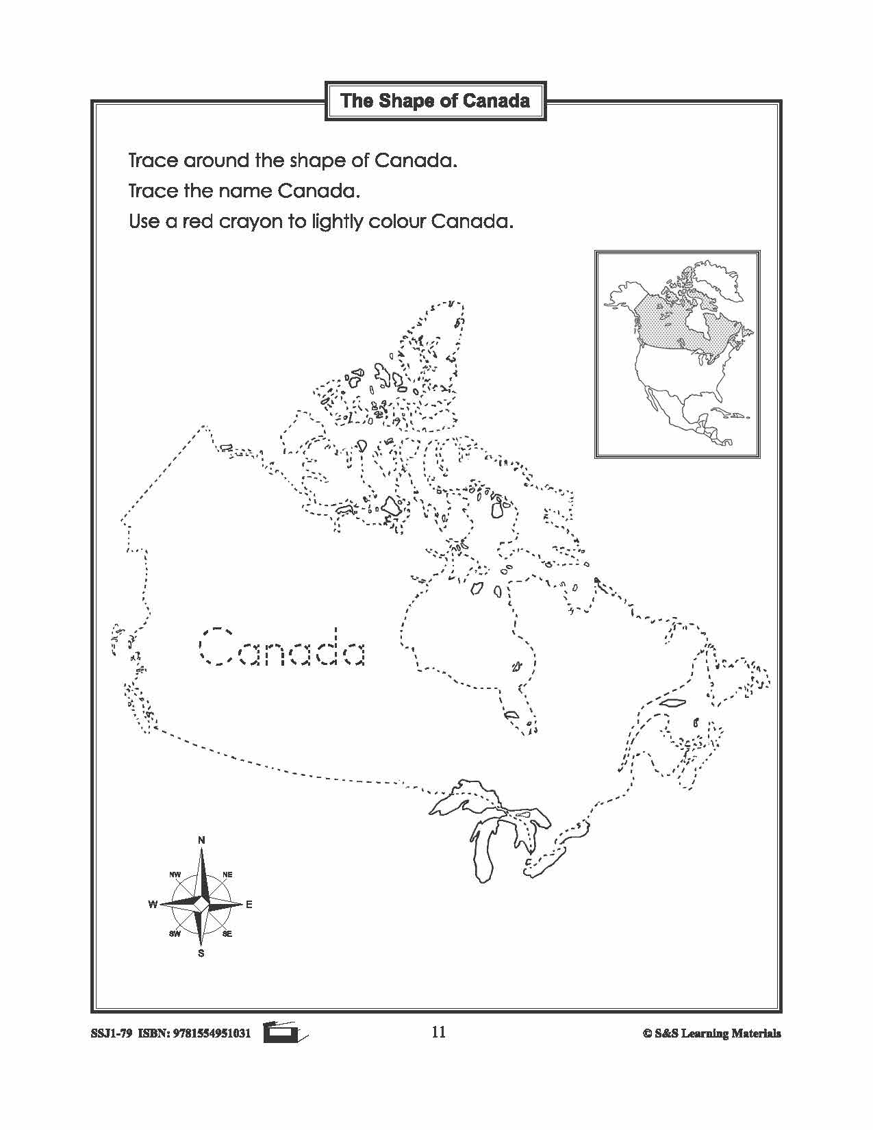
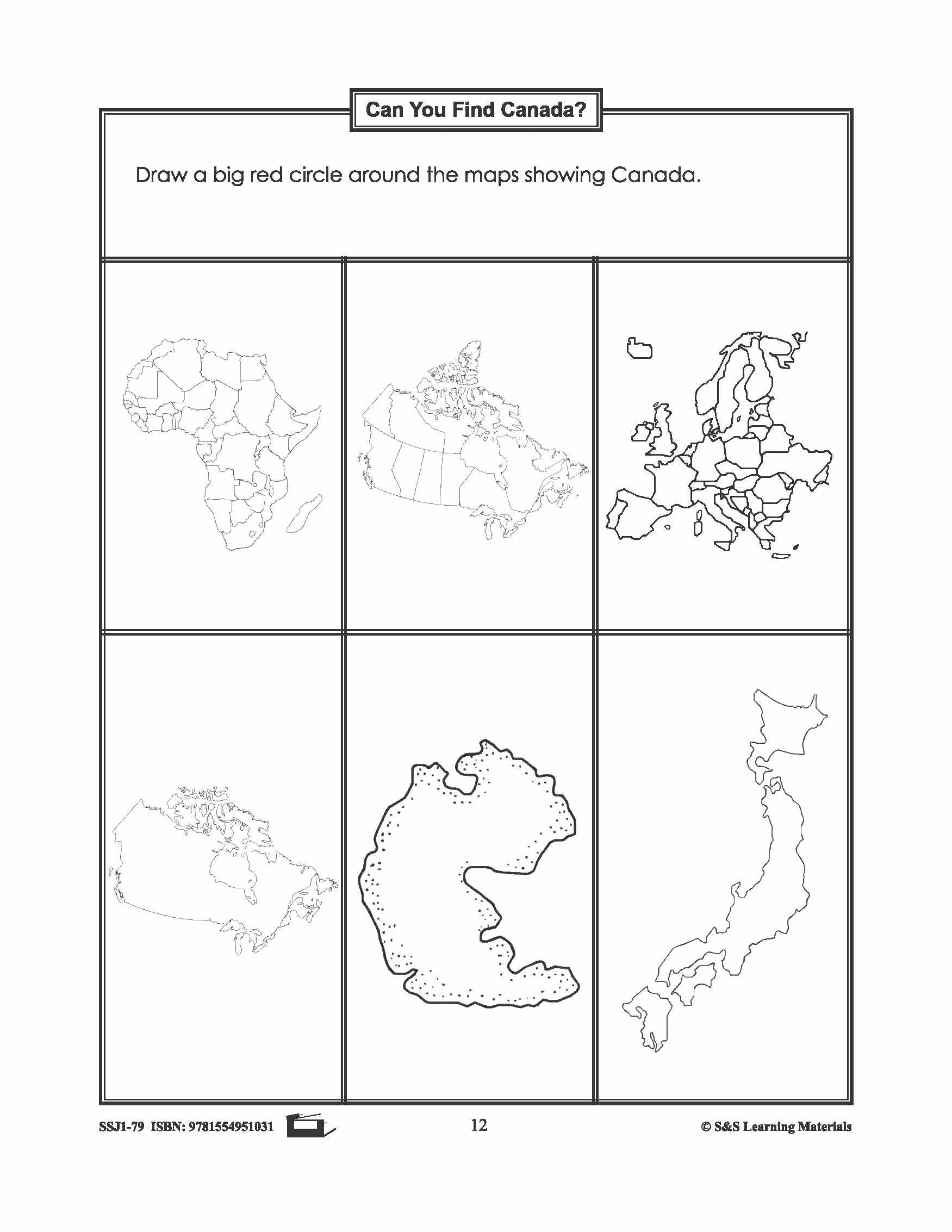
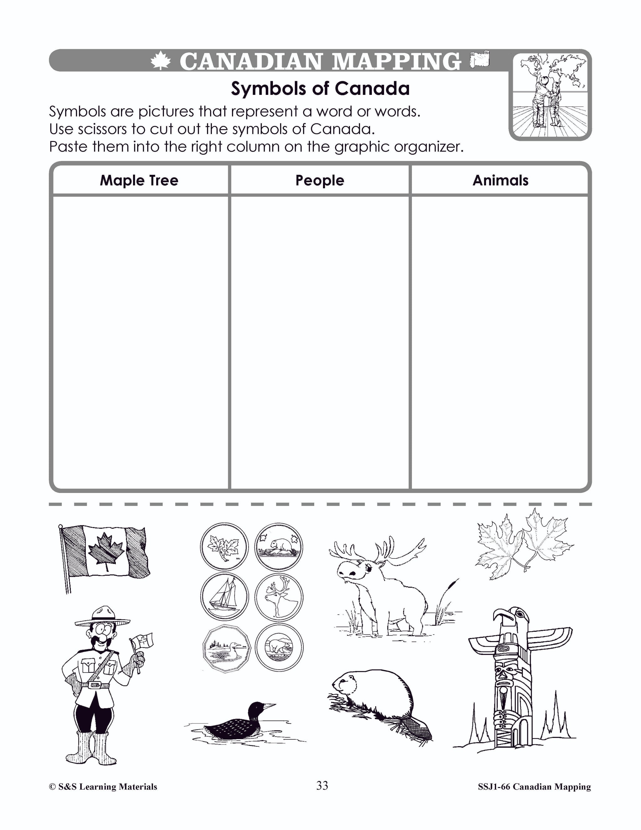
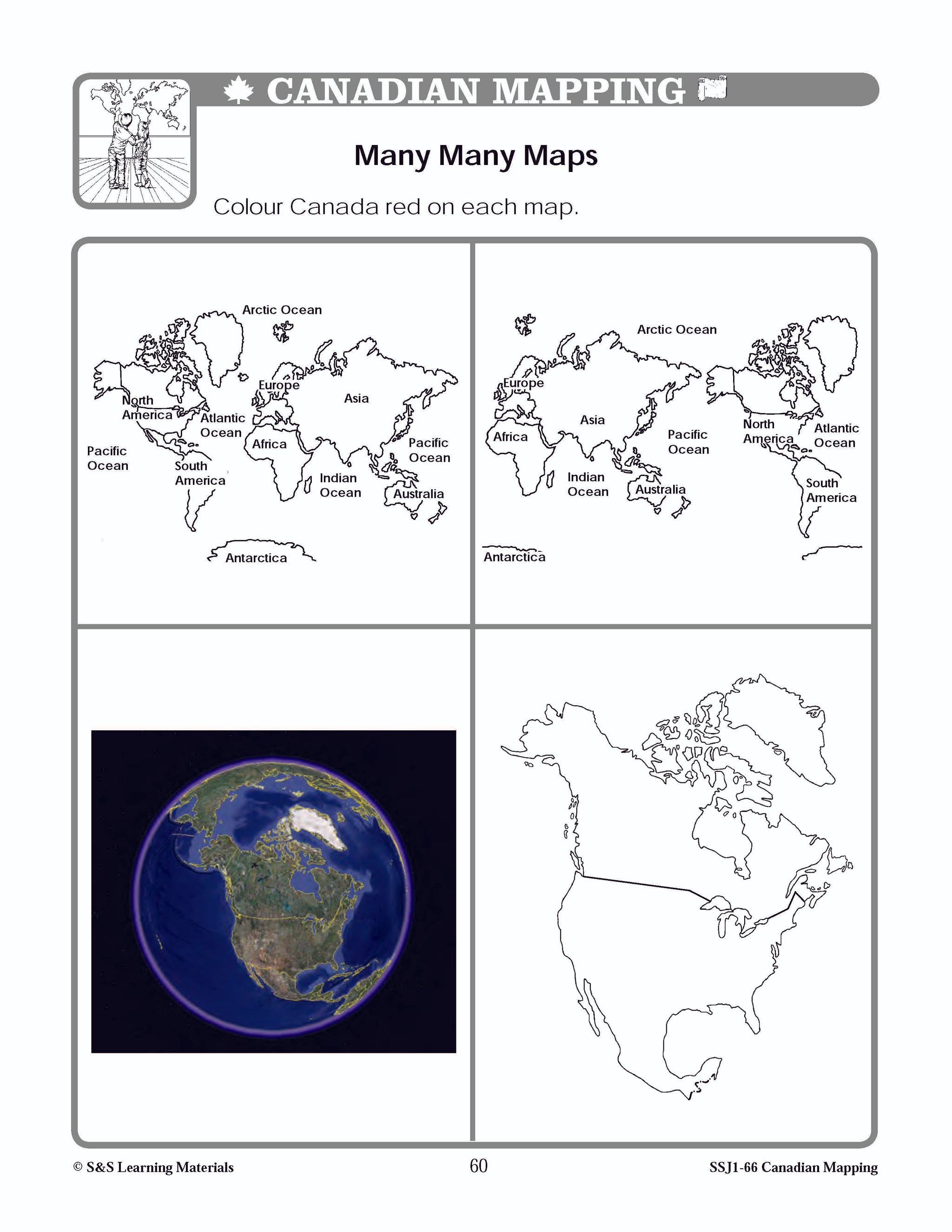
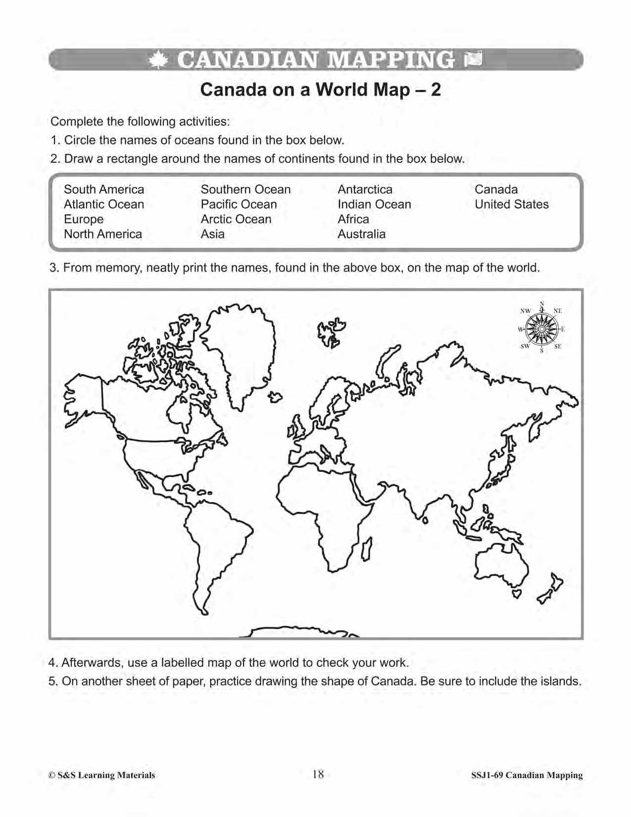
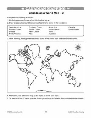
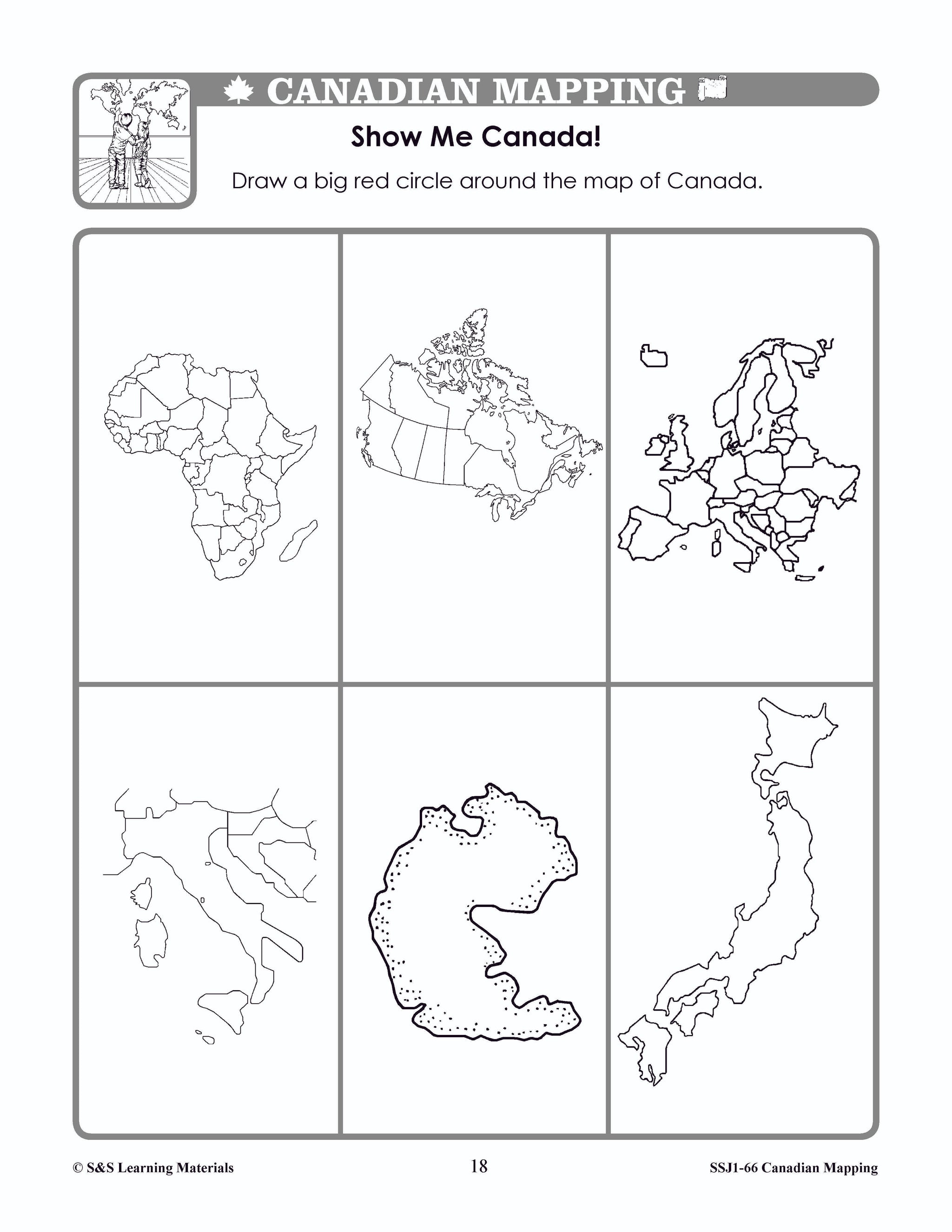
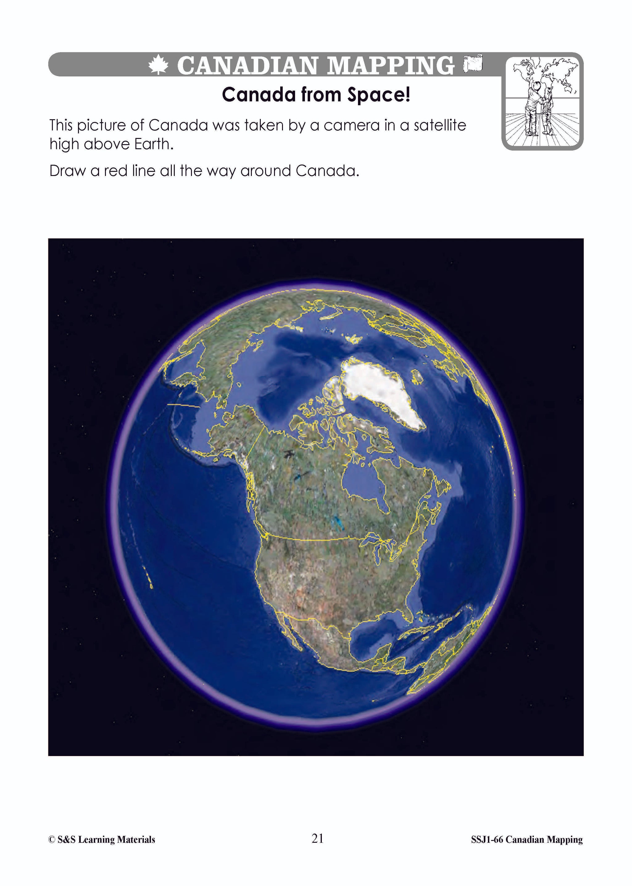
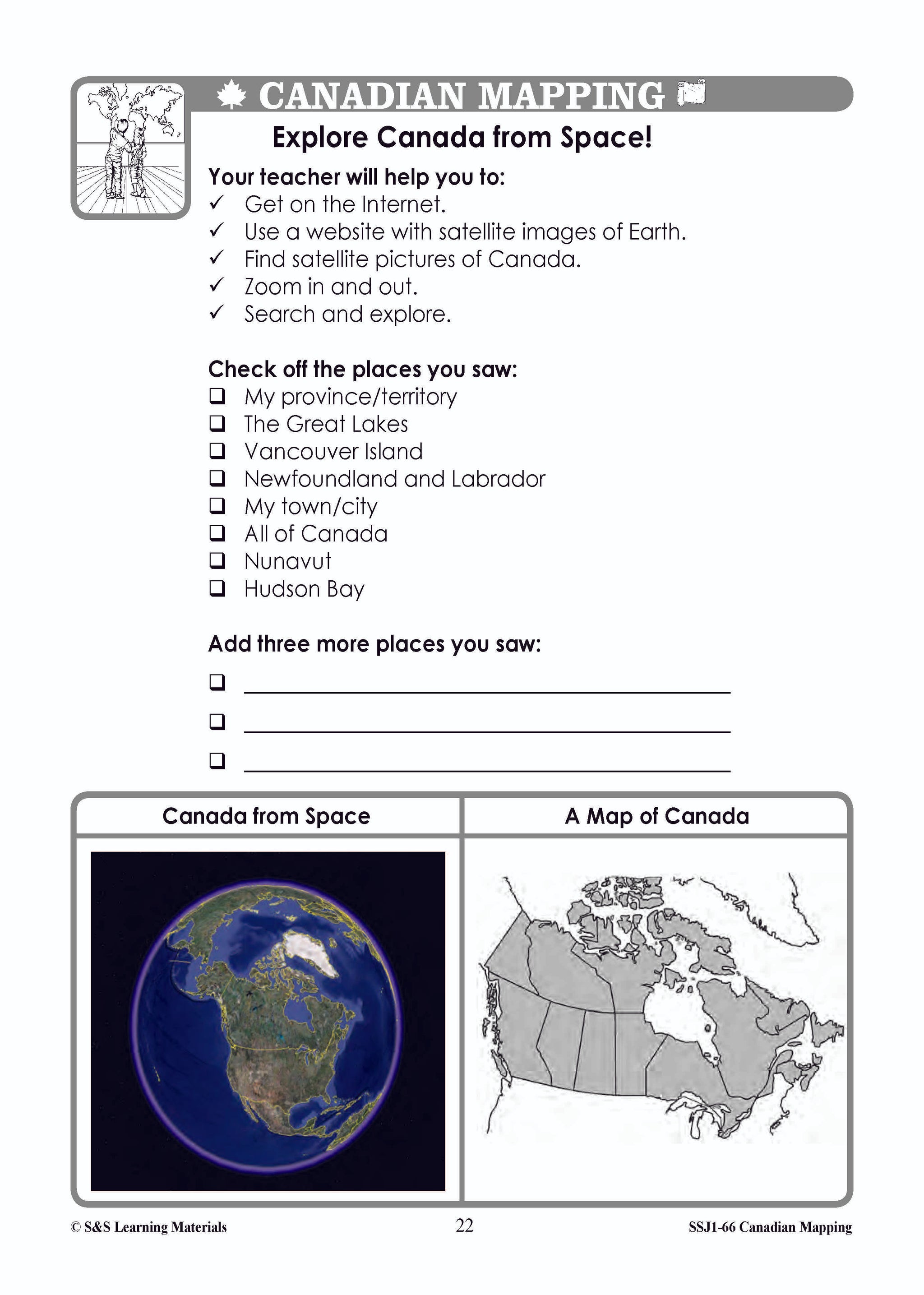
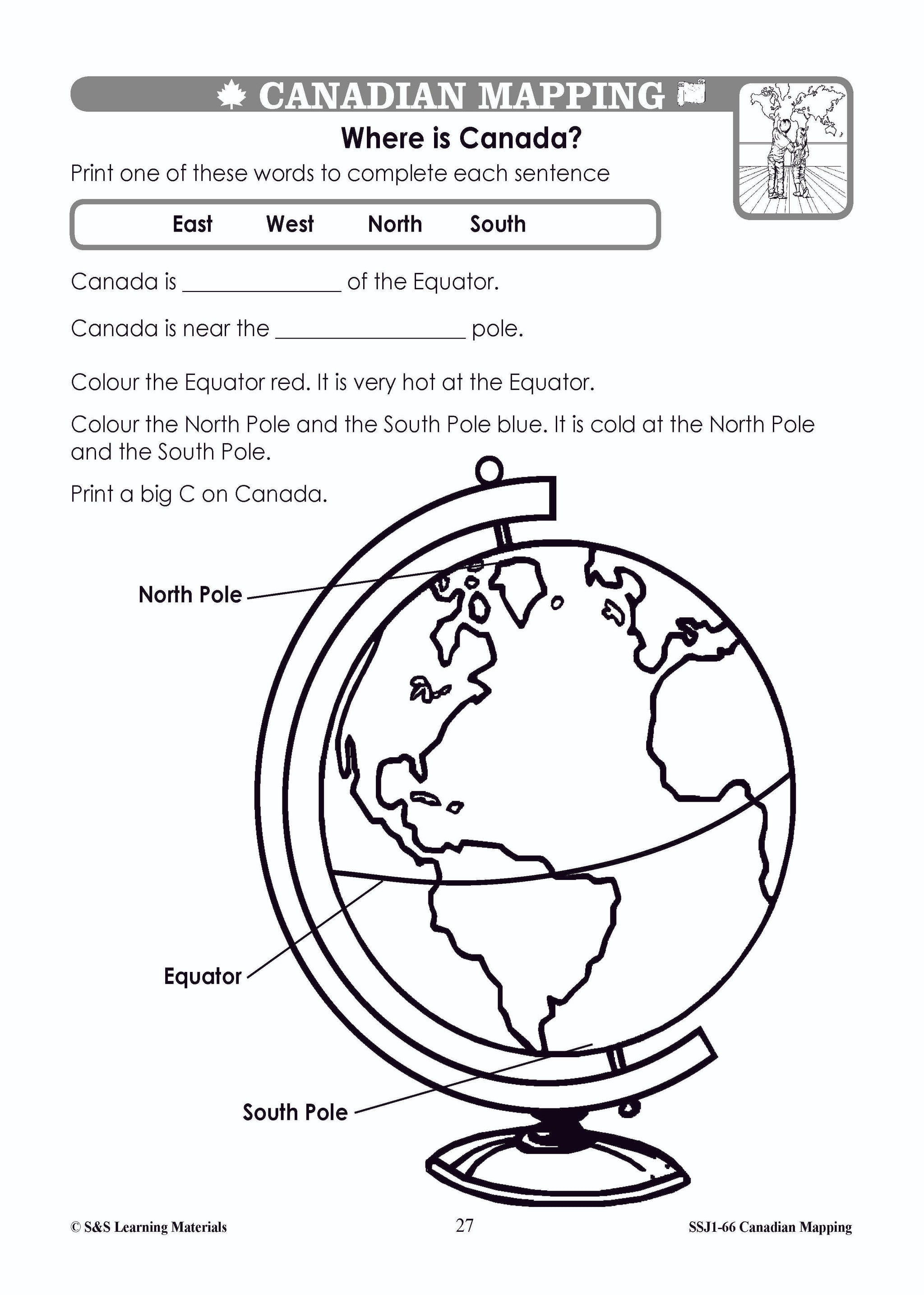
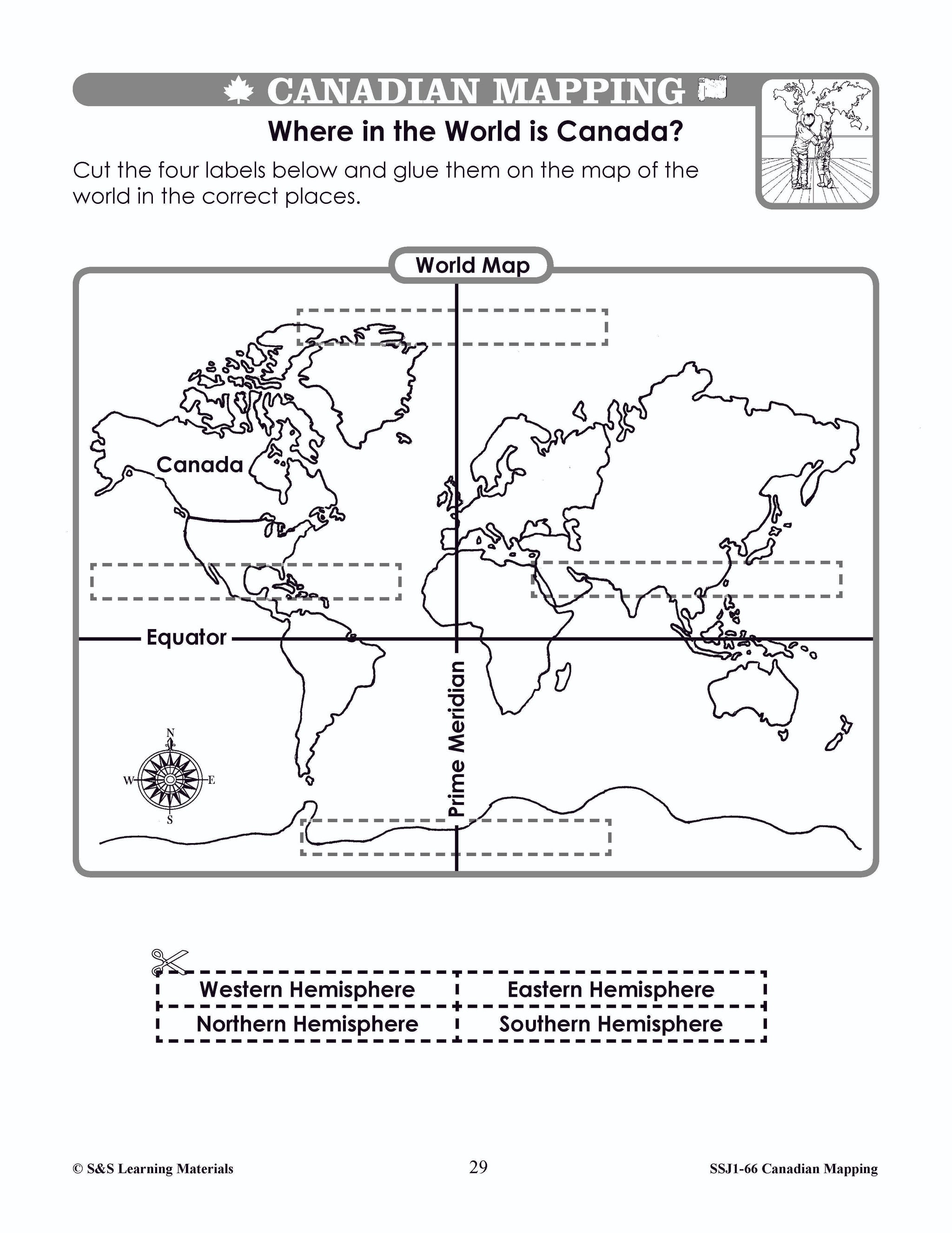
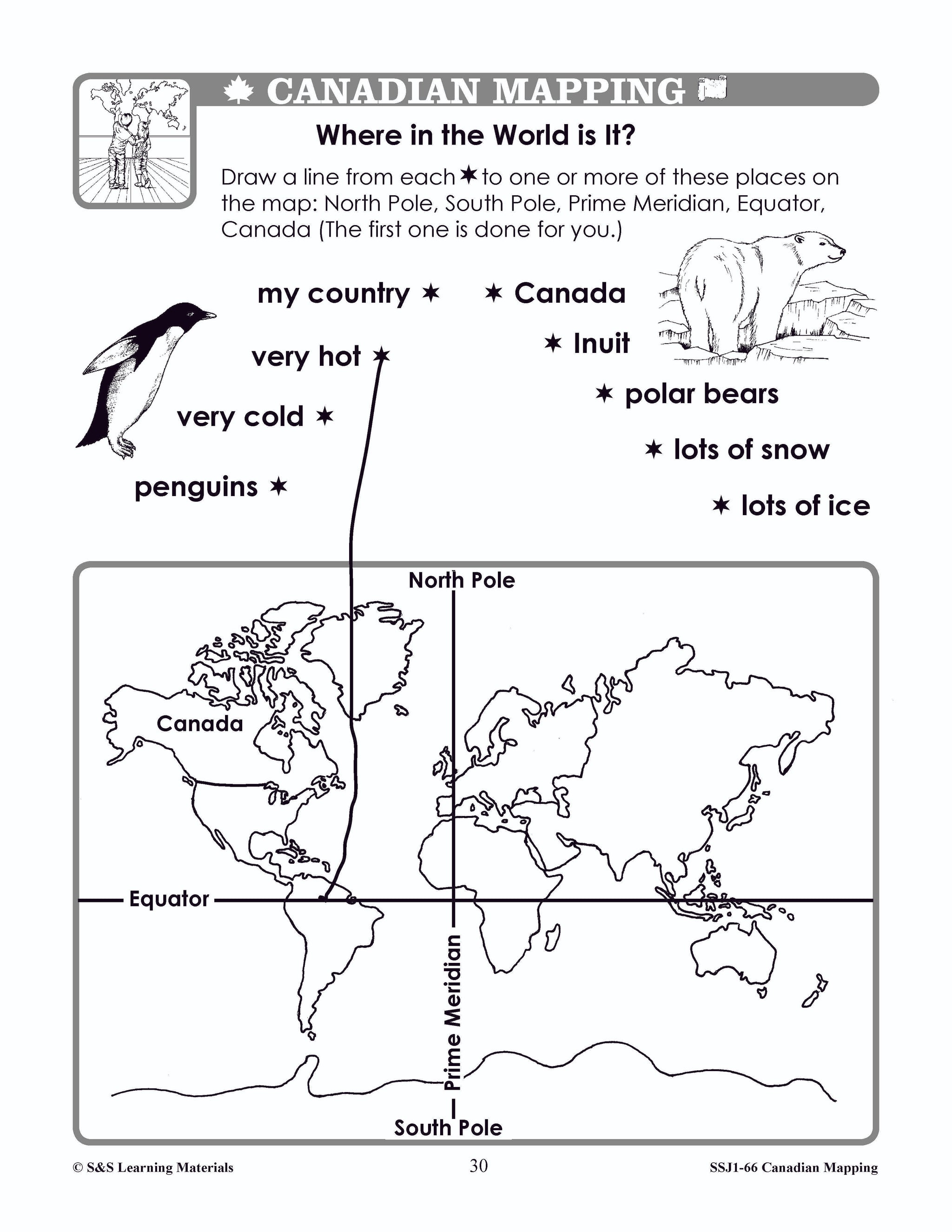
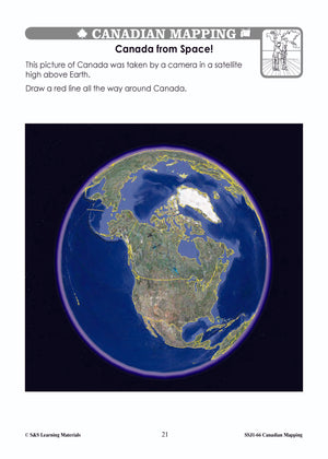
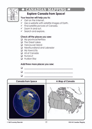
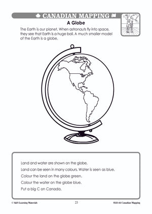
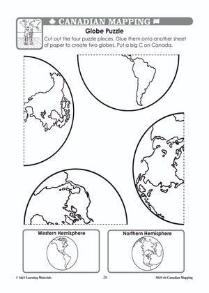
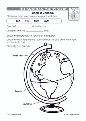
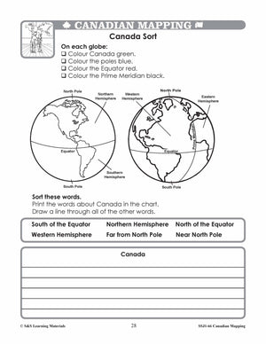
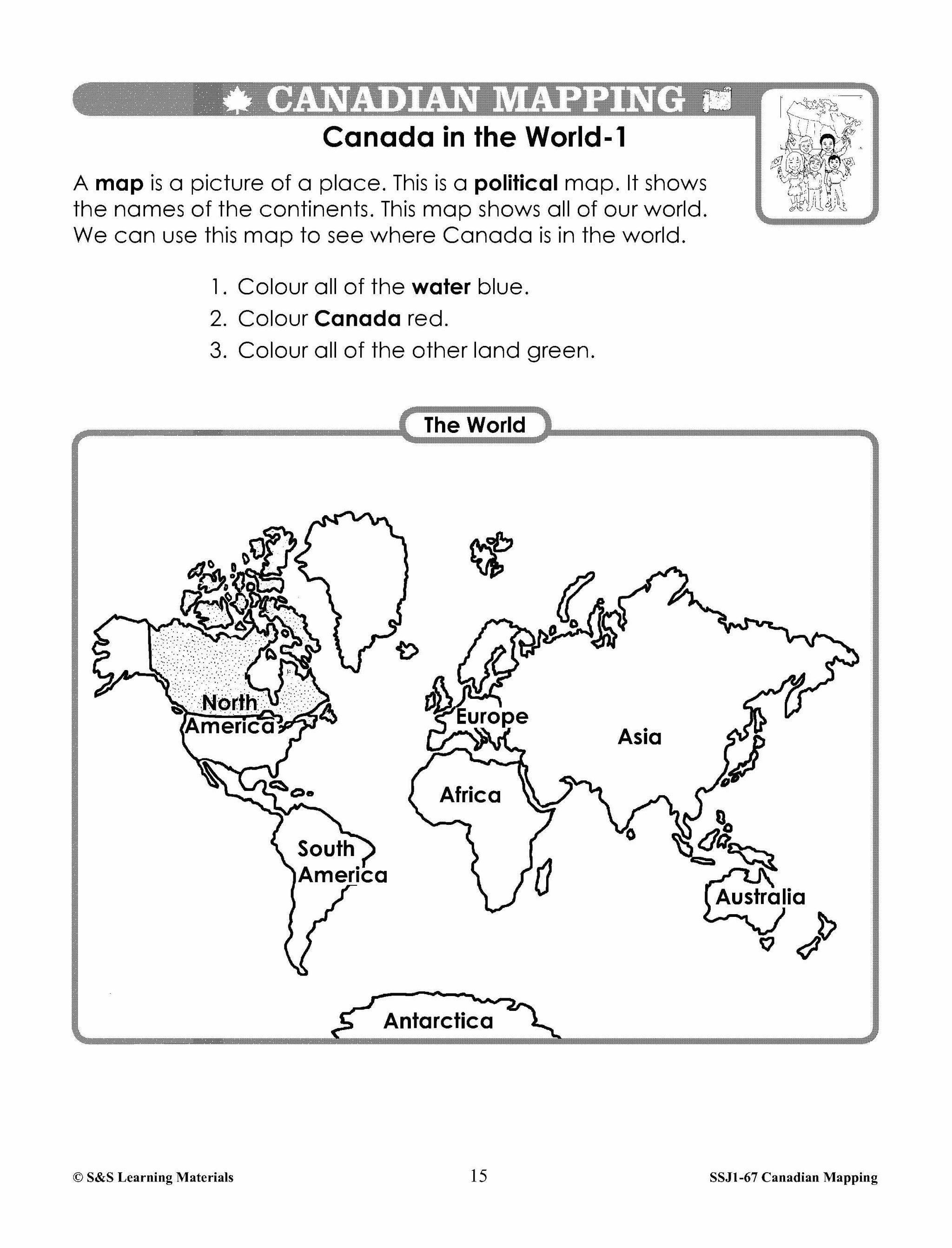
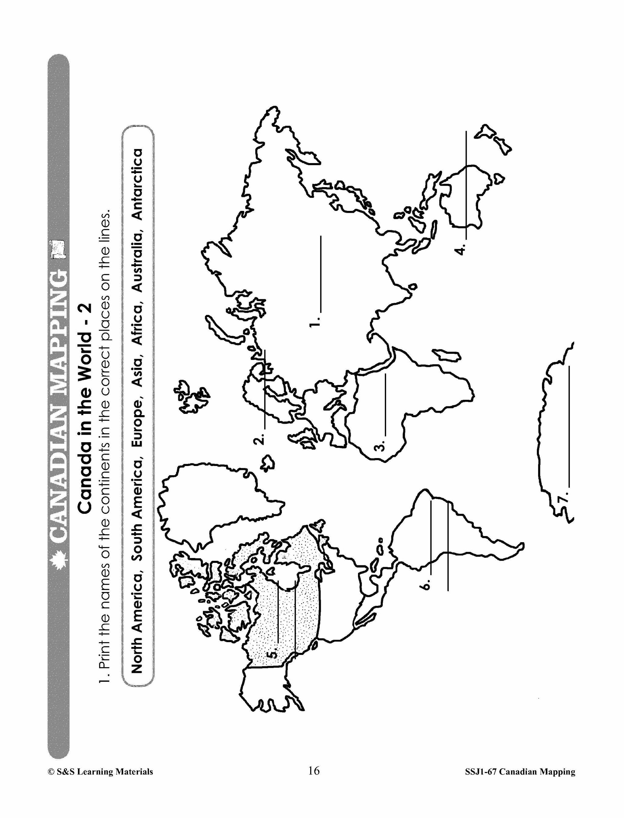
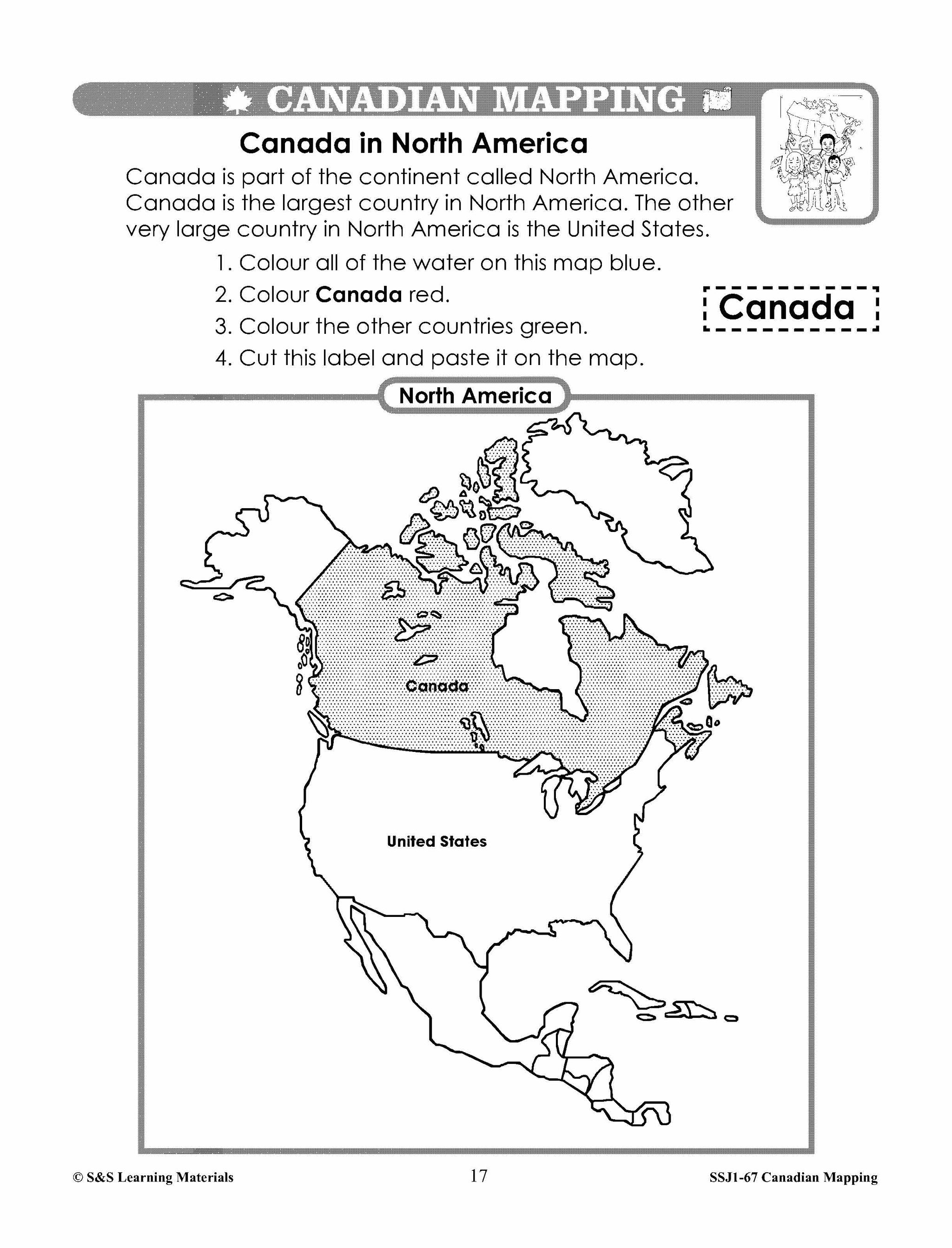
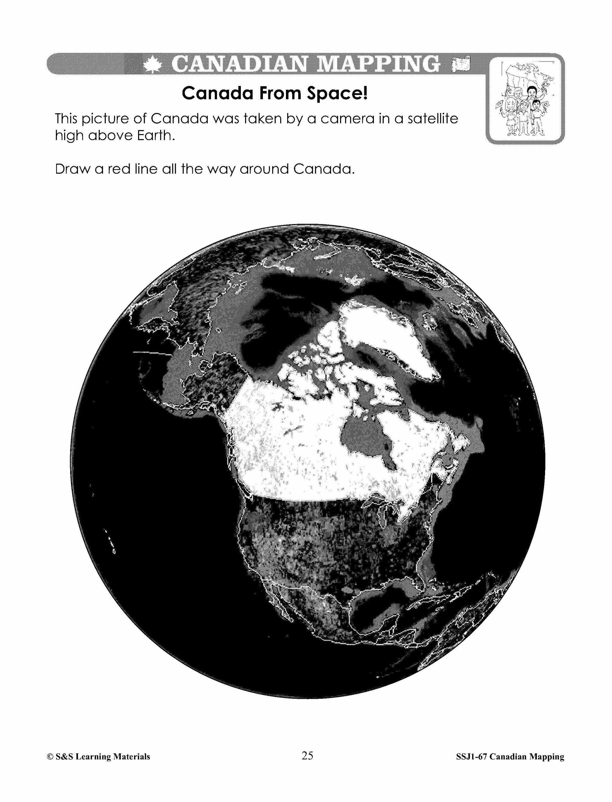
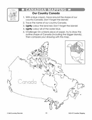
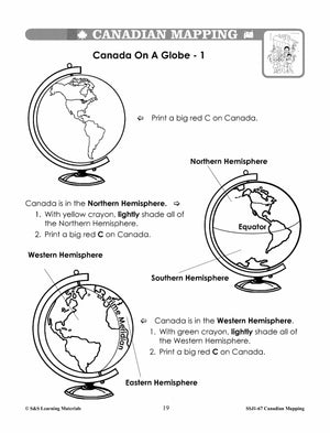
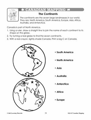
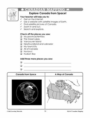
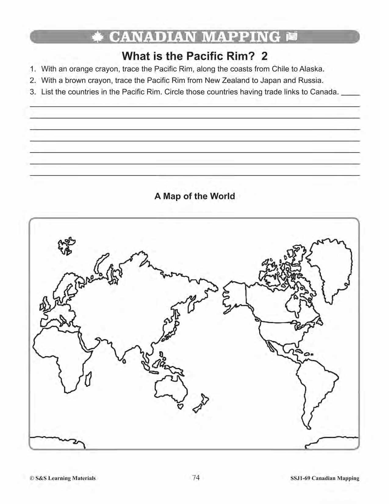
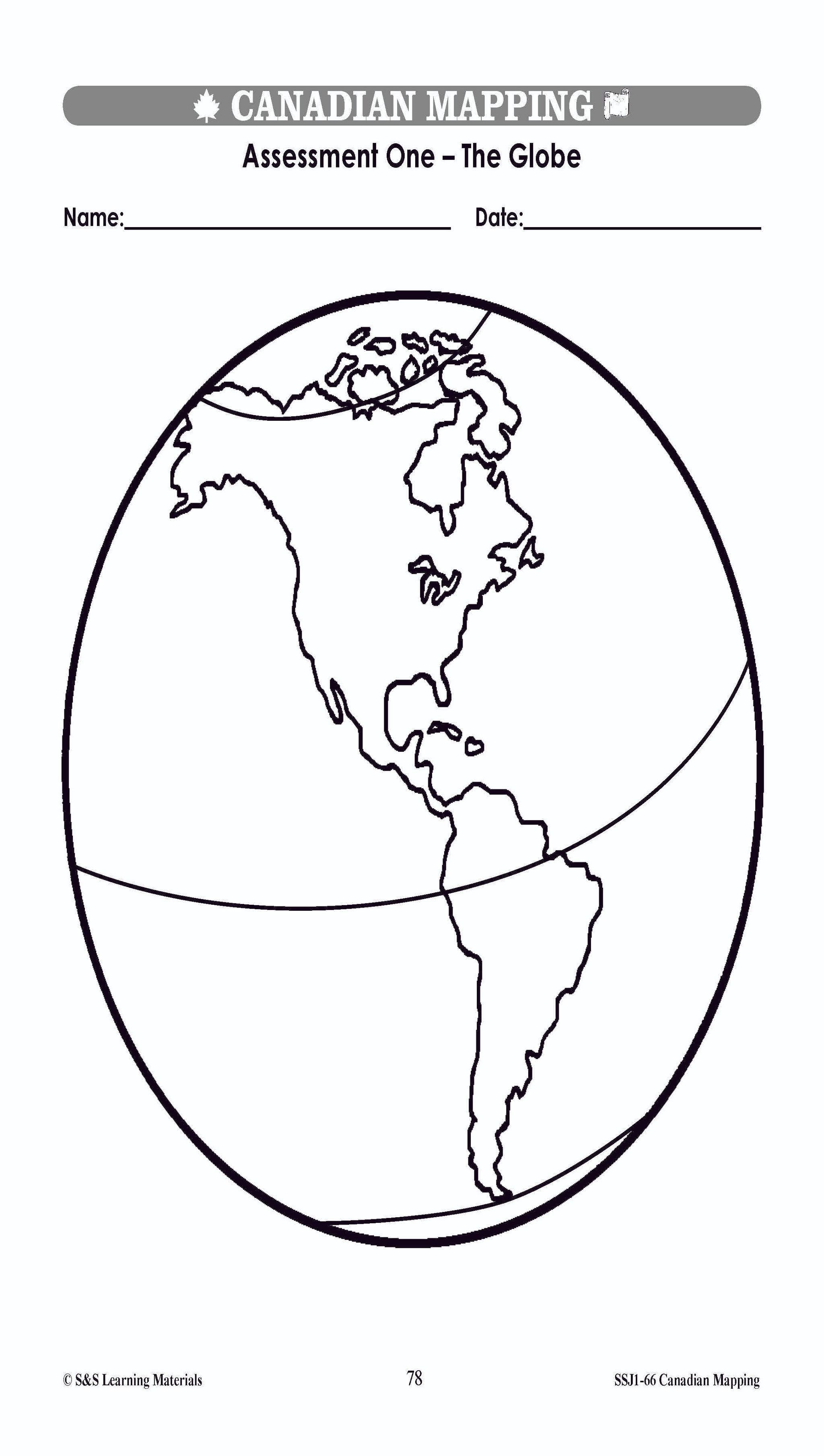
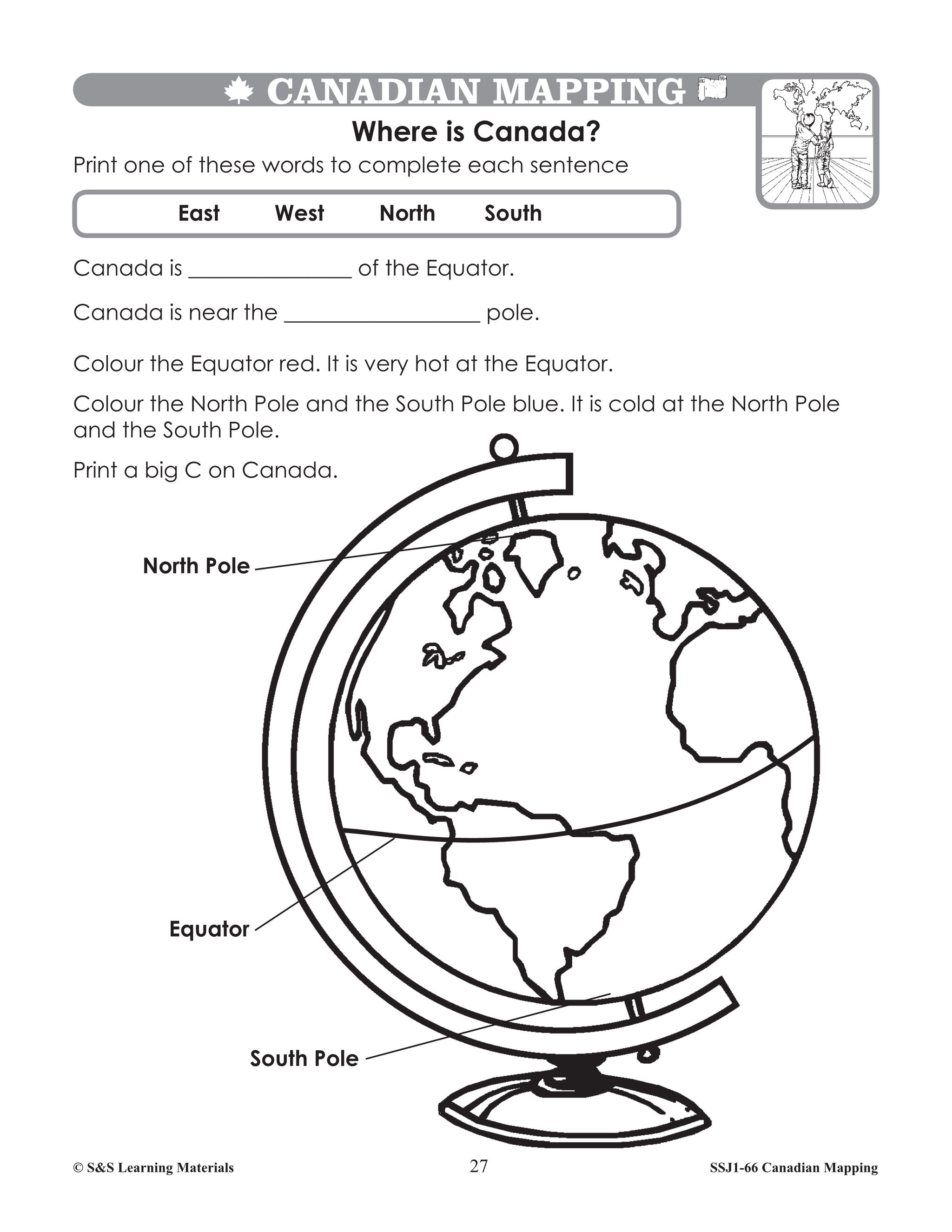
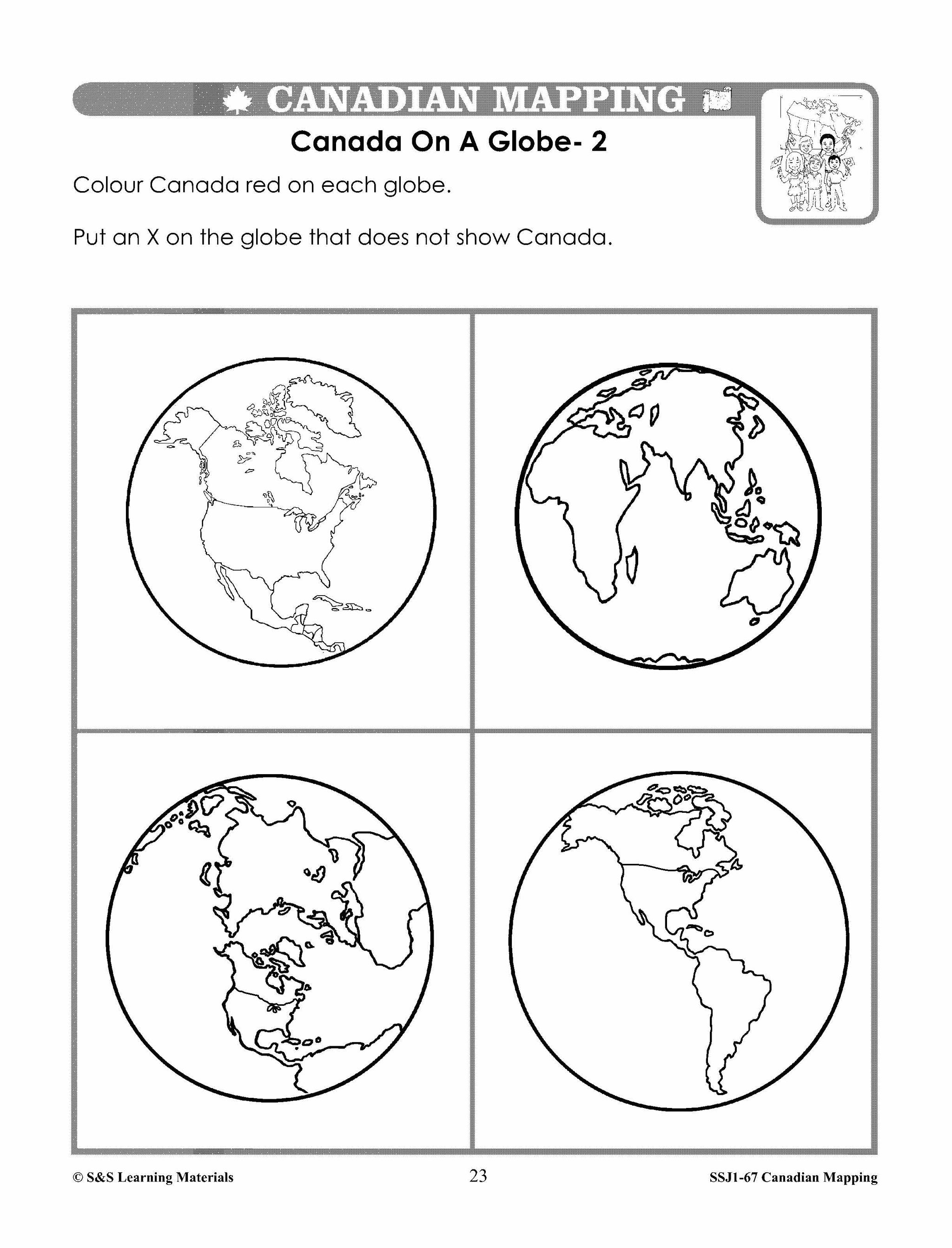
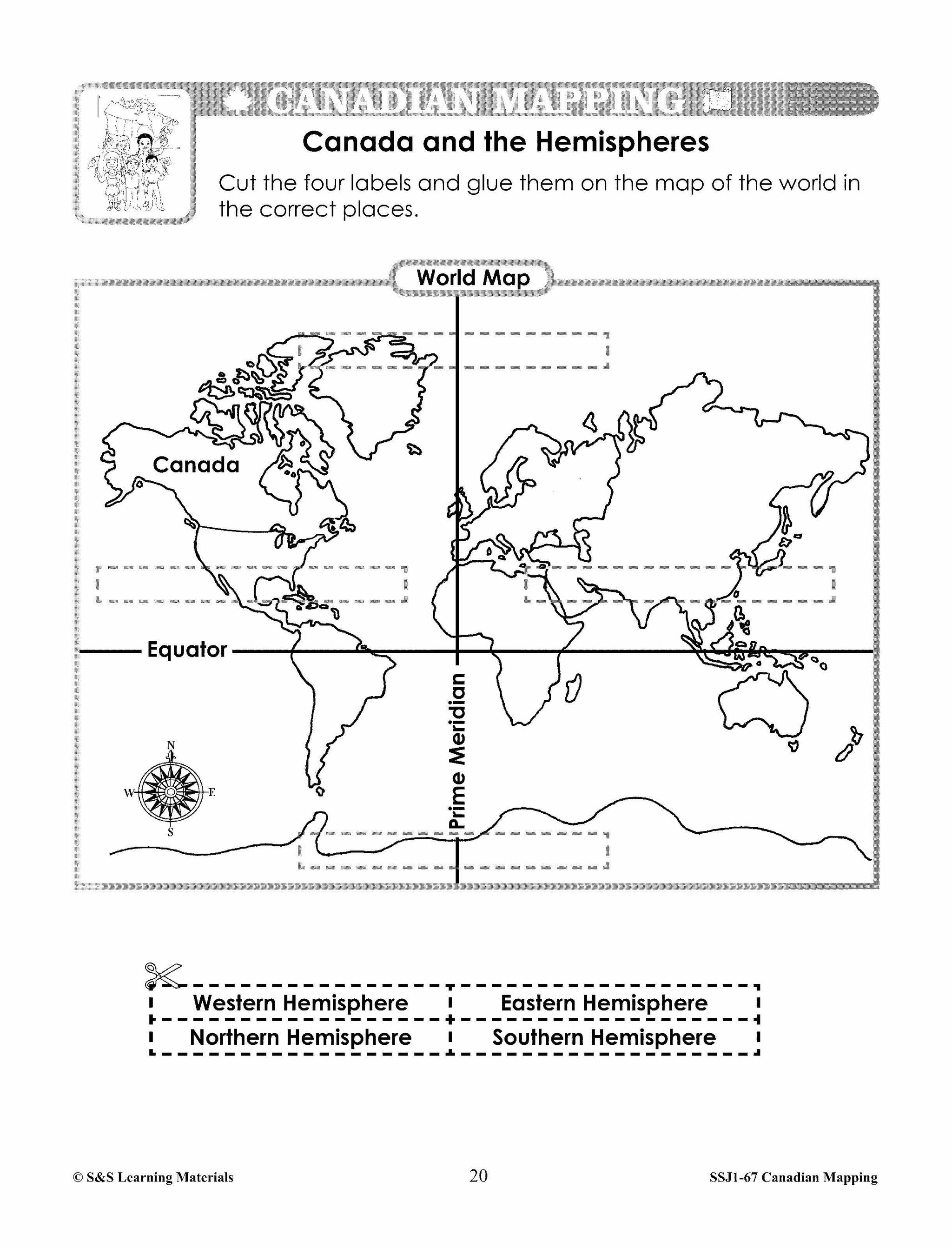
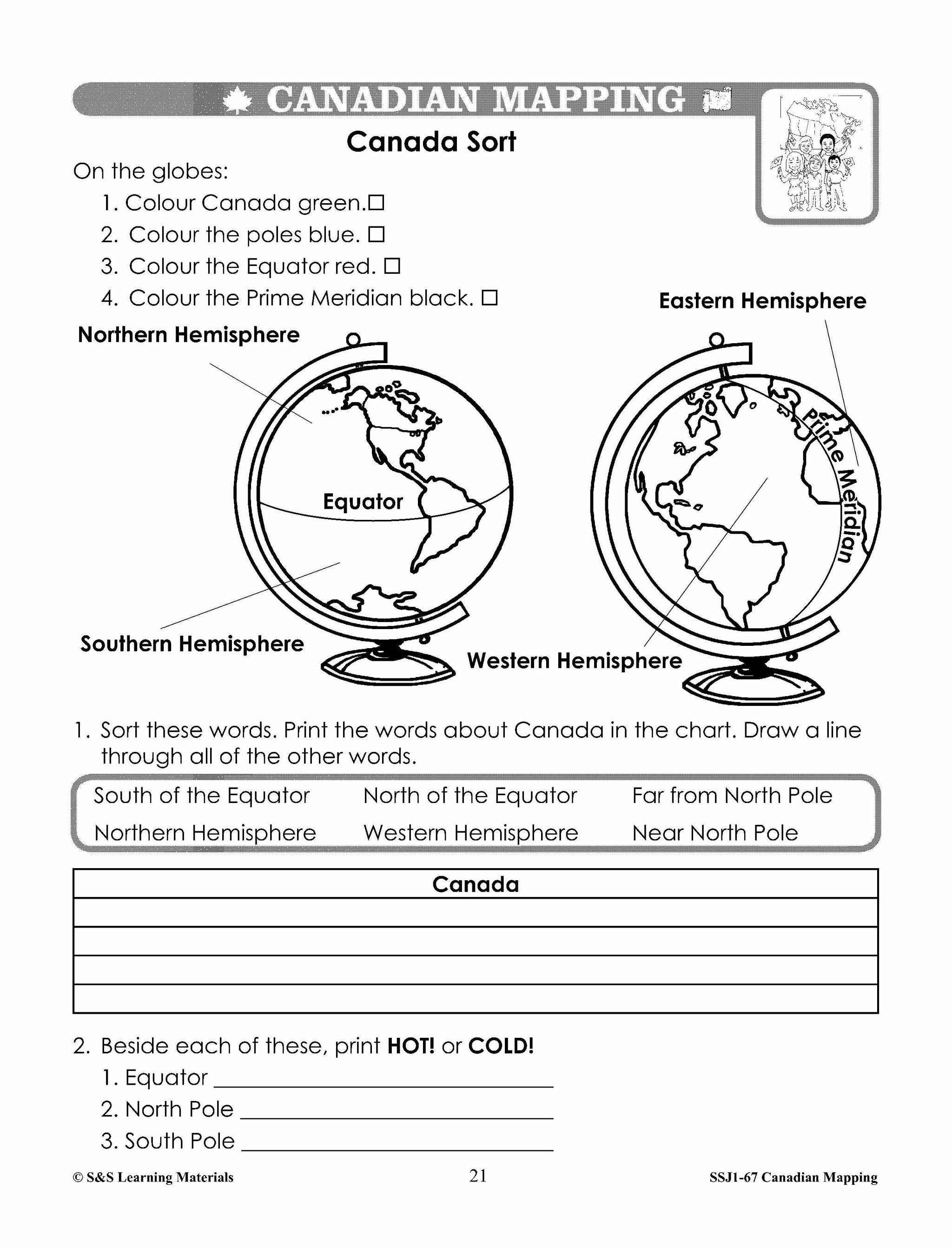
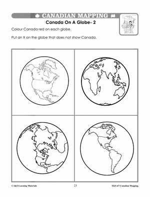
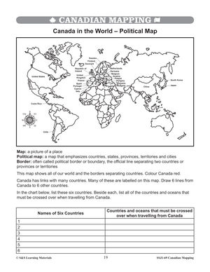
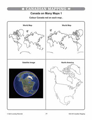
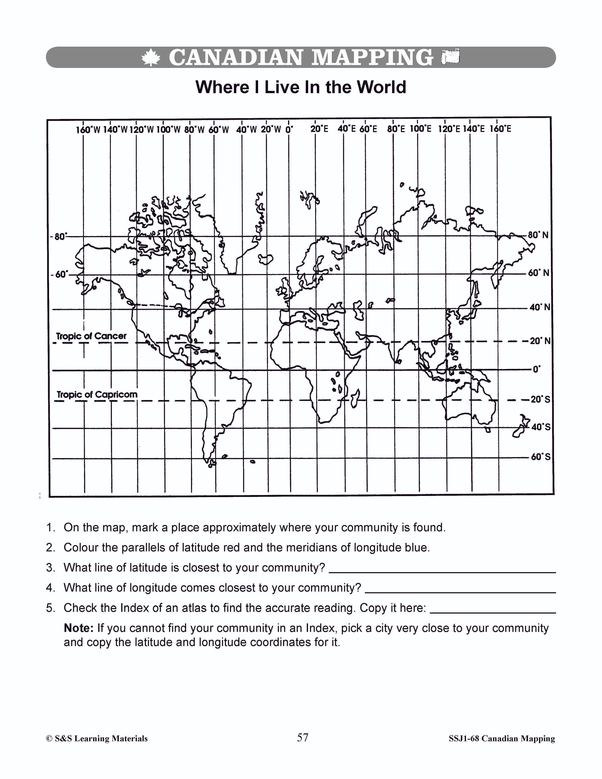
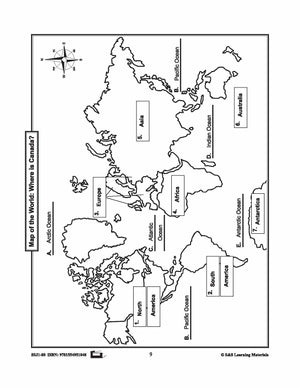
Students will gain an understanding of where Canada is in the World. Nine activities with maps help students: recognize the shape of Canada; locate Canada in North America and the world; find Canada on the globe in various views; view...

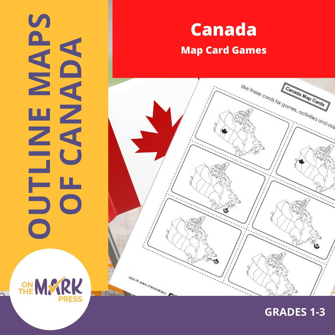


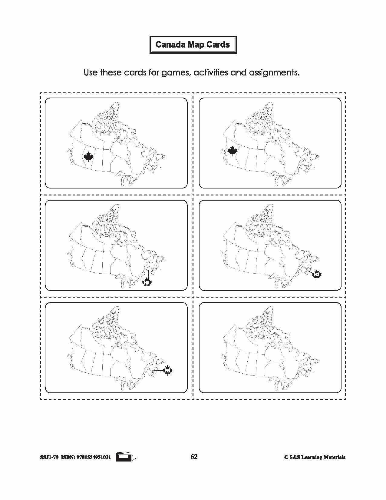
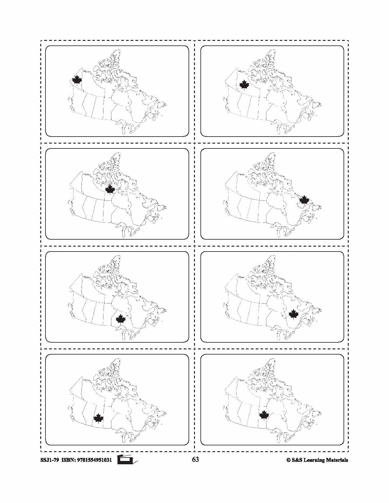

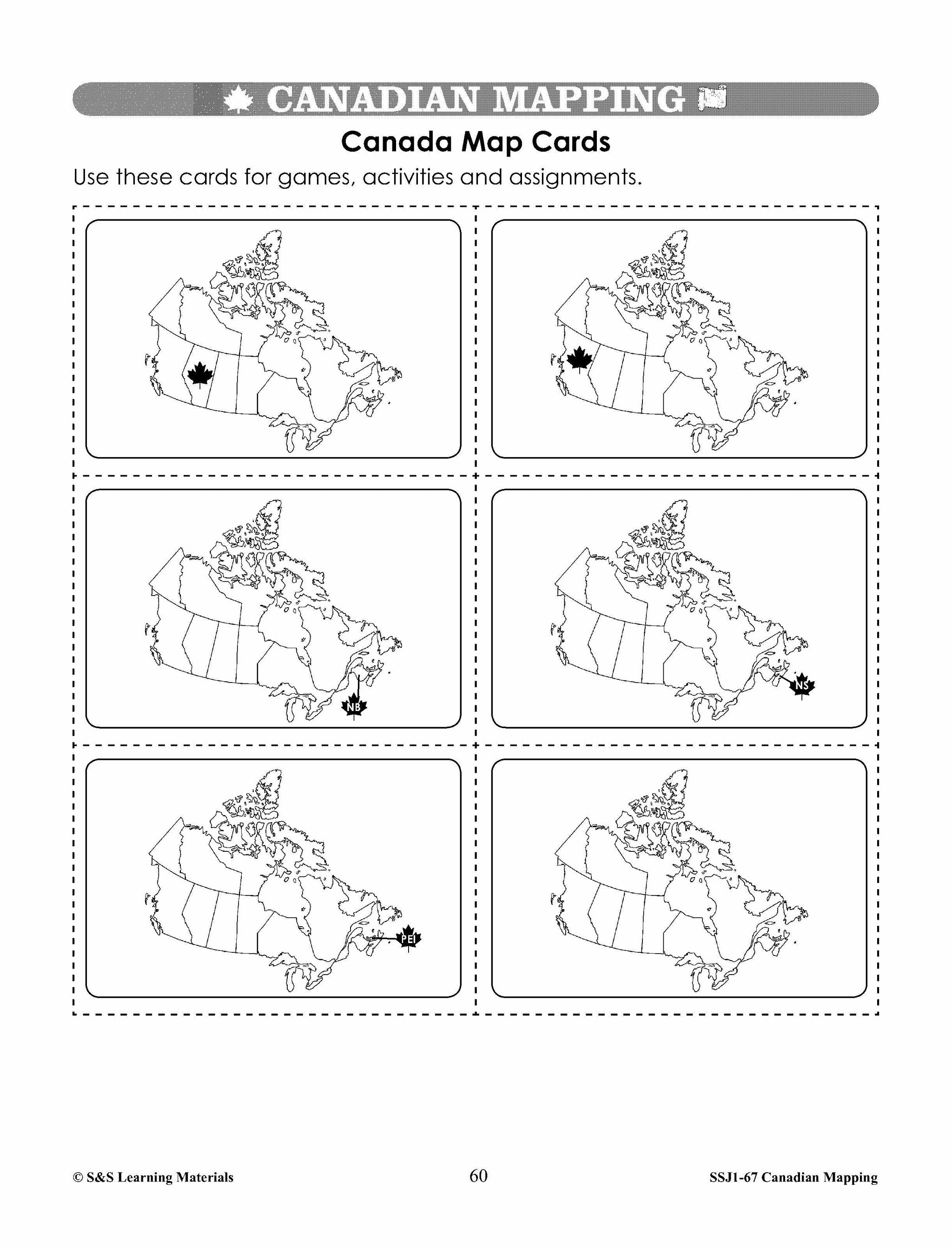
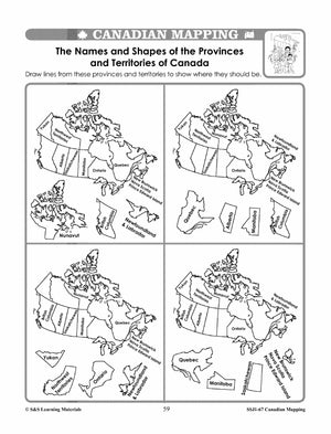
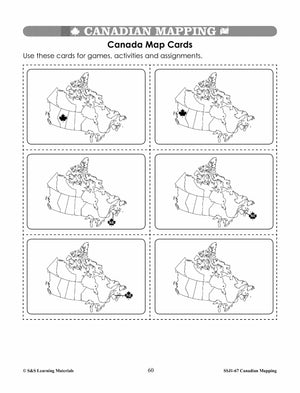
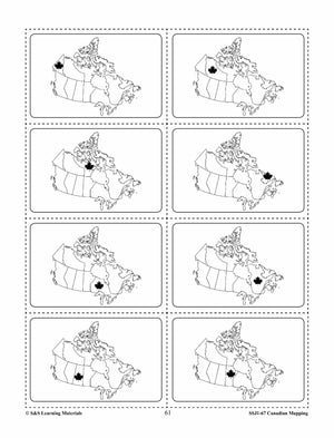
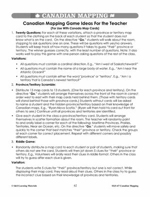
Canada Map Card Game Gr. 1-3
$2.45 CAD
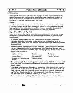
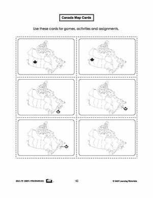
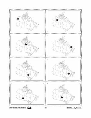
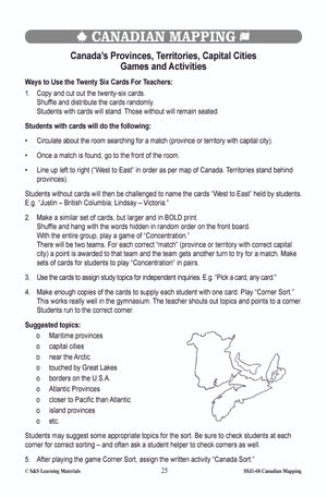
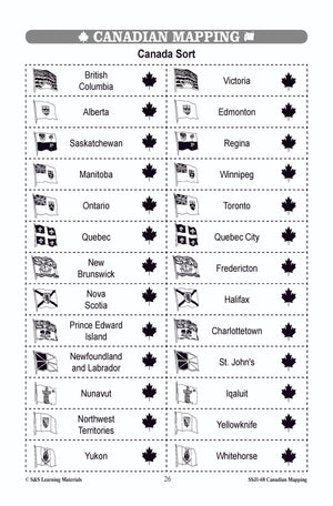
This package includes a card representing all provinces and territories. The following games can be placed with the cards: 20 Question Game: Attach a map card to the clothing at the back of each student. Encourage students to use direction words...


Canada Maps & Map Features Worksheets Grades 1-2
$8.95 CAD
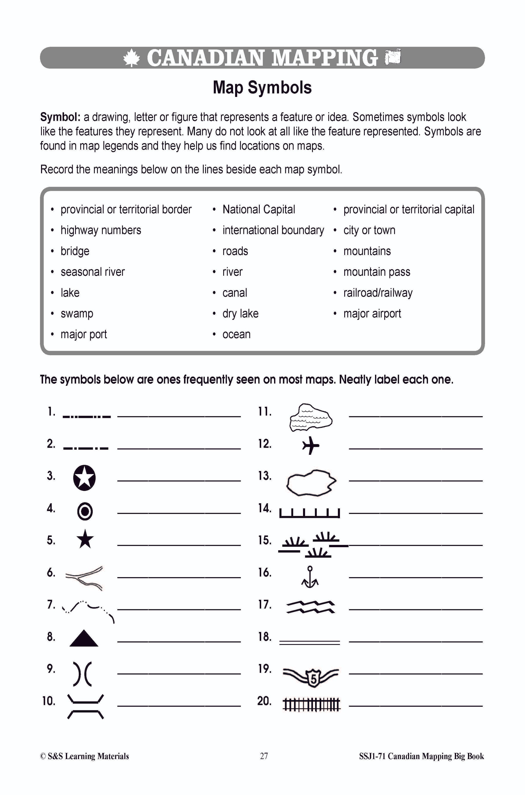
Students will learn about Canada's Maps and map features with the nineteen worksheets. Teacher information on these topics: what a map is, types of maps, how to read a map, map indexes, hemispheres, directional indicators, and map symbols. The glossary...

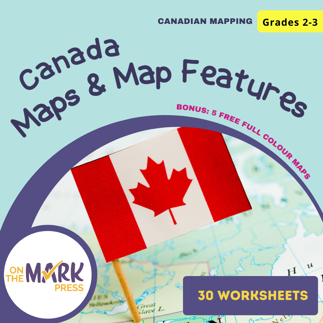


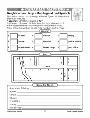


Canada Maps & Map Features Worksheets Grades 2-3
$8.95 CAD
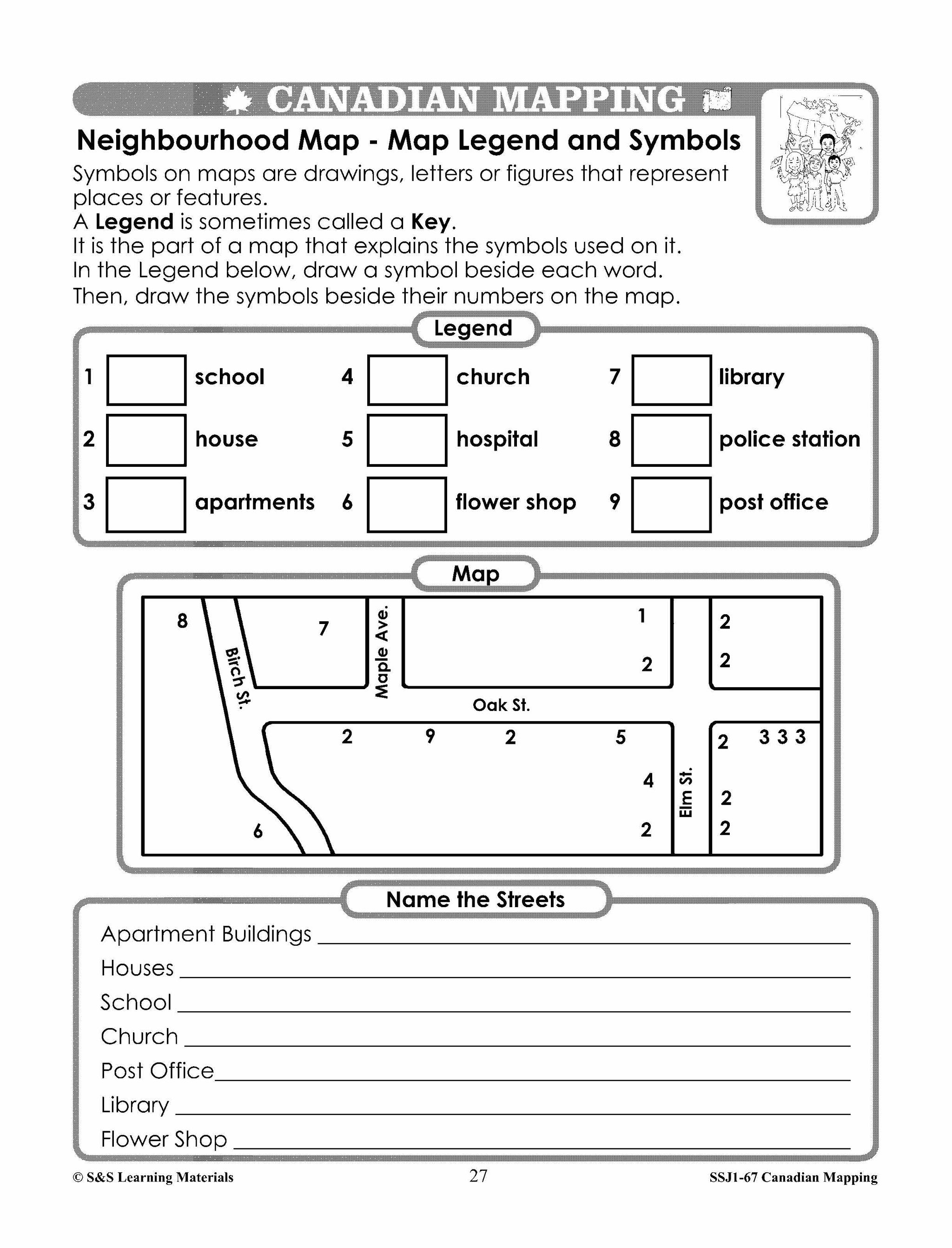
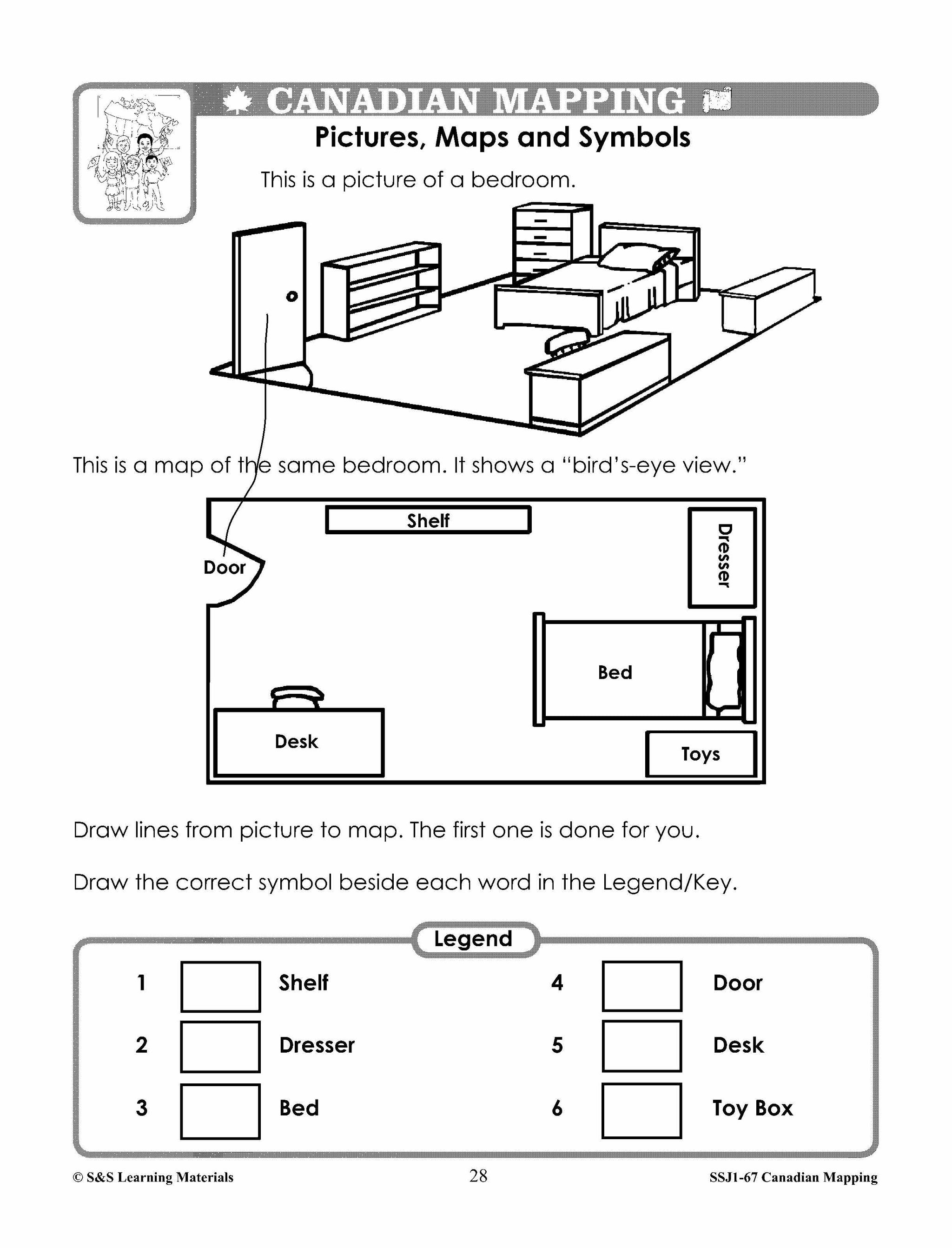
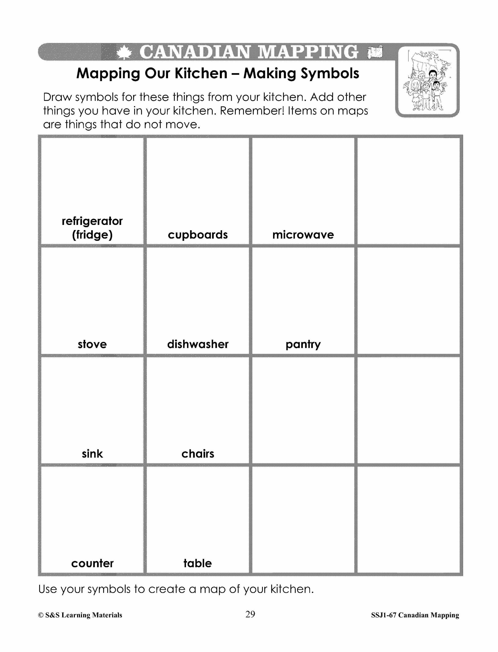
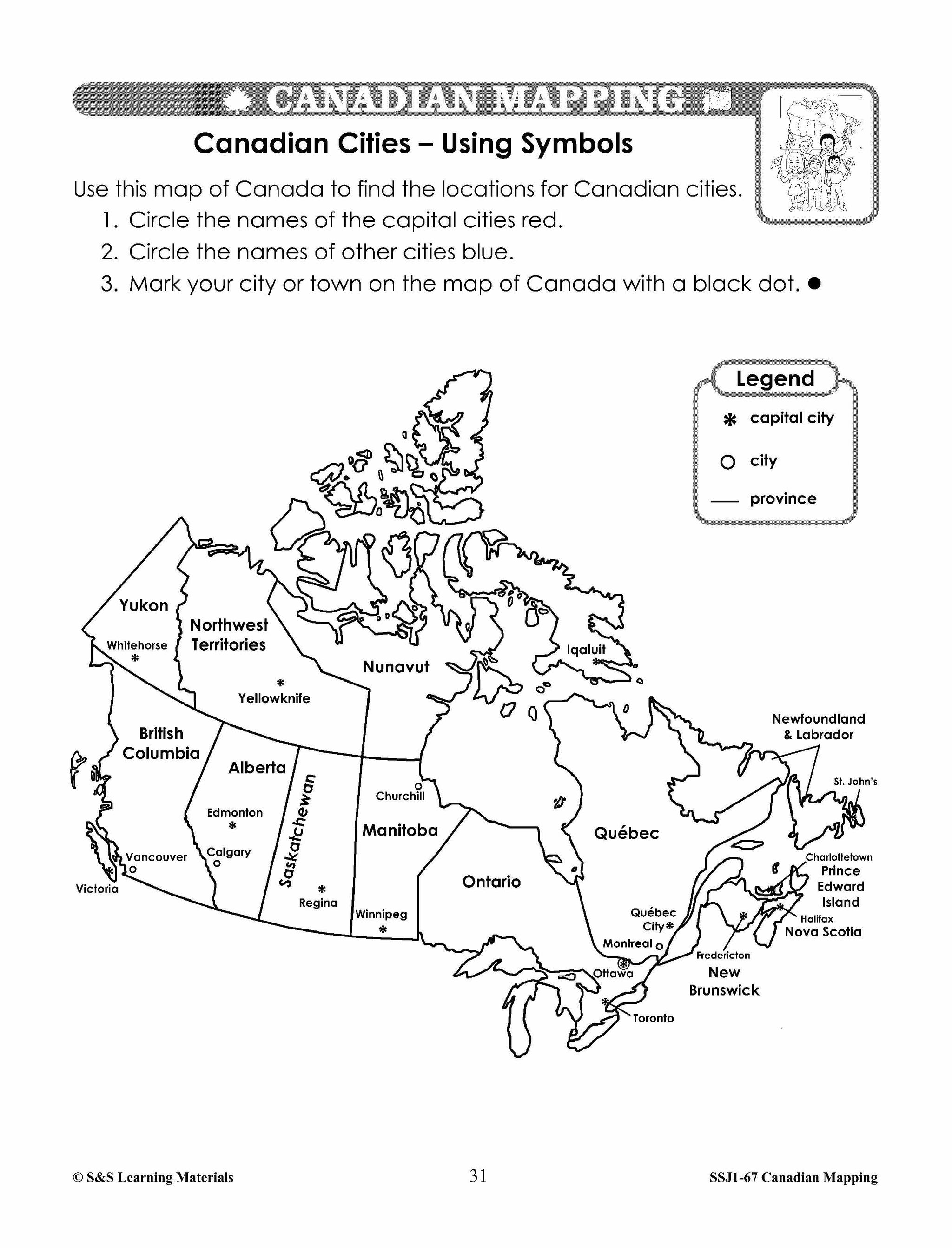
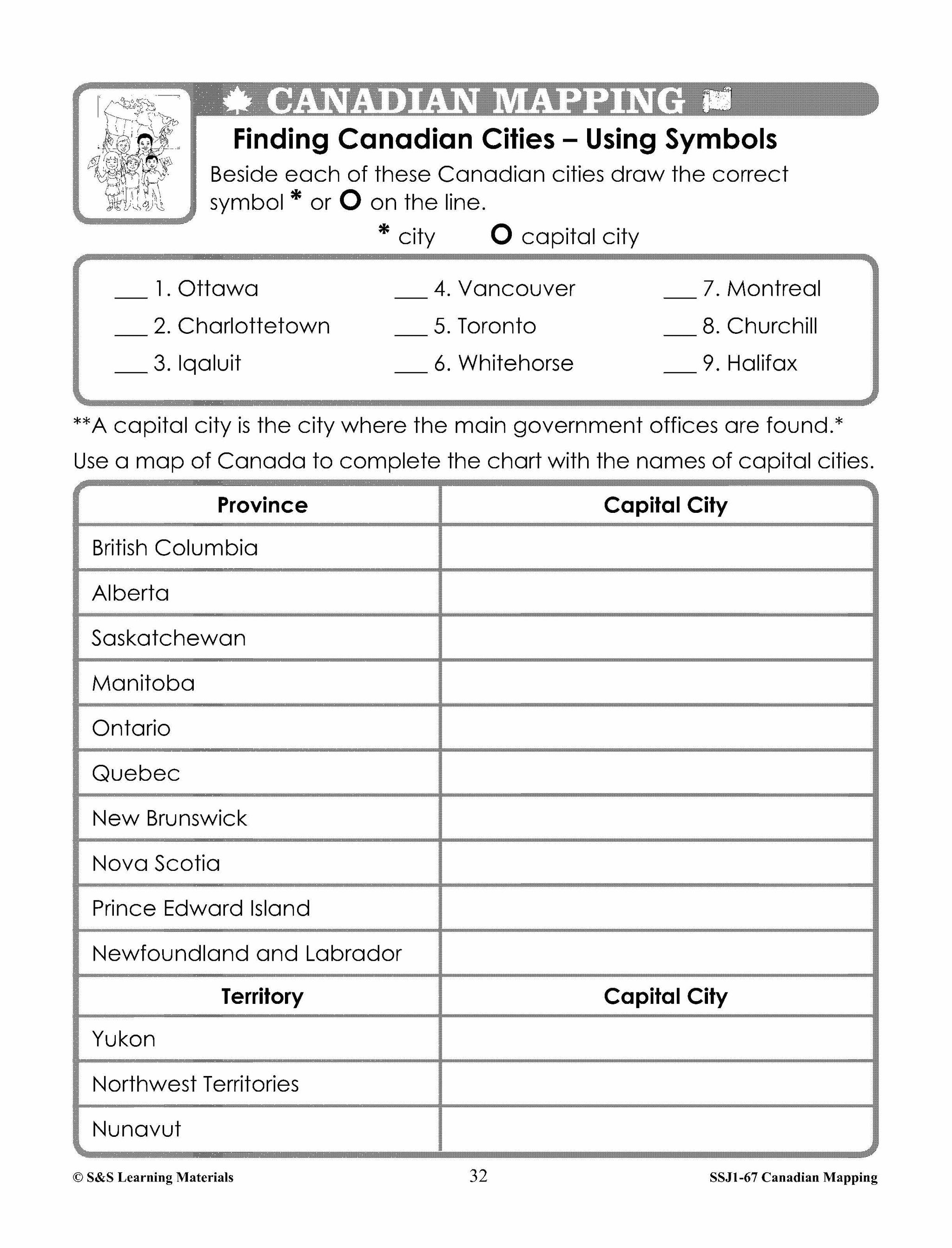
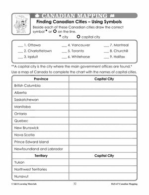
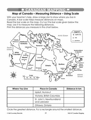
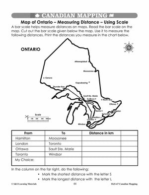
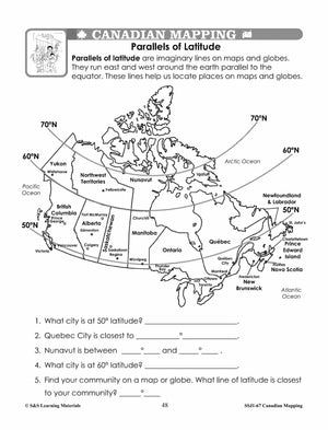
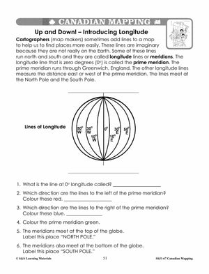
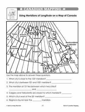
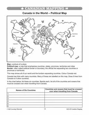
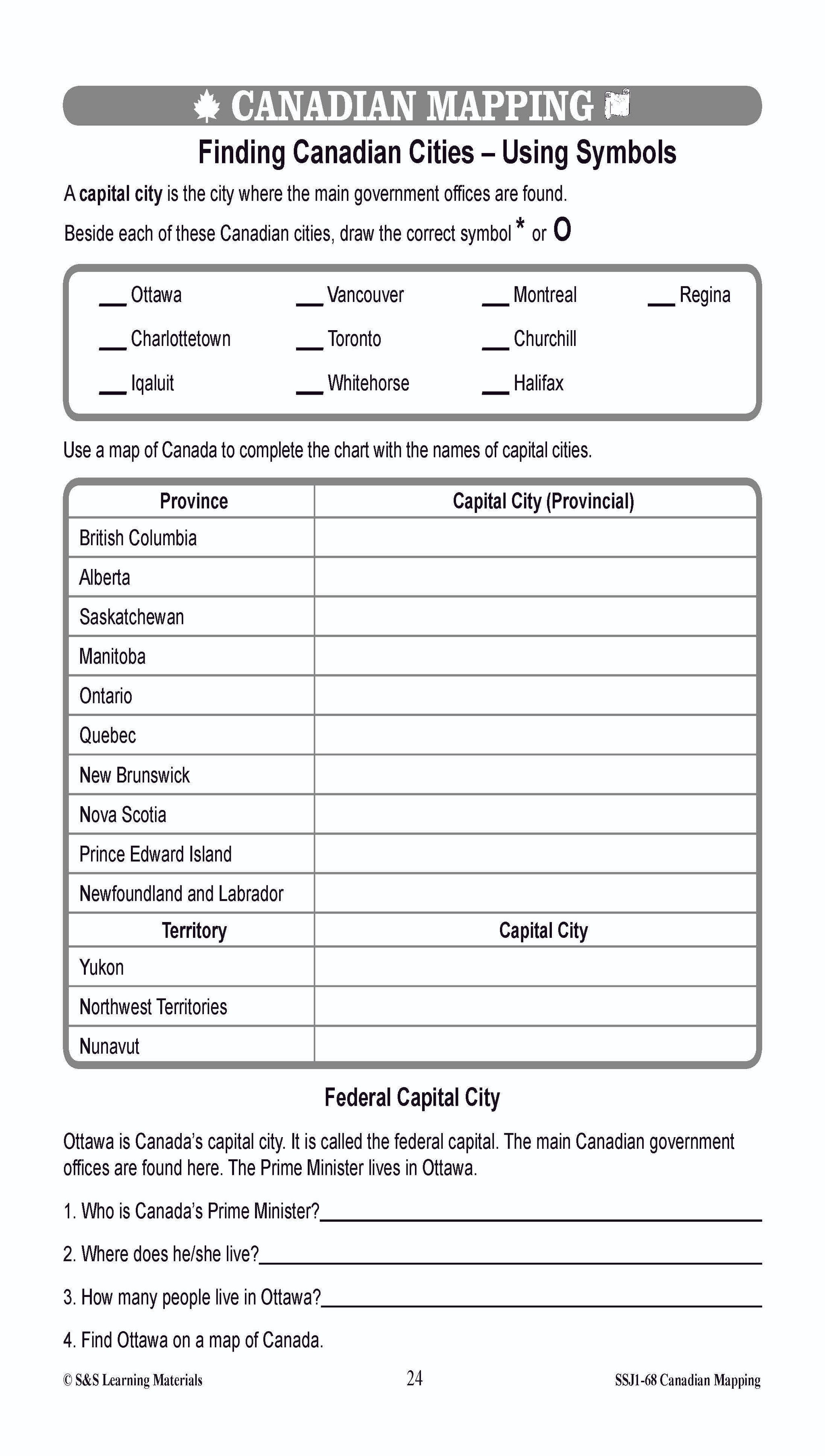
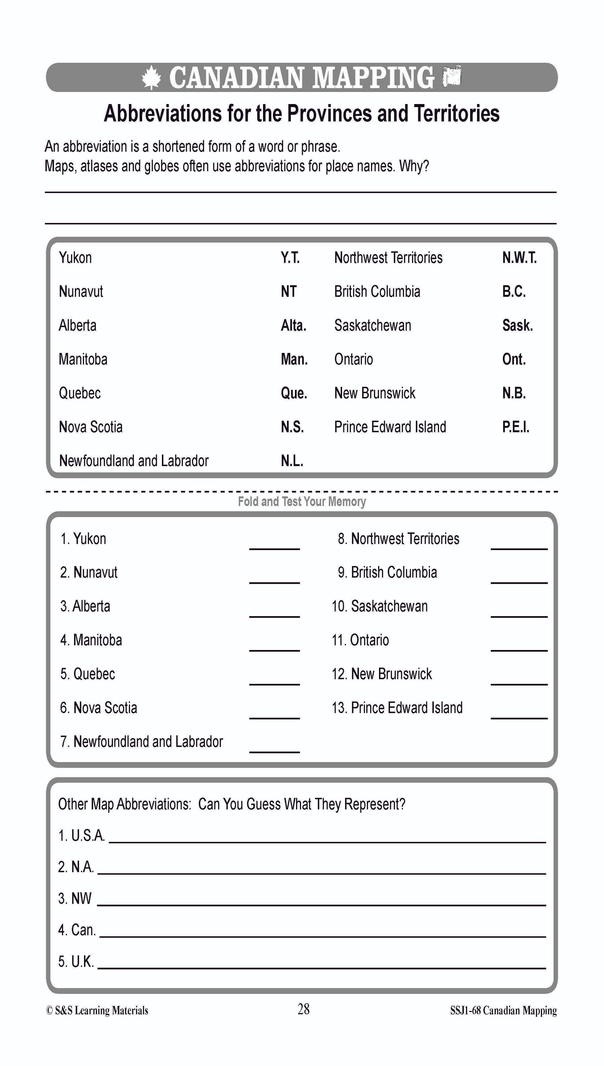
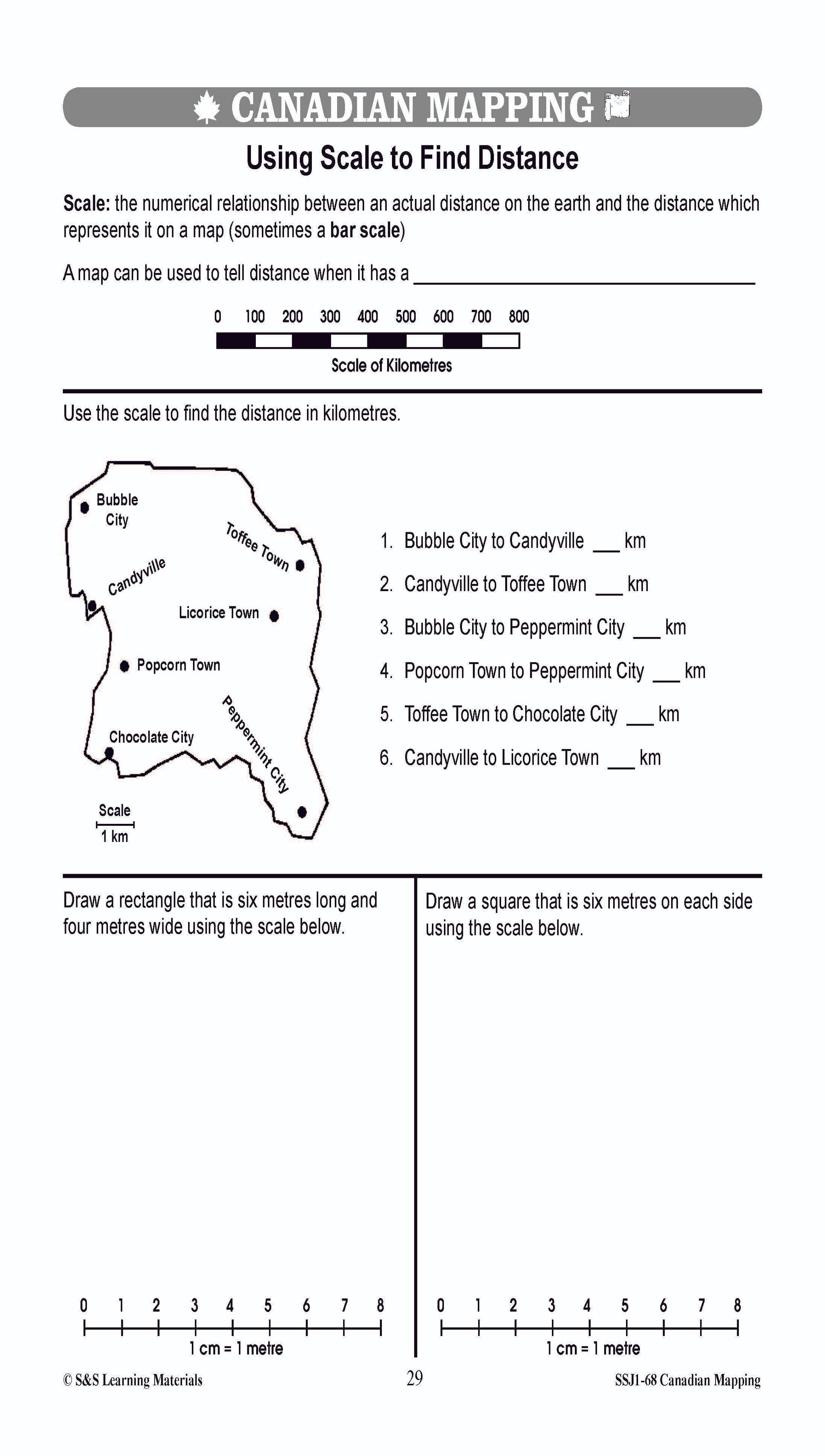
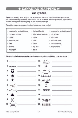
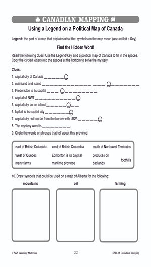
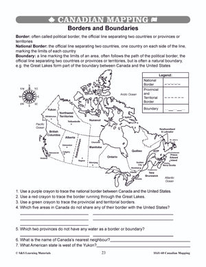
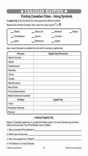
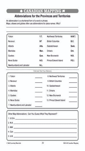
Students will learn about Canada Maps and map features with the thirty worksheets in this lesson. Mapping symbols, using cardinal and intermediate directions, measuring distances using standard units of scale, locating Canadian cities, political boundaries, meridian of longitude, parallels of...

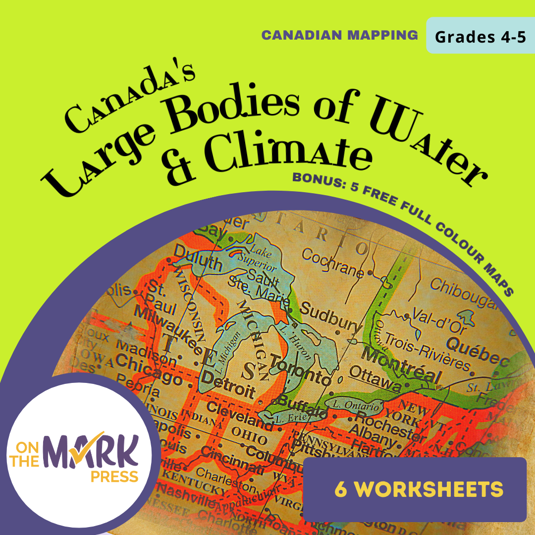

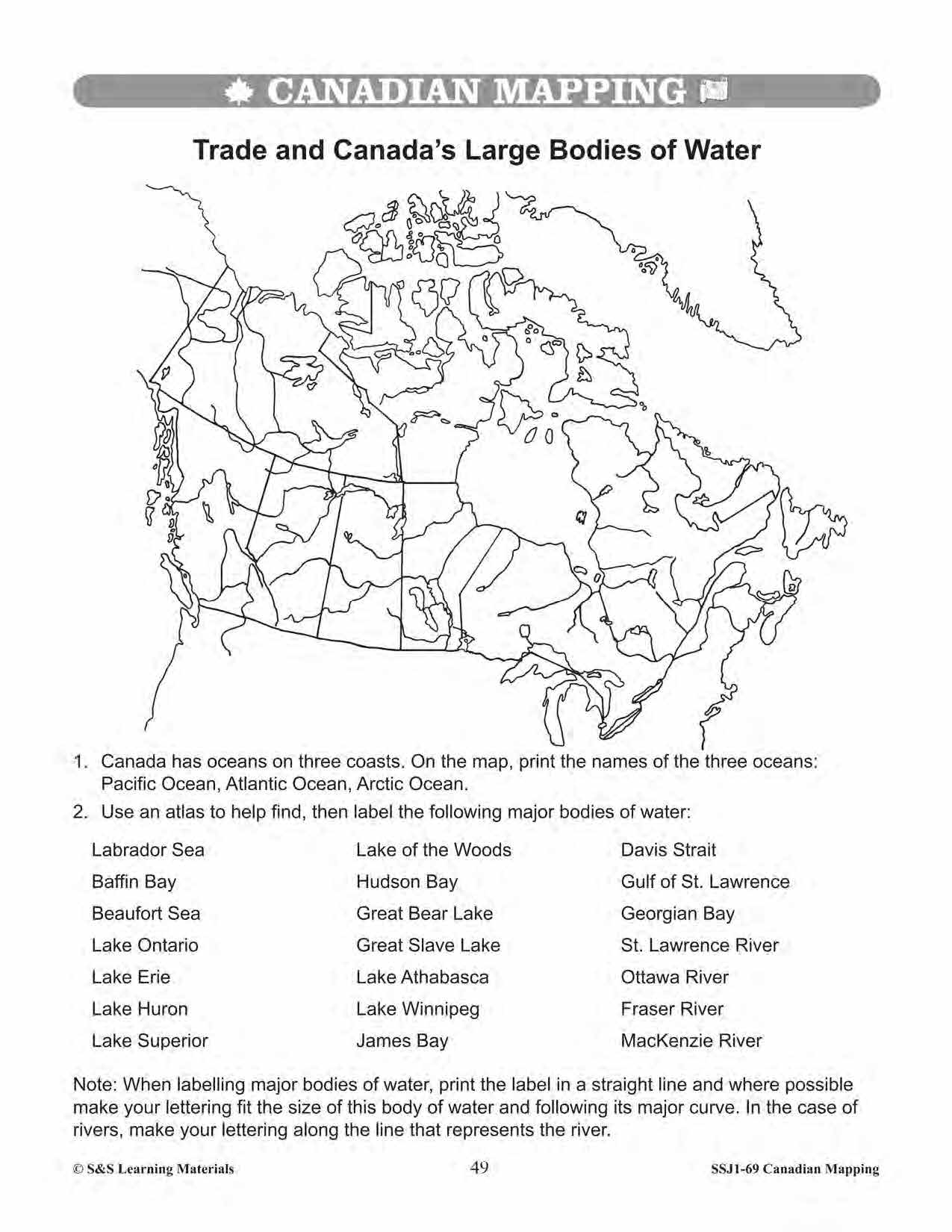
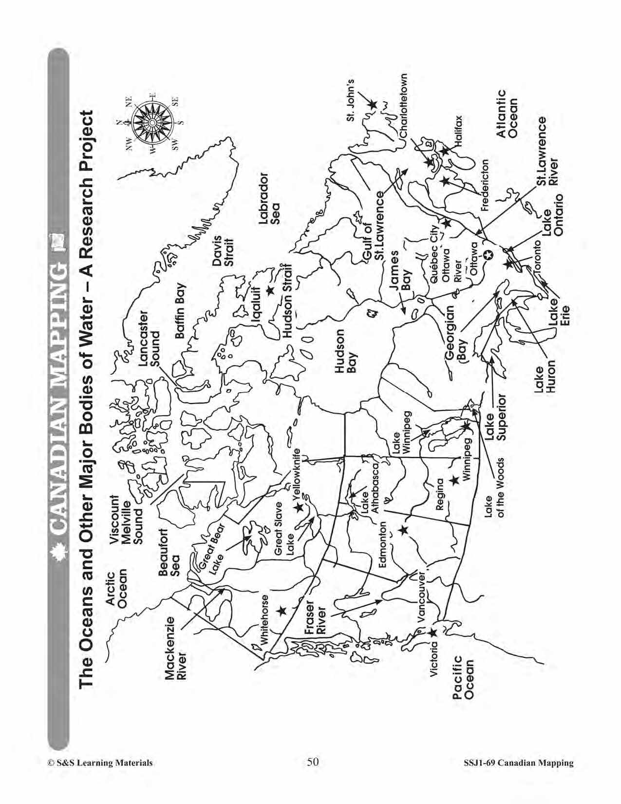

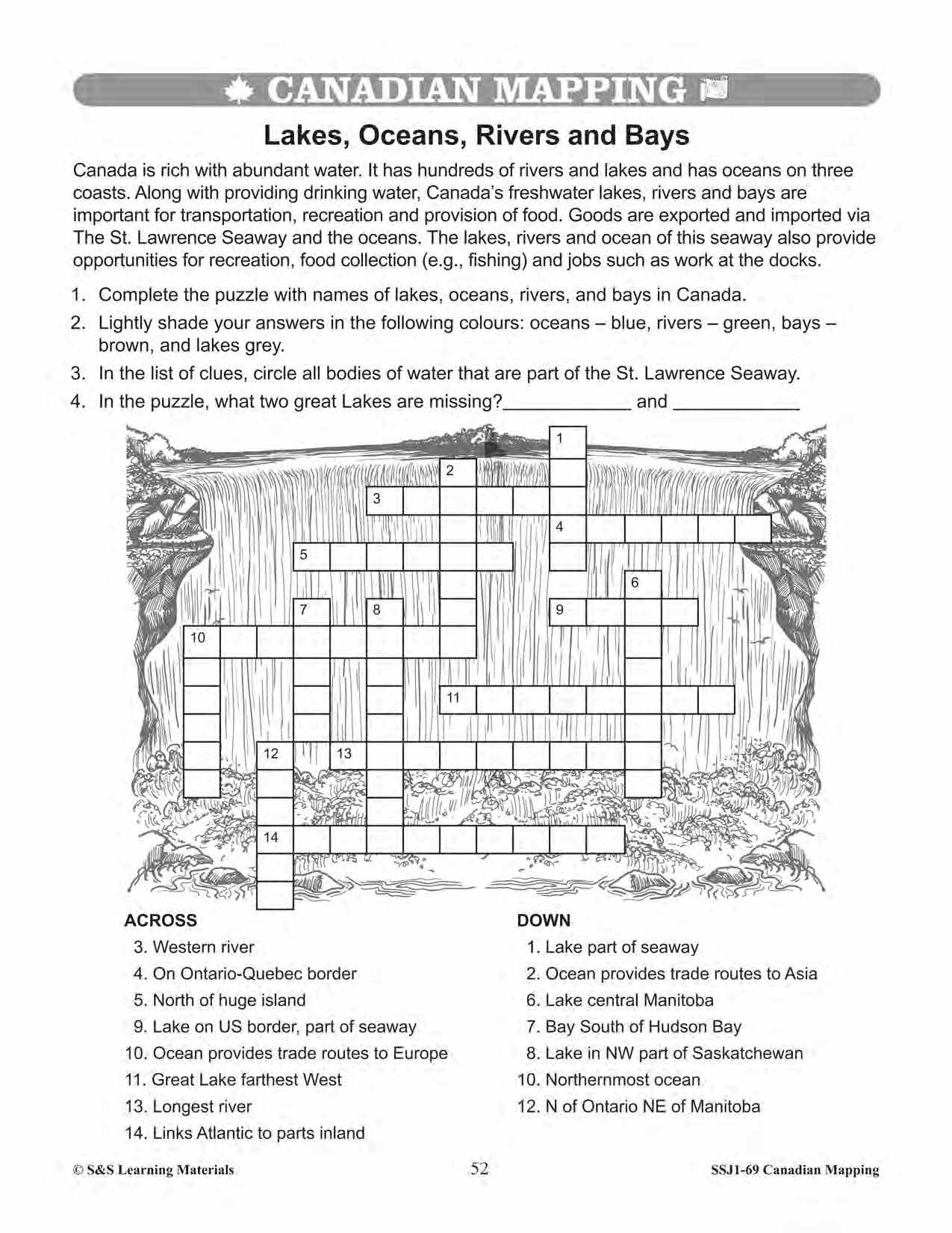
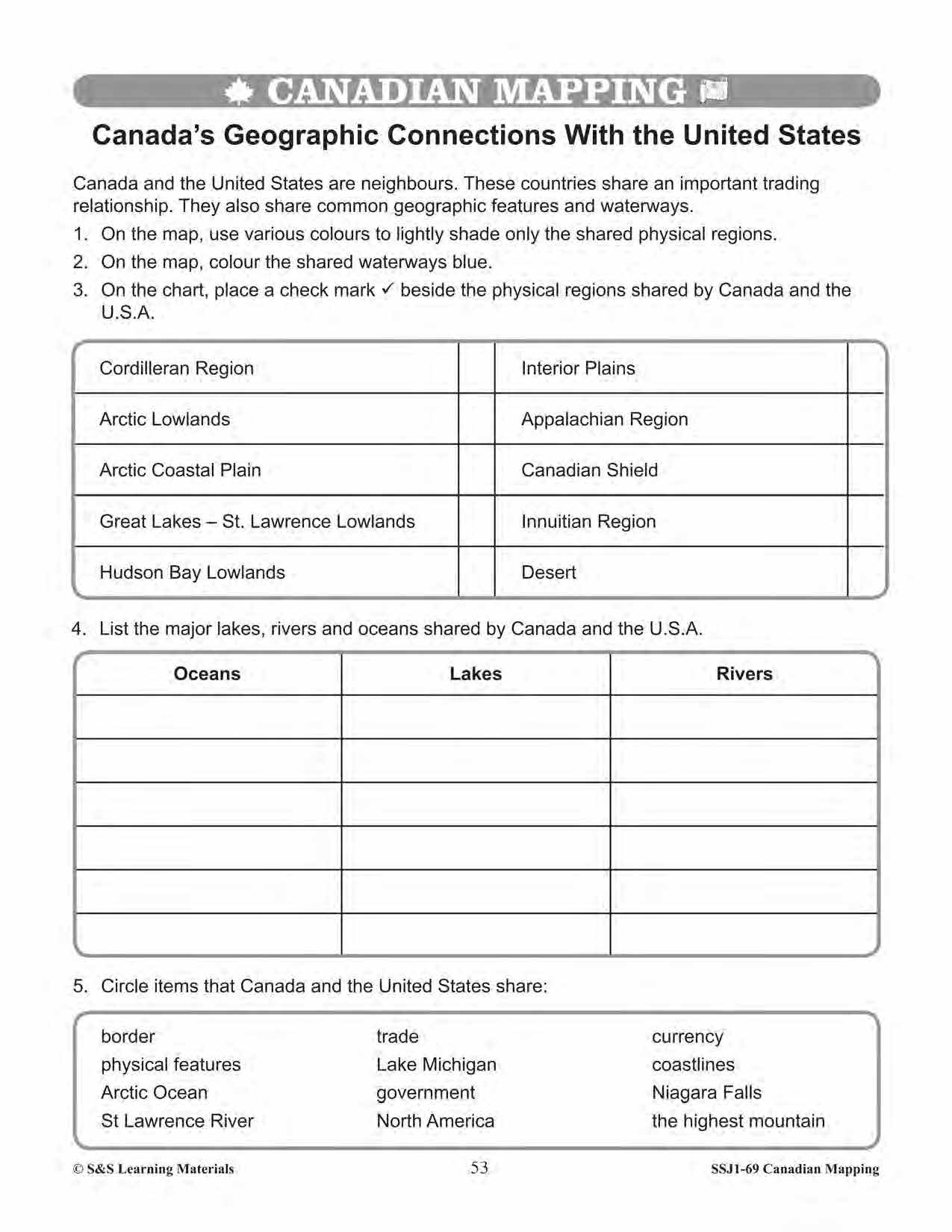

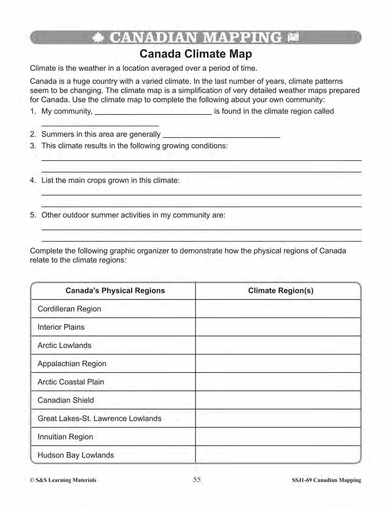
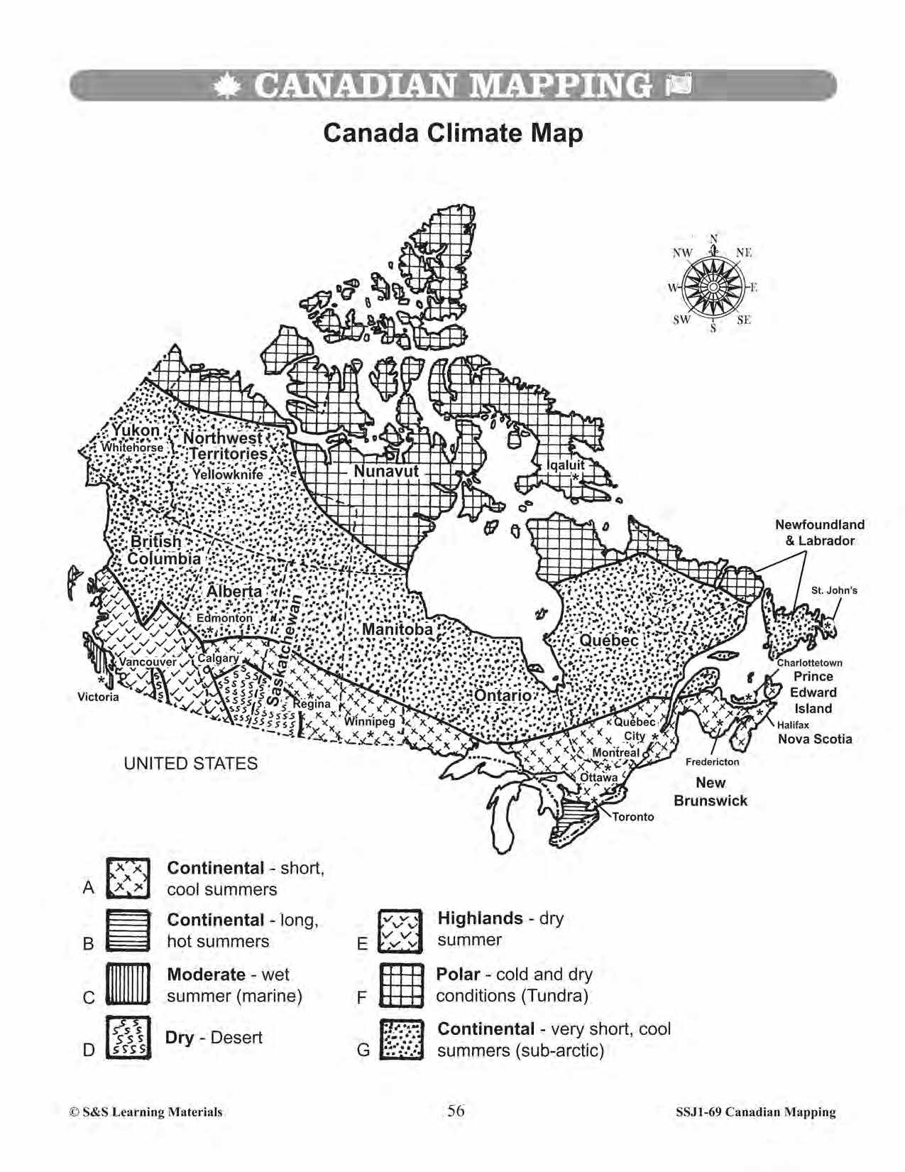
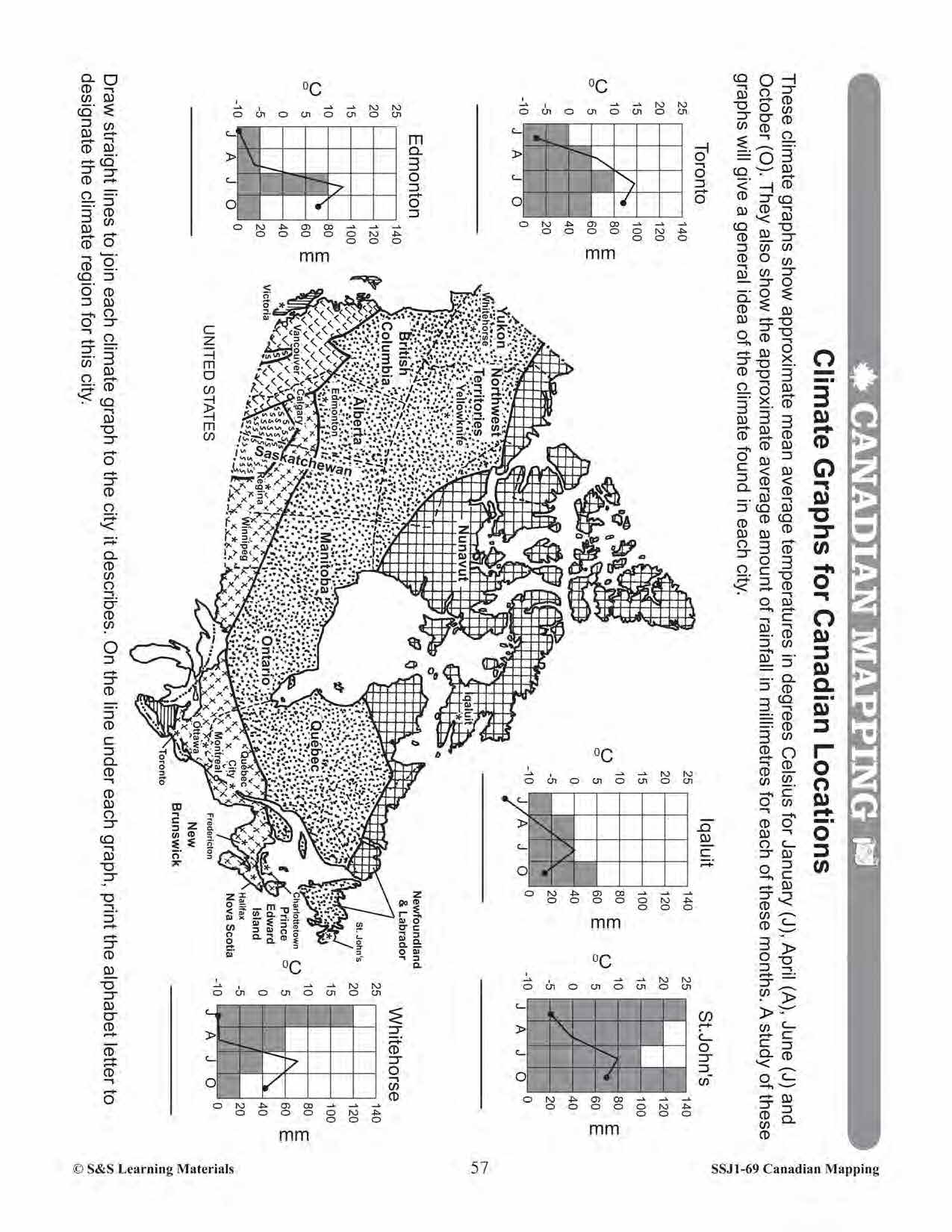


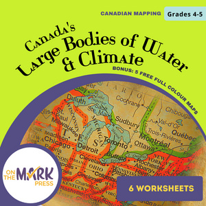
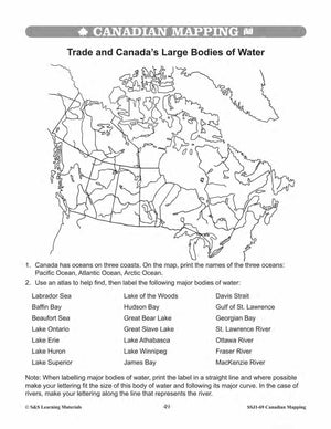
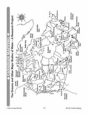
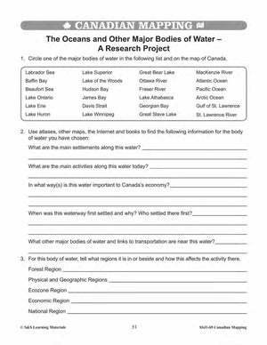

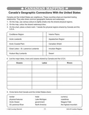


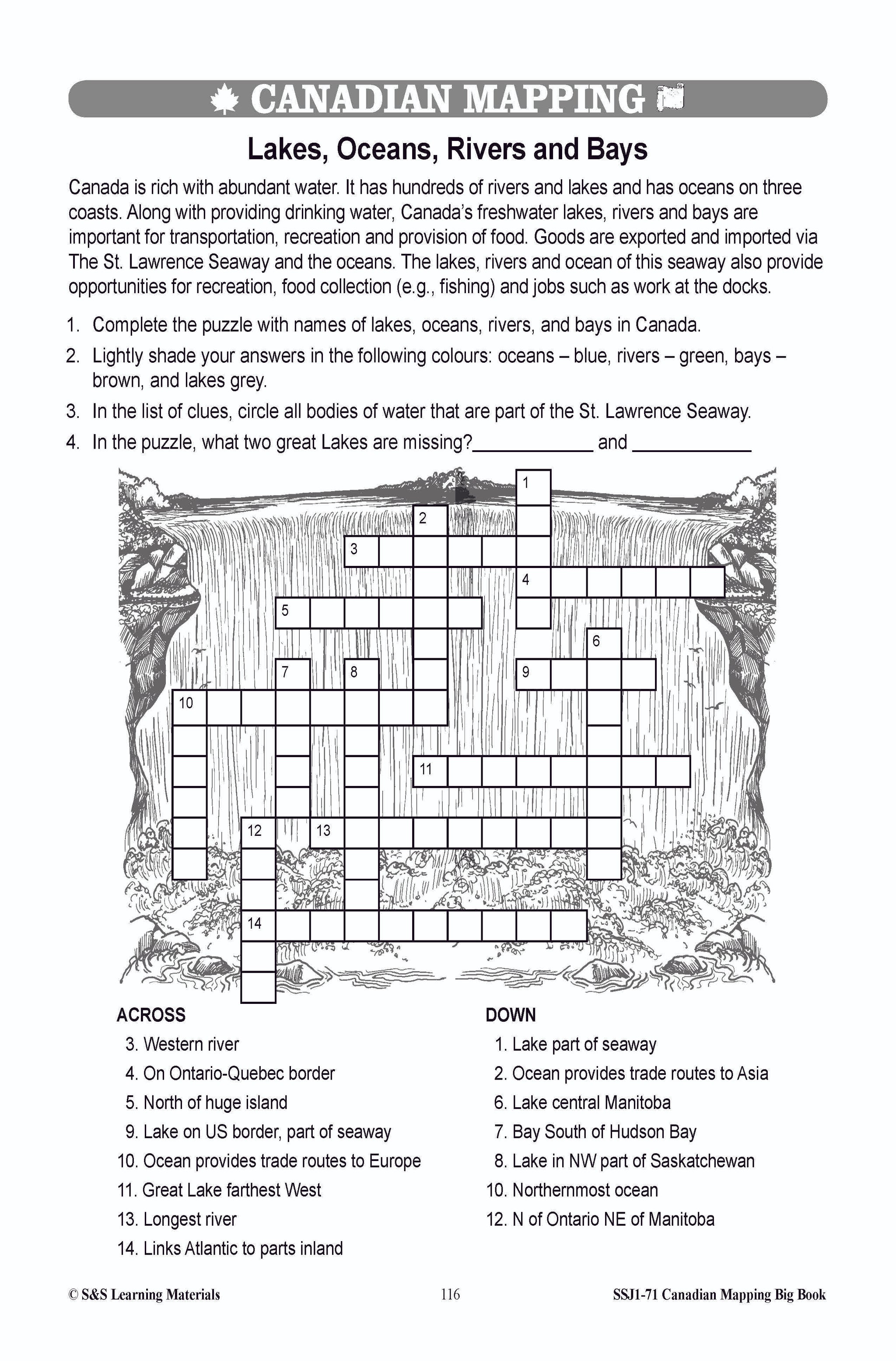
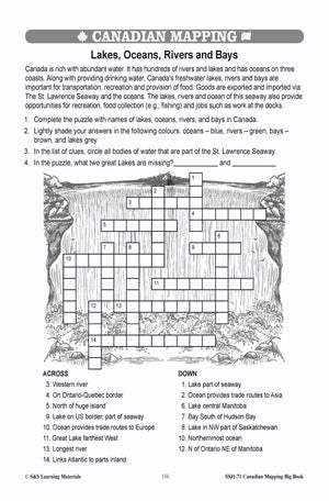
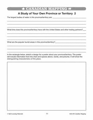
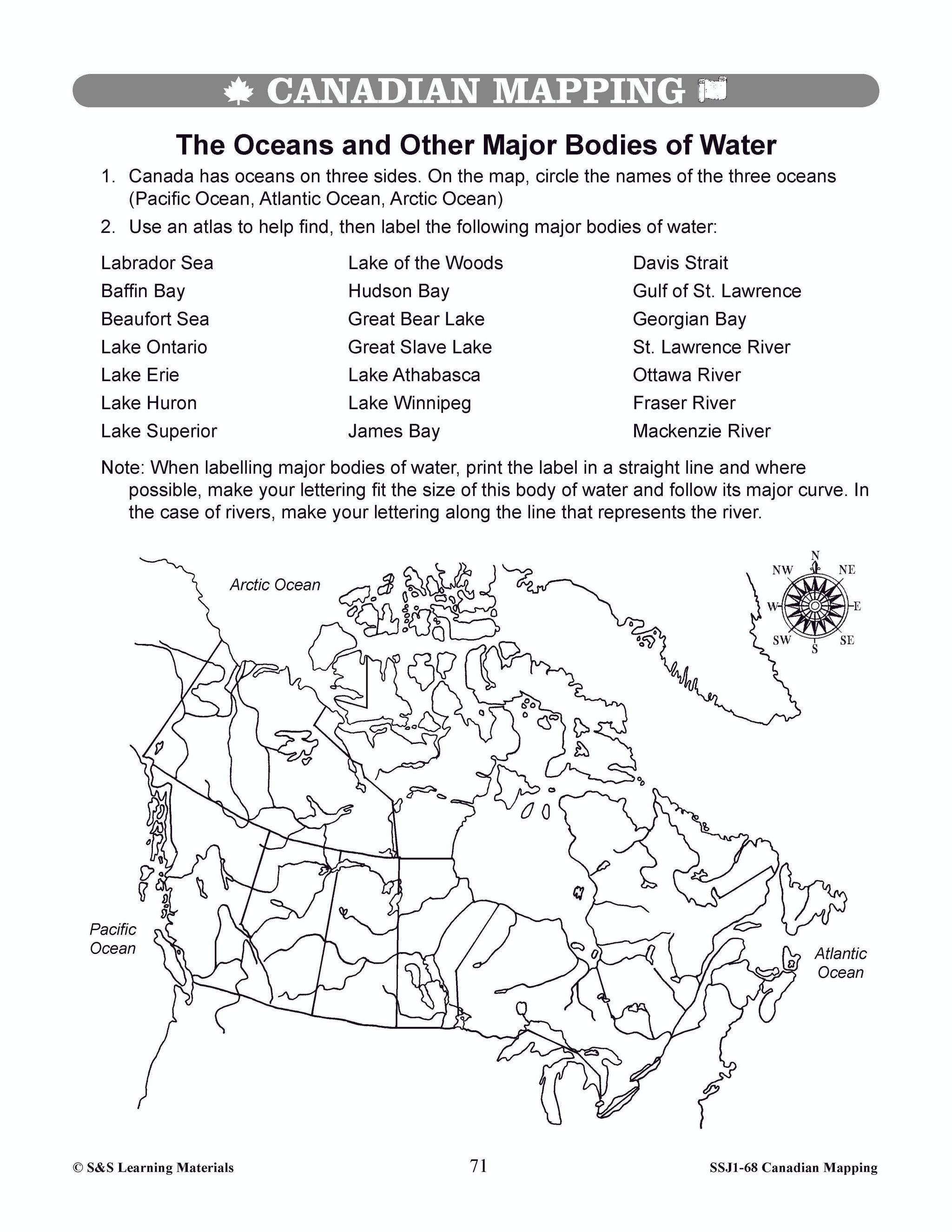
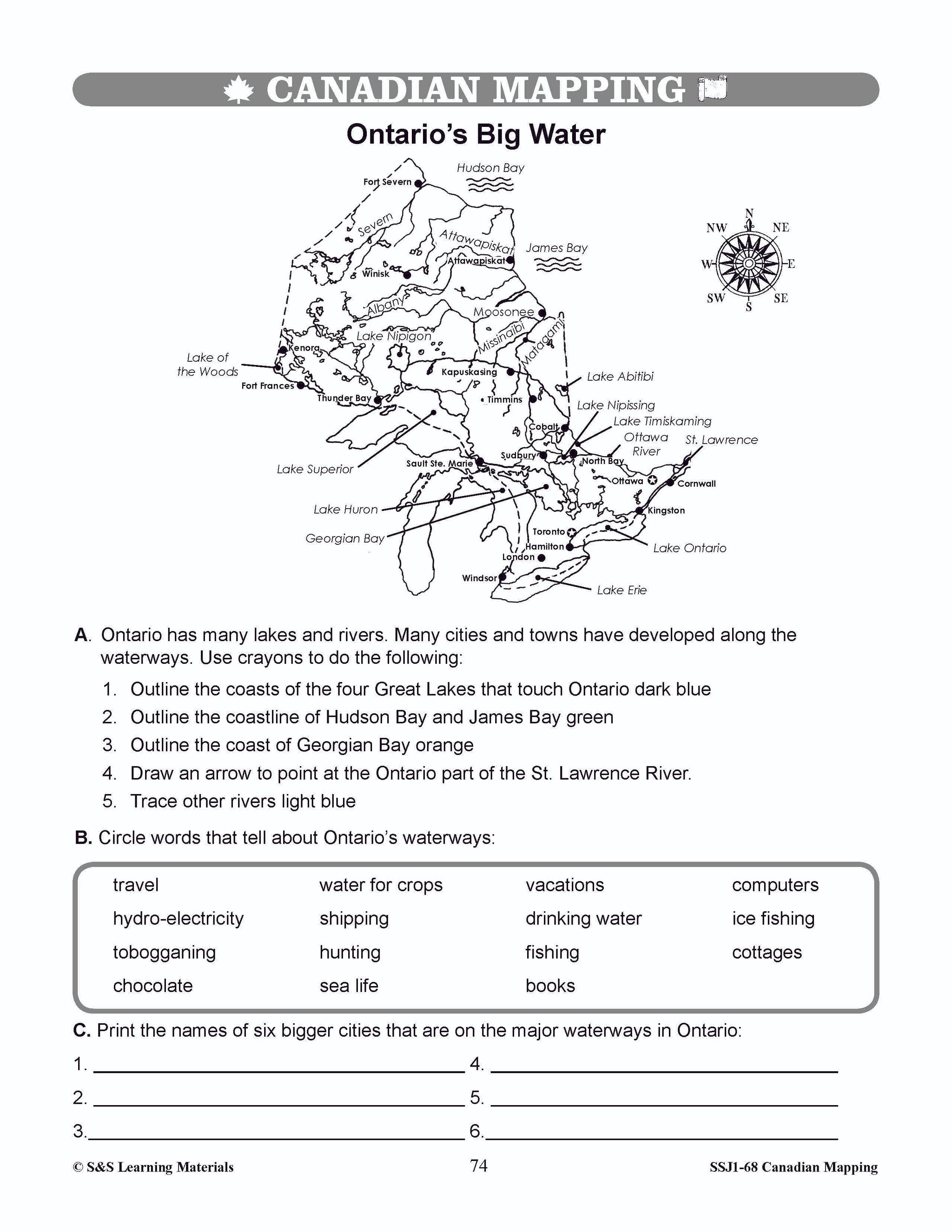
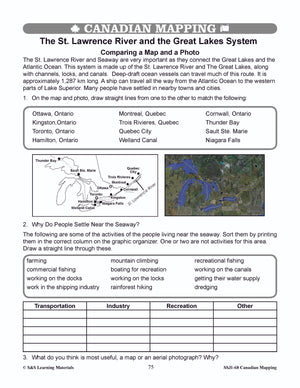
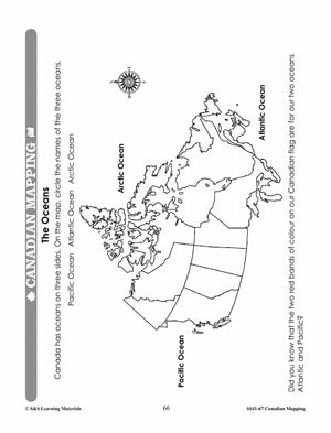
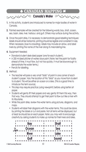
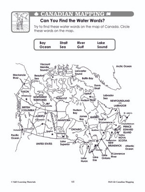
Canada's Large Bodies of Water & Climate Worksheets Grades 5-6
$7.45 CAD
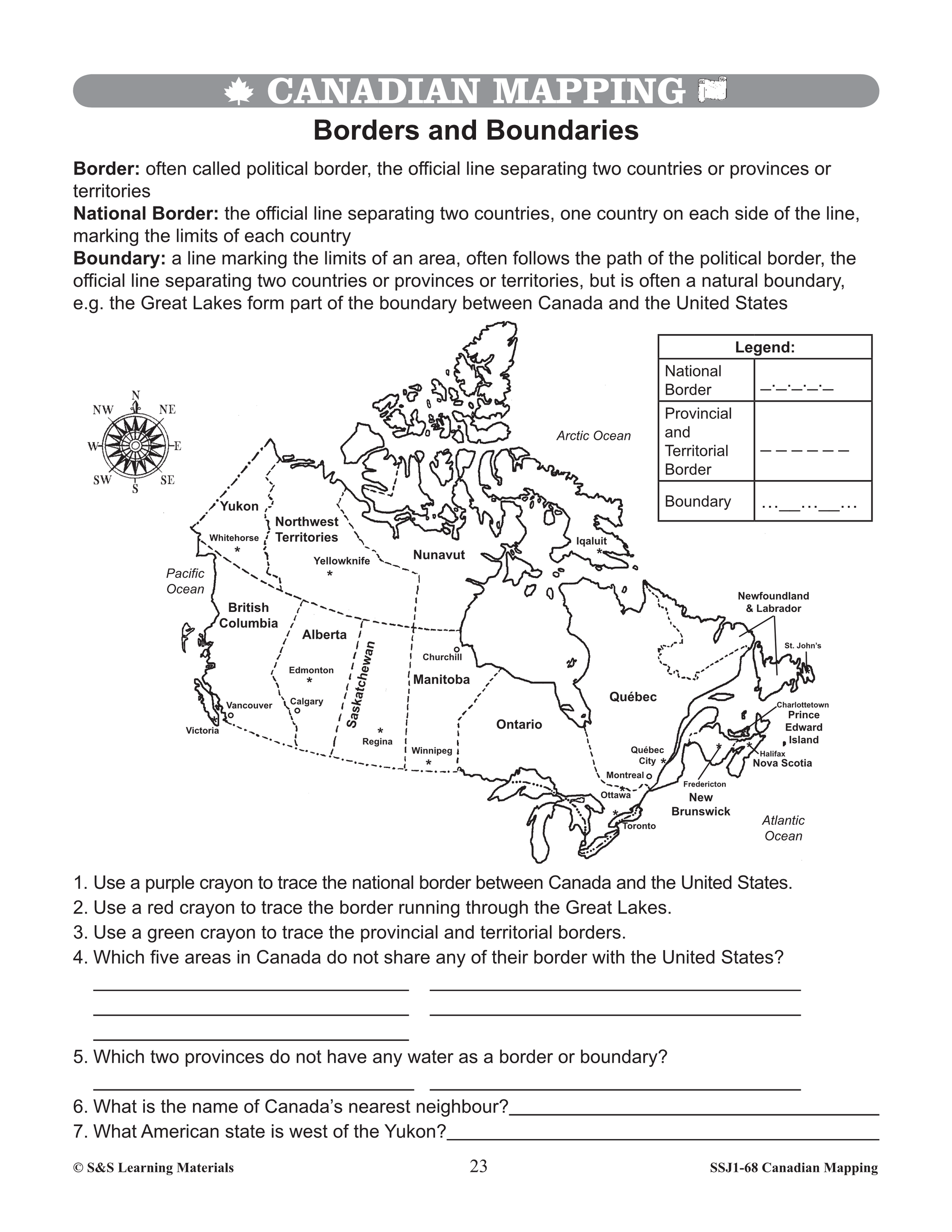
Using the six activities with worksheets, students will learn about Canada's large bodies of water, our climate and our geographic connection with the United States. Trade and Canada’s Large Bodies of Water The Oceans and Other Major Bodies of Water...

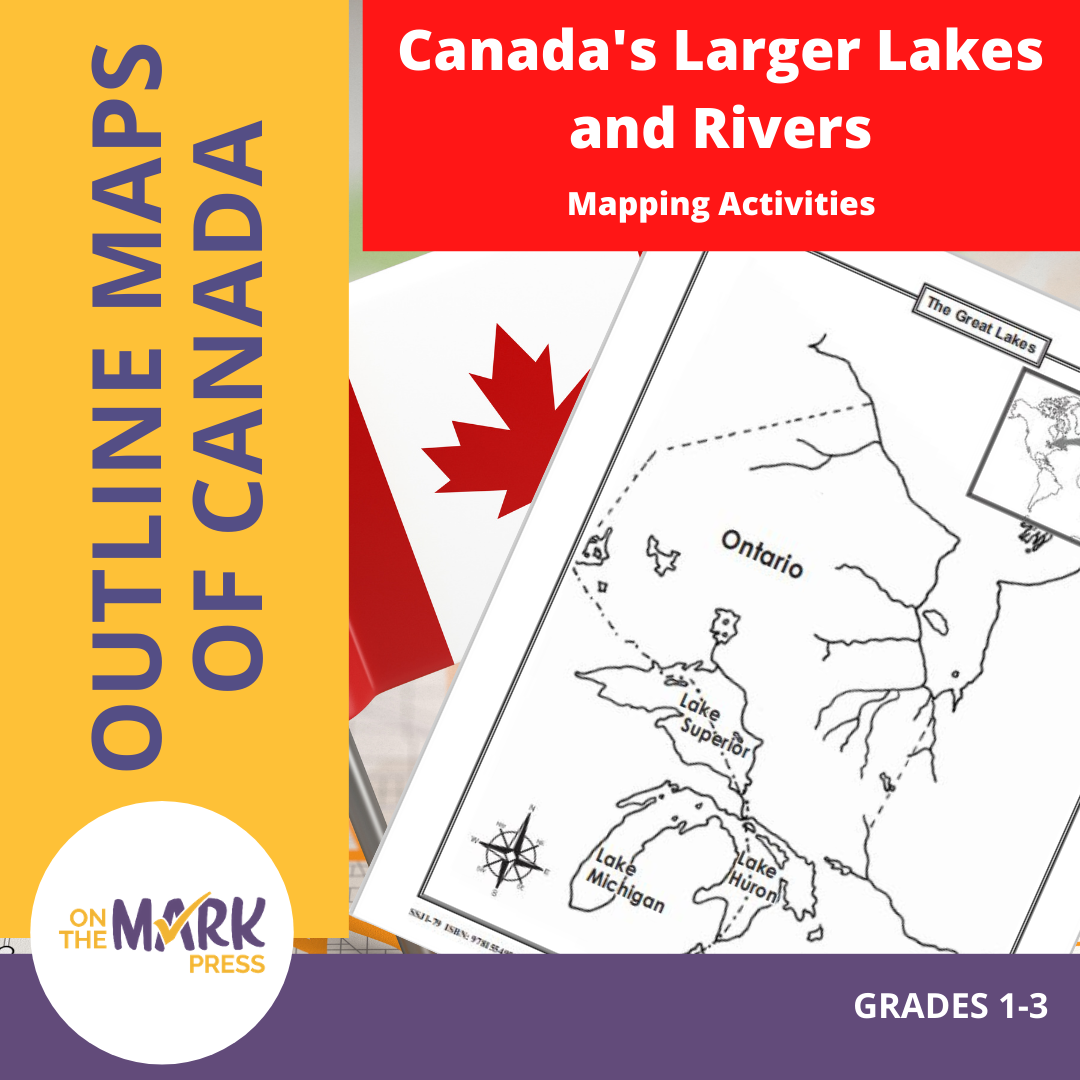

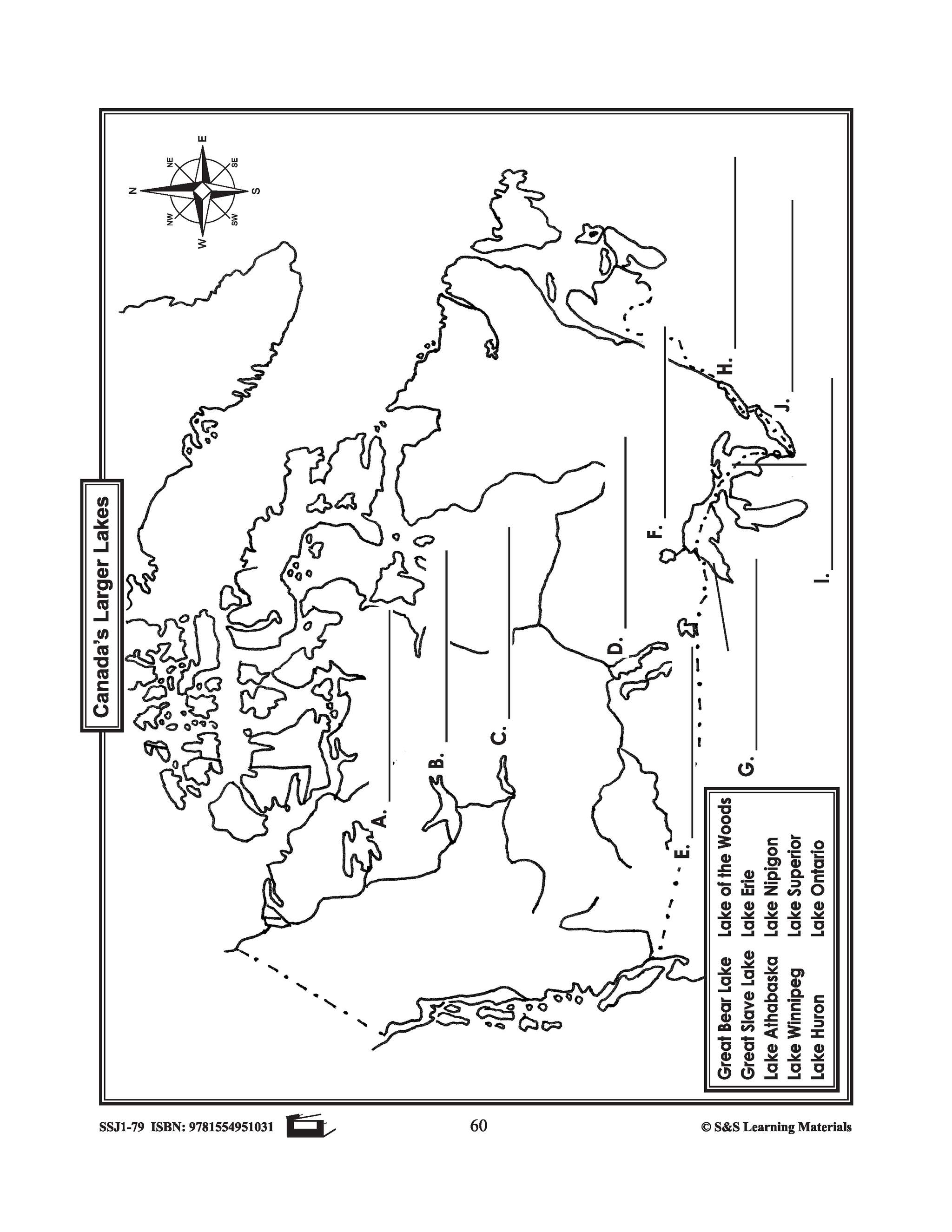
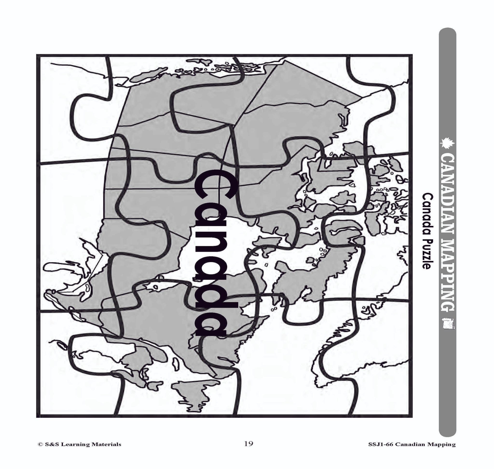
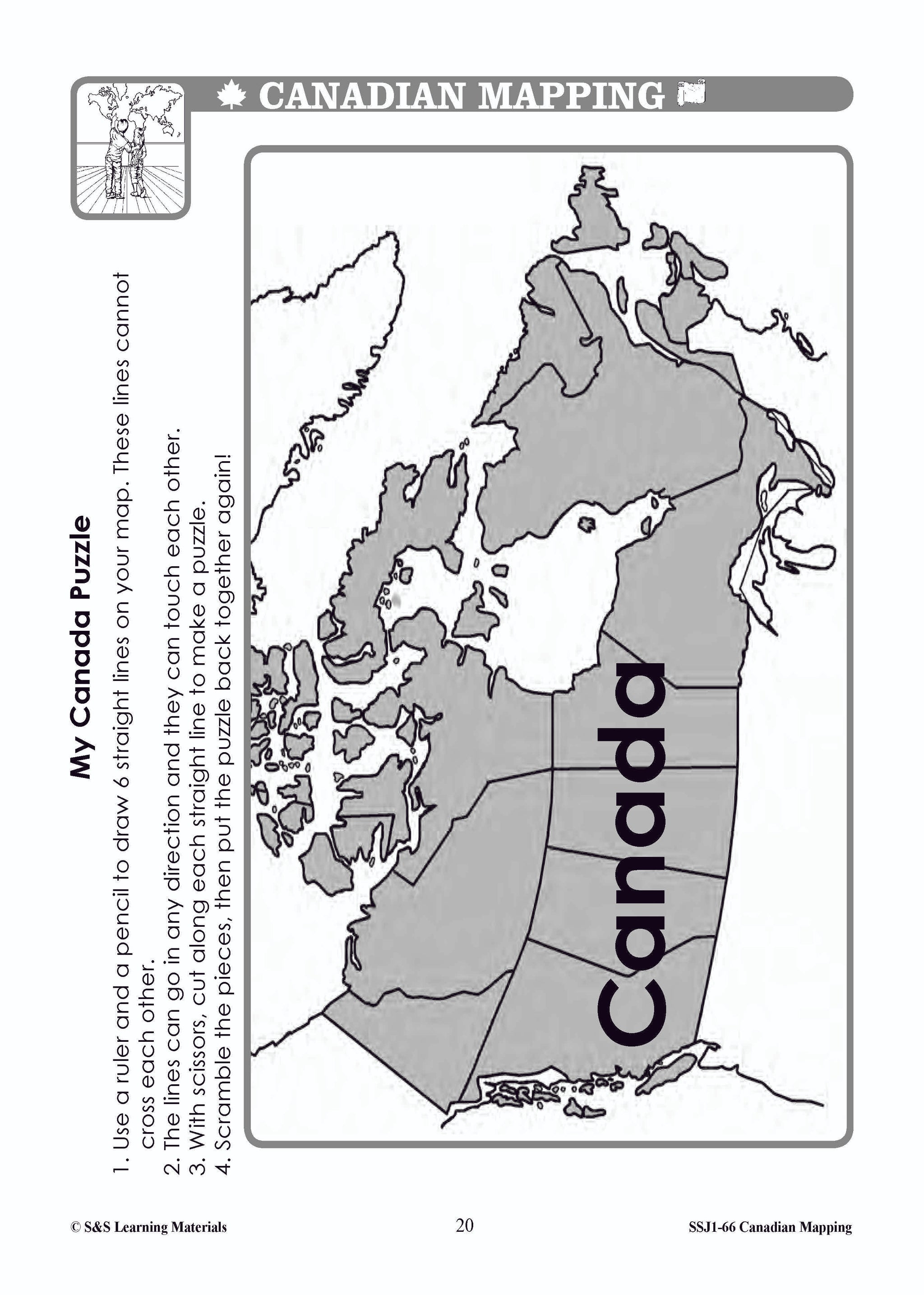
Canada's Larger Lakes & Rivers Mapping Activities Gr. 1-3
$4.95 CAD
This package includes one worksheet for the following: Labelling the Great Lakes Labelling Canada's Larger Lakes


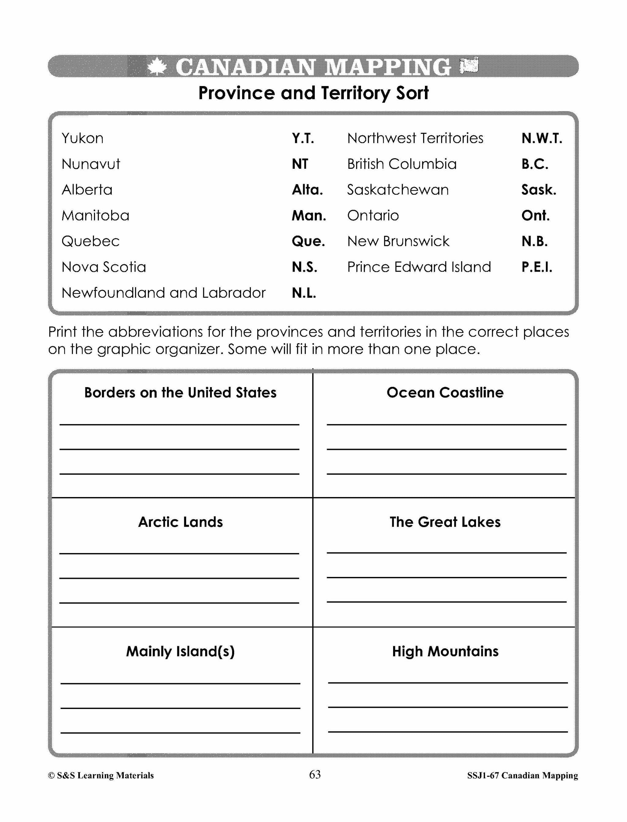


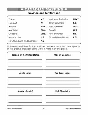


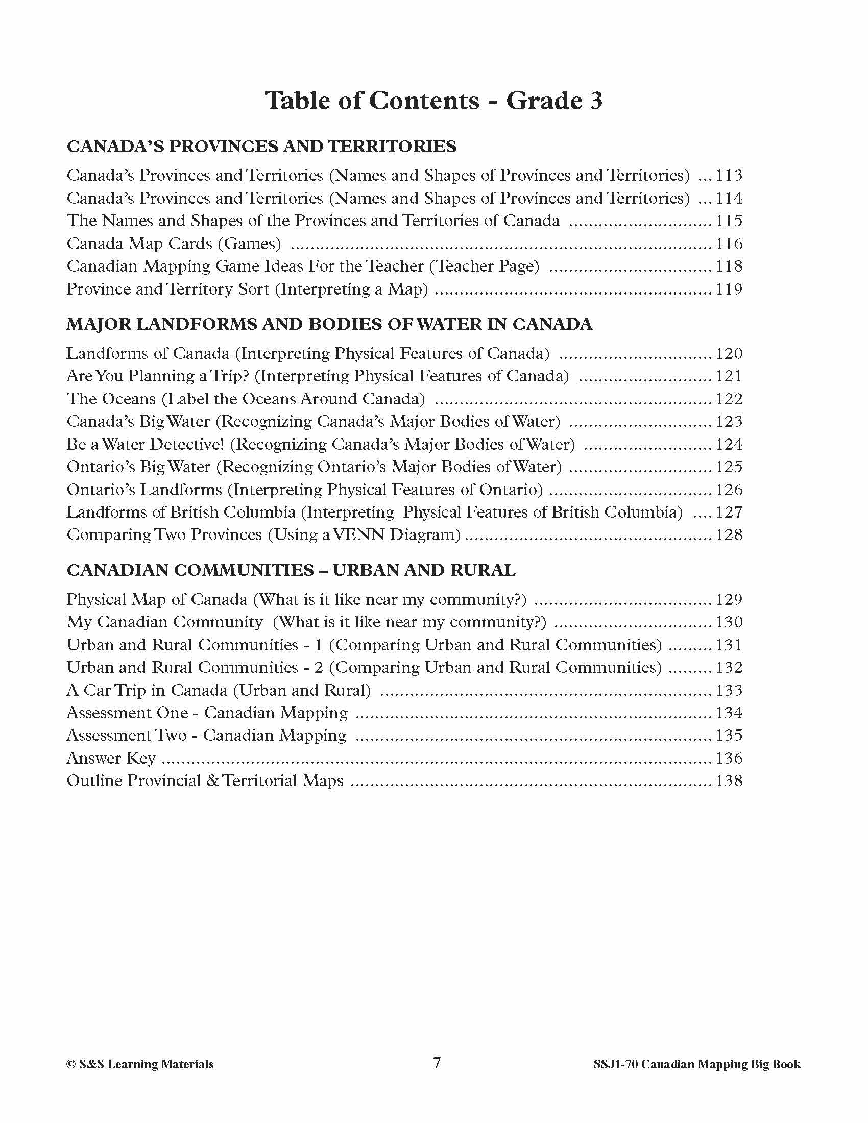
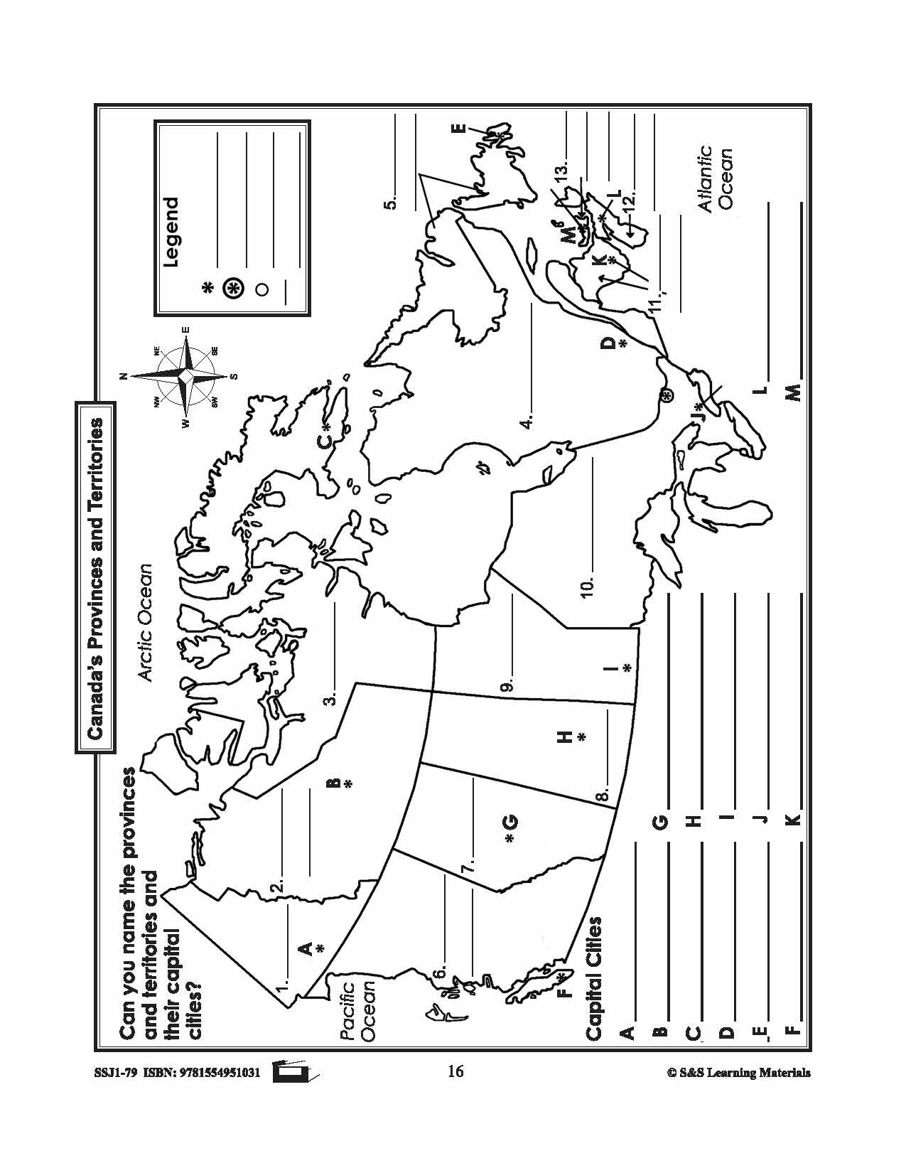
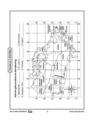
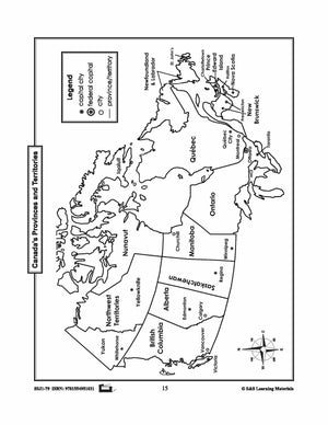
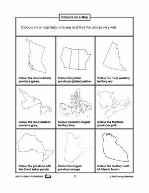
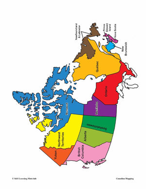
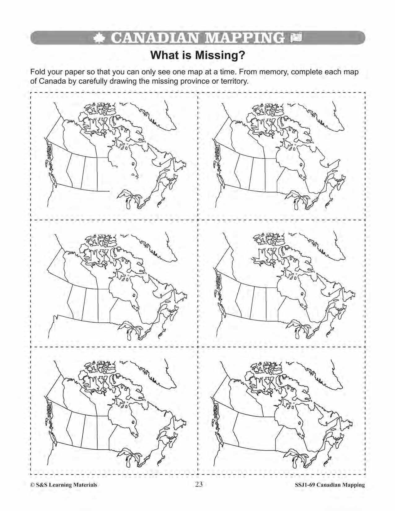
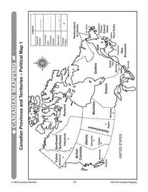
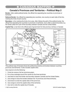
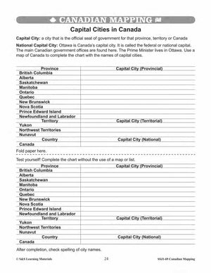
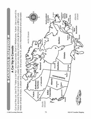
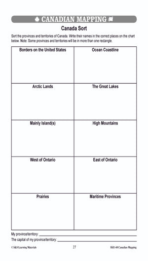
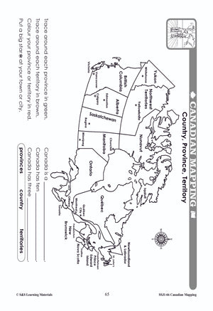
Canada's Provinces & Territories Mapping Worksheets Grades 2-3
$7.25 CAD
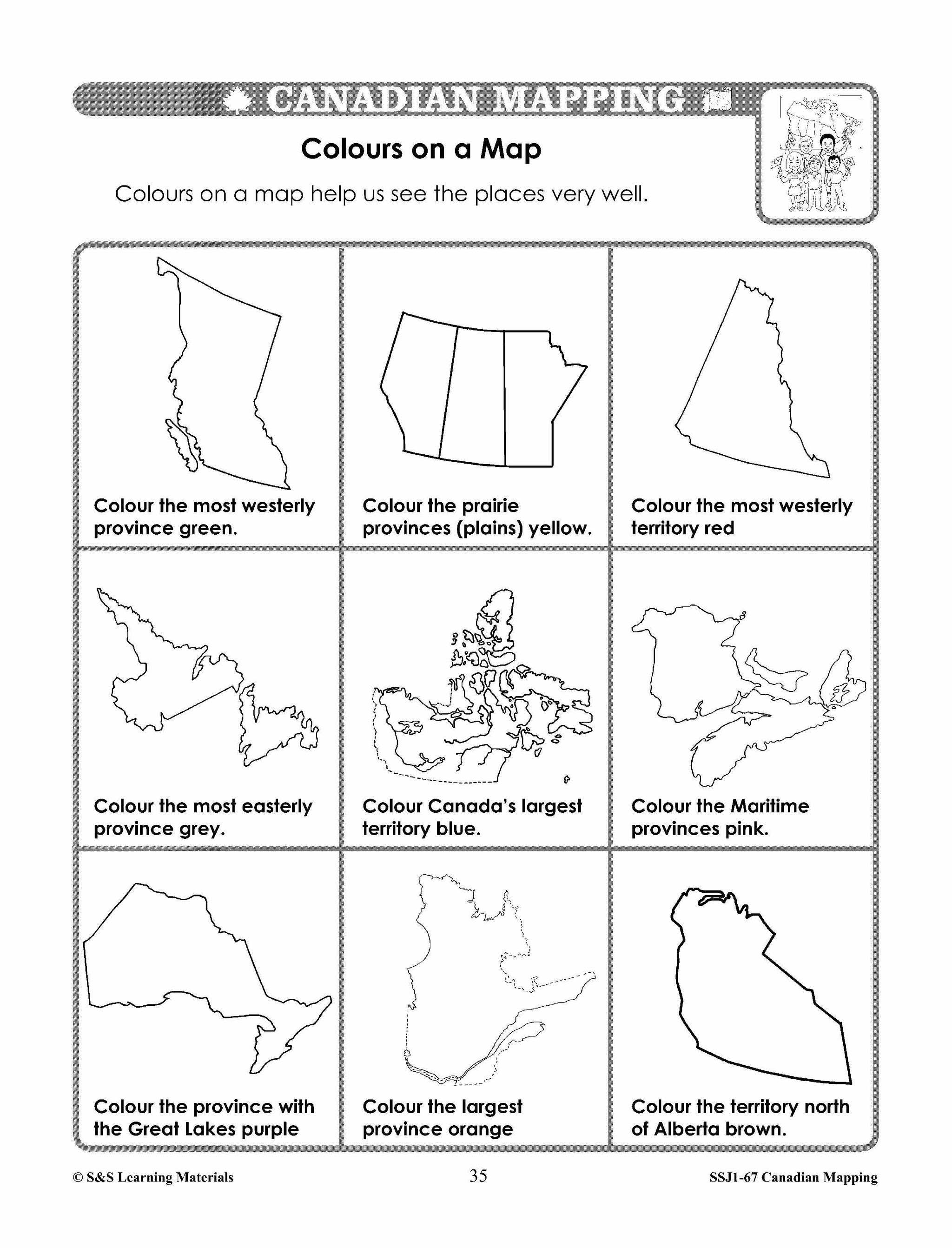
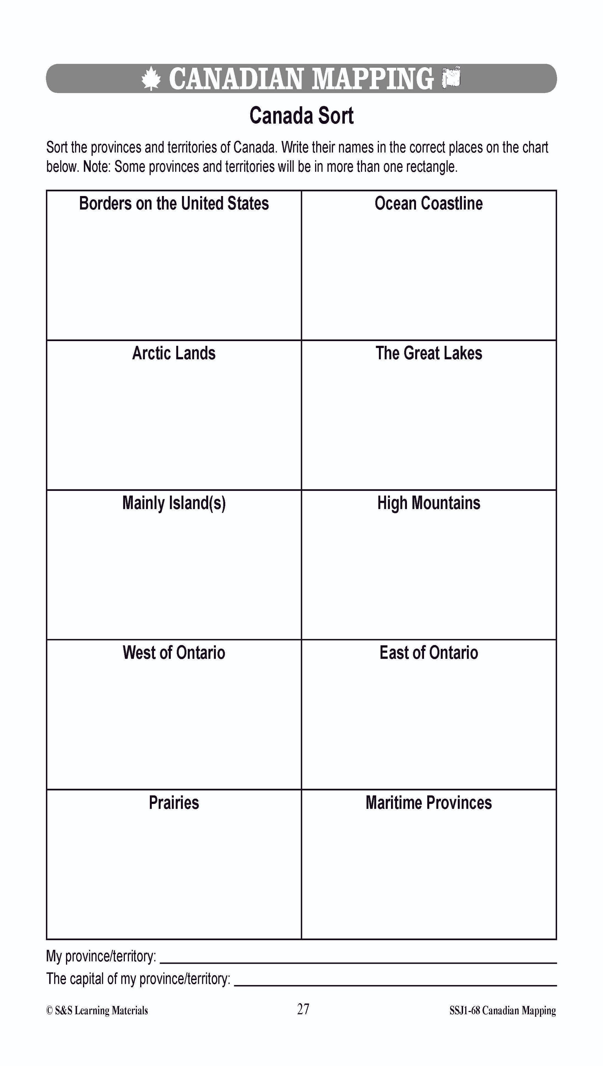
Students will learn about Canada's provinces and territories with the seven mapping worksheets. Teacher information on these topics: what a map is, types of maps, how to read a map, map indexes, hemispheres, directional indicators, and map symbols. The glossary...


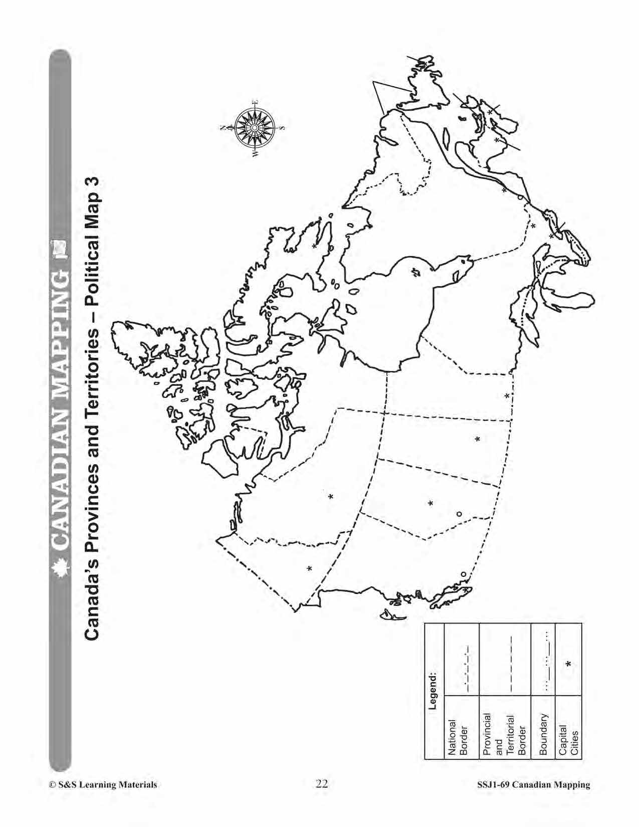


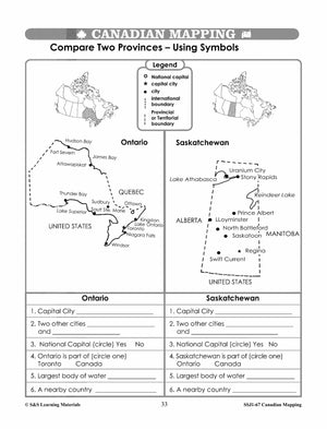
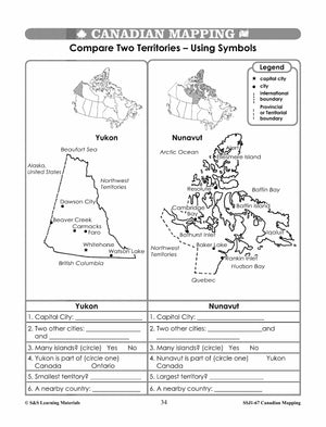
Canada's Provinces & Territories Worksheets Grades 5-6
$7.45 CAD
Students will learn about major bodies of water in Canada's provinces and territories while they complete the eight mapping worksheets in this lesson. Teacher information on these topics: what a map is, types of maps, how to read a map,...


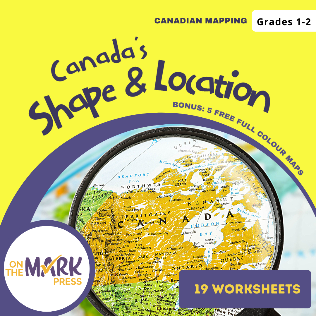
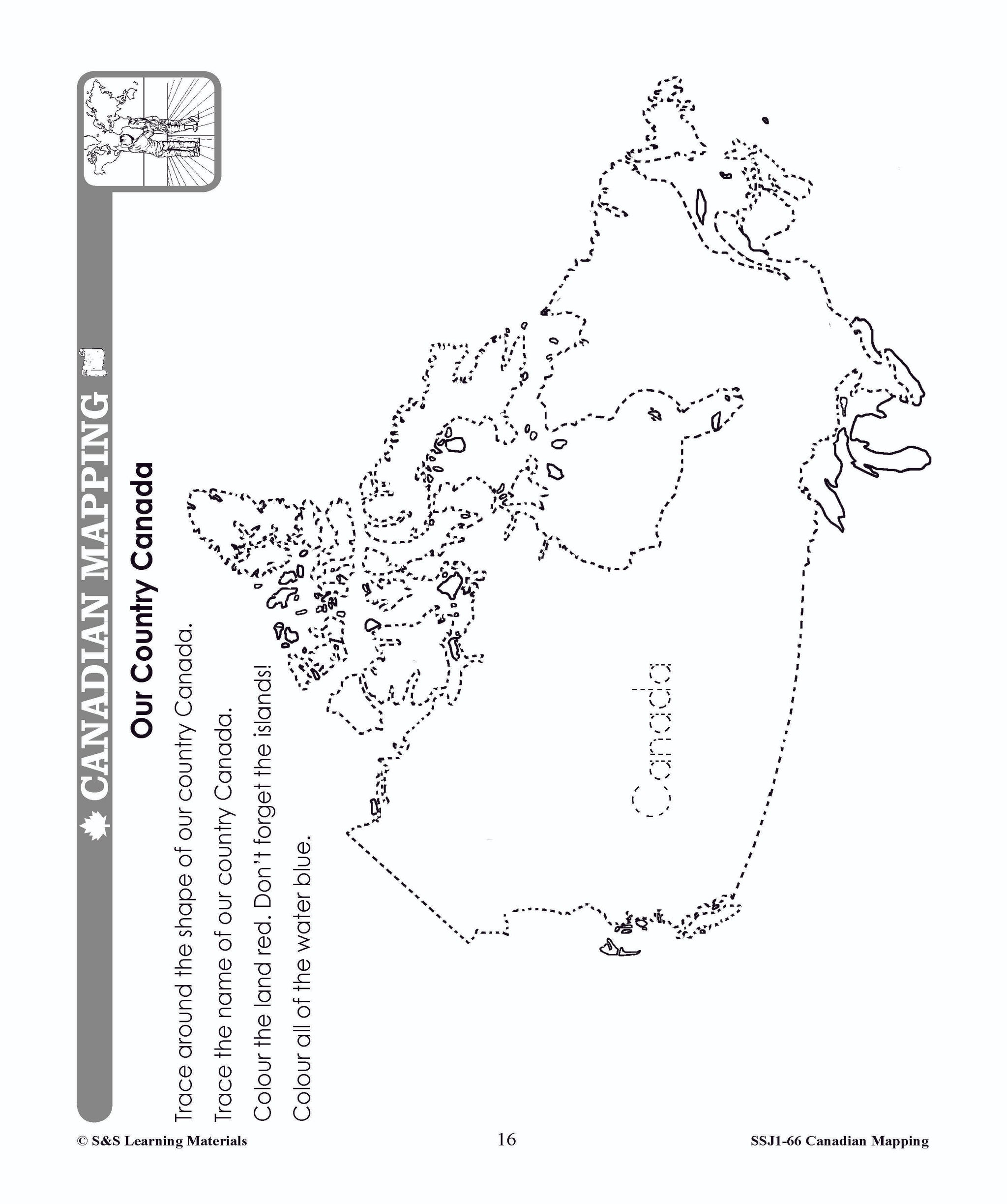
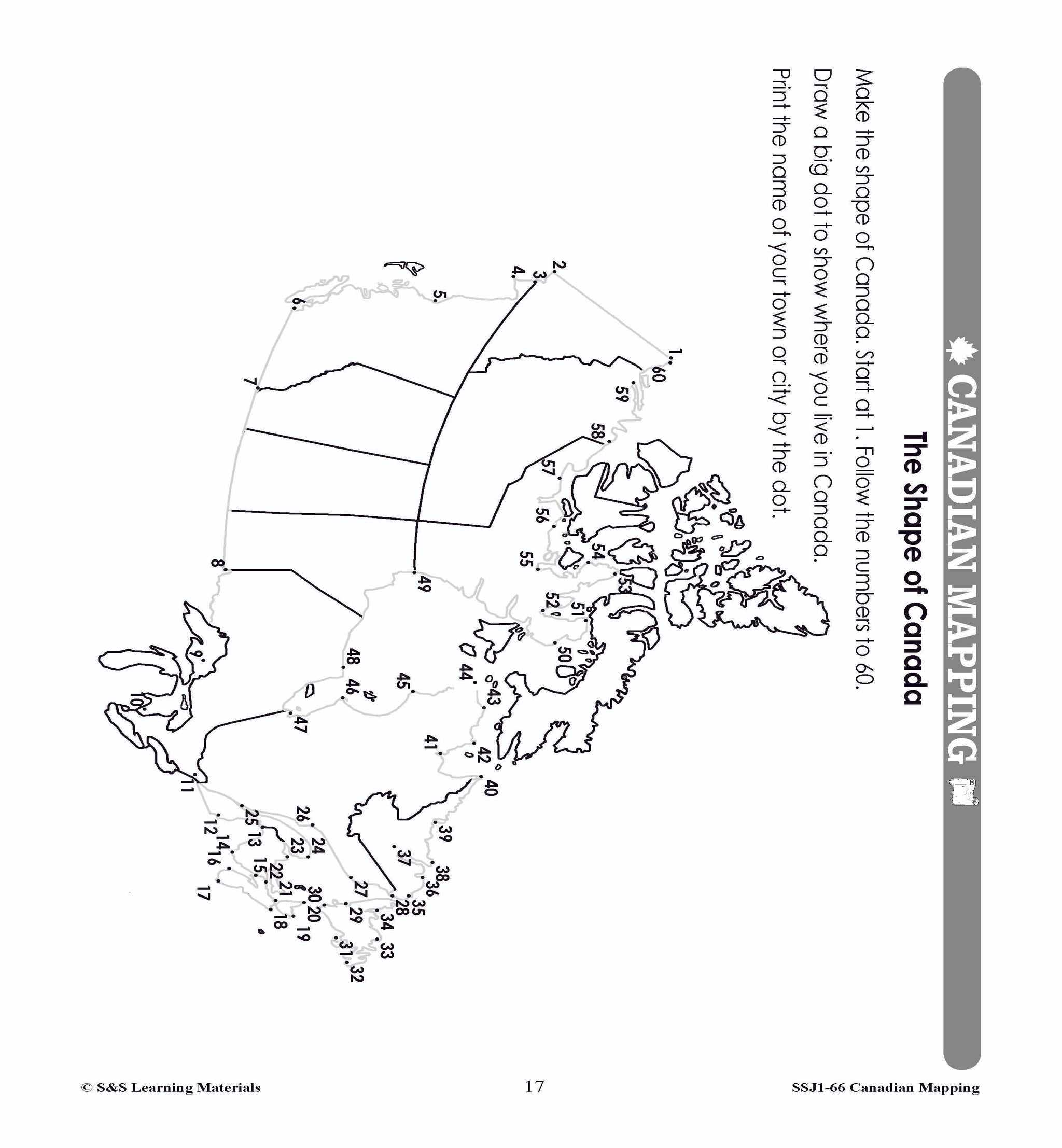


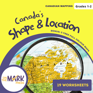
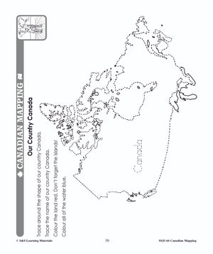
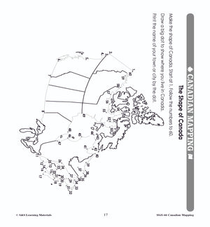


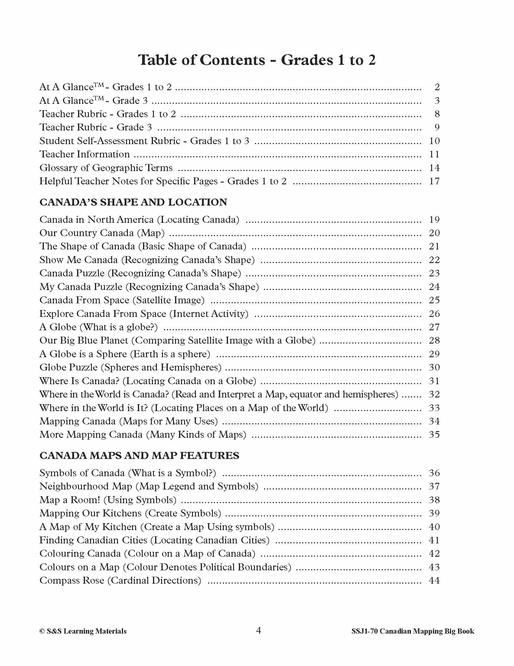
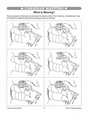
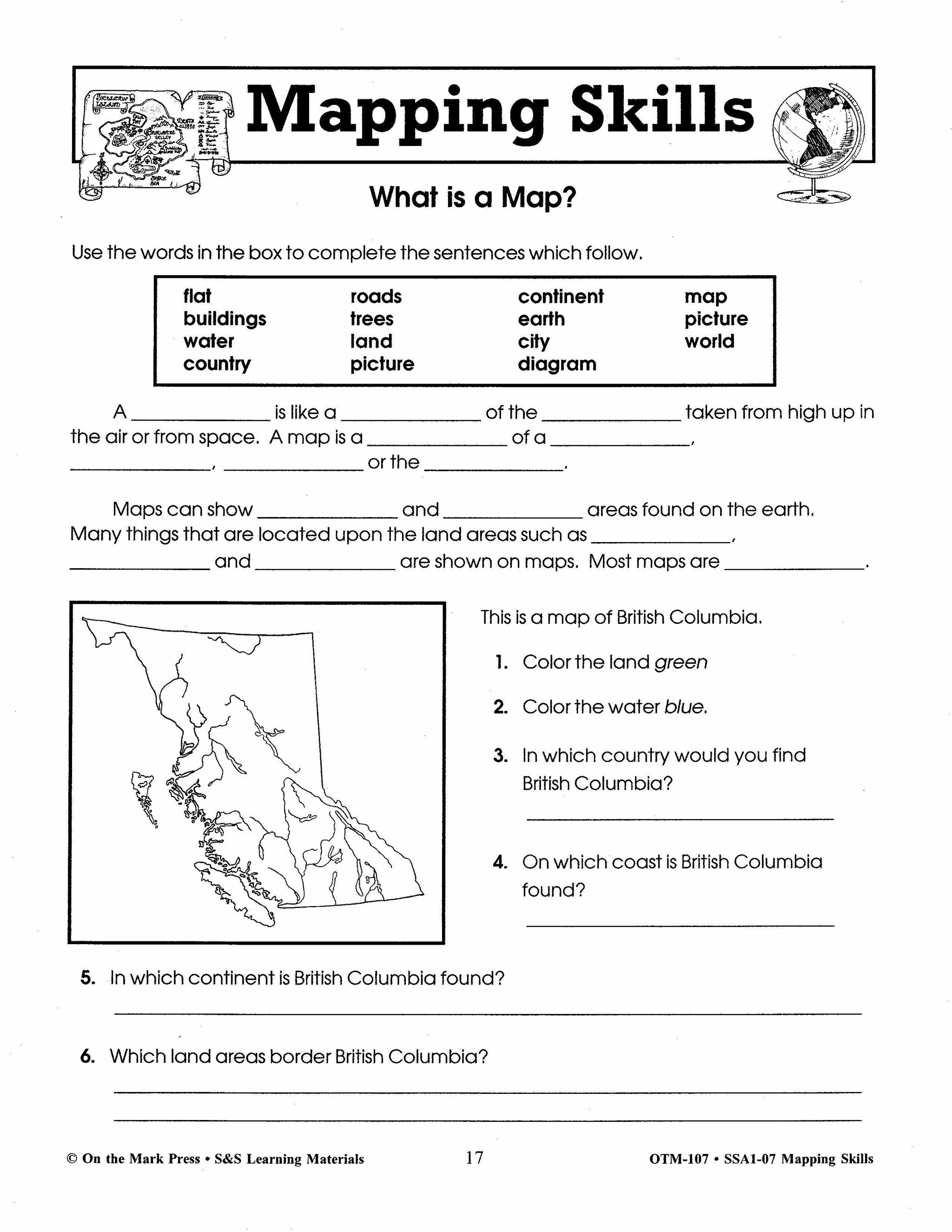
Canada's Shape & Location Mapping Worksheets Grades 1-2
$8.45 CAD
Students will learn about Canada's Shape & Location with the nineteen mapping worksheets. Teacher information on these topics: what a map is, types of maps, how to read a map, map indexes, hemispheres, directional indicators, and map symbols. The glossary...

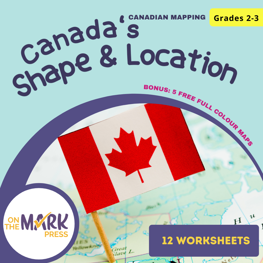


Canada's Shape & Location Mapping Worksheets Grades 2-3
$7.45 CAD
Students will learn about Canada's Shape and Location with the twelve mapping worksheets. Teacher information on these topics: what a map is, types of maps, how to read a map, map indexes, hemispheres, directional indicators, and map symbols. The glossary...


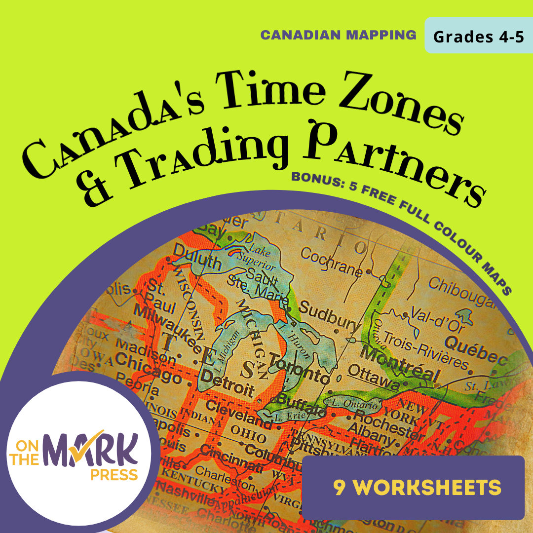
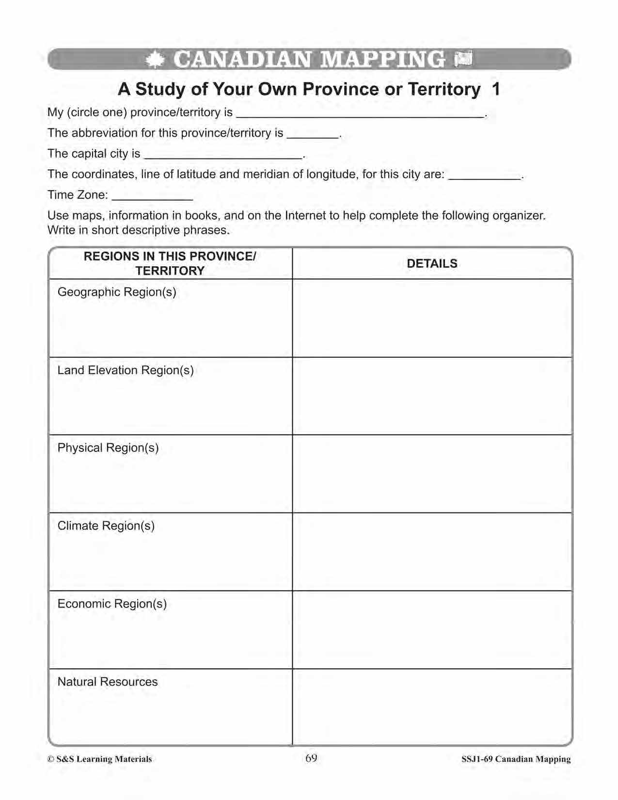


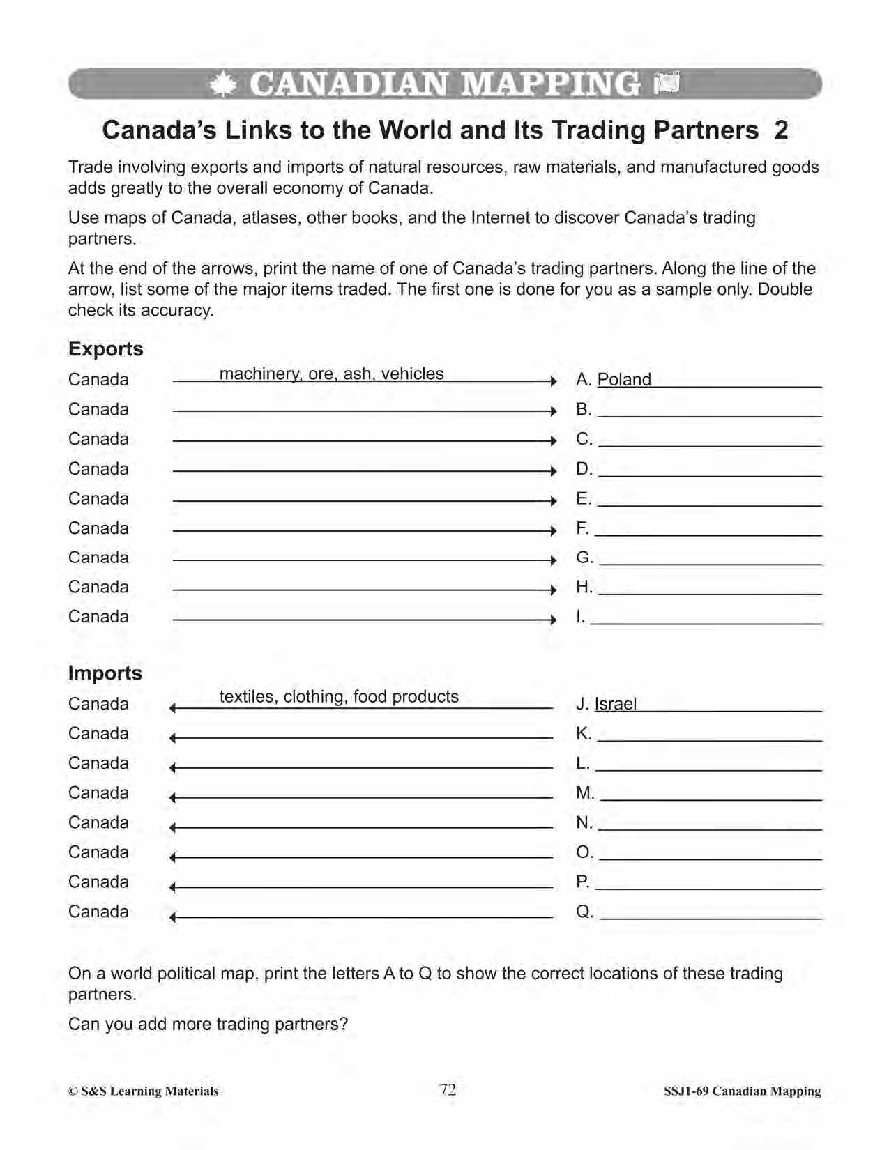
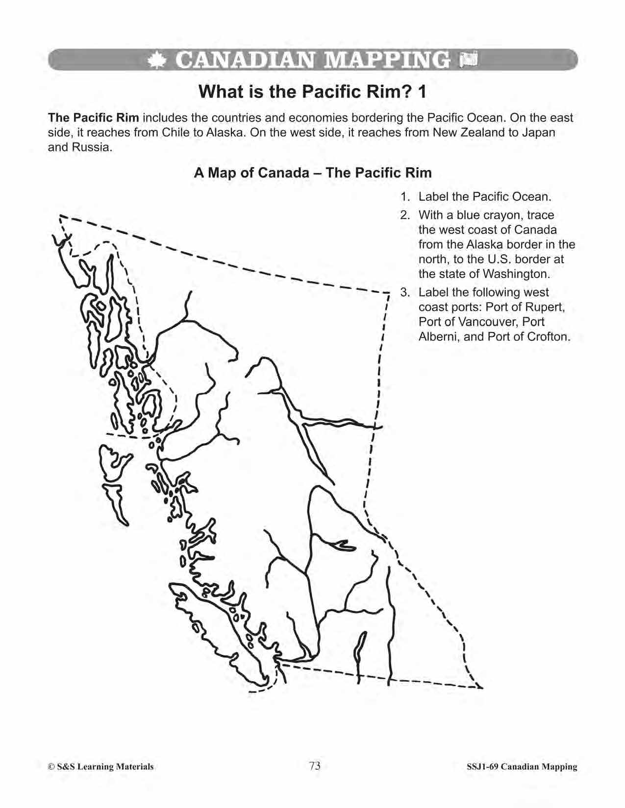


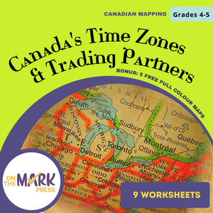

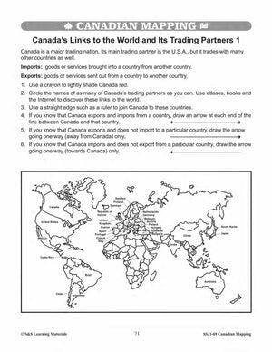
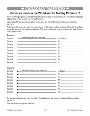


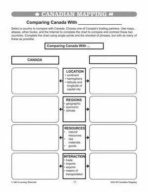


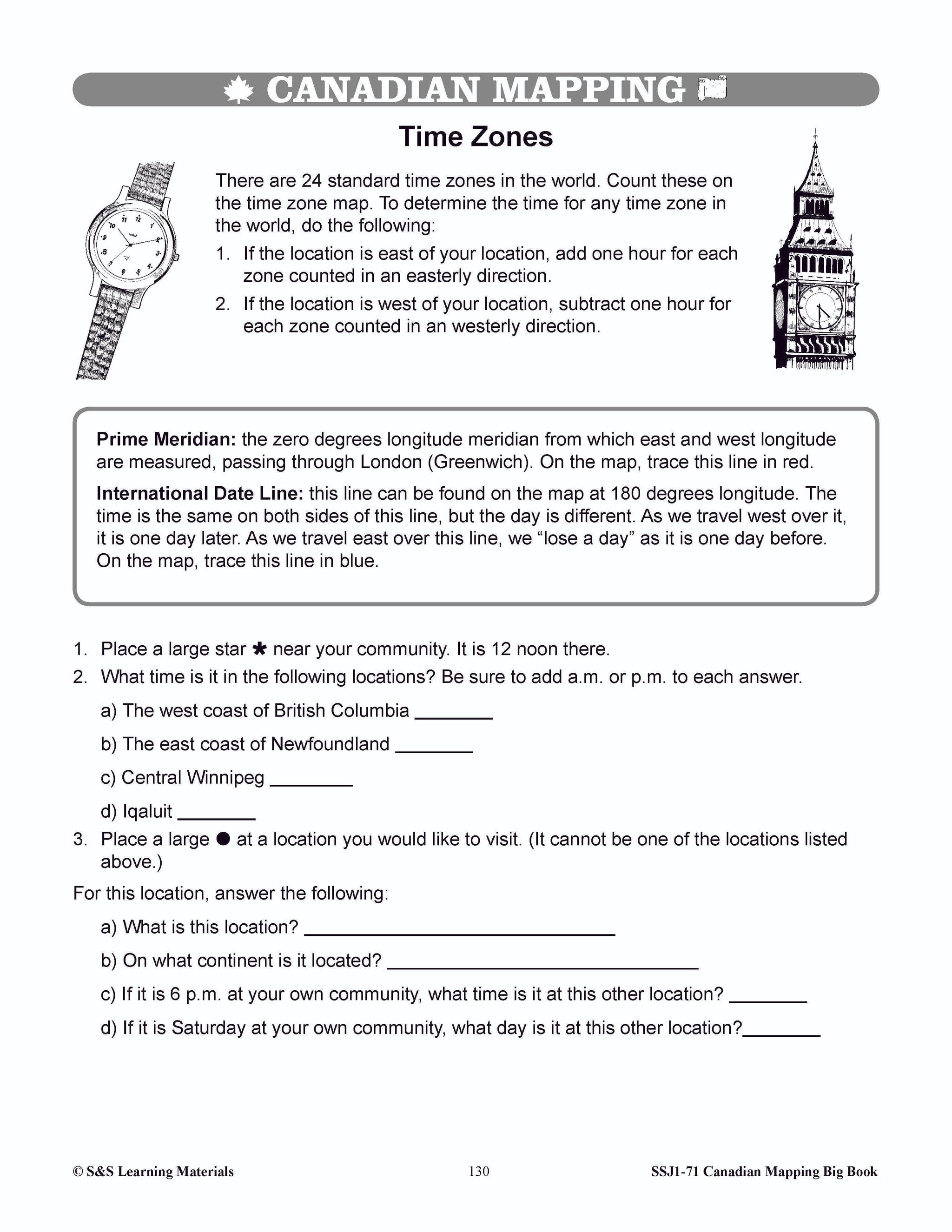
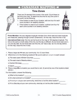
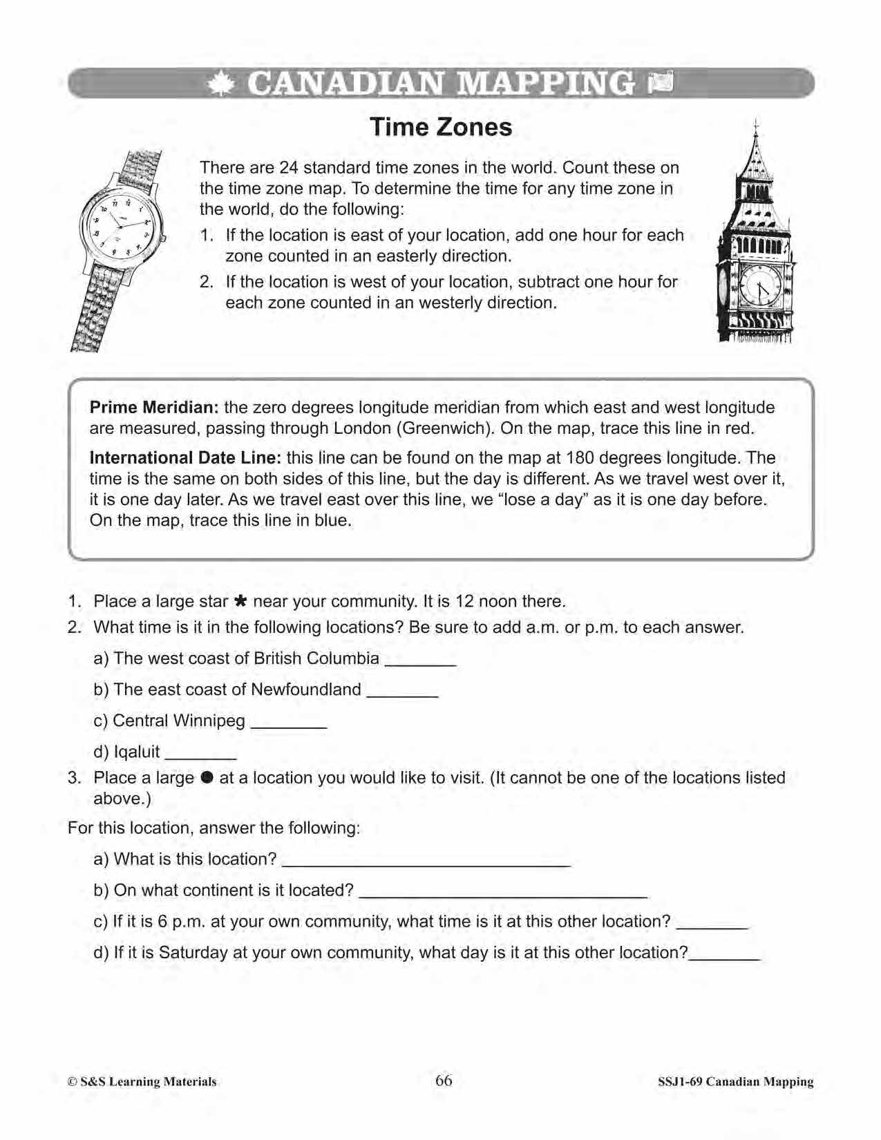
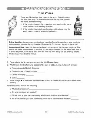
Canada's Time Zones & Trading Partners Worksheets Grades 5-6
$7.45 CAD
Students will learn about Canada's time zones and trading partners through working through the nine worksheets. Teacher information on these topics: what a map is, types of maps, how to read a map, map indexes, scale, and geographic grids, hemispheres,...


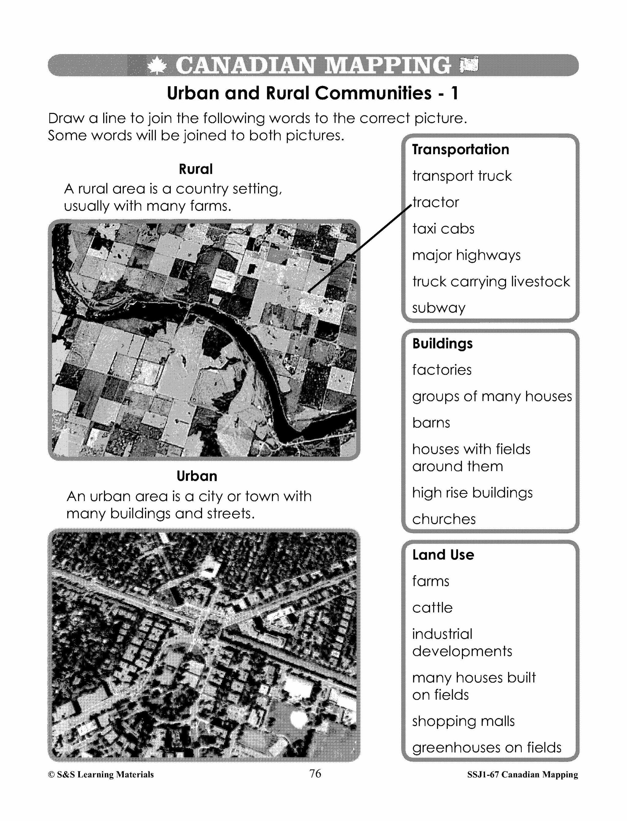
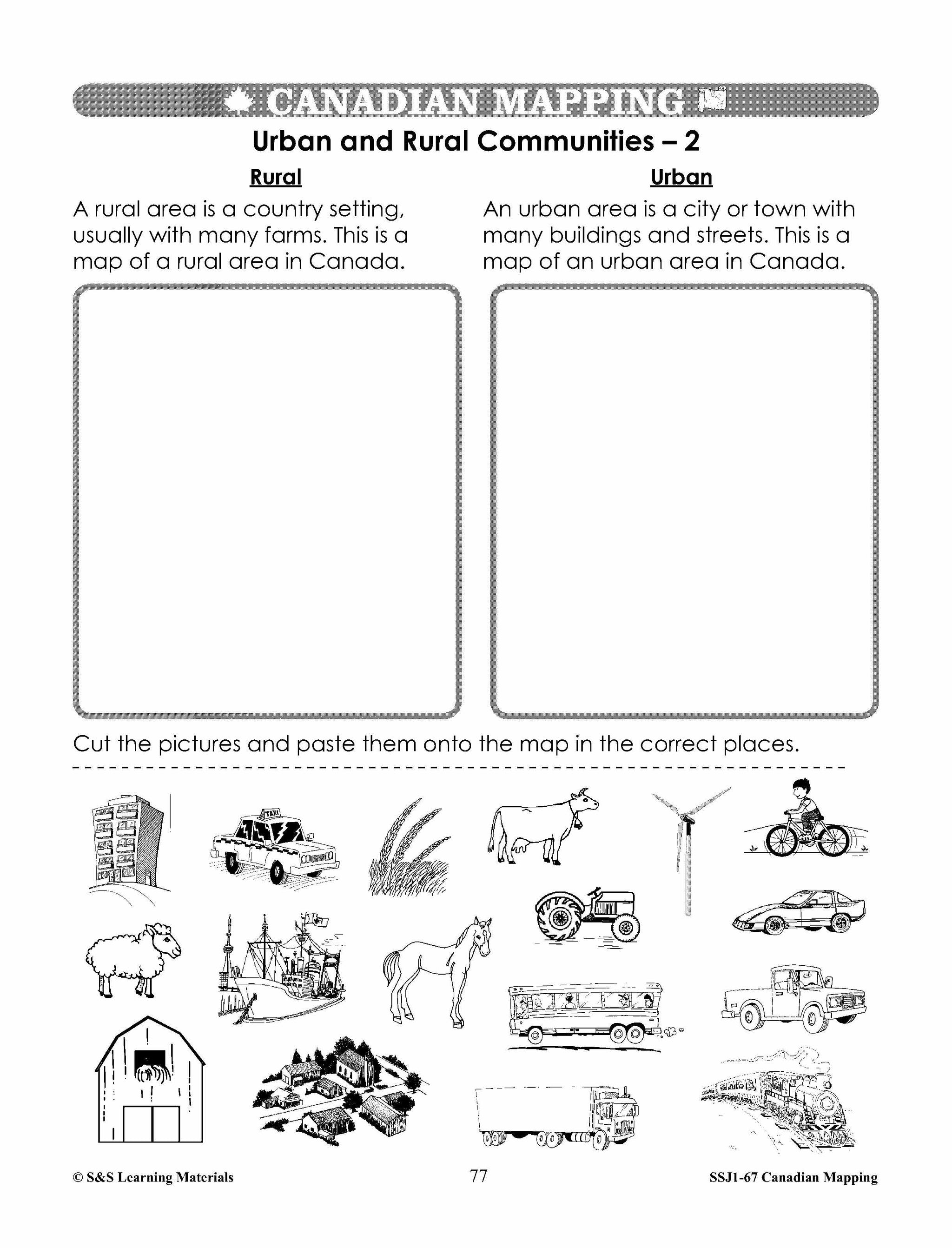
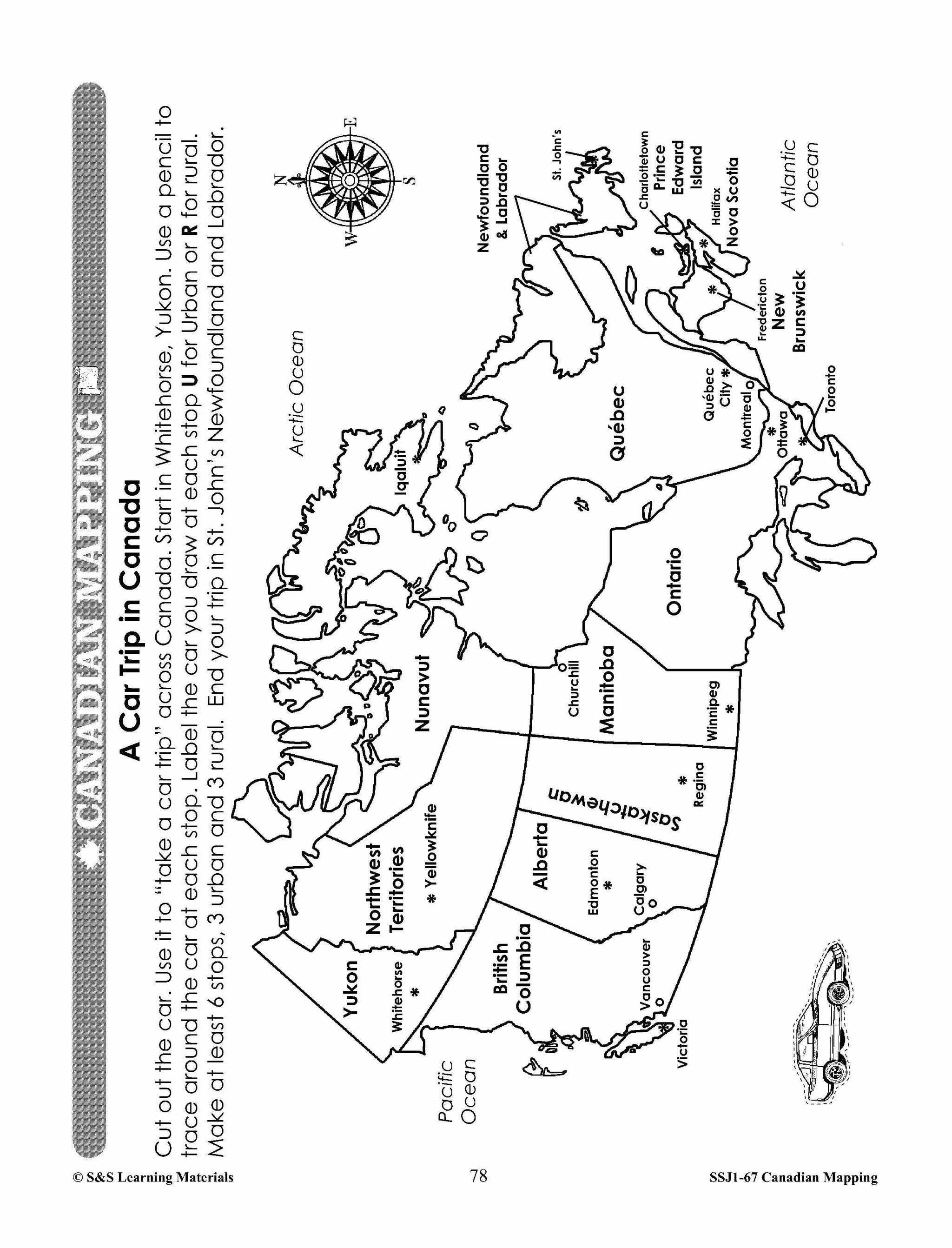


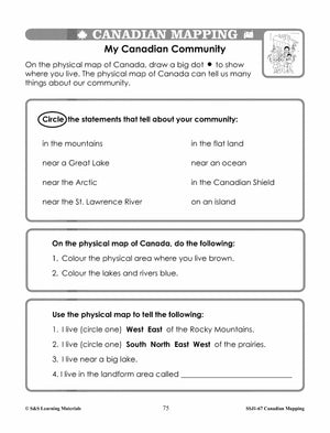
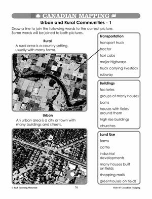


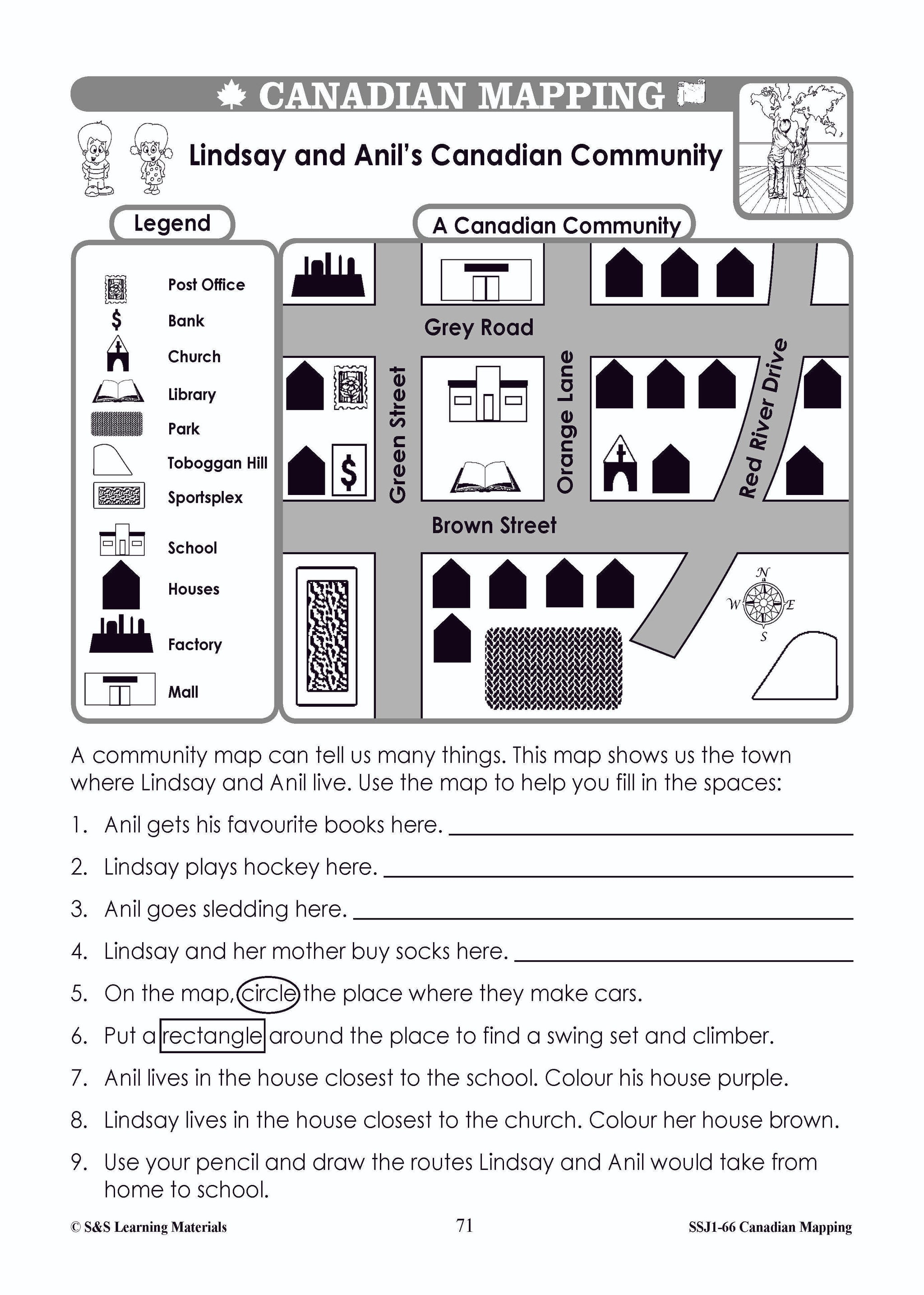
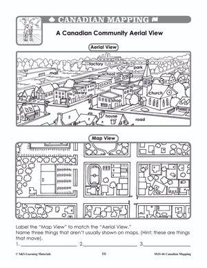
Canadian Communities - Urban & Rural Mapping Worksheets Grades 2-3
$7.25 CAD
Students will learn about urban and rural communities with the six mapping worksheets. Teacher information on these topics: what a map is, types of maps, how to read a map, map indexes, hemispheres, directional indicators, and map symbols. The glossary...


Canadian Communitites Mapping Worksheets Grades 1-2
$7.95 CAD
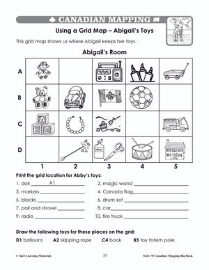
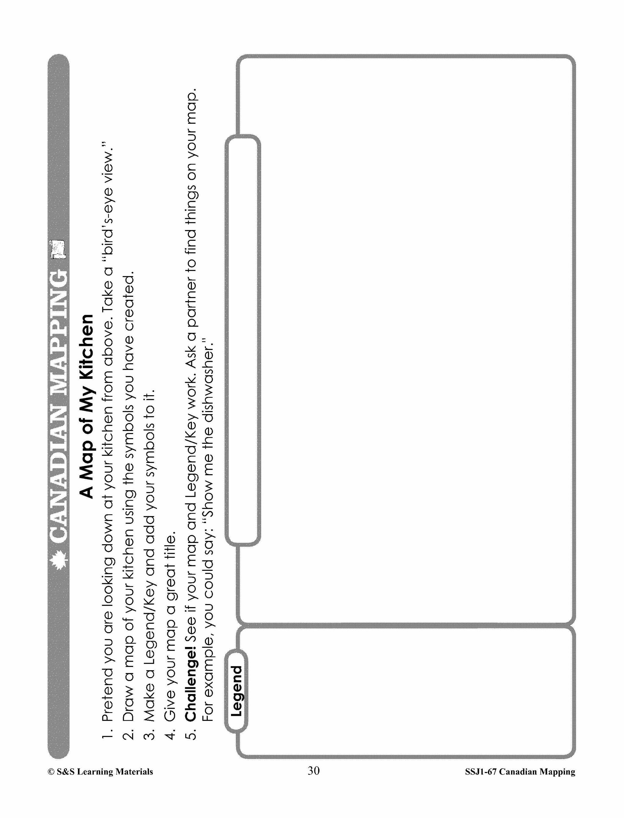
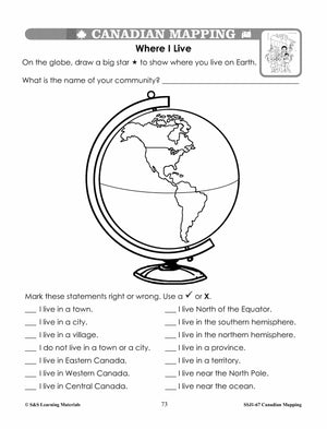
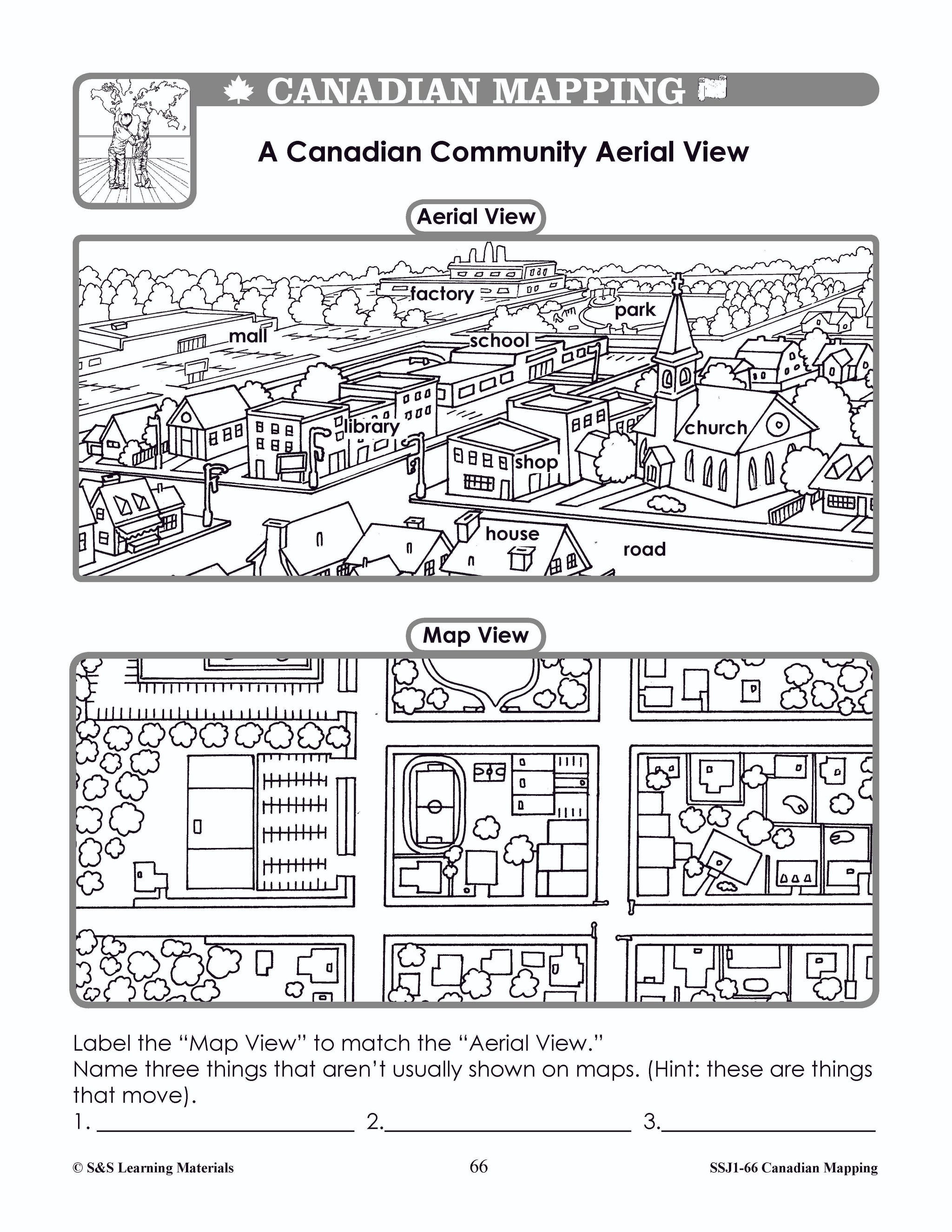
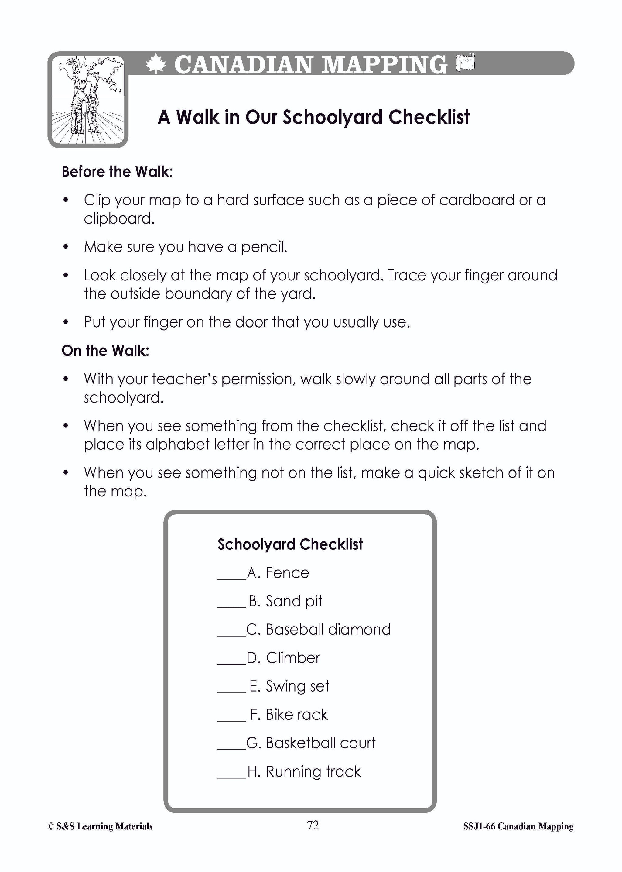
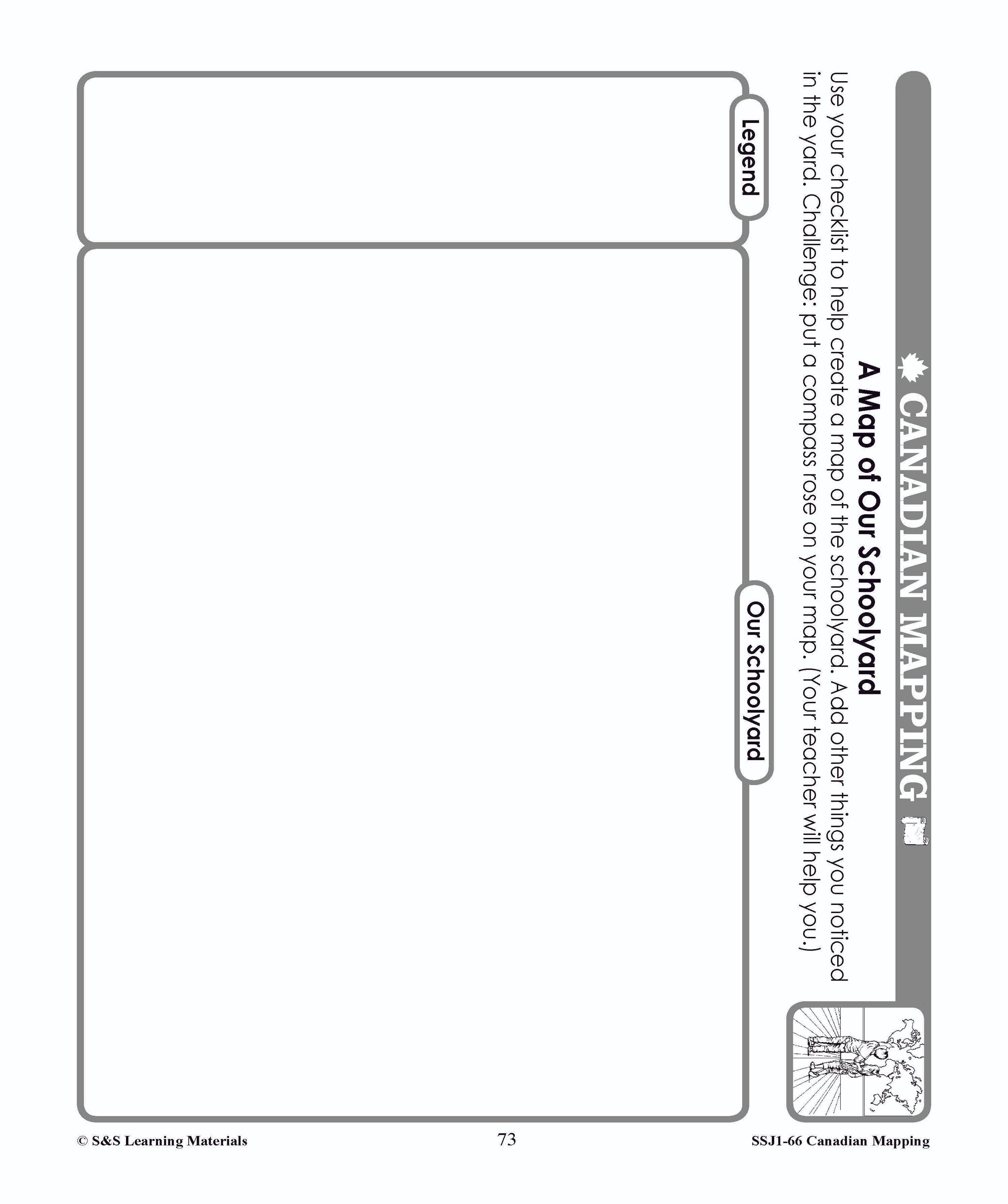
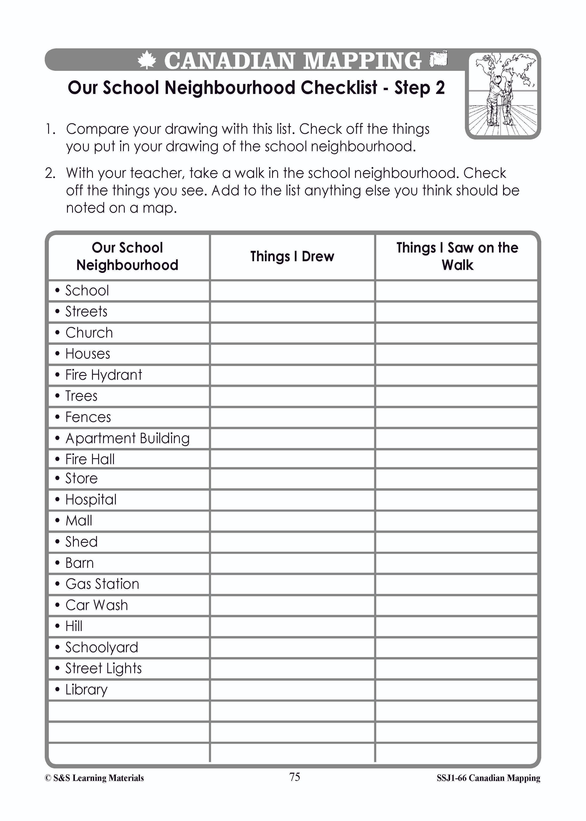
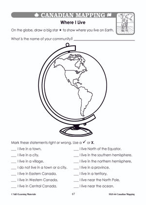
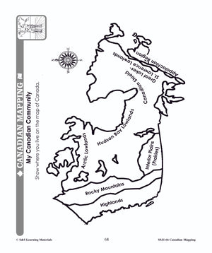
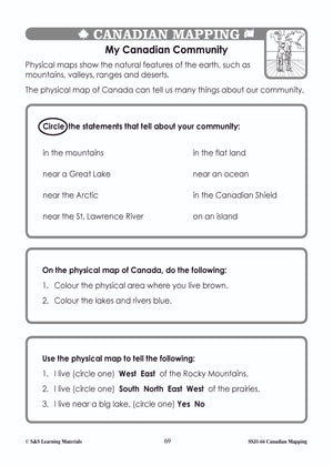
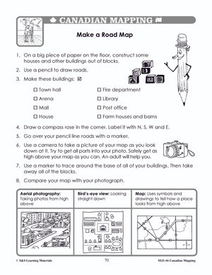
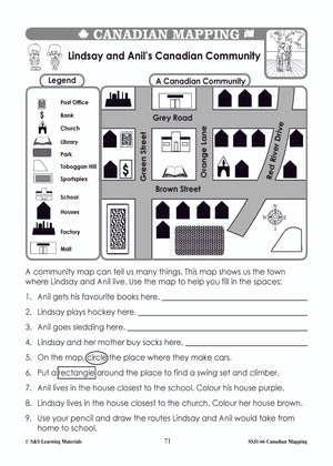
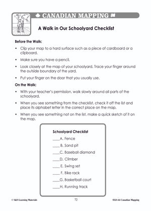
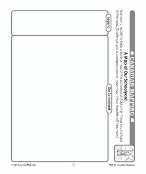
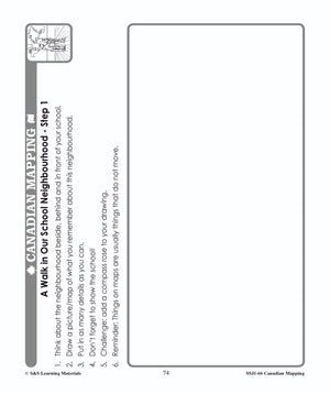
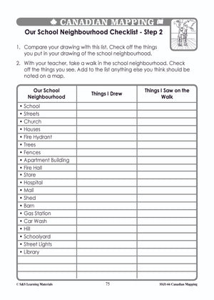
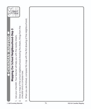
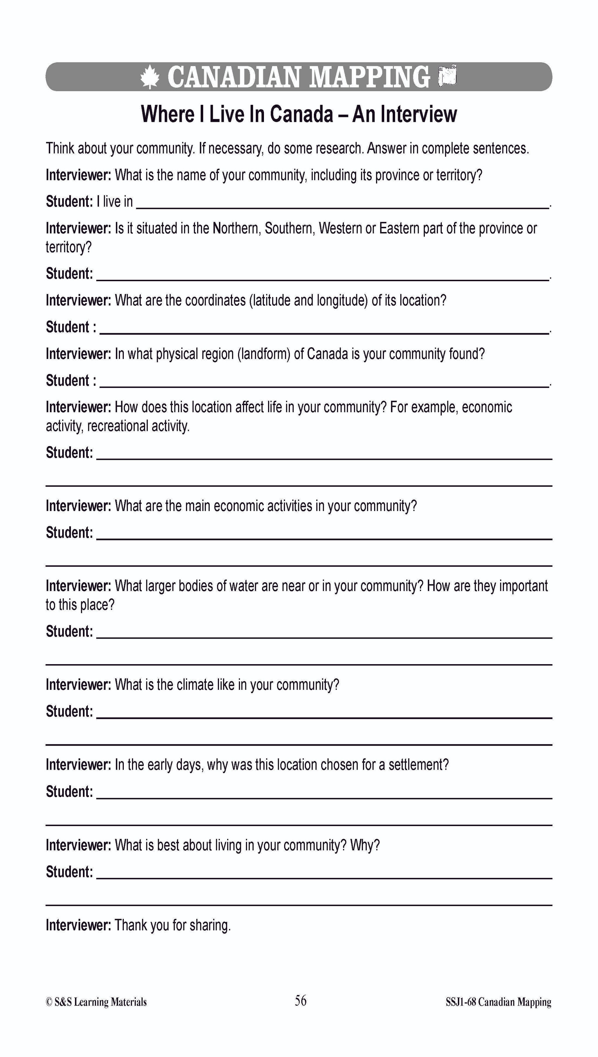
Students will complete 14 worksheets that help them understand where they live on a map of the world and on a map of Canada. They will make a road map of their community, and take a walk in their schoolyard...


Canadian Mapping Skills Worksheets Grades 5-6
$7.95 CAD
Students will learn Canadian mapping skills with the eleven worksheets in this lesson. Teacher information on these topics: what a map is, types of maps, how to read a map, map indexes, scale, and geographic grids, hemispheres, directional indicators, and...


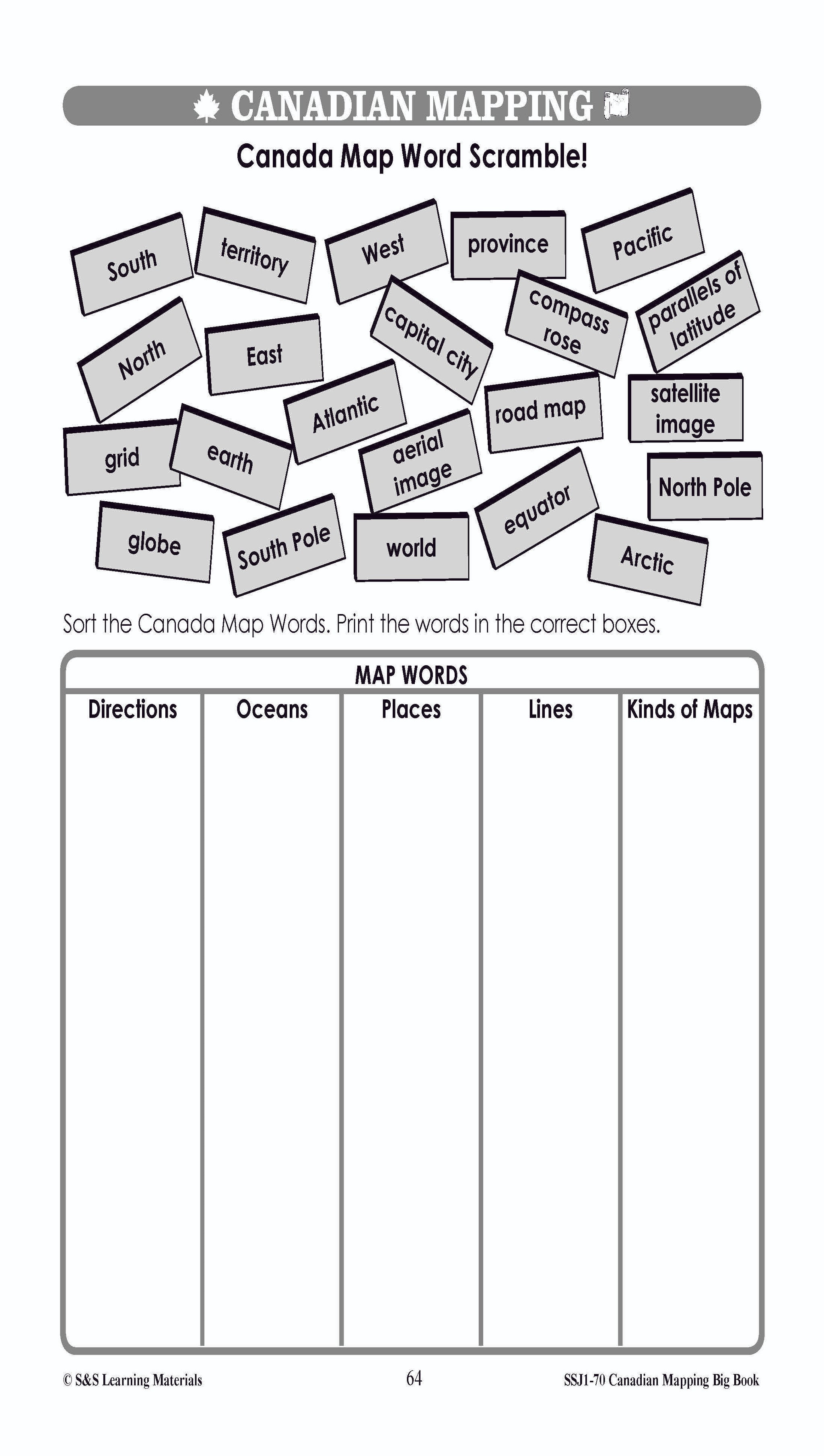
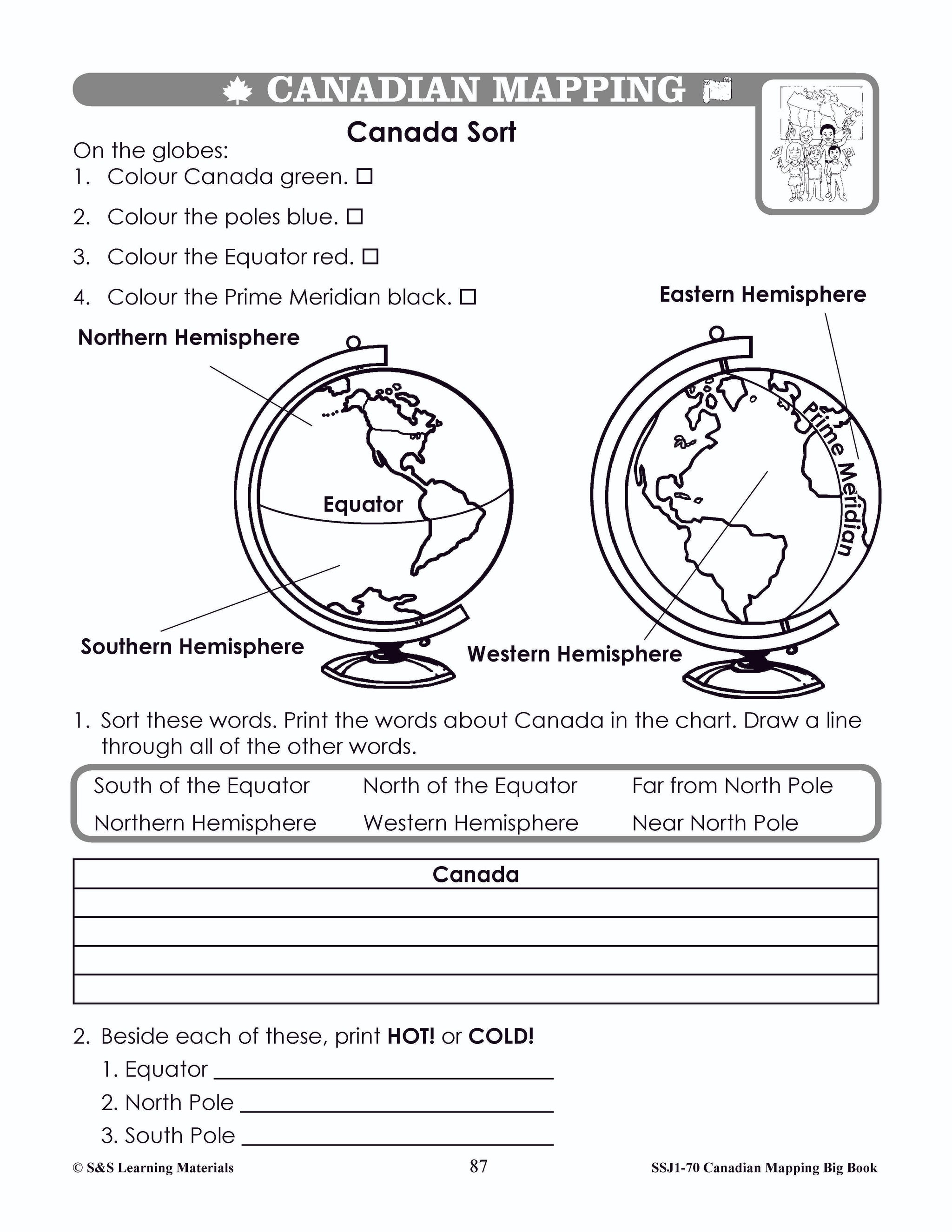
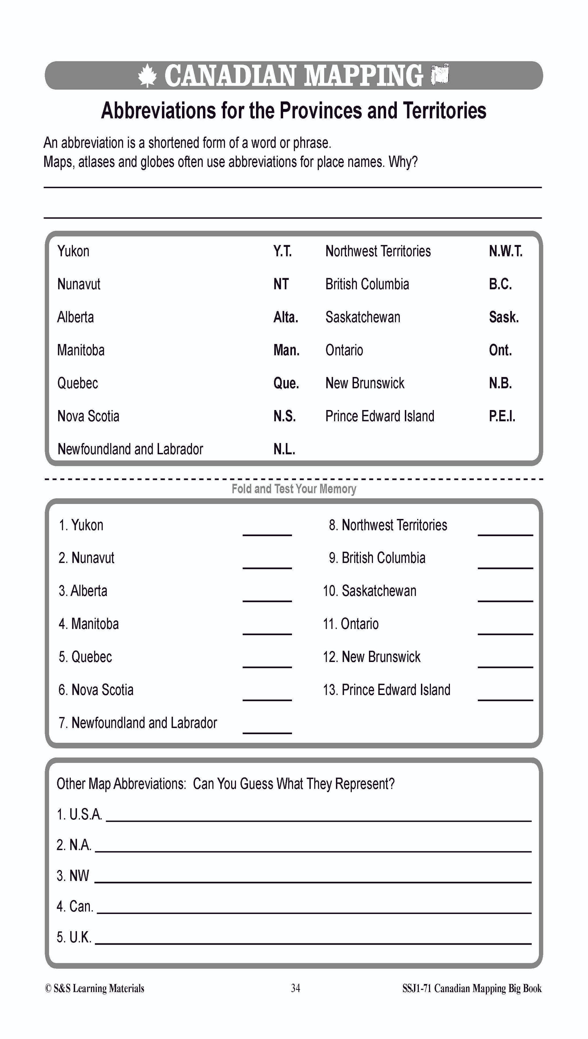
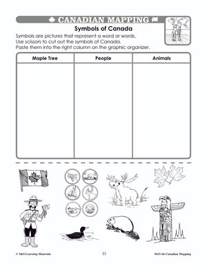
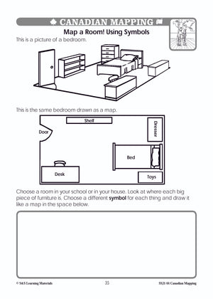
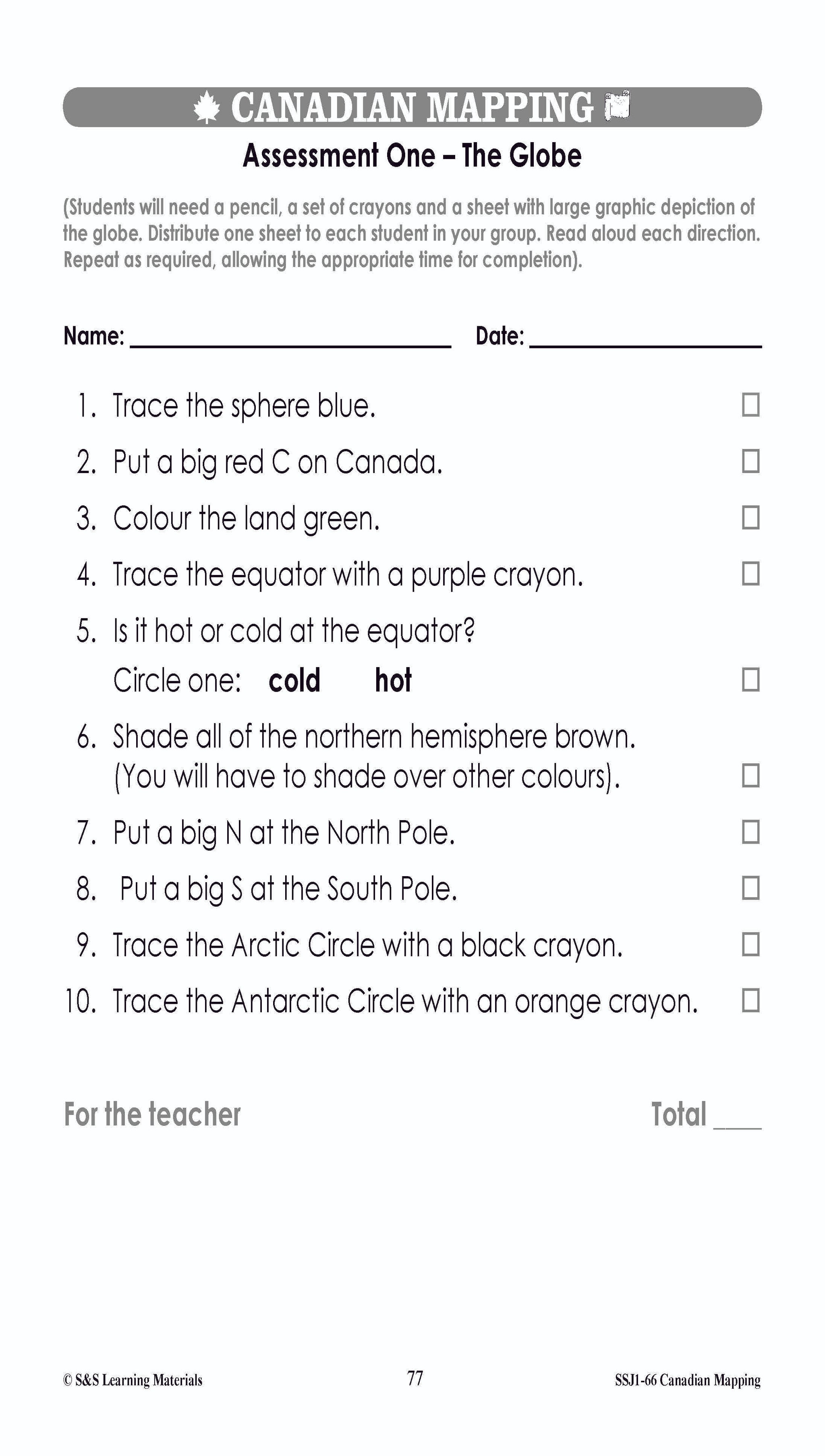
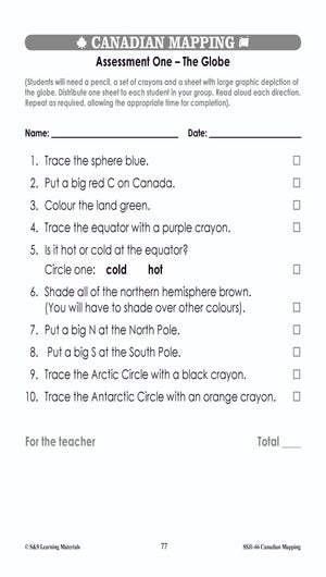
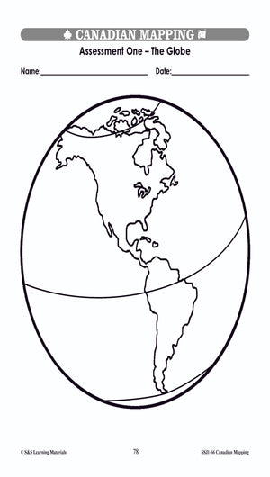
Canadian Mapping Skills: An Introduction to Mapping Grades 1-2
$32.99 CAD
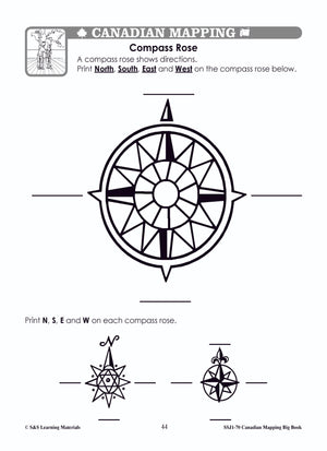
Help young learners to understand the geography of Canada with the introduction of basic mapping skills. Students will learn the terms compass rose, scale, legend, map symbols, and directional terms. They will be introduced to various types of maps and...


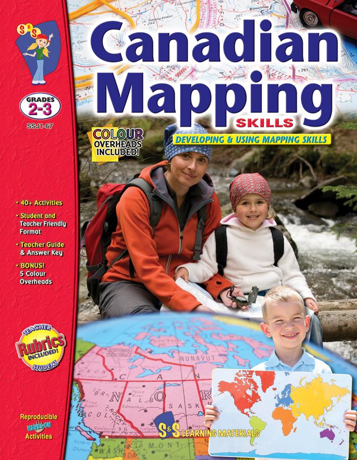


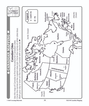
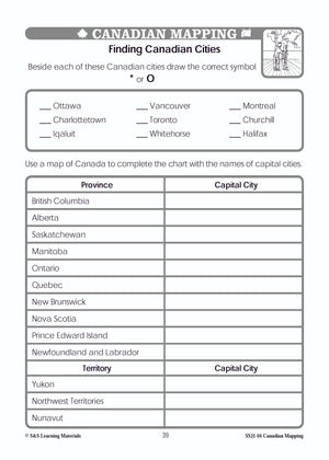
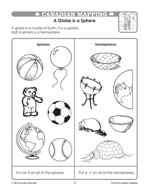
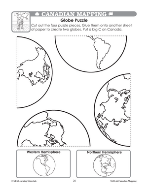
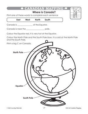
Canadian Mapping Skills: Developing and Using Mapping Skills Grades 2-3
$32.99 CAD
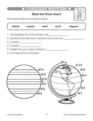
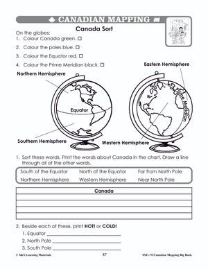
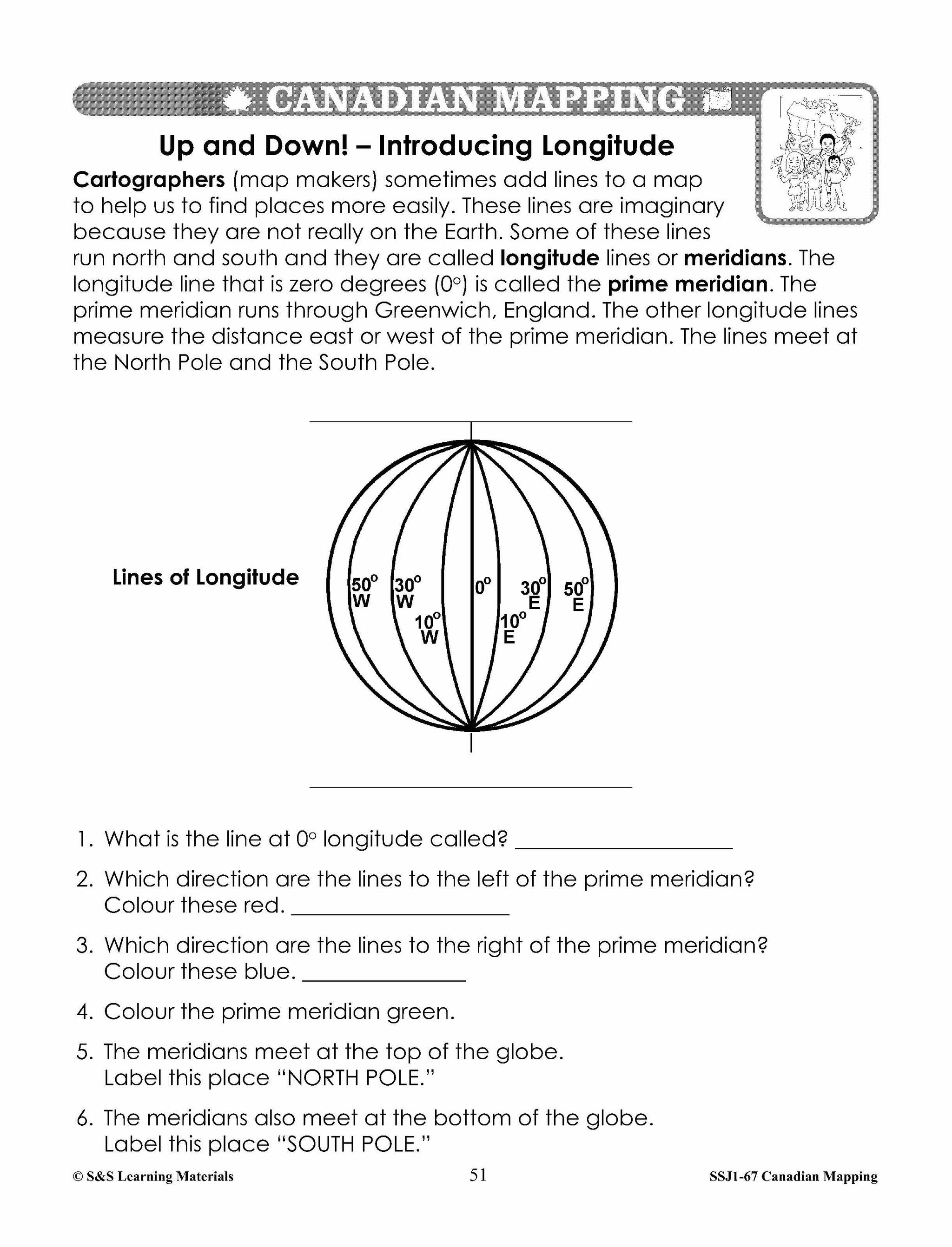
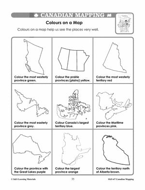
Strengthen your students; mapping skills and understanding of geographic terminology. Students will be introduced to the terms hemisphere, continent, latitude, longitude, pictorial symbols, legend, key, scale, land-forms, and cardinal and intermediate directions. Students will explore Canada using maps and will...

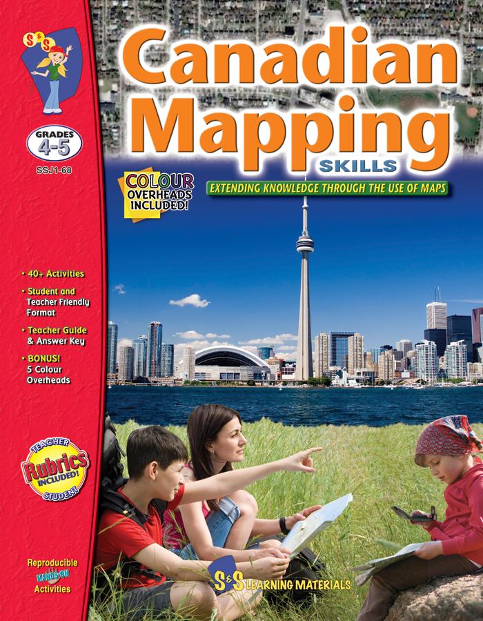

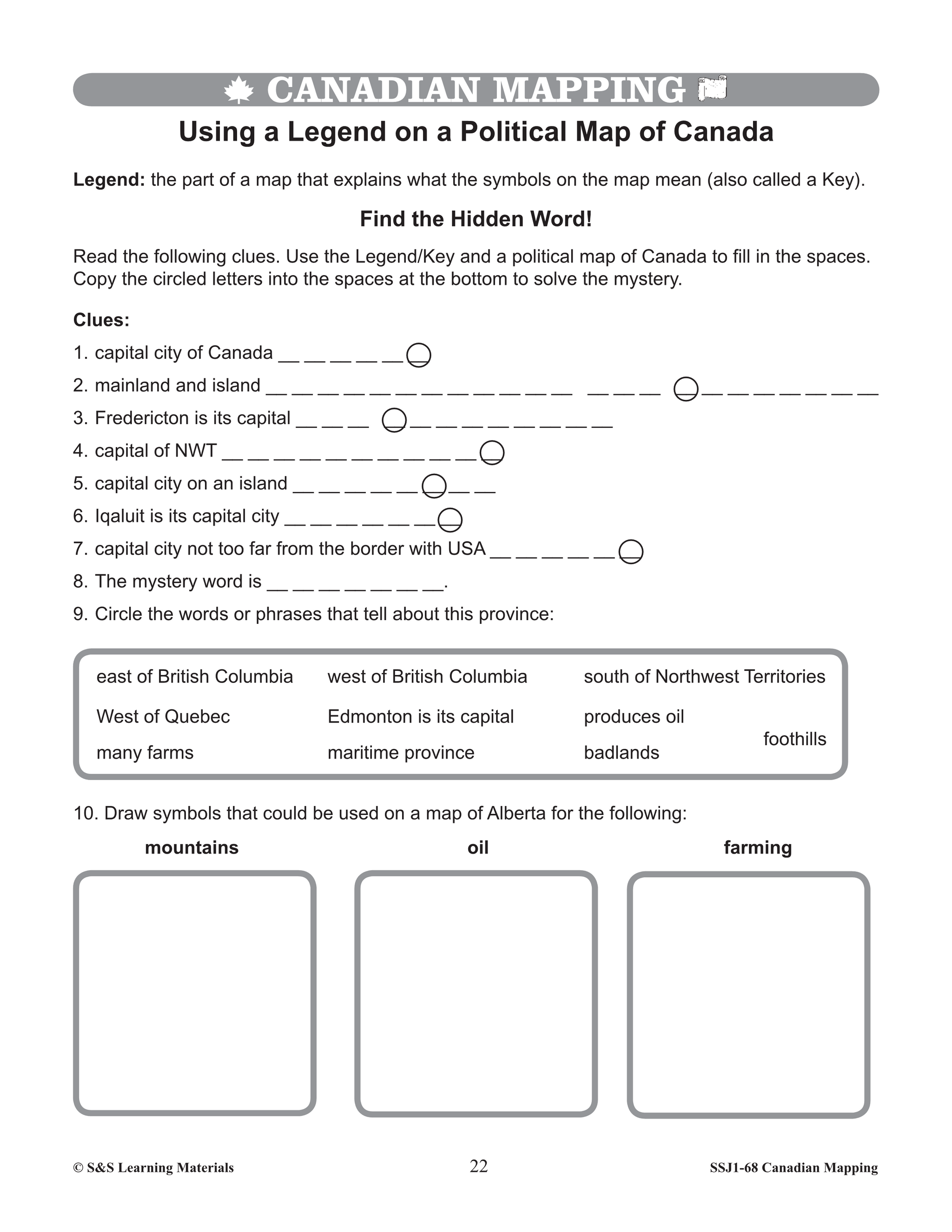


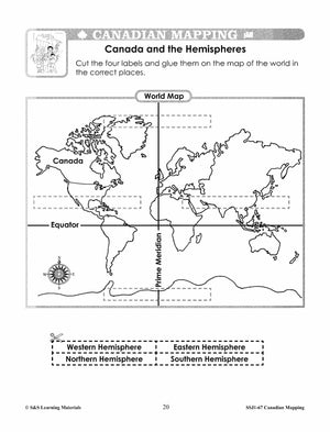
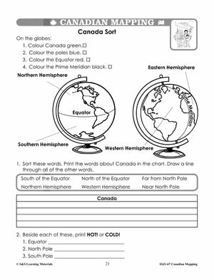
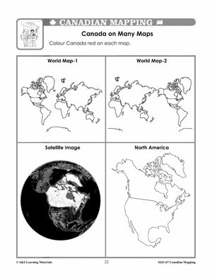
Canadian Mapping Skills: Extending Knowledge Grades 4-5
$32.99 CAD
They will learn terms such as regions, provinces, territories, physical features, land-forms, parallels of latitude, meridians of longitude, coordinates, map symbols, cardinal and intermediate directions, and scale. Skills such as locating places on a map, recording on maps, interpreting different...
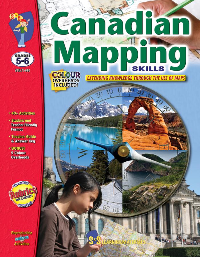


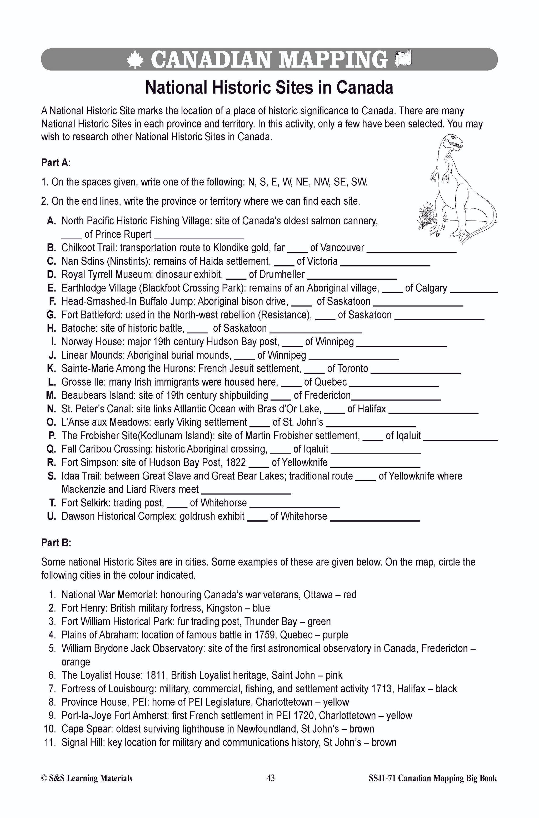
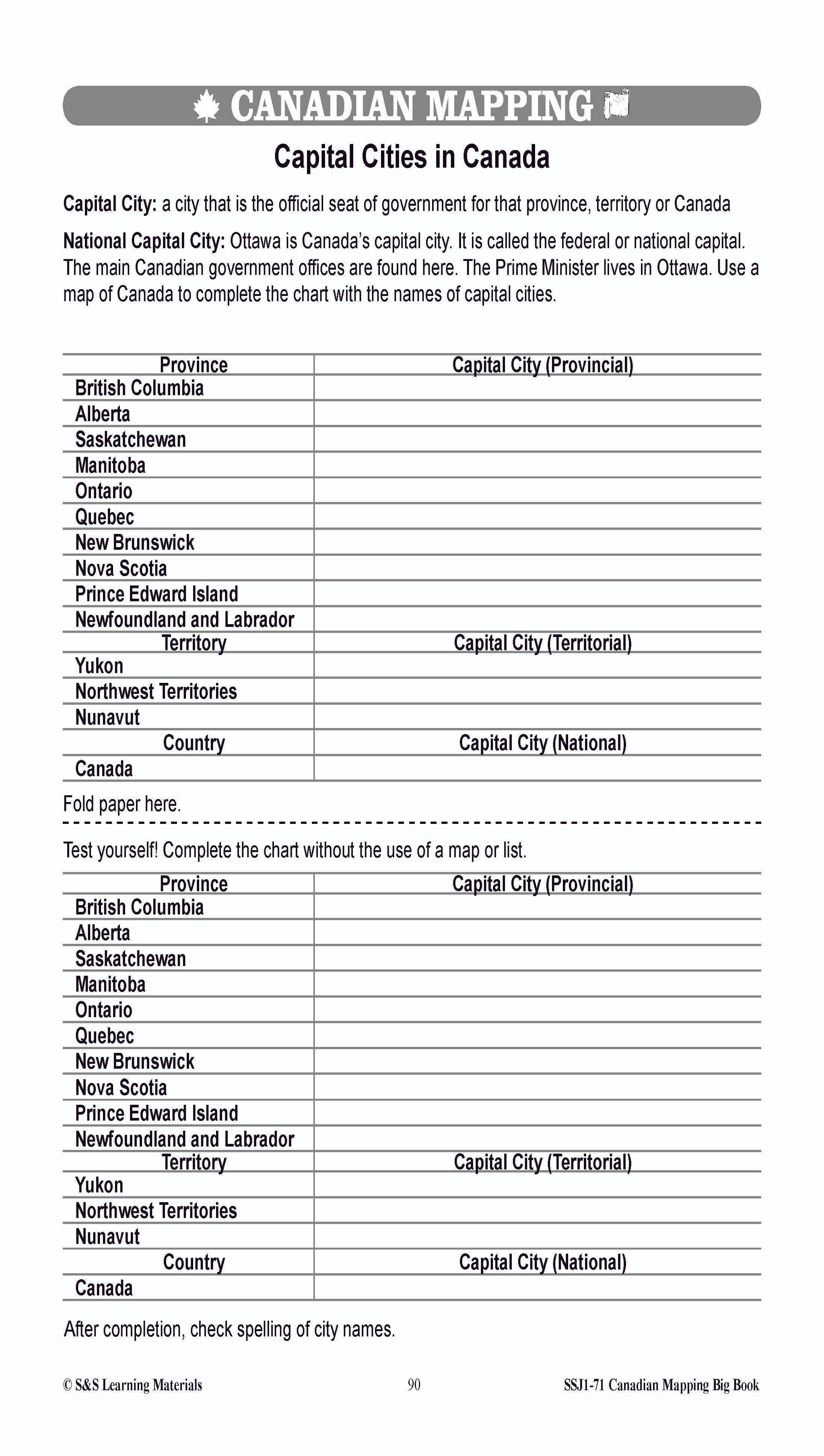
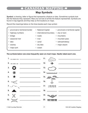
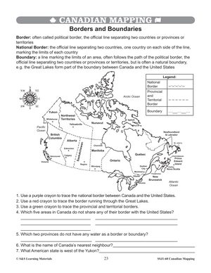
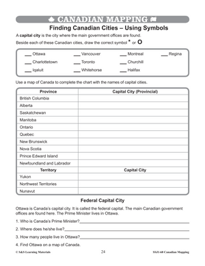
Canadian Mapping Skills: Extending Knowledge Grades 5-6
$32.99 CAD
Immerse your classroom in the exciting world of Canadian geography with our comprehensive mapping resource! Designed specifically for Grades 5 and 6, this curriculum bundle equips students with an in‐depth understanding of Canada’s varied regions, provinces, territories, communities, bodies of...


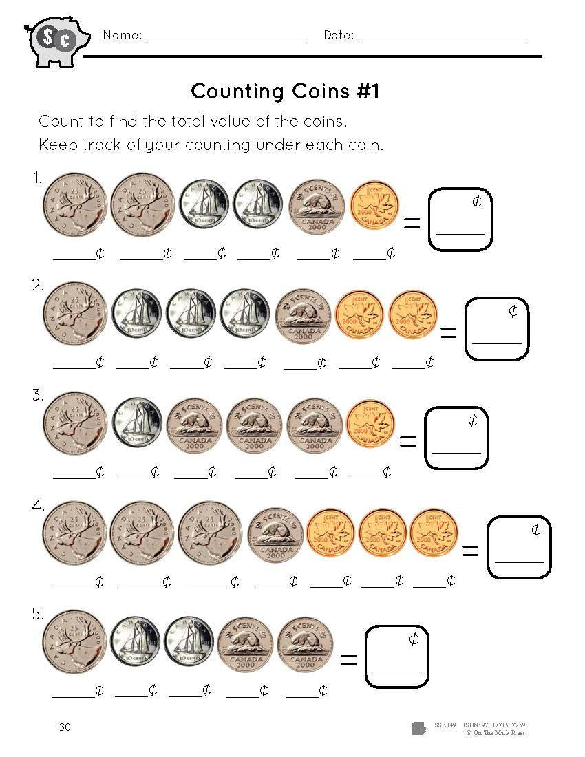
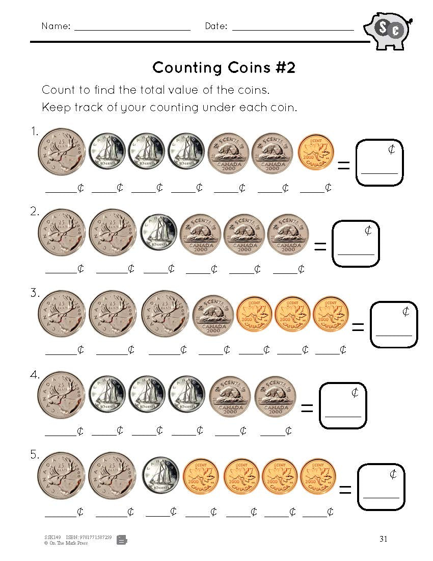
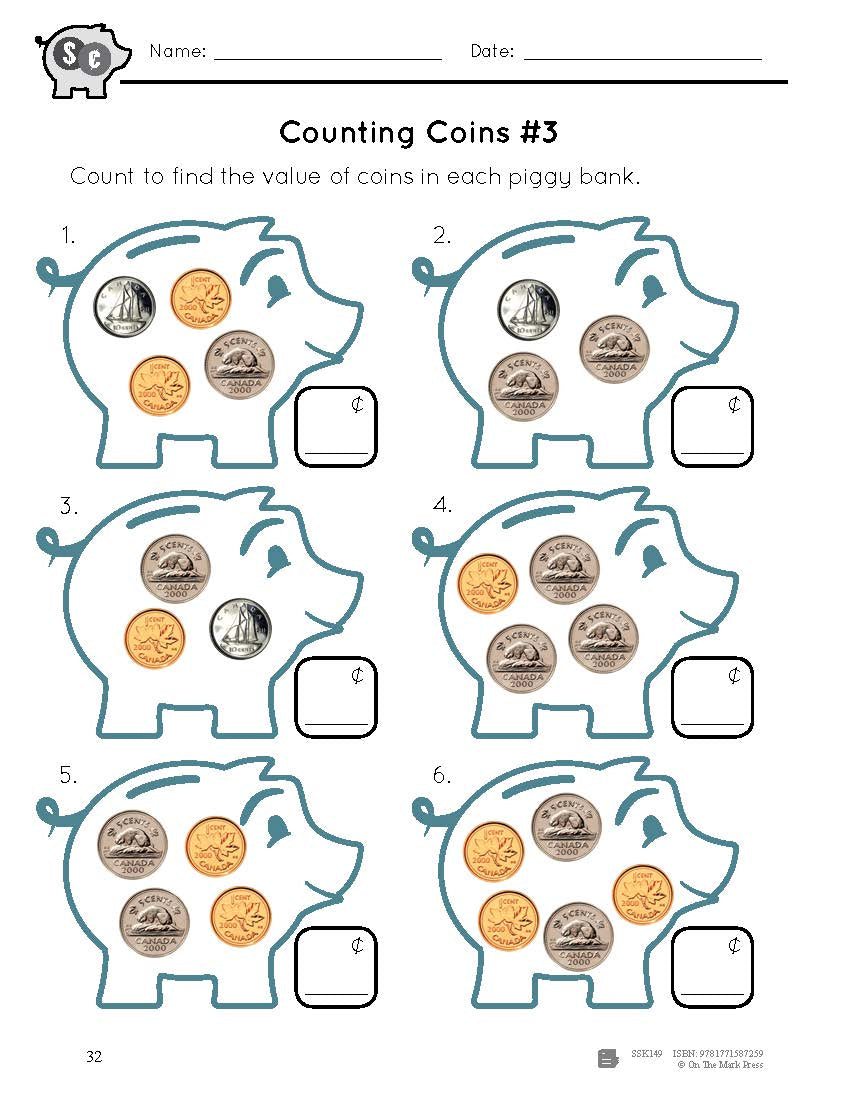
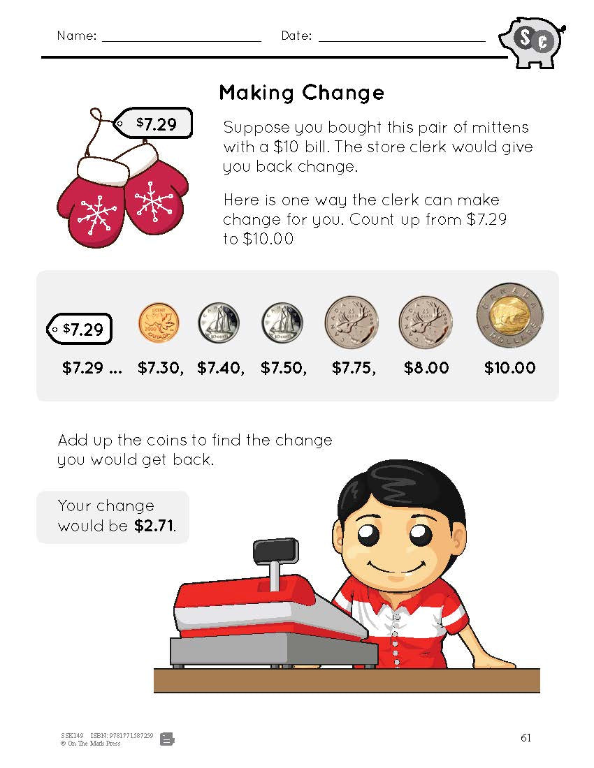
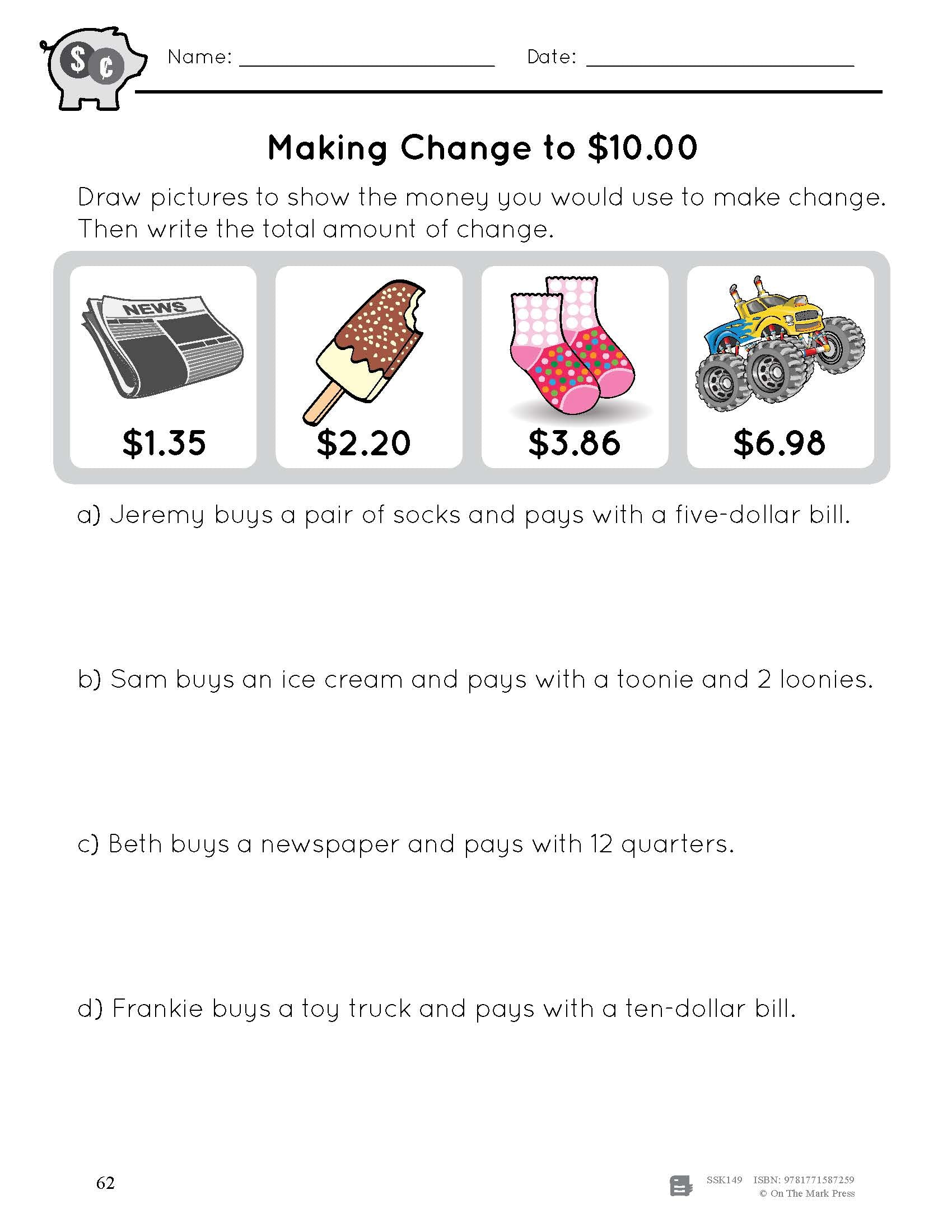
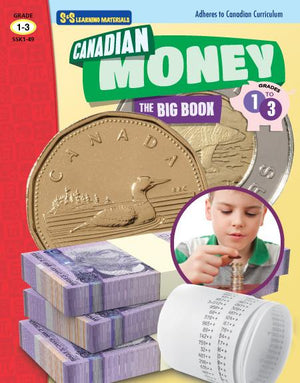

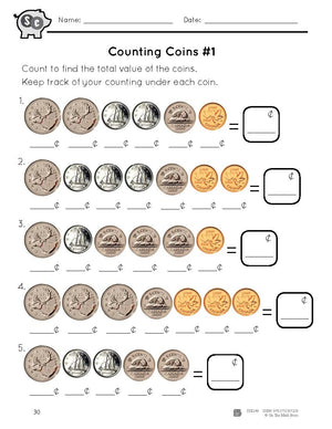


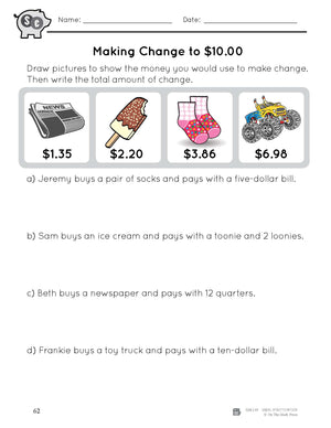
Canadian Money Big Book Grades 1-3
$34.99 CAD
Learning how to count money is an important skill as we need money to buy some of our favourite things!This resource is packed with worksheets and activities that allow students to practice important concepts involving money to meet expectations of...


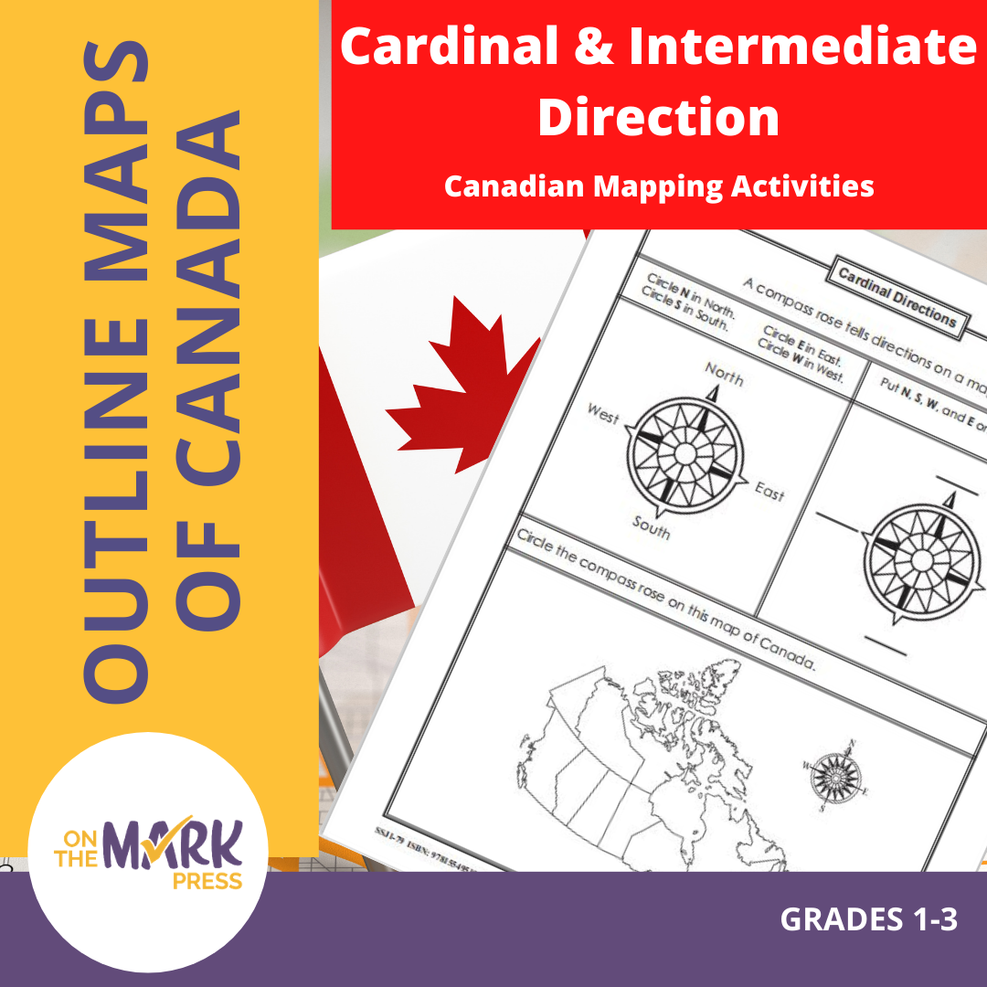

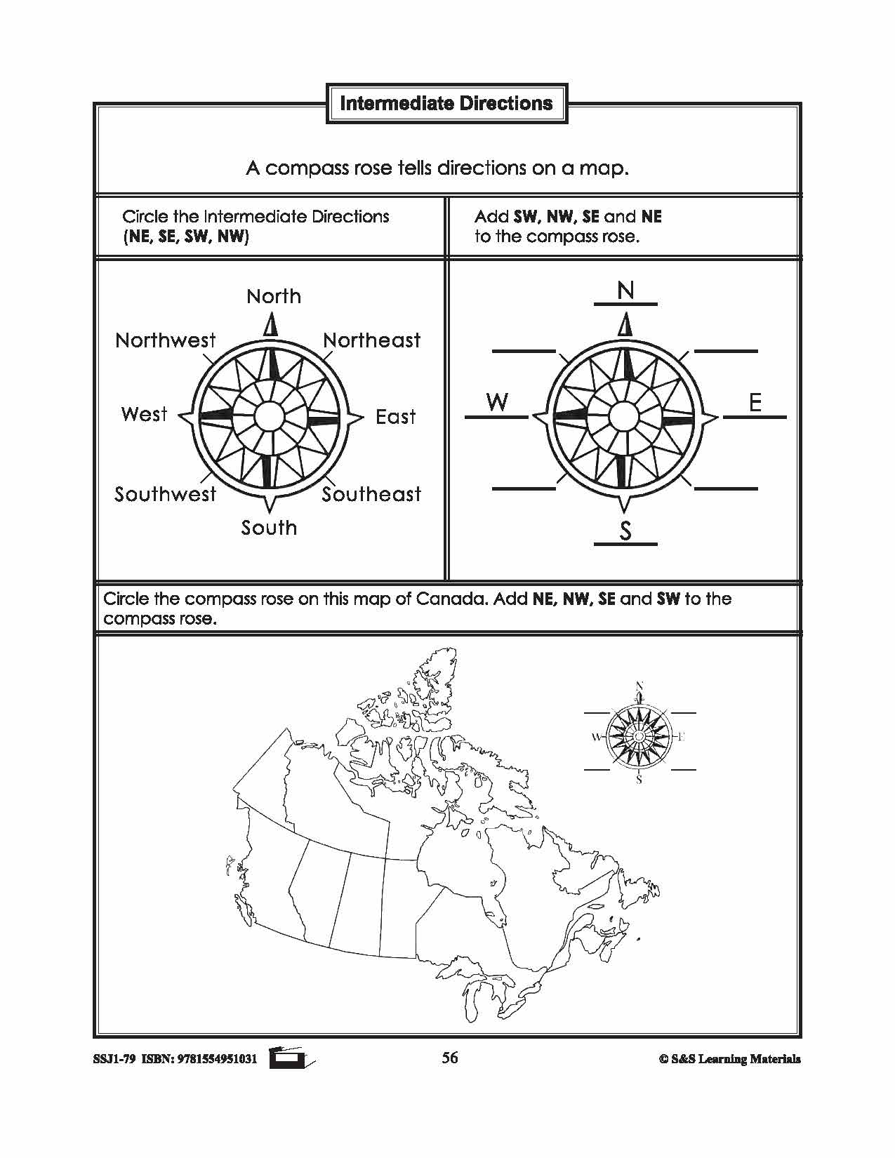

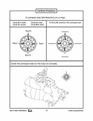

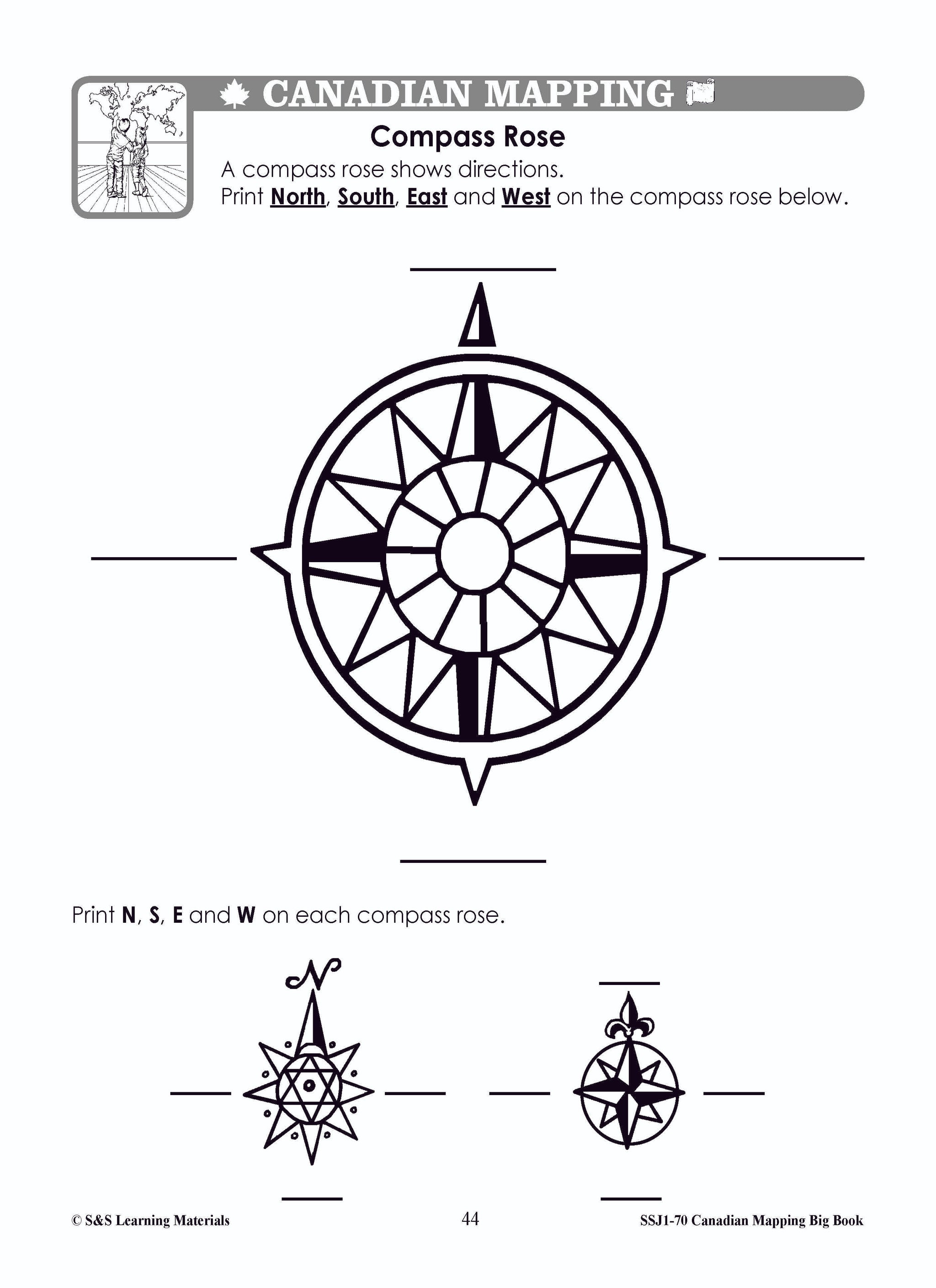
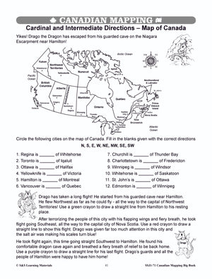
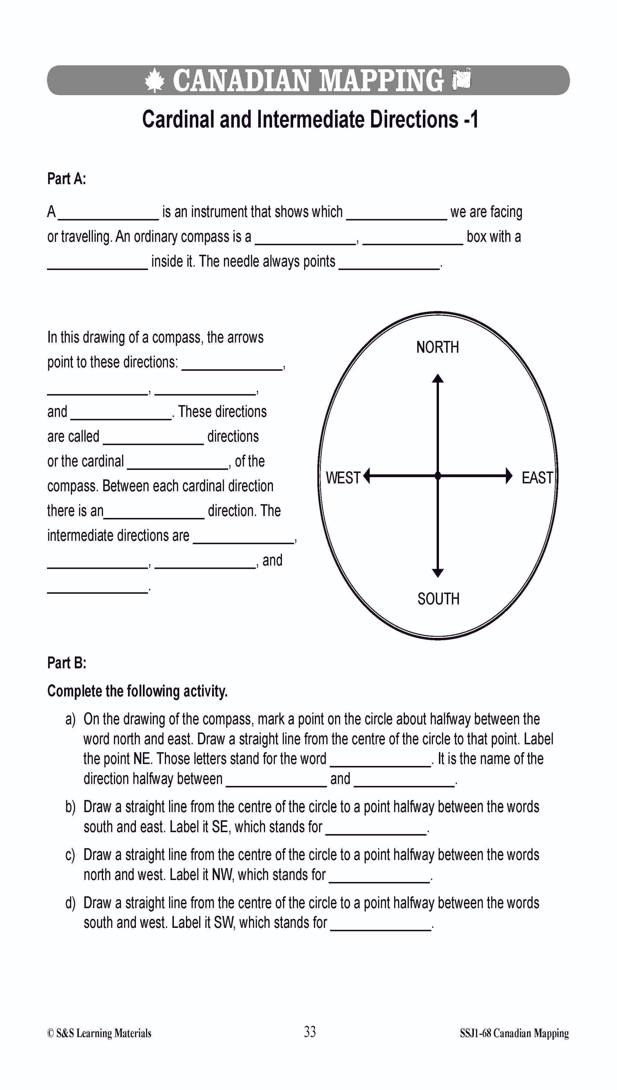
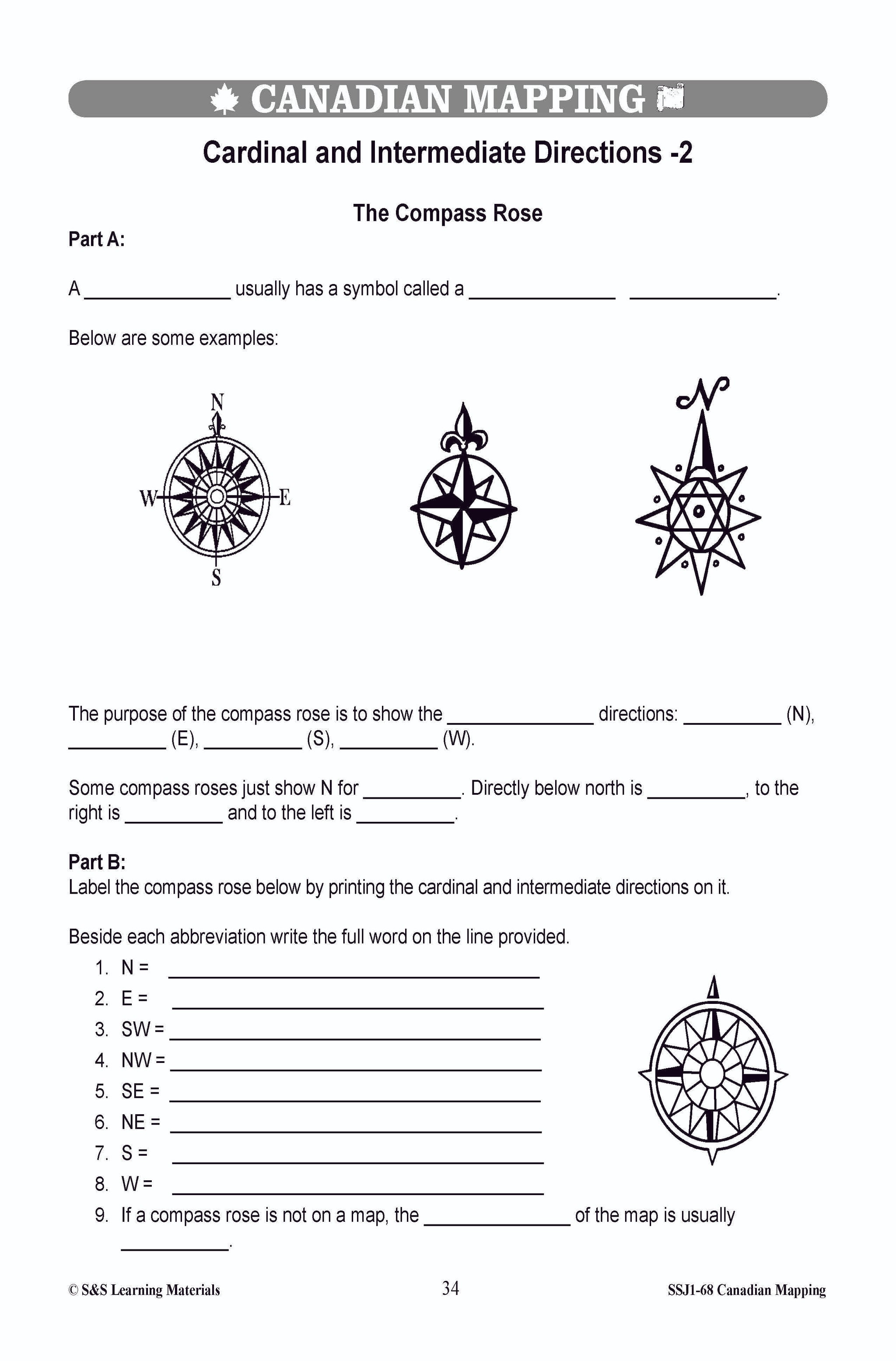
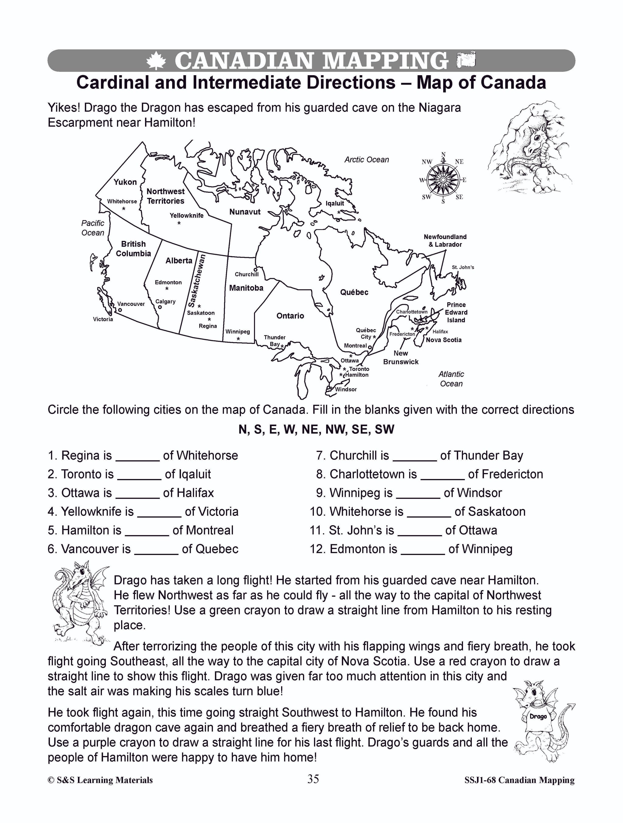
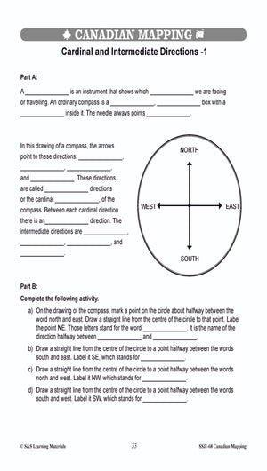
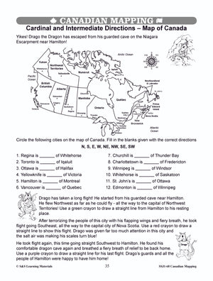
Cardinal and Intermediate Direction Canadian Mapping Activities Gr. 1-3
$2.95 CAD
This package includes one activity for both cardinal and intermediate direction mapping skills. Each worksheet has three exercises for students to practice identifying cardinal or intermediate direction. 2 pages


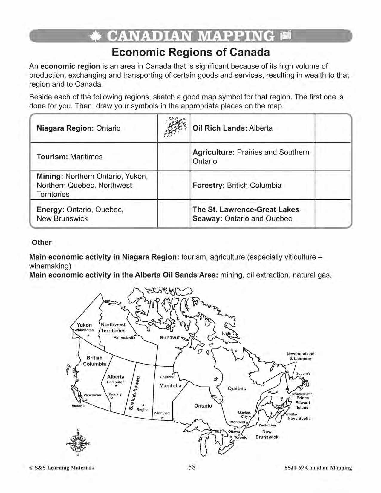
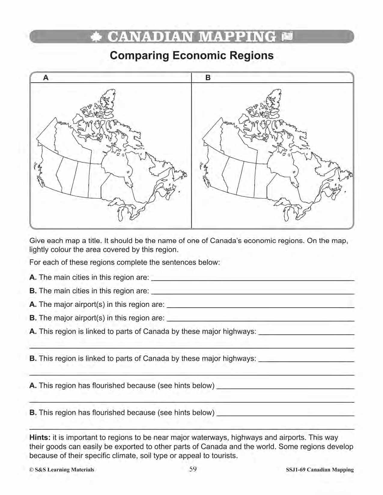

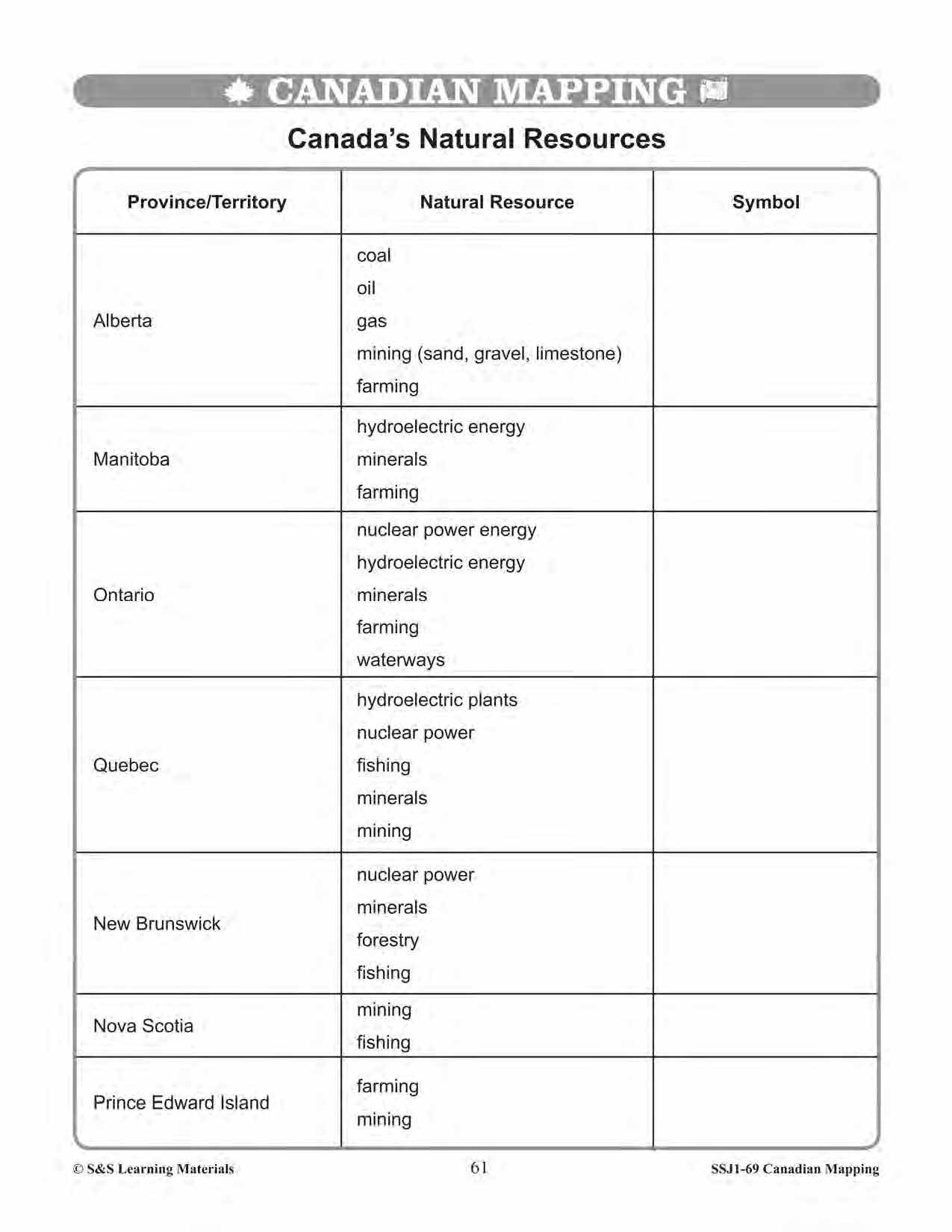
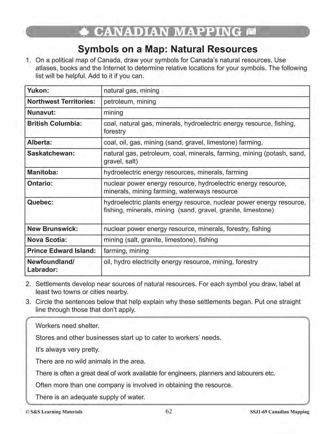
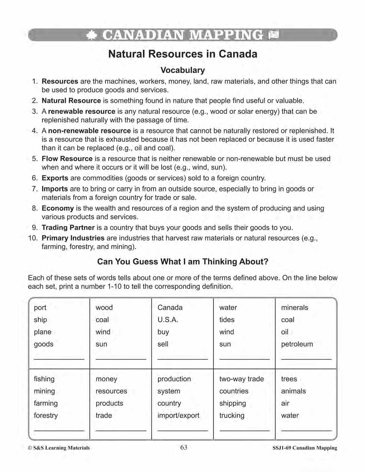


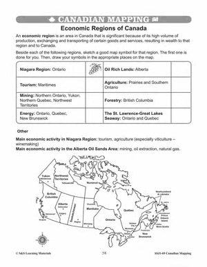
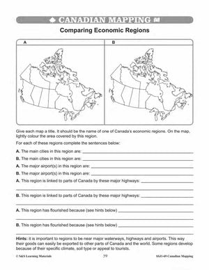
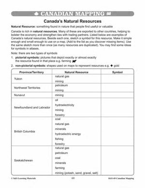
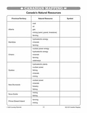


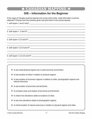
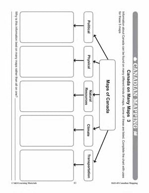
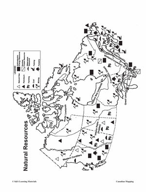
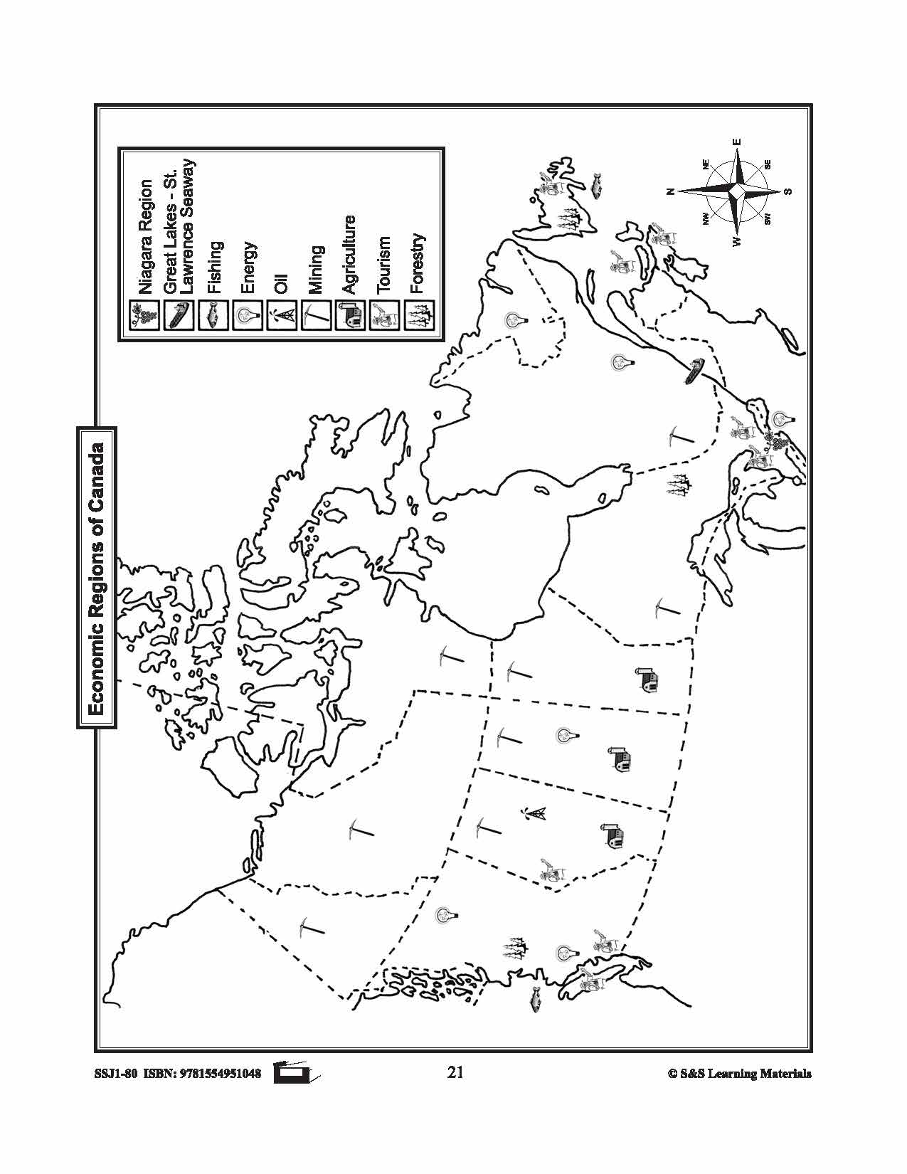
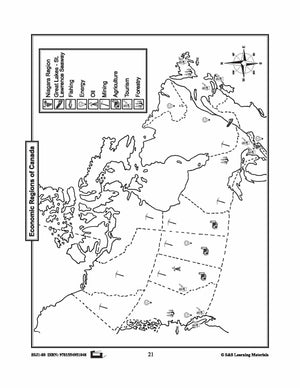
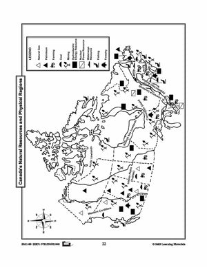
Economic Regions & Natural Resources in Canada Mapping Worksheets Grades 5-6
$7.45 CAD
Students will learn about Canada's economic regions and natural resources while completing the nine worksheets. Teacher information on these topics: what a map is, types of maps, how to read a map, map indexes, scale, and geographic grids, hemispheres, directional...
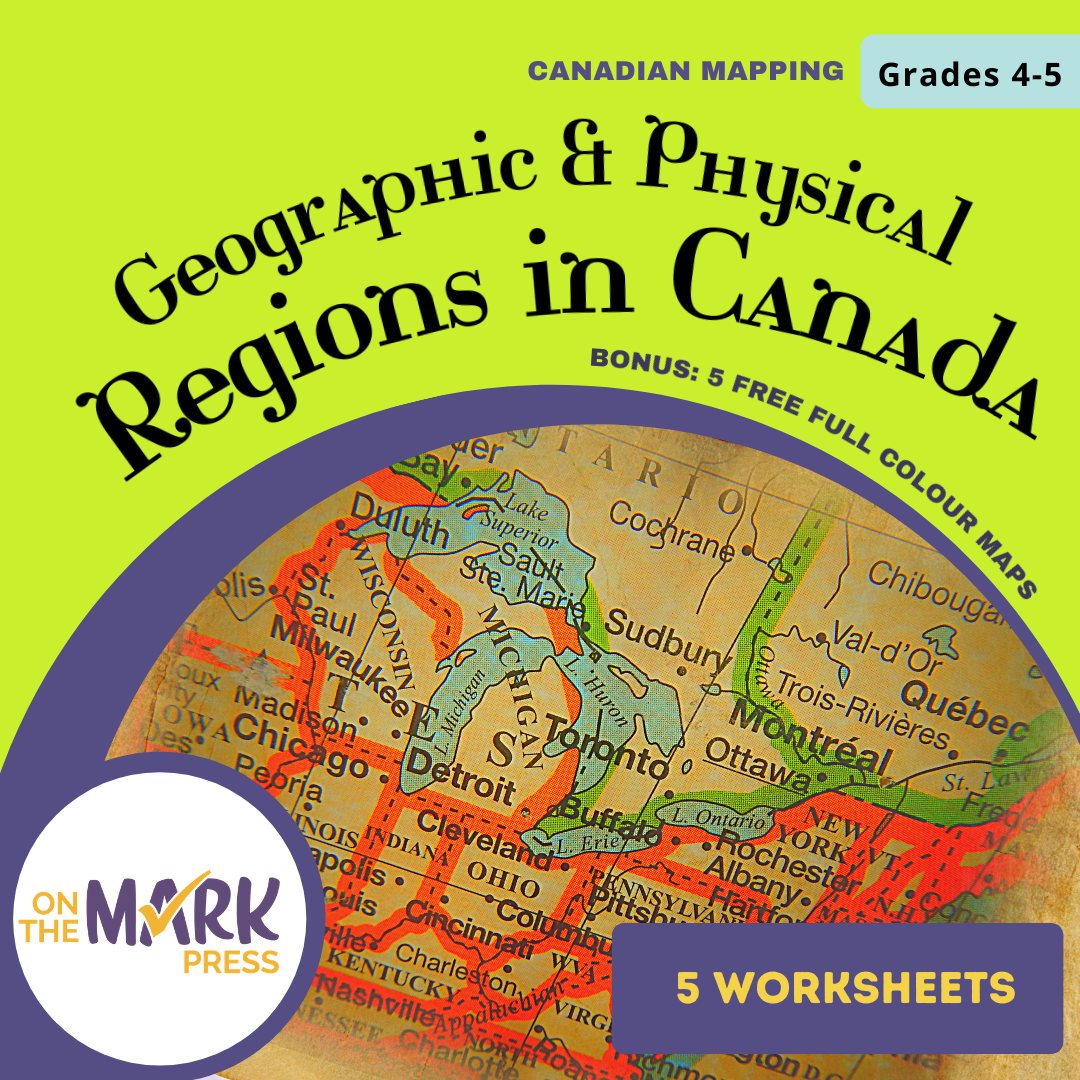


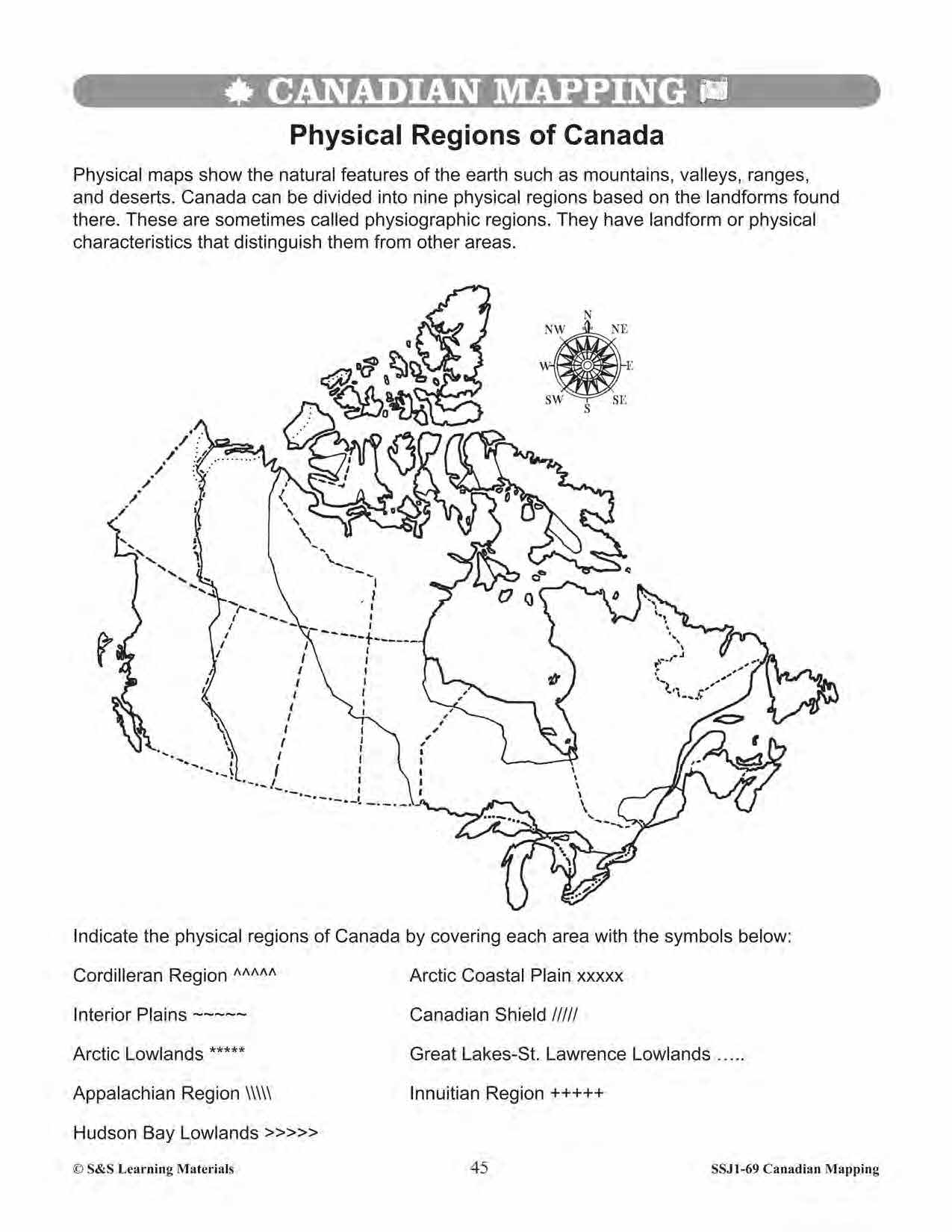
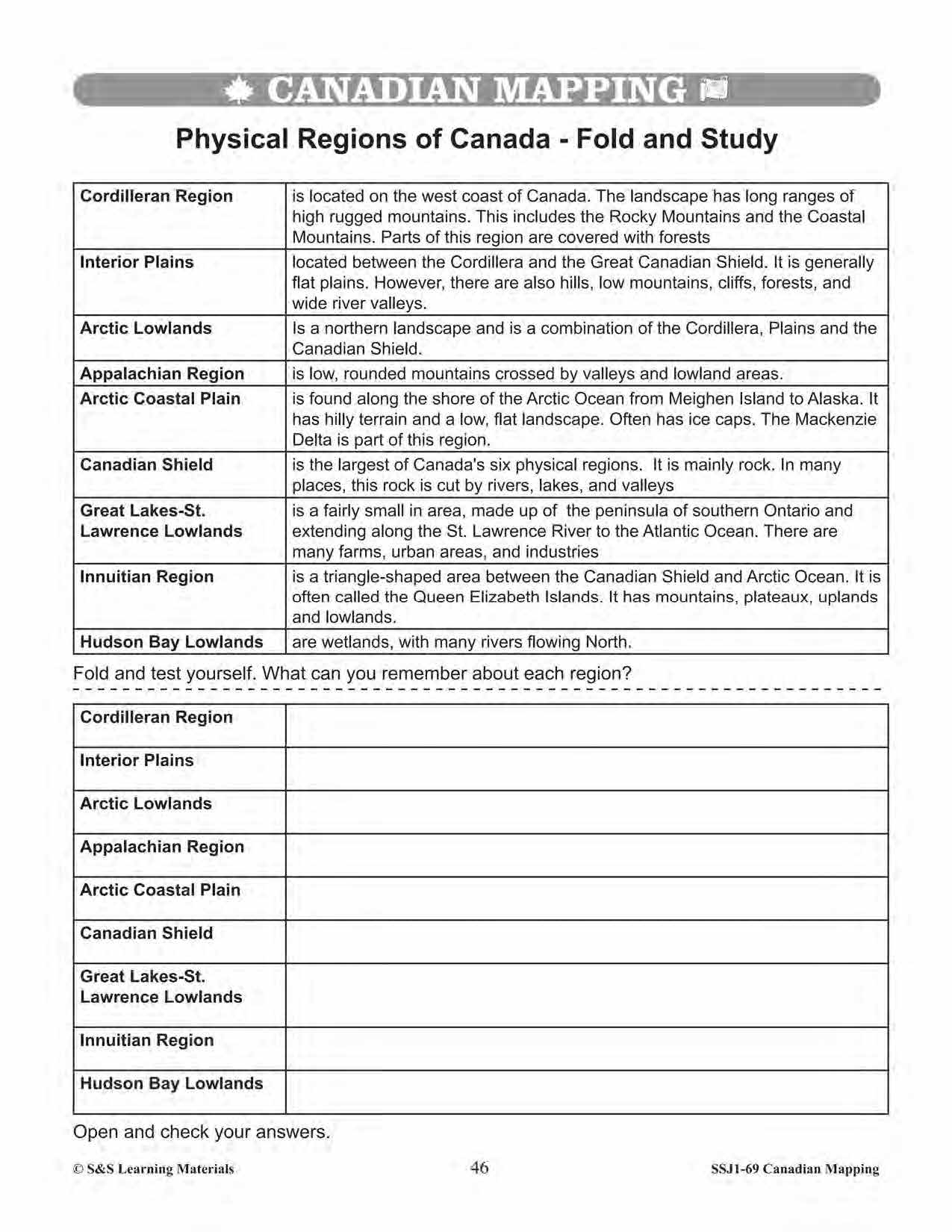
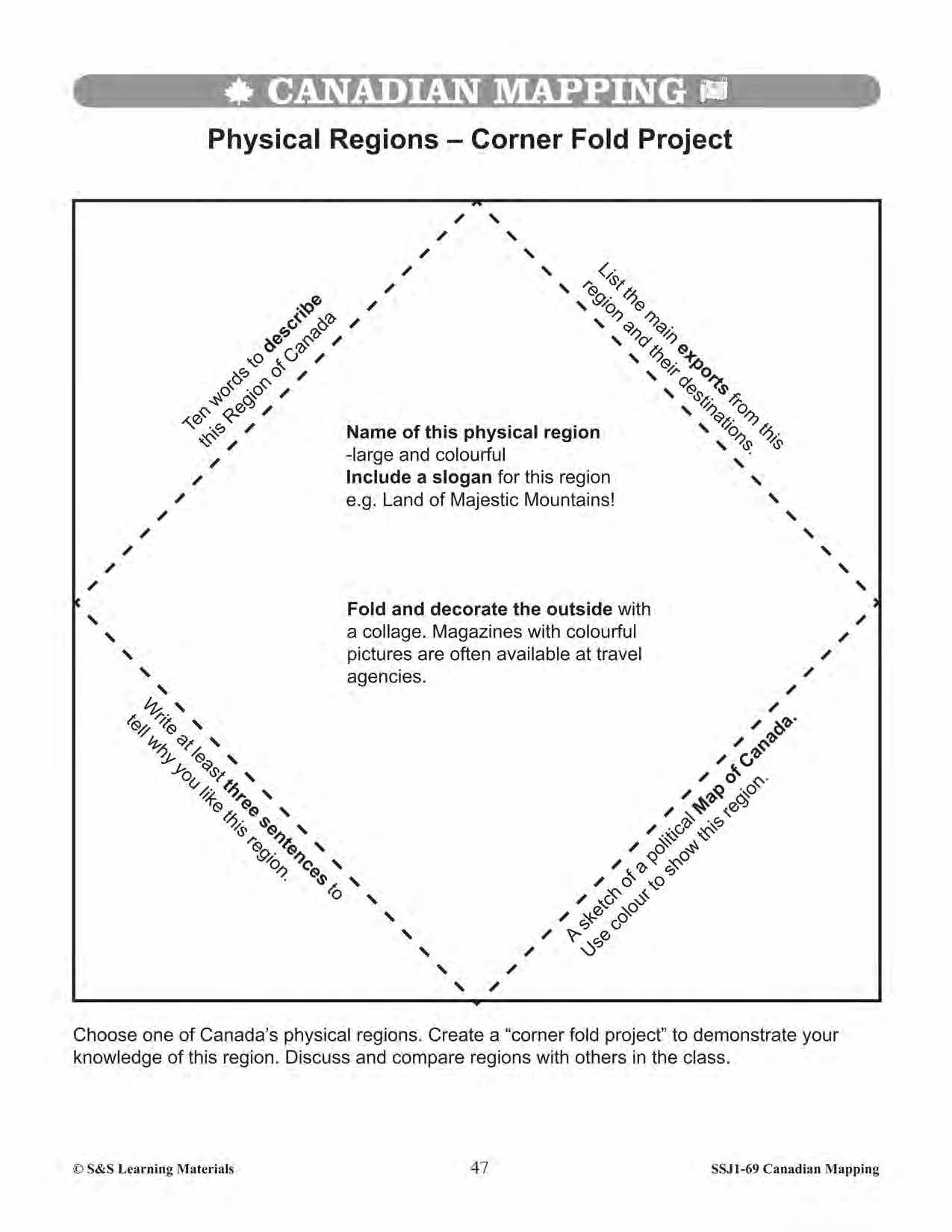
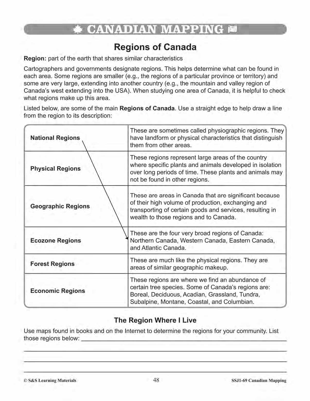


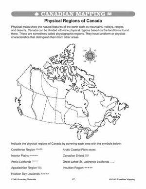
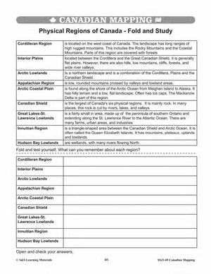
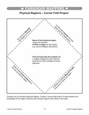
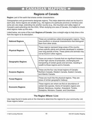


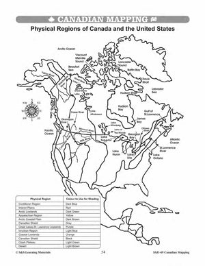
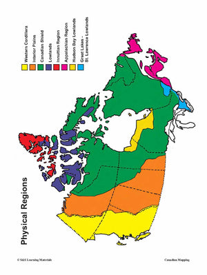
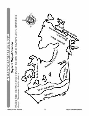
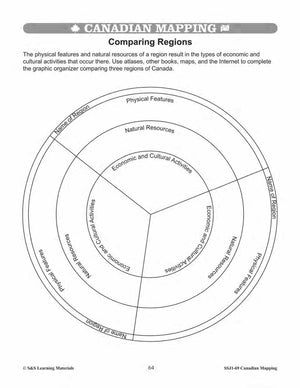
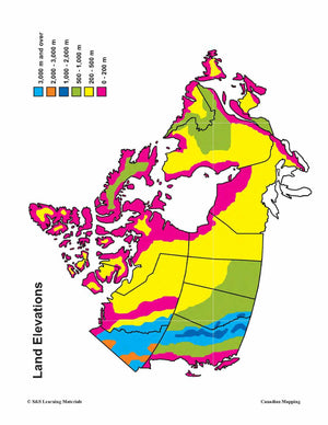
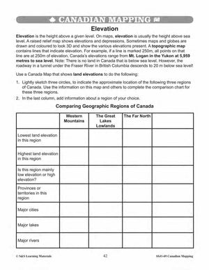
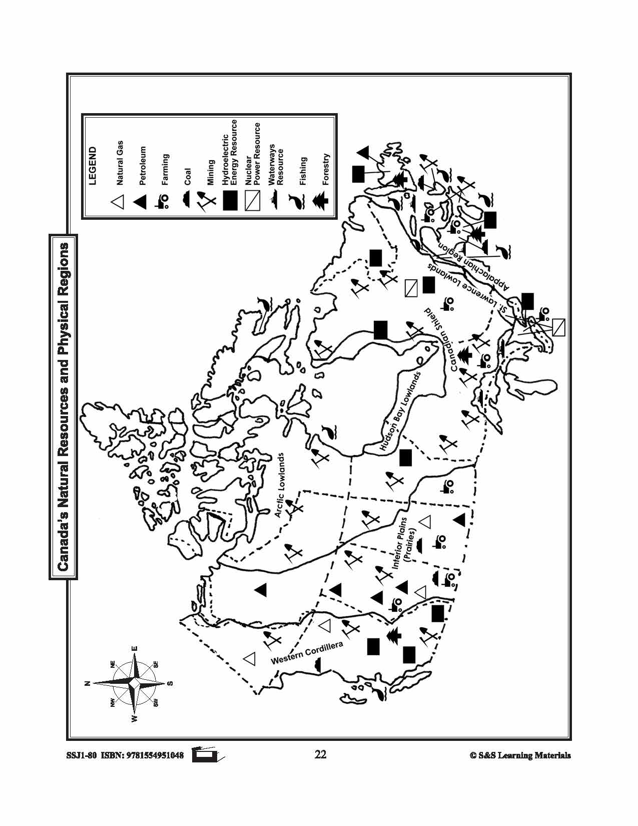
Geographic & Physical Regions in Canada Worksheets Grades 5-6
$7.45 CAD
Students will learn about geographic and physical regions in Canada while completing the five worksheets. Teacher information on these topics: what a map is, types of maps, how to read a map, map indexes, scale, and geographic grids, hemispheres, directional...

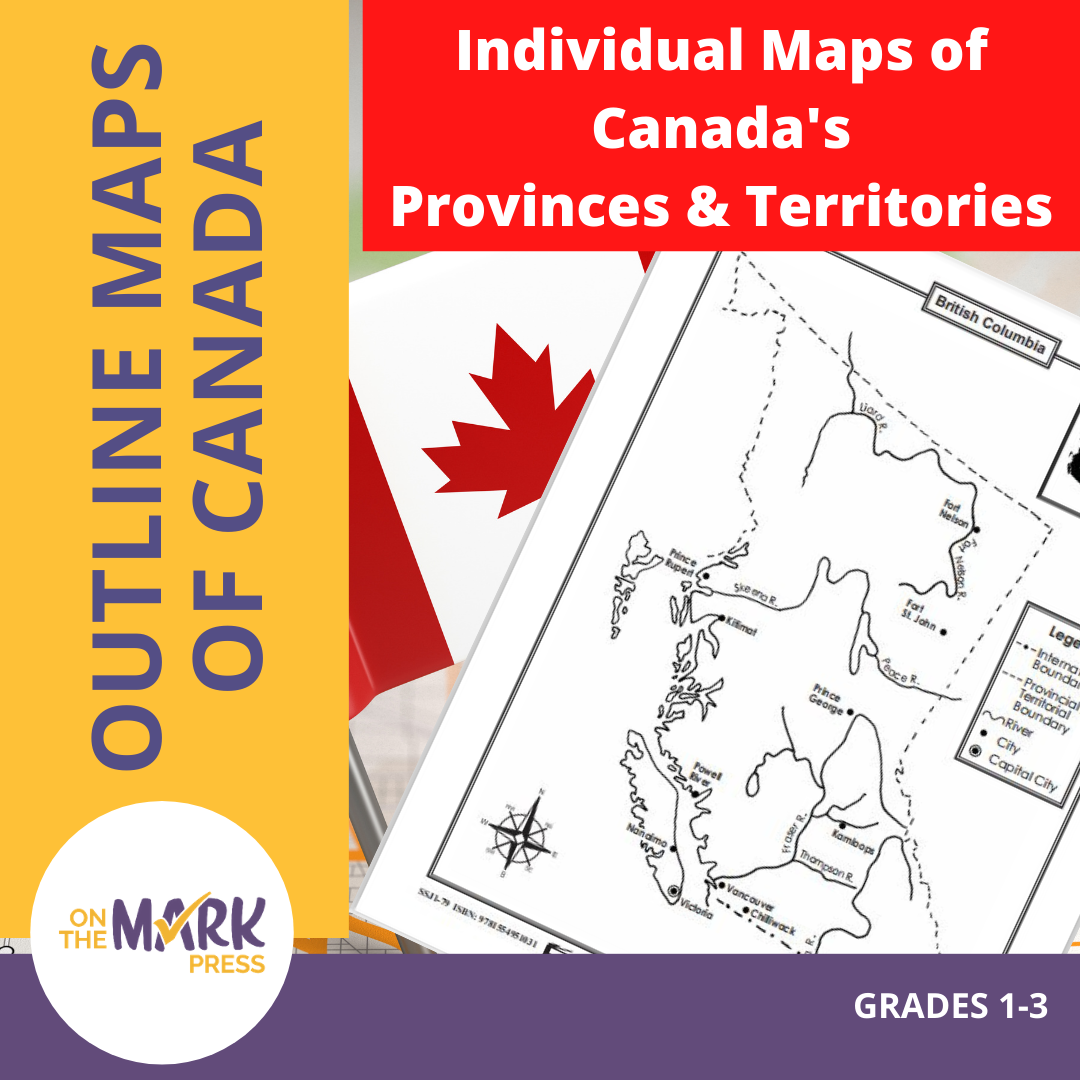


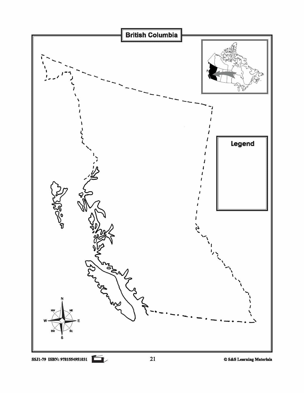
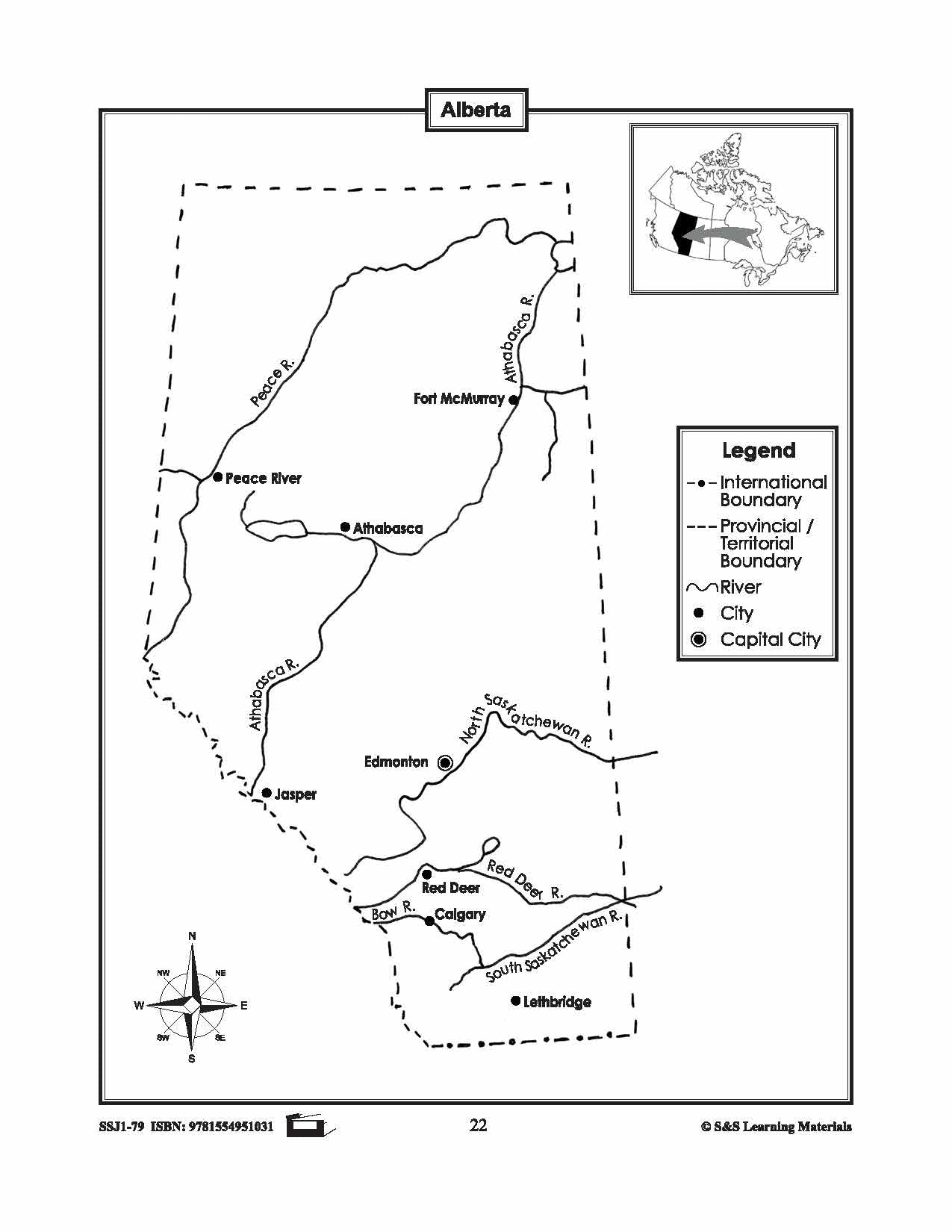
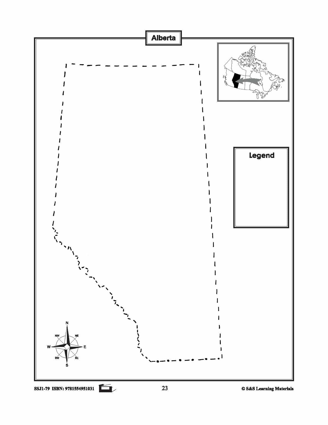


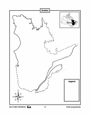


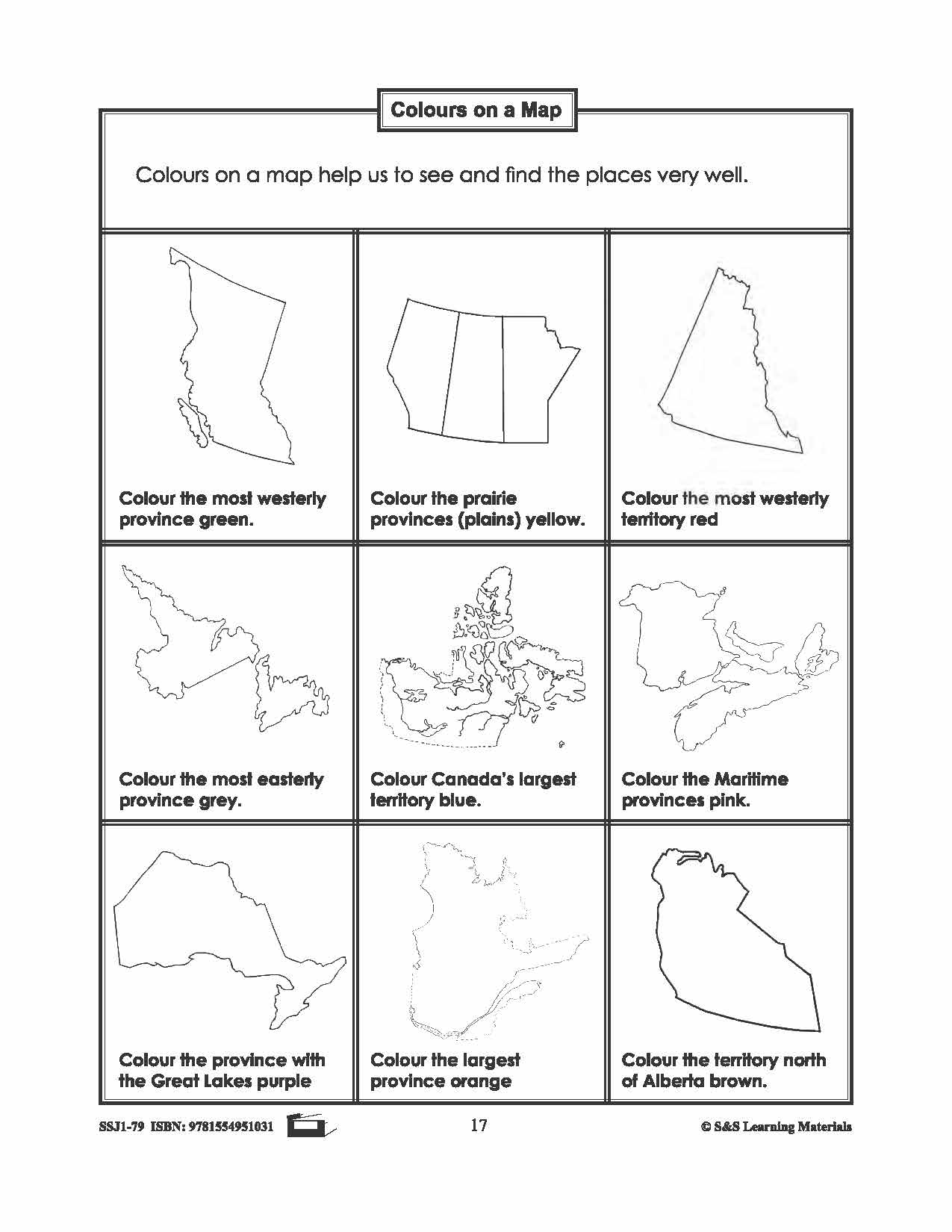
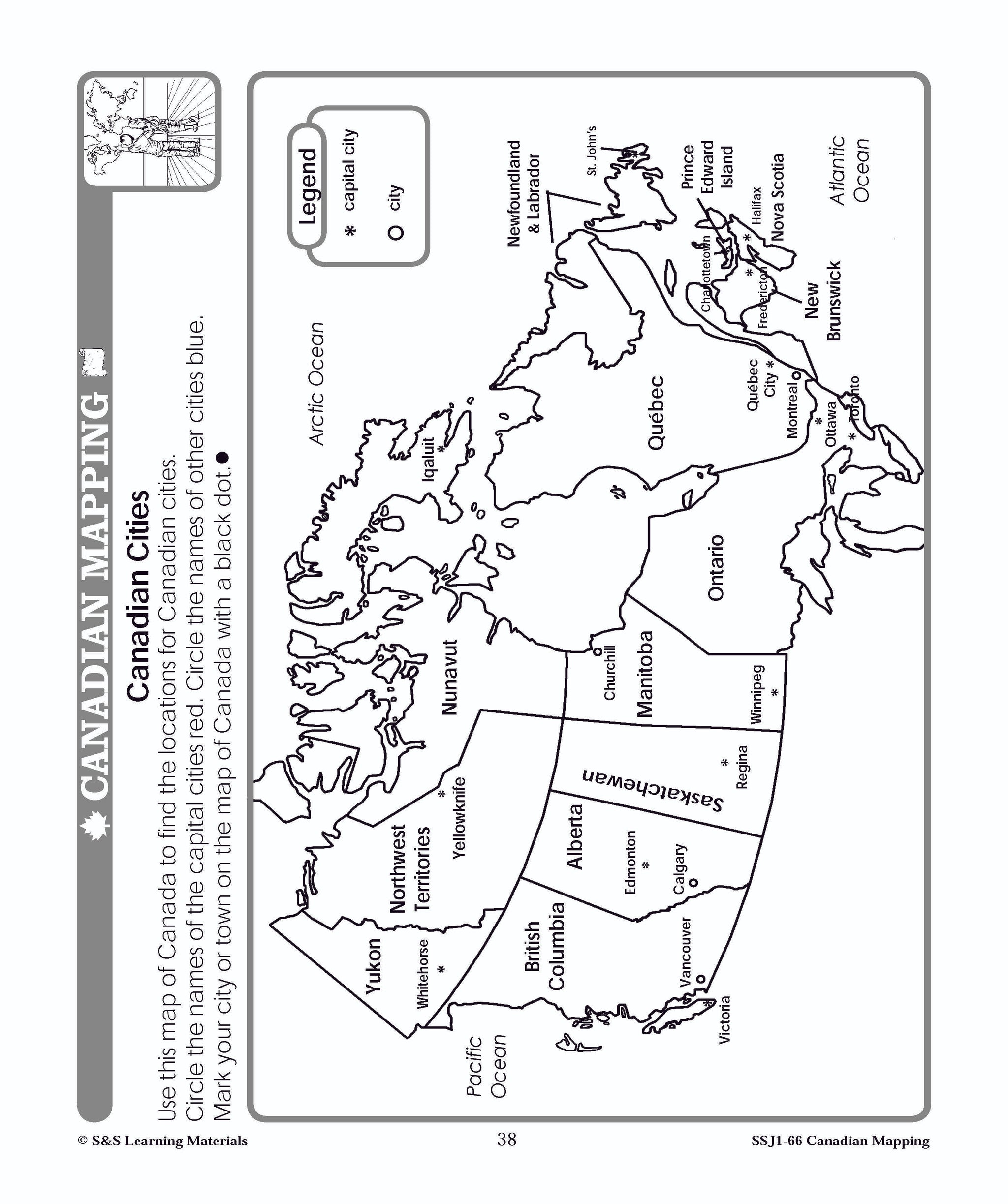
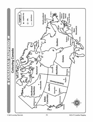
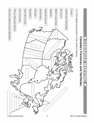
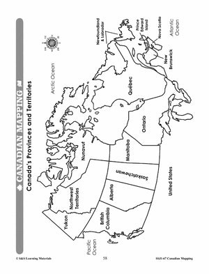
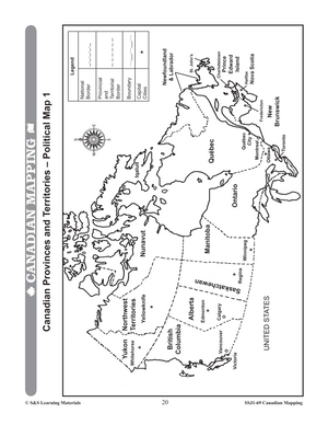
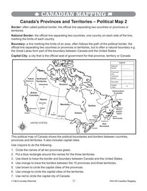
Individual Maps of Canada's Provinces & Territories Grades 1-3
$6.45 CAD
This package includes two maps for each province and territory in Canada. The first map supplies locations for major cities and rivers. The second map is blank and could be used for a variety of purposes from locating and labeling...


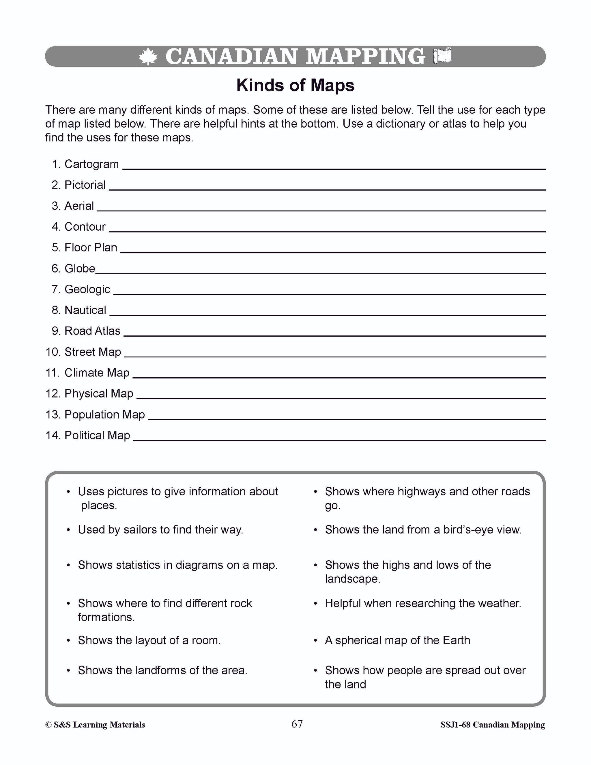

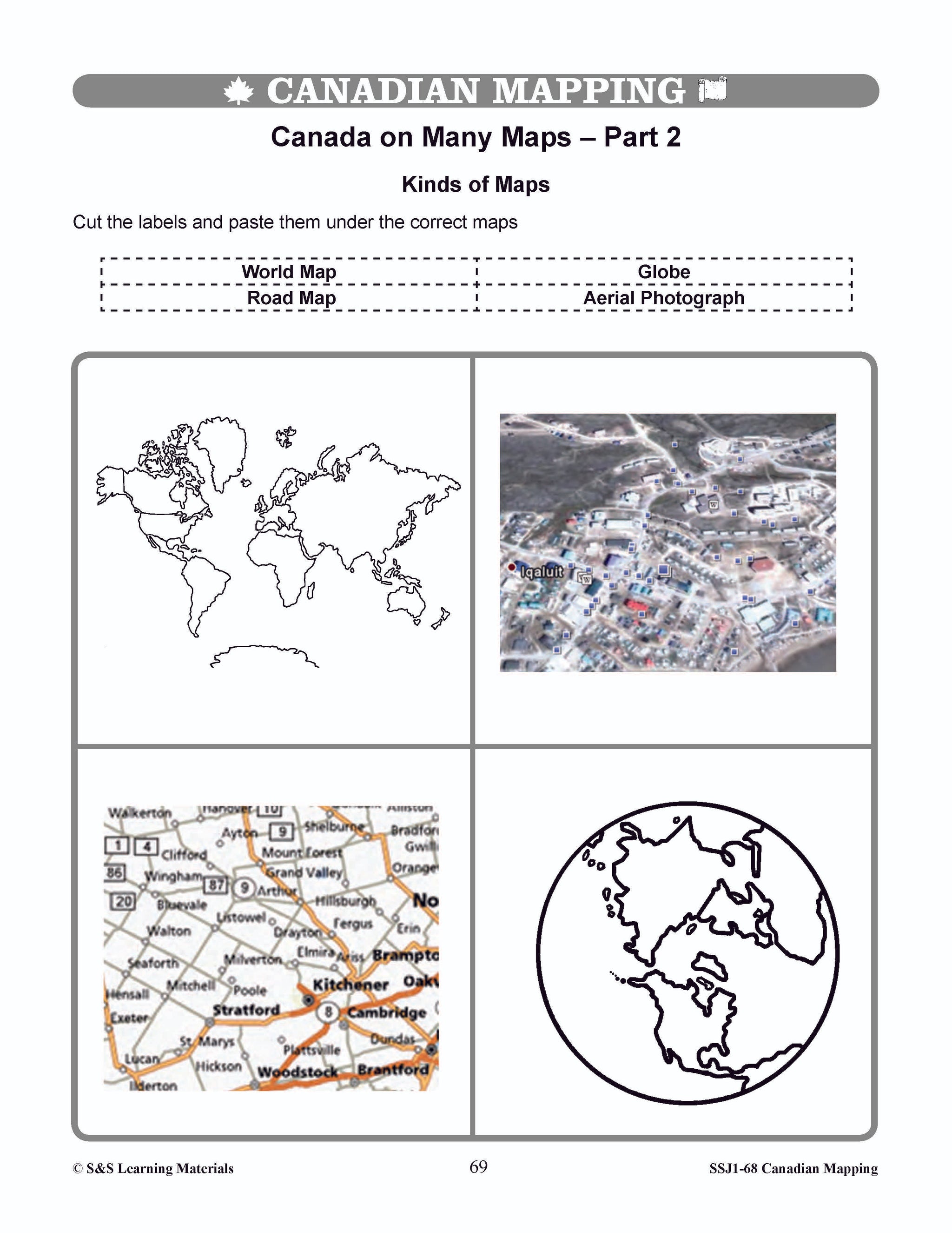


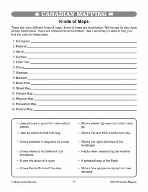
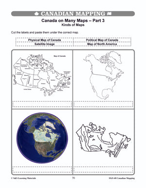


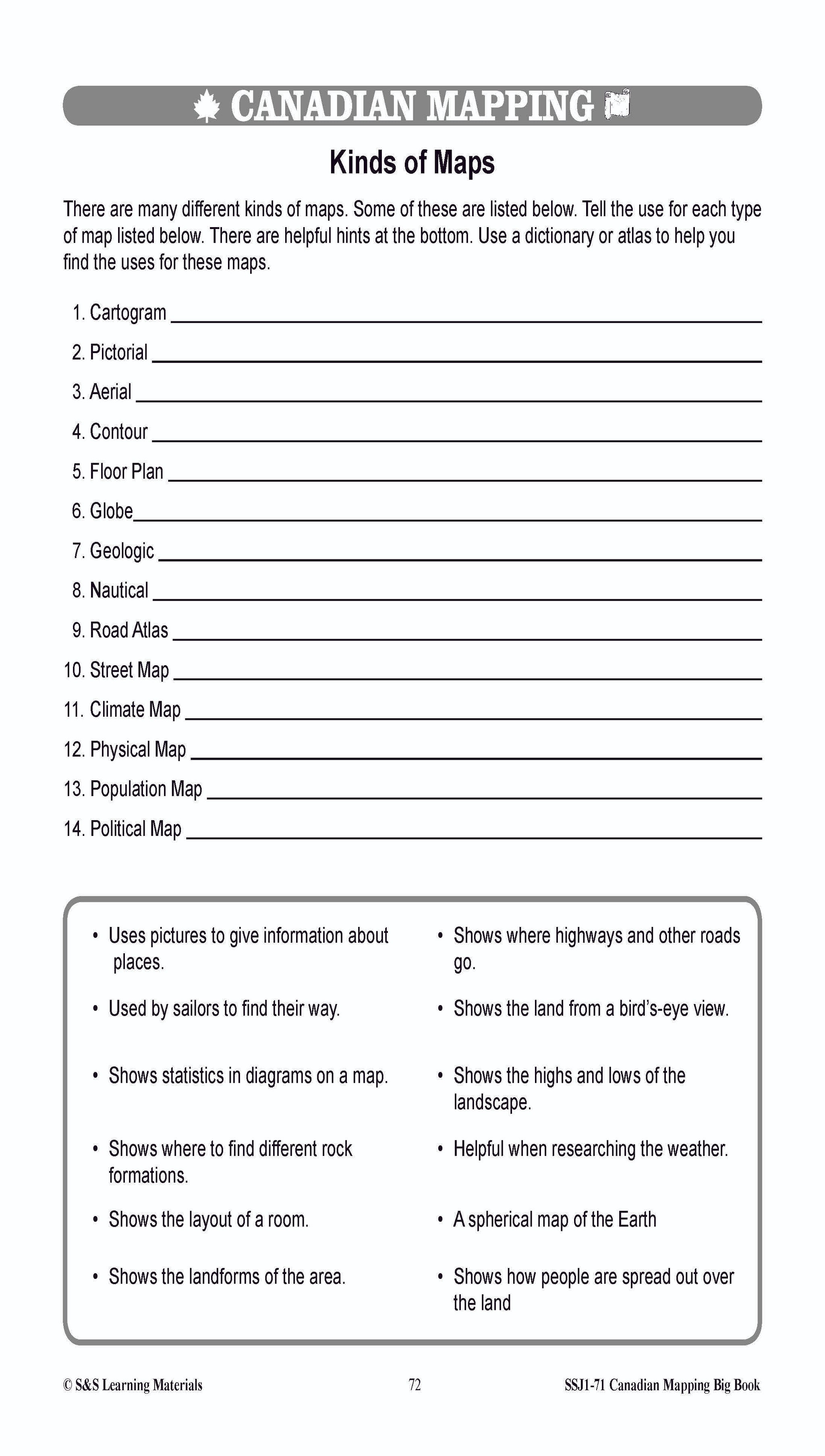
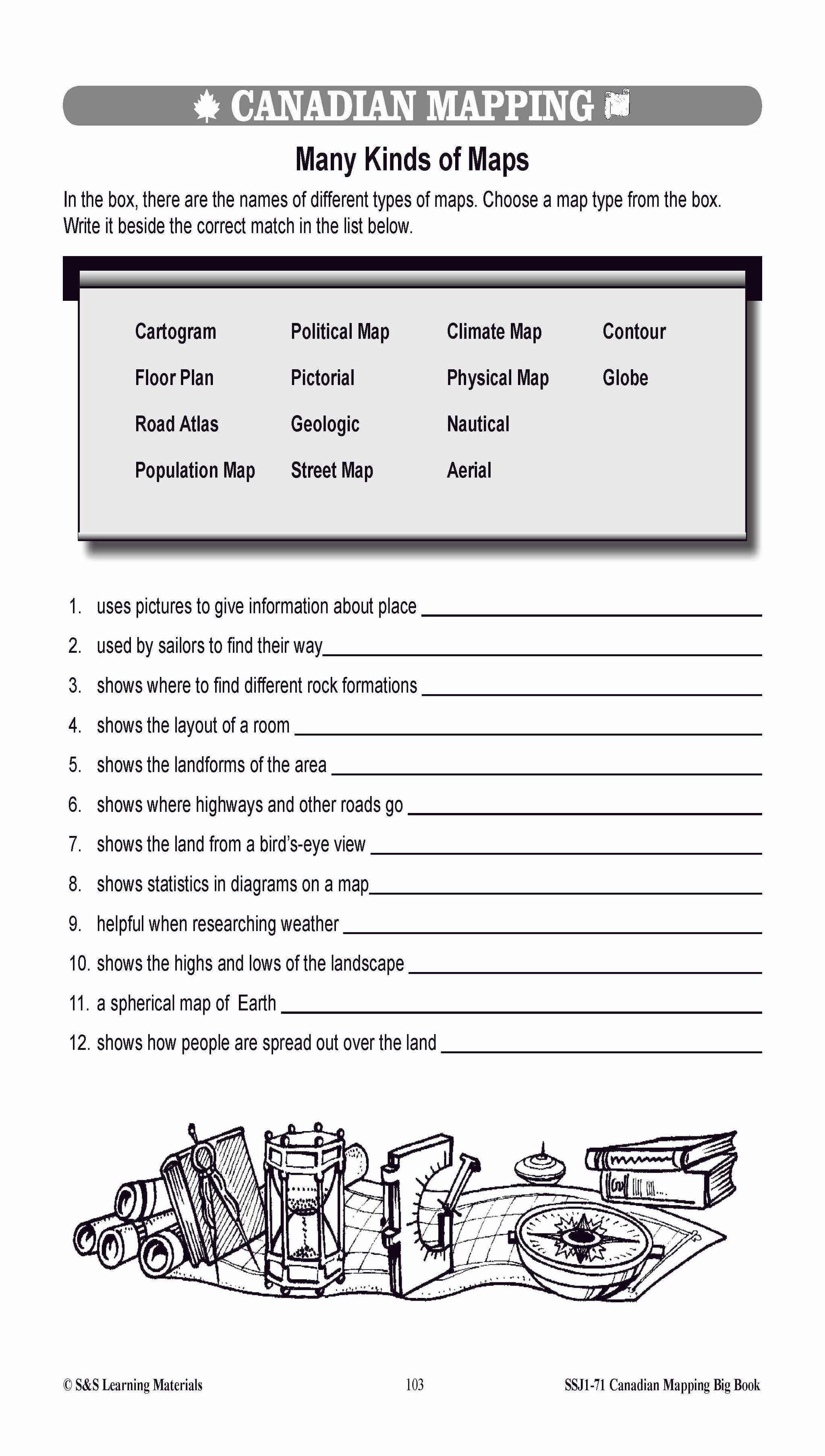
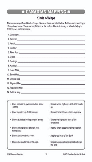
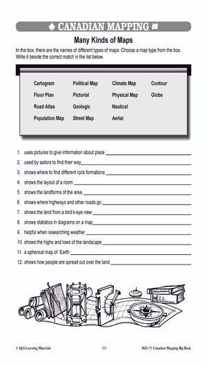
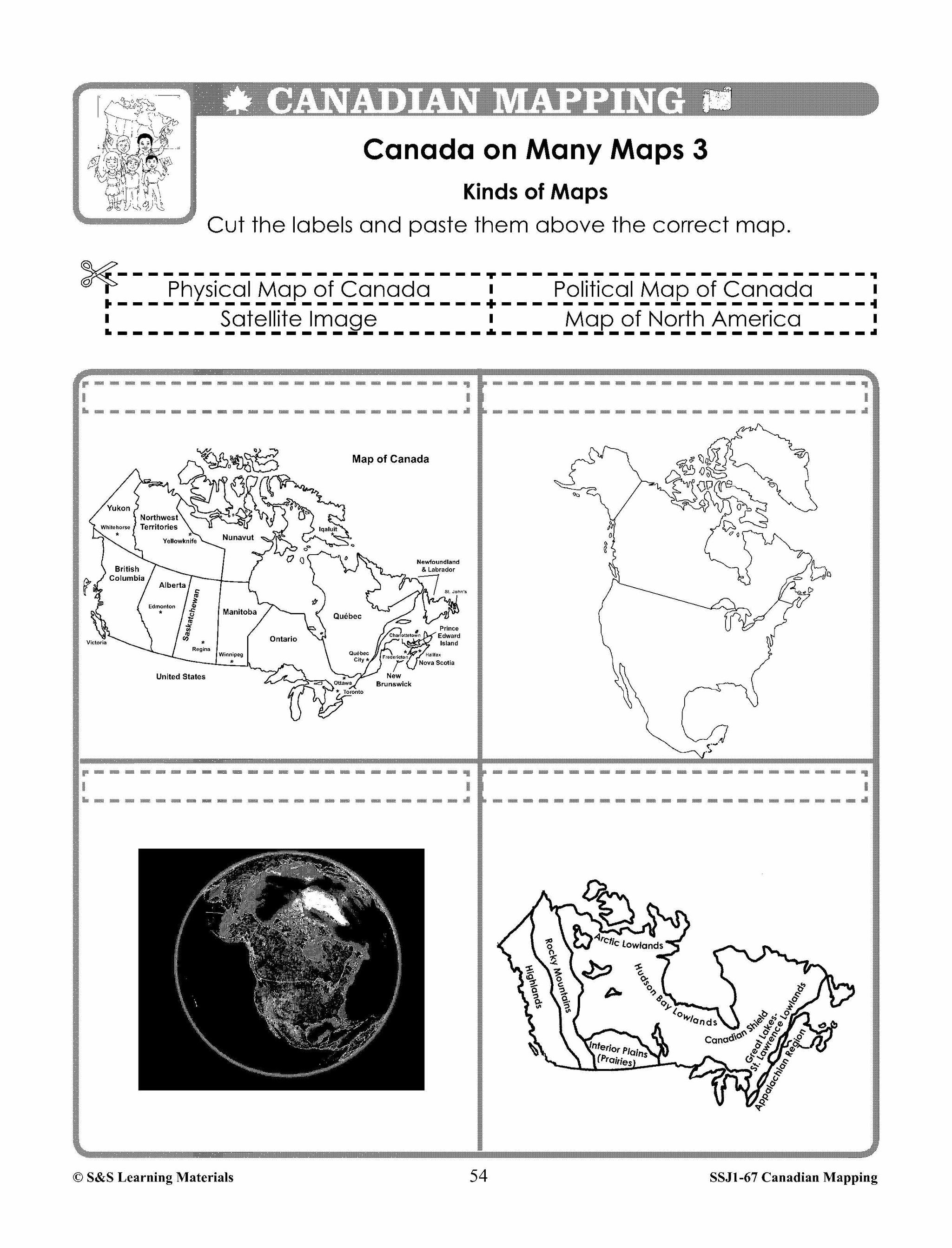
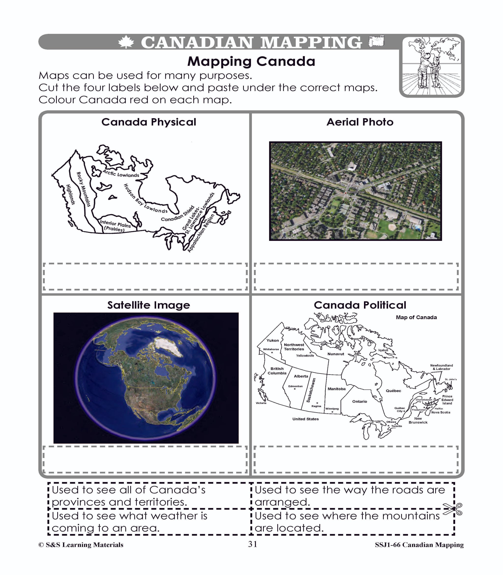
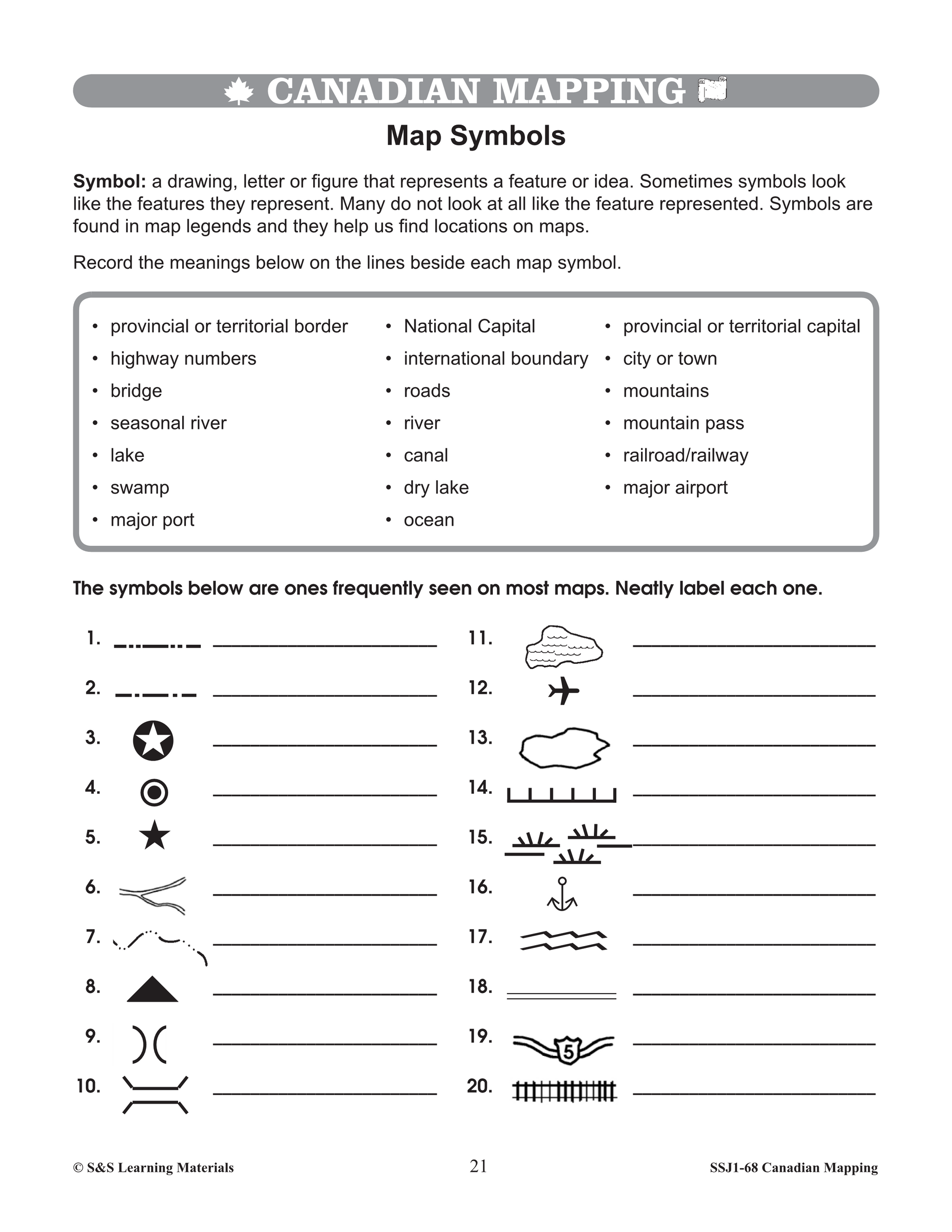
Kinds of Maps Worksheets Grades 4-5
$6.45 CAD
Students will learn about the different kinds of maps with these four worksheets. Teacher information on these topics: what a map is, types of maps, how to read a map, map indexes, scale, and geographic grids, hemispheres, directional indicators, and...


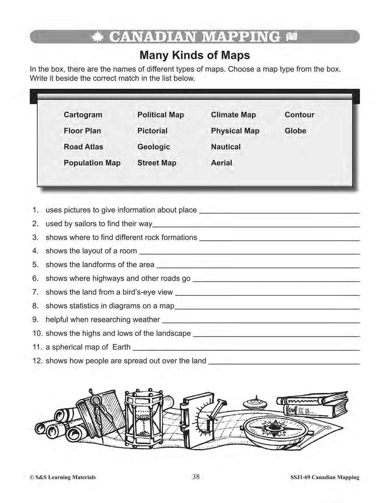


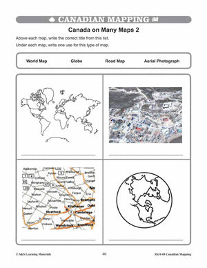


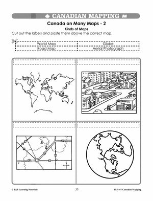
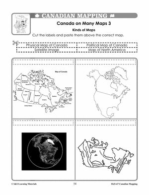
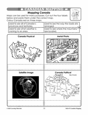
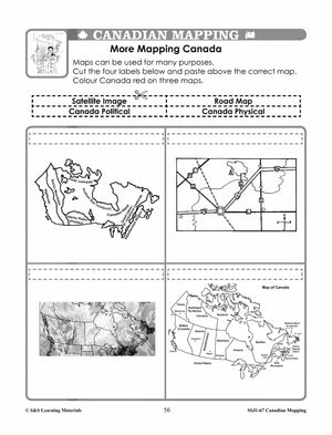
Kinds of Maps Worksheets Grades 5-6
$6.95 CAD
Students will learn about the different kinds of maps with the five worksheets in this lesson. Teacher information on these topics: what a map is, types of maps, how to read a map, map indexes, scale, and geographic grids, hemispheres,...


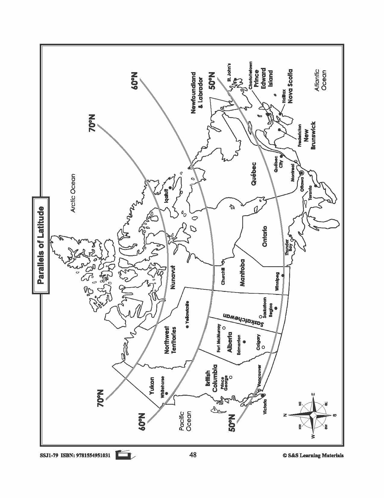
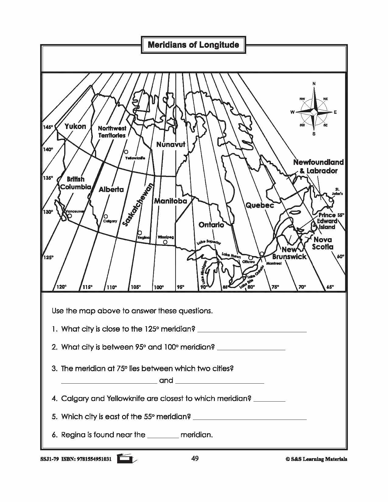
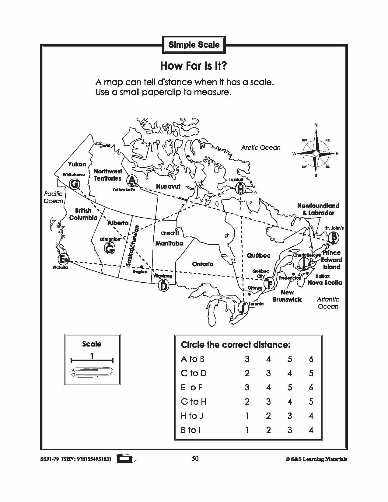
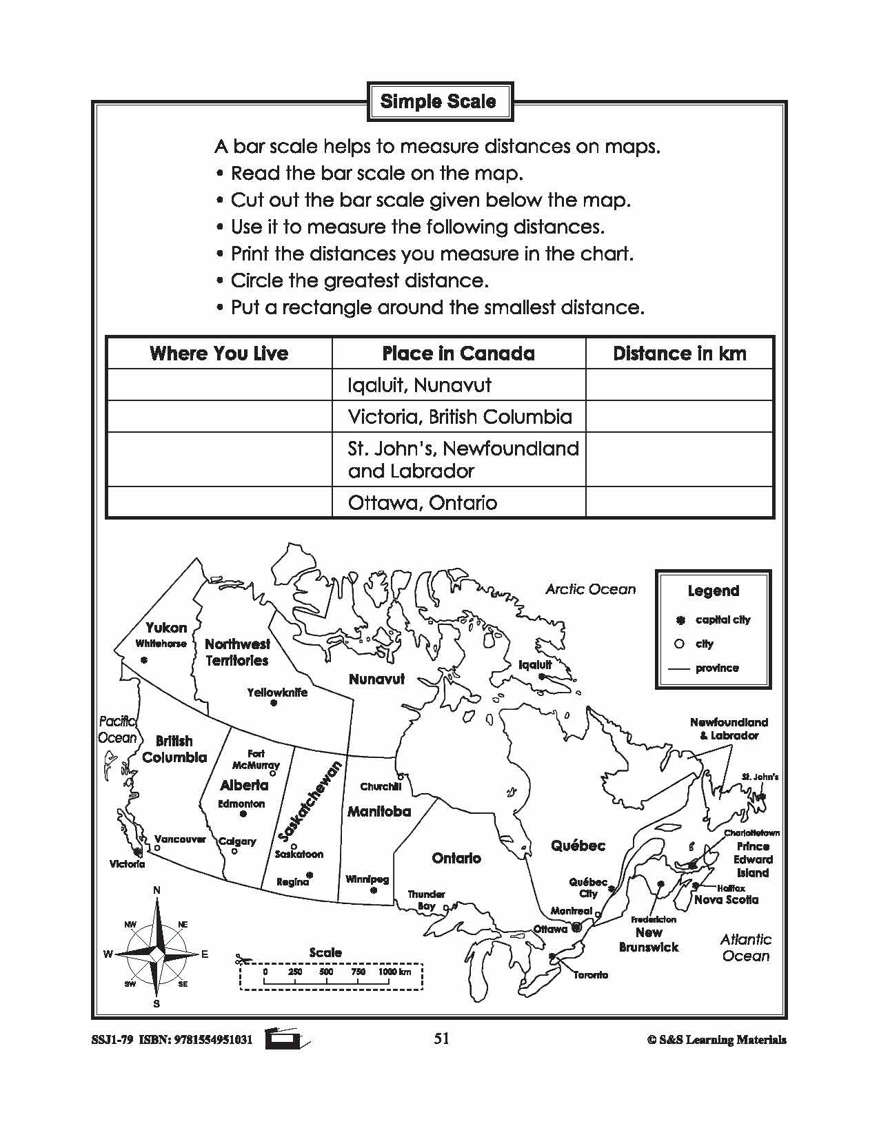
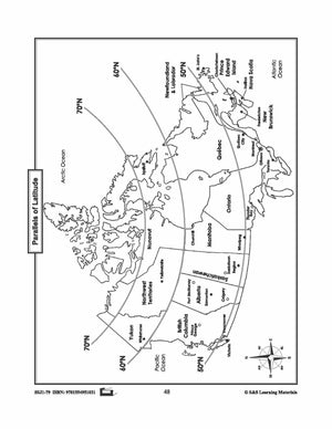
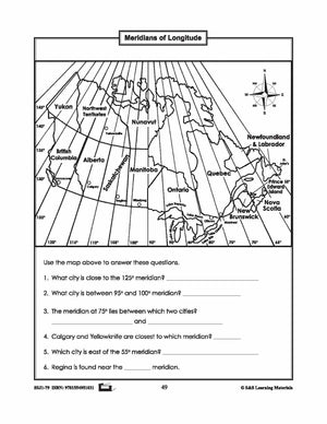

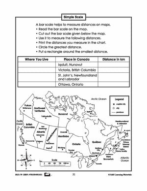
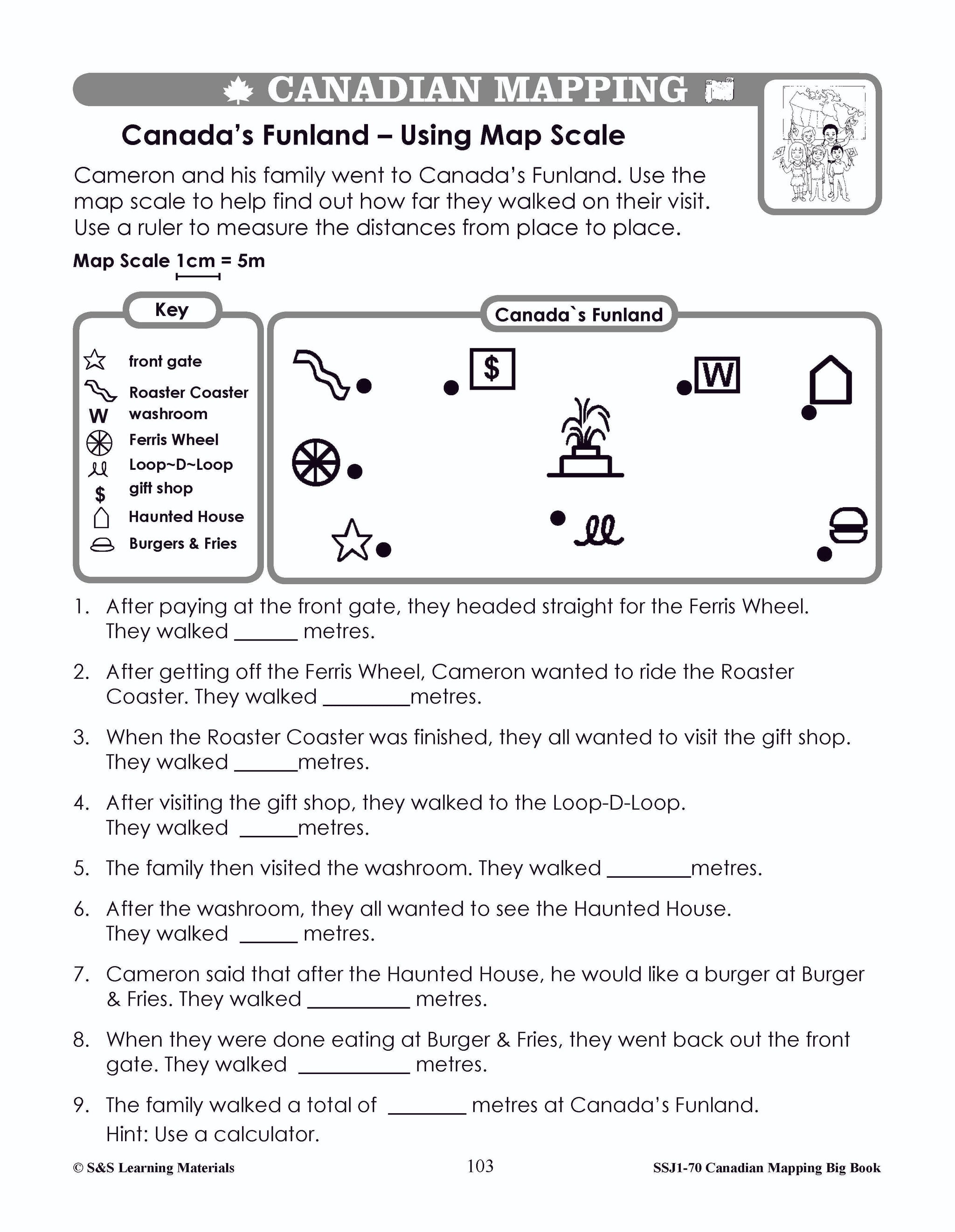
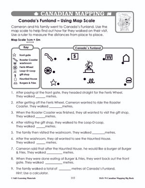
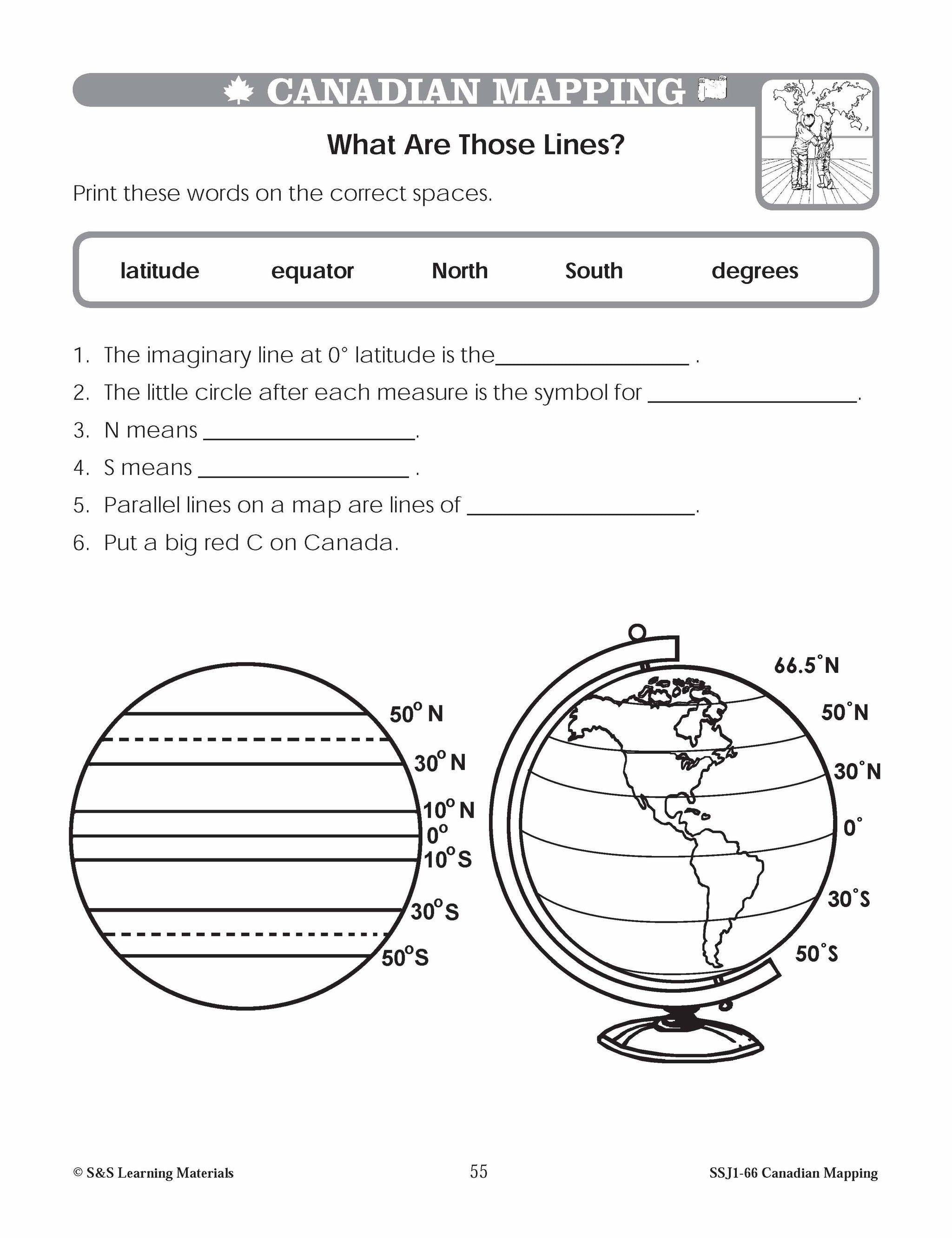
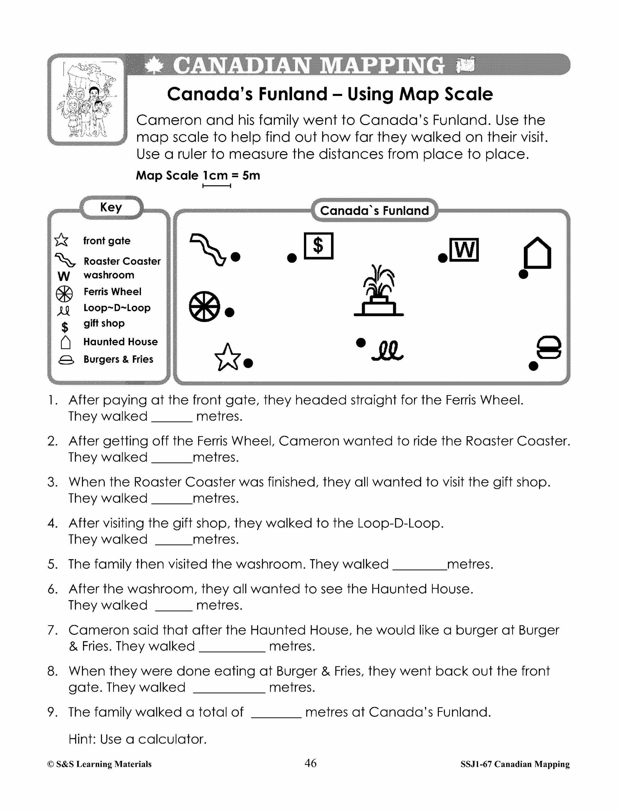
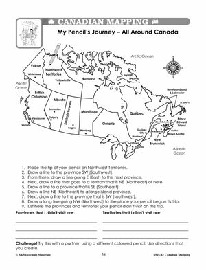
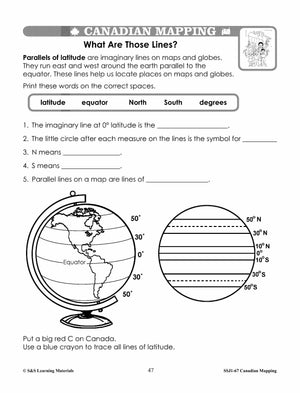
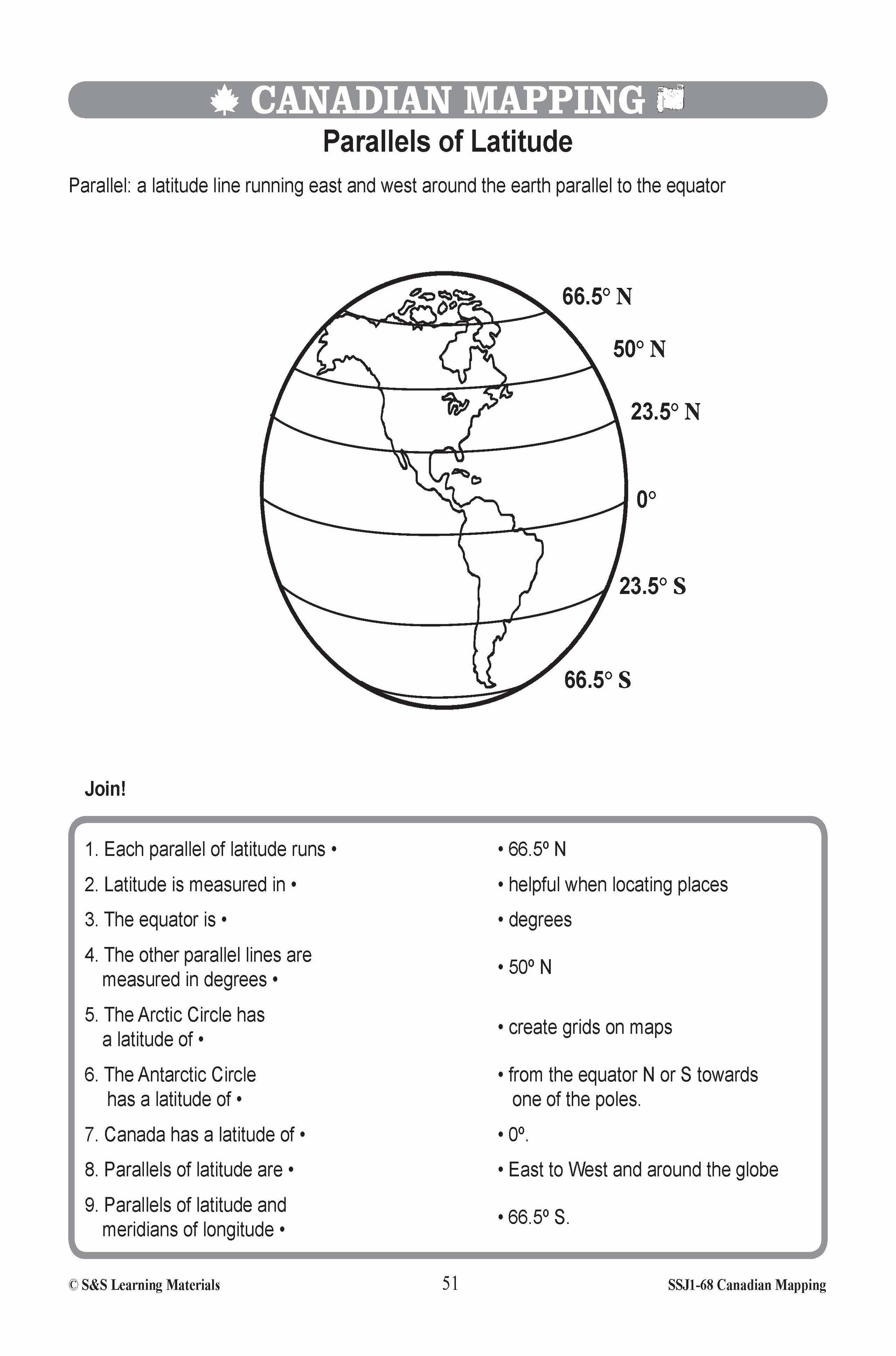
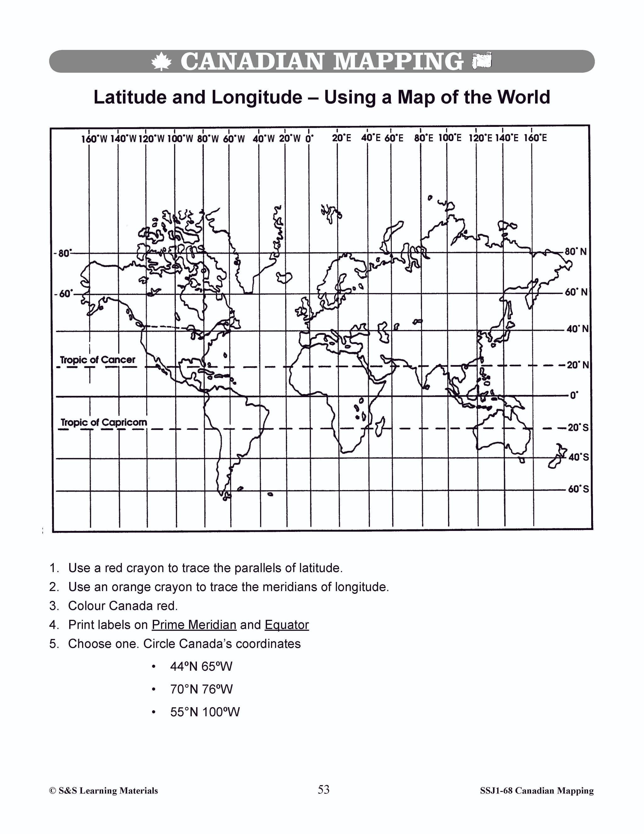
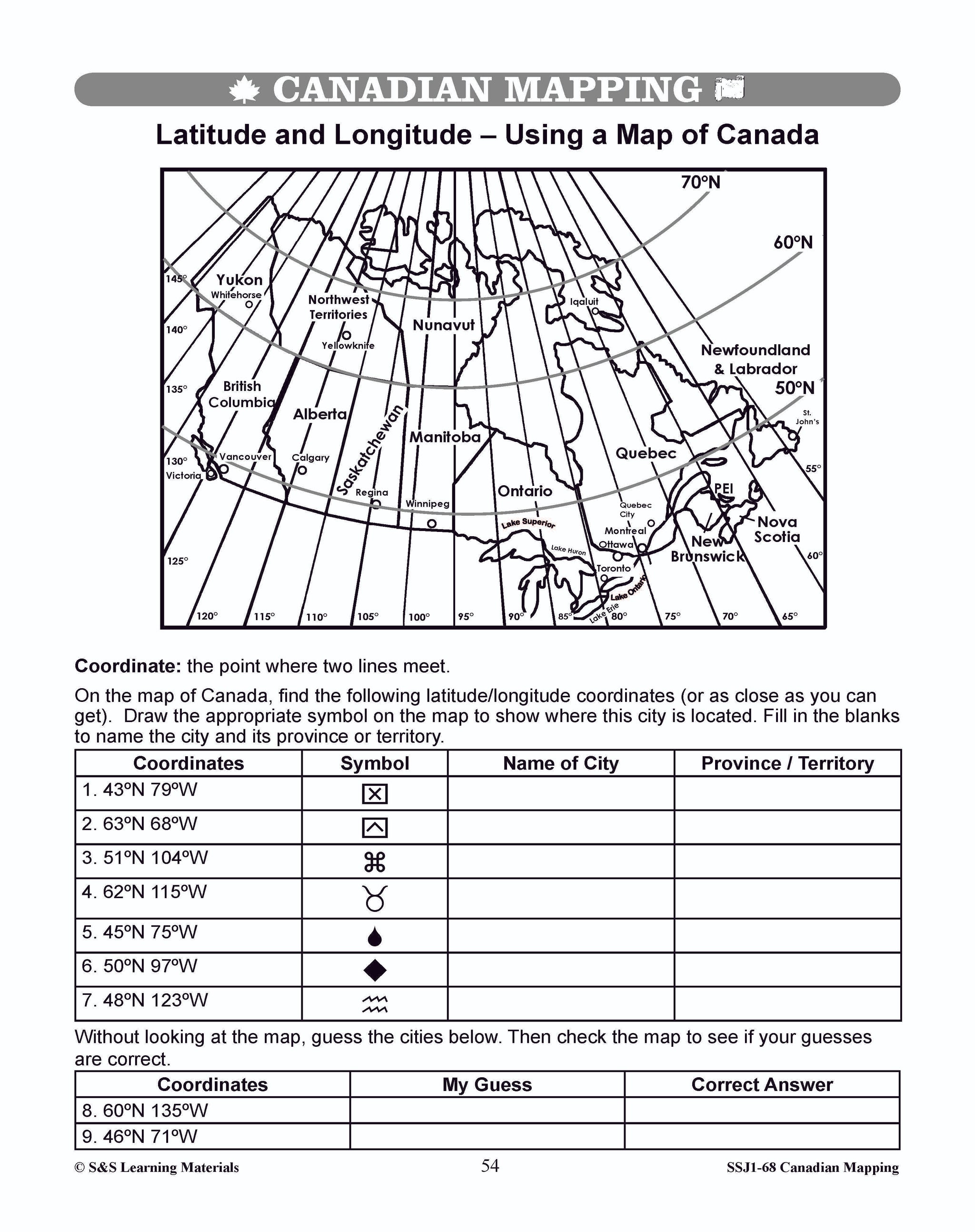
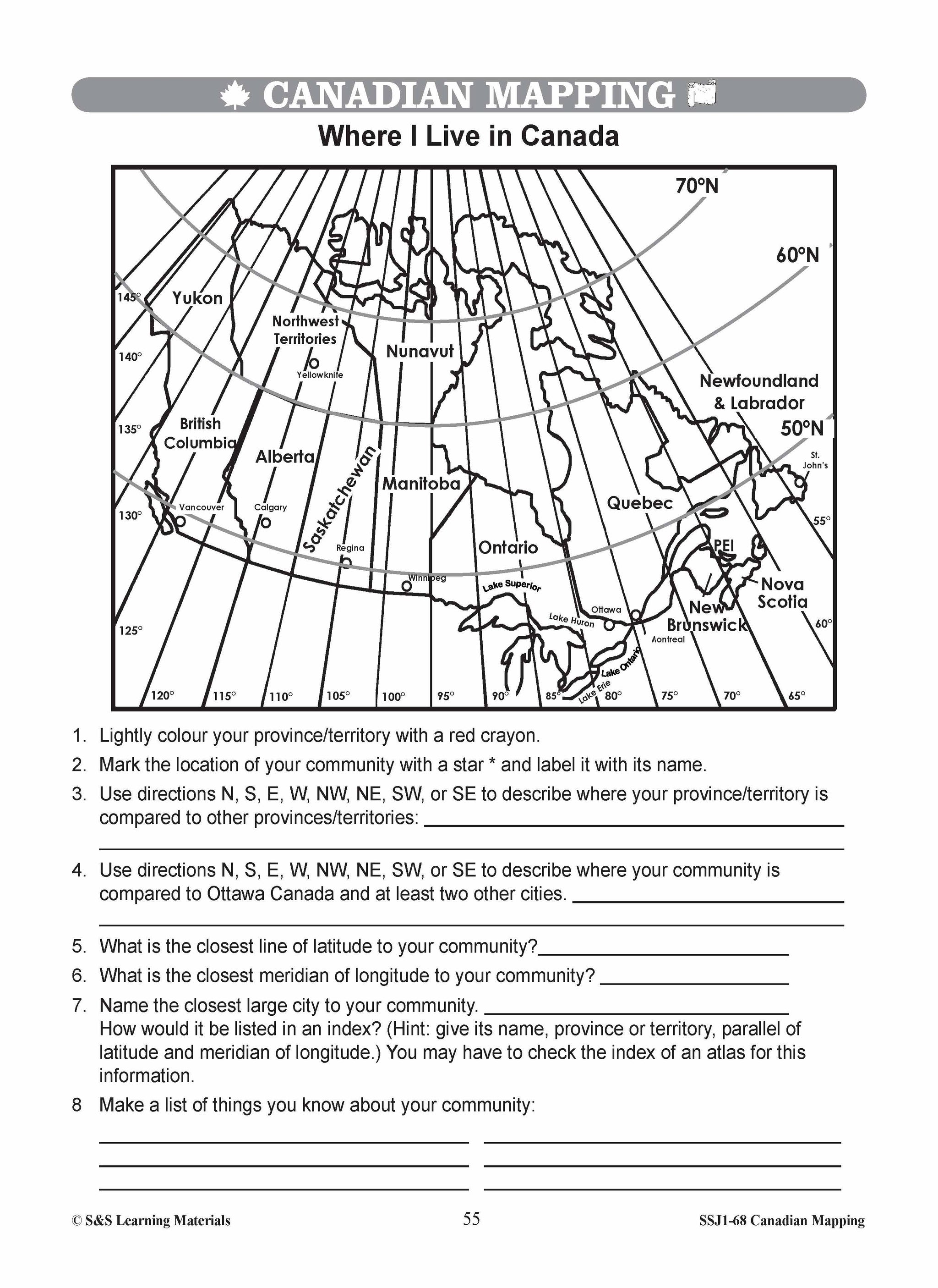
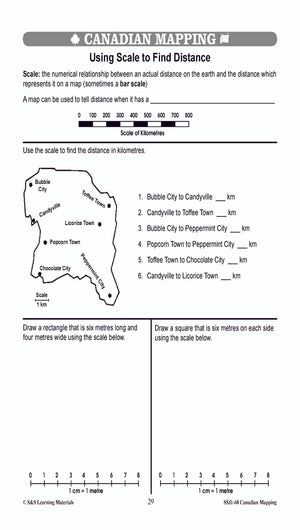
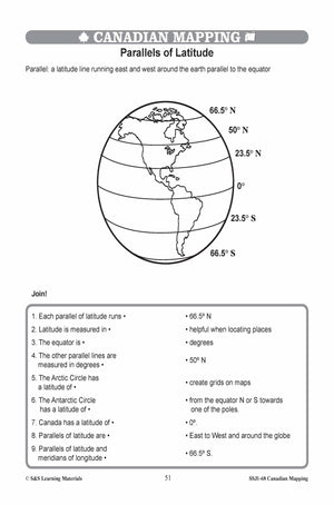
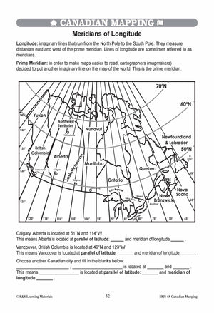
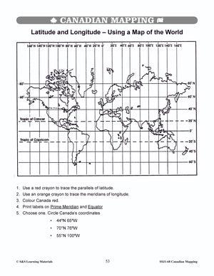
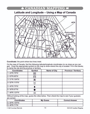
Latitude, Longitude & Scale Canadian Mapping Activities Grades 1-3
$4.95 CAD
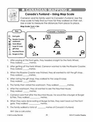
Four activities on: Parallels of Latitude Meridians of Longitude Simple Scale: How Far Is It? Simple Scale: Where You Live? Students can use maps with a simple scale to provide practice with addition, subtraction, and estimation skills. They may use...

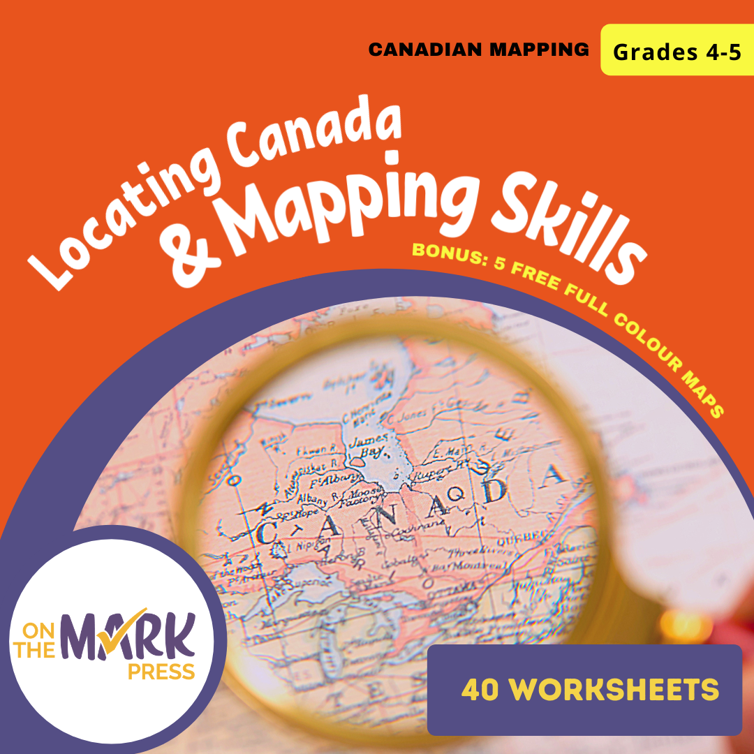


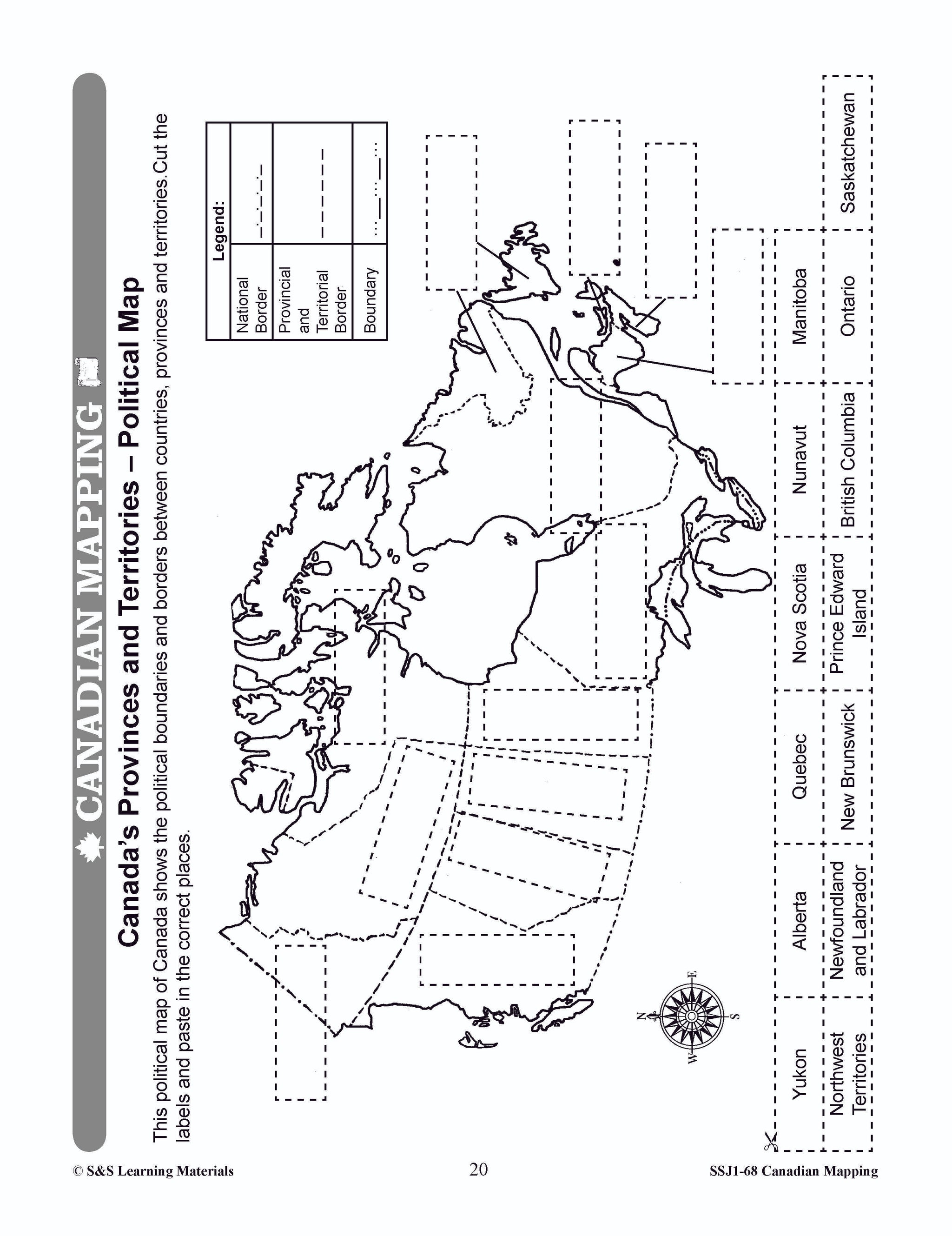

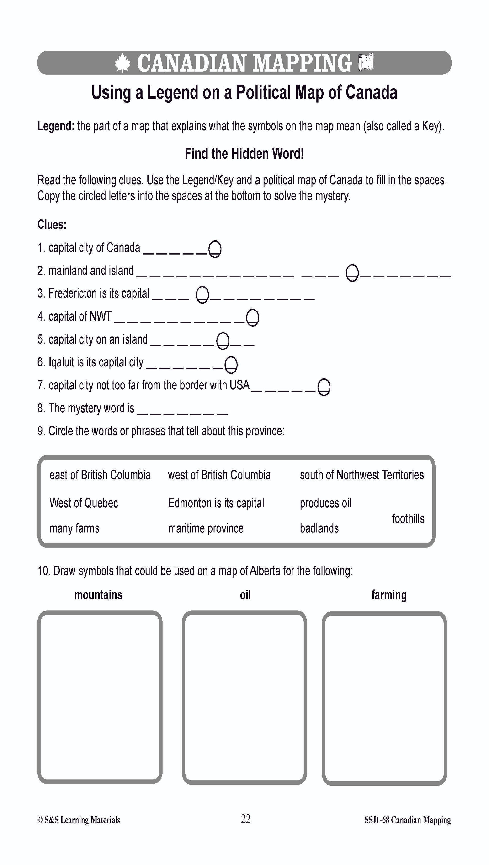
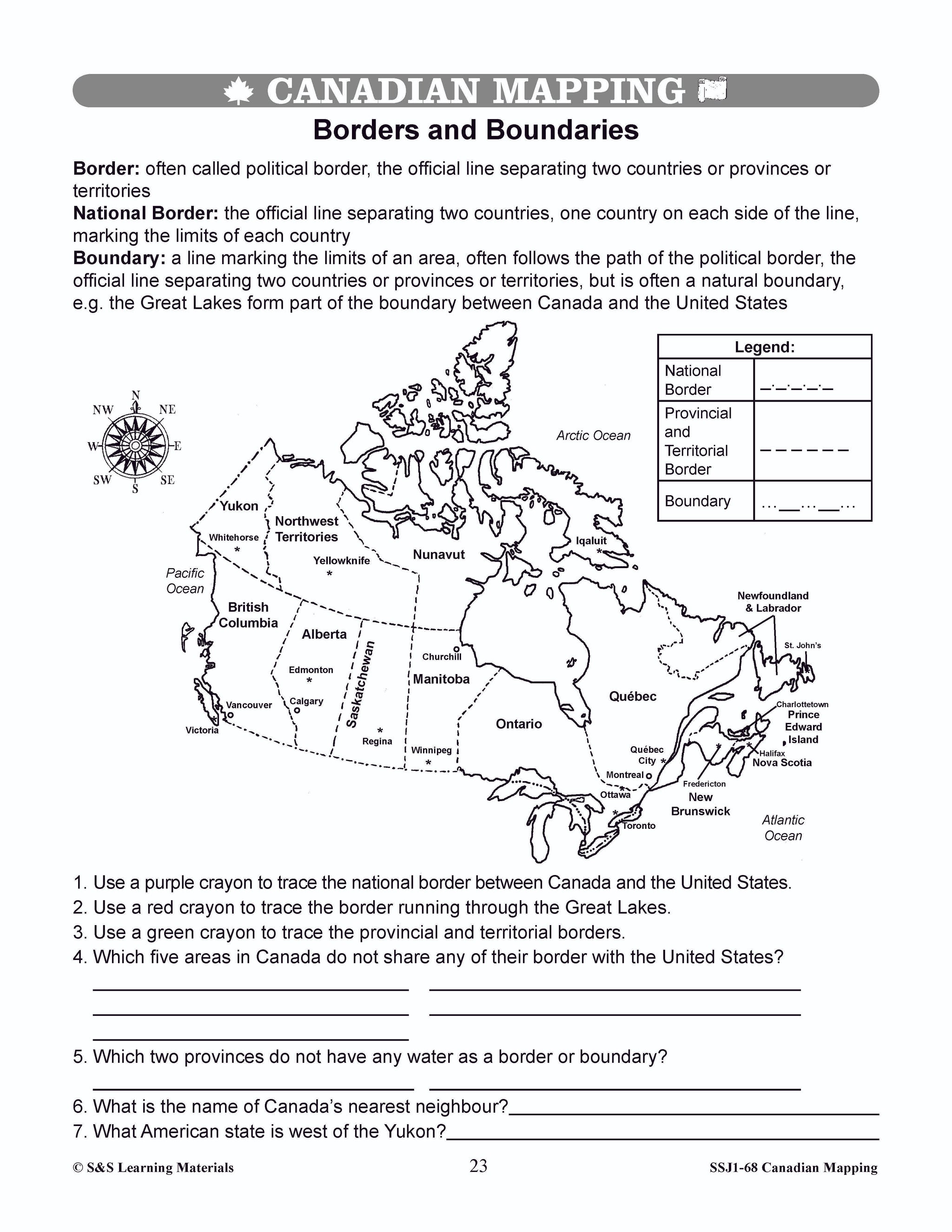


Locating Canada & Mapping Skills Worksheets Grades 4-5
$9.45 CAD
Students will learn about locating Canada and mapping skills with these forty worksheets. Teacher information on these topics: what a map is, types of maps, how to read a map, map indexes, scale, and geographic grids, hemispheres, directional indicators, and...


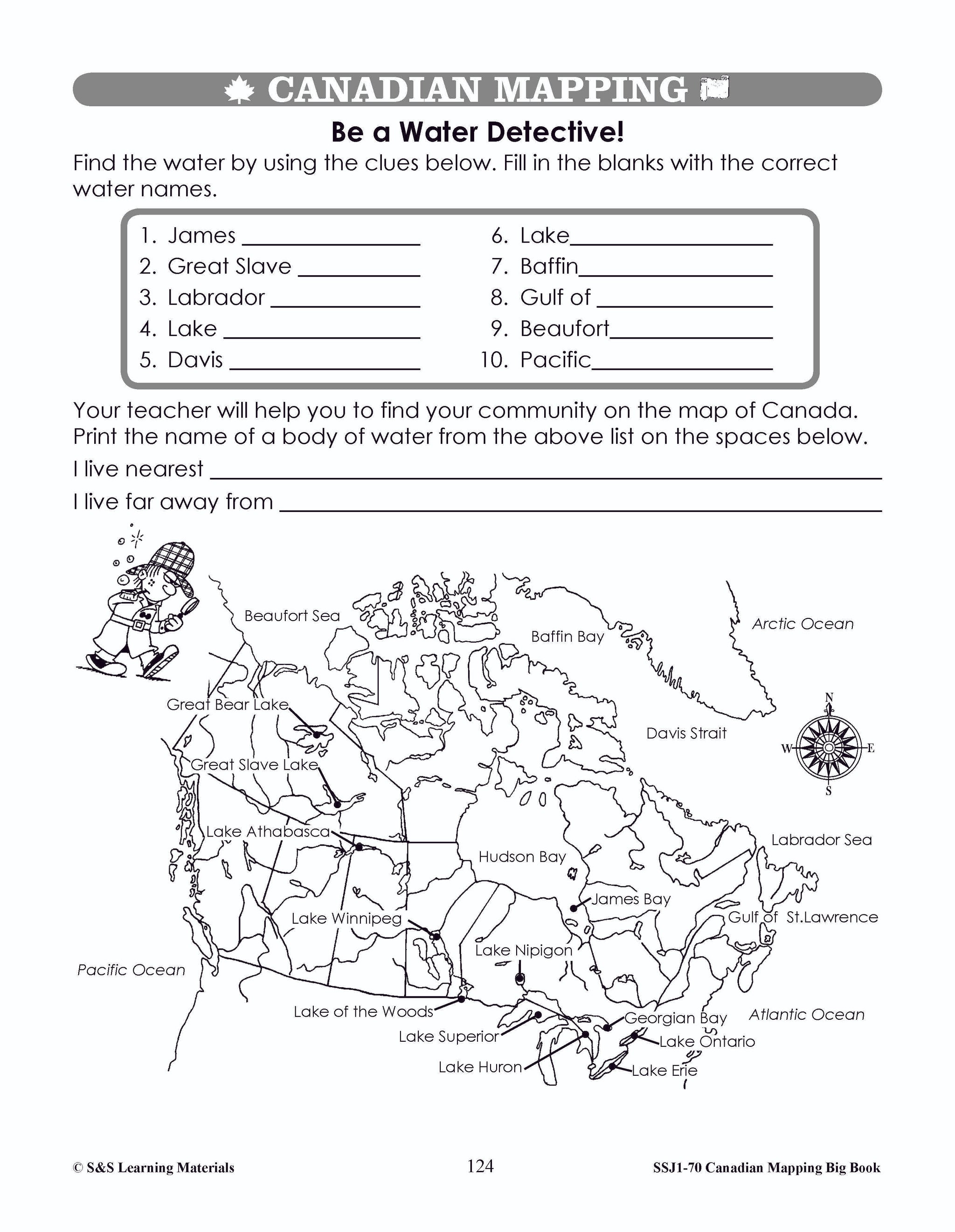
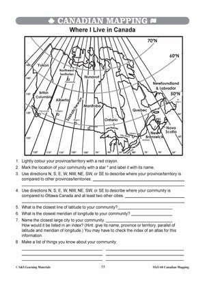
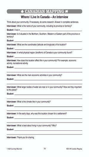
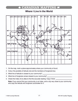
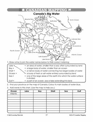
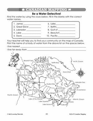
Major Bodies of Water in Canada Worksheets Grades 4-5
$7.45 CAD
Students will learn about major bodies of water in Canada with the five worksheets in this lesson. Teacher information on these topics: what a map is, types of maps, how to read a map, map indexes, scale, and geographic grids,...
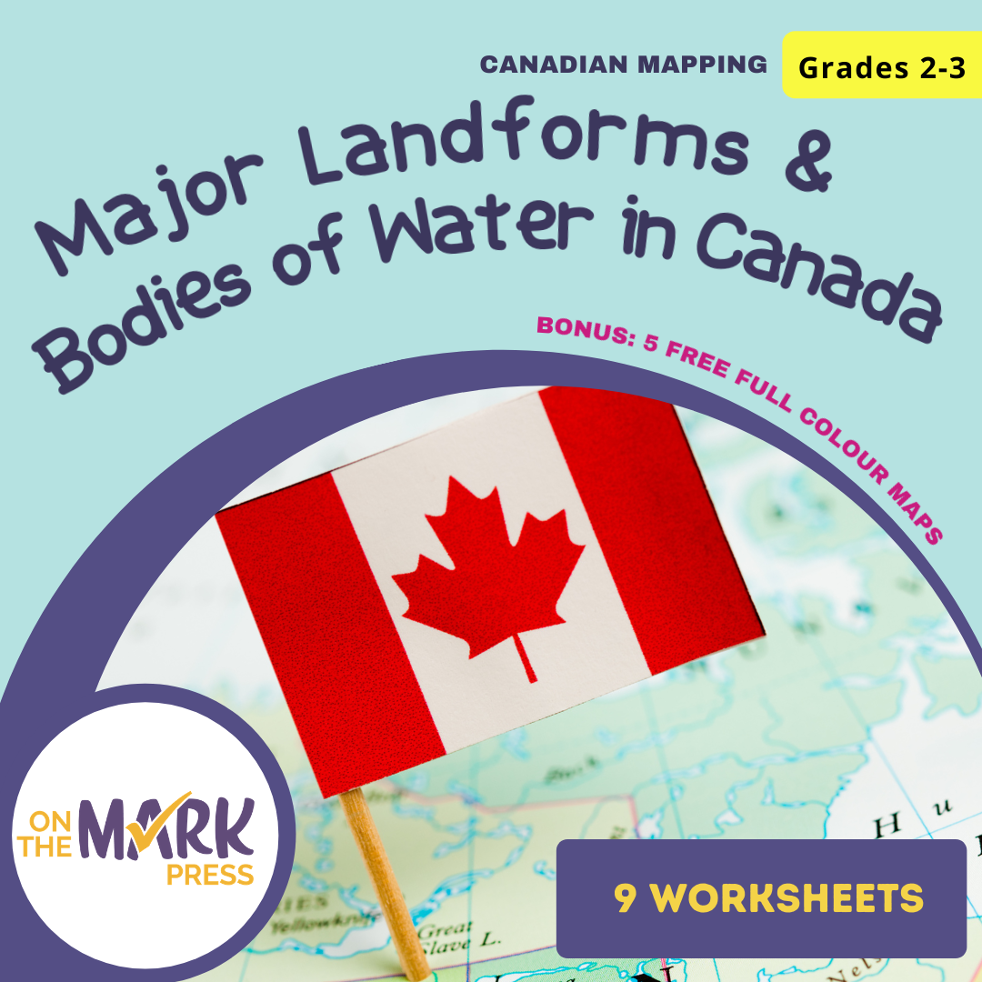


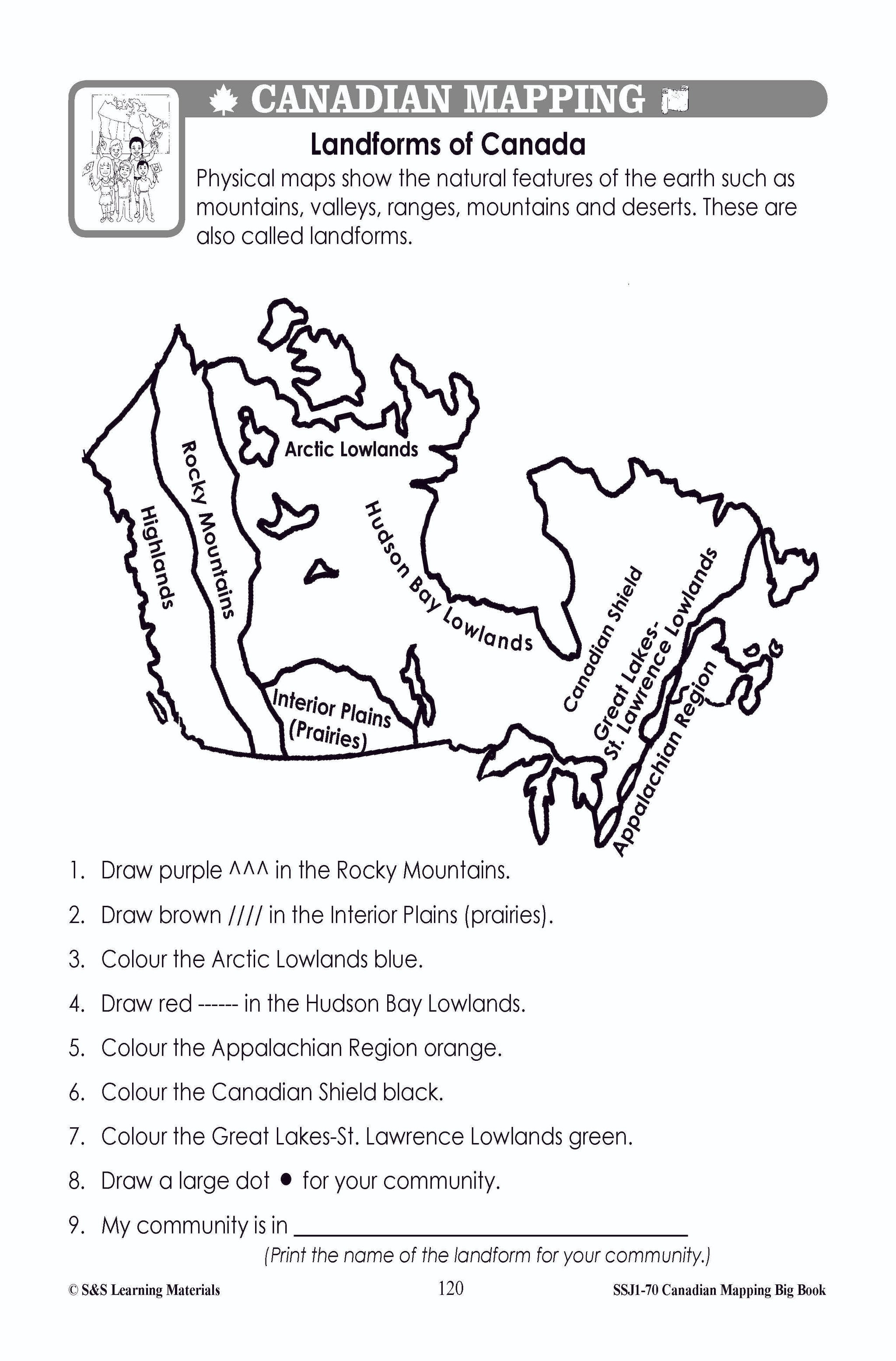
Major Landforms & Bodies of Water in Canada Mapping Worksheets Grades 2-3
$7.45 CAD
Students will learn about major landforms and bodies of water in Canada with the nine worksheets. Teacher information on these topics: what a map is, types of maps, how to read a map, map indexes, hemispheres, directional indicators, and map...

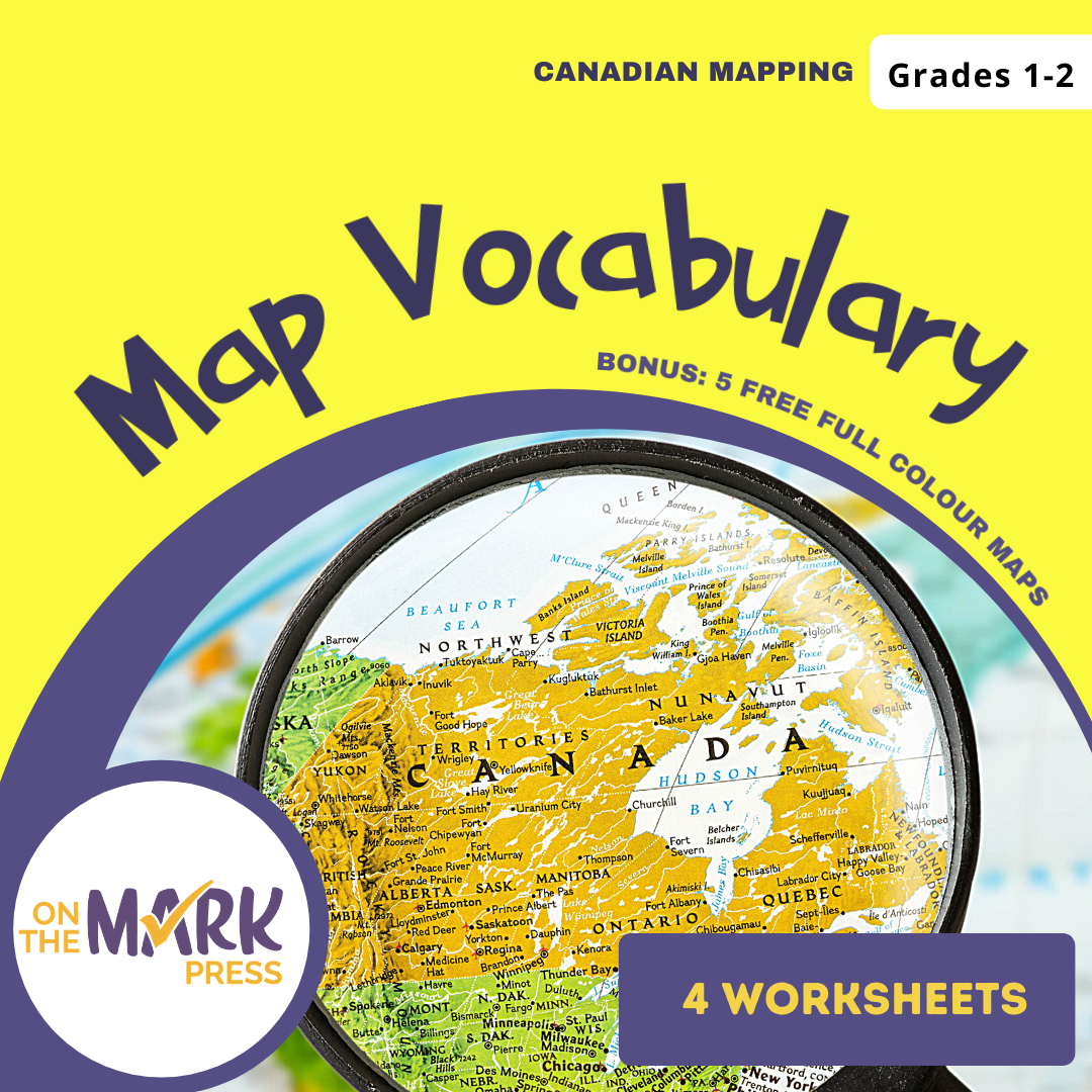


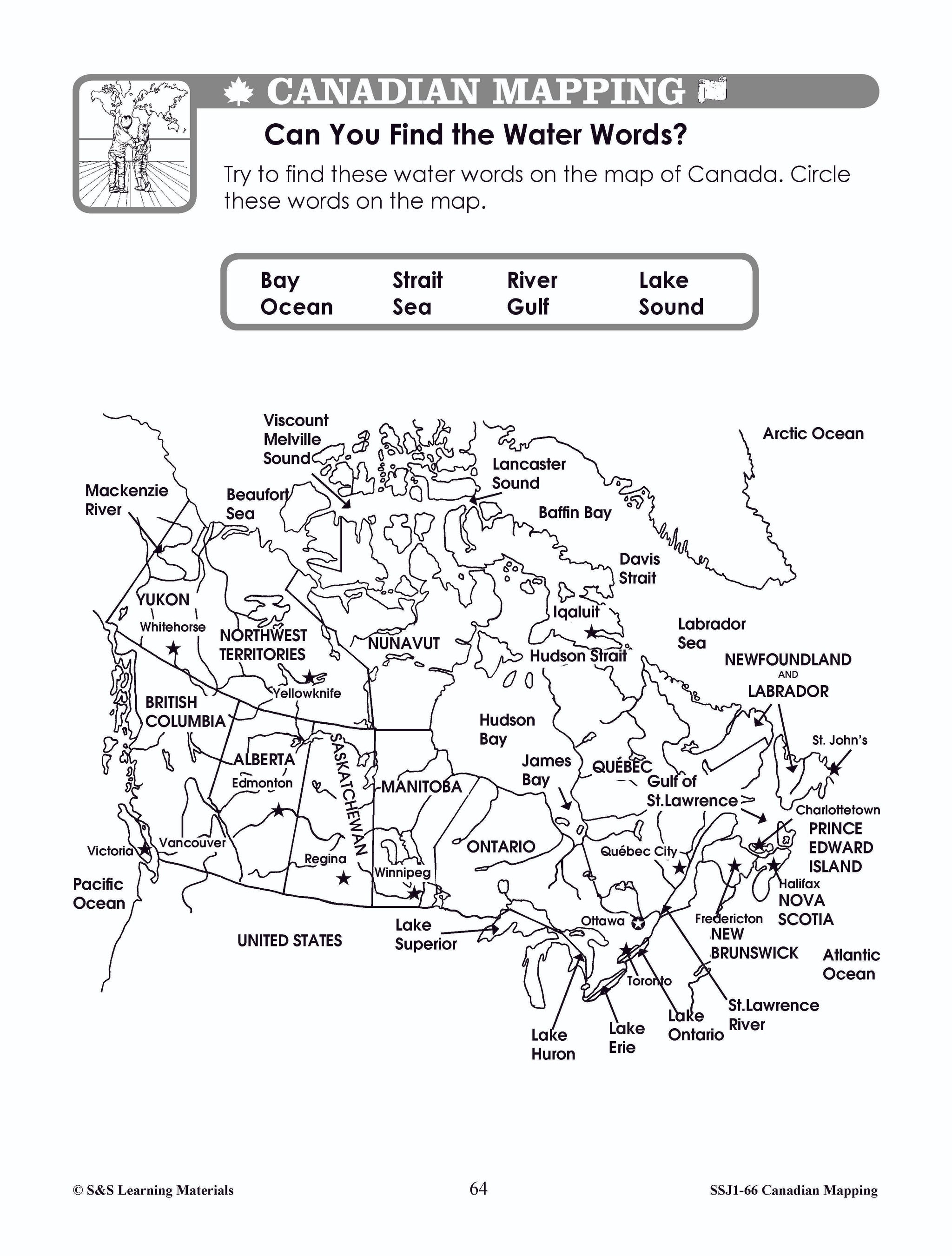
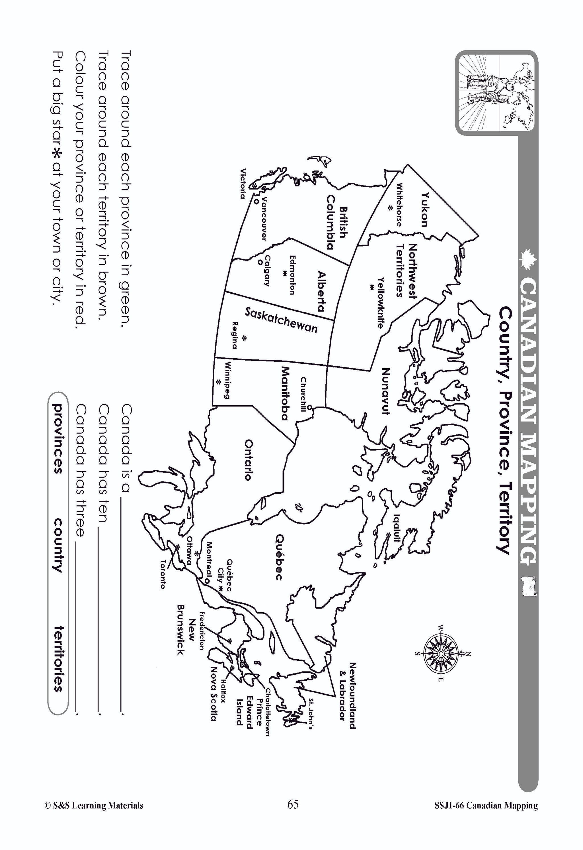


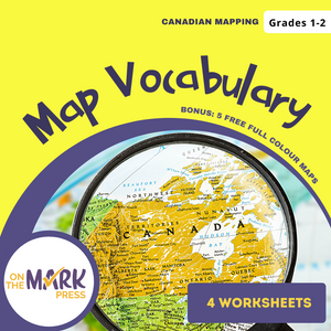
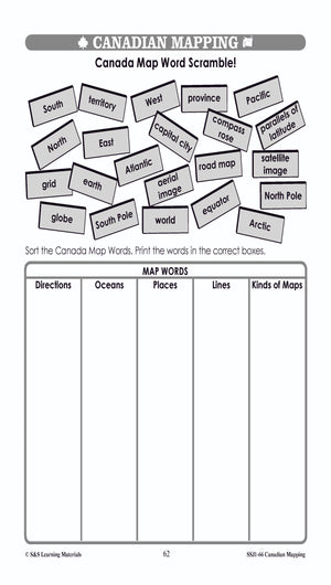


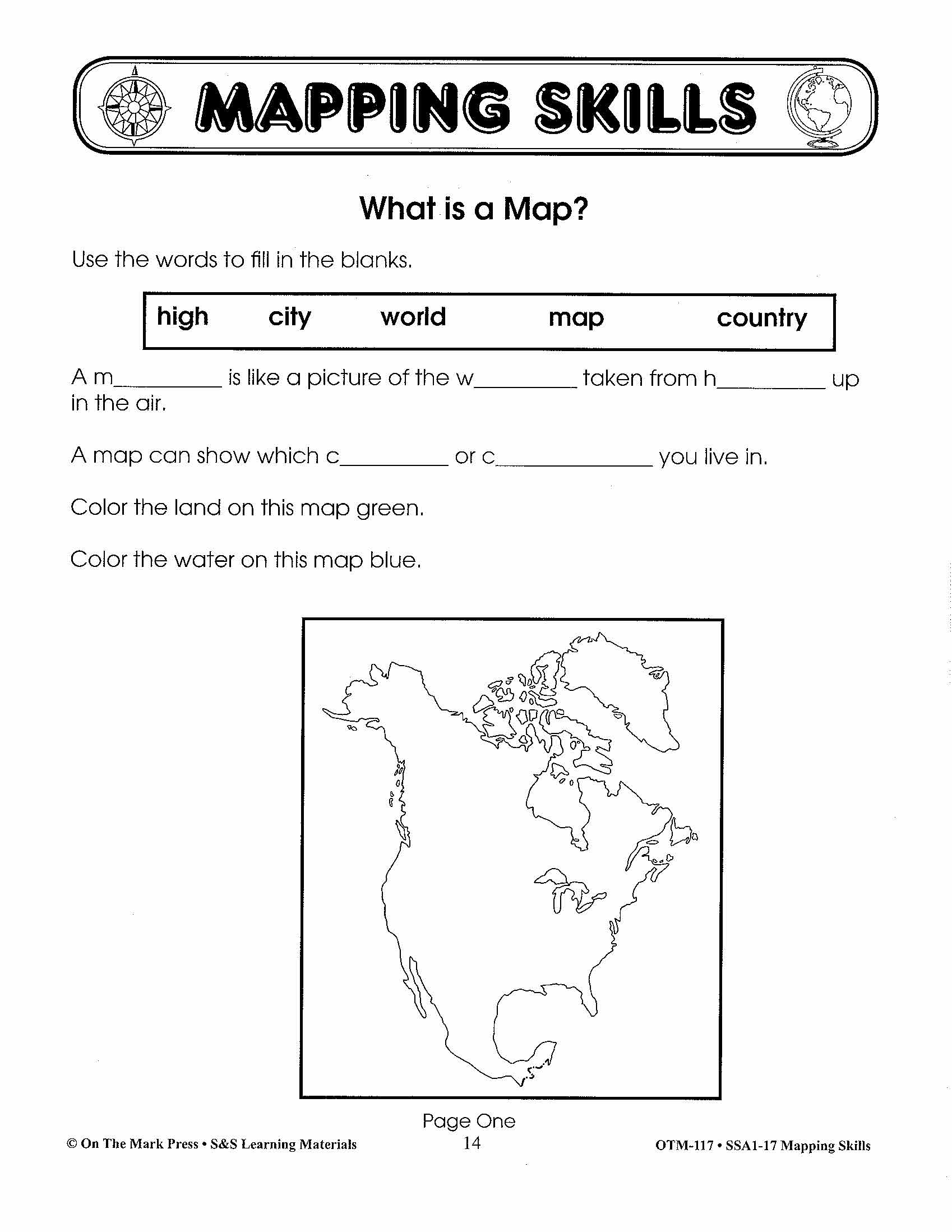
Map Vocabulary Worksheets Grades 1-2
$7.25 CAD
Students will learn map vocabulary with the 4 worksheets. Teacher information on these topics: what a map is, types of maps, how to read a map, map indexes, hemispheres, directional indicators, and map symbols. The glossary of geographic terms can...


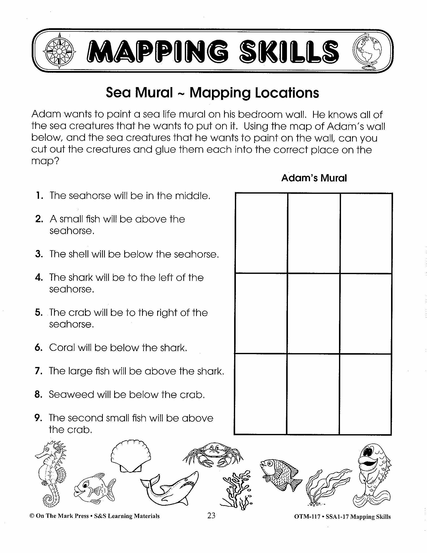

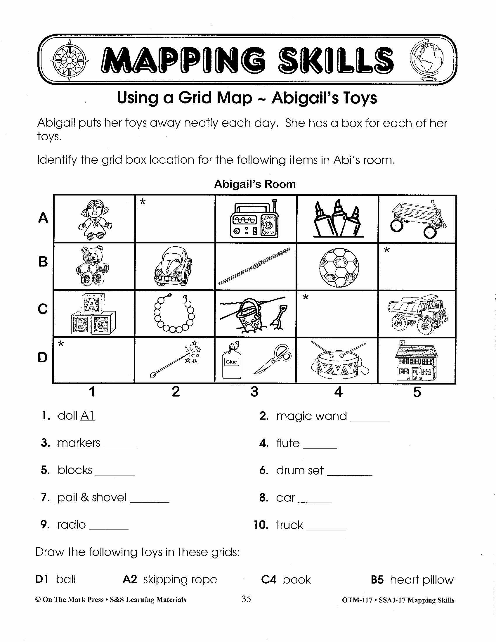
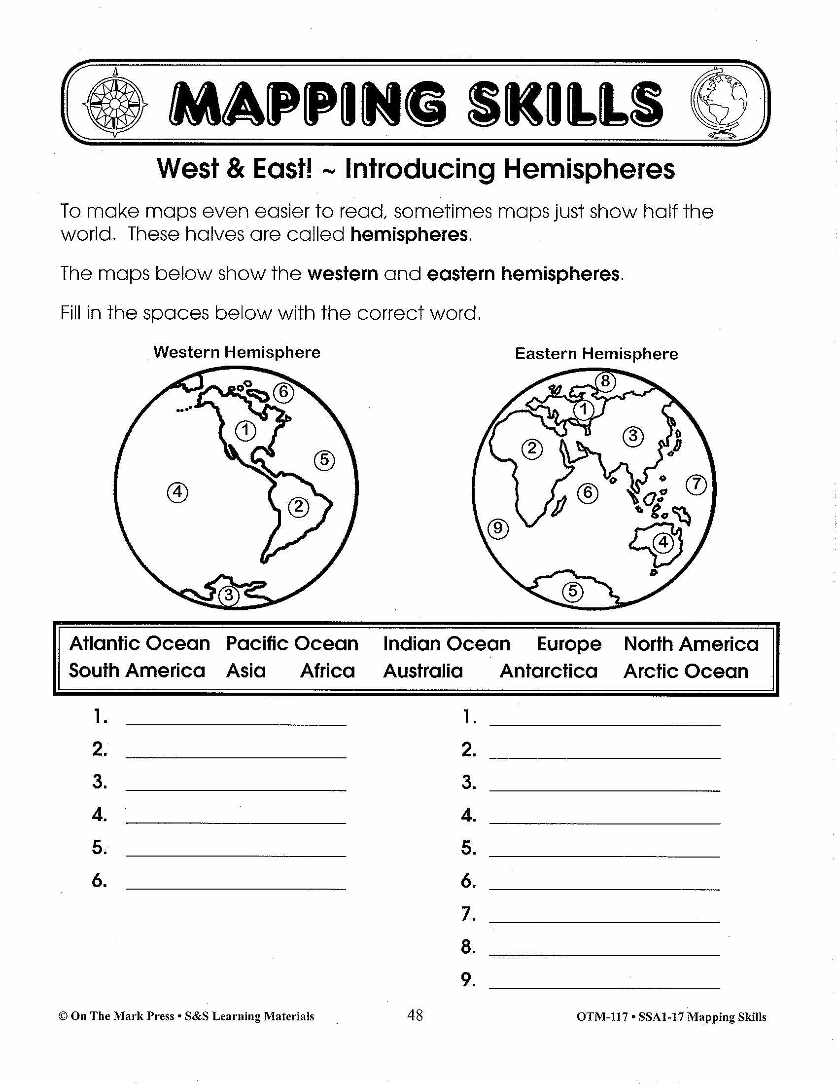

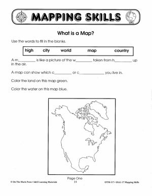
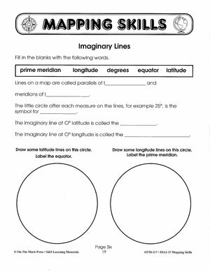


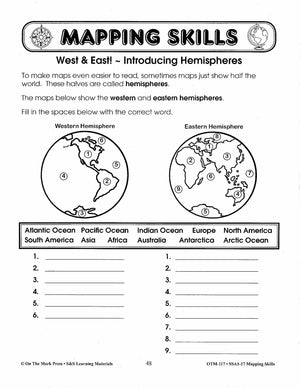
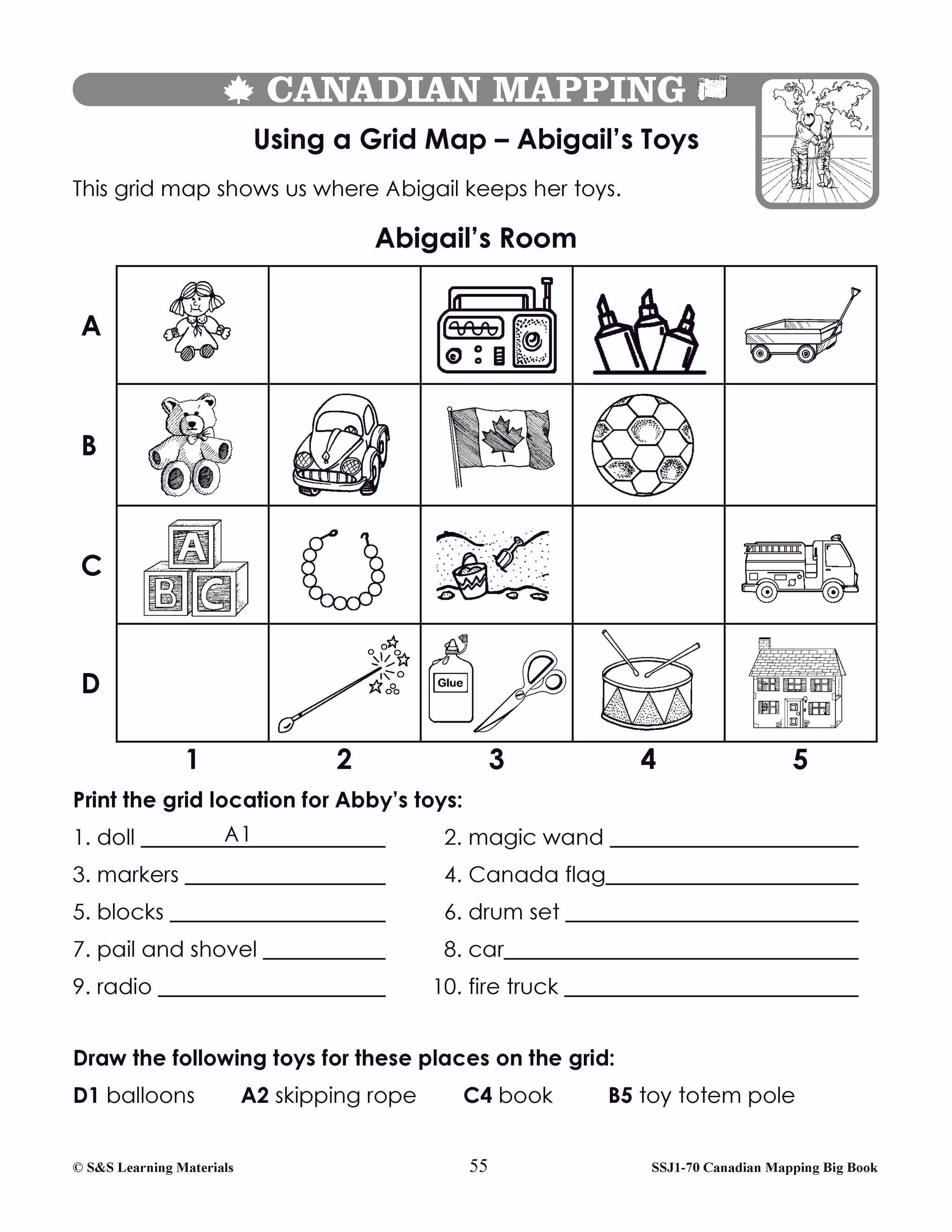
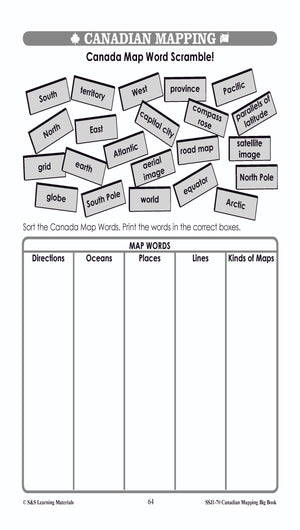
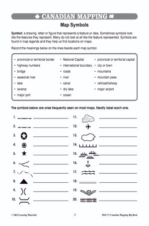
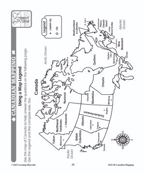
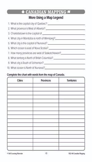
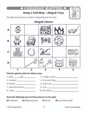
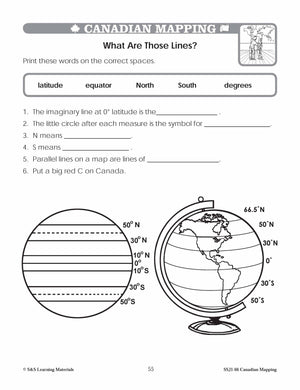
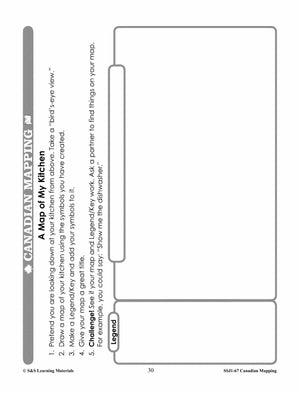
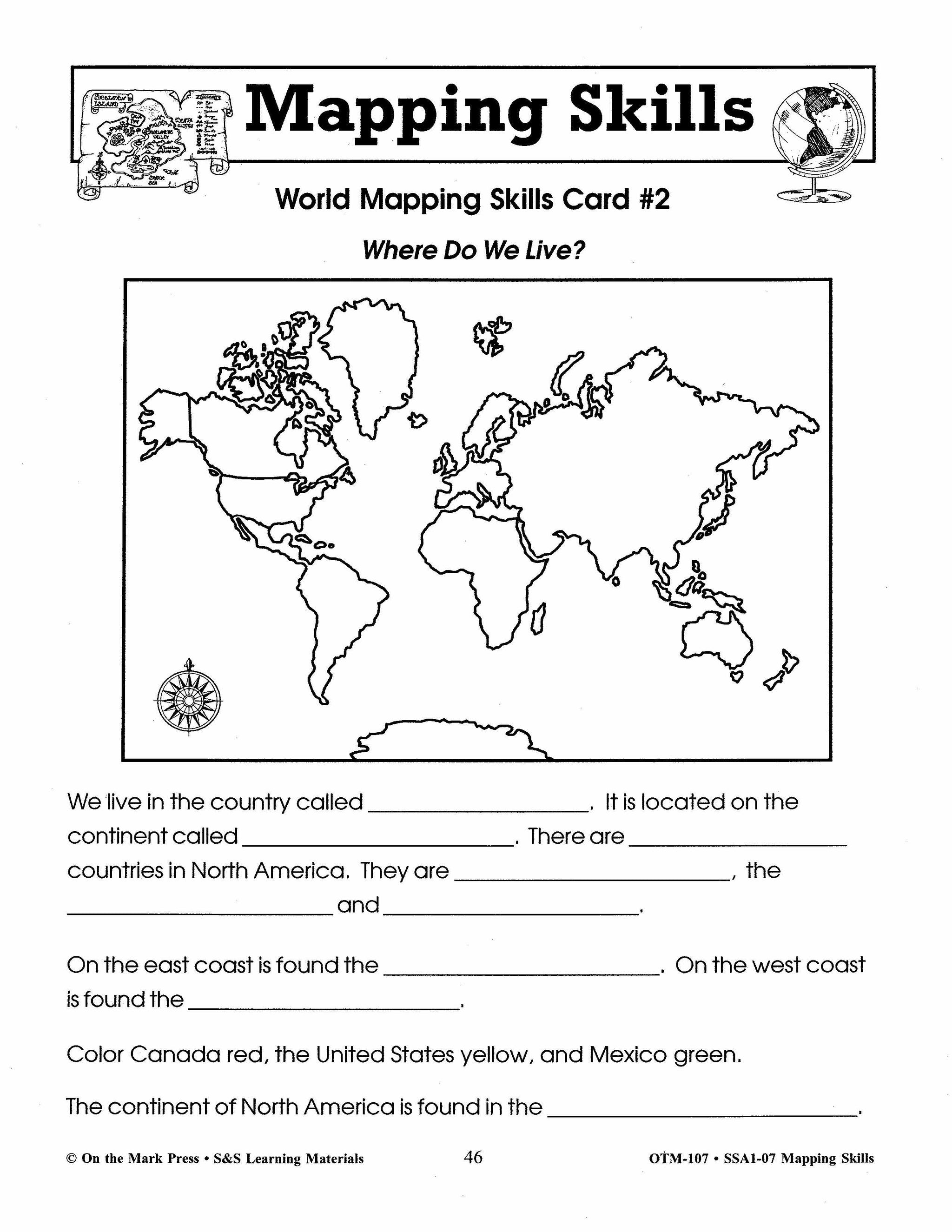
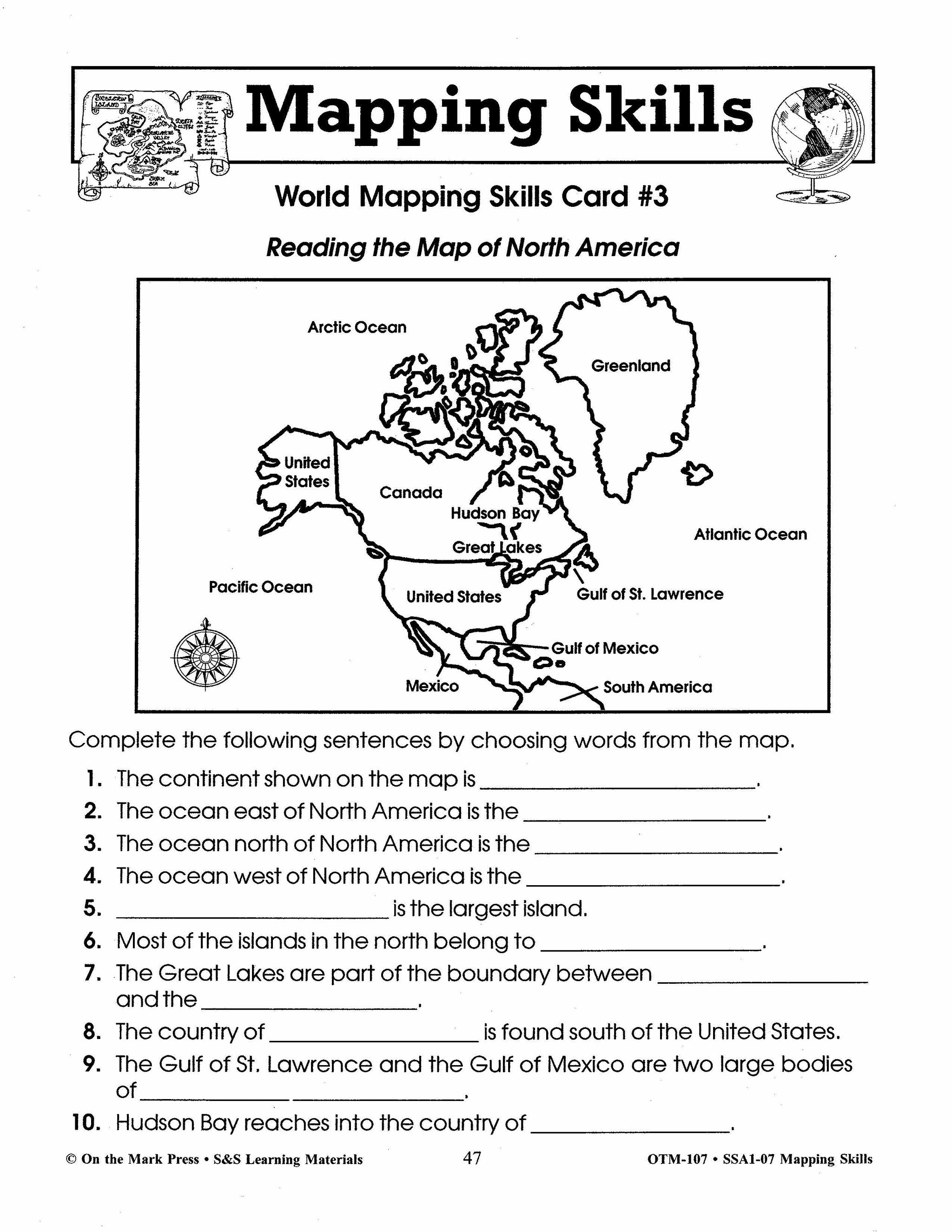
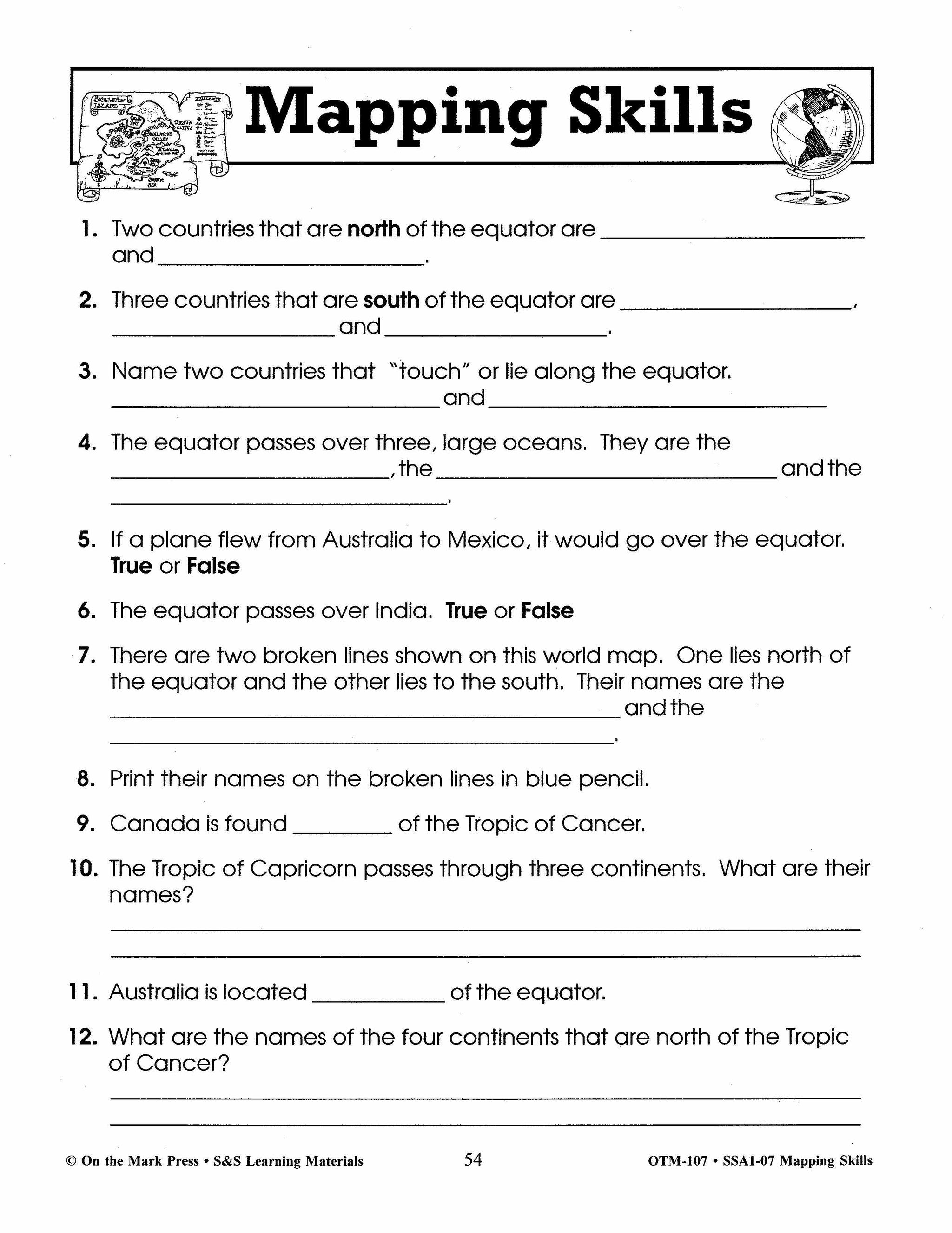
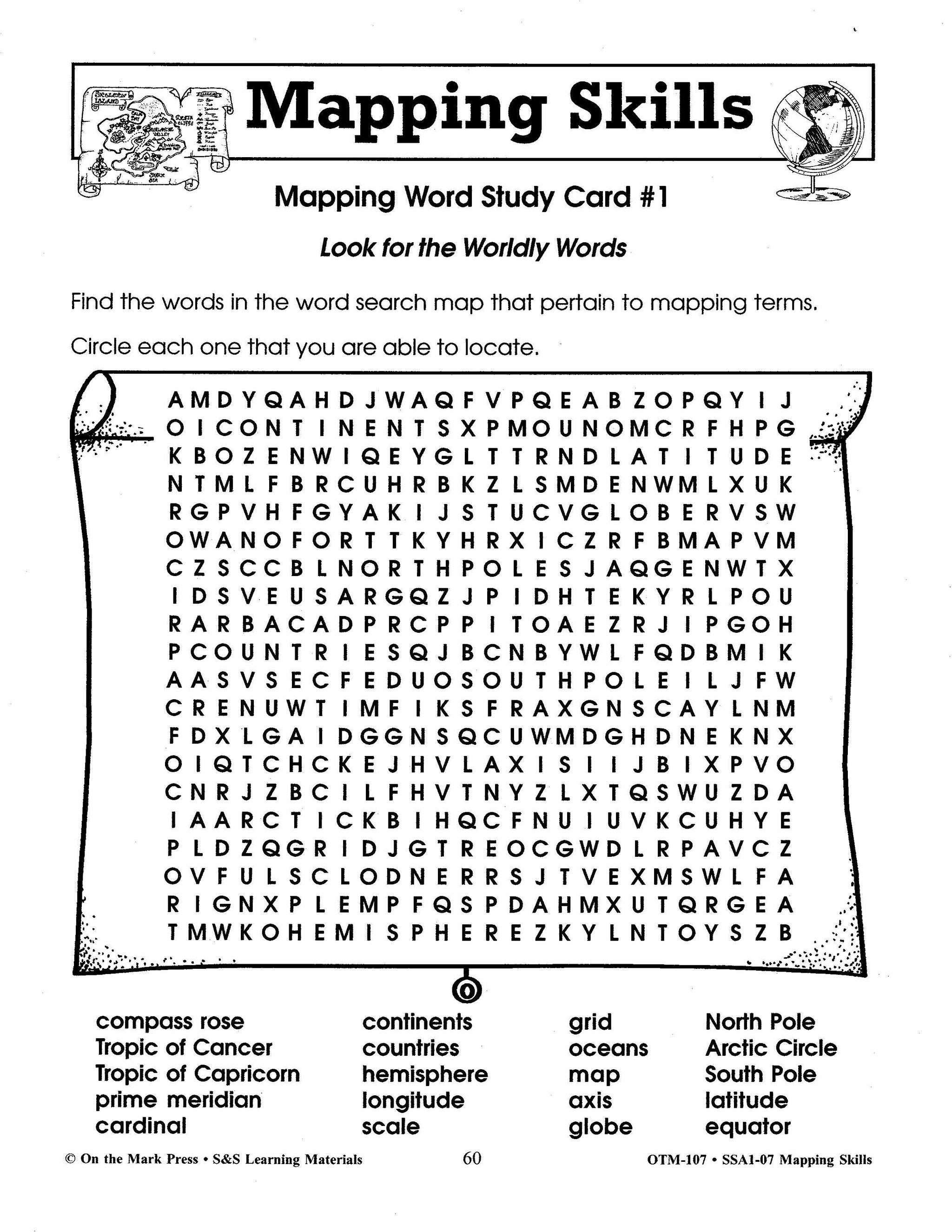
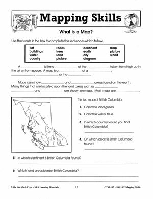
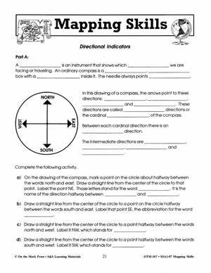
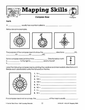
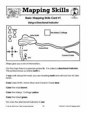
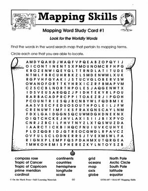
Mapping Skills Grades 1-3
$23.99 CAD
Help your young learners understand the basics of reading and following maps with the ideas and information in this resource. Students will learn about the compass rose, direction word, map symbols and using a map legend. Continents, hemispheres, meridians, latitude,...


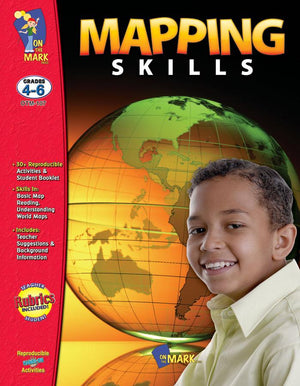


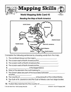

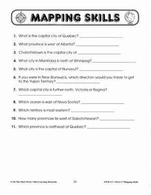
Mapping Skills Grades 4-6
$23.99 CAD
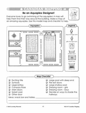
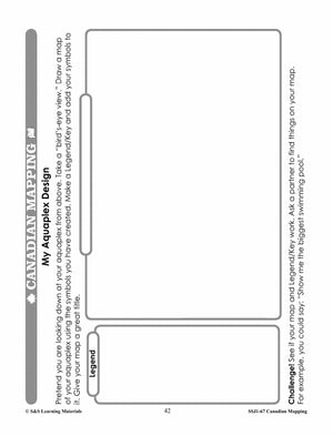
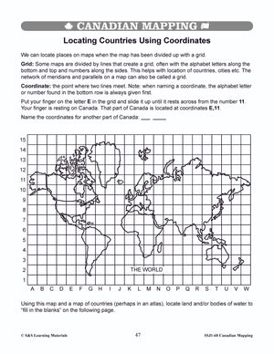
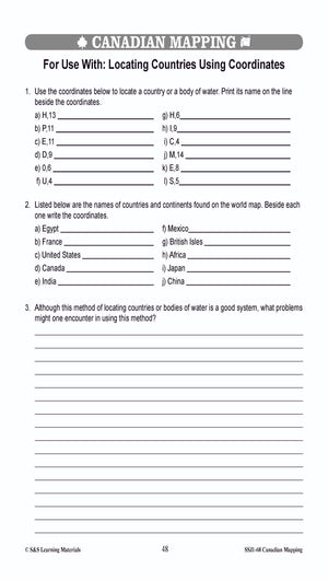
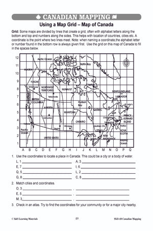
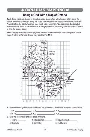
Provide in-depth coverage of the skills needed in map reading. Students make maps of their classroom, school, and Neighborhood. They will learn to locate places on a map, to find countries using coordinates, and locate themselves on a map. The...


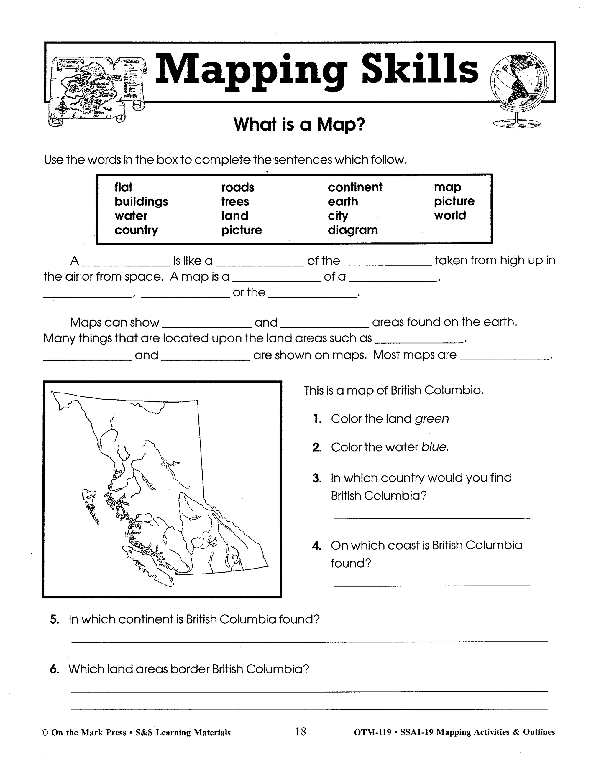
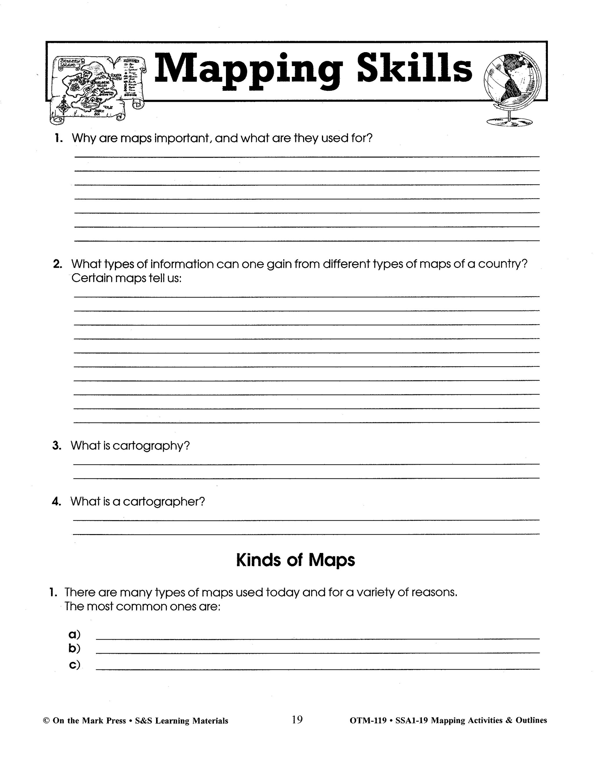
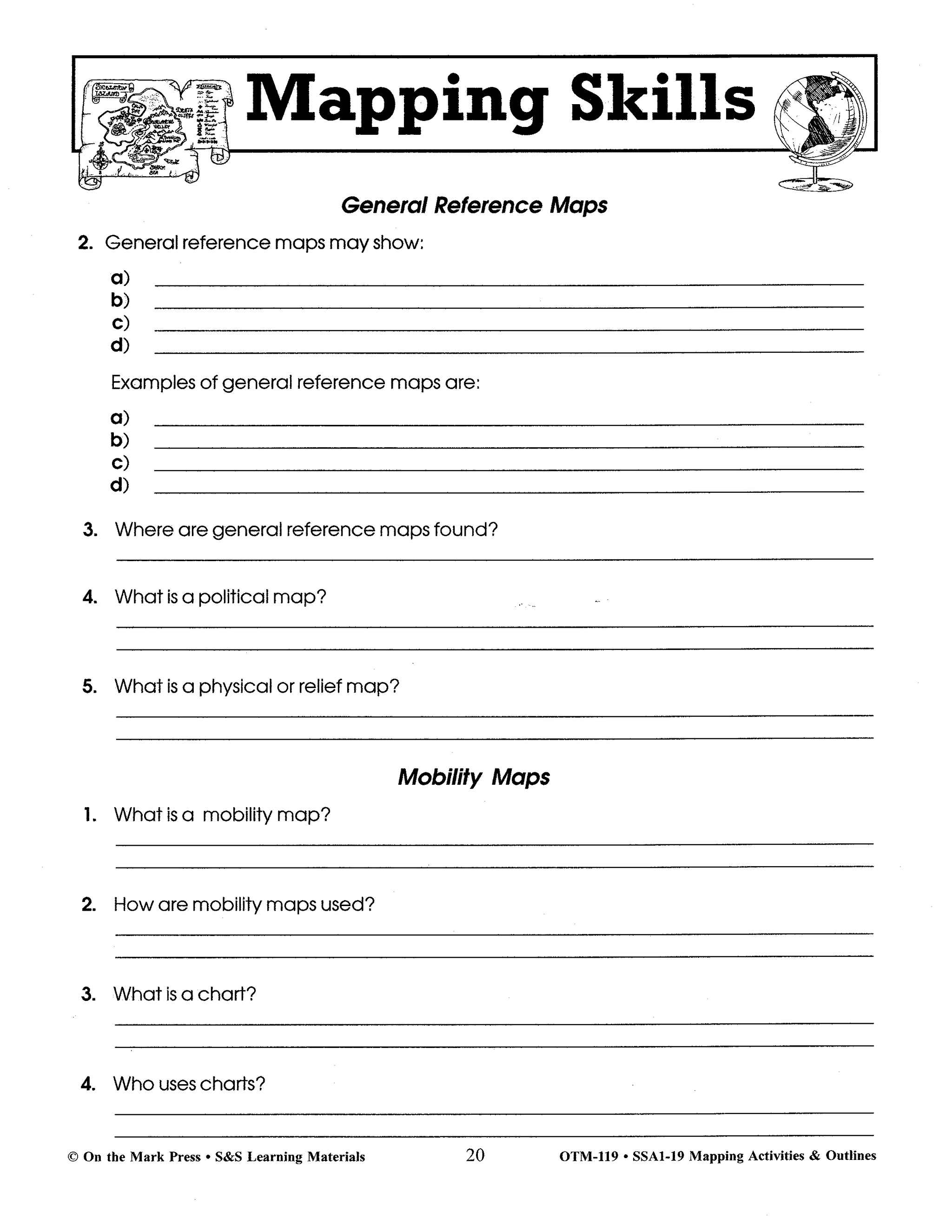

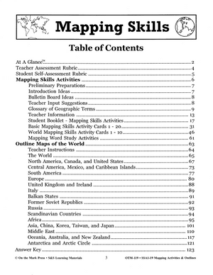
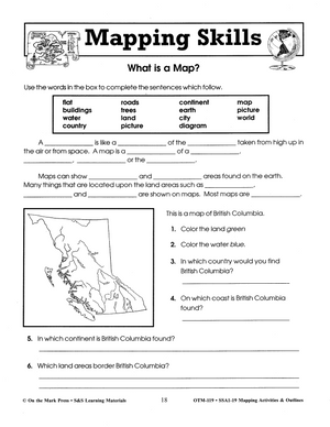
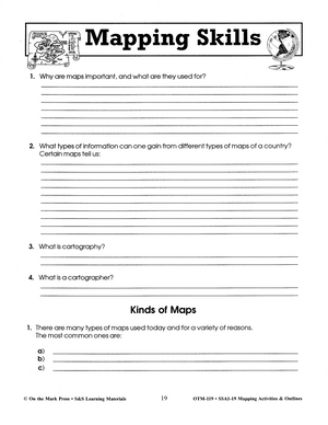
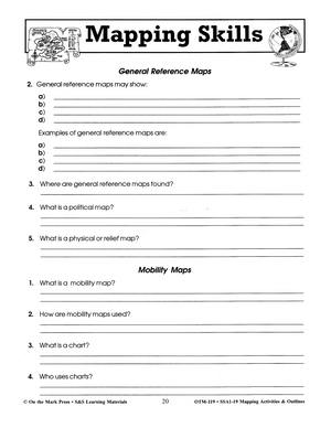
Mapping Skills: Activities & Outlines Grades 4-8
$30.99 CAD
50 Lessons help improve mapping skills. This resource provides in-depth coverage of the skills needed in map reading: north-south-east-west, legend, scale, longitude and latitude. Plus over 50 up-to-date maps of countries and regions of the world. 128 pages Learning and...


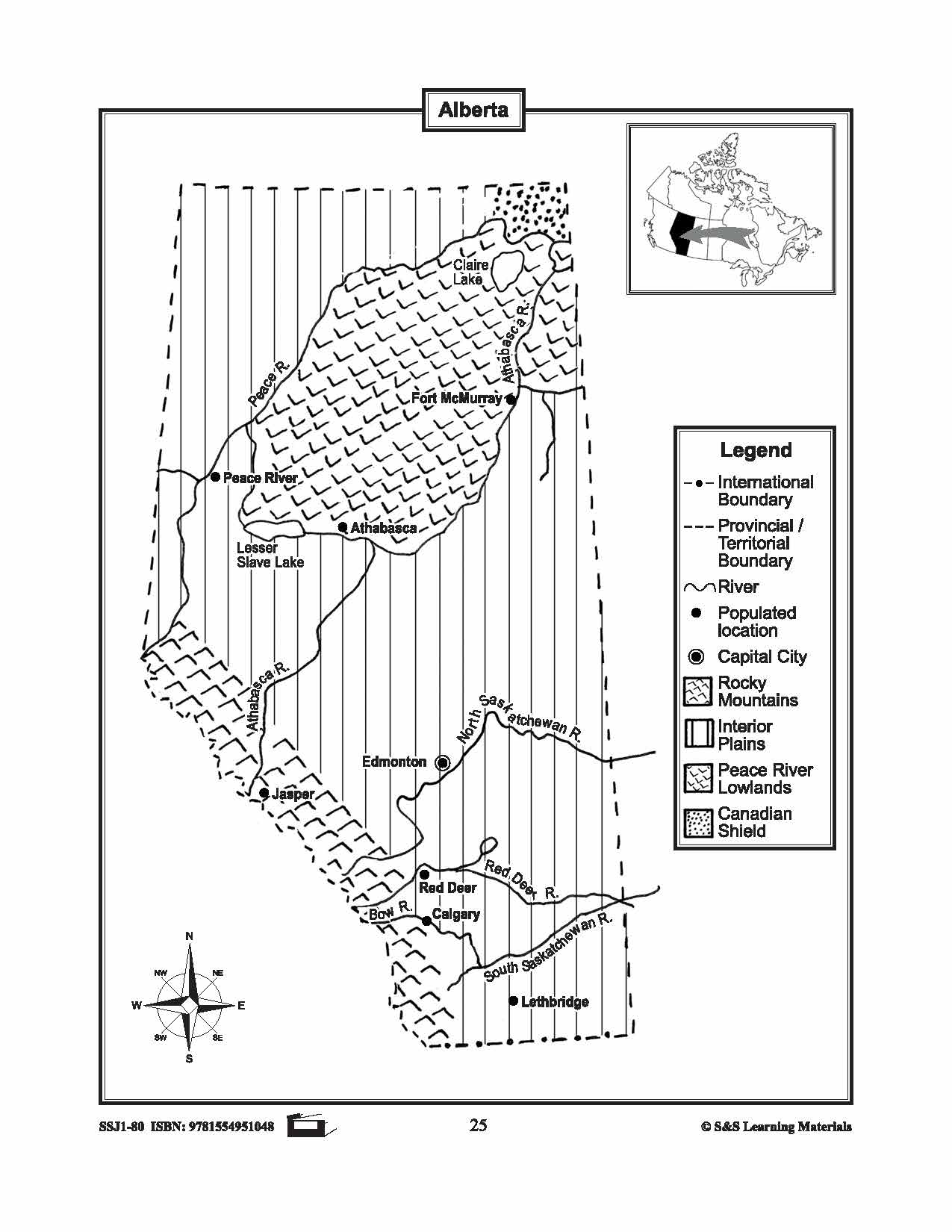


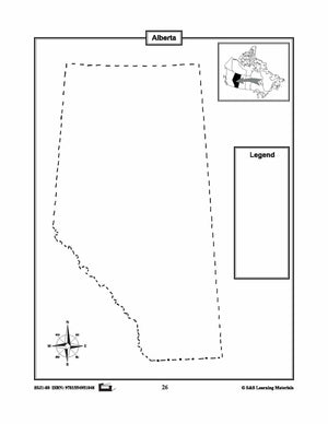
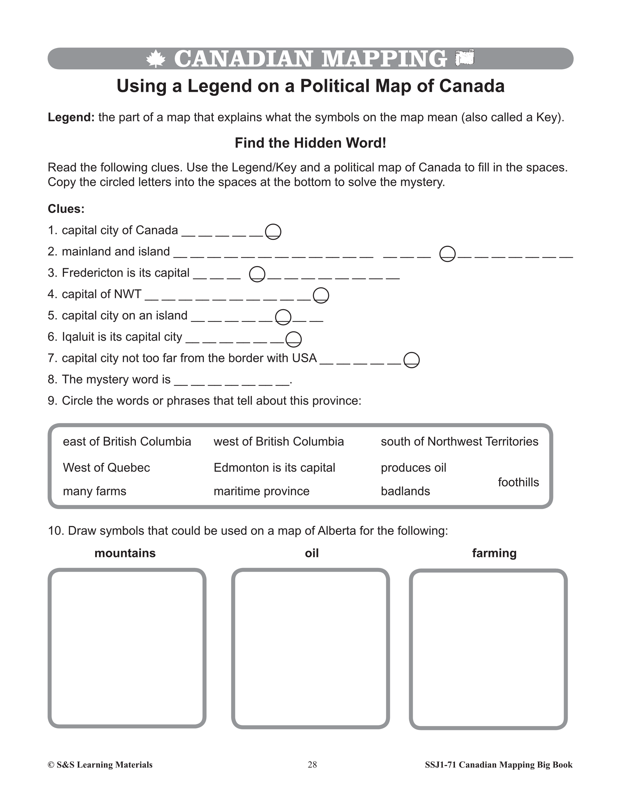
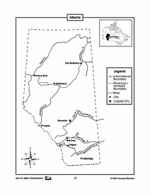
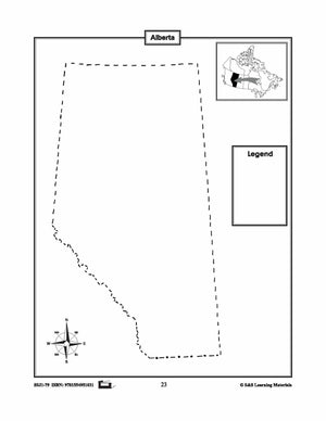
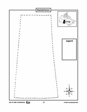
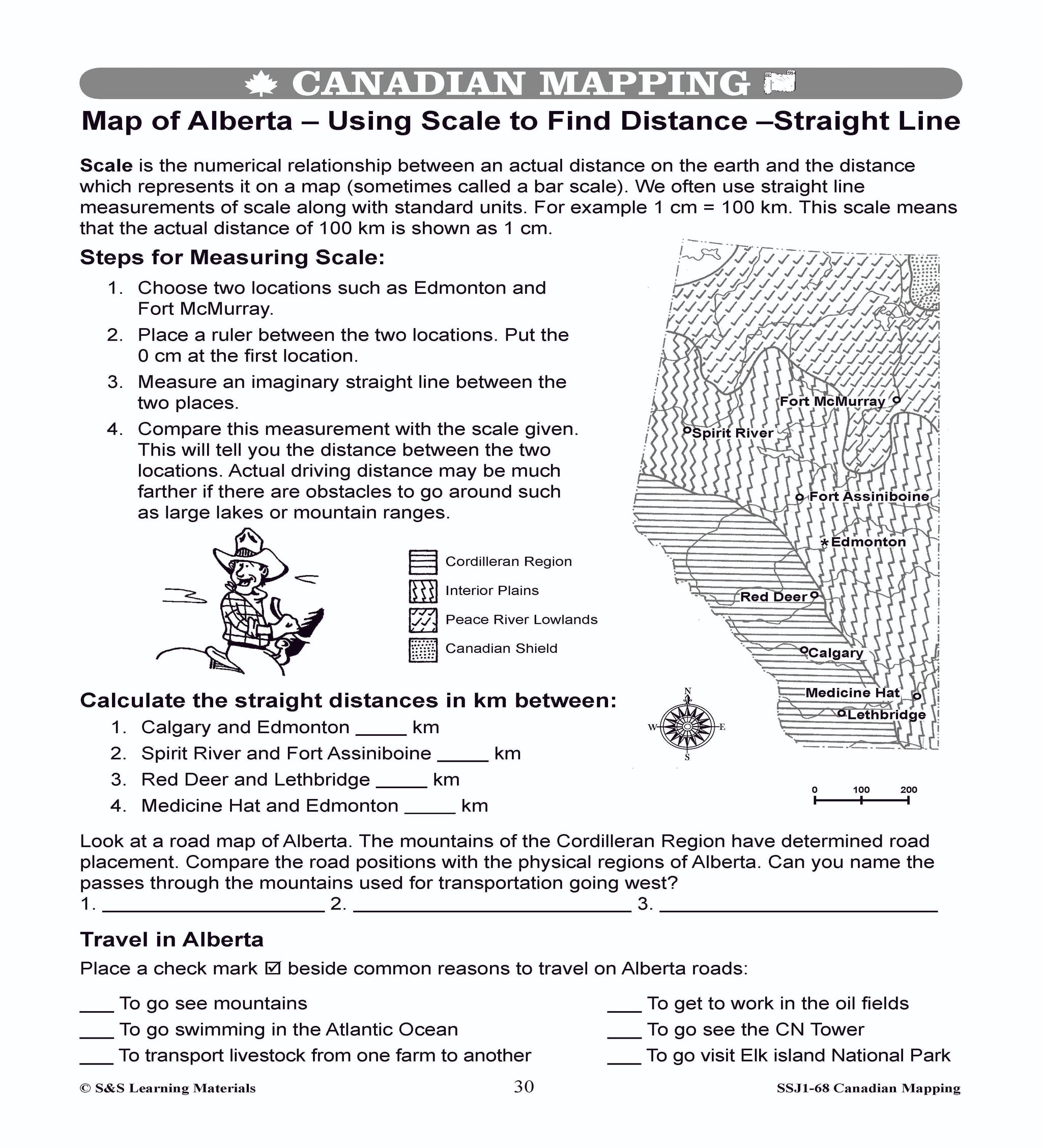
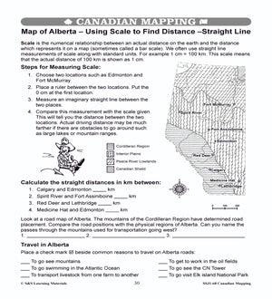
Maps of Alberta Grades 4-8
$3.45 CAD
The maps will help students learn about Alberta and its international and provincial/territorial boundary, rivers, landforms, the capital city, and other cities. 2 pages


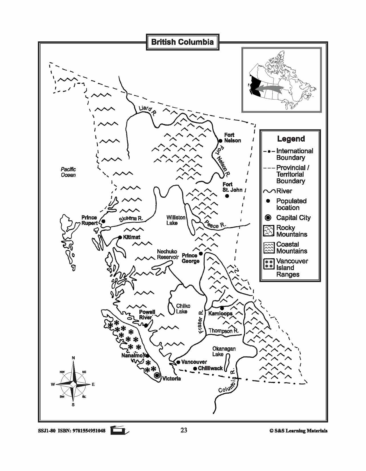

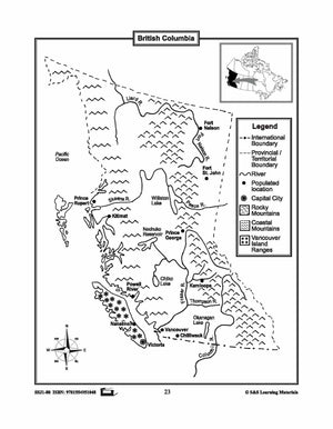
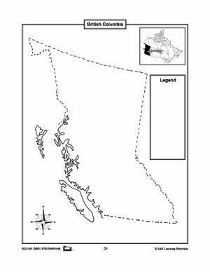
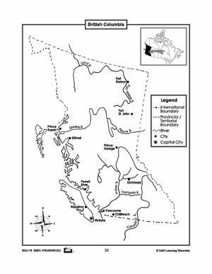
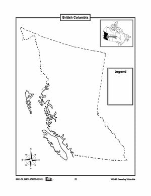
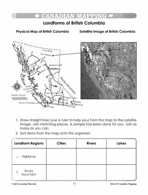
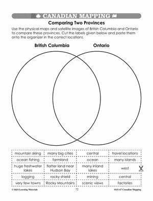
Maps of British Columbia Grades 4-8
$3.45 CAD
The maps will help students learn about British Columbia and its international and provincial/territorial boundary, rivers, landforms, the capital city, and other cities. 2 pages


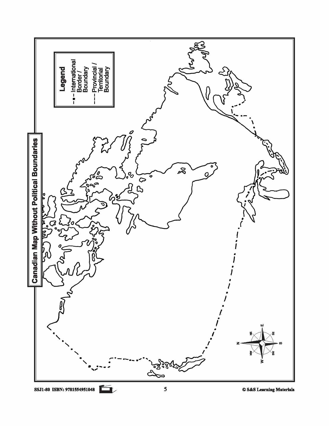
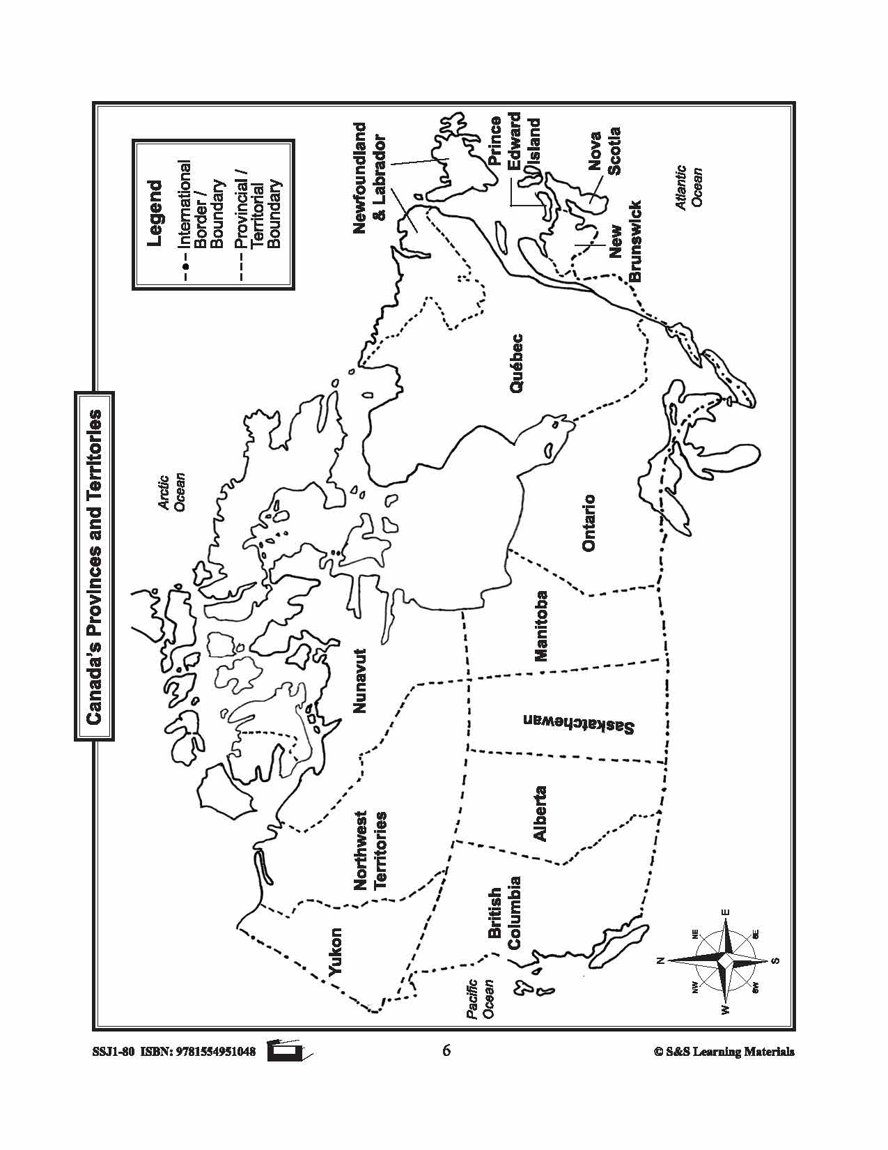
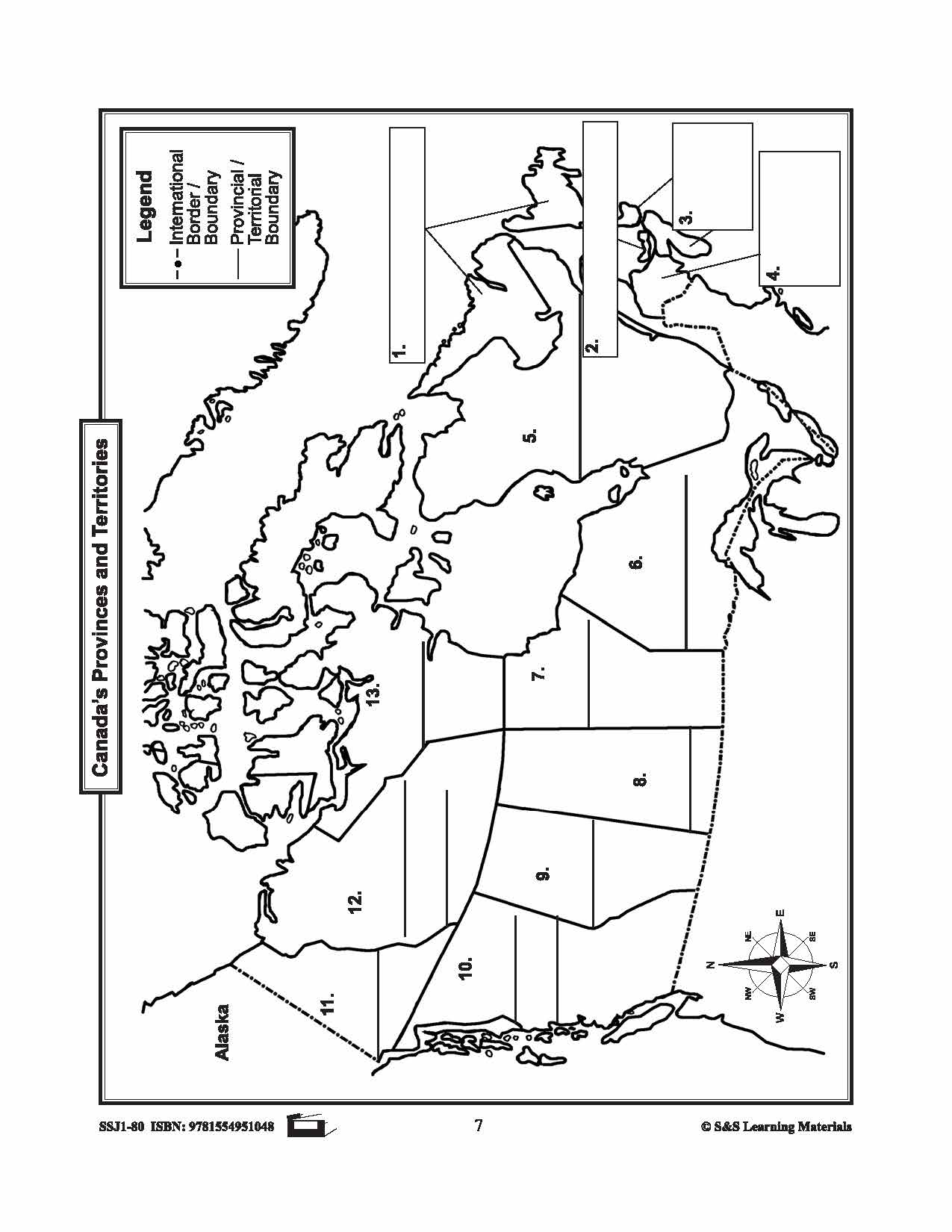
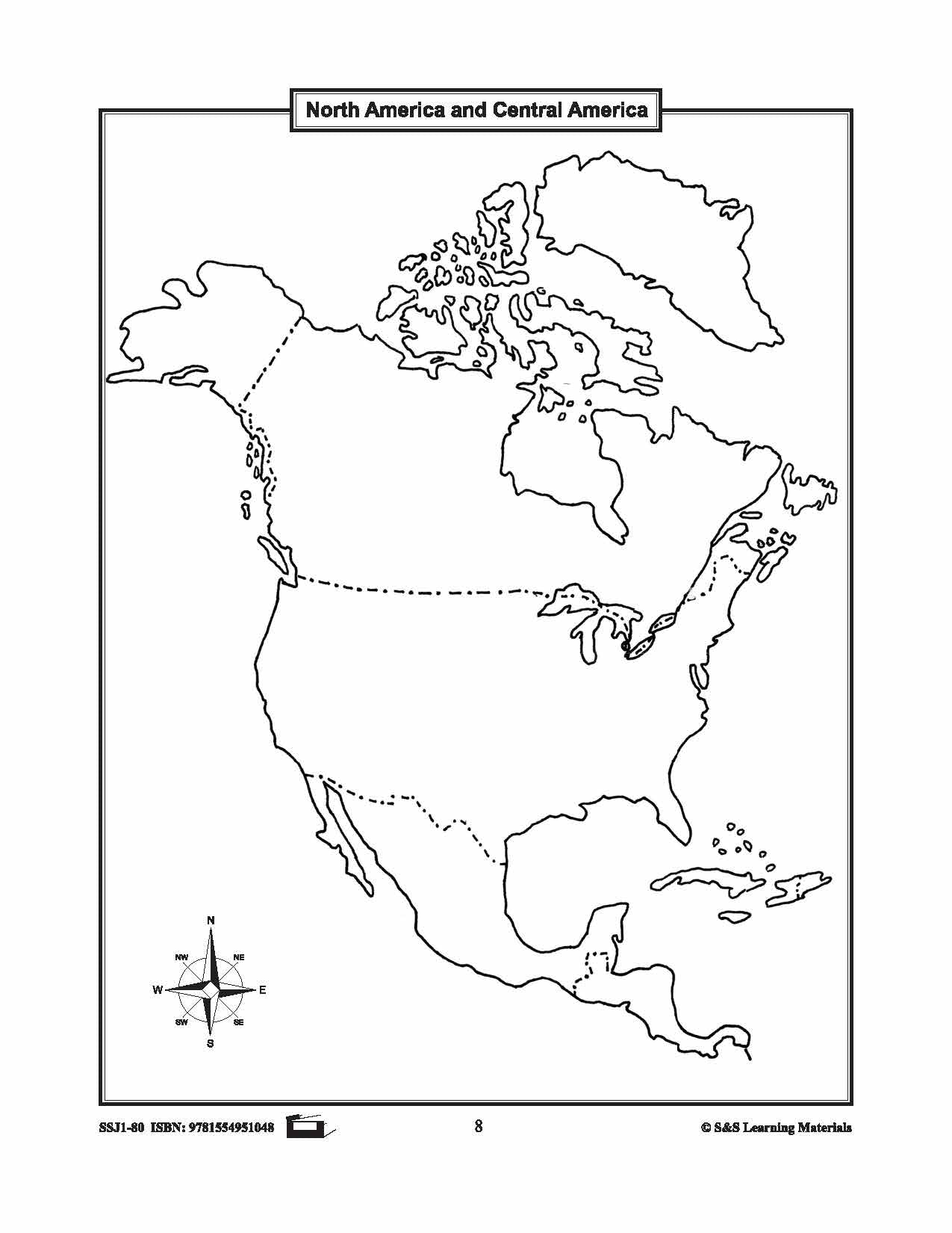

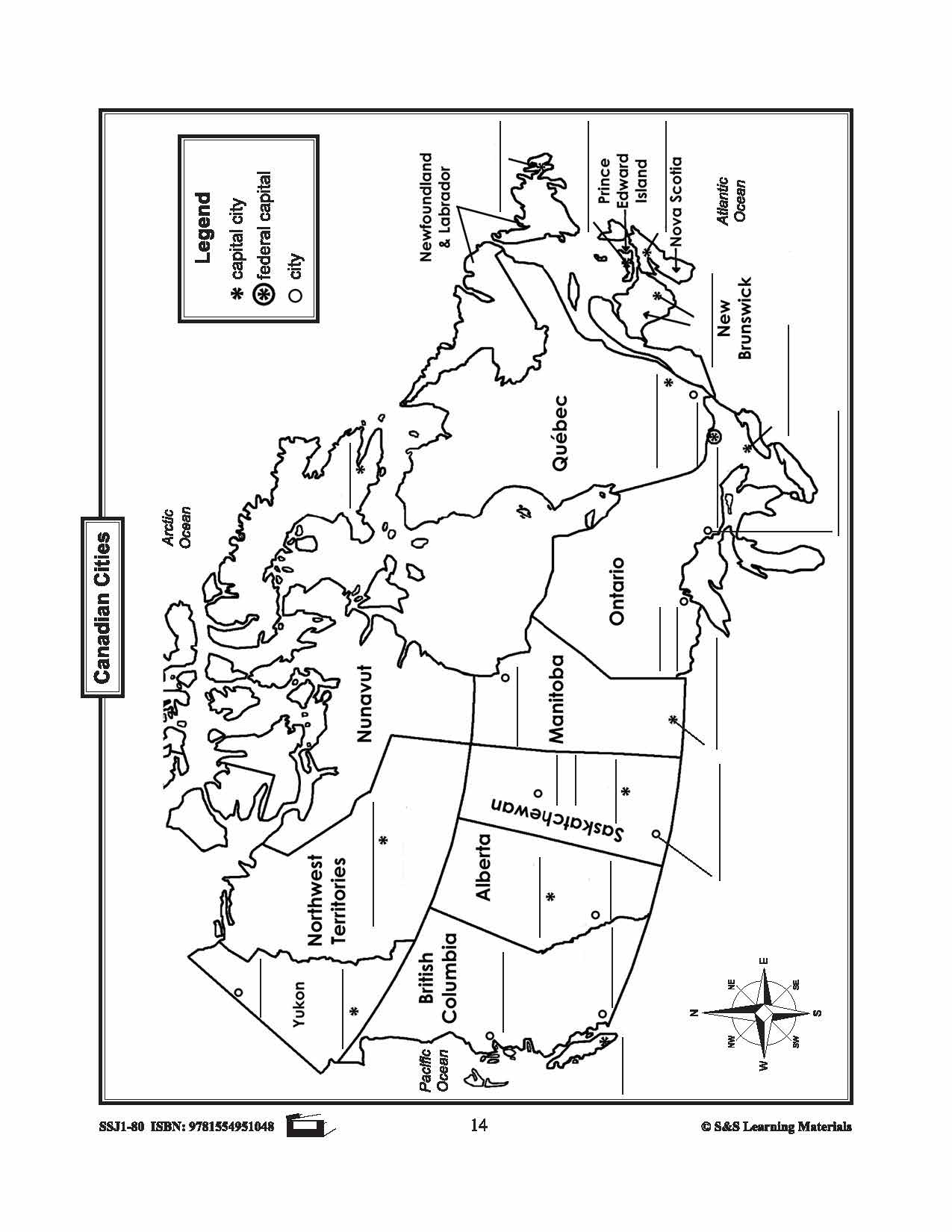
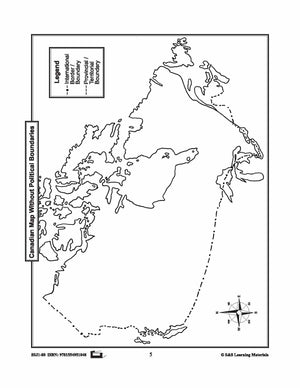
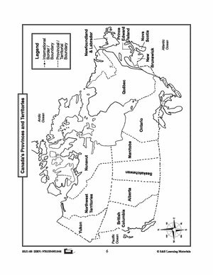


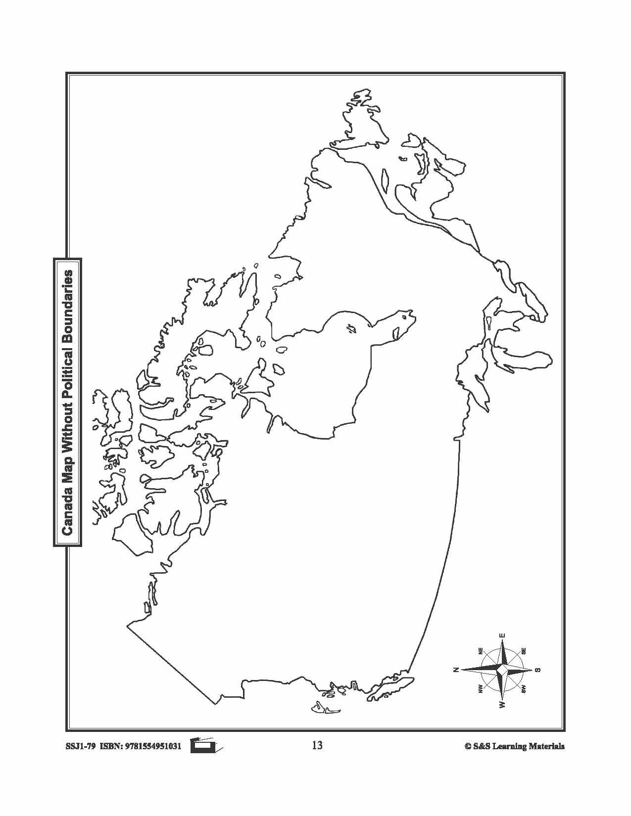
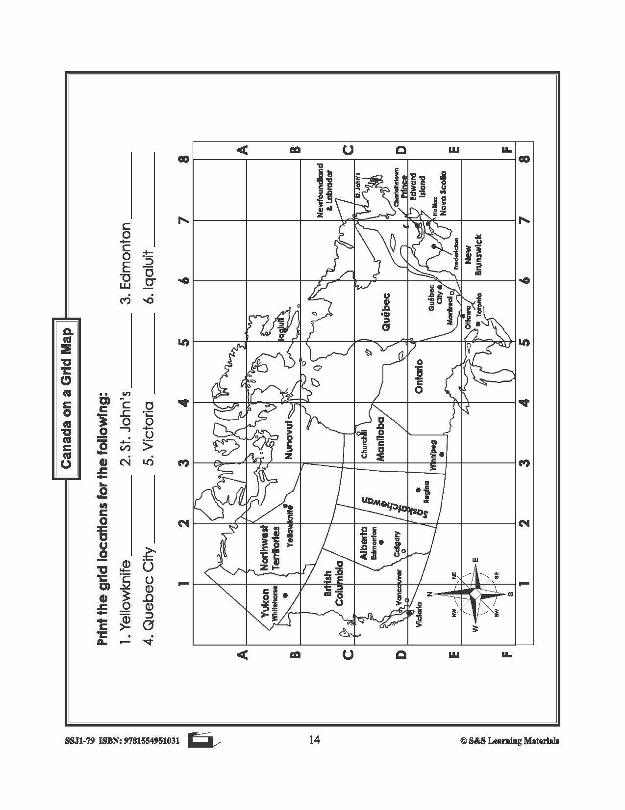
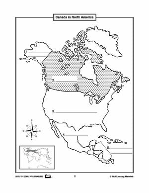
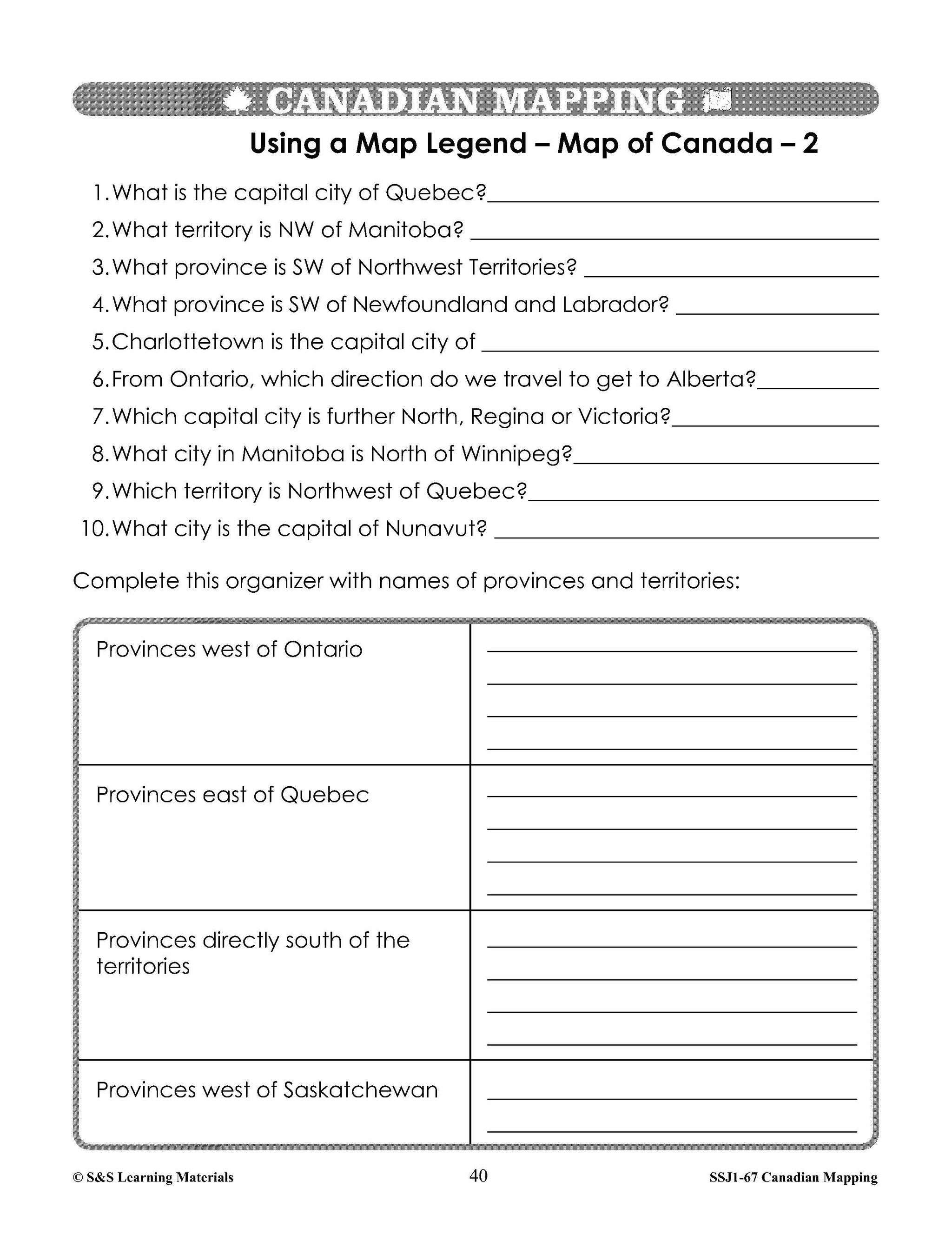
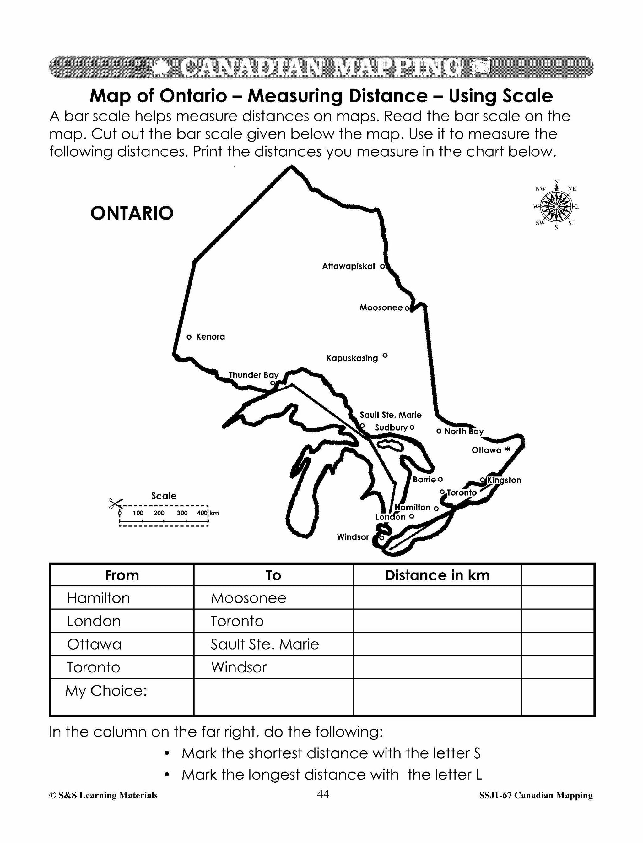
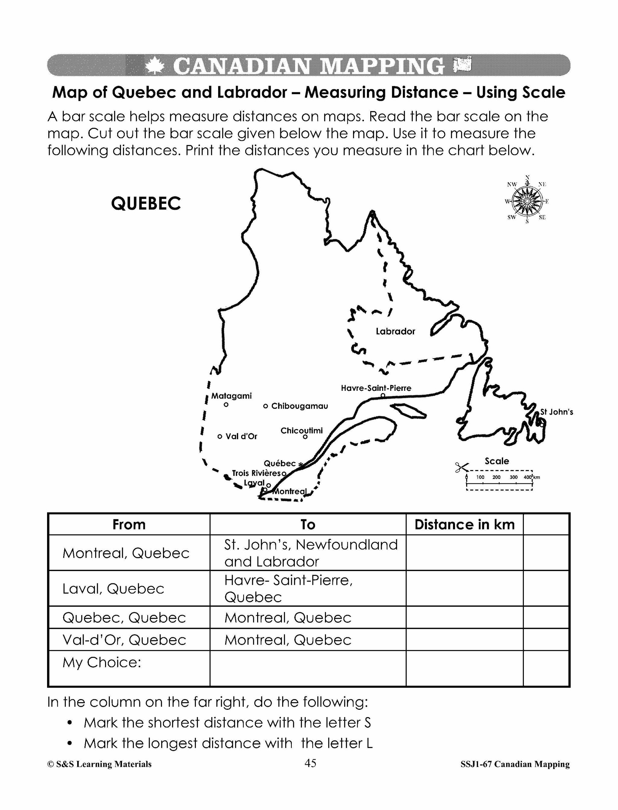
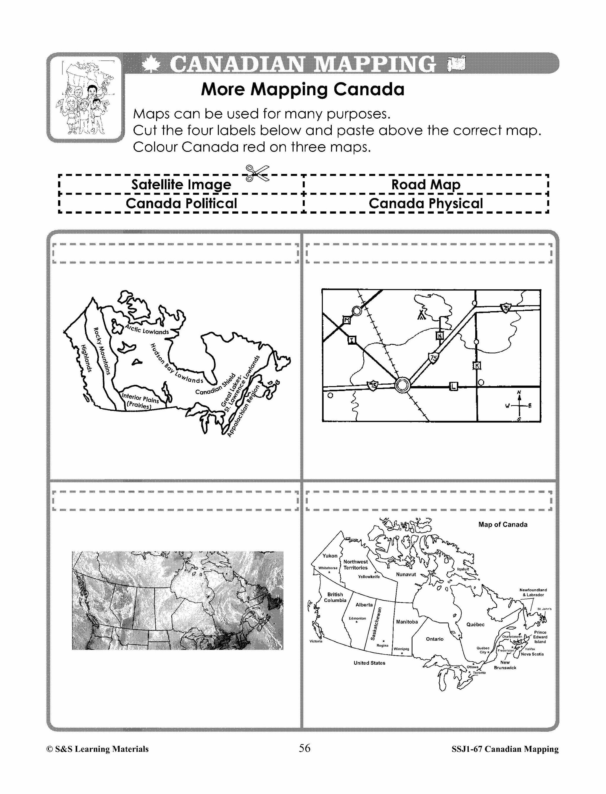
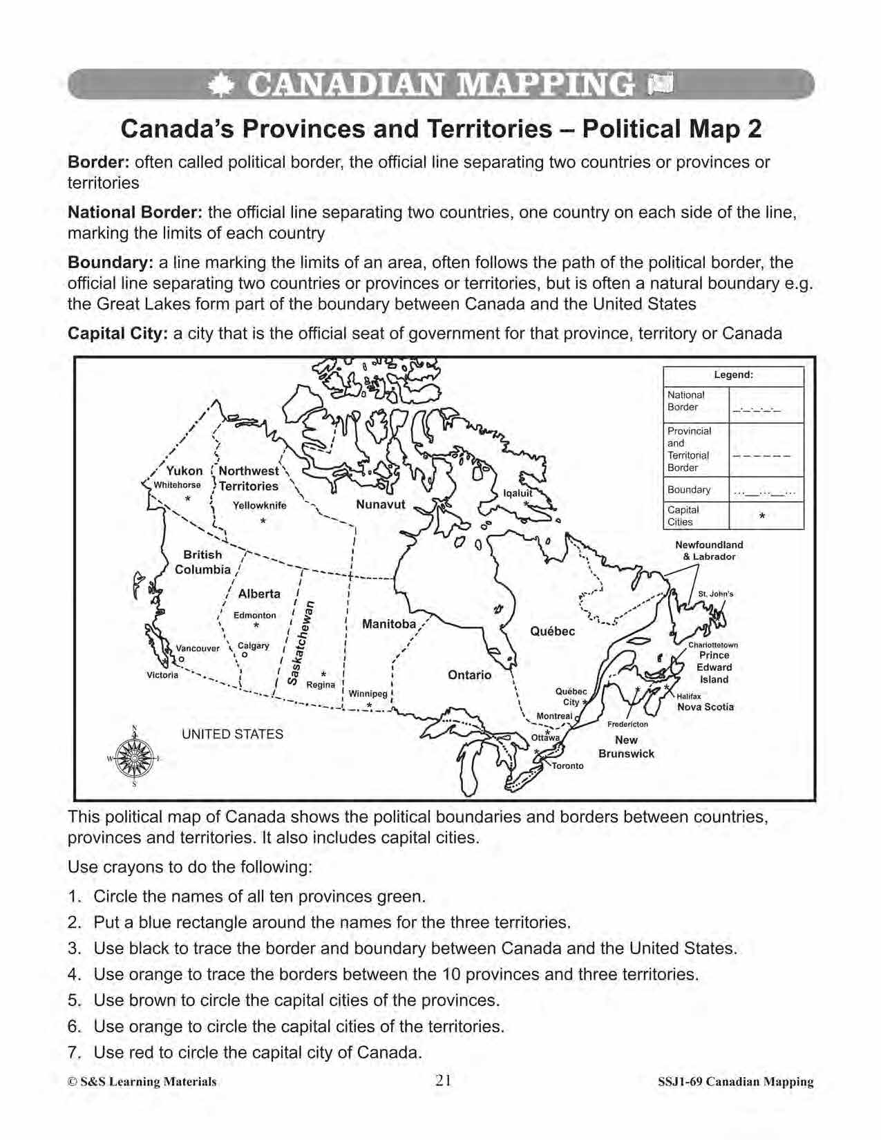
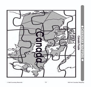
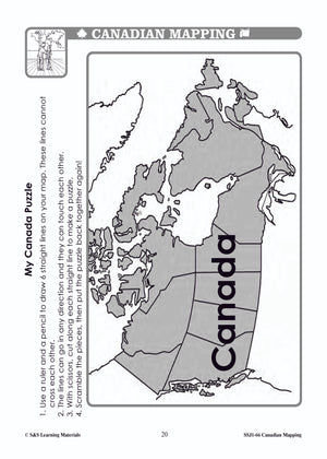
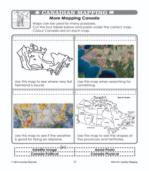
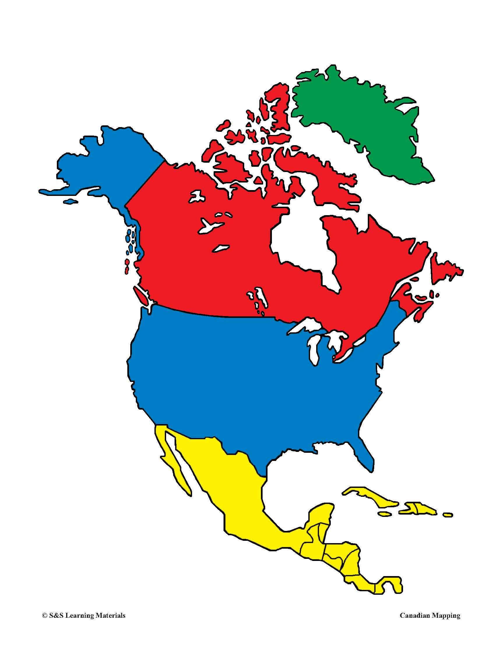
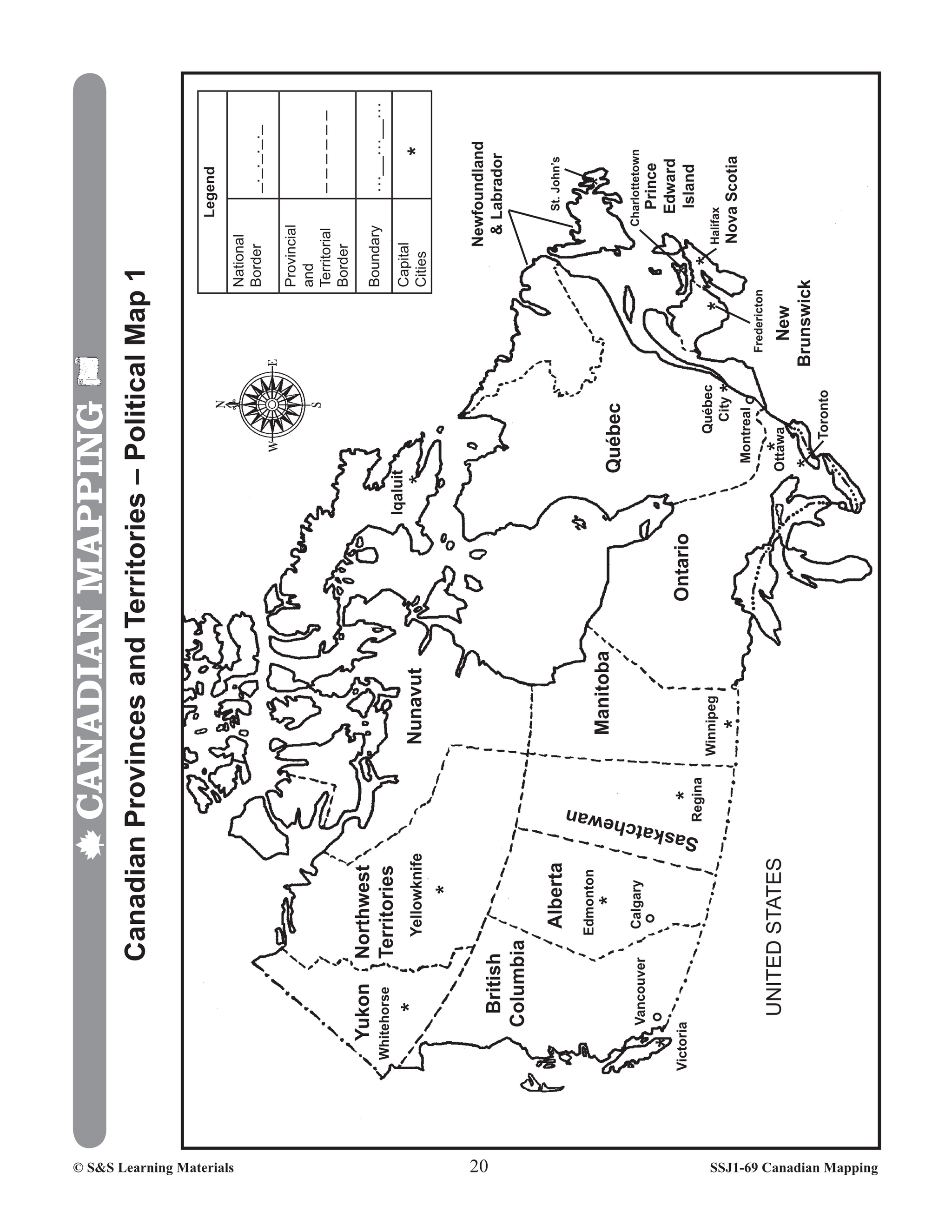
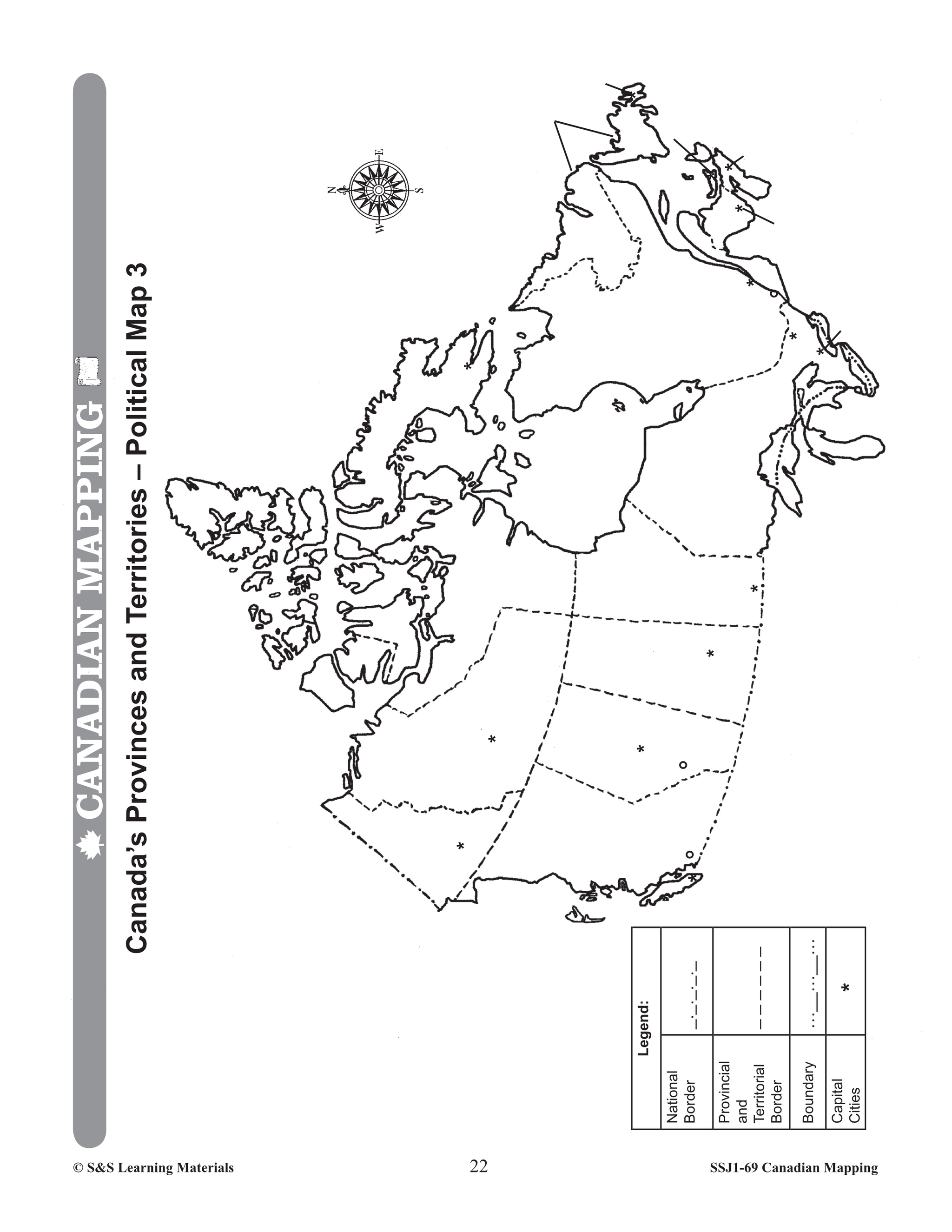
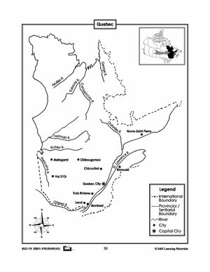
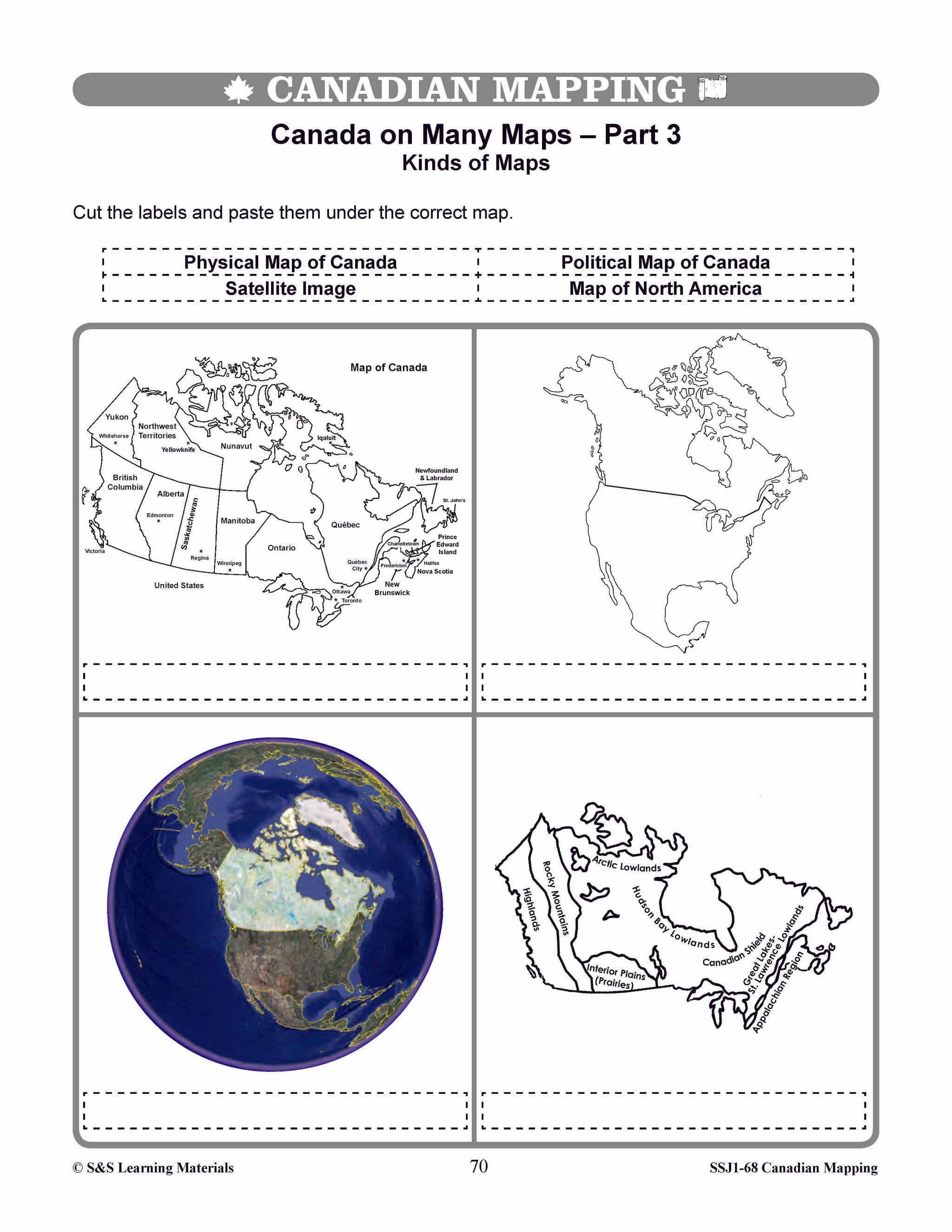
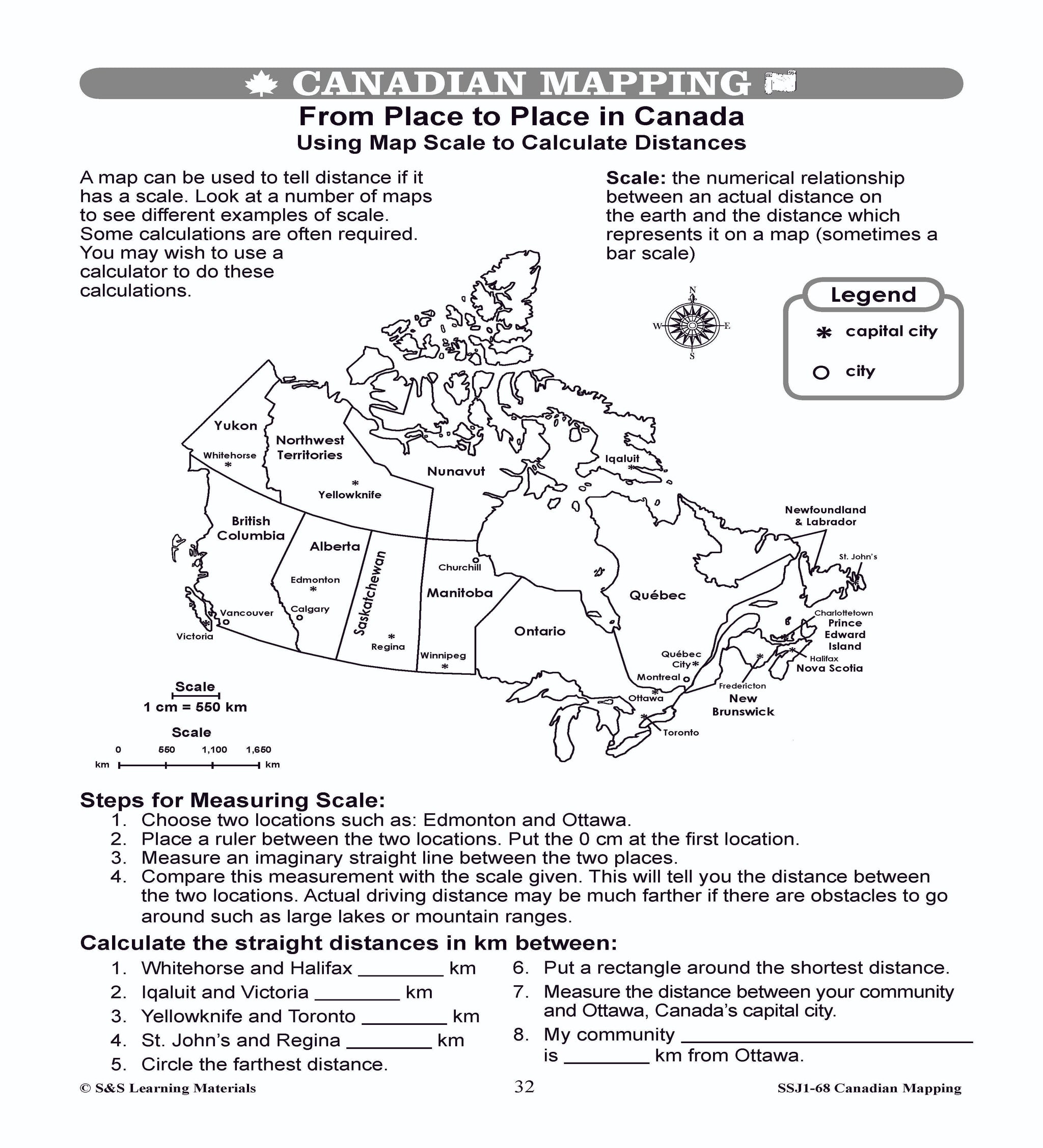
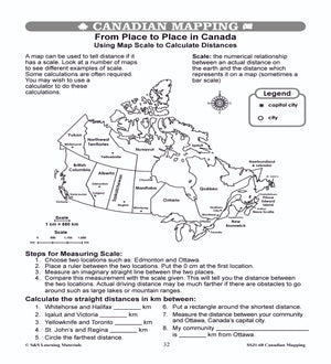
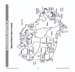
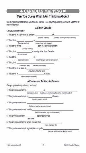
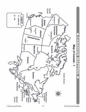
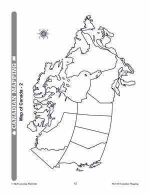
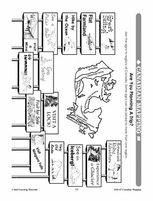
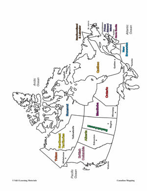
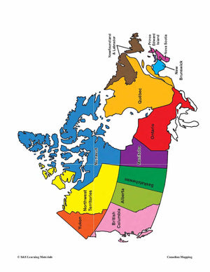
Maps of Canada Grades 4-8
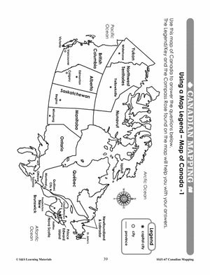
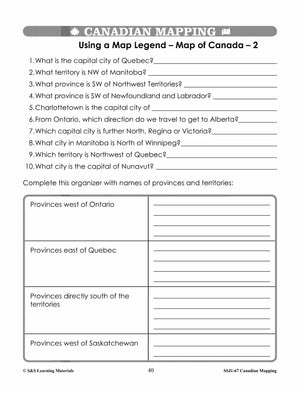
$6.95 CAD
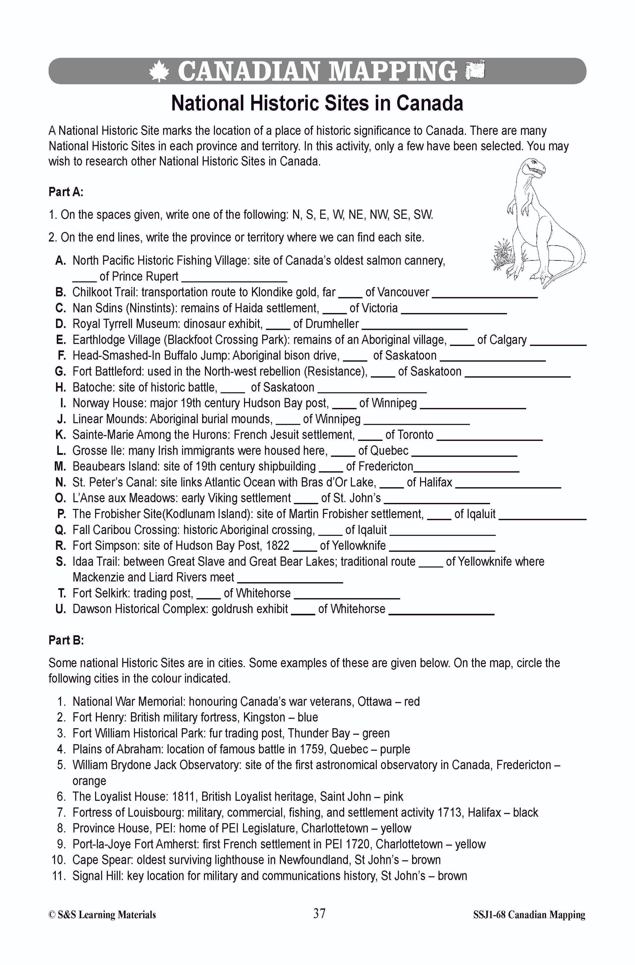
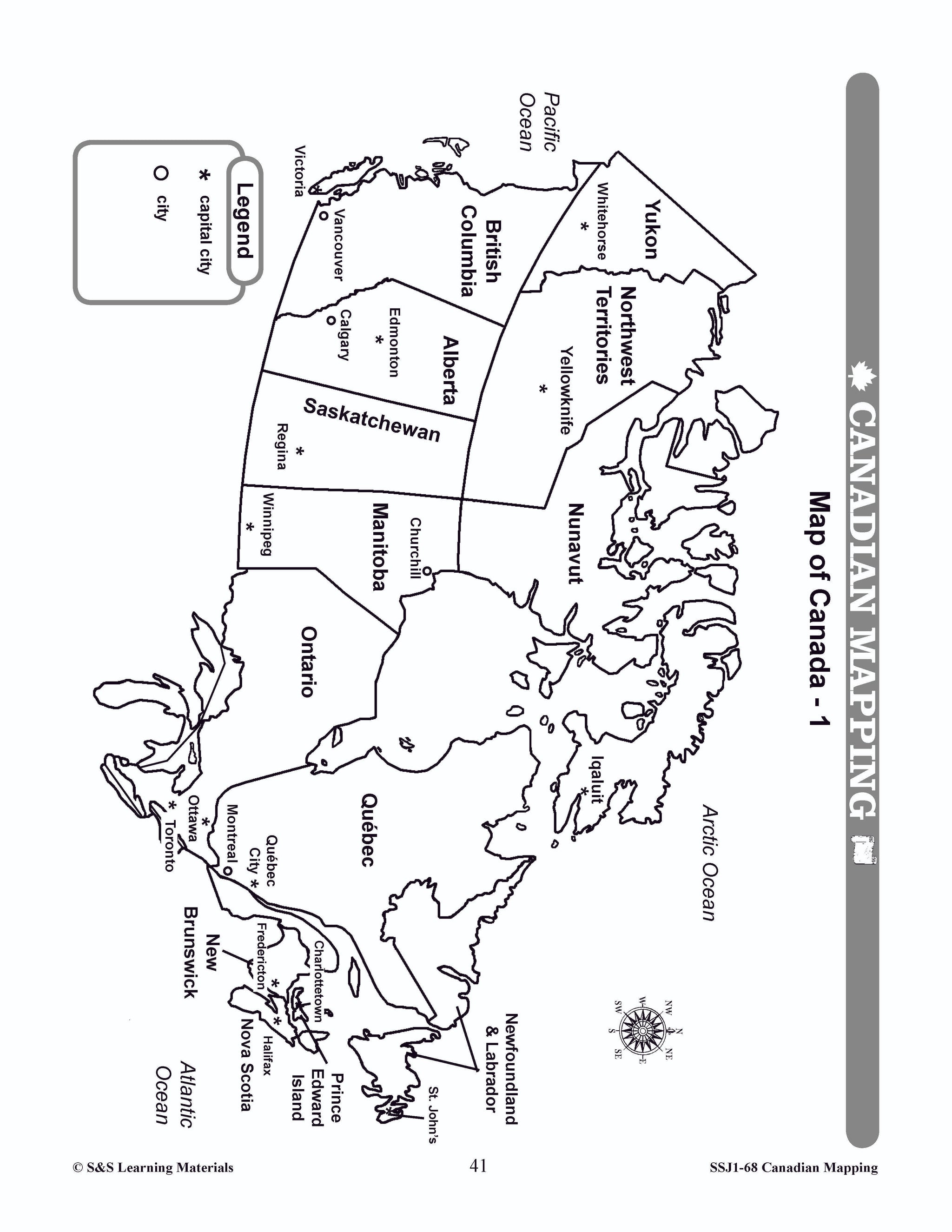
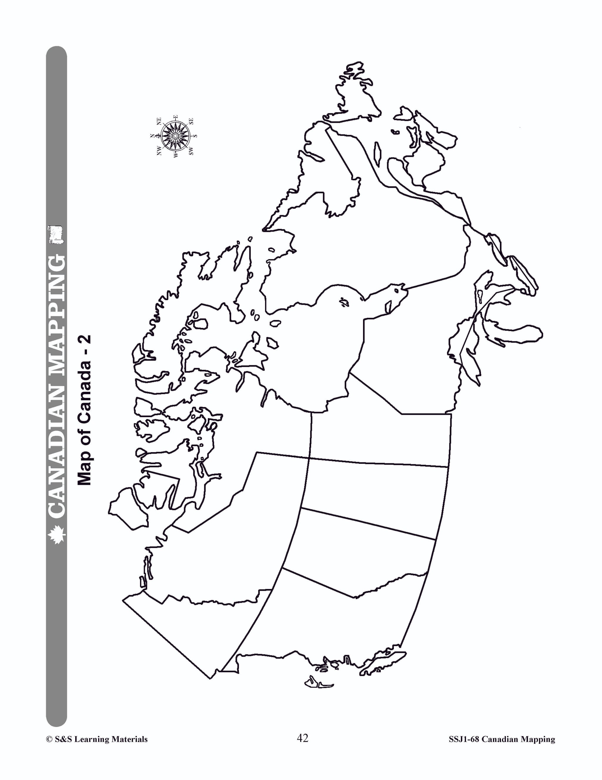
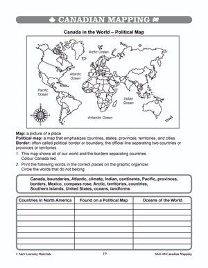
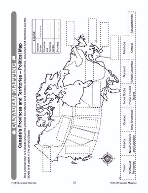
The maps can be used to teach or review the use of directions on a compass rose, symbols on a legend, and mapping terms such as border, boundary, and hemisphere. They will help students: recognize the shape of Canada locate...

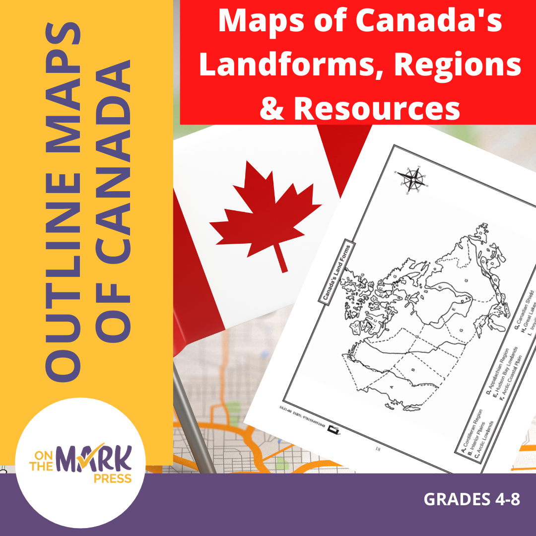

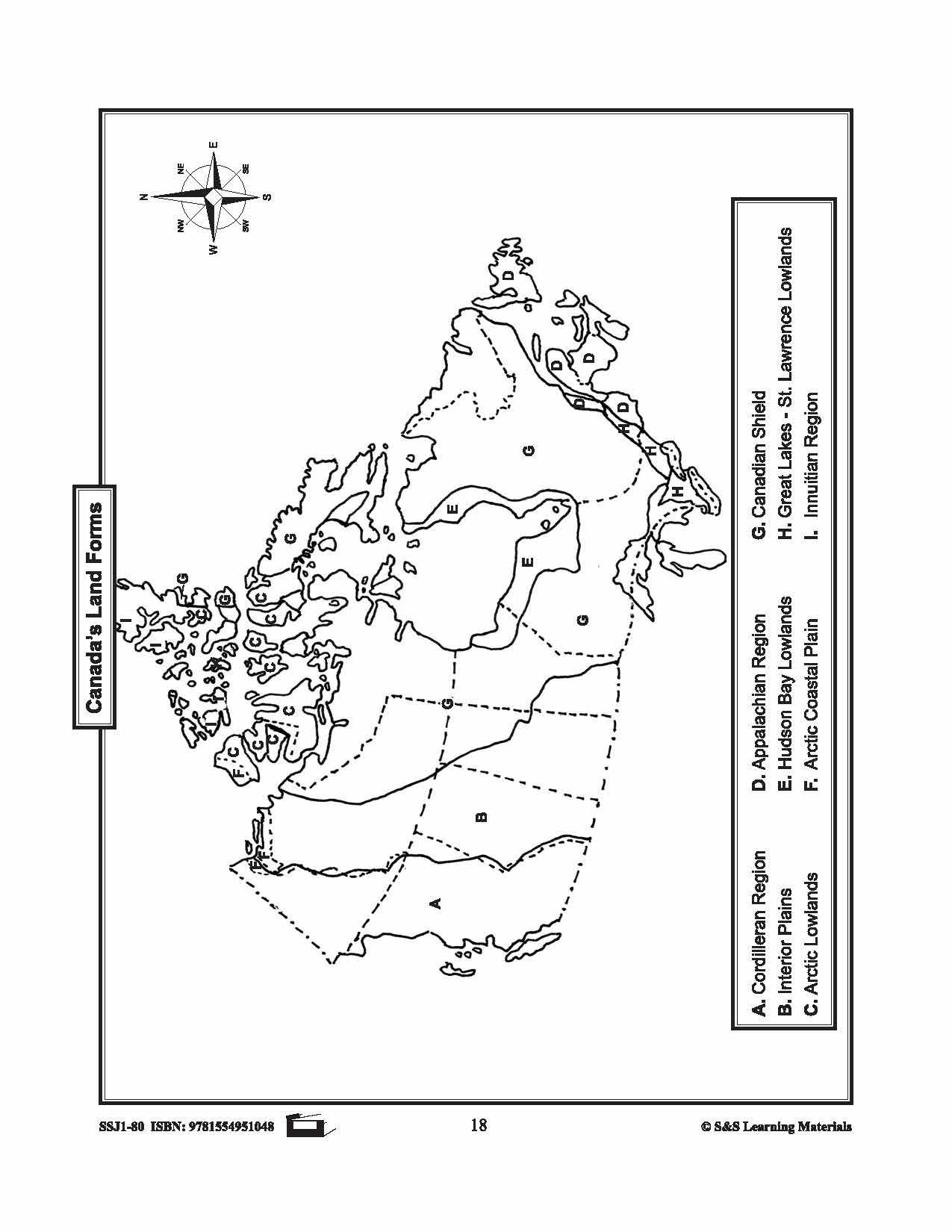
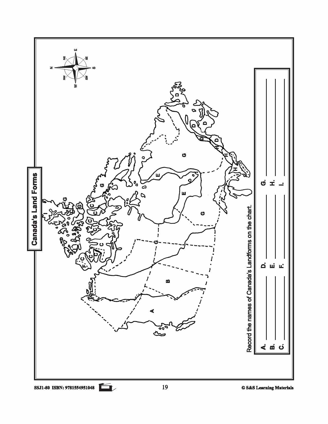
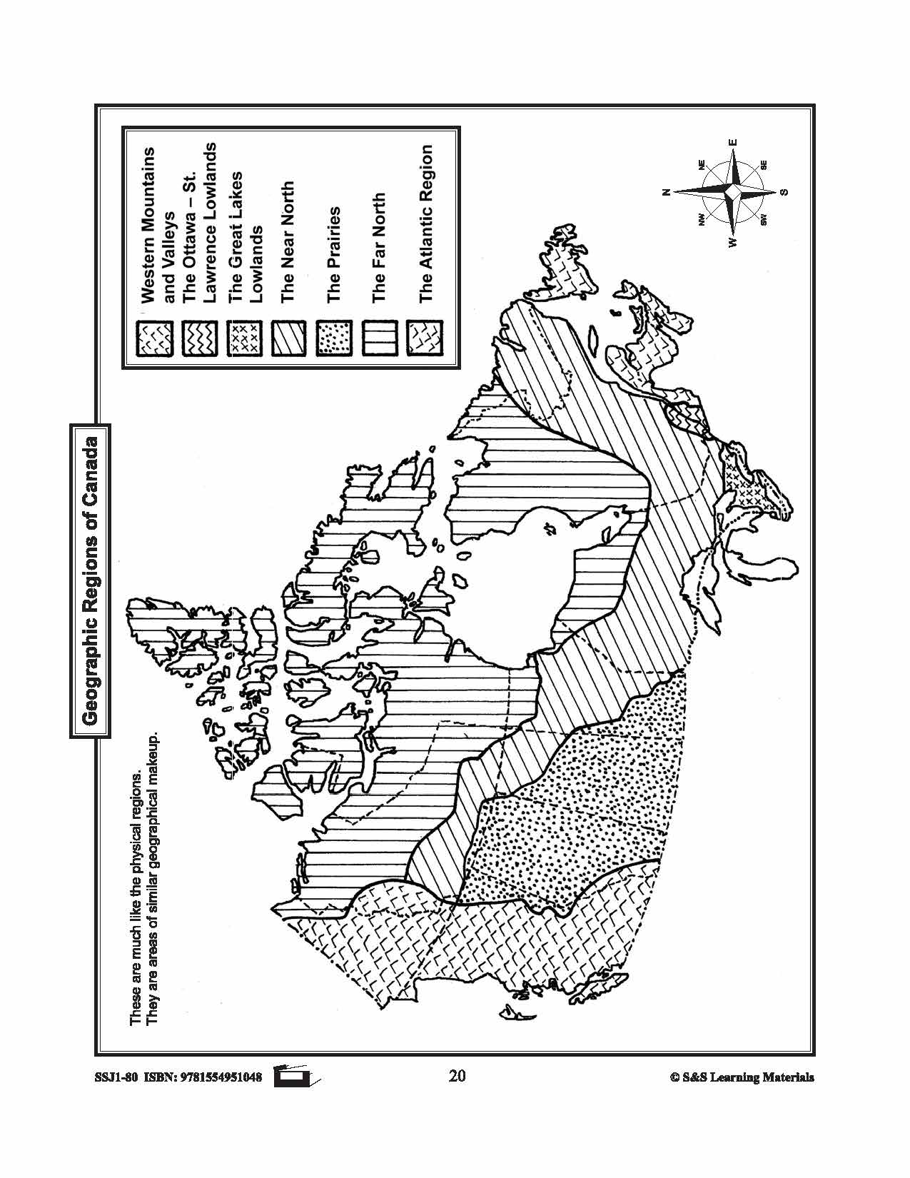
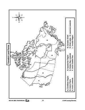


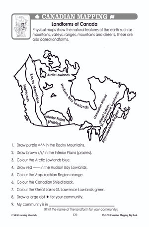
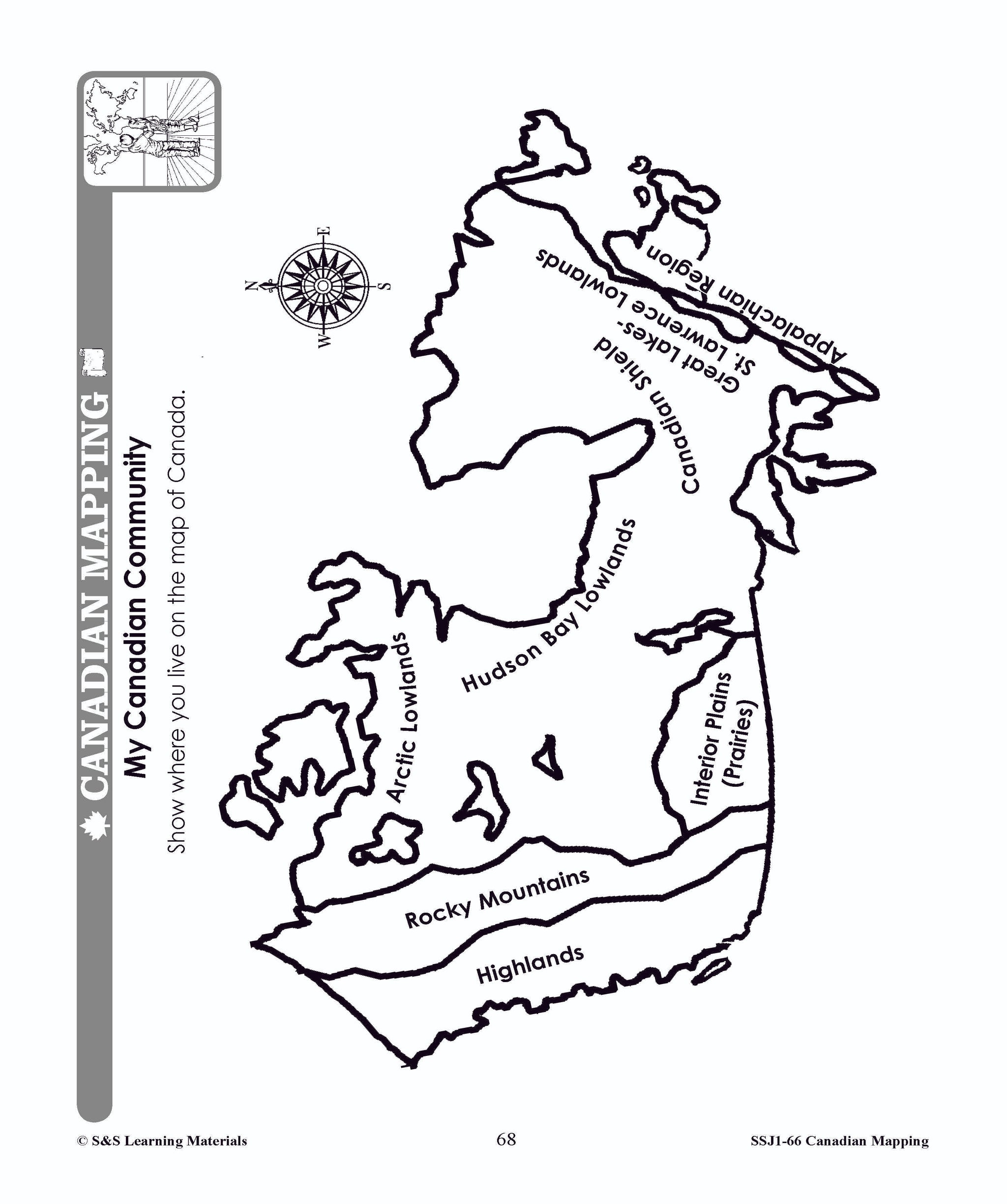
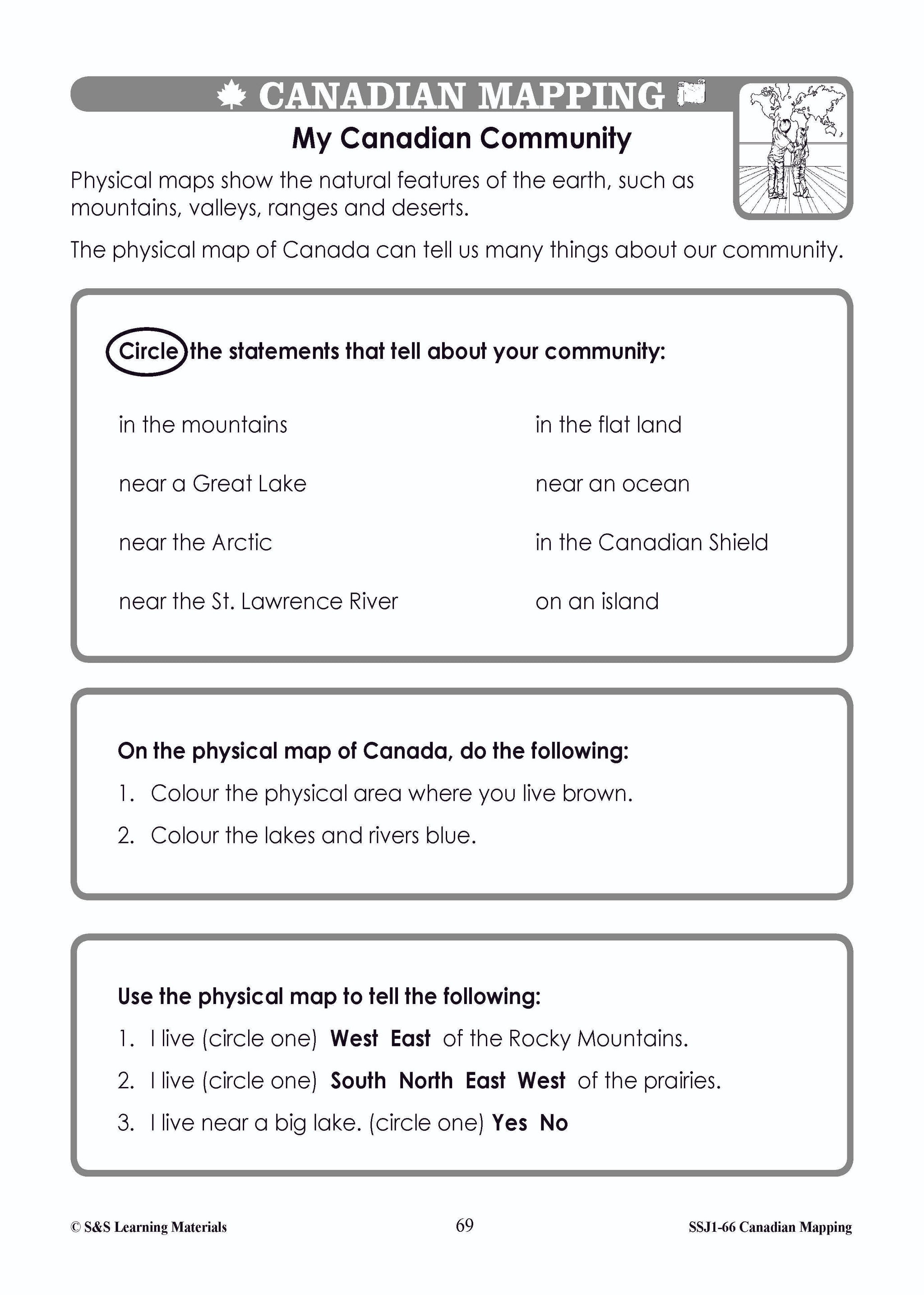
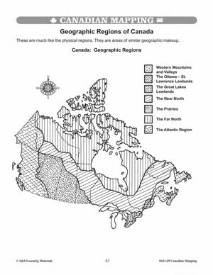
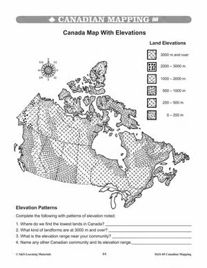
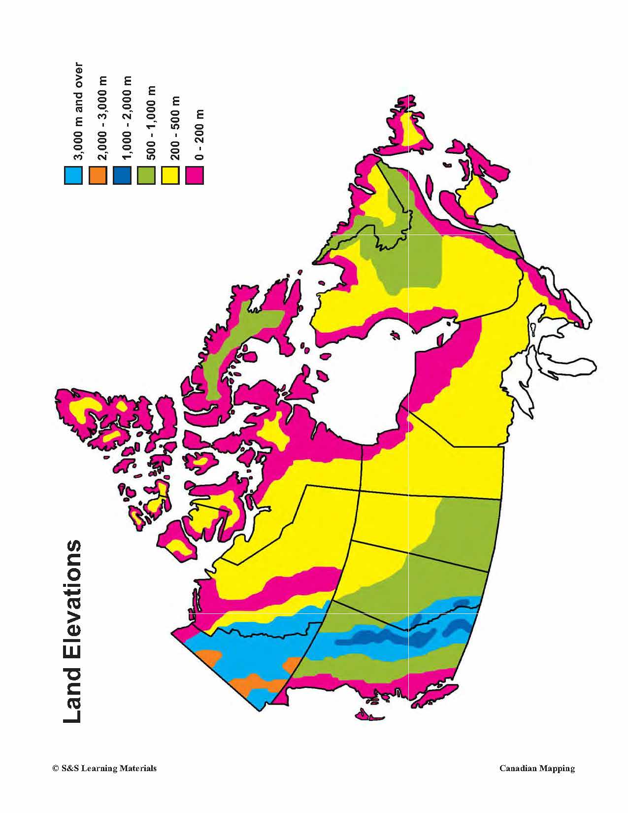
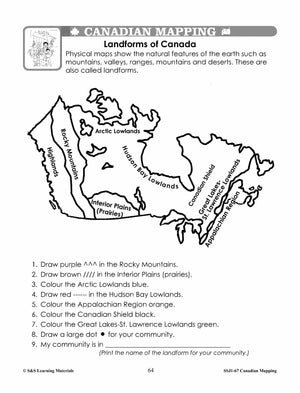
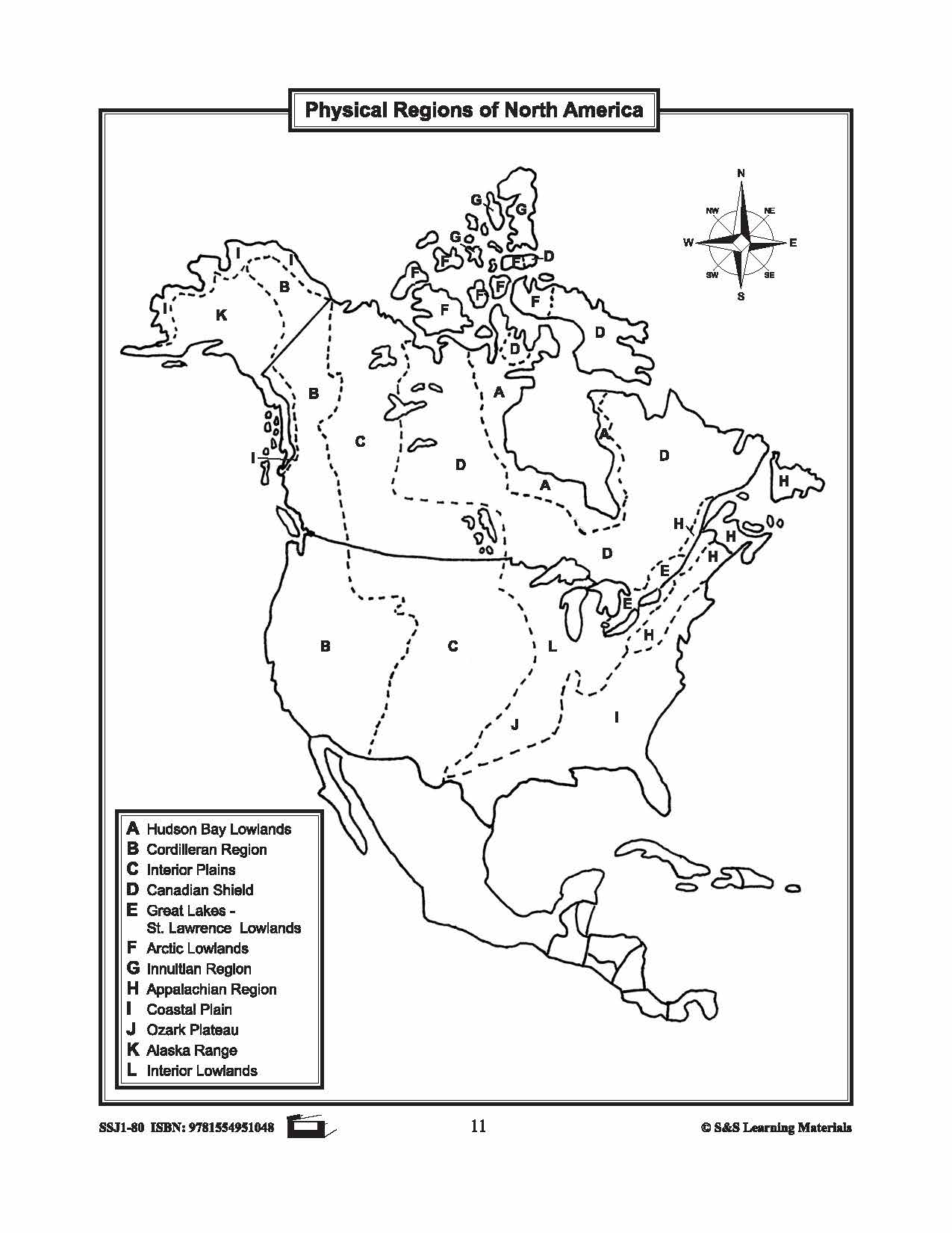
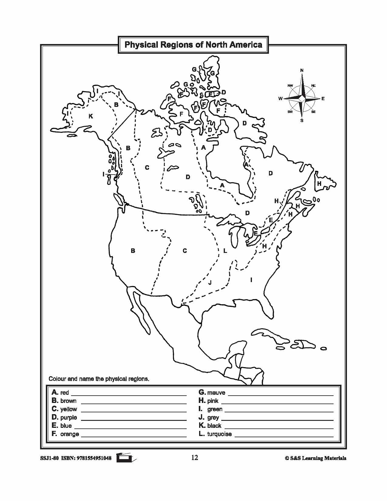
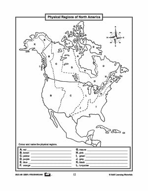
Maps of Canada's Landforms, Regions & Resources Grades 4-8
$5.45 CAD
The maps will help students learn about Canada's landforms, geographic regions of Canada, economic regions, natural resources, and physical regions of Canada. 6 pages


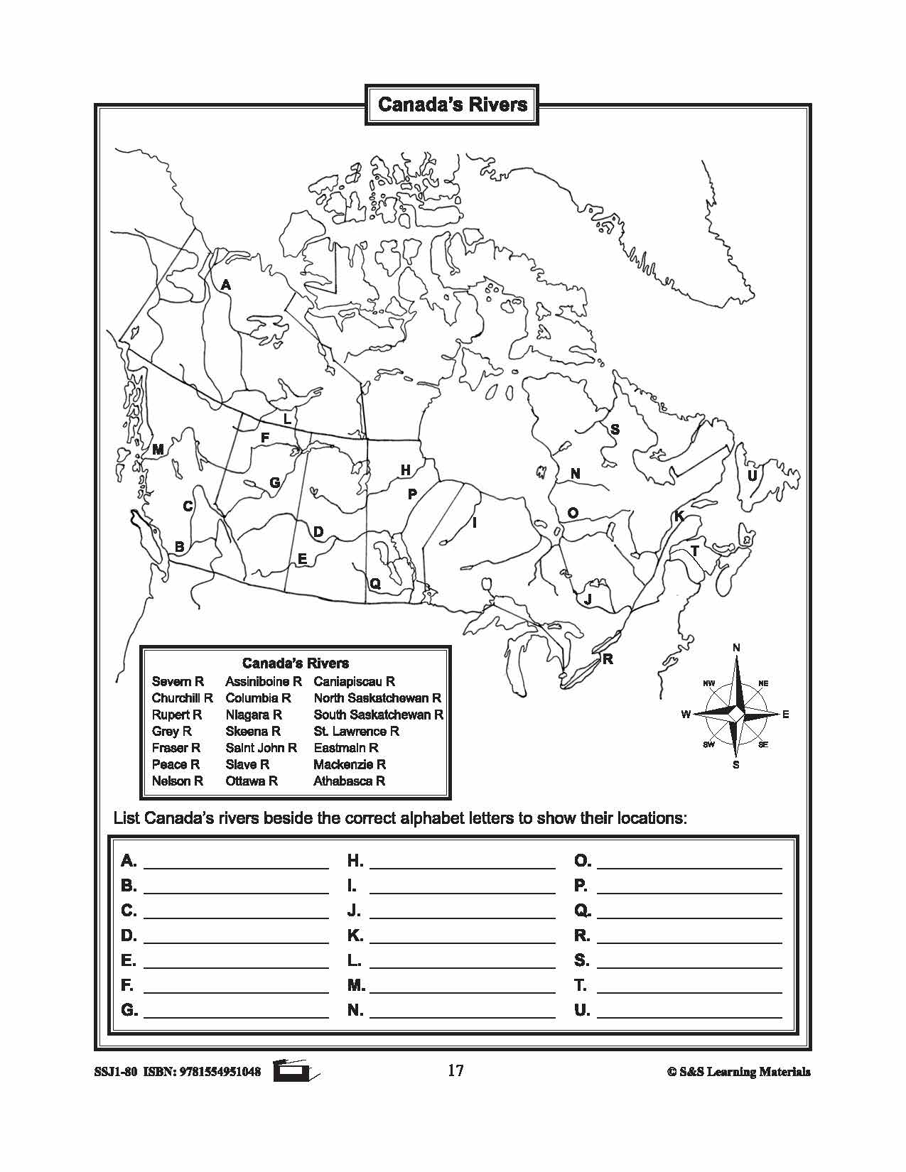
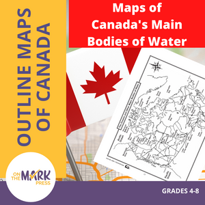
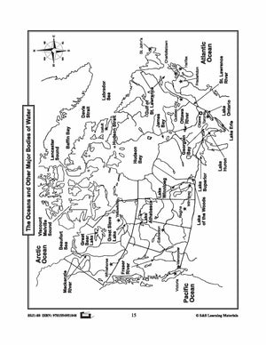
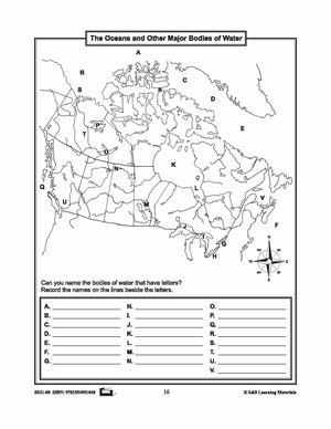

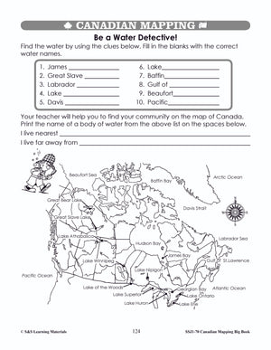
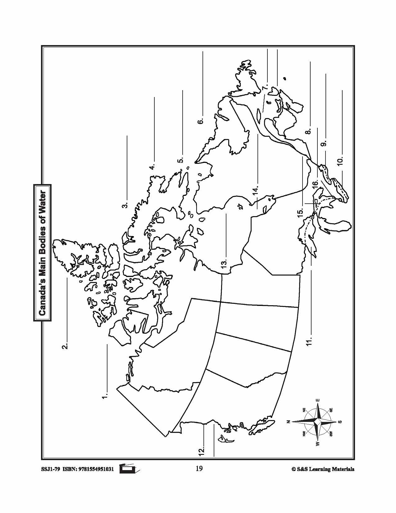
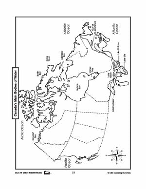
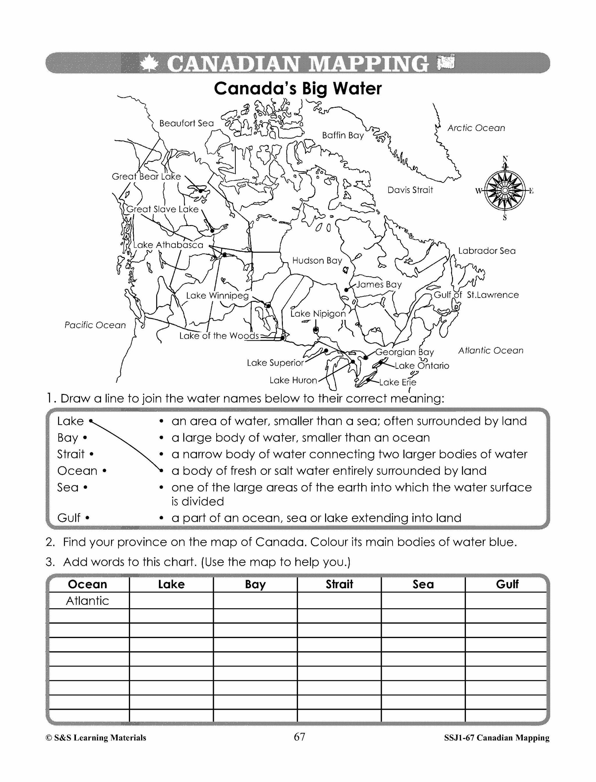
Maps of Canada's Main Bodies of Water Grades 4-8
$4.45 CAD
The maps will help students to recognize and locate Canada's main bodies of water, and discover rivers and lakes in each province or territory. 4 Pages


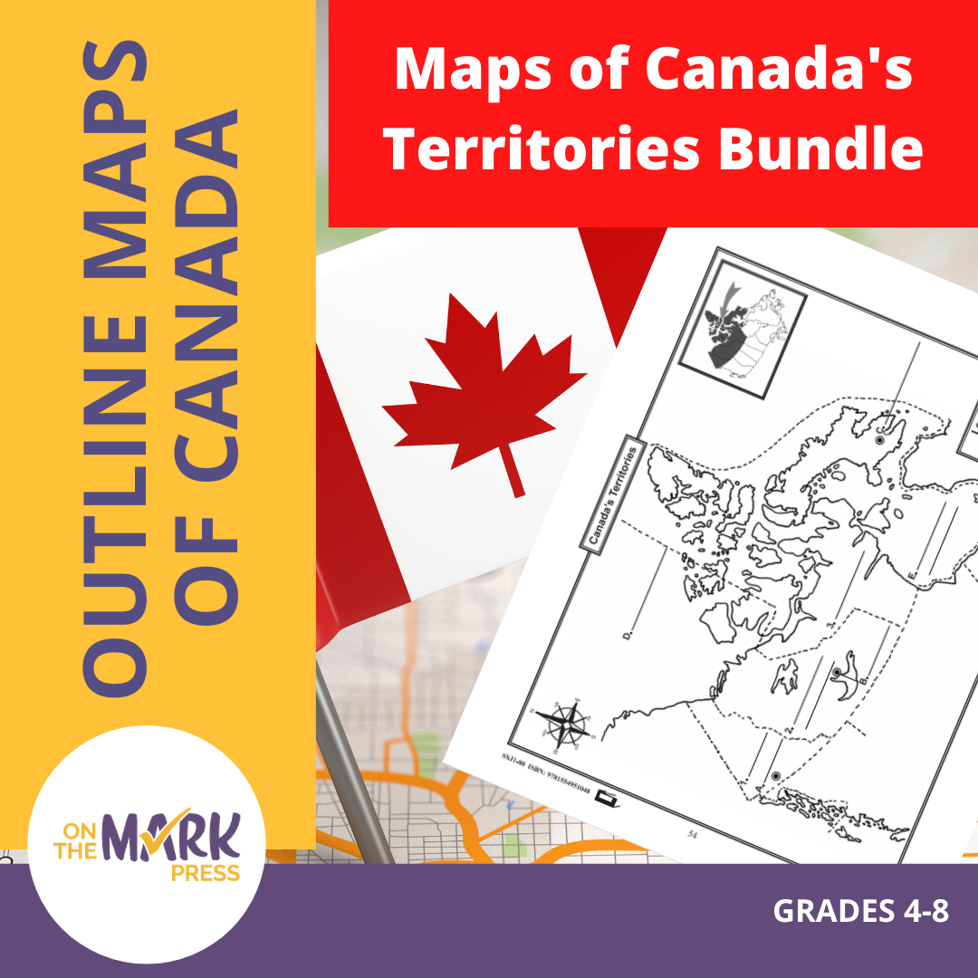
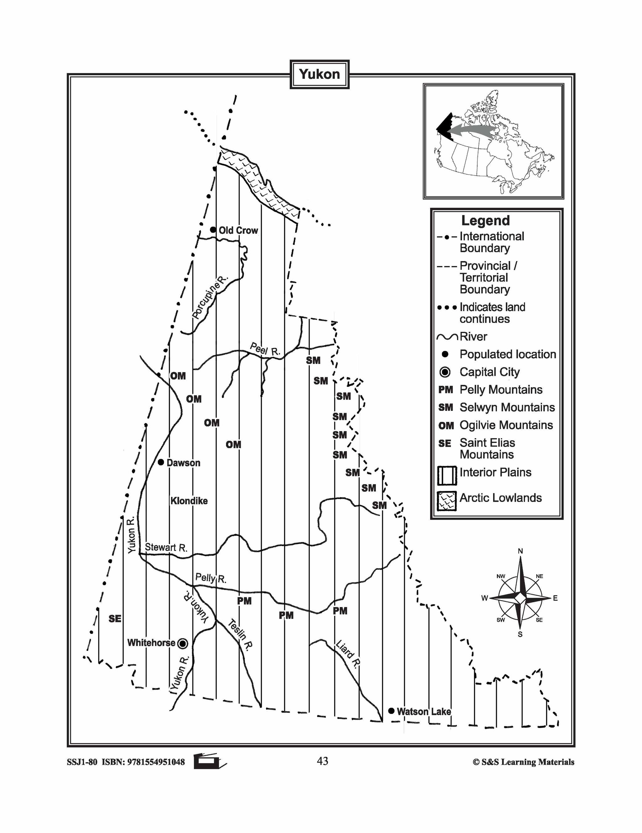
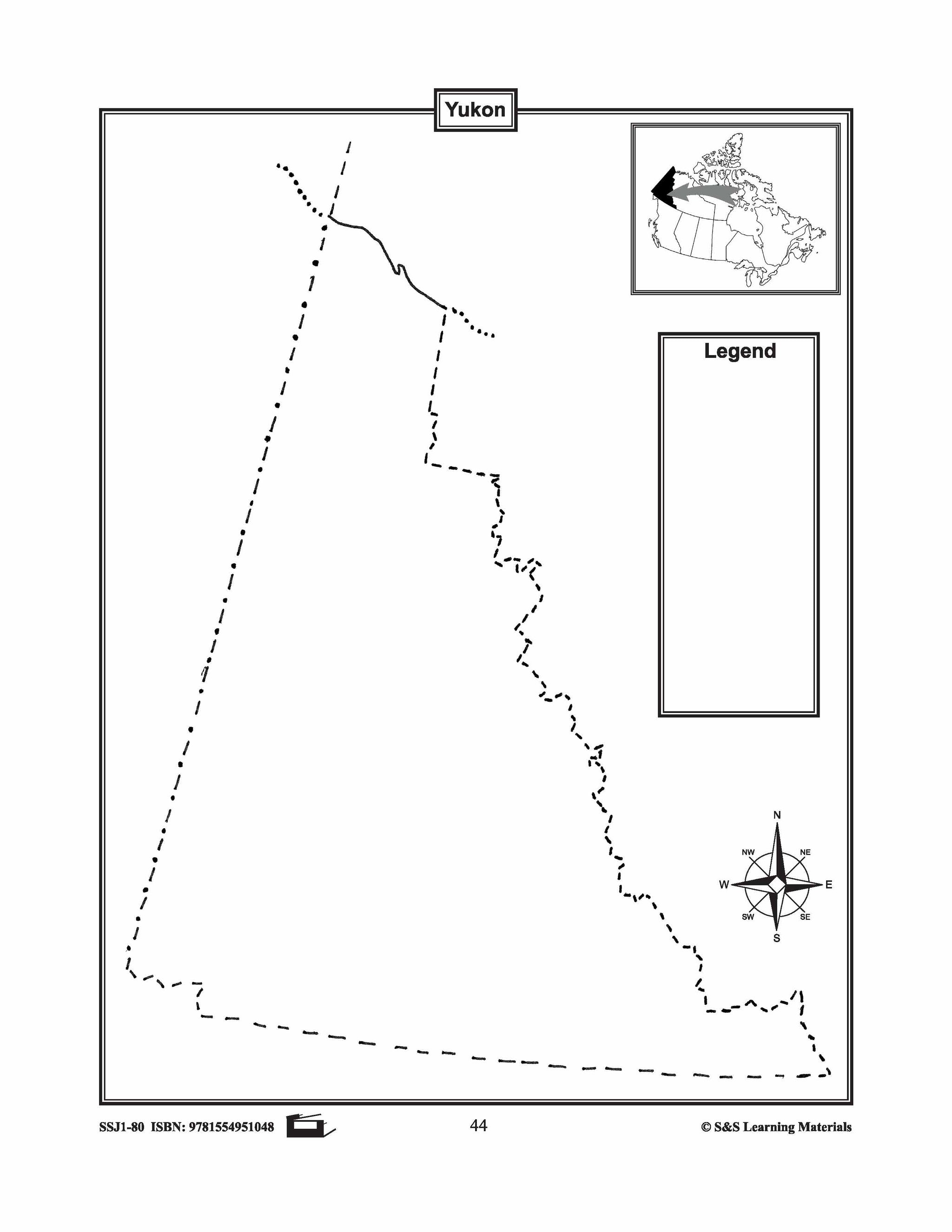

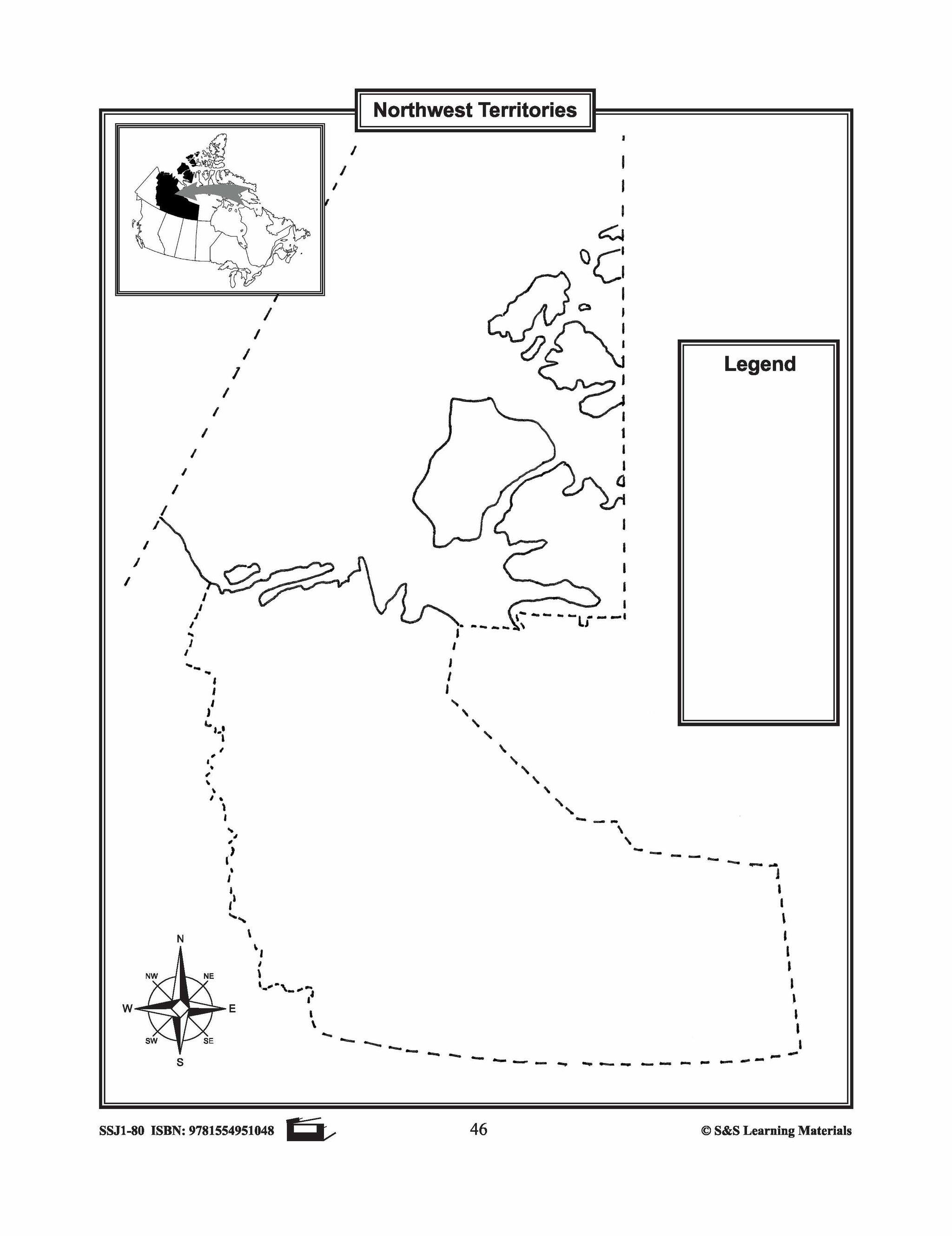


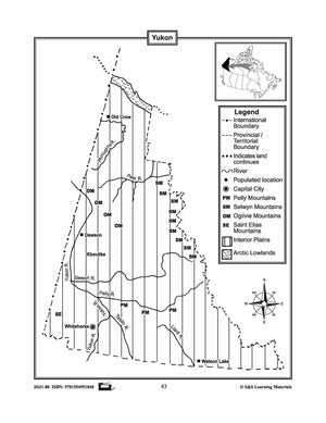
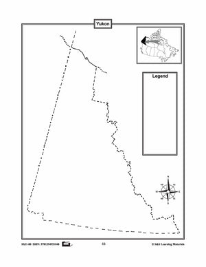
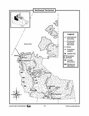
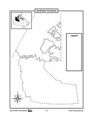


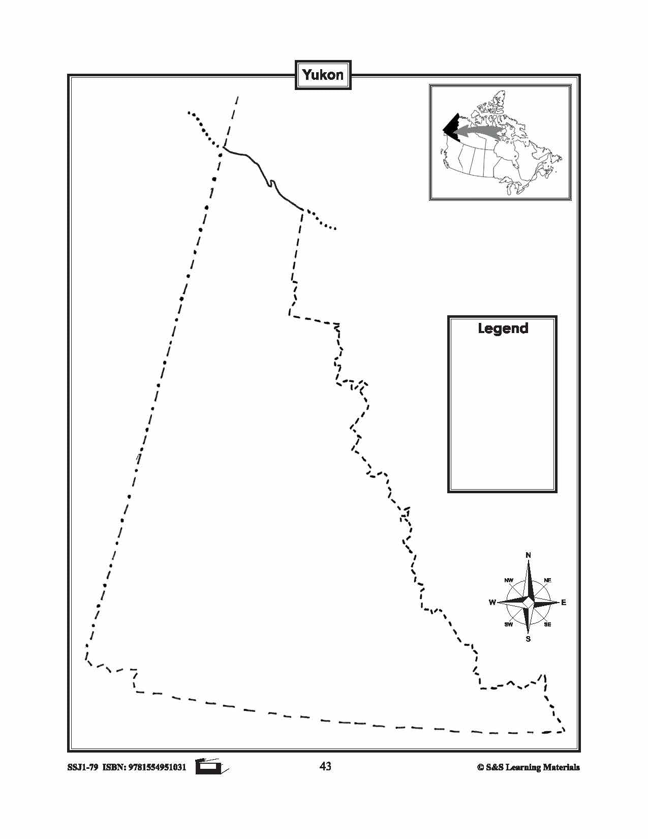
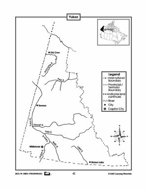
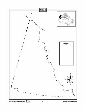
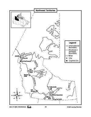
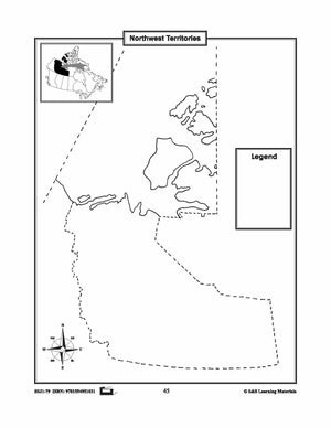
Maps of Canada's Territories $avings Bundle! Grades 4-8
$6.45 CAD
These resources help students learn about the Territories: Yukon, Northwest Territories, and Nunavut.They learn about their international and provincial/territorial boundary, rivers, landforms, capital cities, and other cities. 6 pages Subscribe to our Fan List!: Our FANlist newsletter is full of tips...


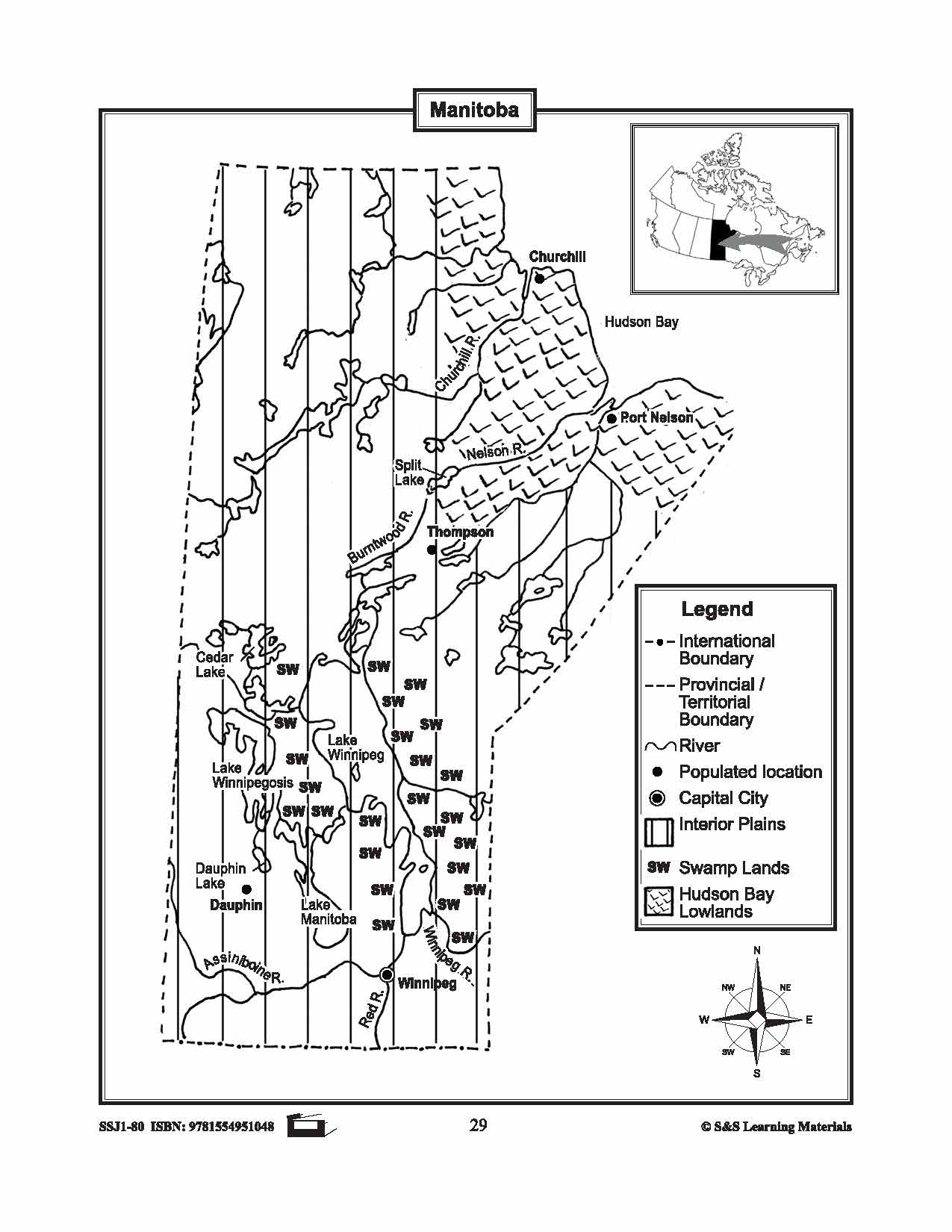


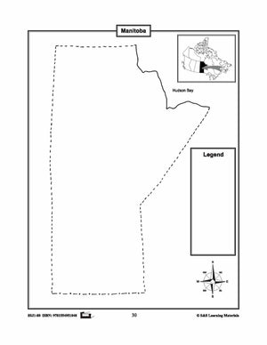
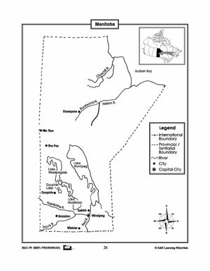
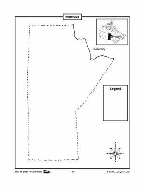
Maps of Manitoba Grades 4-8
$3.45 CAD
The maps will help students learn about Manitoba and its international and provincial/territorial boundary, rivers, landforms, the capital city, and other cities. 2 pages

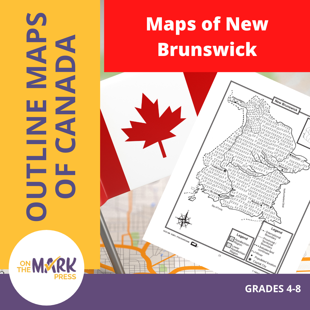

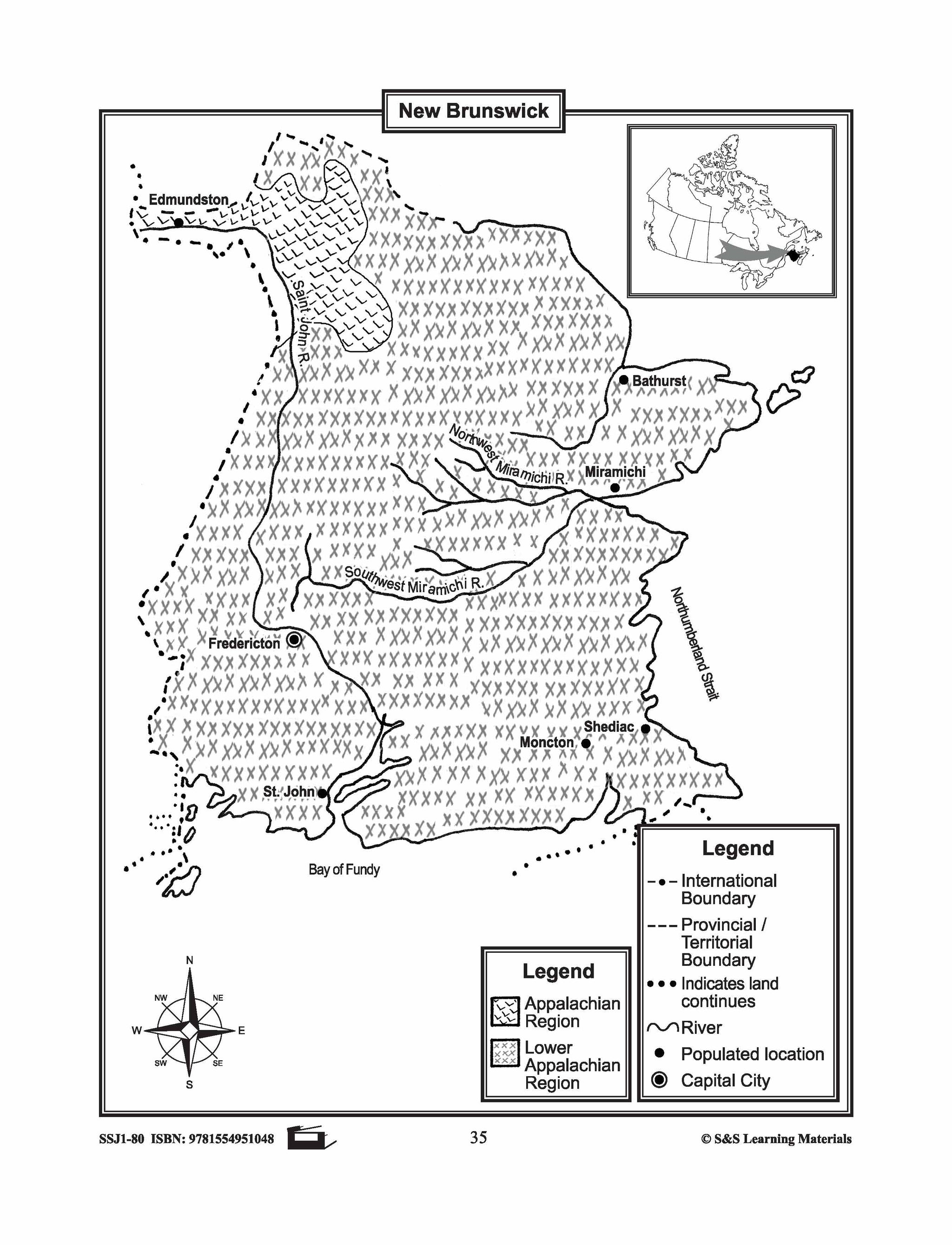

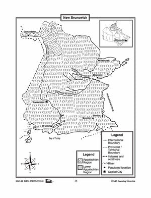
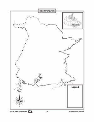
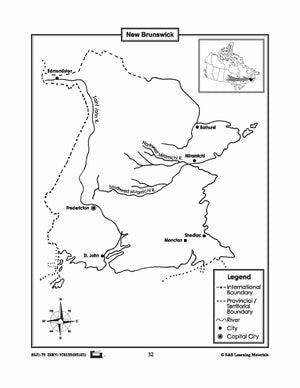
Maps of New Brunswick Grades 4-8
$3.45 CAD
The maps will help students learn about New Brunswick and its international and provincial/territorial boundary, rivers, landforms, the capital city, and other cities. 2 pages

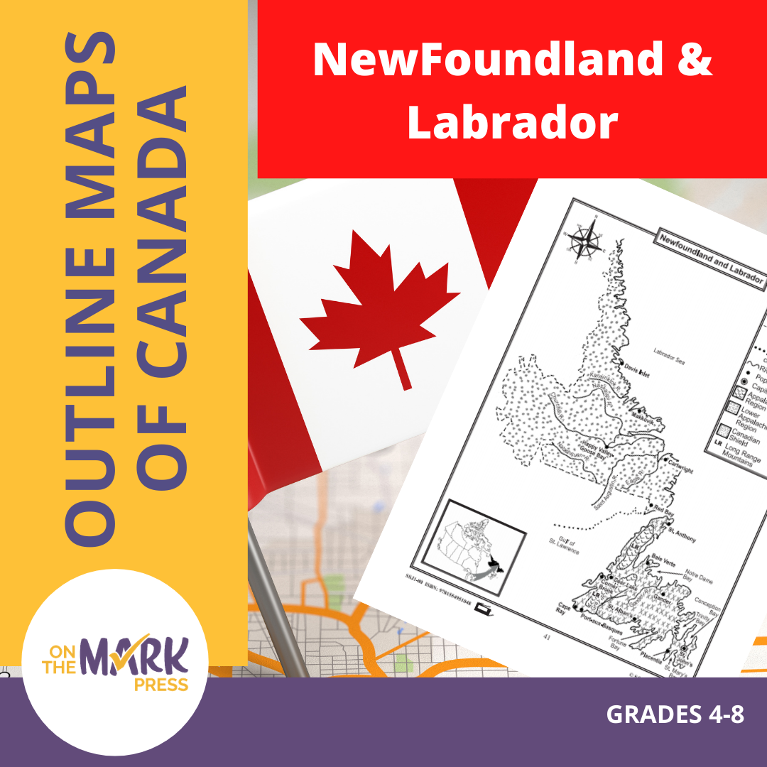


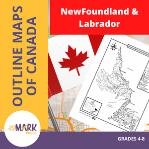
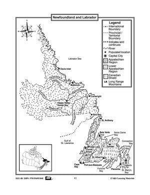
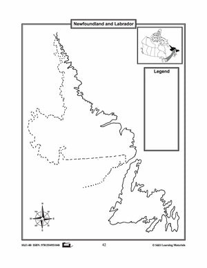
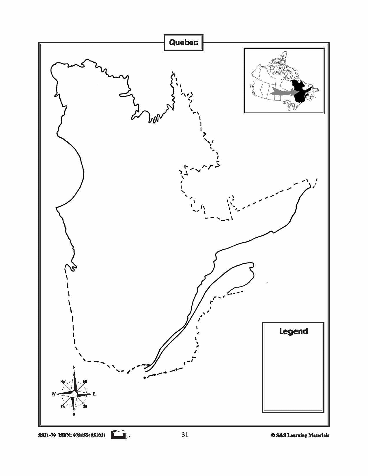
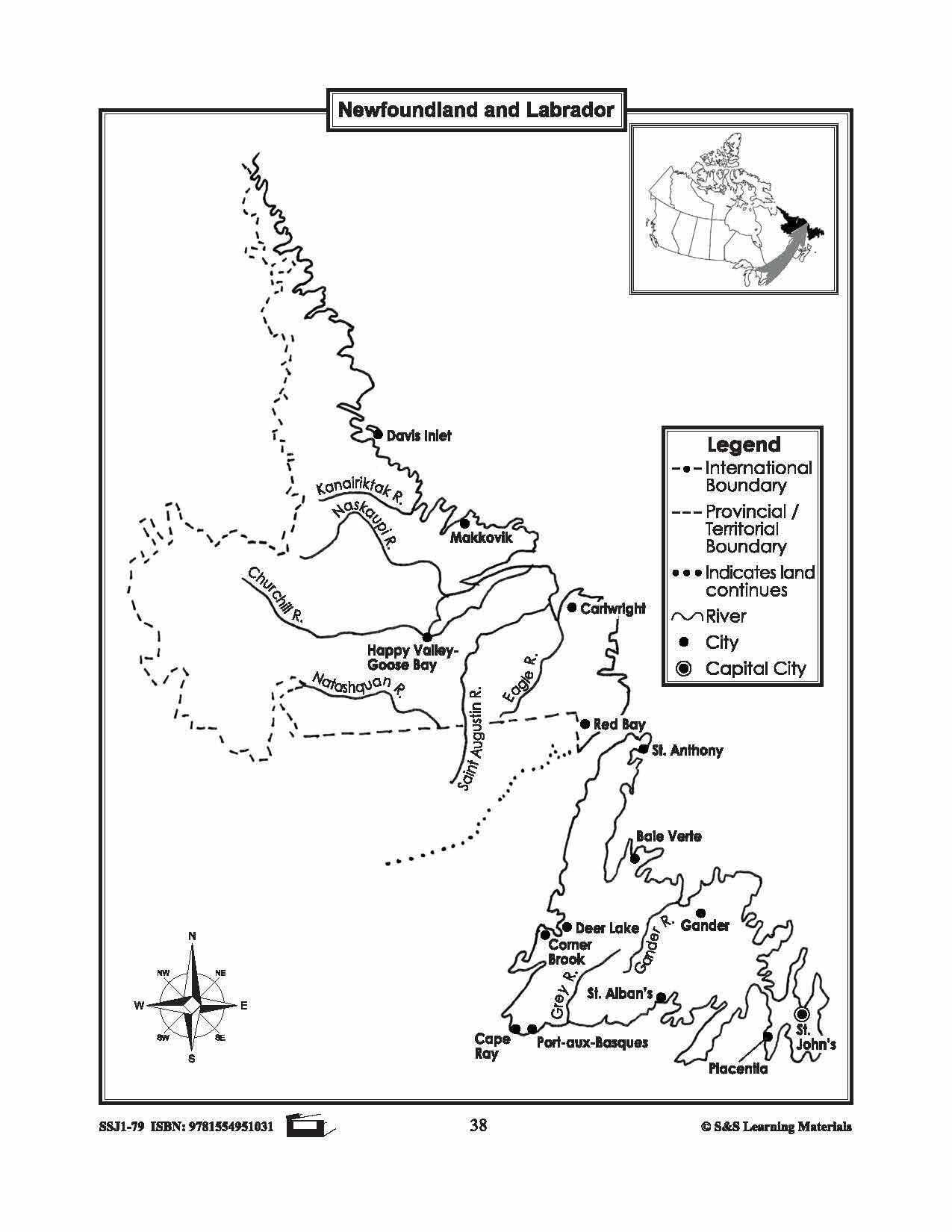
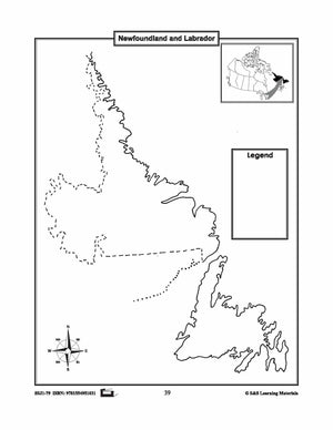
Maps of Newfoundland & Labrador Grades 4-8
$3.45 CAD
The maps will help students learn about Newfoundland and Labrador and provincial/territorial boundary, rivers, landforms, the capital city, and other cities. 2 pages


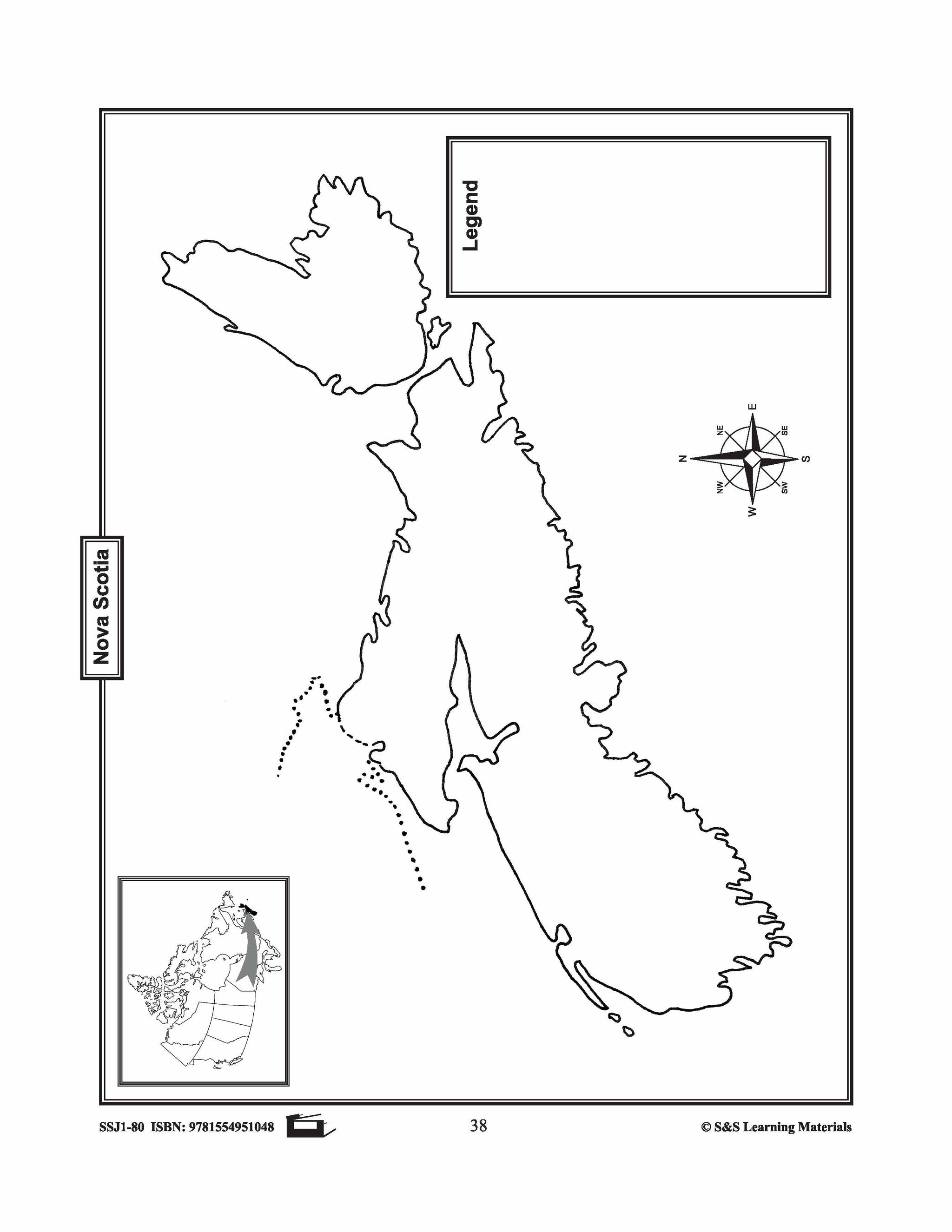
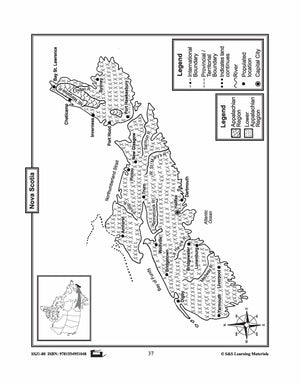
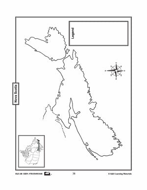
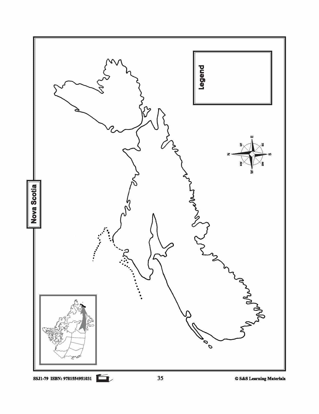
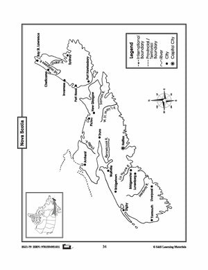
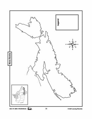
Maps of Nova Scotia Grades 4-8
$3.45 CAD
The maps will help students learn about Nova Scotia and its international and provincial/territorial boundary, rivers, landforms, the capital city, and other cities. 2 pages


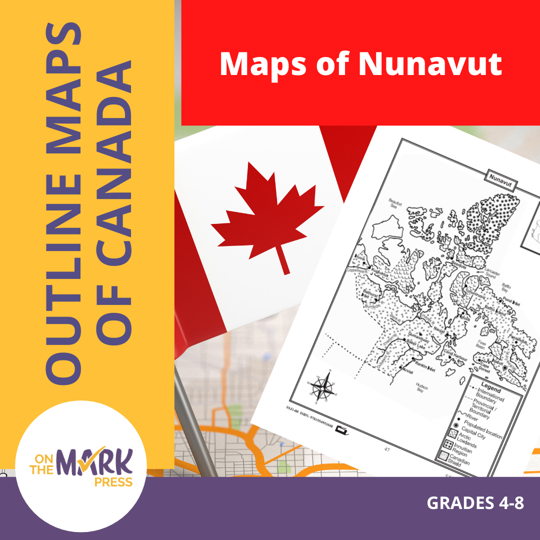

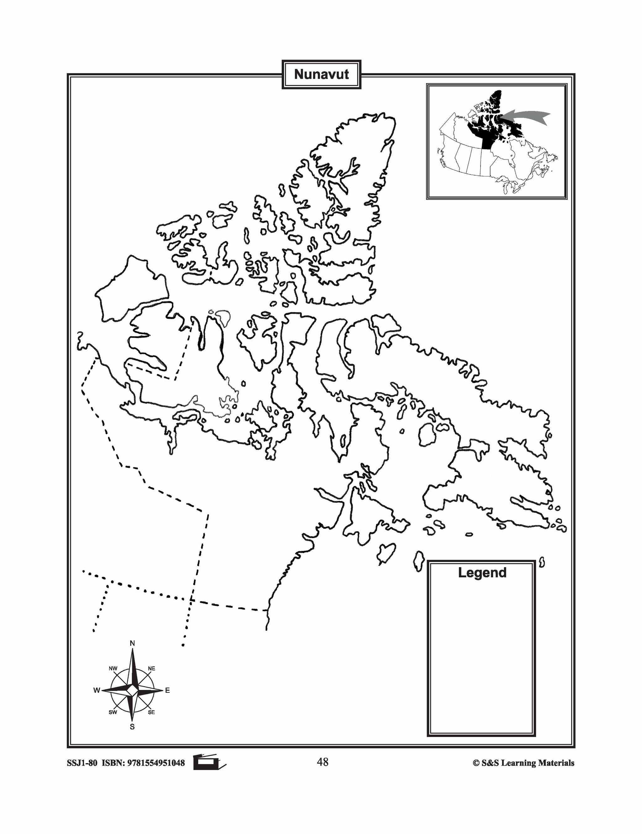

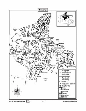

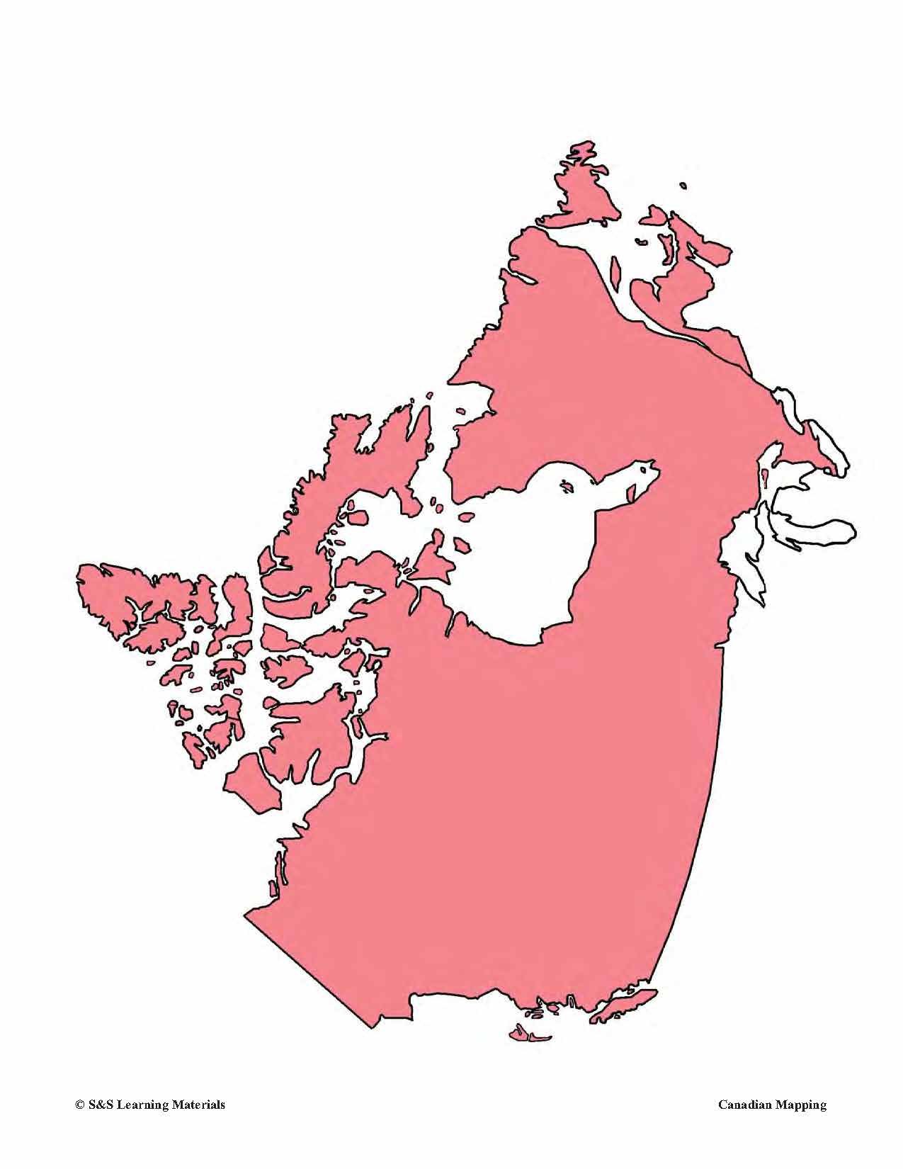
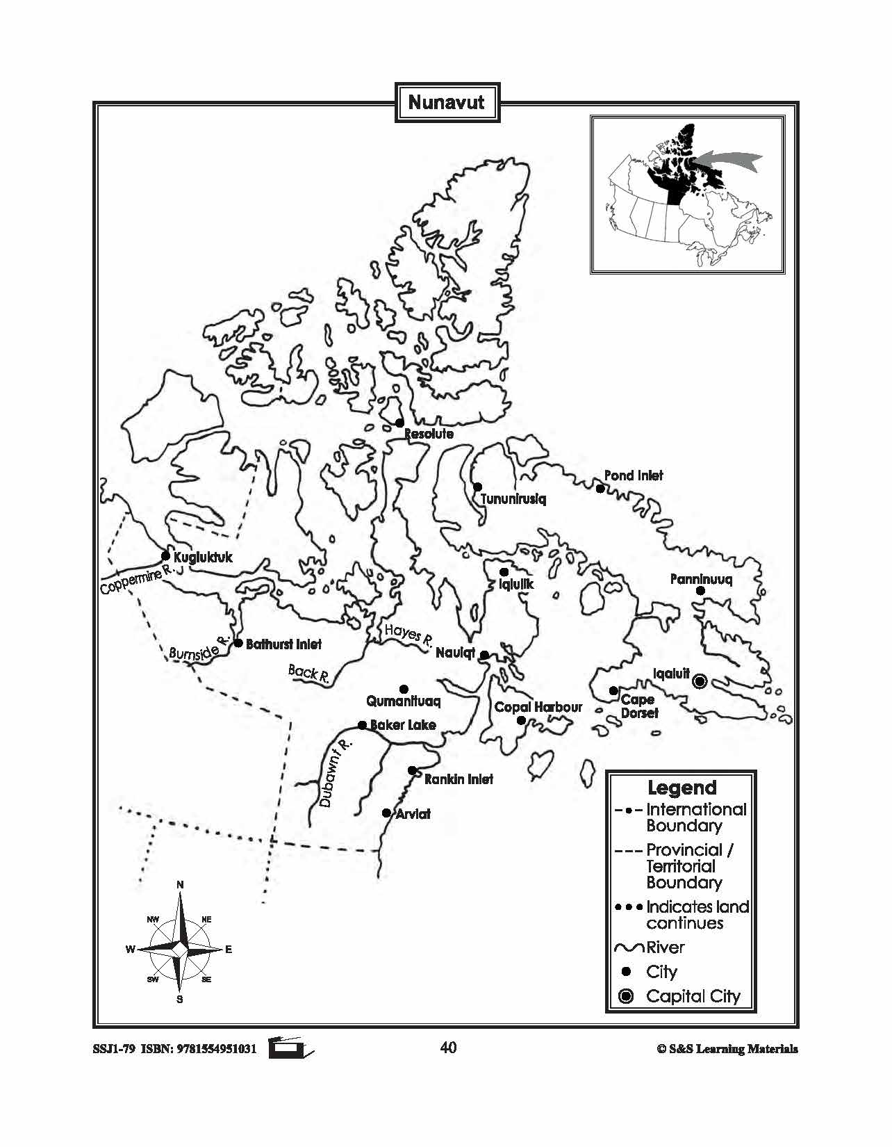
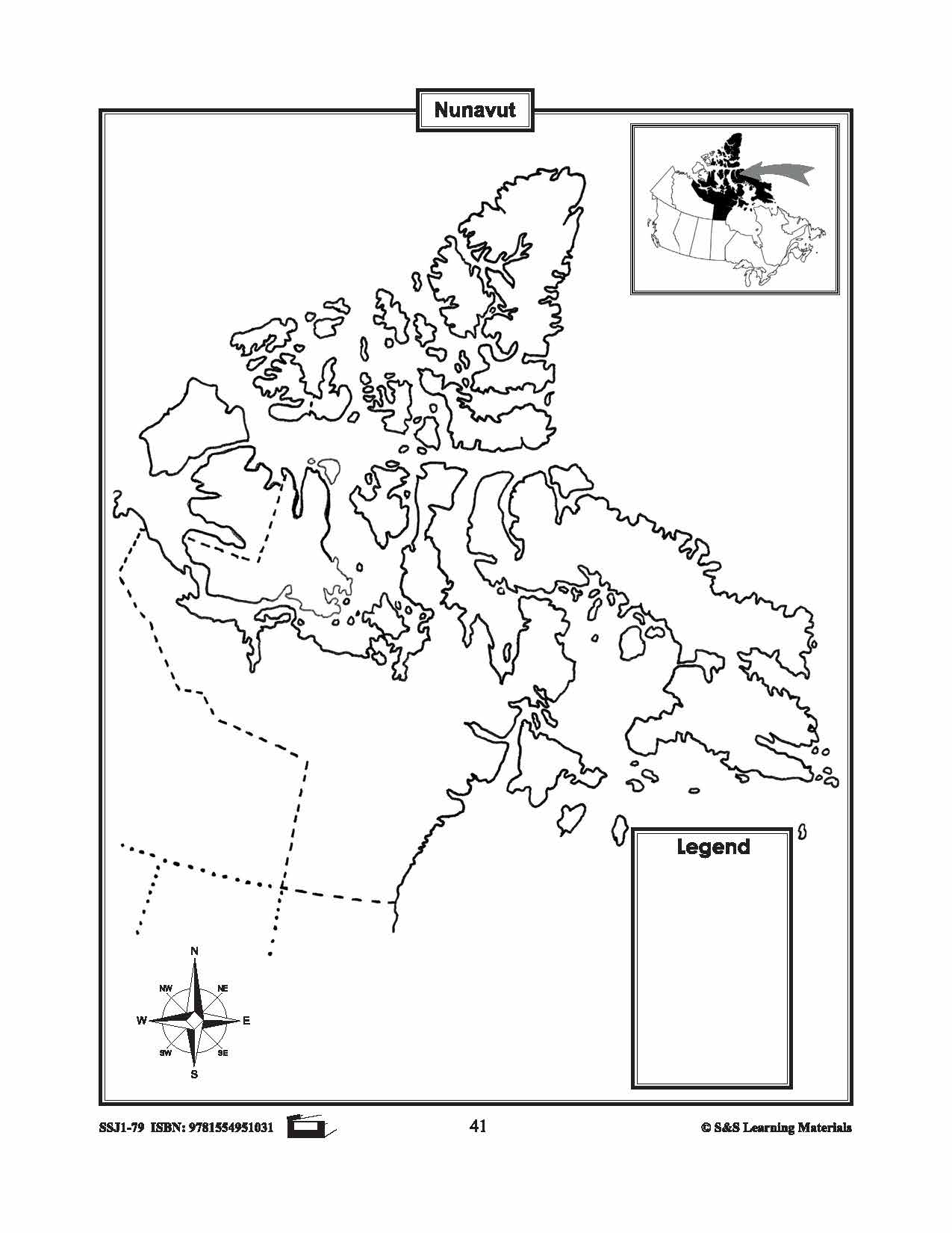
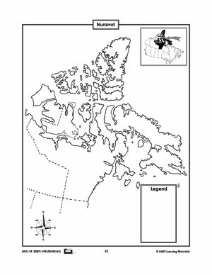
Maps of Nunavut Grades 4-8
$3.45 CAD
The maps will help students learn about Nunavut and its provincial/territorial boundary, rivers, landforms, the capital city, and other cities. 2 pages


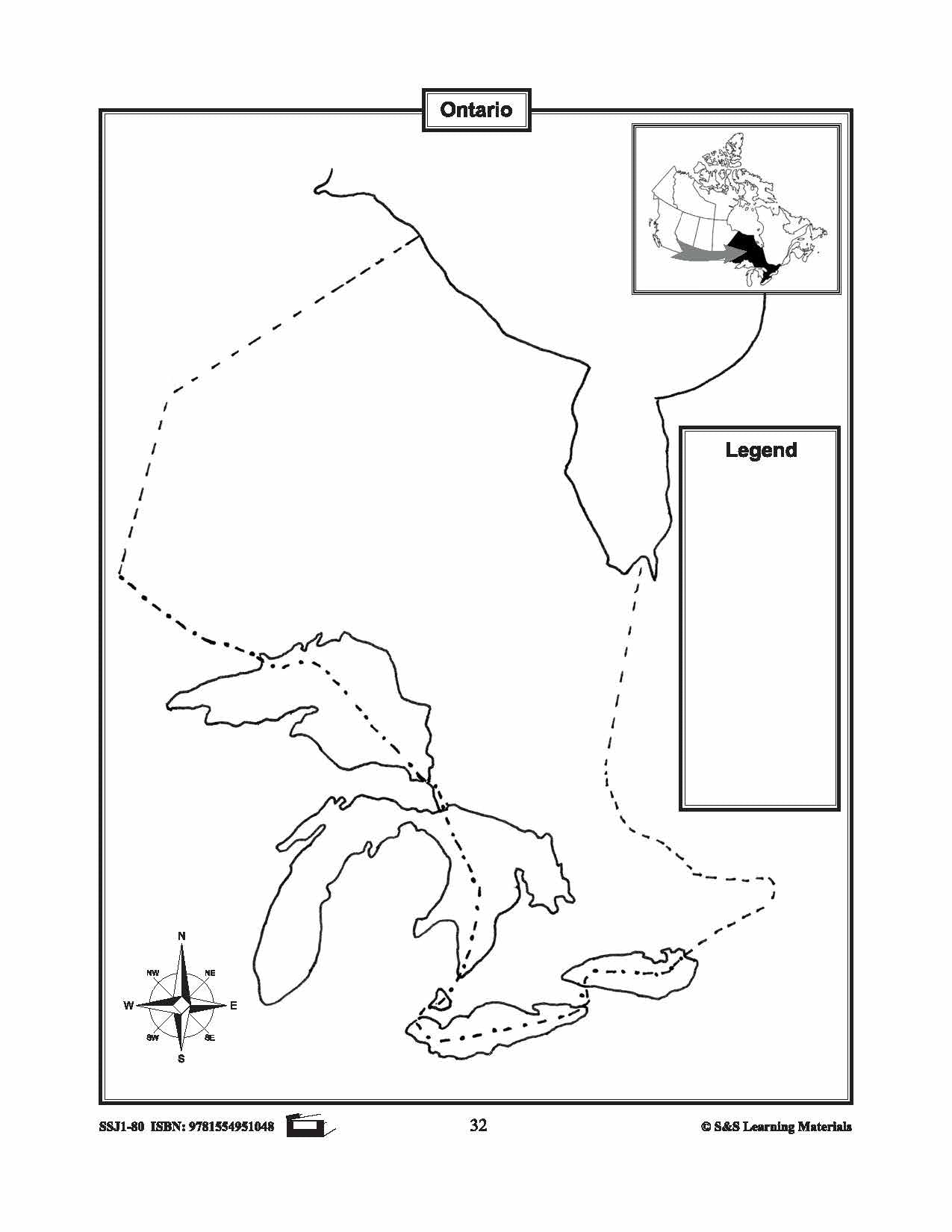

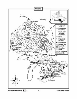
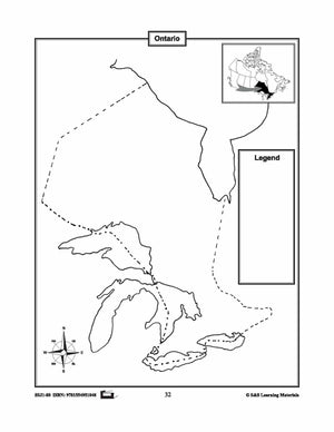
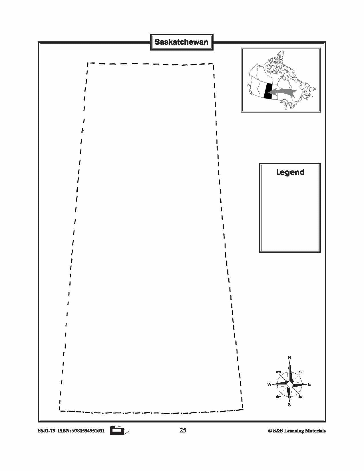
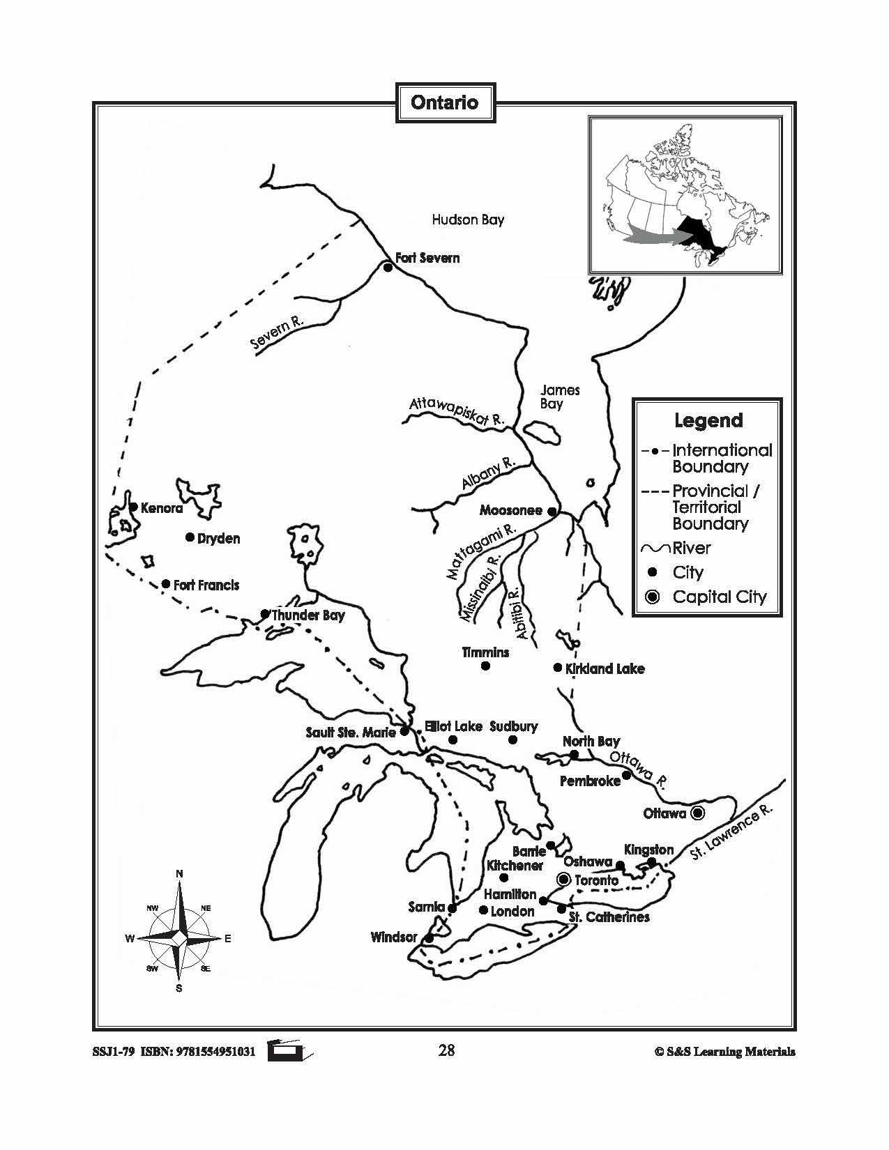
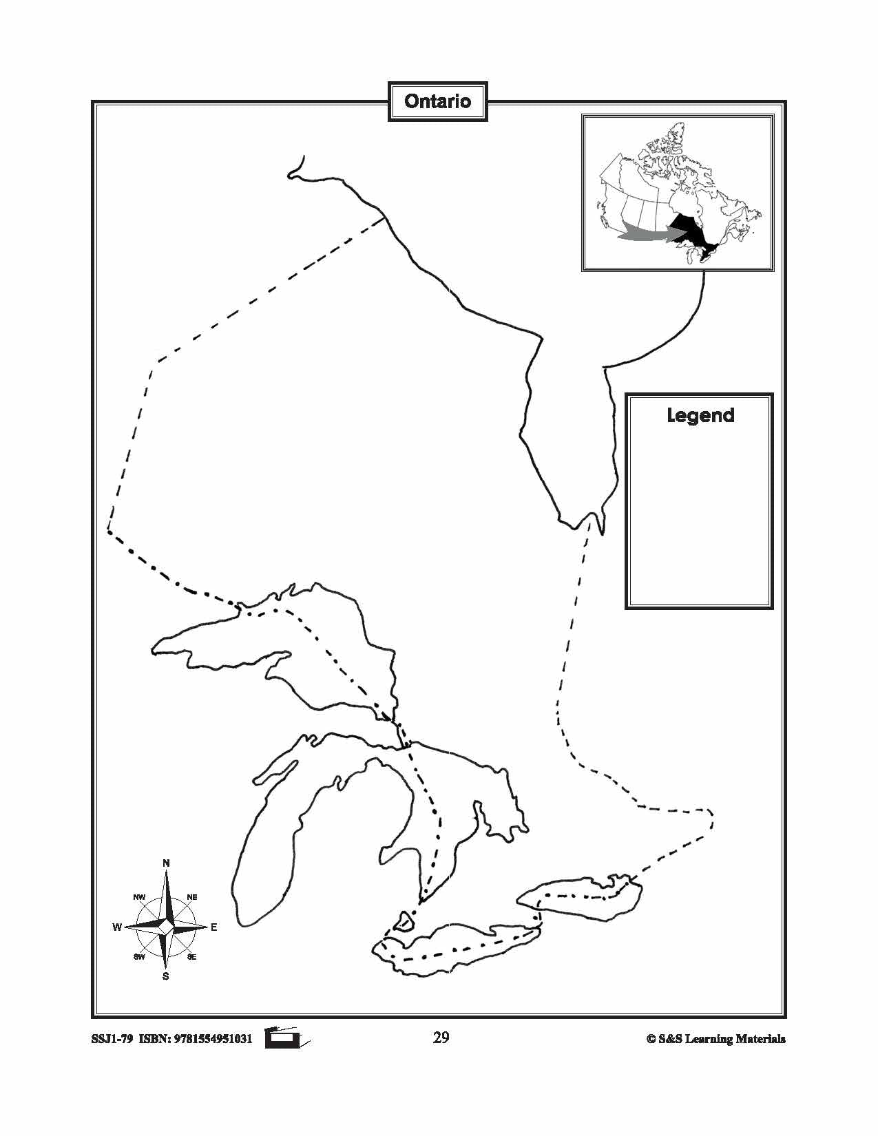
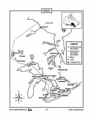
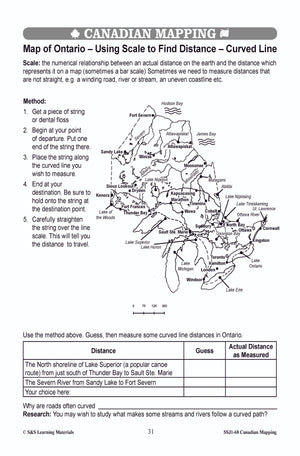
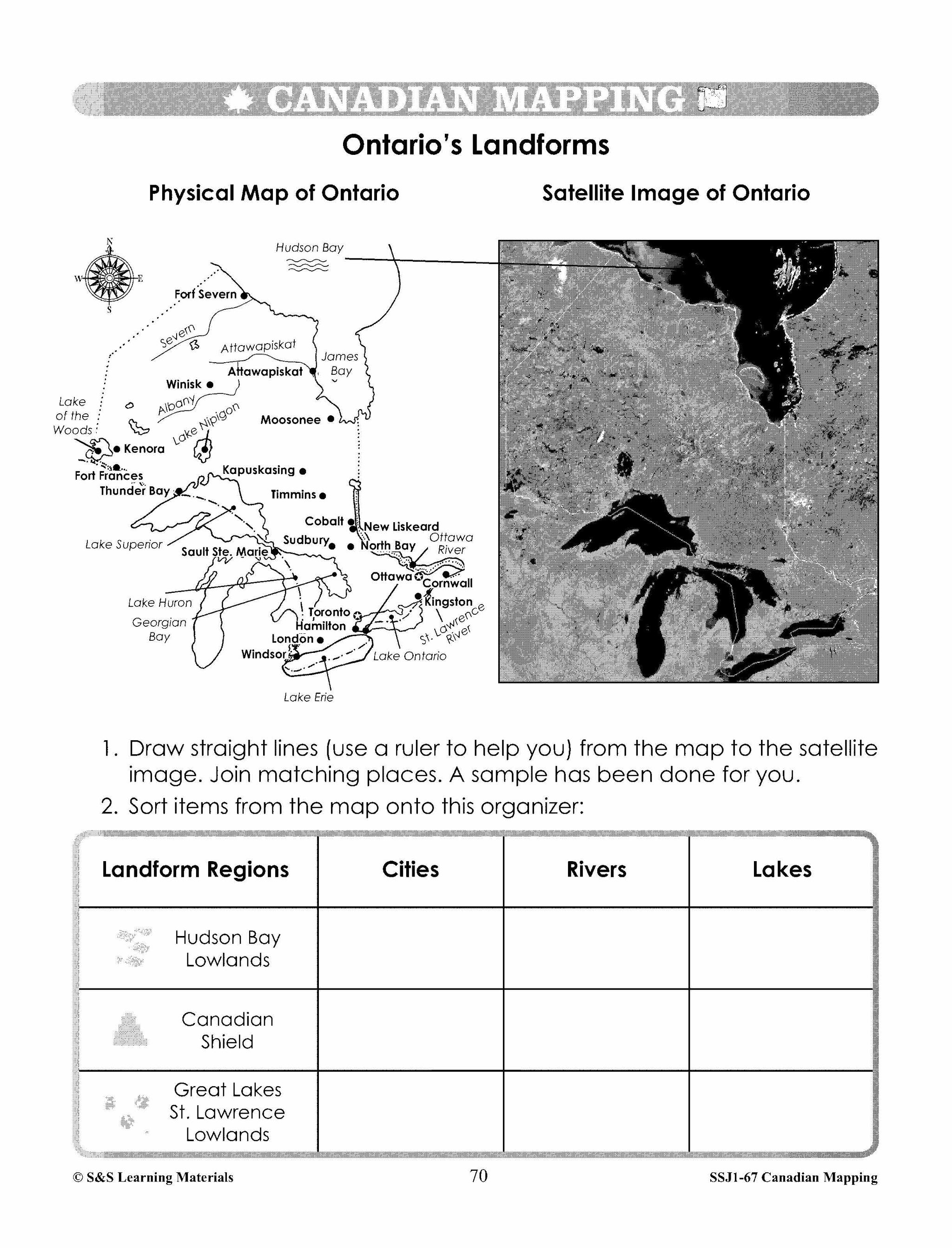
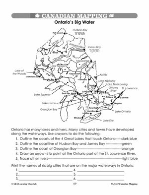
Maps of Ontario Grades 4-8
$3.45 CAD
The maps will help students learn about Ontario and its international and provincial/territorial boundary, rivers, landforms, the capital city, and other cities.


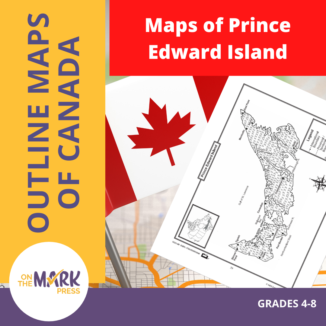
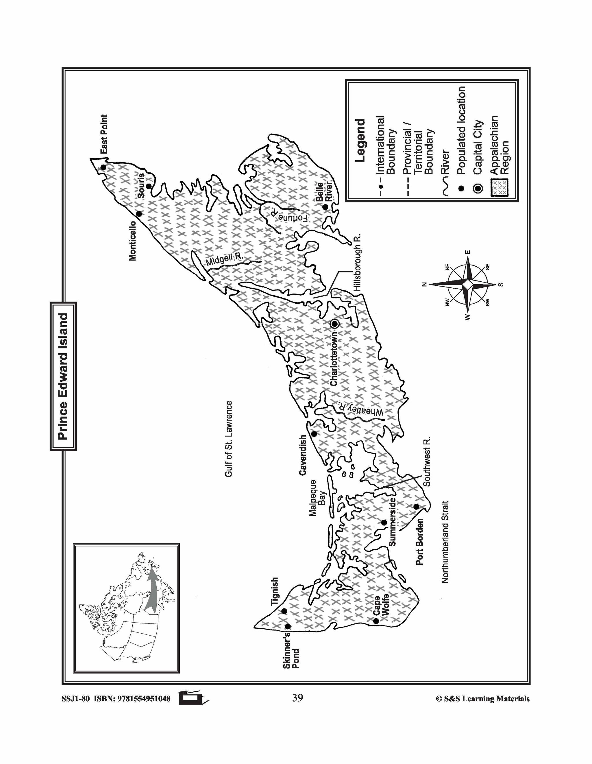
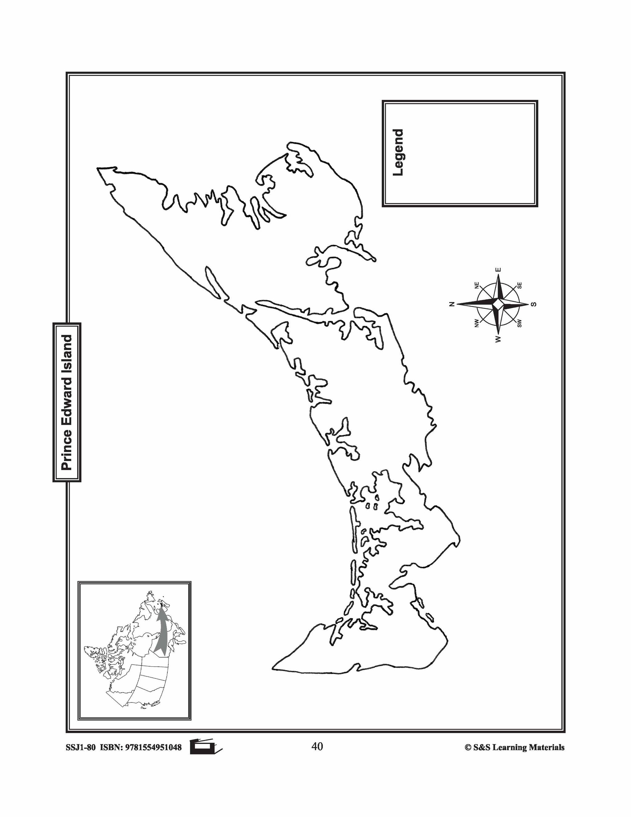
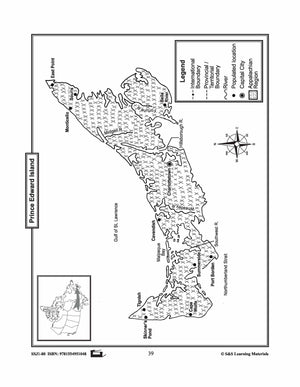
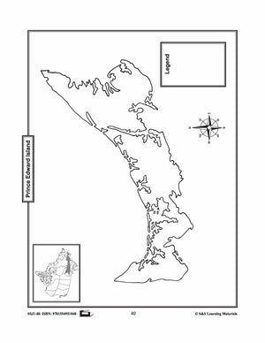
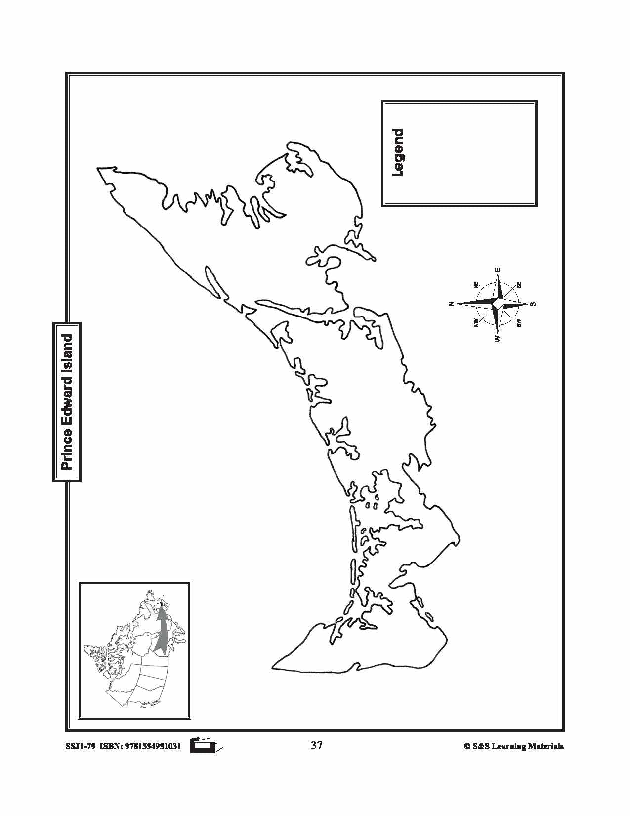
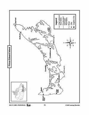
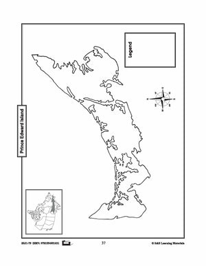
Maps of Prince Edward Island Grades 4-8
$3.45 CAD
The maps will help students learn about Prince Edward Island and its rivers, landforms, the capital city, and other cities. 2 pages